Block
From the record
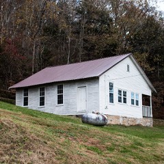
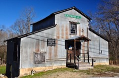
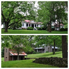
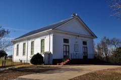
35 National Register listings published here.
Sources: the National Register database, National Park Service
96 topographic sheets cover 83 settlements here, and 35 properties are on the National Register of Historic Places.
35 National Register listings published here.
Sources: the National Register database, National Park Service
Every property in this county listed on the National Register of Historic Places, with the year it was listed and the federal nomination document.
Every wildfire the federal occurrence database records inside this county: 585 of them, burning about 2,740 acres. 3 started naturally and 87 were recorded as arson. Each settlement page carries the fires within five miles of it.
| Reported cause | Fires |
|---|---|
| Debris and open burning | 315 |
| Arson/incendiarism | 87 |
| Missing data/not specified/undetermined | 72 |
| Equipment and vehicle use | 52 |
| Smoking | 17 |
| Railroad operations and maintenance | 11 |
| Other causes | 9 |
| Power generation/transmission/distribution | 6 |
| Recreation and ceremony | 6 |
| Misuse of fire by a minor | 5 |
| Natural | 3 |
| Fireworks | 2 |
The five largest, by the area the report gives. None of them was recorded as arson.
| Date | Cause | Size | Reported by | Name on the report |
|---|---|---|---|---|
| 7 February 2001 | Debris and open burning | 108 acres | Tennessee Division of Forestry | not named |
| 8 October 2016 | Equipment and vehicle use | 84 acres | Tennessee Division of Forestry | SULCER BEAN FIELD |
| 28 August 2011 | Debris and open burning | 76 acres | Tennessee Division of Forestry | KUCHINKA FIRE #1 |
| 15 September 1999 | Equipment and vehicle use | 75 acres | Tennessee Division of Forestry | not named |
| 9 May 2007 | Equipment and vehicle use | 63 acres | Tennessee Division of Forestry | NEWBY FIRE |
| 21 March 2009 | Debris and open burning | 60 acres | Tennessee Division of Forestry | CURRY FIRE |
| 28 November 1998 | Debris and open burning | 50 acres | Tennessee Division of Forestry | not named |
| 11 April 2006 | Debris and open burning | 37 acres | Tennessee Division of Forestry | not named |
Every settlement page carries the fires within five miles of it - see the settlement index below.
The NOAA Storm Events Database holds 327 reports for this county, causing 3 deaths, 12 injuries and about $9,442,727 in recorded property damage. Each settlement page carries the reports that name it.
| Kind of event | Reports |
|---|---|
| Thunderstorm Wind | 193 |
| Hail | 56 |
| Flash Flood | 43 |
| Tornado | 20 |
| Lightning | 7 |
| Heavy Rain | 3 |
| Flood | 3 |
| Funnel Cloud | 2 |
The most serious of them, by death, then injury, then recorded damage. The accounts are quoted exactly as the forecast office filed them.
| When | Event | Place named | Harm | What the report says |
|---|---|---|---|---|
| May 1989 | Tornado (F2) | not stated | 1 killed, 2 hurt, $250,000 | no account filed |
| May 2004 | Thunderstorm Wind | Minor Hill | 1 killed, $20,000 | Straight line winds were estimated to be 115 to 120 mph. The path length of destruction was 1/2 mile wide and 3/4 of a mile long. A house was severely damaged with a roof blown off and a wall blown down. It was a brick frame house built in 1980. A 7 year-old girl was killed inside her grandparent's home, at 520 Tacketts Branch Road, when a wall collapsed on her. Several outbuildings were damaged. Numerous trees were uprooted and blown down. |
| July 2023 | Thunderstorm Wind | Bodenham | 1 killed, $1,000 | Thunderstorm winds downed a tree near Lee Chapman Road and Hurricane Creek Road. The tree fell on a man who was in his yard at the time moving his motorcycle. Unfortunately, he died from his injuries. |
| April 1972 | Tornado (F3) | not stated | 4 hurt | no account filed |
| April 1985 | Thunderstorm Wind | not stated | 2 hurt | no account filed |
| May 2024 | Tornado (EF2) | Bethel | 1 hurt, $4,000,000 | This EF-2 tornado touched down along Case Road southwest of Prospect where some trees were damaged. As the tornado continued east, a home sustained roof damage, and a tied-down manufactured home was completely removed from its base and destroyed. One person was critically injured in the manufactured home. As the tornado continued east, major tree damage occurred along Bethel Prospect Road, a metal shop building was destroyed, and another tied-down mobile was completely lifted off its base and wrapped around a tree with the remaining debris blown down a hillside. More trees continued to be blown down with roof damage to some homes and outbuildings as the tornado passed across the south edge of the town of Prospect and crossed Veto Road. The tornado continued to snap and uproot hundreds of trees as it moved up and down hills along El Reed Road before crossing the Elk River and dissipating. Damages are a rough estimate. |
| April 1998 | Tornado (F4) | Yokley | 1 hurt, $1,000,000 | The most extensive damage was north of Yokley. There were downed trees and power lines, a ruptured gas tank, cars overturned, and homes damaged. 5 homes and 8 mobile homes were destroyed in Giles county. |
| August 1985 | Tornado (F3) | not stated | 1 hurt, $250,000 | no account filed |
| May 1995 | Tornado (F0) | Liberty Hill to | 1 hurt, $7 | Over 40 building suffered structural damage to them. A few trees were knocked down. A man was injured in Liberty Hill as he sought shelter in his camp trailer. Eight power poles were blown down. |
| April 2008 | Tornado (EF3) | Liberty Hill | $1,000,000 | A low end EF3 tornado hit northwest Giles County near Liberty Hill. This was part of the same storm complex that hit Lawrence County. Numerous trees were snapped and uprooted. Many homes had roof damage. The hardest hit area was along Rhea Branch Rd. One residential home was completely leveled. Major damage occurred to the back of the Liberty Hill Baptist Church.||A newspaper article stated that 8 homes were completely destroyed, and 30 other homes had serious damage. |
| March 2026 | Tornado (EF1) | Marbuts | $250,000 | This narrative is a continuation of the tornado that originated in Lauderdale County, Alabama and traveled into Lawrence County and then Giles County. As the tornado crossed into Giles County, damage was mostly trees downed or uprooted and branches snapped. A few structures were impacted in Giles County south to southwest of Minor Hill due to trees falling. A few metal farm outbuildings were also collapsed. The tornado ended quickly south-southeast of Minor Hill. Damages are a rough estimate. |
| May 2024 | Thunderstorm Wind | Wales | $250,000 | A NWS storm survey team found straight line wind damage in Giles County, particularly around the Pulaski area. Numerous trees were snapped and uprooted in a northwest to southeast direction. Some of the worst damage was found on Cherry Drive and Richland Street where some trees fell onto homes. Winds were estimated up to 75 mph. Damages are a rough estimate. |
| March 1965 | Tornado (F1) | not stated | $250,000 | no account filed |
| May 2017 | Lightning | Liberty Hill | $200,000 | A business on Liberty Hill Loop was struck by lightning and destroyed in the ensuing fire. A nearby home was also damaged. |
| July 1999 | Lightning | Pulaski | $150,000 | Four mobile homes were struck by lightning. These homes were fully loaded when they were struck at the Oakwood Homes on Highway 31. |
| May 2020 | Thunderstorm Wind | Pulaski | $113,220 | Numerous trees and power lines were blown down across Giles County. |
| May 2024 | Thunderstorm Wind | Yokley | $100,000 | Severe thunderstorm winds damaged a farm on Smith Hollow Road at Campbellsville Pike near Lynnville. A silo fell into a swimming pool and several trees were also blown down. Damages are a rough estimate. |
| May 2009 | Tornado (EF1) | Campbellsville | $100,000 | This EF1 Tornado, with maximum estimated wind speed at 100 mph, caused damage that resulted in many large trees that were either snapped or uprooted. Several homes sustained minor roof damage and several outbuildings were also destroyed.||Newspaper reported that the Union Valley Baptist Church received significant roof and exterior wall damage as it was blown off of its foundation. Newspaper also reported that several roads were blocked with debris from buildings and trees and also several roads were closed due to localized flooding. |
| March 1997 | Flash Flood | Pulaski | $100,000 | 8 roads closed due to high water. Several roads were damaged. Hardest hit area was northwest to northeast of Pulaski. |
| January 2002 | Flash Flood | Liberty Hill | $60,000 | Millions of gallons of water roared through a breached dam on Dave Risner Road, affecting the family of Mike and Patti Risner. A car was swept away. A building, storing antique collectables, was washed downstream. A substantial block spring house was leveled, and a footbridge was washed out. Trees and utility poles were swept away as well. |
| May 2024 | Thunderstorm Wind | Pulaski | $50,000 | A NWS storm survey team found straight line wind damage in Giles County, particularly around the Pulaski area. Numerous trees were snapped and uprooted in a northwest to southeast direction. Some of the worst damage was found on Cherry Drive and Richland Street where some trees fell onto homes. Winds were estimated up to 75 mph. Damages are a rough estimate. |
| March 2023 | Thunderstorm Wind | Abernathy Arpt | $50,000 | The Giles County emergency manager reported roof damage to a metal building near Pulaski as a severe thunderstorm moved through the area. Damages are estimated. |
| January 2022 | Tornado (EF1) | Thorne Store | $50,000 | This tornado touched down in Limestone County, Alabama near the intersection of Persimmon Tree Road and Siniard Road, where a few trees were snapped or uprooted. It moved to the northeast, snapping and uprooting numerous trees as it crossed Tommy Hill Road and Lester Road. As the tornado crossed Holly Lane, it downed dozens of trees. It continued its northeastward progression, uprooting trees along Salem Minor Hill Road and Gardner Holly Road. It then continued into Giles County, Tennessee. Special thanks to the Limestone County EMA for their assistance with this survey. In Tennessee, the tornado continued northeast where NASA satellite imagery showed it blew down dozens of trees south of Hagan Road. On the eastern end of Hagan Road, two homes received minor damage and several outbuildings were destroyed. Another home had minor damage on Case Road at Bethel Road. The worst damage occurred on Alf Harris Road where several homes and outbuildings received significant damage. The tornado then turned more eastward and passed just north of the Prospect community, before more homes and outbuildings were damaged on Liberty Road, Kelley Road, and Prospect Elkton Road. The tornado lifted just west of Elkton, Tennessee. Total path length of this EF-1 tornado in Alabama and Tennessee was 16.9 miles. Special thanks to Giles County EMA for their help with this storm damage survey. |
| May 2006 | Lightning | Pulaski | $50,000 | The downtown studios of WKSR-AM and WKSR-FM were struck by lightning on South Second St. in Pulaski. The lightning knocked out the phone system and the inner office network. The inner office network allows the on-air computers to talk to each other, including the EAS computer system at the station. The station's satellite system, Internet service, the Associated Press link to the radio station, an office computer, and a modem in another computer were completely destroyed. |
| May 1999 | Thunderstorm Wind | North Portion | $50,000 | Wide spread trees and power lines were blown down in the northern part of the county. 2 homes were damaged from fallen trees in Lynnville. |
| July 1998 | Lightning | Minor Hill | $50,000 | Lightning struck a home in Minor Hill. The home was completely ravaged by fire. The home was located at 522 Jackson Clinic Rd. |
| June 1997 | Flash Flood | Countywide | $50,000 | There was high water on many roads around Giles county. |
| March 1994 | Thunderstorm Wind | Campbellsville | $50,000 | One barn was destroyed and a second barn had its roof lifted off. A mobile home was damaged when a large tree fell on top of it. |
| May 1994 | Thunderstorm Wind | Pulaski | $50,000 | A few trees were knocked down. One tree smashed into a mobile home producing considerable damage to the home. |
| June 2005 | Thunderstorm Wind | Pulaski | $40,000 | EMA Director reported a tin roof was peeled off a Department of Highway Building by a strong thunderstorm wind gust. |
| April 2011 | Thunderstorm Wind | Pulaski | $30,000 | Numerous trees and power lines were downed across the county. One report was received of a church sustaining damage. Specific details concerning the exact location|of the church, the amount and type of damage that occurred along with the associated cost, were unknown. |
| May 2024 | Thunderstorm Wind | Tarpley | $25,000 | A NWS storm survey team found straight line wind damage in Giles County, particularly around the Pulaski area. Numerous trees were snapped and uprooted in a northwest to southeast direction. Some of the worst damage was found on Cherry Drive and Richland Street where some trees fell onto homes. Winds were estimated up to 75 mph. Damages are a rough estimate. |
| March 2023 | Thunderstorm Wind | Prospect | $25,000 | A severe thunderstorm tracking through Giles County downed tree limbs and power poles near Elkton. Damages are estimated. |
| March 2020 | Flash Flood | Yokley | $25,000 | Several bridges and driveways were washed out in Lynnville and other parts of northern Giles County. |
| May 2011 | Thunderstorm Wind | Elkton | $25,000 | Numerous trees were downed. |
| April 1997 | Hail | Minor Hill | $25,000 | The Citizen-Pulaski newspaper reported golf ball size hail struck the area and caused damage to cars and roofs. One home had a hole in the roof due to the hail storm. The hardest hit area was on Pleasant Ridge Road. |
| April 1963 | Tornado (F2) | not stated | $25,000 | no account filed |
| November 1951 | Tornado (F2) | not stated | $25,000 | no account filed |
| July 2022 | Thunderstorm Wind | Stiversville | $20,000 | Approximately 15 to 20 large trees were uprooted near the Maury County line, with some trees blown down across Columbia Highway. Dime size hail also fell two separate times that covered the front porch of a nearby home. |
| December 2021 | Tornado (EF0) | Poplar Hill | $20,000 | This EF-0 tornado touched down near Old Poplar School Road where it blew the sheet metal roofing off a small church. NASA satellite imagery showed the tornado continued northeast across Poplar Hill Road, Kelley Road, and Beasley Branch Road where it blew down numerous trees. Along Witt Road, some shingles were lost on a house, the roof of a shed was blown off and a few trees were uprooted or had large branches snapped off. The tornado continued east-northeast and paralleled the Elk River uprooting additional trees and snapping large branches. The tornado blew a semi truck off of I-65 before lifting just east of I-65 near Dixon Town Road. |
| May 2020 | Thunderstorm Wind | Minor Hill | $20,000 | Numerous trees and power lines were blown down across Giles County with approximately 40 roads blocked. |
| December 2019 | Thunderstorm Wind | Bufords | $20,000 | A swath of wind damage struck areas along and south of Buford Station Road. A barn roof was damaged at the Milky Way Farm on the west side of Columbia. A path of damage through the trees could be seen on the east side of Columbia Highway. Further east, an outbuilding was heavily damaged on Buford Station Road east of Cemetery Road, and several trees and tombstones were blown down at the Everbright Cemetery. Based on radar data, this may have been a brief EF-0 tornado, but the storm survey reported the damage was too inconclusive. |
| April 2015 | Thunderstorm Wind | Elkton | $20,000 | A large equpiment shed was destroyed and a truck flipped over on Vinta Mill Road. |
| August 2011 | Thunderstorm Wind | Pulaski | $20,000 | Approximately 100 trees were blown down across Giles County. |
| August 2005 | Lightning | Pulaski | $20,000 | Lightning struck a home at 200 Harmon Dr. The lightning set fire in the attic and burned the rafters. The fire was under control in 10 to 15 minutes by the Pulaski Fire Department. |
| June 1997 | Flash Flood | Bodenham | $20,000 | Hurricane Creek came out of its banks and flooded U.S. Highway 64 just west of Bodenham. A portion of U.S. HWY 64 had to be closed. Troopers from the Tennessee State Highway patrol and workers from the Tennessee Department of Transportation rescued 2 motorists from the high water. |
| May 2024 | Thunderstorm Wind | Bunker Hill | $15,000 | A NWS storm survey team found straight line wind damage in Giles County, particularly around the Pulaski area. Numerous trees were snapped and uprooted in a northwest to southeast direction. Some of the worst damage was found on Cherry Drive and Richland Street where some trees fell onto homes. Winds were estimated up to 75 mph. Damages are a rough estimate. |
| June 2023 | Thunderstorm Wind | Minor Hill | $15,000 | Severe thunderstorm winds caused a tree to fall through a home near Minor Hill. No injuries were reported. Damages are a rough estimate. |
| February 2020 | Thunderstorm Wind | Five Pts | $15,000 | A 1.8 mile long by 75 yard wide path of significant wind damage struck areas east of Pulaski from Britton Hollow Road northeastward along Gunter Hollow Road to Bunkhum Road. One home and a nearby barn suffered extensive roof damage on Britton Hollow Road, and dozens of trees were snapped and uprooted along Britton Hollow Road and on Gunter Hollow Road just east of Britton Hollow Road. Further to the east on Gunter Hollow Road, one barn was destroyed, two others suffered roof damage, and one home had minor roof damage, and more trees were blown down on Bunkhum Road. Winds were estimated up to 90 mph. Although the damage path was relatively concentrated and narrow, as well as associated with a velocity couplet on radar, the NWS storm survey team could not conclusively determine if this was a possible tornado. |
| July 2010 | Thunderstorm Wind | Minor Hill | $15,000 | Highway department reported 4 to 5 trees blown down and blocking roads in Minor Hill. |
| February 2009 | Thunderstorm Wind | Pulaski | $12,000 | Trees were blown down across the area. |
| July 2005 | Lightning | Pulaski | $12,000 | News article stated that a home located at 2202 Cherry Drive was struck by lightning in the Westview subdivision. The lightning welded the gutters to the house, blew out the phones and cable television lines, and scorched the homes in several spots. Officials with the Pulaski Fire Department estimated the damage to be at about $12,000. |
| May 2025 | Thunderstorm Wind | Waco | $10,000 | Severe thunderstorm winds downed multiple trees across northern Giles County. Damages are a rough estimate. |
| March 2023 | Thunderstorm Wind | Prospect | $10,000 | Severe thunderstorm winds in southern Giles County caused downed tree limbs and minor shingle damage. Damages are a rough estimate. |
| July 2023 | Thunderstorm Wind | Pulaski | $10,000 | A Facebook user reported numerous trees down across Giles County with a shed overturned in Pulaski. Damages are a rough estimate. |
| February 2020 | Thunderstorm Wind | Anthony Hill | $10,000 | A 10 mile long by 1 mile wide downburst struck southern Giles County from Nancy Green Ridge Road northeastward across Bethel Road and Highway 31 to around Highway 64 at Green Valley Road. Numerous trees were blown down, several barns and outbuildings were damaged or destroyed, and a few homes suffered minor roof damage. Winds were estimated up to 75 mph. |
| February 2020 | Thunderstorm Wind | Frankewing | $10,000 | Dozens of pine trees were blown down along Red Oak Lane near the Lincoln County border. |
| June 2014 | Flash Flood | Yokley | $10,000 | Widespread flash flooding affected much of Giles County with several roads flooded and closed. Two people were rescued from vehicles stranded in flood waters. |
| February 2014 | Thunderstorm Wind | Pulaski | $10,000 | Trees and power lines were blown down in several parts of Giles County. |
| June 2014 | Thunderstorm Wind | Pulaski | $10,000 | Numerous trees were blown down all across Giles County. |
The Survey's mineral resources record lists 91 workings inside this county. 9 still produce and 82 are closed or unrecorded. Each settlement page carries the workings within five miles of it.
| Commodity | Workings |
|---|---|
| Phosphorus-Phosphates | 82 |
| Sand and Gravel, Construction | 5 |
| Stone, Crushed/Broken | 3 |
| Stone | 1 |
The least common of them first, because a county's hundredth gravel pit says nothing its first ten did not.
| Where | Site | Commodity | Status | Recorded |
|---|---|---|---|---|
| Ardmore Quarry | Stone | Past Producer | ||
| Ardmore Quarry | Stone, Crushed/Broken | Past Producer | Limestone | |
| Cedar Grove Limestone Co. Quarry | Stone, Crushed/Broken | Producer | Limestone | |
| Giles County Materials | Stone, Crushed/Broken | Producer | ||
| Felker Pit | Sand and Gravel, Construction | Producer | ||
| Felker Pit | Sand and Gravel, Construction | Past Producer | Sedimentary | |
| Felker Pit | Sand and Gravel, Construction | Producer | ||
| Wilson Pit | Sand and Gravel, Construction | Past Producer | ||
| Wilson Powder Mill Hill Pit | Sand and Gravel, Construction | Past Producer | ||
| Angus Tract | Phosphorus-Phosphates | Producer | ||
| Buford Mine-Lynnesville | Phosphorus-Phosphates | Producer | ||
| Buford Mine-Pulaski | Phosphorus-Phosphates | Past Producer | ||
| Bufords Cheatham #2483 | Phosphorus-Phosphates | Past Producer | 1968 | |
| Bufords No. 2483 Pit Cheatam Pit | Phosphorus-Phosphates | Past Producer | ||
| Bufords No. 861 Pit | Phosphorus-Phosphates | Past Producer | ||
| Bufords Number 2484 Pit | Phosphorus-Phosphates | Past Producer | ||
| Bufords Number 2484 Pit | Phosphorus-Phosphates | Past Producer | ||
| Bufords Union Bank #861 | Phosphorus-Phosphates | Past Producer | 1968 | |
| Darwin | Phosphorus-Phosphates | Prospect | ||
| Dunavant | Phosphorus-Phosphates | Prospect | 1900 | |
| George White Pit | Phosphorus-Phosphates | Producer | ||
| Giles County Deposit | Phosphorus-Phosphates | Prospect | 1936 | |
| Giles County Mine | Phosphorus-Phosphates | Past Producer | ||
| Hooker Chemical Company No.5 | Phosphorus-Phosphates | Unknown | ||
| Mobil Phosphate Deposit No.19 | Phosphorus-Phosphates | Unknown | ||
| Mobil Phosphate Deposit No.20 | Phosphorus-Phosphates | Unknown | ||
| Mobil Phosphate Deposit No.21 | Phosphorus-Phosphates | Unknown | ||
| Monsanto Phosphate Deposit No.26 | Phosphorus-Phosphates | Unknown | ||
| Monsanto Phosphate Deposit No.30 | Phosphorus-Phosphates | Unknown | ||
| Monsanto Phosphate Deposit No.32 | Phosphorus-Phosphates | Unknown | ||
| Monsanto Phosphate Deposit No.33 | Phosphorus-Phosphates | Unknown | ||
| Monsanto Phosphate No.27 | Phosphorus-Phosphates | Unknown | ||
| Monsanto Phosphate No.31 | Phosphorus-Phosphates | Unknown | ||
| Prospect Mine | Phosphorus-Phosphates | Producer | ||
| Prospect Number 2353 | Phosphorus-Phosphates | Past Producer | ||
| Prospect Number 2353 | Phosphorus-Phosphates | Past Producer | ||
| Prospect Number 2505 | Phosphorus-Phosphates | Past Producer | ||
| Prospect Number 2505 | Phosphorus-Phosphates | Past Producer | ||
| Prospect Number 2550 | Phosphorus-Phosphates | Past Producer | ||
| Smithson and Paisley | Phosphorus-Phosphates | Producer | 1975 | |
| Stauffer #231-18 Ruthen Sands | Phosphorus-Phosphates | Past Producer | 1974 | |
| Stauffer #231-19 Vick | Phosphorus-Phosphates | Past Producer | 1974 | |
| Stauffer #231-20 J. W. Moore | Phosphorus-Phosphates | Past Producer | 1974 | |
| Stauffer #231-21 Melvin Hickman | Phosphorus-Phosphates | Past Producer | ||
| Stauffer #231-23 H. Thurman | Phosphorus-Phosphates | Past Producer | 1973 | |
| Stauffer #231-26 C. Thurman | Phosphorus-Phosphates | Past Producer | 1974 | |
| Stauffer #231-27 J. A. Brown | Phosphorus-Phosphates | Past Producer | Surface | |
| Stauffer 223-45 | Phosphorus-Phosphates | Past Producer | 1972 | |
| Stauffer Phosphate Deposit No.10 | Phosphorus-Phosphates | Unknown | ||
| Stauffer Phosphate Deposit No.11 | Phosphorus-Phosphates | Unknown | ||
| Stauffer Phosphate Deposit No.12 | Phosphorus-Phosphates | Unknown | ||
| Stauffer Phosphate Deposit No.13 | Phosphorus-Phosphates | Unknown | ||
| Stauffer Phosphate Deposit No.6 | Phosphorus-Phosphates | Unknown | ||
| Stauffer Phosphate Deposit No.8 | Phosphorus-Phosphates | Unknown | ||
| Stauffer Phosphate Deposit No.9 | Phosphorus-Phosphates | Unknown | ||
| Stauffer Pit | Phosphorus-Phosphates | Past Producer | ||
| Stauffer Pit | Phosphorus-Phosphates | Past Producer | ||
| Tva Phosphate Deposit No.5 | Phosphorus-Phosphates | Unknown | ||
| Tva Phosphate Deposit No.1 | Phosphorus-Phosphates | Unknown | ||
| Tva Phosphate Deposit No.10 | Phosphorus-Phosphates | Unknown | ||
| Tva Phosphate Deposit No.11 | Phosphorus-Phosphates | Unknown | ||
| Tva Phosphate Deposit No.12 | Phosphorus-Phosphates | Unknown | ||
| Tva Phosphate Deposit No.13 | Phosphorus-Phosphates | Unknown | ||
| Tva Phosphate Deposit No.14 | Phosphorus-Phosphates | Unknown | ||
| Tva Phosphate Deposit No.15 | Phosphorus-Phosphates | Unknown | ||
| Tva Phosphate Deposit No.16 | Phosphorus-Phosphates | Unknown | ||
| Tva Phosphate Deposit No.17 | Phosphorus-Phosphates | Unknown | ||
| Tva Phosphate Deposit No.18 | Phosphorus-Phosphates | Unknown | ||
| Tva Phosphate Deposit No.19 | Phosphorus-Phosphates | Unknown | ||
| Tva Phosphate Deposit No.2 | Phosphorus-Phosphates | Unknown | ||
| Tva Phosphate Deposit No.20 | Phosphorus-Phosphates | Unknown | ||
| Tva Phosphate Deposit No.21 | Phosphorus-Phosphates | Unknown | ||
| Tva Phosphate Deposit No.22 | Phosphorus-Phosphates | Unknown | ||
| Tva Phosphate Deposit No.23 | Phosphorus-Phosphates | Unknown | ||
| Tva Phosphate Deposit No.24 | Phosphorus-Phosphates | Unknown | ||
| Tva Phosphate Deposit No.25 | Phosphorus-Phosphates | Unknown | ||
| Tva Phosphate Deposit No.26 | Phosphorus-Phosphates | Unknown | ||
| Tva Phosphate Deposit No.27 | Phosphorus-Phosphates | Unknown | ||
| Tva Phosphate Deposit No.28 | Phosphorus-Phosphates | Unknown | ||
| Tva Phosphate Deposit No.29 | Phosphorus-Phosphates | Unknown | ||
| Tva Phosphate Deposit No.3 | Phosphorus-Phosphates | Unknown | ||
| Tva Phosphate Deposit No.4 | Phosphorus-Phosphates | Unknown | ||
| Tva Phosphate Deposit No.6 | Phosphorus-Phosphates | Unknown | ||
| Tva Phosphate Deposit No.8 | Phosphorus-Phosphates | Unknown | ||
| Tva Phosphate Deposit No.9 | Phosphorus-Phosphates | Unknown | ||
| Unnamed | Phosphorus-Phosphates | Prospect | ||
| Unnamed | Phosphorus-Phosphates | Prospect | ||
| Unnamed | Phosphorus-Phosphates | Prospect | ||
| Unnamed | Phosphorus-Phosphates | Prospect | 1900 | |
| Unnamed | Phosphorus-Phosphates | Prospect | ||
| Walters | Phosphorus-Phosphates | Prospect | 1900 |
Named settlements recorded in the Geographic Names Information System, each with the topographic sheets covering it. Villages, hamlets and abandoned places alike. Each is shown with the nearest named watercourse or landform and the survey quadrangle it falls on.
District 4 · 38478 · On Little Bradshaw Creek · Tarpley quadrangle
11 sheets, 1936 to 1981
District 4 · 38472 · On Calvert Branch · Campbells Station quadrangle
12 sheets, 1936 to 1981
District 5 · 38478 · Near Big Henry Hill · Tarpley quadrangle
11 sheets, 1936 to 1981
District 3 · 38478 · Near Knox Hollow · Campbellsville quadrangle
13 sheets, 1936 to 1985
District 6 · 38478 · Near Muck Hollow · Pulaski quadrangle
13 sheets, 1936 to 1985
No longer a settlement
District 1 · 38449 · Near Magnusson Hollow · Dellrose quadrangle
12 sheets, 1936 to 1981
District 4 · 38472 · On Blue Creek · Brick Church quadrangle
12 sheets, 1936 to 1981
No longer a settlement
District 4 · 38472 · On Tacker Branch · Milky Way quadrangle
11 sheets, 1936 to 1985
No longer a settlement
District 6 · 38478 · Near Abernathy Hill · Pulaski quadrangle
13 sheets, 1936 to 1985
District 5 · 38478 · Near Hagan Hollow · Brick Church quadrangle
12 sheets, 1936 to 1981
District 3 · 38456 · Near Carpenter Hollow · Campbellsville quadrangle
13 sheets, 1936 to 1985
District 1 · 38477 · On Richland Creek · Elkton quadrangle
11 sheets, 1936 to 1981
No longer a settlement
District 4 · 38478 · On Anderson Branch · Brick Church quadrangle
12 sheets, 1936 to 1981
District 5 · 38478 · Near Dry Branch Hollow · Tarpley quadrangle
11 sheets, 1936 to 1981
District 1 · 38477 · On Westmoreland Branch · Aspen Hill quadrangle
13 sheets, 1936 to 1985
District 4 · 38478 · Near Ezell Hollow · Brick Church quadrangle
12 sheets, 1936 to 1981
No longer a settlement
The vanished settlements of Giles County: the places named above that are no longer on the map.