 Block
From the record
18 National Register listings published here.
Sources: the National Register database, National Park Service
133 topographic sheets cover 133 settlements here, and 18 properties are on the National Register of Historic Places.
18 National Register listings published here.
Sources: the National Register database, National Park Service
Every property in this county listed on the National Register of Historic Places, with the year it was listed and the federal nomination document.
| Photograph | Property | Type | Listed | Reference |
|---|---|---|---|---|
| Allen-Birdwell Farm | district | 2011 | 11000088 | |
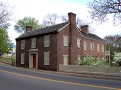 | Andrew Johnson National Historic Site | district | 1966 | 66000073 |
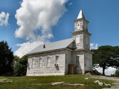 | Blue Springs Lutheran Church and Cemetery | building | 2017 | 100001824 |
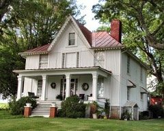 | Brown-Neas House | building | 1984 | 84000374 |
 | Conway Bridge | structure | 2009 | 09000948 |
| Crescent School | building | 2020 | 100005134 | |
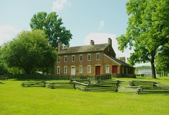 | Samuel Doak House | building | 1975 | 75001755 |
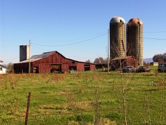 | Earnest Farms Historic District | district | 2002 | 01001449 |
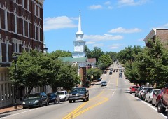 | Greeneville Historic District | district | 1974 | 74001913 |
| James Lowry House | building | 1982 | 82003972 | |
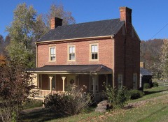 | Maden Hall Farm | district | 2009 | 09000667 |
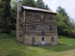 | Mauris-Earnest Fort House | building | 1978 | 78002591 |
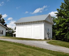 | New Bethel Cumberland Presbyterian Church | building | 1978 | 78002592 |
| Rainbow Bridge | structure | 2026 | 100012553 | |
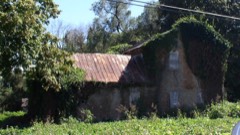 | David Rankin House | building | 1983 | 83003035 |
| Ripley Stone House | building | 1978 | 78002590 | |
| Tusculum College Historic District | district | 1980 | 80003800 |
Every wildfire the federal occurrence database records inside this county: 95 of them, burning about 6,574 acres. 8 started naturally and 19 were recorded as arson. Each settlement page carries the fires within five miles of it.
| Reported cause | Fires |
|---|---|
| Debris and open burning | 40 |
| Arson/incendiarism | 19 |
| Missing data/not specified/undetermined | 16 |
| Natural | 8 |
| Recreation and ceremony | 5 |
| Other causes | 2 |
| Smoking | 2 |
| Equipment and vehicle use | 2 |
| Power generation/transmission/distribution | 1 |
The five largest, by the area the report gives. Three of them were set deliberately.
| Date | Cause | Size | Reported by | Name on the report |
|---|---|---|---|---|
| 23 May 2007 | Natural | 2,115 acres | Cherokee National Forest | PIGEON BRANCH |
| 20 November 1994 | Arson/incendiarism | 1,285 acres | Cherokee National Forest | CHEROKEE NORTH |
| 6 November 2000 | Arson/incendiarism | 1,119 acres | Cherokee National Forest | HORSEHITCH |
| 20 October 2016 | Missing data/not specified/undetermined | 920 acres | Tennessee Division of Forestry | CHIMNEY TOP |
| 2 May 2018 | Missing data/not specified/undetermined | 163 acres | Tennessee Division of Forestry | BEAR HOLLOW |
| 13 November 2005 | Debris and open burning | 150 acres | Tennessee Division of Forestry | not named |
| 30 March 2016 | Arson/incendiarism | 125 acres | Tennessee Division of Forestry | STARLIGHT FIRE |
| 24 May 2007 | Natural | 110 acres | National Forests in North Carolina | SHAD FIRE |
Every settlement page carries the fires within five miles of it - see the settlement index below.
The NOAA Storm Events Database holds 402 reports for this county, causing 9 deaths, 113 injuries and about $40,617,200 in recorded property damage. Each settlement page carries the reports that name it.
| Kind of event | Reports |
|---|---|
| Thunderstorm Wind | 268 |
| Hail | 73 |
| Flash Flood | 28 |
| Flood | 16 |
| Tornado | 11 |
| Lightning | 5 |
| Funnel Cloud | 1 |
The most serious of them, by death, then injury, then recorded damage. The accounts are quoted exactly as the forecast office filed them.
| When | Event | Place named | Harm | What the report says |
|---|---|---|---|---|
| April 2011 | Tornado (EF3) | Flag Branch | 6 killed, 33 hurt, $8,000,000 | Camp Creek Tornado. A NWS storm survey reported an EF3 tornado touched down in the Camp Creek area. It tracked into Washington county where it dissipated. It had a path width of 1500 yards and path length of 16 miles. There were 6 fatalities in the Camp Creek, 3 on Rambo Road, 2 on Ricker Road, and 1 on Tabor road--all within one mile of each other. There were approximately 220 injuries from this tornado. The fatalities included a 58 year old man and his 56 year old wife who died in their home. In addition, a 70 year old man died in his home. A 47 year old man died in his mobile home. A 63 year old man also died in his home. A 47 year old woman died in her home.||The max wind of 150 mph did significant damage in the area including destroying 40 houses, 35 moble homes, 60 structures on farms, and one public building. Over 100 houses received damage. |
| April 2011 | Tornado (EF3) | Greystone | 1 killed, 70 hurt, $5,000,000 | Horse Creek Tornado. A NWS storm survey reported an EF3 tornado touched down in Greene County in the Horse Creek area, near the path where the Camp Creek tornado had passed about 1 hour and 40 minutes before. The tornado continued northeast into Washington county. It had a total path length of about 14 miles and a path width of 1000 yards. The maximum wind of 160 mph downed trees and also damaged and destroyed many houses and trailers. Multiple barns were destroyed. Two people died in the tornado...one in Greene County and one in Washington County. The fatalities were a 63 year old women (Greene County) and a 47 year old man (Washington County), both dying in their homes. The death in Greene County occurred on Morgan Branch Road. Approximate damage was 15 houses destroyed with 40 damaged; 10 mobile homes destroyed, and around 25 farms with structures destroyed.||In total, between the Camp Creek and Horse Creek tornadoes in Greene County there were 7 deaths, 293 injuries with 10 admitted to hospitals; 54 houses destroyed with 156 damaged; 46 mobile homes destroyed and 78 damaged, one public building destroyed, and structures on 88 farms destroyed with 109 damaged. |
| March 1967 | Tornado (F2) | not stated | 1 killed, 5 hurt, $250,000 | no account filed |
| September 2024 | Flood | St James | 1 killed, $22,700,000 | The massive flood wave on the Nolichucky River entered the eastern half of Greene County. Nolichucky Dam crested at 66.03 feet during the early morning of the 28th, setting a new record crest by far. Justified concerns that Nolichucky Dam would not withstand the flood wave were fortunately eased as the dam withstood the onslaught, although the power station building was damaged beyond repair. Downstream, the river gauge at Lowland just outside of Greene County shattered its previous record crest by 9 feet, cresting at 35.16 feet at 10:15 am EST on the 28th. Numerous structures were flooded or destroyed. Numerous roadways were inundated and some bridges were destroyed. |
| August 2016 | Thunderstorm Wind | Ducktown | 4 hurt | A tree fell on a car traveling on Old Ducktown Road, resulting in injury to the vehicle's occupants. |
| December 1973 | Tornado (F1) | not stated | 1 hurt, $25,000 | no account filed |
| August 2001 | Flash Flood | Countywide | $1,100,000 | no account filed |
| February 2019 | Flood | Mohawk | $550,000 | Flooding of roads and structures occurred at various locations across the county. |
| April 2011 | Tornado (EF2) | Liberty Hill | $300,000 | Ducktown Tornado. A NWS storm survey reported an EF2 tornado touched down in the Ducktown area in Greene County area and tracked northeast into Washington County south of Falls Branch. It had a path width of 150 yards and path length of 10 miles. The 120 mph wind damaged several homes and downed numerous trees. One house was destroyed. |
| April 1967 | Tornado (F2) | not stated | $250,000 | no account filed |
| February 2020 | Flood | Chuckey | $175,000 | Numerous roads covered with or damaged by water or debris. |
| August 2005 | Thunderstorm Wind | Greeneville | $70,000 | A large metal storage building was destroyed and a second nearby one had the roof blown off. Numerous trees also down in the county. |
| July 2005 | Lightning | Chestnut Ridge | $70,000 | no account filed |
| July 1996 | Thunderstorm Wind | West Part | $60,000 | no account filed |
| July 1997 | Thunderstorm Wind | Afton | $50,000 | County dispatch and WJHL TV station reported roof damage at West Pine Elementary School just off I-81 exit 44. Several trees down. |
| May 1998 | Thunderstorm Wind | Greeneville | $50,000 | no account filed |
| June 1996 | Thunderstorm Wind | Ottway | $50,000 | no account filed |
| May 2006 | Thunderstorm Wind | Mohawk | $45,000 | no account filed |
| June 2004 | Flash Flood | Mosheim | $40,000 | Several homes flooded on Shackleford Road. |
| August 2002 | Thunderstorm Wind | Greeneville | $40,000 | no account filed |
| August 2007 | Thunderstorm Wind | Mohawk | $35,000 | The Greenville Sun newspaper reported high winds from a thunderstorm ripped the roof from an open storage building near Mohawk. In addition a 14 foot camper trailer was destroyed in the same area. The sheriffs dispatch reported numerous trees and powerlines downed by thunderstorm winds from Mohawk to Mosheim. |
| May 2006 | Thunderstorm Wind | Tusculum | $35,000 | no account filed |
| May 2006 | Thunderstorm Wind | Countywide | $35,000 | no account filed |
| May 2006 | Thunderstorm Wind | Greeneville | $30,000 | no account filed |
| May 2006 | Thunderstorm Wind | Greeneville | $30,000 | no account filed |
| July 2006 | Thunderstorm Wind | Countywide | $30,000 | no account filed |
| July 2005 | Thunderstorm Wind | Greeneville | $30,000 | no account filed |
| August 2005 | Thunderstorm Wind | Greeneville | $28,000 | Numerous trees and power lines down in Greenville and across most of the county. |
| February 2009 | Thunderstorm Wind | Baileyton | $25,000 | Law enforcement personnel reported several trees and powerlines downed by thunderstorm winds in Baileyton. In addition, a home was damaged in Greeneville by a falling tree. |
| April 2007 | Thunderstorm Wind | Greeneville | $25,000 | Several trees were reported down at various locations throughout the county. A garage and a small wooden barn were also damaged near Greeneville. |
| August 2007 | Thunderstorm Wind | Greeneville | $25,000 | A spotter reported a Kentucky Fried Chicken Restaurant's sign was blown off by thunderstorm winds in Greenville. In addition, a credit union had some roof damage. Bleachers at the fairground were also damaged by winds. Trees were also downed in the area. |
| April 2006 | Thunderstorm Wind | Greeneville | $25,000 | A Greenville fire department's fire hall sustained roof damage. In addition, a mobile home sustained minor damage when an awning that was attached to it was blown off. Several trees were also down across the county. |
| May 2006 | Thunderstorm Wind | Greeneville | $25,000 | no account filed |
| May 2005 | Thunderstorm Wind | Greeneville | $25,000 | no account filed |
| August 2002 | Lightning | Camp Creek | $25,000 | no account filed |
| July 2002 | Thunderstorm Wind | Mosheim | $25,000 | no account filed |
| June 1977 | Tornado (F1) | not stated | $25,000 | no account filed |
| March 1975 | Tornado (F1) | not stated | $25,000 | no account filed |
| March 1955 | Tornado (F1) | not stated | $25,000 | no account filed |
| January 1997 | Thunderstorm Wind | Countywide | $21,000 | no account filed |
| August 2012 | Thunderstorm Wind | Greeneville | $20,000 | A trained spotter reported 2 barns were destroyed by thunderstorm wind 3 miles north of Greeneville. |
| April 2011 | Thunderstorm Wind | Greeneville | $20,000 | Law enforcement personnel reported trees downed by thunderstorm wind countywide. |
| April 2011 | Thunderstorm Wind | Tusculum | $20,000 | Law enforcement personnel reported numerous trees downed by thunderstorm wind in Tusculum. |
| June 2009 | Thunderstorm Wind | Greeneville | $20,000 | The newspaper reported numerous trees and powerlines downed by thunderstorm winds countywide. |
| June 2009 | Thunderstorm Wind | Greeneville | $20,000 | Law enforcement officials reported numerous trees and a few powerlines downed by thunderstorm winds countywide. |
| June 2004 | Thunderstorm Wind | Greeneville | $20,000 | Three farm buildings destroyed |
| July 2001 | Thunderstorm Wind | Countywide | $20,000 | Trees and power lines down. |
| October 2001 | Thunderstorm Wind | Countywide | $20,000 | Trees and power lines down, mainly in the southern part of the county. |
| March 1995 | Thunderstorm Wind | Greeneville | $20,000 | A library sustained roof damage. Some gutters were blown off of an elementary school. |
| May 2006 | Thunderstorm Wind | Mosheim | $20,000 | no account filed |
| July 2006 | Thunderstorm Wind | Baileyton | $20,000 | no account filed |
| May 2005 | Thunderstorm Wind | Greeneville | $20,000 | no account filed |
| May 2004 | Thunderstorm Wind | Greeneville | $20,000 | no account filed |
| June 2003 | Thunderstorm Wind | Chuckey | $20,000 | no account filed |
| June 2001 | Thunderstorm Wind | Mohawk | $20,000 | no account filed |
| February 2000 | Thunderstorm Wind | Countywide | $20,000 | no account filed |
| November 2000 | Thunderstorm Wind | Greeneville | $18,000 | Trees, power lines, power poles down. |
| May 2003 | Thunderstorm Wind | Greeneville | $16,000 | no account filed |
| June 2014 | Thunderstorm Wind | Graysburg | $15,000 | The broadcast media reported a barn damaged and a roof blown off by thunderstorm wind 7 miles south-southwest of Fall Branch. |
| August 2012 | Thunderstorm Wind | Baileyton | $15,000 | Emergency manager personnel reported trees and powerline downed by thunderstorm wind near Baileyton. |
The Survey's mineral resources record lists 93 workings inside this county. 15 still produce and 78 are closed or unrecorded. Each settlement page carries the workings within five miles of it.
| Commodity | Workings |
|---|---|
| Barium-Barite | 41 |
| Iron | 12 |
| Stone, Crushed/Broken | 9 |
| Sand and Gravel, Construction | 7 |
| Zinc | 5 |
| Manganese | 5 |
| Zinc, Barium-Barite | 4 |
| Barium-Barite, Iron | 2 |
| Zinc, Lead, Iron | 2 |
| Dolomite | 1 |
| Limestone, General | 1 |
| Zinc, Iron | 1 |
| Stone, Crushed/Broken, Limestone, General | 1 |
| Stone | 1 |
The least common of them first, because a county's hundredth gravel pit says nothing its first ten did not.
| Where | Site | Commodity | Status | Recorded |
|---|---|---|---|---|
| Afton Quarry | Limestone, General | Past Producer | Sedimentary | |
| Agricultural Lime Company, Inc. Quarry | Dolomite | Producer | Dolomite | |
| Brown Prospect | Lead, Zinc | Prospect | ||
| Clay Deposit | Clay | Prospect | ||
| Greene County Highway Department Quarry | Stone, Crushed/Broken, Limestone, General | Producer | Limestone | |
| Greene Ct. Hwy. Dept. Quarry | Stone | Past Producer | ||
| Jearoldstown | Barium-Barite, Zinc | Prospect | ||
| Naff | Barium-Barite, Iron, Zinc | Prospect | ||
| Naff Prospect | Barium-Barite, Zinc, Iron | Past Producer | 1870 | |
| Neas | Zinc, Lead | Prospect | ||
| Berkey Barite Prospect | Barium-Barite, Iron | Occurrence | Barite, Limonite | |
| Brown Prospect | Zinc, Lead, Iron | Occurrence | 1900 | |
| Hull Mill Barite Occurrence | Barium-Barite, Iron | Occurrence | Barite, Limonite | |
| Tipton Prospect | Zinc, Lead, Iron | Occurrence | Limonite, Smithsonite, Sphalerite | |
| Dobbins | Zinc, Barium-Barite | Prospect | ||
| R. P. Johnson | Zinc, Barium-Barite | Prospect | ||
| R. P. Johnson Zinc Prospect | Zinc, Barium-Barite | Occurrence | Barite, Sphalerite | |
| Roberta Johnson Prospect | Zinc, Barium-Barite | Occurrence | Barite, Sphalerite | |
| Brown-Tipton | Zinc | Prospect | ||
| Carl Mill Prospect | Manganese | Prospect | 1951 | |
| Colvard Prospects | Zinc | Occurrence | Sphalerite | |
| Colvard Prospects | Zinc | Prospect | ||
| Haysville Prospect | Manganese | Past Producer | 1917 | |
| Lamb Prospect | Manganese, Iron | Prospect | ||
| Payne Prospect | Manganese | Prospect | ||
| Roberta Johnson | Zinc | Prospect | ||
| Sylvia Prospect | Manganese, Iron | Past Producer | ||
| Cove Creek Quarry | Sand and Gravel, Construction | Past Producer | Sedimentary | |
| Malone Brothers Quarry | Sand and Gravel, Construction | Past Producer | Sedimentary | |
| Nolichucky Sand and Gravel Co. Pit No. 436 | Sand and Gravel, Construction | Producer | Unconsolidated Sediments | |
| Parvin Pit | Sand and Gravel, Construction | Producer | Unconsolidated Sediments | |
| Parvin Pit | Sand and Gravel, Construction | Past Producer | Sedimentary | |
| Parvin Pit | Sand and Gravel, Construction | Producer | ||
| Pit Number 436 | Sand and Gravel, Construction | Producer | ||
| Afton Quarry | Stone, Crushed/Broken | Producer | ||
| Agricultural Lime Co., Inc. Quarry | Stone, Crushed/Broken | Producer | ||
| Cove Creek | Stone, Crushed/Broken | Producer | Limestone | |
| Cove Creek Quarry | Stone, Crushed/Broken | Producer | ||
| Dog Walk Quarry | Stone, Crushed/Broken | Producer | ||
| Greeneville Quarry | Stone, Crushed/Broken | Producer | ||
| Kyker Quarry | Stone, Crushed/Broken | Producer | 1961 | |
| Malone Brothers Quarry | Stone, Crushed/Broken | Producer | Limestone | |
| Midway Quarry | Stone, Crushed/Broken | Producer | ||
| Iron Mine | Iron | Past Producer | ||
| Iron Mine | Iron | Past Producer | ||
| Iron Mine | Iron | Past Producer | ||
| Iron Mine | Iron | Past Producer | ||
| J.H. Mills Prospect | Iron | Prospect | ||
| Ore Bank Iron Mines | Iron | Past Producer | 1827 | |
| Ore Bank Iron Mines | Iron | Past Producer | ||
| Ore Bank Mine | Iron | Past Producer | ||
| Ore Banks Fe Mine | Iron | Past Producer | Residual | |
| Unnamed Limonite Occurrences | Iron | Occurrence | Limonite | |
| Babbs Mill Barite Mine A | Barium-Barite | Past Producer | Barite | |
| Babbs Mill Barite Mine A | Barium-Barite | Past Producer | ||
| Babbs Mill Mine B | Barium-Barite | Past Producer | ||
| Berkey Barite Prospect | Barium-Barite | Occurrence | ||
| Cox Barite Prospect | Barium-Barite | Occurrence | Barite | |
| Cox Barite Prospect | Barium-Barite | Prospect | ||
| Harmon Barite Prospect | Barium-Barite | Occurrence | Barite | |
| Harmon Barite Prospect | Barium-Barite | Prospect | ||
| Hull Mill Barite Prospect | Barium-Barite | Occurrence | ||
| J. J. King Barite Prospect | Barium-Barite | Occurrence | 1925 | |
| J. J. King Barite Prospect | Barium-Barite | Prospect | ||
| Lovelace Barite Mine | Barium-Barite | Past Producer | ||
| M. E. Harmon Barite Mine | Barium-Barite | Past Producer | 1880 | |
| M. E. Harmon Barite Mine | Barium-Barite | Past Producer | ||
| Matthews Barite Prospect | Barium-Barite | Occurrence | Barite | |
| Matthews Barite Prospect | Barium-Barite | Occurrence | ||
| N. C. Hartman Barite Mine | Barium-Barite | Past Producer | ||
| N. C. Hartman Barite Mine No. 2 | Barium-Barite | Past Producer | ||
| R. P. Johnson Barite Mine | Barium-Barite | Past Producer | Barite | |
| R. P. Johnson Barite Mine | Barium-Barite | Past Producer | ||
| Solomon Barite Mine | Barium-Barite | Past Producer | Barite | |
| Solomon Barite Mine | Barium-Barite | Past Producer | ||
| Thornburg Barite Mine | Barium-Barite | Past Producer | Barite | |
| Thornburg Barite Mine | Barium-Barite | Past Producer | ||
| Tine Britton Barite Prospect | Barium-Barite | Occurrence | Barite | |
| Tine Britton Barite Prospect | Barium-Barite | Prospect | ||
| Unnamed Barite Occurrence 1 | Barium-Barite | Occurrence | Barite | |
| Unnamed Barite Occurrence 11 | Barium-Barite | Occurrence | Barite | |
| Unnamed Barite Occurrence 12 | Barium-Barite | Occurrence | Barite | |
| Unnamed Barite Occurrence 13 | Barium-Barite | Occurrence | Barite | |
| Unnamed Barite Occurrence 2 | Barium-Barite | Occurrence | Barite | |
| Unnamed Barite Occurrence 3 | Barium-Barite | Occurrence | Barite | |
| Unnamed Barite Occurrence 4 | Barium-Barite | Occurrence | Barite | |
| Unnamed Barite Occurrence 6 | Barium-Barite | Occurrence | Barite | |
| Unnamed Barite Occurrence 7 | Barium-Barite | Occurrence | Barite | |
| Unnamed Barite Occurrence 8 | Barium-Barite | Occurrence | Barite | |
| Unnamed Barite Occurrence 9 | Barium-Barite | Occurrence | Barite | |
| Unnamed Barite Occurrences | Barium-Barite | Occurrence | Barite | |
| Unnamed Barite Occurrences 10 | Barium-Barite | Occurrence | Barite | |
| Unnamed Barite Occurrences 5 | Barium-Barite | Occurrence | Barite |
Named settlements recorded in the Geographic Names Information System, each with the topographic sheets covering it. Villages, hamlets and abandoned places alike. Each is shown with the nearest named watercourse or landform and the survey quadrangle it falls on.
District 4 · 37743 · On Holley Creek · Greeneville quadrangle
18 sheets, 1892 to 1980
District 5 · 37743 · Near Russell Island · Cedar Creek quadrangle
20 sheets, 1892 to 2003
No longer a settlement
District 1 · 37745 · On Wattenbarger Branch · Baileyton quadrangle
17 sheets, 1892 to 1980
District 5 · 37743 · On Richland Creek · Davy Crockett Lake quadrangle
20 sheets, 1892 to 2003
District 4 · 37743 · On Caney Branch · Davy Crockett Lake quadrangle
20 sheets, 1892 to 2003
District 2 · 37681 · Near Hootowl Hollow · Jearoldstown quadrangle
17 sheets, 1892 to 1980
District 6 · 37711 · On Little Gap Creek · McCloud quadrangle
18 sheets, 1892 to 1980
No longer a settlement
District 1 · 37745 · Near Grassy Valley · Greeneville quadrangle
18 sheets, 1892 to 1980
No longer a settlement
District 4 · 37743 · Near Cinder Hill · Davy Crockett Lake quadrangle
20 sheets, 1892 to 2003
District 4 · 37616 · On Stage Creek · Chuckey quadrangle
17 sheets, 1892 to 2003
No longer a settlement
District 7 · 37745 · On Tipton Creek · Greeneville quadrangle
18 sheets, 1892 to 1980
District 5 · 37743 · On Burgen Branch · Paint Rock quadrangle
27 sheets, 1894 to 2003
District 1 · 37641 · Near Tadpole Hollow · Jearoldstown quadrangle
17 sheets, 1892 to 1980
District 1 · 37681 · Near Sugar Hollow · Jearoldstown quadrangle
17 sheets, 1892 to 1980
District 5 · 37743 · On Hipps Branch · Davy Crockett Lake quadrangle
20 sheets, 1892 to 2003
District 7 · 37818 · Near Norton Hollow · Cedar Creek quadrangle
20 sheets, 1892 to 2003
No longer a settlement
District 1 · 37641 · Near Taylor Knob · Jearoldstown quadrangle
17 sheets, 1892 to 1980
No longer a settlement
District 6 · 37818 · On Puncheon Camp Creek · Mosheim quadrangle
16 sheets, 1892 to 1980
No longer a settlement
District 2 · 37681 · On Milburnton Creek · Jearoldstown quadrangle
17 sheets, 1892 to 1980
District 1 · 37745 · On Babb Creek · McCloud quadrangle
18 sheets, 1892 to 1980
No longer a settlement
District 1 · 37745 · On Gardner Creek · Baileyton quadrangle
17 sheets, 1892 to 1980
No longer a settlement
District 1 · 37745 · On Double Lick Branch · Jearoldstown quadrangle
17 sheets, 1892 to 1980
District 5 · 37743 · Near Houston Valley · Hot Springs quadrangle
28 sheets, 1894 to 1985
District 2 · 37641 · Near Quaker Knobs · Jearoldstown quadrangle
17 sheets, 1892 to 1980
District 1 · 37616 · On Union Temple Creek · Baileyton quadrangle
17 sheets, 1892 to 1980
District 5 · 37743 · On East Fork Richland Creek · Greeneville quadrangle
18 sheets, 1892 to 1980
District 7 · 37743 · On Buffalo Creek · Cedar Creek quadrangle
20 sheets, 1892 to 2003
District 5 · 37743 · On Richland Creek · Davy Crockett Lake quadrangle
20 sheets, 1892 to 2003
District 5 · 37743 · Cedar Creek quadrangle
20 sheets, 1892 to 2003
No longer a settlement
District 5 · 37743 · On East Fork Richland Creek · Davy Crockett Lake quadrangle
20 sheets, 1892 to 2003
District 1 · 37641 · Near Bone Valley · Jearoldstown quadrangle
17 sheets, 1892 to 1980
No longer a settlement
District 4 · 37743 · On Tipton Creek · Greeneville quadrangle
18 sheets, 1892 to 1980
District 3 · 37745 · On Frank Creek · Greeneville quadrangle
18 sheets, 1892 to 1980
District 1 · 37616 · Near Crabtree Hollow · Jearoldstown quadrangle
17 sheets, 1892 to 1980
District 4 · 37743 · Near Kelly Knob · Davy Crockett Lake quadrangle
20 sheets, 1892 to 2003
The vanished settlements of Greene County: the places named above that are no longer on the map.