BlockBefore
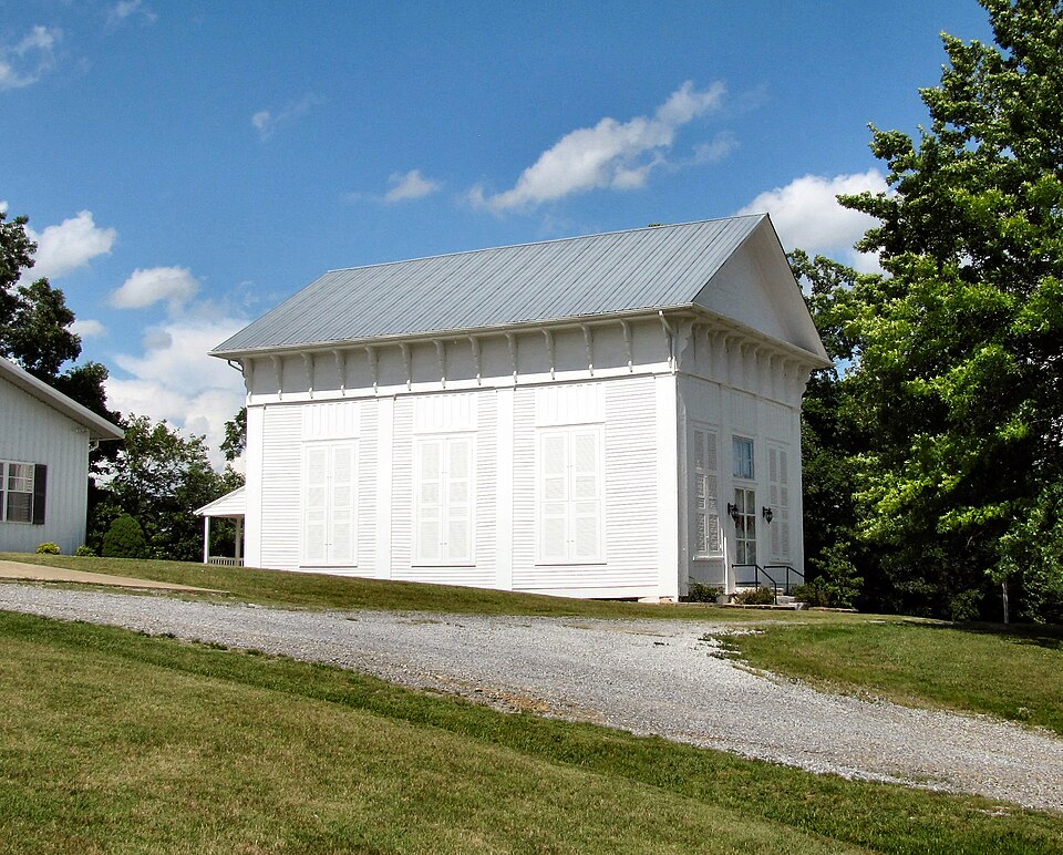
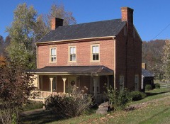
Photograph of New Bethel Cumberland Presbyterian Church
Photograph by Brian Stansberry, CC BY 3.0. Via Wikimedia Commons.

New Bethel Cumberland Presbyterian Church

Listed on the National Register of Historic Places in 1978.

From the record

“New Bethel Cumberland Presbyterian Church is a historic church building near Greeneville in rural Greene County, Tennessee, United States.”

Wikipedia article New Bethel Cumberland Presbyterian Church, CC BY-SA 4.0.

One of 18 National Register listings published here for Greene County · listed in 1978 · category: Building.

Sources: the Wikipedia article · the National Register database, National Park Service

The listing

  • What is counted as historic. The nomination lists 1 building as contributing to the listing.
  • Address. NW of Greeneville on TN 70, Greeneville, 37745
  • When was it listed? October 1978
  • Category. building
  • Architectural style. Greek Revival architecture
  • National Register reference number. 78002592 - assigned by the National Park Service when the property was listed.

Fires near this property

8 since 1997

Regional context, not property-specific evidence. The federal wildfire occurrence database lists 8 fires within 5 miles of New Bethel Cumberland Presbyterian Church between 1997 and 2020, burning about 67 acres in total. None started naturally. None was recorded as arson. Distance is straight-line from the map coordinates, so a fire counted here may appear on a neighbouring settlement's page as well.

Reported cause Fires
Debris and open burning5
Missing data/not specified/undetermined2
Other causes1

The most recent of them, most recent first, with the day each was reported and the service that recorded it.

DateCause SizeReported by Name on the report
17 April 2020Debris and open burning1.0 acresTennessee Division of ForestryHARTMAN LANE
24 February 1997Missing data/not specified/undetermined1.0 acresTennessee Division of Forestrynot named
20 February 1997Debris and open burning50 acresTennessee Division of Forestrynot named
18 February 1997Debris and open burning2.0 acresTennessee Division of Forestrynot named
8 November 2016Other causes1.0 acresTennessee Division of ForestryJONES QUARRY
10 November 2020Debris and open burningunder an acreTennessee Division of ForestryLONESOME PINE TRAIL 7345
5 October 2019Debris and open burning11 acresTennessee Division of ForestryLONESOME PINE
10 October 2019Missing data/not specified/undetermined1.0 acresTennessee Division of ForestrySHACKLEFORD RD

Every fire recorded in Greene County

Mines and quarries near this property

10 of 53 shown

Regional context, not property-specific evidence. The federal mineral resources record lists 53 workings within 5 miles of New Bethel Cumberland Presbyterian Church: 30 occurrences, 13 past producers, 8 prospects, 2 producers. 2 still produce. What was taken out: Barium-Barite, Iron, Zinc, Zinc, Barium-Barite. Distance is straight-line from the map coordinates, so a quarry counted here may appear on a neighbouring settlement's page as well.

Where SiteCommodity StatusRecorded
Malone Brothers QuarrySand and Gravel, ConstructionPast ProducerSedimentary
Berkey Barite ProspectBarium-Barite, IronOccurrenceBarite, Limonite
Brown ProspectZinc, Lead, IronOccurrence1900
Greeneville QuarryStone, Crushed/BrokenProducer
Hull Mill Barite OccurrenceBarium-Barite, IronOccurrenceBarite, Limonite
Malone Brothers QuarryStone, Crushed/BrokenProducerLimestone
Tipton ProspectZinc, Lead, IronOccurrenceLimonite, Smithsonite, Sphalerite
R. P. JohnsonZinc, Barium-BariteProspect
R. P. Johnson Zinc ProspectZinc, Barium-BariteOccurrenceBarite, Sphalerite
Roberta Johnson ProspectZinc, Barium-BariteOccurrenceBarite, Sphalerite

Every working recorded in Greene County

Storms near this property

60 of 133 shown

Regional context, not property-specific evidence. The National Weather Service names Greeneville, the town this property stands in, in 133 storm reports between 1993 and 2025: 94 thunderstorm wind, 20 hail, 9 flood, 7 flash flood. No death or injury is recorded in these reports. Each account below is quoted exactly as the forecast office filed it, from the NOAA Storm Events Database, and each date opens the federal record of that event.

WhenEvent Place namedHarm What the report says
August 2005Thunderstorm WindGreeneville$70,000A large metal storage building was destroyed and a second nearby one had the roof blown off. Numerous trees also down in the county.
May 1998Thunderstorm WindGreeneville$50,000no account filed
August 2002Thunderstorm WindGreeneville$40,000no account filed
May 2006Thunderstorm WindGreeneville$30,000no account filed
July 2005Thunderstorm WindGreeneville$30,000no account filed
August 2005Thunderstorm WindGreeneville$28,000Numerous trees and power lines down in Greenville and across most of the county.
April 2007Thunderstorm WindGreeneville$25,000Several trees were reported down at various locations throughout the county. A garage and a small wooden barn were also damaged near Greeneville.
August 2007Thunderstorm WindGreeneville$25,000A spotter reported a Kentucky Fried Chicken Restaurant's sign was blown off by thunderstorm winds in Greenville. In addition, a credit union had some roof damage. Bleachers at the fairground were also damaged by winds. Trees were also downed in the area.
April 2006Thunderstorm WindGreeneville$25,000A Greenville fire department's fire hall sustained roof damage. In addition, a mobile home sustained minor damage when an awning that was attached to it was blown off. Several trees were also down across the county.
May 2006Thunderstorm WindGreeneville$25,000no account filed
May 2005Thunderstorm WindGreeneville$25,000no account filed
August 2012Thunderstorm WindGreeneville$20,000A trained spotter reported 2 barns were destroyed by thunderstorm wind 3 miles north of Greeneville.
April 2011Thunderstorm WindGreeneville$20,000Law enforcement personnel reported trees downed by thunderstorm wind countywide.
June 2009Thunderstorm WindGreeneville$20,000The newspaper reported numerous trees and powerlines downed by thunderstorm winds countywide.
June 2009Thunderstorm WindGreeneville$20,000Law enforcement officials reported numerous trees and a few powerlines downed by thunderstorm winds countywide.
June 2004Thunderstorm WindGreeneville$20,000Three farm buildings destroyed
March 1995Thunderstorm WindGreeneville$20,000A library sustained roof damage. Some gutters were blown off of an elementary school.
May 2005Thunderstorm WindGreeneville$20,000no account filed
May 2004Thunderstorm WindGreeneville$20,000no account filed
November 2000Thunderstorm WindGreeneville$18,000Trees, power lines, power poles down.
May 2003Thunderstorm WindGreeneville$16,000no account filed
June 2005Thunderstorm WindGreeneville$15,000A few trees down on powerlines.
August 1995Thunderstorm WindGreeneville$15,000Several trees down and a roof blown off house on Snaps Ferry Road.
May 2006Thunderstorm WindGreeneville$15,000no account filed
May 2004Thunderstorm WindGreeneville$15,000no account filed
July 2002Thunderstorm WindGreeneville$15,000no account filed
July 2000Thunderstorm WindGreeneville$15,000no account filed
November 1998Thunderstorm WindGreeneville$15,000no account filed
June 2005Thunderstorm WindGreeneville$12,000A few trees down east of Greeneville.
July 2004Thunderstorm WindGreeneville$12,000no account filed
May 2010Thunderstorm WindGreeneville$10,000A few trees and power lines were blown down by thunderstorm winds.
April 2006LightningGreeneville$10,000Lightning struck a mobile home in Greeneville damaging the roof and gutters.
April 2006LightningGreeneville$10,000Lightning struck a barn in Greeneville which was destroyed by fire.
April 2006Thunderstorm WindGreeneville$10,000Several trees down just north of Greeneville.
August 2006Thunderstorm WindGreeneville$10,000A few trees and powerlines down in Greeneville.
May 2004Thunderstorm WindGreeneville$10,000no account filed
July 2004Thunderstorm WindGreeneville$10,000no account filed
June 2014Thunderstorm WindGreeneville$8,000Law enforcement personnel reported sporadic trees downed by thunderstorms wind across the county.
April 2006Thunderstorm WindGreeneville$8,000A few trees down in Greeneville.
August 1999Thunderstorm WindGreeneville$8,000no account filed
May 2006Thunderstorm WindGreeneville$6,000no account filed
July 2006Thunderstorm WindGreeneville$6,000no account filed
June 2003Thunderstorm WindGreeneville$6,000no account filed
August 2014Thunderstorm WindGreeneville$5,000Law enforcement personnel reported a few trees downed by thunderstorm wind 2 miles south of Greeneville.
January 2013FloodGreeneville$5,000Over two dozen roads closed across the county. Two water rescues on Roaring Fork Road.
June 2011Thunderstorm WindGreeneville$5,000Law enforcement personnel reported a few trees downed by thunderstorm wind countywide.
April 2006Thunderstorm WindGreeneville$5,000A few trees down near the county line.
June 2004Thunderstorm WindGreeneville$5,000One tree down on Erwin Highway just north of Greeneville
August 2012Thunderstorm WindGreeneville$4,000A trained spotter reported a couple of trees and large limbs downed by thunderstorm wind in Greeneville.
August 2014Thunderstorm WindGreeneville$3,000Law enforcement personnel reported 2 trees downed by thunderstorm wind 9 miles west-northwest of Greeneville.
January 2013FloodGreeneville$3,000Denzil Bowman Wastewater Treatment Plant experiencing numerous overflows from its collection system.
June 2008Thunderstorm WindGreeneville$3,000Dispatch reported 2 trees downed by thunderstorm winds on Gass Memorial Road in Greeneville.
April 2005Thunderstorm WindGreeneville$3,000Several trees down in Greeneville.
July 2006Thunderstorm WindGreeneville$3,000no account filed
May 2005Thunderstorm WindGreeneville$3,000no account filed
April 2015Thunderstorm WindGreeneville$2,000Dispatch personnel reported a tree downed by thunderstorm wind 7 miles east-southeast of Greeneville on Fracks Roberts Road.

Every storm recorded in Greene County

Map coverage status

No historic map-sheet match is published for this property yet. That does not mean no map exists. This record needs a coordinate-quality review before it can be joined to a sheet boundary. Browse the county's mapped places while that work is pending.

Listed places nearby

6 within 8 miles

Other National Register properties close enough to walk or drive between, ordered by distance from this one. Both positions come from the same geocoding pass that matched these properties to their map sheets.

Photograph PropertyDistance Listed
Crescent School3.5 miles2020
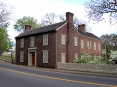
Andrew Johnson National Historic Site3.7 miles1966
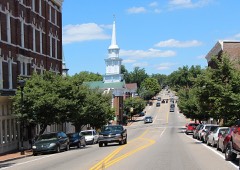
Greeneville Historic District3.8 miles1974
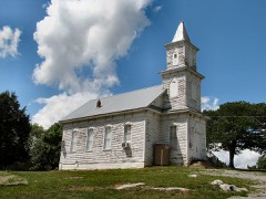
Blue Springs Lutheran Church and Cemetery4.2 miles2017
Maden Hall Farm5.2 miles2009
James Lowry House5.3 miles1982

Sources for this property

National Archives recordThe nomination case file for reference 78002592 in Record Group 79.
Wikipedia articleCommunity-written account of this property, licensed CC BY-SA.
Greene CountyAll 18 listed properties in this county.

Provenance

  • Listing record. National Park Service National Register of Historic Places, listed-properties dataset, current to 2026-05-22.
  • Map join. Address geocoded through the United States Census geocoder, then tested against the published boundary of every sheet in the USGS Historical Topographic Map Collection.
  • How this page is made. Listing fields come from federal records; map-sheet coverage is a labelled coordinate-to-boundary calculation, not a source-field claim.
  • Wildfire. Short, Karen C. 2022. Spatial wildfire occurrence data for the United States, 1992-2020 [FPA_FOD_20221014]. 6th Edition. Fort Collins, CO: Forest Service Research Data Archive. https://doi.org/10.2737/RDS-2013-0009.6 Collected with United States Government funding and usable without additional permissions or fees.
  • Mines and quarries. USGS Mineral Resources Data System (MRDS) https://mrdata.usgs.gov/mrds/ A work of the United States government, no copyright under 17 U.S.C. 105.
  • Storms. NOAA National Centers for Environmental Information, Storm Events Database https://www.ncei.noaa.gov/stormevents/ A work of the United States government, no copyright under 17 U.S.C. 105. Narratives are quoted verbatim from the National Weather Service report and are not edited or summarised.