 Block
From the record
8 National Register listings published here.
Sources: the National Register database, National Park Service
130 topographic sheets cover 47 settlements here, and 8 properties are on the National Register of Historic Places.
8 National Register listings published here.
Sources: the National Register database, National Park Service
Every property in this county listed on the National Register of Historic Places, with the year it was listed and the federal nomination document.
| Photograph | Property | Type | Listed | Reference |
|---|---|---|---|---|
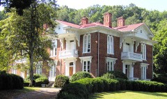 | Butler House | building | 1973 | 73001798 |
| Alfred Johnson Farm | district | 1998 | 98000820 | |
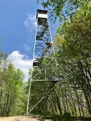 | Kettlefoot Fire Lookout Tower | building | 2015 | 15000833 |
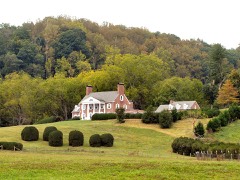 | Maymead Farm | district | 2012 | 11000100 |
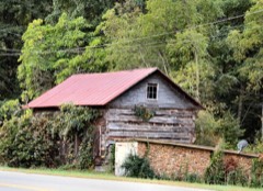 | Morrison Farm and Store | building | 1973 | 73001797 |
| Rhea House | building | 1973 | 73001799 | |
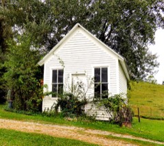 | Dr. Wiley Wagner Vaught Office | building | 2009 | 09000950 |
| A.J. Wright Farm | district | 2000 | 00000808 |
Every wildfire the federal occurrence database records inside this county: 63 of them, burning about 2,176 acres. 4 started naturally and 32 were recorded as arson. Each settlement page carries the fires within five miles of it.
| Reported cause | Fires |
|---|---|
| Arson/incendiarism | 32 |
| Debris and open burning | 19 |
| Natural | 4 |
| Missing data/not specified/undetermined | 4 |
| Power generation/transmission/distribution | 2 |
| Equipment and vehicle use | 1 |
| Smoking | 1 |
The five largest, by the area the report gives. 6 of them were set deliberately.
| Date | Cause | Size | Reported by | Name on the report |
|---|---|---|---|---|
| 12 November 2005 | Arson/incendiarism | 297 acres | Cherokee National Forest | CUT LAUREL |
| 15 November 1999 | Arson/incendiarism | 215 acres | Cherokee National Forest | DELANEY MOUNTAIN |
| 16 May 1997 | Natural | 200 acres | Cherokee National Forest | PIONEER LANDING |
| 1 May 2006 | Arson/incendiarism | 190 acres | Cherokee National Forest | SINK MT. |
| 5 November 1999 | Arson/incendiarism | 162 acres | Cherokee National Forest | SINKS MOUNTAIN |
| 28 April 2008 | Natural | 161 acres | Tennessee Division of Forestry | not named |
| 4 November 2005 | Arson/incendiarism | 158 acres | Cherokee National Forest | WINNIE KNOB |
| 14 April 2018 | Arson/incendiarism | 122 acres | Cherokee National Forest | COOK HOLLOW FIRE |
Every settlement page carries the fires within five miles of it - see the settlement index below.
The NOAA Storm Events Database holds 120 reports for this county, causing 3 deaths, 3 injuries and about $9,432,000 in recorded property damage. Each settlement page carries the reports that name it.
| Kind of event | Reports |
|---|---|
| Thunderstorm Wind | 71 |
| Hail | 23 |
| Flash Flood | 17 |
| Flood | 5 |
| Tornado | 3 |
| Heavy Rain | 1 |
The most serious of them, by death, then injury, then recorded damage. The accounts are quoted exactly as the forecast office filed them.
| When | Event | Place named | Harm | What the report says |
|---|---|---|---|---|
| April 2011 | Tornado (EF2) | Doeville | 2 killed, $1,000,000 | A NWS storm survey reported an EF2 tornado touched down near Butler. It had a path length of 12 miles and a path width of 250 yards. The max wind of 120 mph destroyed homes and buildings and downed numerous trees. In addition, 2 women died. A 54 year old woman died in her home in the Doe Valley community and a 53 year old woman died in her home in Butler. |
| September 2024 | Flash Flood | Trade | 1 killed, $6,500,000 | Reports of water rescues in Trade were received at 8:30 am EST. By 9:30 am EST, multiple structures had been damaged by flood waters throughout Trade. Damaging flood waters occurred in Mountain City and northward through Laurel Bloomery through the morning. Employees at the Parkdale Plant between Mountain City and Midway were evacuated by helicopter. Antioch Baptist Church near Midway was completely washed away by Roan Creek, to which it was adjacent. Portions of TN 91 from Laurel Bloomery northward to the state line were washed out. Flooding hazards in the county continued into the night. Reports were received from county officials, trained spotters, social media, and broadcast media. |
| June 1998 | Tornado (F1) | Doeville | 3 hurt, $125,000 | no account filed |
| February 2019 | Flood | Neva | $900,000 | Flooding in the Neva community along Mill Creek Road. |
| January 1998 | Flash Flood | Countywide | $500,000 | no account filed |
| May 2005 | Thunderstorm Wind | Countywide | $25,000 | no account filed |
| May 1997 | Flash Flood | Countywide | $25,000 | no account filed |
| June 2003 | Thunderstorm Wind | Countywide | $20,000 | no account filed |
| June 1998 | Thunderstorm Wind | Mountain City | $20,000 | no account filed |
| June 1997 | Thunderstorm Wind | Countywide | $19,000 | Numerous trees and powerlines down across county. |
| June 1998 | Thunderstorm Wind | Shady Vly | $18,000 | no account filed |
| September 2010 | Thunderstorm Wind | Shady Vly | $15,000 | An isolated thunderstorm produced wind damage in a small area in the higher elevations of Shady Valley. Several trees were blown down by thunderstorm winds. |
| June 2010 | Thunderstorm Wind | Mountain City | $15,000 | The Tomahawk newspaper in Mountain City reported several tress and powerlines downed by thunderstorm winds in the Mountain City area. A few buildings were also damaged. |
| June 2009 | Thunderstorm Wind | Mountain City | $15,000 | Law enforcement officials reported multiple trees and powerlines downed by thunderstorm winds in the Iron Mountain area. |
| April 2006 | Thunderstorm Wind | Countywide | $15,000 | Numerous trees down countywide. |
| May 2004 | Thunderstorm Wind | Mountain City | $15,000 | no account filed |
| May 2004 | Thunderstorm Wind | Countywide | $15,000 | no account filed |
| June 2002 | Thunderstorm Wind | Central Portion | $15,000 | no account filed |
| June 2005 | Thunderstorm Wind | Mountain City | $12,000 | A few trees down on powerlines in the Neva area. Reported by Mountain Electric Co-Op. |
| August 2013 | Flash Flood | Little Doe | $10,000 | One family was evacuated from their home due to water entering. One road was also washed out. |
| August 2010 | Flash Flood | Trade | $10,000 | Highway department personnel reported 3 roads in Trade covered by high water from a slow moving thunderstorm. |
| June 2007 | Thunderstorm Wind | Shady Vly | $10,000 | A few trees were downed by thunderstorm winds near Shady Valley. |
| May 2002 | Thunderstorm Wind | Shady Vly | $10,000 | no account filed |
| August 2002 | Thunderstorm Wind | Mountain City | $10,000 | no account filed |
| April 1998 | Thunderstorm Wind | Mountain City | $10,000 | no account filed |
| June 2013 | Thunderstorm Wind | Shady Vly | $8,000 | Law enforcement personnel reported several trees downed by thunderstorm wind in Shady Valley. |
| June 2010 | Thunderstorm Wind | Mountain City | $8,000 | Law enforcement personnel reported several trees downed by thunderstorm winds in Mountain City. |
| August 2010 | Thunderstorm Wind | Mountain City | $8,000 | Law enforcement personnel reported a few trees and powerlines downed by thunderstorm winds between Mountain City and Maymead. |
| June 2009 | Thunderstorm Wind | Mountain City | $8,000 | Law enforcement officials reported several trees and powerlines downed by thunderstorm winds in the Mountain City area. |
| April 2006 | Thunderstorm Wind | Mountain City | $8,000 | A few trees down near Mountain City. |
| June 2006 | Thunderstorm Wind | Countywide | $8,000 | A few trees and powerlines down countywide. |
| May 2003 | Thunderstorm Wind | Mountain City | $6,000 | no account filed |
| June 2011 | Thunderstorm Wind | Butler | $5,000 | Law enforcement personnel reported a few trees downed by thunderstorm wind in the Butler area. |
| June 2010 | Thunderstorm Wind | Shady Vly | $5,000 | Law enforcement personnel reported a few trees and large limbs downed by thunderstorm winds in the Shady Valley area. |
| February 2009 | Thunderstorm Wind | Butler | $5,000 | Law enforcement personnel reported a few trees downed by thunderstorm winds in the Butler area. |
| June 2009 | Thunderstorm Wind | Mountain City | $5,000 | Law enforcement personnel reported a few trees downed by thunderstorm winds from Mountain City to Laurel. |
| June 2007 | Heavy Rain | Mountain City | $5,000 | Highway 421 at Bulldog Road closed from high water and mudslide over road. |
| August 2006 | Thunderstorm Wind | Mountain City | $5,000 | A few trees down in Mountain City. |
| July 1995 | Thunderstorm Wind | Mountain City | $5,000 | A few trees and power lines were blown down. |
| April 2002 | Hail | Mountain City | $5,000 | no account filed |
| June 2009 | Thunderstorm Wind | Doeville | $2,000 | The highway department officials reported one tree downed by thunderstorm winds southeast of Doeville. |
| June 2009 | Thunderstorm Wind | Walnut Grove | $2,000 | The highway department officials reported one tree downed by thunderstorm winds southeast of Mountain City. |
| June 2009 | Thunderstorm Wind | Laurel Bloomery | $2,000 | The highway department officials reported one tree downed by thunderstorm winds northeast of Laurel Bloomery. |
| January 2013 | Flood | Mountain City | $1,000 | Several roads closed across the county. |
| August 2007 | Thunderstorm Wind | Mountain City | $1,000 | The county highway department reported one tree downed by thunderstorm winds on Cross Mountain Road near Mountain City. |
| May 1995 | Hail | Mountain City | $1,000 | no account filed |
| March 2025 | Thunderstorm Wind | Mountain City | - | Several trees were blown down by severe thunderstorm downburst winds. |
| May 2025 | Thunderstorm Wind | Mountain City | - | Several trees were blown down by severe thunderstorm wind gusts. Hail also fell during the storm, unknown size. |
| September 2024 | Flash Flood | Mountain City | - | Several roadways remain flooded across Johnson County, and a few roads were washed out. Several people needed rescue due to the flooding and washouts. |
| May 2023 | Thunderstorm Wind | Shady Vly | - | Multiple trees were blown down by severe winds. |
| July 2023 | Thunderstorm Wind | Doeville | - | A few trees were knocked down by severe thunderstorm winds. |
| February 2022 | Flash Flood | Laurel Bloomery | - | High water observed on roadway near Laurel Bloomery, but road was still passable. |
| August 2022 | Flash Flood | Doeville | - | Minor flooding reported near Doeville. |
| July 2022 | Thunderstorm Wind | Mountain City | - | A few trees were blown down. |
| June 2022 | Thunderstorm Wind | Cold Spgs | - | Several trees were blown down. |
| June 2022 | Thunderstorm Wind | Doeville | - | Several trees were blown down. |
| June 2022 | Thunderstorm Wind | Cold Spgs | - | Several trees were blown down. |
| March 2021 | Flash Flood | Mountain City | - | Mudslide occurred across Roan Creek Road. |
| November 2020 | Flood | Laurel Bloomery | - | Minor flooding of some roadways near Laurel Bloomery. |
| August 2019 | Thunderstorm Wind | Laurel Bloomery | - | Several trees were downed around the Laurel Bloomery area. |
The Survey's mineral resources record lists 148 workings inside this county. 2 still produce and 146 are closed or unrecorded. Each settlement page carries the workings within five miles of it.
| Commodity | Workings |
|---|---|
| Manganese | 117 |
| Iron | 19 |
| Phosphorus-Phosphates | 4 |
| Barium-Barite | 3 |
| Iron, Manganese | 2 |
| Stone, Crushed/Broken, Dolomite | 1 |
| Zinc, Lead, Mercury | 1 |
| Zinc, Mercury | 1 |
| Zinc, Barium-Barite, Iron | 1 |
| Sulfur-Pyrite | 1 |
| Nickel, Cobalt | 1 |
| Cobalt, Nickel | 1 |
| Cobalt | 1 |
| Nickel | 1 |
The least common of them first, because a county's hundredth gravel pit says nothing its first ten did not.
| Where | Site | Commodity | Status | Recorded |
|---|---|---|---|---|
| Daugherty | Mercury, Zinc | Prospect | ||
| Dougherty Zinc Prospect | Zinc, Mercury | Occurrence | Sphalerite | |
| Dowell Quarry | Stone, Crushed/Broken, Dolomite | Producer | 1962 | |
| Dugger | Barium-Barite, Iron, Zinc | Prospect | ||
| Dugger Prospect | Zinc, Barium-Barite, Iron | Occurrence | Barite, Pyrite, Sphalerite | |
| Potter Quarry | Stone, Crushed/Broken | Producer | ||
| Proffit Prospect | Nickel, Cobalt | Occurrence | Psilomelane | |
| Scott Prospect | Cobalt, Nickel | Occurrence | Hollandite, Pyrolusite | |
| Scott Prospect | Cobalt, Nickel | Occurrence | ||
| Unnamed Sulfide Occurrence | Sulfur-Pyrite | Occurrence | 1976 | |
| Wagner Property | Zinc | Prospect | 1951 | |
| Wagner Zinc Prospect | Zinc, Lead, Mercury | Occurrence | Sphalerite | |
| Flint Knob/Little Mt. Mines | Iron, Manganese | Past Producer | Residual | |
| Neely Iron Pits | Iron, Manganese | Prospect | 1951 | |
| Draught Creek Prospect | Barium-Barite | Occurrence | Residual | |
| Draught Creek Prospect | Barium-Barite | Prospect | ||
| Dry Run Mine | Manganese, Barium-Barite | Past Producer | 1917 | |
| Eastern White-rock Phosphate Deposit | Phosphorus-Phosphates | Past Producer | Chemical Sediment, Marine | |
| Unnamed Phosphate Prospect | Phosphorus-Phosphates | Prospect | 1916, 1940 | |
| Unnamed Phosphate Prospect | Phosphorus-Phosphates | Prospect | 1916, 1940 | |
| Unnamed Phosphate Prospect | Phosphorus-Phosphates | Prospect | 1916, 1960 | |
| Baker Bank | Iron | Past Producer | ||
| Cable Prospect | Iron | Prospect | ||
| Chalk Branch Prospect | Manganese, Iron | Occurrence | ||
| Clyde Bentley Farm Prospect | Manganese, Iron | Occurrence | ||
| Flint Knob Mine | Iron, Manganese | Past Producer | ||
| King Mine | Iron | Past Producer | ||
| King Prospect | Iron, Manganese | Prospect | ||
| Little Mountain Mine | Iron | Past Producer | ||
| Mahala Prospect | Manganese, Iron | Prospect | ||
| Shouns Mine | Iron | Past Producer | Residual | |
| Taylor Valley Mine | Manganese, Iron | Past Producer | Residual | |
| Unnamed Iron Prospect | Iron | Prospect | Hematite | |
| Unnamed Iron Prospect | Iron | Prospect | Hematite | |
| Unnamed Iron Prospect | Iron | Prospect | Hematite | |
| Unnamed Iron Prospect | Iron | Occurrence | Hematite | |
| Unnamed Iron Prospect | Iron | Prospect | Hematite | |
| Unnamed Iron Prospects 4 | Iron | Prospect | Hematite | |
| Walker Prospect | Iron, Manganese | Past Producer | ||
| Wills Property Prospect | Iron, Manganese | Occurrence | ||
| Ambrose Gentry Prospect | Manganese | Prospect | 1951 | |
| Barker Tract Prospect | Manganese | Prospect | 1951 | |
| Belle Hawkins Mine | Manganese | Past Producer | 1941 | |
| Belle Hawkins Mine/Wright Mine | Manganese | Past Producer | Residual | |
| Bentley Prospect | Manganese | Past Producer | 1943 | |
| Betty Cornett Prospect | Manganese | Past Producer | 1951 | |
| Big Rock Prospect | Manganese | Prospect | 1951 | |
| Blackburn Prospect | Manganese | Prospect | 1943 | |
| Blevins Prospect | Manganese | Occurrence | ||
| Blevins Prospect | Manganese | Prospect | 1943 | |
| Boiling Springs | Manganese | Prospect | 1951 | |
| Burt Hawkins Prospect | Manganese | Past Producer | 1941 | |
| Butler Bank | Manganese | Prospect | 1951 | |
| C.J. Sluder Prospect | Manganese | Past Producer | 1951 | |
| Cabbage Creek Prospect | Manganese | Prospect | 1942 | |
| Clyde Taylor Prospect | Manganese | Occurrence | 1951 | |
| Cobb Creek Prospect | Manganese | Prospect | ||
| Cole Prospect | Manganese | Prospect | 1951 | |
| Cornett Prospect | Manganese | Past Producer | 1940 | |
| Cress Prospect | Manganese | Prospect | 1951 | |
| Davis Mine | Manganese | Past Producer | 1938 | |
| Doe Valley | Manganese | Past Producer | 1917 | |
| Doe Valley Mine | Manganese | Past Producer | Residual | |
| Donelly Prospect | Manganese | Prospect | 1951 | |
| Dry Run Mine | Manganese | Past Producer | 1934 | |
| Dry Run Mine/Young Mine | Manganese | Past Producer | Residual | |
| East Tank Hollow Prospect | Manganese | Prospect | 1954 | |
| F.M. Bucannon Prospect | Manganese | Prospect | 1951 | |
| Floyd Cable Prospect | Manganese | Prospect | 1951 | |
| Forge Mountain Mine | Manganese | Past Producer | 1951 | |
| Forge Mt. Mine | Manganese | Past Producer | Residual | |
| Forrester Prospect | Manganese | Prospect | 1951 | |
| Garland Prospect | Manganese | Prospect | 1951 | |
| Gentry Prospect | Manganese | Past Producer | 1940 | |
| Goss Mine | Manganese | Past Producer | Residual | |
| Goss Mine | Manganese | Past Producer | 1918 | |
| Gregger Prospect | Manganese | Prospect | ||
| H.J. White Prospect | Manganese | Occurrence | ||
| Ham Greer Mine | Manganese | Past Producer | Residual | |
| Ham Greer Mine | Manganese | Past Producer | 1941 | |
| Ham Greer Prospect | Manganese | Past Producer | 1939 | |
| Hogback Mine | Manganese | Past Producer | Residual | |
| Hogback Mine | Manganese | Past Producer | 1940 | |
| Holloway Prospect | Manganese | Prospect | ||
| Hopper Prospect | Manganese | Occurrence | ||
| Huckleberry Ridge Mine | Manganese | Past Producer | Residual | |
| Huckleberry Ridge Mine | Manganese | Past Producer | 1941 | |
| James Branch Prospect | Manganese | Prospect | 1951 | |
| Jones-Shoun Prospect | Manganese | Prospect | 1951 | |
| Kemp Shoun Mine | Manganese | Past Producer | Residual | |
| Kemp Shoun Mine | Manganese | Past Producer | 1940 | |
| Lipford Prospect | Manganese | Prospect | 1943 | |
| M.L. Gentry Prospect | Manganese | Prospect | 1951 | |
| Madron Prospect | Manganese | Prospect | 1951 | |
| Mast Prospect | Manganese | Past Producer | 1951 | |
| Maxwell Mine | Manganese | Past Producer | 1918 | |
| Mcqueen Prospect | Manganese | Prospect | ||
| Miller Prospect | Manganese | Prospect | 1951 | |
| Moody Prospect | Manganese | Prospect | ||
| N.W. Harper Prospect | Manganese | Prospect | 1951 | |
| National Metals Corp/ Shady Valley | Manganese | Past Producer | 1883, 1917 | |
| Neely Mine | Manganese | Past Producer | Residual | |
| Neely Mine | Manganese | Past Producer | 1929 | |
| Neil Prospect | Manganese | Prospect | 1951 | |
| Nelson King Prospect | Manganese | Occurrence | ||
| Osborn Prospect | Manganese | Prospect | ||
| Pandora Mine | Manganese | Past Producer | 1937 | |
| Parks Gap Prospect | Manganese | Prospect | 1951 | |
| Phillips Mine | Manganese | Past Producer | Residual | |
| Phillips Mine | Manganese | Past Producer | 1942 | |
| Profitt Prospect | Manganese | Past Producer | 1922 | |
| Robbin Hollow Prospect | Manganese | Past Producer | 1951 | |
| Scott Prospect | Manganese | Past Producer | 1949 | |
| Sebert Prospect | Manganese | Occurrence | ||
| Sheets Prospect | Manganese | Prospect | 1951 | |
| Shouns Mine | Manganese | Past Producer | 1951 | |
| Shouns Prospect | Manganese | Past Producer | 1942 | |
| Silver Lake Mine | Manganese | Past Producer | Residual | |
| Silver Lake Mine | Manganese | Past Producer | 1918 | |
| Silver Lake Prospect | Manganese | Prospect | 1951 | |
| Sink Mountain Prospect | Manganese | Prospect | 1951 | |
| Spear Branch Prospect | Manganese | Prospect | 1951 | |
| Spice Branch Prospect | Manganese | Prospect | 1951 | |
| Stalcup Prospect | Manganese | Prospect | 1951 | |
| Stanton Prospect | Manganese | Prospect | 1951 | |
| State Line Mine | Manganese | Past Producer | Residual | |
| State Line Mine | Manganese | Past Producer | 1942 | |
| Sutherland Prospect | Manganese | Occurrence | 1951 | |
| Taylor Prospect | Manganese | Past Producer | 1951 | |
| Taylor Valley Mine | Manganese | Past Producer | 1939 | |
| Virginia Iron, Coal, and Coke Co. | Manganese | Prospect | 1951 | |
| Wallace Mine | Manganese | Past Producer | 1951 | |
| Ward Ore Bank Mine | Manganese | Past Producer | 1951 | |
| Watauga River Mine | Manganese | Past Producer | Residual | |
| Wautauga River Mine | Manganese | Past Producer | 1918 | |
| West Tank Hollow Prospect | Manganese | Occurrence | ||
| William H. Gentry Prospect | Manganese | Occurrence | 1951 | |
| Wills Mine | Manganese | Past Producer | Residual | |
| Wills Mine | Manganese | Past Producer | ||
| Wills Prospect | Manganese | Occurrence | ||
| Wilson Hill Mine | Manganese | Past Producer | Residual | |
| Wilson Hill Mine | Manganese | Past Producer | 1940 | |
| Wilson Hill Mine No. 1 | Manganese | Past Producer | 1940 | |
| Wilson Hill Mine No. 2 | Manganese | Past Producer | 1940 | |
| Wilson Prospect | Manganese | Prospect | 1944 | |
| Wright Mine | Manganese | Past Producer | 1948 | |
| Wright Prospect | Manganese | Past Producer | 1917 | |
| Young Mine | Manganese | Past Producer | 1951 |
Named settlements recorded in the Geographic Names Information System, each with the topographic sheets covering it. Villages, hamlets and abandoned places alike. Each is shown with the nearest named watercourse or landform and the survey quadrangle it falls on.
District 4 · 37640 · On Baker Branch · Elk Mills quadrangle
28 sheets, 1893 to 2003
No longer a settlement
District 1 · 37683 · On Fenner Branch · Laurel Bloomery quadrangle
27 sheets, 1891 to 1982
District 4 · 37640 · On Draught Creek · Elk Mills quadrangle
28 sheets, 1893 to 2003
No longer a settlement
District 3 · 37683 · On Vaught Branch · Mountain City quadrangle
26 sheets, 1893 to 2003
District 6 · 37688 · On Johnson Blevins Branch · Shady Valley quadrangle
29 sheets, 1891 to 2003
District 2 · 37683 · On Payne Branch · Baldwin Gap quadrangle
24 sheets, 1893 to 2003
No longer a settlement
District 4 · 37640 · Near Dry Branch Hollow · Elk Mills quadrangle
28 sheets, 1893 to 2003
No longer a settlement
District 4 · 37640 · Near Dry Branch Hollow · Elk Mills quadrangle
28 sheets, 1893 to 2003
No longer a settlement
District 4 · 37640 · Near Gipson Mountain · Watauga Dam quadrangle
22 sheets, 1891 to 2003
No longer a settlement
District 4 · 37640 · Near Duncan Hollow · Elk Mills quadrangle
28 sheets, 1893 to 2003
No longer a settlement
District 1 · 37680 · On Gentry Creek · Laurel Bloomery quadrangle
27 sheets, 1891 to 1982
District 7 · 37683 · On Reservoir Branch · Mountain City quadrangle
26 sheets, 1893 to 2003
District 3 · 37683 · Near Triplett Hollow · Mountain City quadrangle
26 sheets, 1893 to 2003
District 6 · 37688 · On Green Mountain Branch · Shady Valley quadrangle
29 sheets, 1891 to 2003
District 1 · 37683 · On Shingletown Branch · Laurel Bloomery quadrangle
27 sheets, 1891 to 1982
District 1 · 37683 · On Trigger Branch · Laurel Bloomery quadrangle
27 sheets, 1891 to 1982
District 4 · 37640 · On Lipford Branch · Elk Mills quadrangle
28 sheets, 1893 to 2003
No longer a settlement
District 6 · 37688 · On Reservoir Branch · Laurel Bloomery quadrangle
27 sheets, 1891 to 1982
District 6 · 37688 · On East Fork Beaverdam Creek · Shady Valley quadrangle
29 sheets, 1891 to 2003
District 3 · 37683 · On Laurel Branch · Mountain City quadrangle
26 sheets, 1893 to 2003
No longer a settlement
District 3 · 37683 · Near Howard Hollow · Mountain City quadrangle
26 sheets, 1893 to 2003
District 2 · 37683 · Near Catface Mountain · Baldwin Gap quadrangle
24 sheets, 1893 to 2003
District 1 · 37683 · Near Hoot Owl Hollow · Laurel Bloomery quadrangle
27 sheets, 1891 to 1982
District 6 · 37688 · Near Locust Pole Knob · Shady Valley quadrangle
29 sheets, 1891 to 2003
The vanished settlements of Johnson County: the places named above that are no longer on the map.