BlockBefore
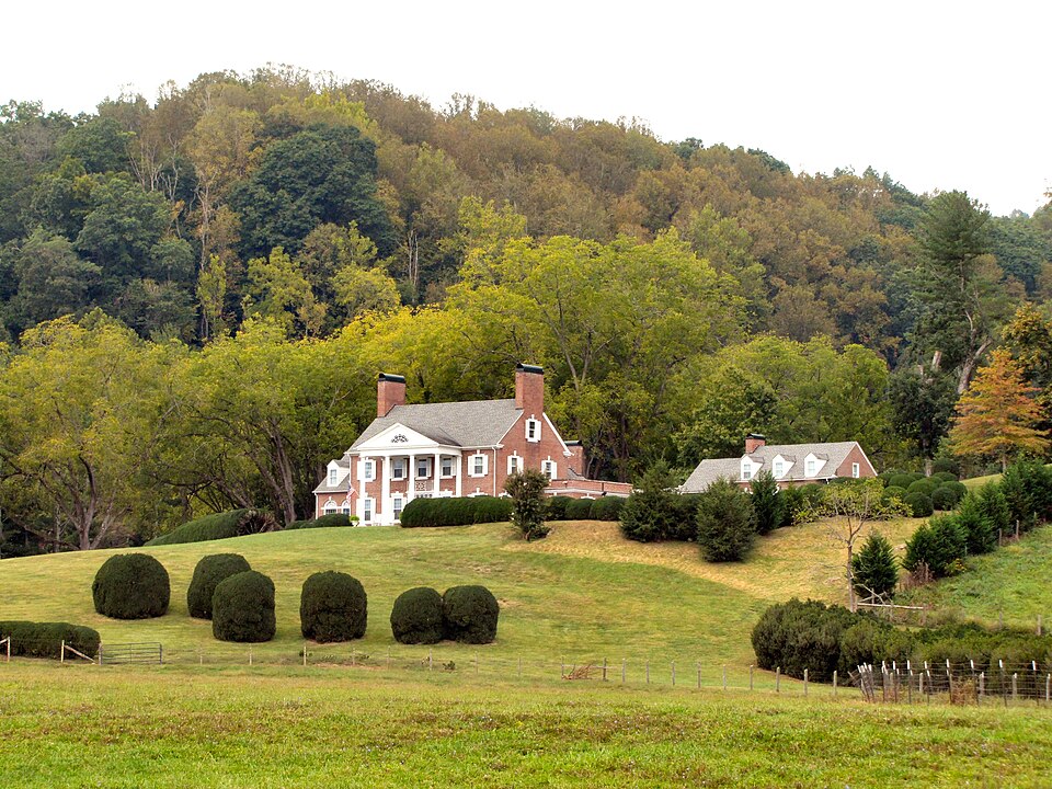
Photograph of Maymead Farm
Photograph by Brian Stansberry, CC BY 3.0. Via Wikimedia Commons.

Maymead Farm

Listed on the National Register of Historic Places in 2012.

From the record

“Maymead Farm, also known as Maymead Stock Farm, is a historic farm in Johnson County, Tennessee, located two miles west of Mountain City.”

Wikipedia article Maymead Farm, CC BY-SA 4.0.

One of 8 National Register listings published here for Johnson County · listed in 2012 · category: District.

Sources: the Wikipedia article · the National Register database, National Park Service

The listing

  • Address. 1995 Roan Creek Rd, Mountain City, 37683
  • When was it listed? February 2012
  • Category. district
  • District. District 3
  • National Register reference number. 11000100 - assigned by the National Park Service when the property was listed.

Fires near this property

17 since 2006

Regional context, not property-specific evidence. The federal wildfire occurrence database lists 17 fires within 5 miles of Maymead Farm between 2006 and 2019, burning about 324 acres in total. 1 started naturally. 6 were recorded as arson. Distance is straight-line from the map coordinates, so a fire counted here may appear on a neighbouring settlement's page as well.

Reported cause Fires
Debris and open burning7
Arson/incendiarism6
Power generation/transmission/distribution2
Missing data/not specified/undetermined1
Natural1

The most recent of them, most recent first, with the day each was reported and the service that recorded it.

DateCause SizeReported by Name on the report
2 May 2007Power generation/transmission/distribution3.7 acresTennessee Division of ForestryCRACKERS NECK
1 May 2019Debris and open burning2.5 acresTennessee Division of ForestryDOE MOUTAIN
8 April 2009Debris and open burning8.4 acresTennessee Division of ForestryCALLALANTEE
30 April 2007Arson/incendiarism1.5 acresTennessee Division of ForestryANTIOCH ROAD FIRE
28 April 2015Debris and open burning6.8 acresTennessee Division of ForestryGENTRY MTN
28 April 2008Natural161 acresTennessee Division of Forestrynot named
21 April 2014Debris and open burning14 acresCherokee National ForestSTOUT BRANCH
16 April 2008Missing data/not specified/undetermined13 acresTennessee Division of Forestrynot named

Every fire recorded in Johnson County

Mines and quarries near this property

10 of 33 shown

Regional context, not property-specific evidence. The federal mineral resources record lists 33 workings within 5 miles of Maymead Farm: 15 prospects, 15 past producers, 2 producers, 1 occurrence. 2 still produce. What was taken out: Manganese, Iron, Phosphorus-Phosphates, Zinc, Lead, Mercury. Distance is straight-line from the map coordinates, so a quarry counted here may appear on a neighbouring settlement's page as well.

Where SiteCommodity StatusRecorded
Dowell QuarryStone, Crushed/Broken, DolomiteProducer1962
Flint Knob/Little Mt. MinesIron, ManganesePast ProducerResidual
Potter QuarryStone, Crushed/BrokenProducer
Wagner Zinc ProspectZinc, Lead, MercuryOccurrenceSphalerite
Unnamed Phosphate ProspectPhosphorus-PhosphatesProspect1916, 1940
Unnamed Phosphate ProspectPhosphorus-PhosphatesProspect1916, 1960
Flint Knob MineIron, ManganesePast Producer
Little Mountain MineIronPast Producer
Shouns MineIronPast ProducerResidual

Every working recorded in Johnson County

Storms near this property

47 since 1995

Regional context, not property-specific evidence. The National Weather Service names Mountain City, the town this property stands in, in 47 storm reports between 1995 and 2025: 28 thunderstorm wind, 10 hail, 6 flash flood, 2 flood. No death or injury is recorded in these reports. Each account below is quoted exactly as the forecast office filed it, from the NOAA Storm Events Database, and each date opens the federal record of that event.

WhenEvent Place namedHarm What the report says
June 1998Thunderstorm WindMountain City$20,000no account filed
June 2010Thunderstorm WindMountain City$15,000The Tomahawk newspaper in Mountain City reported several tress and powerlines downed by thunderstorm winds in the Mountain City area. A few buildings were also damaged.
June 2009Thunderstorm WindMountain City$15,000Law enforcement officials reported multiple trees and powerlines downed by thunderstorm winds in the Iron Mountain area.
May 2004Thunderstorm WindMountain City$15,000no account filed
June 2005Thunderstorm WindMountain City$12,000A few trees down on powerlines in the Neva area. Reported by Mountain Electric Co-Op.
August 2002Thunderstorm WindMountain City$10,000no account filed
April 1998Thunderstorm WindMountain City$10,000no account filed
June 2010Thunderstorm WindMountain City$8,000Law enforcement personnel reported several trees downed by thunderstorm winds in Mountain City.
August 2010Thunderstorm WindMountain City$8,000Law enforcement personnel reported a few trees and powerlines downed by thunderstorm winds between Mountain City and Maymead.
June 2009Thunderstorm WindMountain City$8,000Law enforcement officials reported several trees and powerlines downed by thunderstorm winds in the Mountain City area.
April 2006Thunderstorm WindMountain City$8,000A few trees down near Mountain City.
May 2003Thunderstorm WindMountain City$6,000no account filed
June 2009Thunderstorm WindMountain City$5,000Law enforcement personnel reported a few trees downed by thunderstorm winds from Mountain City to Laurel.
June 2007Heavy RainMountain City$5,000Highway 421 at Bulldog Road closed from high water and mudslide over road.
August 2006Thunderstorm WindMountain City$5,000A few trees down in Mountain City.
July 1995Thunderstorm WindMountain City$5,000A few trees and power lines were blown down.
April 2002HailMountain City$5,000no account filed
January 2013FloodMountain City$1,000Several roads closed across the county.
August 2007Thunderstorm WindMountain City$1,000The county highway department reported one tree downed by thunderstorm winds on Cross Mountain Road near Mountain City.
May 1995HailMountain City$1,000no account filed
March 2025Thunderstorm WindMountain City-Several trees were blown down by severe thunderstorm downburst winds.
May 2025Thunderstorm WindMountain City-Several trees were blown down by severe thunderstorm wind gusts. Hail also fell during the storm, unknown size.
September 2024Flash FloodMountain City-Several roadways remain flooded across Johnson County, and a few roads were washed out. Several people needed rescue due to the flooding and washouts.
July 2022Thunderstorm WindMountain City-A few trees were blown down.
March 2021Flash FloodMountain City-Mudslide occurred across Roan Creek Road.
August 2018Thunderstorm WindMountain City-Several trees were reported down.
June 2016Thunderstorm WindMountain City-Several trees were reported down in Mountain City.
November 2016Thunderstorm WindMountain City-Several trees were downed and a utility building was blown over.
July 2014Thunderstorm WindMountain City-A few trees were reported down near Mountain City.
May 2013Thunderstorm WindMountain City-A few trees were reported down in the vicinity of Mountain City.
May 2011Thunderstorm WindMountain City-Several trees were reported down.
May 2011Thunderstorm WindMountain City-Three trees were reported down in Mountain City.
September 2009FloodMountain City-Areal flooding occurred along highways 421 and 67 in Mountain City, Tennessee. Several inches of water was over the road, with a few areas briefly impassable due to the flooding.
June 2008HailMountain City-A trained spotter reported nickel-size hail in Mountain City.
September 2006HailMountain City-no account filed
July 2005HailMountain City-no account filed
August 2003Flash FloodMountain City-no account filed
May 2002HailMountain City-no account filed
July 2002Flash FloodMountain City-no account filed
May 2001Thunderstorm WindMountain City-no account filed
July 2001Flash FloodMountain City-no account filed
July 2000HailMountain City-no account filed
May 1999HailMountain City-no account filed
June 1998Thunderstorm WindMountain City-no account filed
May 1998HailMountain City-no account filed

Every storm recorded in Johnson County

Map coverage status

No historic map-sheet match is published for this property yet. That does not mean no map exists. This record needs a coordinate-quality review before it can be joined to a sheet boundary. Browse the county's mapped places while that work is pending.

Listed places nearby

6 within 8 miles

Other National Register properties close enough to walk or drive between, ordered by distance from this one. Both positions come from the same geocoding pass that matched these properties to their map sheets.

Photograph PropertyDistance Listed
Dr. Wiley Wagner Vaught Office1.4 miles2009
Rhea House1.7 miles1973
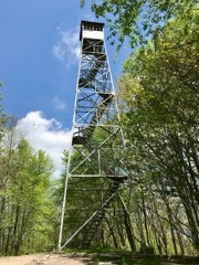
Kettlefoot Fire Lookout Tower2.5 miles2015
Butler House3.2 miles1973
Alfred Johnson Farm4.7 miles1998
A.J. Wright Farm7.9 miles2000

Sources for this property

National Archives recordThe nomination case file for reference 11000100 in Record Group 79.
Wikipedia articleCommunity-written account of this property, licensed CC BY-SA.
Johnson CountyAll 8 listed properties in this county.

Provenance

  • Listing record. National Park Service National Register of Historic Places, listed-properties dataset, current to 2026-05-22.
  • Map join. Address geocoded through the United States Census geocoder, then tested against the published boundary of every sheet in the USGS Historical Topographic Map Collection.
  • How this page is made. Listing fields come from federal records; map-sheet coverage is a labelled coordinate-to-boundary calculation, not a source-field claim.
  • Wildfire. Short, Karen C. 2022. Spatial wildfire occurrence data for the United States, 1992-2020 [FPA_FOD_20221014]. 6th Edition. Fort Collins, CO: Forest Service Research Data Archive. https://doi.org/10.2737/RDS-2013-0009.6 Collected with United States Government funding and usable without additional permissions or fees.
  • Mines and quarries. USGS Mineral Resources Data System (MRDS) https://mrdata.usgs.gov/mrds/ A work of the United States government, no copyright under 17 U.S.C. 105.
  • Storms. NOAA National Centers for Environmental Information, Storm Events Database https://www.ncei.noaa.gov/stormevents/ A work of the United States government, no copyright under 17 U.S.C. 105. Narratives are quoted verbatim from the National Weather Service report and are not edited or summarised.