 Block
From the record
15 National Register listings published here, 1 of them a National Historic Landmark.
Sources: the National Register database, National Park Service
125 topographic sheets cover 88 settlements here, and 15 properties are on the National Register of Historic Places.
15 National Register listings published here, 1 of them a National Historic Landmark.
Sources: the National Register database, National Park Service
Every property in this county listed on the National Register of Historic Places, with the year it was listed and the federal nomination document.
| Photograph | Property | Type | Listed | Reference |
|---|---|---|---|---|
| Akins House | building | 2022 | 100008378 | |
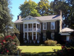 | Cooke-Kefauver House | building | 1988 | 74001921 |
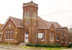 | First Presbyterian Church | building | 2001 | 01000772 |
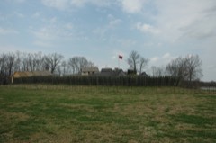 | Fort Loudoun | site | 1966 | 66000729 |
| William J. Fowler Mill and House | building | 1983 | 83003057 | |
| Elisha Johnson Mansion | building | 1974 | 74001923 | |
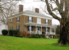 | John McCroskey House | building | 2000 | 00000125 |
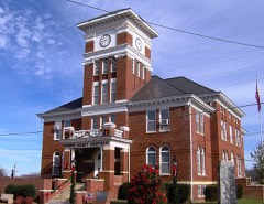 | Monroe County Courthouse | building | 1995 | 95000341 |
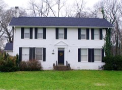 | Charles Owen House | building | 1998 | 98000875 |
| James M. Pardue House | building | 2025 | 100011553 | |
| Scott Mansion | building | 1993 | 92001816 | |
| Smith-Kefauver House | building | 2026 | 100012590 | |
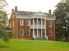 | Stickley House | building | 1974 | 74001922 |
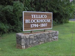 | Tellico Blockhouse Site | site | 1975 | 75001771 |
| Tennessee Military Institute Residential Historic District | district | 2019 | 100003903 |
Every wildfire the federal occurrence database records inside this county: 1,090 of them, burning about 17,606 acres. 26 started naturally and 566 were recorded as arson. Each settlement page carries the fires within five miles of it.
| Reported cause | Fires |
|---|---|
| Arson/incendiarism | 566 |
| Debris and open burning | 273 |
| Missing data/not specified/undetermined | 109 |
| Equipment and vehicle use | 27 |
| Recreation and ceremony | 27 |
| Smoking | 26 |
| Natural | 26 |
| Other causes | 16 |
| Power generation/transmission/distribution | 11 |
| Misuse of fire by a minor | 4 |
| Fireworks | 3 |
| Railroad operations and maintenance | 2 |
The five largest, by the area the report gives. Five of them were set deliberately.
| Date | Cause | Size | Reported by | Name on the report |
|---|---|---|---|---|
| 14 March 2014 | Missing data/not specified/undetermined | 1,056 acres | Cherokee National Forest | GRAVEL STAND COMPLEX |
| 7 June 2011 | Natural | 749 acres | Cherokee National Forest | MILLIGAN |
| 15 November 2016 | Arson/incendiarism | 652 acres | Cherokee National Forest | QUARRY CREEK |
| 20 November 1999 | Arson/incendiarism | 607 acres | Cherokee National Forest | CITICO |
| 16 April 2006 | Arson/incendiarism | 592 acres | Cherokee National Forest | CHERIKEE SOUTH COMP |
| 19 November 1999 | Arson/incendiarism | 360 acres | Cherokee National Forest | FRESHCORN |
| 23 April 2002 | Arson/incendiarism | 346 acres | Tennessee Division of Forestry | not named |
| 12 April 1999 | Debris and open burning | 330 acres | Cherokee National Forest | COW CAMP |
Every settlement page carries the fires within five miles of it - see the settlement index below.
The NOAA Storm Events Database holds 421 reports for this county, causing no deaths, 28 injuries and about $35,489,100 in recorded property damage. Each settlement page carries the reports that name it.
| Kind of event | Reports |
|---|---|
| Thunderstorm Wind | 294 |
| Hail | 73 |
| Flash Flood | 21 |
| Tornado | 20 |
| Flood | 10 |
| Funnel Cloud | 2 |
| Lightning | 1 |
The most serious of them, by death, then injury, then recorded damage. The accounts are quoted exactly as the forecast office filed them.
| When | Event | Place named | Harm | What the report says |
|---|---|---|---|---|
| February 1993 | Tornado (F3) | One home was destroye | 10 hurt, $5,000,000 | The tornado that was in McMinn County continued into Monroe County and produced considerable damage to the town of Tellico Plains. Over 100 houses were either damaged or destroyed. A high school had its gymnasium roof damaged. Numerous trees and power lines were knocked down. The tornado continued into part of the Cherokee National Forest and damaged numerous trees and closed a campground for the season. |
| February 1993 | Tornado (F1) | Englewood to | 7 hurt, $500,000 | The tornado that was in McMinn County continued into Monroe County and produced considerable damage to the town of Tellico Plains. Over 100 houses were either damaged or destroyed. A high school had its gymnasium roof damaged. Numerous trees and power lines were knocked down. The tornado continued into part of the Cherokee National Forest and damaged numerous trees and closed a campground for the season. |
| March 2012 | Tornado (EF2) | Tellico Plains | 3 hurt, $5,000,000 | An EF-2 tornado touched down in Tellico Plains, leaving a path of destruction 14 miles long through downtown and crossed Hwy 360 to Ballplay Road, and into the Citico Wilderness area. Property damage to residential and commercial buildings was extensive (30 buildings), but, although there were 3 injuries, miraculously, there were no fatalities. One of the TDS buildings and the police department annex were destroyed. The cabins, main lodge and pavilion at the KOA Campground were leveled. Downed, broken, and uprooted trees cover hillsides and roadsides in the tornado's path. |
| March 1975 | Tornado (F1) | not stated | 3 hurt, $25,000 | no account filed |
| May 2025 | Tornado (EF0) | Northpoint | 2 hurt, $50,000 | An EF0 tornado entered Monroe County from Loudon County and remained on the ground for approximately another mile through northern portions of Monroe County, inflicting minor roof damage to several farm buildings, minor tree damage, and causing additional injuries upon rolling a second RV camper vehicle. The tornado eventually crossed New Hope Road and dissipated shortly thereafter. |
| April 2011 | Tornado (EF2) | Brownhill | 1 hurt, $500,000 | Chapel Road Tornado. A NWS storm survey reported an EF2 tornado touched down near Tellico Plains. It started near Highway 39 and Chapel Road then moved to Ball Street Road where it ended. The 115 mph wind blew the top story of a two story building off. Several homes were either destroyed or damaged. A trailer was also destroyed. Numerous trees were also downed. One person was injured in the Mount Vernon area. |
| April 1980 | Tornado (F2) | not stated | 1 hurt, $250,000 | no account filed |
| April 2011 | Tornado (EF1) | Gudger | 1 hurt, $100,000 | Englewood-S. Madisonville Tornado. A NWS storm survey indicated an EF1 tornado touched down northeast of Englewood in McMinn County and continued into Monroe County. It tracked to near Hopewell Spring Road near Madisonville before dissipating. The 100 mph wind damaged several homes and downed numerous trees and powerlines. One person was injured. |
| May 2003 | Flash Flood | Countywide | $11,160,000 | Widespread flooding, road closures, damage, evacuations. |
| August 2023 | Flash Flood | Tellico Plains | $10,000,000 | Multiple road closures due to flash flooding. Washouts occurred along the Cherohala Skyway at MM 4.5, and along Hwy 360 northeast of Tellico Plains. Other road damages in the Cherokee National Forest blocked access to homes. Floodwaters entered several buildings, and flooded the ball park to nearly a foot of depth. Rain gauge and radar estimates depicted around 5 inches of rain fell over this mountainous area. EM estimates $6 million in damages to the area, while another $4 million was requested for repairs in the National Forest. These estimates did not include apparent losses to agriculture. |
| February 1994 | Thunderstorm Wind | Madisonville | $500,000 | A furniture store had its roof blown off. A house lost its roof with around 15 other houses damaged. |
| April 1974 | Tornado (F2) | not stated | $250,000 | no account filed |
| April 2011 | Tornado (EF2) | Citico Beach | $100,000 | Dog Gap Tornado. The Cherokee National Forest reported this tornado path that was less than a mile south of the EF4 Chilhowee track from two hours earlier. Aerial photographs from this tornado showed heavy tree damage in the heart of the path. The tornado dissipated just before getting to Chilhowee Lake. |
| April 2010 | Thunderstorm Wind | Vonore | $100,000 | The emergency manager reported a barn was destroyed and a roof blown off a house at the intersection of Lakeside Road and Kincaid Road southwest of Vonore. Several other homes and businesses were also damaged in the area. |
| April 1998 | Thunderstorm Wind | Sweetwater | $100,000 | no account filed |
| April 2013 | Thunderstorm Wind | Madisonville | $50,000 | Newspaper personnel reported many buildings...numerous trees and powerlines downed by thunderstorm wind in Madisonville and the surrounding area. More than 1600 customers were without power. |
| April 2011 | Tornado (EF4) | Citico Beach | $50,000 | A massive EF-4 tornado quickly spun up just west of Chilhowee Lake in northern Monroe County that scoured the forest in the Cherokee National Forest. The tornado entered the Lake (at the Blount County line) and smashed a large steel transmission tower. The tornado then entered the Great Smoky Mountains National Park on the other side of the lake and again began to rip through heavy forest. |
| June 2004 | Thunderstorm Wind | Vonore | $50,000 | Three boats blown from dock. Three chimneys blown from homes. Numerous trees down |
| June 1994 | Thunderstorm Wind | Sweetwater | $50,000 | The roof blew off the Sweetwater Hosiery Mills. A pump house was damaged by a fallen tree. A few other trees and power lines were blown down as well. |
| December 2005 | Thunderstorm Wind | Madisonville | $35,000 | Roof blown off a building in Madisonville. Trees down countywide. |
| July 1997 | Thunderstorm Wind | Countywide | $30,000 | Trees and powerlines down throughout the county. Public also reported a funnel cloud and pea-sized hail. |
| July 2006 | Thunderstorm Wind | Countywide | $30,000 | no account filed |
| April 2013 | Thunderstorm Wind | Tellico Plains | $25,000 | Law enforcement personnel reported many trees downed by thunderstorm wind across the county. |
| April 2011 | Tornado (EF1) | Wilson Station | $25,000 | Sleepy Valley Tornado. A NWS storm survey reported an EF1 tornado touched down south of Madisonville. It formed near Sleepy Valley Road and tracked to near Tellico Lake near Corn Tassel Road then dissipated. The 100 mph wind downed numerous trees. |
| April 2011 | Tornado (EF1) | Wilson Station | $25,000 | Old Federal Road Tornado. A NWS storm survey reported an EF1 tornado touched down just south of Madisonville. It formed near Old Federal Road and Marvin Atkins Road and tracked to Corn Tassel Road near Tellico Lake before dissipating. The 90 mph wind downed numerous trees. |
| April 2011 | Tornado (EF1) | Fagin | $25,000 | Stinnett Road Tornado. A NWS storm survey reported an EF1 tornado touched down northeast of Madisonville. It formed near Stinnett Road and tracked to Chota View Road before dissipating. The 100 mph wind downed numerous trees. |
| April 2010 | Tornado (EF0) | Vonore | $25,000 | The NWS storm survey determined a tornado developed near the Hugh Storage Facility 2 miles west southwest Vonore, It was classified as an EF0 tornado with winds estimated at 80 mph and a path width of 50 yards. The tornado produced damage near the Pro-Tex plant. |
| February 2009 | Thunderstorm Wind | Madisonville | $25,000 | Law enforcement personnel reported numerous trees and powerlines downed by thunderstorm winds countywide. |
| June 2007 | Thunderstorm Wind | Sweetwater | $25,000 | A small aluminum building was blown from a CO-OP lot into the parking area at a Sonic Restaurant in Sweetwater. Three cars were damaged as well the roof of the restaurant. |
| July 2005 | Thunderstorm Wind | Sweetwater | $25,000 | no account filed |
| July 2005 | Thunderstorm Wind | Countywide | $25,000 | no account filed |
| July 2002 | Thunderstorm Wind | Countywide | $25,000 | no account filed |
| April 2015 | Thunderstorm Wind | Madisonville | $20,000 | The public reported damage to roof of a gas station by thunderstorm wind in Madisonville. |
| June 2011 | Thunderstorm Wind | Sweetwater | $20,000 | Amateur radio personnel reported many trees and powerlines downed by thunderstorm wind in Sweetwater. |
| February 2009 | Thunderstorm Wind | West Chapel | $20,000 | Law enforcement personnel reported a barn destroyed by thunderstorm winds near Sweetwater. |
| June 2009 | Thunderstorm Wind | Madisonville | $20,000 | Law enforcement personnel reported a roof of a business was damaged by thunderstorm winds near Madisonville. |
| June 2007 | Thunderstorm Wind | Madisonville | $20,000 | Numerous trees were downed by thunderstorm winds near Madisonville. |
| June 2007 | Thunderstorm Wind | Madisonville | $20,000 | Thunderstorm winds downed numerous trees in and around Madisonville. |
| August 2006 | Thunderstorm Wind | Mt Vernon | $20,000 | A tree downed onto a mobile home in Mount Vernon. |
| June 2005 | Thunderstorm Wind | Tellico Plains | $20,000 | Numerous trees down in Tellico Plains and Mt Vernon. |
| May 2006 | Thunderstorm Wind | Sweetwater | $20,000 | no account filed |
| May 2004 | Thunderstorm Wind | Madisonville | $20,000 | no account filed |
| July 2004 | Thunderstorm Wind | Sweetwater | $20,000 | no account filed |
| June 2003 | Thunderstorm Wind | Countywide | $20,000 | no account filed |
| July 2002 | Thunderstorm Wind | Tellico Plains | $20,000 | no account filed |
| August 2002 | Thunderstorm Wind | Sweetwater | $20,000 | no account filed |
| July 1999 | Thunderstorm Wind | Madisonville | $20,000 | no account filed |
| April 2009 | Thunderstorm Wind | Notchy Creek | $18,000 | A local newspaper reported several trees and powerlines downed by thunderstorm winds in the Madisonville area. In addition, a home sustained minor roof damage as well as a section of bleachers at the high school. |
| May 2004 | Thunderstorm Wind | Tellico Plains | $18,000 | no account filed |
| June 2003 | Thunderstorm Wind | Madisonville | $18,000 | no account filed |
| October 2001 | Thunderstorm Wind | Countywide | $17,000 | Trees and power lines down. A few roofs and chimneys damaged. |
| April 2015 | Thunderstorm Wind | Vonore | $15,000 | Dispatch personnel reported multiple trees downed across the county by thunderstorm wind including Vonore and Madisonville. |
| August 2014 | Thunderstorm Wind | Sweetwater | $15,000 | Law enforcement personnel reported numerous trees downed by thunderstorm wind especially in the Sweetwater and Madisonville areas. |
| April 2014 | Thunderstorm Wind | Madisonville | $15,000 | Law enforcement personnel reported numerous trees downed by thunderstorm wind countywide. |
| April 2011 | Tornado (EF0) | Hopewell Spgs | $15,000 | Brakebill Tornado. A NWS storm survey reported an EF0 touched down northeast of Madisonville. It formed near Brakebill School Road and McClung Road and tracked to near Corn Tassel Road where it dissipated. The wind speed at 70 mph downed a few trees. |
| December 2009 | Flash Flood | Madisonville | $15,000 | Flash flooding was occurring with several roads closed due to two feet of water over the roads. Some trees were also across the roads near Madisonville Tennessee, that fell due to the flooding. |
| February 2009 | Thunderstorm Wind | Mc Ghee | $15,000 | The highway department personnel reported numerous trees downed by thunderstorm winds in the northeast portions of the county. |
| June 2009 | Thunderstorm Wind | Sweetwater | $15,000 | The newspaper reported several trees and powerlines downed by thunderstorm winds in Sweetwater and countywide. A small storage building was also damaged. |
| August 2005 | Thunderstorm Wind | Madisonville | $15,000 | A tree and several large limbs downed powerlines just east of Madisonville. |
| May 2004 | Thunderstorm Wind | Tellico Plains | $15,000 | no account filed |
The Survey's mineral resources record lists 320 workings inside this county. 8 still produce and 312 are closed or unrecorded. Each settlement page carries the workings within five miles of it.
| Commodity | Workings |
|---|---|
| Gold | 206 |
| Barium-Barite | 65 |
| Iron | 17 |
| Manganese | 17 |
| Fluorine-Fluorite | 5 |
| Copper | 3 |
| Silver | 3 |
| Stone, Crushed/Broken, Limestone, General | 2 |
| Stone, Crushed/Broken | 2 |
| Zinc | 2 |
| Gold, Copper | 1 |
| Gold, Copper, Lead, Arsenic | 1 |
| Lead, Copper, Silver, Gold | 1 |
| Iron, Zinc, Lead, Fluorine-Fluorite | 1 |
The least common of them first, because a county's hundredth gravel pit says nothing its first ten did not.
| Where | Site | Commodity | Status | Recorded |
|---|---|---|---|---|
| Ballard Mine & Mill | Barium-Barite, Fluorine-Fluorite, Iron, Lead, Zinc | Past Producer | ||
| Eve Mills | Zinc, Iron | Prospect | ||
| Lower Peck Adit | Gold, Copper | Occurrence | 1865 | |
| Millsap Adit | Lead, Copper, Silver, Gold | Occurrence | 1913 | |
| Millsap Adit | Gold, Lead, Silver, Copper | Occurrence | ||
| Monroe | Barium-Barite, Iron, Zinc, Lead, Fluorine-Fluorite | Producer | Barite, Fluorite, Galena, Pyrite, Sphalerite | |
| Monroe Mine | Barium-Barite, Zinc, Lead, Iron, Fluorine-Fluorite | Past Producer | ||
| Peck Prospect | Gold, Lead | Occurrence | 1865 | |
| Peck Prospect | Gold, Lead | Prospect | ||
| Sixmile Creek Adit | Gold, Copper, Lead, Arsenic | Occurrence | Vein | |
| Sixmile Creek Adit | Gold, Arsenic, Copper, Lead | Occurrence | ||
| Stoner Mine | Zinc, Fluorine-Fluorite, Lead, Barium-Barite | Past Producer | ||
| Craighead Quarry | Stone, Crushed/Broken, Limestone, General | Producer | Limestone | |
| Craighead Quarry | Stone, Crushed/Broken | Producer | ||
| Fork Creek Prospect | Zinc | Prospect | ||
| Mt Mount Vernon Quarry | Stone, Crushed/Broken | Producer | ||
| Mt. Vernon Quarry | Stone, Crushed/Broken, Limestone, General | Producer | 1969 | |
| Big Branch Placer | Gold, Silver | Past Producer | Placer | |
| Buck Miller Copper Mine | Copper | Past Producer | 1914 | |
| Buck Miller Copper Mine | Copper | Past Producer | ||
| Hotwater Placer | Gold, Silver | Past Producer | Placer | |
| Lower Peck Adit | Gold, Copper | Prospect | ||
| Peck Prospect | Gold, Silver | Past Producer | ||
| Ballard Exploration Area | Fluorine-Fluorite | Prospect | ||
| Howard Mine | Barium-Barite, Fluorine-Fluorite | Past Producer | Barite, Fluorite | |
| Howard Mine | Fluorine-Fluorite, Barium-Barite | Past Producer | ||
| Hudson Mine | Barium-Barite, Fluorine-Fluorite | Past Producer | Barite, Fluorite | |
| Hudson Mine | Barium-Barite, Fluorine-Fluorite | Past Producer | ||
| Beaty Prospect | Iron | Prospect | ||
| Cole Manganese Property | Manganese | Prospect | 1952 | |
| Cole Prospect | Iron | Occurrence | 1964 | |
| Cole Prospect | Iron | Occurrence | ||
| Dickey Prospect | Manganese | Past Producer | 1898 | |
| Donnelly Bank | Iron | Past Producer | ||
| Erwin and Cardin Prospect | Manganese | Prospect | 1951 | |
| Ewing Mine | Manganese | Past Producer | ||
| G.A.Graves Prospect | Manganese | Prospect | ||
| Ground Hog Mountain Prospect | Manganese | Prospect | 1951 | |
| Ground Hog Mt. Bank Curd Bank | Iron | Past Producer | Residual | |
| Hale Bank | Iron | Past Producer | ||
| Hale Bill Coppinger Bank/Donelly Bank | Iron | Past Producer | Residual | |
| Harris Prospect | Manganese | Prospect | 1951 | |
| Heiskill Mine | Manganese | Past Producer | 1939 | |
| Kilby Prospect | Manganese | Prospect | 1951 | |
| Kimbrough Prospect | Manganese | Past Producer | 1951 | |
| Latrobe Bank | Iron | Past Producer | ||
| Latrobe Bank/Queen Bank/Red Hill Bank | Iron | Past Producer | Residual | |
| Linderman Iron Mine | Iron | Past Producer | 1950 | |
| Linderman Iron Mine | Iron | Past Producer | ||
| Linderman Mine | Iron | Past Producer | Residual | |
| Mcdaniel Prospect | Manganese | Prospect | 1951 | |
| Mcdonald Prospect | Manganese | Prospect | 1951 | |
| Mcguire and North Vida Mine | Manganese | Past Producer | 1918 | |
| Mills Prospect | Manganese | Past Producer | 1918 | |
| Preston Prospect | Manganese | Past Producer | 1918 | |
| Queen Bank | Iron | Past Producer | ||
| S.L. Williams Prospect | Iron | Occurrence | ||
| South Vida Mine | Manganese | Prospect | 1951 | |
| Wilson Iron Mine | Iron | Past Producer | Limonite | |
| Wilson Iron Mine | Iron | Past Producer | ||
| Wilson Mine | Iron | Past Producer | Residual | |
| Wilson Mine | Manganese | Past Producer | 1951 | |
| Barnes Mine | Barium-Barite | Past Producer | Barite | |
| Barnes Mine | Barium-Barite | Past Producer | ||
| Beverly Wood Barite Mine | Barium-Barite | Past Producer | Barite | |
| Beverly Wood Barite Mine | Barium-Barite | Past Producer | ||
| Blevins Mine | Barium-Barite | Past Producer | Barite | |
| Blevins Mine | Barium-Barite | Past Producer | ||
| C. C. Stephens Mine | Barium-Barite | Past Producer | ||
| C.C. Stephens Mine | Barium-Barite | Past Producer | Barite | |
| Dixon Mine | Barium-Barite | Past Producer | Barite | |
| Dixon Mine | Barium-Barite | Past Producer | Residual | |
| Dixon Mine | Barium-Barite | Past Producer | ||
| Dunsmore Mine | Barium-Barite | Past Producer | Barite | |
| Dunsmore Mine | Barium-Barite | Past Producer | ||
| F. Thompson Mine | Barium-Barite | Past Producer | Barite | |
| F. Thompson Mine | Barium-Barite | Past Producer | ||
| Forkner Mine | Barium-Barite | Past Producer | Barite | |
| Forkner Mine | Barium-Barite | Past Producer | ||
| Goddard Barite Mines | Barium-Barite | Past Producer | Barite | |
| Goddard Barite Mines | Barium-Barite | Past Producer | ||
| Gutherie-Jones Mine | Barium-Barite | Past Producer | Barite | |
| Gutherie-Jones Mine | Barium-Barite | Past Producer | ||
| Harmon Mine | Barium-Barite | Past Producer | Barite | |
| Harmon Mine | Barium-Barite | Past Producer | ||
| Harrison Prospect | Barium-Barite | Occurrence | Barite | |
| Harrison Prospect | Barium-Barite | Occurrence | ||
| Howard Mine B | Barium-Barite | Past Producer | ||
| Howell Mine | Barium-Barite | Past Producer | Barite | |
| Howell Mine | Barium-Barite | Past Producer | ||
| J. L. Camp Barite Mine | Barium-Barite | Past Producer | Barite | |
| J. L. Camp Barite Mine | Barium-Barite | Past Producer | ||
| Jones Mine | Barium-Barite | Past Producer | Barite | |
| Jones Mine | Barium-Barite | Past Producer | ||
| Kyle Mine | Barium-Barite | Past Producer | Barite | |
| Kyle Mine | Barium-Barite | Past Producer | ||
| Kyle Mine B | Barium-Barite | Past Producer | ||
| L. A. Wood Mine | Barium-Barite | Past Producer | ||
| L. G. Camp Mine | Barium-Barite | Past Producer | ||
| L. Thompson Mine | Barium-Barite | Past Producer | Barite | |
| L. Thompson Mine | Barium-Barite | Past Producer | ||
| L.A. Wood Mine | Barium-Barite | Past Producer | Barite | |
| L.G. Camp Mine | Barium-Barite | Past Producer | Barite | |
| National Barium Mine | Barium-Barite | Past Producer | Barite | |
| National Barium Mine | Barium-Barite | Past Producer | ||
| Notchy Creek Barite Mine | Barium-Barite | Occurrence | Barite | |
| Notchy Creek Barite Mine | Barium-Barite | Occurrence | ||
| Notchy Creek Mine | Barium-Barite | Past Producer | Residual | |
| Roy Mine | Barium-Barite | Past Producer | Barite | |
| Roy Mine | Barium-Barite | Past Producer | ||
| Stephens Barite Mine | Barium-Barite | Past Producer | ||
| Sweetwater Mine | Barium-Barite | Producer | ||
| Unnamed Mine | Barium-Barite | Past Producer | ||
| W. Harrison Mine - East | Barium-Barite | Past Producer | ||
| W. Harrison Mine-East | Barium-Barite | Past Producer | Barite | |
| Watson Barite Mine | Barium-Barite | Past Producer | ||
| Watson Barite Mine | Barium-Barite | Producer | 1932 | |
| Watson Barite Mine | Barium-Barite | Past Producer | ||
| Wicker Mine | Barium-Barite | Past Producer | Barite | |
| Wicker Mine | Barium-Barite | Past Producer | ||
| Alvin Branch Placer Workings | Gold | Past Producer | 1831 | |
| Alvin Branch Placer Workings | Gold | Past Producer | ||
| Annette Placer Workings | Gold | Past Producer | 1831 | |
| Annette Placer Workings | Gold | Past Producer | ||
| Big Branch Placer Workings | Gold | Past Producer | 1831, 1862 | |
| Big Branch Placer Workings | Gold | Past Producer | ||
| Big Surface Workings | Gold | Past Producer | 1831 | |
| Big Surface Workings | Gold | Past Producer | ||
| Blackjack Ridge Adit | Gold | Occurrence | ||
| Blackjack Ridge Adit | Gold | Occurrence | ||
| Boyd Mine | Gold | Occurrence | 1915 | |
| Boyd Mine | Gold | Occurrence | ||
| Boyd Placer Workings | Gold | Past Producer | Placer | |
| Boyd Placer Workings | Gold | Past Producer | ||
| Brannon Prospect | Gold | Occurrence | Vein | |
| Brannon Prospect | Gold | Occurrence | ||
| Calf Yoke Adit | Gold | Occurrence | 1861 | |
| Calf Yoke Adit | Gold | Occurrence | ||
| Calico Trenches | Gold | Occurrence | 1865 | |
| Calico Trenches | Gold | Occurrence | ||
| Cindy Hole | Gold | Occurrence | Unknown | |
| Closman Workings | Gold | Occurrence | 1938 | |
| Closman Workings | Gold | Prospect | ||
| Cooper Mine | Gold | Past Producer | 1862 | |
| Cooper Mine | Gold | Past Producer | Placer | |
| Cooper Mine | Gold | Past Producer | ||
| Duckett Ridge Adit | Gold | Occurrence | ||
| Duckett Ridge Adit | Gold | Occurrence | ||
| El Tigre Mine | Gold | Occurrence | 1950 | |
| El Tigre Mine | Gold | Occurrence | ||
| El Tigre Placer | Gold | Past Producer | 1960 | |
| El Tigre Placer | Gold | Past Producer | ||
| Gear Placer Workings | Gold | Past Producer | 1922 | |
| Gear Placer Workings | Gold | Past Producer | ||
| Hollinghead Field Placer | Gold | Past Producer | ||
| Hollinghead Field Placer Workings | Gold | Past Producer | 1834 | |
| Hotwater Branch Placer Workings | Gold | Past Producer | 1831 | |
| Hotwater Branch Placers Workings | Gold | Past Producer | ||
| Johnson Branch Placer Workings | Gold | Past Producer | 1831 | |
| Johnson Branch Placer Workings | Gold | Past Producer | ||
| Johnson Prospect Pit | Gold | Occurrence | Vein | |
| Johnson Prospect Pit | Gold | Occurrence | ||
| Johnson Shaft | Gold | Occurrence | ||
| Johnson Shaft | Gold | Occurrence | ||
| Lenderman Adit | Gold | Occurrence | 1923 | |
| Lenderman Adit | Gold | Occurrence | ||
| Lenderman Prospect Pit | Gold | Occurrence | 1923 | |
| Lenderman Prospect Pit | Gold | Occurrence | ||
| Lonsdale Adit, Northeast | Gold | Occurrence | 1900 | |
| Lonsdale Adit, Northeast | Gold | Occurrence | ||
| Lonsdale Adit, Southwest | Gold | Occurrence | 1900 | |
| Lonsdale Adit, Southwest | Gold | Occurrence | ||
| Lonsdale Tunnel, Northwest | Gold | Occurrence | 1900 | |
| Lonsdale Tunnel, Northwest | Gold | Occurrence | ||
| Lonsdale Tunnel, Southeast | Gold | Occurrence | 1900 | |
| Lonsdale Tunnel, Southeast | Gold | Occurrence | ||
| Lost River Mine | Gold | Producer | 1970 | |
| Lost River Mine | Gold | Past Producer | ||
| Lost River Mine | Gold | Past Producer | ||
| Lower Johnson Adit | Gold | Occurrence | Gold | |
| Lower Johnson Adit | Gold | Occurrence | ||
| Lower Magill Prospect | Gold | Occurrence | Gold | |
| Lower Magill Prospect | Gold | Prospect | ||
| Mcallister Branch Placer | Gold | Past Producer | ||
| Mcallister Branch Placer Workings | Gold | Past Producer | 1831 | |
| Mill Branch Placer Workings | Gold | Past Producer | 1831 | |
| Mill Branch Placer Workings | Gold | Past Producer | ||
| Paris Adit | Gold | Occurrence | 1923 | |
| Paris Adit | Gold | Occurrence | ||
| Prospect Pit | Gold | Occurrence | Vein | |
| Prospect Pit | Gold | Occurrence | ||
| Pumphouse Workings | Gold | Occurrence | Gold | |
| Pumphouse Workings | Gold | Occurrence | ||
| Roberts Branch Adit, Northeast | Gold | Occurrence | ||
| Roberts Branch Adit, Northeast | Gold | Occurrence | ||
| Roberts Branch Adit, Southwest | Gold | Occurrence | Gold | |
| Roberts Branch Adit, Southwest | Gold | Occurrence | ||
| Round Top, Lower Adit | Gold | Occurrence | 1925 | |
| Round Top, Lower Adit | Gold | Prospect | ||
| Round Top, North Workings | Gold | Occurrence | Vein | |
| Round Top, North Workings | Gold | Occurrence | ||
| Round Top, Upper Adit | Gold | Occurrence | 1925 | |
| Round Top, Upper Adit | Gold | Prospect | ||
| Stripped Area | Gold | Occurrence | 1967 | |
| Stripped Area | Gold | Occurrence | ||
| Unnamed Adit | Gold | Occurrence | Underground | |
| Unnamed Adit | Gold | Occurrence | Vein | |
| Unnamed Adit | Gold | Occurrence | Vein | |
| Unnamed Adit | Gold | Occurrence | Vein | |
| Unnamed Adit | Gold | Occurrence | ||
| Unnamed Adit | Gold | Occurrence | ||
| Unnamed Adit | Gold | Occurrence | ||
| Unnamed Adit | Gold | Occurrence | Vein | |
| Unnamed Adit | Gold | Occurrence | Underground | |
| Unnamed Adit | Gold | Occurrence | Underground | |
| Unnamed Adit | Gold | Occurrence | ||
| Unnamed Adit | Gold | Occurrence | Vein | |
| Unnamed Adit | Gold | Occurrence | Vein | |
| Unnamed Adit | Gold | Occurrence | ||
| Unnamed Adit | Gold | Occurrence | ||
| Unnamed Adit | Gold | Occurrence | ||
| Unnamed Adit | Gold | Occurrence | ||
| Unnamed Adit | Gold | Occurrence | ||
| Unnamed Adit | Gold | Occurrence | ||
| Unnamed Adit | Gold | Occurrence | ||
| Unnamed Adit | Gold | Occurrence | ||
| Unnamed Adit | Gold | Occurrence | ||
| Unnamed Adit | Gold | Occurrence | ||
| Unnamed Adit | Gold | Occurrence | ||
| Unnamed Adit | Gold | Occurrence | ||
| Unnamed Adit | Gold | Occurrence | ||
| Unnamed Adits | Gold | Occurrence | ||
| Unnamed Adits | Gold | Occurrence | ||
| Unnamed Pit & Shaft | Gold | Occurrence | ||
| Unnamed Pit and Shaft | Gold | Occurrence | ||
| Unnamed Prospect | Gold | Occurrence | Surface | |
| Unnamed Prospect | Gold | Occurrence | Vein | |
| Unnamed Prospect | Gold | Occurrence | Vein | |
| Unnamed Prospect | Gold | Occurrence | Vein | |
| Unnamed Prospect | Gold | Occurrence | Vein | |
| Unnamed Prospect | Gold | Occurrence | ||
| Unnamed Prospect | Gold | Occurrence | Vein | |
| Unnamed Prospect | Gold | Occurrence | ||
| Unnamed Prospect | Gold | Occurrence | ||
| Unnamed Prospect | Gold | Occurrence | ||
| Unnamed Prospect | Gold | Occurrence | Vein | |
| Unnamed Prospect | Gold | Occurrence | Vein | |
| Unnamed Prospect | Gold | Occurrence | Vein | |
| Unnamed Prospect | Gold | Occurrence | ||
| Unnamed Prospect | Gold | Occurrence | Vein | |
| Unnamed Prospect | Gold | Occurrence | ||
| Unnamed Prospect | Gold | Occurrence | ||
| Unnamed Prospect | Gold | Occurrence | ||
| Unnamed Prospect | Gold | Occurrence | ||
| Unnamed Prospect | Gold | Occurrence | ||
| Unnamed Prospect | Gold | Occurrence | ||
| Unnamed Prospect | Gold | Occurrence | ||
| Unnamed Prospect | Gold | Occurrence | ||
| Unnamed Prospect | Gold | Occurrence | ||
| Unnamed Prospect | Gold | Occurrence | ||
| Unnamed Prospect | Gold | Occurrence | ||
| Unnamed Prospect | Gold | Occurrence | ||
| Unnamed Prospect | Gold | Occurrence | ||
| Unnamed Prospect | Gold | Occurrence | ||
| Unnamed Prospect | Gold | Occurrence | ||
| Unnamed Prospect | Gold | Occurrence | ||
| Unnamed Prospect | Gold | Occurrence | ||
| Unnamed Prospect | Gold | Occurrence | ||
| Unnamed Prospect | Gold | Occurrence | ||
| Unnamed Prospect Pit | Gold | Occurrence | Vein | |
| Unnamed Prospect Pit | Gold | Occurrence | Vein | |
| Unnamed Prospect Pit | Gold | Occurrence | Vein | |
| Unnamed Prospect Pit | Gold | Occurrence | ||
| Unnamed Prospect Pit | Gold | Occurrence | Vein | |
| Unnamed Prospect Pit | Gold | Occurrence | Vein | |
| Unnamed Prospect Pit | Gold | Occurrence | Vein | |
| Unnamed Prospect Pit | Gold | Occurrence | ||
| Unnamed Prospect Pit | Gold | Occurrence | Vein | |
| Unnamed Prospect Pit | Gold | Occurrence | ||
| Unnamed Prospect Pit | Gold | Occurrence | 1915 | |
| Unnamed Prospect Pit | Gold | Occurrence | ||
| Unnamed Prospect Pit | Gold | Past Producer | 1861 | |
| Unnamed Prospect Pit | Gold | Occurrence | ||
| Unnamed Prospect Pit | Gold | Occurrence | ||
| Unnamed Prospect Pit | Gold | Occurrence | ||
| Unnamed Prospect Pit | Gold | Occurrence | ||
| Unnamed Prospect Pit | Gold | Occurrence | ||
| Unnamed Prospect Pit | Gold | Prospect | ||
| Unnamed Prospect Pit | Gold | Occurrence | ||
| Unnamed Prospect Pit | Gold | Occurrence | ||
| Unnamed Prospect Pit | Gold | Occurrence | ||
| Unnamed Prospect Pit | Gold | Occurrence | ||
| Unnamed Prospect Pit | Gold | Occurrence | ||
| Unnamed Prospect Pit | Gold | Occurrence | ||
| Unnamed Prospect Pit | Gold | Occurrence | ||
| Unnamed Prospect Pits | Gold | Occurrence | Vein | |
| Unnamed Prospect Pits | Gold | Occurrence | Vein | |
| Unnamed Prospect Pits | Gold | Occurrence | 1923 | |
| Unnamed Prospect Pits | Gold | Occurrence | Vein | |
| Unnamed Prospect Pits | Gold | Occurrence | ||
| Unnamed Prospect Pits | Gold | Occurrence | ||
| Unnamed Prospect Pits | Gold | Occurrence | ||
| Unnamed Prospect Pits | Gold | Occurrence | ||
| Unnamed Prospect Pits | Gold | Occurrence | ||
| Unnamed Prospect Pits | Gold | Occurrence | ||
| Unnamed Prospect Pits | Gold | Occurrence | ||
| Unnamed Prospect Trench | Gold | Occurrence | Surface | |
| Unnamed Prospect Trench | Gold | Occurrence | ||
| Unnamed Prospects | Gold | Occurrence | Vein | |
| Unnamed Prospects | Gold | Occurrence | ||
| Unnamed Shaft | Gold | Occurrence | Vein | |
| Unnamed Shaft | Gold | Occurrence | ||
| Upper Johnson Adit | Gold | Occurrence | Vein | |
| Upper Johnson Adit | Gold | Prospect | ||
| Upper Magill Prospect | Gold | Occurrence | Gold | |
| Upper Magill Prospect | Gold | Prospect | ||
| Upper Peck Adit | Gold | Occurrence | 1865 | |
| Upper Peck Adit | Gold | Prospect | ||
| Whippoorwill Branch Placer Workings | Gold | Past Producer | 1834 | |
| Whippoorwill Branch Placer Workings | Gold | Past Producer |
Named settlements recorded in the Geographic Names Information System, each with the topographic sheets covering it. Villages, hamlets and abandoned places alike. Each is shown with the nearest named watercourse or landform and the survey quadrangle it falls on.
District 3 · 37354 · On Little Laurel Creek · Mount Vernon quadrangle
26 sheets, 1893 to 2003
District 4 · 37354 · Madisonville quadrangle
22 sheets, 1895 to 2003
No longer a settlement
District 3 · 37885 · On Sellers Branch · Tallassee quadrangle
22 sheets, 1895 to 2003
No longer a settlement
District 3 · 37885 · Near Tyler Mountain · Rafter quadrangle
27 sheets, 1893 to 2003
District 3 · 37885 · Near Cook Hollow · Tallassee quadrangle
22 sheets, 1895 to 2003
No longer a settlement
District 4 · 37885 · Near Rocky Hollow · Vonore quadrangle
23 sheets, 1895 to 2003
No longer a settlement
District 3 · 37885 · On Parnell Branch · Tallassee quadrangle
22 sheets, 1895 to 2003
No longer a settlement
District 3 · 37885 · On Parnell Branch · Tallassee quadrangle
22 sheets, 1895 to 2003
No longer a settlement
District 3 · 37885 · On McSpadden Branch · Tallassee quadrangle
22 sheets, 1895 to 2003
District 3 · 37385 · On Steer Creek · Tellico Plains quadrangle
25 sheets, 1893 to 2003
District 4 · 37885 · On Fourmile Creek · Vonore quadrangle
23 sheets, 1895 to 2003
No longer a settlement
District 3 · 37885 · On Ryall Branch · Tallassee quadrangle
22 sheets, 1895 to 2003
No longer a settlement
District 2 · 37354 · On Craighead Creek · Madisonville quadrangle
22 sheets, 1895 to 2003
District 3 · 37354 · Near Dean Ridge · Englewood quadrangle
26 sheets, 1893 to 1981
No longer a settlement
District 2 · 37354 · By Crowder Bluff · Madisonville quadrangle
22 sheets, 1895 to 2003
District 2 · 37354 · By Crowder Bluff · Madisonville quadrangle
22 sheets, 1895 to 2003
District 3 · 37885 · Near Turkeypen Hollow · Tallassee quadrangle
22 sheets, 1895 to 2003
No longer a settlement
District 3 · 37385 · On Powdermill Branch · Tellico Plains quadrangle
25 sheets, 1893 to 2003
District 3 · 37885 · On South Fork Citico Creek · Whiteoak Flats quadrangle
27 sheets, 1893 to 2003
No longer a settlement
District 4 · 37885 · On Tellico River · Vonore quadrangle
23 sheets, 1895 to 2003
No longer a settlement
District 4 · 37885 · On Island Creek · Vonore quadrangle
23 sheets, 1895 to 2003
No longer a settlement
District 3 · 37385 · Near Kelso Knob · Mount Vernon quadrangle
26 sheets, 1893 to 2003
District 3 · 37385 · Near Atkins Knob · Mount Vernon quadrangle
26 sheets, 1893 to 2003
District 4 · 37801 · Near Cooks Hollow · Vonore quadrangle
23 sheets, 1895 to 2003
No longer a settlement
District 1 · 37874 · Near Turkeypen Ridge · Madisonville quadrangle
22 sheets, 1895 to 2003
District 2 · 37354 · On Carson Branch · Sweetwater quadrangle
21 sheets, 1895 to 1981
District 3 · 37385 · Near Red Mountain · Mount Vernon quadrangle
26 sheets, 1893 to 2003
No longer a settlement
District 3 · 37385 · On Little Sixmile Creek · Tellico Plains quadrangle
25 sheets, 1893 to 2003
District 3 · 37354 · Near Notchy Creek Knobs · Mount Vernon quadrangle
26 sheets, 1893 to 2003
District 3 · 37385 · On Lyons Creek · Tellico Plains quadrangle
25 sheets, 1893 to 2003
District 3 · 37385 · On Hunt Branch · Tellico Plains quadrangle
25 sheets, 1893 to 2003
District 4 · 37885 · Near Rocky Hollow · Vonore quadrangle
23 sheets, 1895 to 2003
No longer a settlement
District 4 · 37885 · Near Toqua Bottoms · Vonore quadrangle
23 sheets, 1895 to 2003
No longer a settlement
District 4 · 37885 · Near Calloway Island · Vonore quadrangle
23 sheets, 1895 to 2003
No longer a settlement
District 3 · 37385 · On Edmunson Branch · Tellico Plains quadrangle
25 sheets, 1893 to 2003
No longer a settlement
District 4 · 37885 · Near Icehouse Bottom · Vonore quadrangle
23 sheets, 1895 to 2003
No longer a settlement
The vanished settlements of Monroe County: the places named above that are no longer on the map.