 Block
From the record
19 National Register listings published here.
Sources: the National Register database, National Park Service
126 topographic sheets cover 56 settlements here, and 19 properties are on the National Register of Historic Places.
19 National Register listings published here.
Sources: the National Register database, National Park Service
Every property in this county listed on the National Register of Historic Places, with the year it was listed and the federal nomination document.
| Photograph | Property | Type | Listed | Reference |
|---|---|---|---|---|
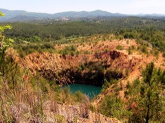 | Burra Burra Mine Historic District | district | 1983 | 83003059 |
| Buzzard's Roost Historic District | district | 1992 | 92000451 | |
 | Center & Abernathy Store Building | building | 1992 | 92001071 |
| Central Headframe | structure | 1992 | 92001073 | |
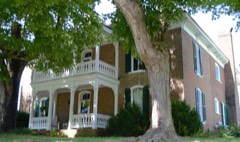 | Copeland House | building | 1984 | 84003674 |
| Copperhill Historic District | district | 1992 | 92000449 | |
| Copperhill Historic District (Boundary Increase) | site | 2008 | 08000688 | |
| Ducktown Historic District | district | 1992 | 92000450 | |
| Isabella Managers' Row | district | 1992 | 92000448 | |
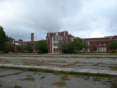 | Kimsey Junior College | building | 1992 | 92001072 |
| Knoxville Southern Railroad Historic District | district | 2007 | 07000187 | |
| Newtown Historic District | district | 1992 | 92000452 | |
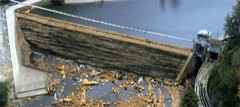 | Ocoee Hydroelectric Plant No. 2 | building | 1979 | 79002453 |
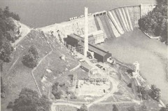 | Ocoee No. 1 Hydroelectric Station | district | 1990 | 90001003 |
| Ocoee No. 3 Hydroelectric Project | district | 2017 | 100001473 | |
 | Polk County Courthouse | building | 1993 | 93000562 |
| Reliance Historic District | district | 1986 | 86000350 | |
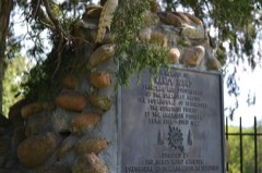 | Nancy Ward Tomb | object | 1973 | 73001815 |
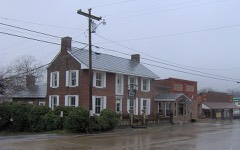 | William Wiggins House | building | 1993 | 93001355 |
Every wildfire the federal occurrence database records inside this county: 730 of them, burning about 9,603 acres. 43 started naturally and 298 were recorded as arson. Each settlement page carries the fires within five miles of it.
| Reported cause | Fires |
|---|---|
| Arson/incendiarism | 298 |
| Debris and open burning | 195 |
| Missing data/not specified/undetermined | 61 |
| Recreation and ceremony | 50 |
| Natural | 43 |
| Equipment and vehicle use | 28 |
| Smoking | 19 |
| Railroad operations and maintenance | 19 |
| Misuse of fire by a minor | 10 |
| Power generation/transmission/distribution | 5 |
| Other causes | 2 |
The five largest, by the area the report gives. 6 of them were set deliberately.
| Date | Cause | Size | Reported by | Name on the report |
|---|---|---|---|---|
| 3 December 1999 | Arson/incendiarism | 640 acres | Cherokee National Forest | CHESTNUT MOUNTAIN |
| 18 November 2016 | Arson/incendiarism | 446 acres | Cherokee National Forest | BIG POPLAR |
| 28 October 2016 | Arson/incendiarism | 444 acres | Cherokee National Forest | WOLF CREEK |
| 1 April 1997 | Arson/incendiarism | 315 acres | Cherokee National Forest | ROGERS BRANCH |
| 15 April 2017 | Arson/incendiarism | 279 acres | National Forests in North Carolina | STATELINE |
| 15 April 2017 | Missing data/not specified/undetermined | 279 acres | National Forests in North Carolina | STATELINE |
| 25 June 2012 | Missing data/not specified/undetermined | 223 acres | Cherokee National Forest | GOFORTH |
| 23 October 2016 | Arson/incendiarism | 202 acres | Cherokee National Forest | RATTLESNAKE HOLLOW |
Every settlement page carries the fires within five miles of it - see the settlement index below.
The NOAA Storm Events Database holds 271 reports for this county, causing 4 deaths, 11 injuries and about $10,247,100 in recorded property damage. Each settlement page carries the reports that name it.
| Kind of event | Reports |
|---|---|
| Thunderstorm Wind | 197 |
| Hail | 46 |
| Tornado | 14 |
| Flood | 6 |
| Flash Flood | 5 |
| Funnel Cloud | 3 |
The most serious of them, by death, then injury, then recorded damage. The accounts are quoted exactly as the forecast office filed them.
| When | Event | Place named | Harm | What the report says |
|---|---|---|---|---|
| November 2016 | Tornado (EF3) | Ocoee | 2 killed | The tornado formed south of Ocoee with several large trees snapped. It strengthened to an EF-2 and moved north northeast and collapsed a cell phone tower. It quickly increased to an EF-3 and heavily damaged a post office. Several more buildings were heavily damaged along with some manufactured homes. Two fatalities occurred in the manufactured housing. Twenty other people were injured in this area. The tornado weakened to an EF-0 as it moved northeast towards Benton. It snapped off the tops of a few pine trees. |
| February 2011 | Thunderstorm Wind | Benton | 1 killed, 1 hurt, $15,000 | Law enforcement personnel reported a tree downed by thunderstorm wind on a mobile home 10 miles south of Benton in a the Old Fort Area on Ladd Springs Road. |
| April 1974 | Tornado (F3) | not stated | 1 killed, $250,000 | no account filed |
| March 1974 | Tornado (F2) | not stated | 7 hurt, $250,000 | no account filed |
| December 1973 | Tornado (F2) | not stated | 3 hurt, $250,000 | no account filed |
| May 2003 | Flash Flood | Countywide | $4,220,000 | Widespread flooding, road closures, damage, evacuations. |
| February 1986 | Tornado (F3) | not stated | $2,500,000 | no account filed |
| March 2012 | Tornado (EF1) | Patty | $1,450,000 | Harrison Tornado - Segment #3. The Harrison Tornado struggled as it crossed the Hiwassee River from Bradley County as an EF0. It remained an EF0 for about the next 6 miles as it only downed a few sporatic trees and larger limbs. The tornado started to intensify again near Dentville Rd. and reached it's maximum strength of EF1 at 100 mph as it damaged a couple of single family houses on Columbus Rd., just north of Lindale Rd.||Along its path, 10 homes were damaged with a total estimate of $600K, 5 barns were destroyed with the total agricultural property losses totaling $800K. Total infrastructure damages were $50K. Grand total damages were nearly $1.5 Million. There were no injuries.||Note: This tornado took the following turns: entering the county moving almost due east along the Hiwassee River, then turning to the left near 35.2289/-84.6988, then turning to the right as it intensified near 35.2596/-84.6246. It continued on this track to the McMinn County line. |
| May 1998 | Tornado (F1) | Ducktown | $100,000 | no account filed |
| March 1997 | Tornado (F1) | Grassy Creek | $100,000 | no account filed |
| April 2011 | Tornado (EF1) | Benton Station | $50,000 | Ringgold-Apison Tornado. This intense tornado was weaker by the time it had crossed into Polk County--lowering to EF1 with 100 mph winds. The damage was mainly to trees in this area. It tracked across the northwest parts of Polk County and continued into southern McMinn County. |
| April 2011 | Tornado (EF1) | Benton Station | $50,000 | Cleveland-to-Etowah Tornado. This tornado entered the northwest part of Polk County from Bradley County after already traveling over 15 miles. In Polk County, the tornado had weakened somewhat to 100 mph max winds that downed trees and caused some roof damage to homes. It then continued into McMinn County. |
| June 2003 | Thunderstorm Wind | Countywide | $30,000 | no account filed |
| June 2009 | Thunderstorm Wind | Benton | $25,000 | An individual reported numerous trees downed by thunderstorm winds in the Benton area. A car was also damaged by the falling trees. |
| July 2006 | Thunderstorm Wind | Countywide | $25,000 | no account filed |
| September 2006 | Thunderstorm Wind | Turtletown | $25,000 | no account filed |
| September 2006 | Thunderstorm Wind | Copperhill | $25,000 | no account filed |
| July 2004 | Thunderstorm Wind | Countywide | $25,000 | no account filed |
| June 1999 | Thunderstorm Wind | Oldfort | $25,000 | no account filed |
| June 1999 | Thunderstorm Wind | Countywide | $25,000 | no account filed |
| June 1997 | Thunderstorm Wind | Benton | $23,000 | Powerlines down in and around the city of Benton with many power outages. Total power and communications blackout at sheriff's dispatch for about 40 minutes. |
| June 2014 | Thunderstorm Wind | Benton | $20,000 | Law enforcement personnel reported 2 trees downed by thunderstorms wind over the western portions of the county. |
| June 2011 | Thunderstorm Wind | Benton | $20,000 | Law enforcement personnel reported several trees downed by thunderstorm wind along the Bradley and Polk county line. |
| February 2011 | Thunderstorm Wind | Ocoee | $20,000 | Law enforcement personnel reported numerous trees and powerlines downed by thunderstorm wind in Ocoee. |
| February 2011 | Thunderstorm Wind | Benton | $20,000 | Law enforcement personnel reported numerous trees and powerlines downed by thunderstorm wind 6 miles southwest of Benton. |
| April 2010 | Tornado (EF0) | Postelle | $20,000 | A tornado briefly touched down just southwest of highway 64 just west of Ducktown and continued northeast before quickly dissipating. The tornado snapped and twisted 10 trees in its path with 70 mph winds before dissipating. |
| April 2010 | Thunderstorm Wind | Ducktown | $20,000 | Law enforcement personnel reported several trees downed by thunderstorm winds in the southeast part of the county from Isabella to Ducktown to Farner. |
| April 2008 | Thunderstorm Wind | Benton | $20,000 | The utility company reported numerous trees and powerlines downed by thunderstorm winds countywide...especially in the Benton area. |
| June 2008 | Thunderstorm Wind | Reliance | $20,000 | The National Forest Office reported numerous trees and large limbs downed by thunderstorm winds in the National Forest and countywide. |
| July 2006 | Thunderstorm Wind | Benton | $20,000 | no account filed |
| July 2005 | Thunderstorm Wind | Benton | $20,000 | no account filed |
| July 2005 | Thunderstorm Wind | Benton | $20,000 | no account filed |
| July 2004 | Thunderstorm Wind | Copperhill | $20,000 | no account filed |
| January 1997 | Thunderstorm Wind | Benton | $19,000 | no account filed |
| June 2008 | Thunderstorm Wind | Benton | $18,000 | Sheriffs office reported numerous trees downed by thunderstorm winds countywide. |
| April 2011 | Thunderstorm Wind | Benton | $15,000 | Law enforcement personnel reported many trees and powerlines downed by thunderstorm wind near intersection of Athens Road and Pinhook Road near Benton. |
| June 2007 | Thunderstorm Wind | Benton | $15,000 | Thunderstorm winds downed several trees and powerlines across the western half of the county. |
| August 2006 | Thunderstorm Wind | Benton | $15,000 | Numerous trees and powerlines down in Benton. |
| October 2006 | Thunderstorm Wind | Benton | $15,000 | Several trees and powerlines down across the west half of the county. |
| December 2005 | Thunderstorm Wind | Benton | $15,000 | Several trees down countywide. |
| May 2006 | Thunderstorm Wind | Benton | $15,000 | no account filed |
| May 2003 | Thunderstorm Wind | Countywide | $15,000 | no account filed |
| November 2002 | Thunderstorm Wind | Countywide | $15,000 | no account filed |
| November 2002 | Thunderstorm Wind | Countywide | $15,000 | no account filed |
| June 1998 | Thunderstorm Wind | Copperhill | $14,000 | no account filed |
| February 2011 | Thunderstorm Wind | Benton | $12,000 | Law enforcement personnel reported numerous trees downed by thunderstorm wind in Reliance. |
| June 2009 | Thunderstorm Wind | Delano | $12,000 | Law enforcement officials reported several trees and powerlines downed by thunderstorm winds near Delano. |
| December 2008 | Thunderstorm Wind | Benton | $12,000 | Law enforcement reported several trees and powerlines downed by thunderstorm winds in Benton. |
| June 2007 | Thunderstorm Wind | Benton | $12,000 | Thunderstorm winds downed several trees and powerlines in Benton.| |
| May 2005 | Thunderstorm Wind | Reliance | $12,000 | no account filed |
| July 2004 | Thunderstorm Wind | Benton | $12,000 | no account filed |
| June 2011 | Thunderstorm Wind | Benton | $10,000 | Law enforcement personnel reported a large tree downed by thunderstorm wind on powerlines southwest of Benton in the Old Fort Community. |
| August 2010 | Thunderstorm Wind | Benton | $10,000 | Utility company personnel reported several trees downed by thunderstorm winds around Benton and countywide. |
| May 2010 | Thunderstorm Wind | Benton | $10,000 | Several trees were blown down by thunderstorm winds. |
| June 2009 | Thunderstorm Wind | Conasauga | $10,000 | Utility company personnel reported few power lines downed by thunderstorm winds in Conasauga. |
| February 2008 | Thunderstorm Wind | Delano | $10,000 | A trained spotter reported several large trees down along the Polk McMinn County line near Delano. |
| June 2008 | Thunderstorm Wind | Benton | $10,000 | Law enforcement reported several trees and powerlines downed by thunderstorm winds countywide. |
| August 2007 | Thunderstorm Wind | Archville | $10,000 | The sheriffs office reported several trees downed by thunderstorm winds near Archville. |
| May 2004 | Thunderstorm Wind | Parksville | $10,000 | no account filed |
| July 2004 | Thunderstorm Wind | Copperhill | $10,000 | no account filed |
The Survey's mineral resources record lists 41 workings inside this county. 9 still produce and 32 are closed or unrecorded. Each settlement page carries the workings within five miles of it.
| Commodity | Workings |
|---|---|
| Iron | 9 |
| Copper | 7 |
| Sulfur | 4 |
| Copper, Sulfur | 4 |
| Sand and Gravel, Construction | 3 |
| Copper, Iron, Zinc | 3 |
| Zinc, Copper | 3 |
| Sulfur-Pyrite | 3 |
| Silver, Lead, Gold | 3 |
| Gold | 2 |
| Copper, Iron, Sulfur | 2 |
| Zinc, Silver, Gold | 2 |
| Silver, Gold, Lead | 2 |
| Stone, Crushed/Broken | 1 |
The least common of them first, because a county's hundredth gravel pit says nothing its first ten did not.
| Where | Site | Commodity | Status | Recorded |
|---|---|---|---|---|
| Boyd Mine | Iron, Zinc, Copper, Sulfur-Pyrite, Silver, Lead, Gold | Past Producer | 1854, 1941 | |
| Burra Burra Mine | Zinc, Silver, Lead, Iron, Gold, Copper, Sulfur | Past Producer | 1843, 1901 | |
| Calloway Mine | Zinc, Iron, Copper, Sulfur, Lead, Silver, Gold | Past Producer | 1853, 1948 | |
| Cherokee Mine | Copper, Iron, Zinc, Sulfur, Gold, Silver, Lead | Past Producer | 1847, 1962 | |
| Cities Service Iron Roaster | Copper, Sulfur, Sulfuric Acid, Iron, Zinc | Producer | ||
| D & S Rock, Inc. Pit | Stone | Past Producer | ||
| D & S Rock, Inc. Pit No. 413 | Stone, Crushed/Broken | Past Producer | Dolomite | |
| Ducktown District | Lead, Sulfur, Iron, Copper, Silver, Gold, Zinc, Nickel, Cobalt | Producer | 1843, 1847 | |
| East Tennessee Mine | Sulfur, Copper, Iron | Producer | Chalcopyrite, Magnetite, Pyrite, Pyrrhotite, Sphalerite | |
| Eureka Mine | Iron, Copper, Sulfur, Lead, Zinc, Silver, Gold | Producer | Chalcopyrite, Magnetite, Pyrite, Pyrrhotite, Sphalerite | |
| Gee Prospect | Aluminum | Occurrence | ||
| Isabella Mine | Copper, Iron, Sulfur, Lead, Zinc, Silver, Gold | Past Producer | Chalcopyrite, Magnetite, Pyrite, Pyrrhotite, Sphalerite | |
| Mary | Iron, Zinc, Copper, Sulfur | Past Producer | Chalcopyrite, Magnetite, Pyrite, Pyrrhotite, Sphalerite | |
| Paul Campbell Isabella Pit No. 393 | Silica, Sand and Gravel, Construction | Producer | Sand and Gravel | |
| South Pit | Zinc, Copper, Sulfur, Sulfur-Pyrite, Silver, Gold, Lead | Past Producer | 1847, 1977 | |
| Copperhill Mine | Copper, Iron, Zinc, Sulfur, Silver, Gold, Lead | Producer | Chalcopyrite, Galena, Gold, Magnetite, Pyrite, Pyrrhotite, Silver, Sphalerite | |
| London Mine | Copper, Iron, Sulfur | Past Producer | Chalcopyrite, Magnetite, Pyrite, Pyrrhotite, Sphalerite | |
| Mcdonald Prospect | Gold | Occurrence | Vein | |
| Mcdonald Prospect | Gold | Occurrence | ||
| Old Tennessee Mine | Copper, Iron, Sulfur | Past Producer | ||
| Eureka Mine | Zinc, Copper, Sulfur-Pyrite, Silver, Lead, Gold | Past Producer | 1853, 1925 | |
| London Mill | Copper, Iron, Zinc | Plant | ||
| North Pit | Zinc, Copper, Sulfur-Pyrite, Silver, Lead, Gold | Past Producer | 1847, 1976 | |
| Paul Cambel Pit Number 393 | Sand and Gravel, Construction | Past Producer | Sedimentary | |
| Paul Cambel Pit Number 393 | Sand and Gravel, Construction | Producer | ||
| East Tennessee | Copper, Sulfur | Past Producer | ||
| Hiwassee | Iron, Copper, Sulfur | Past Producer | ||
| Mcpherson Mine | Copper, Sulfur | Past Producer | ||
| Old Polk County | Iron, Copper, Sulfur | Past Producer | Chalcopyrite, Magnetite, Pyrite, Pyrrhotite, Sphalerite | |
| Central | Copper | Past Producer | ||
| Central Services | Copper | Producer | ||
| Culchote | Copper | Past Producer | ||
| London | Copper | Past Producer | ||
| Meek Prospect | Copper | Prospect | ||
| Ocoee Mine | Copper | Past Producer | ||
| Bean Mt. Area | Iron | Past Producer | Residual | |
| Gee Creek Prospect | Iron | Prospect | ||
| Gee Creek Prospect | Iron | Prospect | ||
| Starr Mt. Area | Iron | Past Producer | Residual | |
| Unnamed Prospect | Iron | Prospect | ||
| Wetmore Iron Prospect | Iron | Occurrence |
Named settlements recorded in the Geographic Names Information System, each with the topographic sheets covering it. Villages, hamlets and abandoned places alike. Each is shown with the nearest named watercourse or landform and the survey quadrangle it falls on.
District 1 · 37369 · On Spanking Slump Branch · Oswald Dome quadrangle
22 sheets, 1886 to 2003
District 4 · 37307 · Near McCamy Ridge · Oswald Dome quadrangle
22 sheets, 1886 to 2003
District 3 · 37391 · Near Jarnigan Mountain · Isabella quadrangle
25 sheets, 1893 to 1981
No longer a settlement
District 2 · 37361 · Near Sugarloaf Mountain · Parksville quadrangle
24 sheets, 1886 to 2003
District 2 · 37361 · On Dutch Creek · Caney Creek quadrangle
24 sheets, 1886 to 2003
No longer a settlement
District 3 · 37391 · Near Ketchersid Mountain · Ducktown quadrangle
27 sheets, 1893 to 2003
District 1 · 37325 · On Conasauga Creek · Oswald Dome quadrangle
22 sheets, 1886 to 2003
No longer a settlement
District 3 · 37317 · On Davis Mill Creek · Mineral Bluff quadrangle
23 sheets, 1888 to 1999
District 2 · 37361 · On Cookson Branch · Parksville quadrangle
24 sheets, 1886 to 2003
No longer a settlement
District 3 · 37317 · On Stillhouse Branch · Ducktown quadrangle
27 sheets, 1893 to 2003
District 1 · 37310 · On Shumaker Branch · Benton quadrangle
24 sheets, 1886 to 2003
No longer a settlement
District 4 · 37369 · On Springtown Branch · McFarland quadrangle
25 sheets, 1893 to 2003
District 4 · 37307 · Near Little Mountain · Oswald Dome quadrangle
22 sheets, 1886 to 2003
District 4 · On Sulphur Springs Branch · McFarland quadrangle
25 sheets, 1893 to 2003
No longer a settlement
District 3 · 37317 · On Ellis Branch · Isabella quadrangle
25 sheets, 1893 to 1981
No longer a settlement
District 2 · 37362 · On Sawmill Brach · Parksville quadrangle
24 sheets, 1886 to 2003
The vanished settlements of Polk County: the places named above that are no longer on the map.