 Block
From the record
One of 19 National Register listings published here for Polk County · listed in 2017 · category: District.
Sources: the National Register database, National Park Service
Listed on the National Register of Historic Places in 2017.
One of 19 National Register listings published here for Polk County · listed in 2017 · category: District.
Sources: the National Register database, National Park Service
Regional context, not property-specific evidence. The federal wildfire occurrence database lists 91 fires within 5 miles of Ocoee No. 3 Hydroelectric Project between 1992 and 2020, burning about 1,388 acres in total. 4 started naturally. 42 were recorded as arson. Distance is straight-line from the map coordinates, so a fire counted here may appear on a neighbouring settlement's page as well.
| Reported cause | Fires |
|---|---|
| Arson/incendiarism | 42 |
| Debris and open burning | 19 |
| Recreation and ceremony | 6 |
| Smoking | 6 |
| Railroad operations and maintenance | 5 |
| Missing data/not specified/undetermined | 5 |
| Natural | 4 |
| Equipment and vehicle use | 3 |
| Other causes | 1 |
The most recent of them, most recent first, with the day each was reported and the service that recorded it.
| Date | Cause | Size | Reported by | Name on the report |
|---|---|---|---|---|
| 7 September 1993 | Arson/incendiarism | under an acre | Cherokee National Forest | not named |
| 5 September 2008 | Missing data/not specified/undetermined | 7.2 acres | Cherokee National Forest | #3 POWERHOUSE |
| 27 September 1998 | Arson/incendiarism | 1.0 acres | Tennessee Division of Forestry | not named |
| 25 September 1999 | Equipment and vehicle use | 102 acres | Cherokee National Forest | GOFORTH CREEK |
| 20 September 2003 | Smoking | under an acre | Cherokee National Forest | ROGERS BRANCH |
| 20 September 1999 | Arson/incendiarism | under an acre | Tennessee Division of Forestry | not named |
| 15 September 2020 | Equipment and vehicle use | 13 acres | Cherokee National Forest | CANEY CREEK |
| 25 August 2007 | Natural | 12 acres | Cherokee National Forest | BIG CREEK |
Regional context, not property-specific evidence. The National Weather Service names Benton, the town this property stands in, in 85 storm reports between 1993 and 2024: 68 thunderstorm wind, 12 hail, 2 funnel cloud, 2 flood. The reports record 1 death and 1 injury. Each account below is quoted exactly as the forecast office filed it, from the NOAA Storm Events Database, and each date opens the federal record of that event.
| When | Event | Place named | Harm | What the report says |
|---|---|---|---|---|
| February 2011 | Thunderstorm Wind | Benton | 1 killed, 1 hurt, $15,000 | Law enforcement personnel reported a tree downed by thunderstorm wind on a mobile home 10 miles south of Benton in a the Old Fort Area on Ladd Springs Road. |
| June 2009 | Thunderstorm Wind | Benton | $25,000 | An individual reported numerous trees downed by thunderstorm winds in the Benton area. A car was also damaged by the falling trees. |
| June 1997 | Thunderstorm Wind | Benton | $23,000 | Powerlines down in and around the city of Benton with many power outages. Total power and communications blackout at sheriff's dispatch for about 40 minutes. |
| June 2014 | Thunderstorm Wind | Benton | $20,000 | Law enforcement personnel reported 2 trees downed by thunderstorms wind over the western portions of the county. |
| June 2011 | Thunderstorm Wind | Benton | $20,000 | Law enforcement personnel reported several trees downed by thunderstorm wind along the Bradley and Polk county line. |
| February 2011 | Thunderstorm Wind | Benton | $20,000 | Law enforcement personnel reported numerous trees and powerlines downed by thunderstorm wind 6 miles southwest of Benton. |
| April 2008 | Thunderstorm Wind | Benton | $20,000 | The utility company reported numerous trees and powerlines downed by thunderstorm winds countywide...especially in the Benton area. |
| July 2006 | Thunderstorm Wind | Benton | $20,000 | no account filed |
| July 2005 | Thunderstorm Wind | Benton | $20,000 | no account filed |
| July 2005 | Thunderstorm Wind | Benton | $20,000 | no account filed |
| January 1997 | Thunderstorm Wind | Benton | $19,000 | no account filed |
| June 2008 | Thunderstorm Wind | Benton | $18,000 | Sheriffs office reported numerous trees downed by thunderstorm winds countywide. |
| April 2011 | Thunderstorm Wind | Benton | $15,000 | Law enforcement personnel reported many trees and powerlines downed by thunderstorm wind near intersection of Athens Road and Pinhook Road near Benton. |
| June 2007 | Thunderstorm Wind | Benton | $15,000 | Thunderstorm winds downed several trees and powerlines across the western half of the county. |
| August 2006 | Thunderstorm Wind | Benton | $15,000 | Numerous trees and powerlines down in Benton. |
| October 2006 | Thunderstorm Wind | Benton | $15,000 | Several trees and powerlines down across the west half of the county. |
| December 2005 | Thunderstorm Wind | Benton | $15,000 | Several trees down countywide. |
| May 2006 | Thunderstorm Wind | Benton | $15,000 | no account filed |
| February 2011 | Thunderstorm Wind | Benton | $12,000 | Law enforcement personnel reported numerous trees downed by thunderstorm wind in Reliance. |
| December 2008 | Thunderstorm Wind | Benton | $12,000 | Law enforcement reported several trees and powerlines downed by thunderstorm winds in Benton. |
| June 2007 | Thunderstorm Wind | Benton | $12,000 | Thunderstorm winds downed several trees and powerlines in Benton.| |
| July 2004 | Thunderstorm Wind | Benton | $12,000 | no account filed |
| June 2011 | Thunderstorm Wind | Benton | $10,000 | Law enforcement personnel reported a large tree downed by thunderstorm wind on powerlines southwest of Benton in the Old Fort Community. |
| August 2010 | Thunderstorm Wind | Benton | $10,000 | Utility company personnel reported several trees downed by thunderstorm winds around Benton and countywide. |
| May 2010 | Thunderstorm Wind | Benton | $10,000 | Several trees were blown down by thunderstorm winds. |
| June 2008 | Thunderstorm Wind | Benton | $10,000 | Law enforcement reported several trees and powerlines downed by thunderstorm winds countywide. |
| June 2011 | Thunderstorm Wind | Benton | $8,000 | Law enforcement personnel reported 4 trees downed by thunderstorm wind 1 mile northwest of Benton. |
| June 2009 | Thunderstorm Wind | Benton | $8,000 | Highway department personnel reported several trees downed by thunderstorm winds in and around Benton. |
| July 2005 | Thunderstorm Wind | Benton | $8,000 | no account filed |
| May 2003 | Thunderstorm Wind | Benton | $6,000 | no account filed |
| January 2013 | Flood | Benton | $5,000 | Several sink holes affecting roadways. |
| February 2011 | Thunderstorm Wind | Benton | $5,000 | Law enforcement personnel reported a few trees downed by thunderstorm wind in Benton. |
| October 2010 | Thunderstorm Wind | Benton | $5,000 | Law enforcement personnel reported a few trees downed by thunderstorm winds in Benton. |
| April 2006 | Thunderstorm Wind | Benton | $5,000 | A power pole downed in Benton. A tree and several large limbs downed in Conasauga. |
| February 1993 | Thunderstorm Wind | Benton | $5,000 | A mobile home was flipped over and several trees were knocked down. |
| July 2004 | Thunderstorm Wind | Benton | $5,000 | no account filed |
| July 1996 | Thunderstorm Wind | Benton | $5,000 | no account filed |
| August 1996 | Thunderstorm Wind | Benton | $5,000 | no account filed |
| June 2014 | Thunderstorm Wind | Benton | $2,000 | Highway department personnel reported 1 tree downed by thunderstorm wind 7 miles east of Benton along highway TN -30. |
| April 2013 | Thunderstorm Wind | Benton | $2,000 | Law enforcement personnel reported one tree downed by thunderstorm wind in Benton. |
| June 2010 | Thunderstorm Wind | Benton | $2,000 | Law enforcement personnel reported 1 tree downed by thunderstorm winds along Highway 64 southeast of Benton. |
| June 2010 | Thunderstorm Wind | Benton | $2,000 | Law enforcement personnel reported 1 tree downed by thunderstorm winds along County Route 315 near Reliance. |
| June 2009 | Thunderstorm Wind | Benton | $2,000 | Law enforcement officials reported one tree downed by thunderstorm winds near Benton. |
| August 2007 | Thunderstorm Wind | Benton | $1,000 | The County Highway Department reported one tree downed by thunderstorm winds south of Benton. |
| August 1995 | Thunderstorm Wind | Benton | $1,000 | Several trees knocked down. |
| August 2024 | Thunderstorm Wind | Benton | - | Four to five trees were blown down by severe thunderstorm winds on Etowah Road in Benton. |
| May 2024 | Thunderstorm Wind | Benton | - | Several trees were blown down by severe thunderstorm wind gusts. |
| May 2024 | Thunderstorm Wind | Benton | - | Multiple trees in Benton were blown down by severe thunderstorm wind gusts. |
| January 2023 | Thunderstorm Wind | Benton | - | Several trees were blown down across the county. |
| February 2023 | Thunderstorm Wind | Benton | - | Trees were blown down in Benton. |
| May 2023 | Thunderstorm Wind | Benton | - | Multiple trees were blown down by straight line winds. |
| December 2021 | Thunderstorm Wind | Benton | - | Multiple trees were blown down. |
| June 2019 | Thunderstorm Wind | Benton | - | Two trees were reported down near Benton. |
| March 2018 | Hail | Benton | - | Several reports of golf ball size hail was reported across the county. |
| November 2018 | Thunderstorm Wind | Benton | - | Three trees were reported down on power lines at Highway 314 and main street. |
| June 2018 | Thunderstorm Wind | Benton | - | Several trees were reported down. |
| July 2018 | Flash Flood | Benton | - | Flooding near Hwy 411 and Parksville Road. |
| July 2018 | Thunderstorm Wind | Benton | - | Two trees were reported down on highway 64. |
| December 2015 | Flood | Benton | - | Several road closures across the county. |
| July 2013 | Thunderstorm Wind | Benton | - | Two trees were reported down about one mile east of Benton. |
No historic map-sheet match is published for this property yet. That does not mean no map exists. This record needs a coordinate-quality review before it can be joined to a sheet boundary. Browse the county's mapped places while that work is pending.
Other National Register properties close enough to walk or drive between, ordered by distance from this one. Both positions come from the same geocoding pass that matched these properties to their map sheets.
| Photograph | Property | Distance | Listed |
|---|---|---|---|
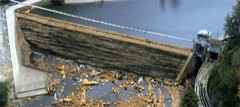 | Ocoee Hydroelectric Plant No. 2 | 2.9 miles | 1979 |
| Buzzard's Roost Historic District | 5.5 miles | 1992 | |
| Ducktown Historic District | 5.5 miles | 1992 | |
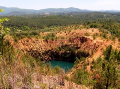 | Burra Burra Mine Historic District | 5.7 miles | 1983 |
| Central Headframe | 5.9 miles | 1992 | |
| Isabella Managers' Row | 7.0 miles | 1992 |
| National Archives record | The nomination case file for reference 100001473 in Record Group 79. |
| Polk County | All 19 listed properties in this county. |