 Block
From the record
16 National Register listings published here.
Sources: the National Register database, National Park Service
69 topographic sheets cover 145 settlements here, and 16 properties are on the National Register of Historic Places.
16 National Register listings published here.
Sources: the National Register database, National Park Service
Every property in this county listed on the National Register of Historic Places, with the year it was listed and the federal nomination document.
| Photograph | Property | Type | Listed | Reference |
|---|---|---|---|---|
 | Algood Methodist Church | building | 1979 | 79002454 |
 | Arcade, The | building | 1979 | 79002455 |
 | Broad Street Church of Christ | building | 2002 | 01001567 |
 | Buffalo Valley School | building | 2006 | 06000548 |
 | Burgess Falls Hydroelectric Station | district | 1990 | 90001006 |
 | Cookeville Railroad Depot | building | 1985 | 85002773 |
| Cowen Farmstead | district | 2005 | 05000205 | |
 | First Presbyterian Church | building | 2010 | 10001060 |
 | Harding Studio | building | 1992 | 92000355 |
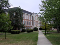 | Henderson Hall | building | 1985 | 85002754 |
 | John's Place | building | 2011 | 11000085 |
| Ralph's Donut Shop | building | 2025 | 100012064 | |
 | Science Building, The | building | 2017 | 100000858 |
 | United States Post Office and Court House | building | 2014 | 14001053 |
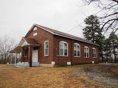 | West End Church of Christ Silver Point | building | 2007 | 07001270 |
 | White Plains | building | 2009 | 09000538 |
Every wildfire the federal occurrence database records inside this county: 217 of them, burning about 2,121 acres. 3 started naturally and 70 were recorded as arson. Each settlement page carries the fires within five miles of it.
| Reported cause | Fires |
|---|---|
| Debris and open burning | 94 |
| Arson/incendiarism | 70 |
| Missing data/not specified/undetermined | 17 |
| Equipment and vehicle use | 10 |
| Other causes | 10 |
| Recreation and ceremony | 5 |
| Smoking | 3 |
| Natural | 3 |
| Misuse of fire by a minor | 3 |
| Power generation/transmission/distribution | 1 |
| Railroad operations and maintenance | 1 |
The five largest, by the area the report gives. Three of them were set deliberately.
| Date | Cause | Size | Reported by | Name on the report |
|---|---|---|---|---|
| 31 October 2001 | Arson/incendiarism | 250 acres | Tennessee Division of Forestry | not named |
| 3 December 2011 | Recreation and ceremony | 198 acres | Tennessee Division of Forestry | EAST OVERLOOK BLUFFS |
| 24 March 2007 | Debris and open burning | 142 acres | Tennessee Division of Forestry | KING |
| 12 February 2007 | Arson/incendiarism | 120 acres | Tennessee Division of Forestry | WELCH |
| 25 April 2009 | Recreation and ceremony | 116 acres | Tennessee Division of Forestry | LAKE |
| 9 March 2007 | Debris and open burning | 114 acres | Tennessee Division of Forestry | HENDERSON |
| 24 April 2008 | Debris and open burning | 64 acres | Tennessee Division of Forestry | not named |
| 26 February 2005 | Arson/incendiarism | 42 acres | Tennessee Division of Forestry | not named |
Every settlement page carries the fires within five miles of it - see the settlement index below.
The NOAA Storm Events Database holds 478 reports for this county, causing 30 deaths, 155 injuries and about $138,350,311 in recorded property damage. Each settlement page carries the reports that name it.
| Kind of event | Reports |
|---|---|
| Thunderstorm Wind | 245 |
| Hail | 121 |
| Flash Flood | 59 |
| Tornado | 20 |
| Lightning | 14 |
| Flood | 12 |
| Funnel Cloud | 5 |
| Heavy Rain | 2 |
The most serious of them, by death, then injury, then recorded damage. The accounts are quoted exactly as the forecast office filed them.
| When | Event | Place named | Harm | What the report says |
|---|---|---|---|---|
| March 2020 | Tornado (EF4) | Ensor | 19 killed, 87 hurt, $100,000,000 | An historic, violent EF-4 tornado began in western Putnam County northwest of Baxter and tracked eastward for over 8 miles before lifting near downtown Cookeville, damaging or destroying dozens of homes and businesses, killing 19 people, and injuring 88 others. The tornado began 2.5 miles northwest of Baxter along Highway 70 where it caused EF-0 damage to several homes and outbuildings. Scattered trees were blown down as the tornado continued eastward across Gainesboro Highway. The tornado quickly intensified to EF-2 in the Prosperity Pointe subdivision just north of Highway 70 and further strengthened to EF-3 as it crossed Bloomington Road and Clemmons Road in the Double Springs community, severely damaging several homes. As the tornado moved across Charleston Square, Plunk Whitson Road, and North McBloom Chapel Road, it intensified even more and produced a 0.8 mile long by 100 yards wide swath of EF-4 damage. 17 well-constructed, large homes in this area were completely leveled, mostly on Hensley Drive, with many deaths occurring in this area. EF-4 damage continued eastward to Echo Valley Drive, where an apartment complex and 5 more homes were completely destroyed. The tornado weakened to EF-3 as it crossed Highway 70 and Locust Grove Road, where numerous more homes and buildings were damaged or destroyed. A dashcam video of the tornado was taken from an unoccupied vehicle on Willow Brook Drive in this area. Continuing along Highway 70, the tornado weakened further to EF-2 intensity as it crossed County Farm Road and Jackson Street, then down to EF-1 strength along Crescent Drive and Buck Avenue. The tornado rapdily dissipated as it entered the downtown area of Cookeville, quickly lifting on Laurel Avenue just west of Cookeville Regional Medical Center. This was the worst tornado on record to affect Putnam County. |
| April 1974 | Tornado (F4) | not stated | 10 killed, 51 hurt | no account filed |
| March 2003 | Tornado (F1) | Cookeville | 1 killed, 1 hurt, $100,000 | The tornado touched down 1.5 miles east of exit #280 on I-40. The tornado continued for about 12.2 miles. One person was killed, and another person was injured inside a mobile home on Pippin Road and near Anderson Rd. The time of the fatality was around 11:15 AM CST. The storm ripped the trailer loose from its anchors and flung it over on its side at least 100 feet from its foundation. Numerous trees and power lines were down. The fallen trees and power lines blocked many roads. A total of 67 properties in the Pippin area reported damage. There was damage to houses, barns, trailers, garages, sheds, and at least one church. In the Buffalo Valley Road area, the tornado destroyed a barn and uprooted several huge trees.All six sirens in Cookeville sounded for the tornado warning, which was issued at 10:58 AM CST. |
| February 1993 | Tornado (F3) | Double Springs | 6 hurt, $500,000 | Eight homes were destroyed and 15 others were damaged. One person was trapped in a van after a tree was knocked down on top of it. |
| January 2002 | Flash Flood | Cookeville | 3 hurt | Culvert collapsed at Fisk and Old Kentucky Road. 3 people were injured in one car. 3 homes and one business were damaged. 10 roads and 2 bridges were closed. 2 people were killed while clearing a culvert during a heavy rain at 10 AM CST. There was no flooding occurring at that time. |
| July 2002 | Lightning | Monterey | 2 hurt | Sara Nugent, 34 and her son, Chad Nugent, 14, of Old Walton Road, were hurt when they were struck by lightning while sitting on a porch. They had to be airlifted to Erlanger Hospital in Chattanooga for treatment of their injuries. |
| March 1991 | Thunderstorm Wind | not stated | 2 hurt | no account filed |
| May 1955 | Tornado (F1) | not stated | 1 hurt, $25,000 | no account filed |
| July 2008 | Thunderstorm Wind | Cookeville | 1 hurt, $10,000 | A tree fell on a car injuring one person at the intersection of Burgess Falls road and River Rd. |
| September 2014 | Lightning | Double Spgs | 1 hurt | The Cookeville Herald-Citizen reported that one person was struck by lightning and injured on Claude Loftis Road. |
| August 2010 | Flood | Buffalo Vly | $25,000,000 | Pippen Road was under 3 to 4 inches of water. Rickman Road near Spring Creek Road area was reported to be flooded. Swiftly moving water was crossing McBroom Chapel Road. Near this same area, a house was flooded and three vehicles were submerged. Portion of Dodson Branch Highway and Willow Avenue were under 7 to 8 inches of water. Multiple structures across the county received flood damage, including several|home furnished basements, garages, and barns. ||Newspapers reported that at least 42 roads, along with a few bridges, were closed across the county, and both Cookeville and Upperman High Schools were damaged. Extent of any damage to county roads, bridges, and both high schools was unknown. Widespread flood damage occurred in the city of Baxter, including flooded parts of Baxter Elementary School which also had the buildings electrical and telephone system damaged due to flooding. Extent of damage in Baxter was unkown.||Newspapers also reported that numerous business in the Cookeville area were also closed due to the flooding, including the shopping center at 541 South Willow Avenue where 4 to 6 inches of water that got into most of the business caused them to be closed up for a week and a half. The complete extent of damage to the business were unknown, but it was reported that several of the business had to replace drywall and flooring that was damaged. A freight train carrying sand derailed near the Frisk Road Railroad Crossing when the tracks were washed away. Several homes also received water damage, including one home in Cookeville that washed off its foundation. Several water rescues also occurred, along with a few livestock, horses, and pet rescues.||Newspapers also reported that more than 25 homes and business across the county sustained uninsured losses of 40 percent or more of their estimated predisaster fair market value, per reports also from the state's small business administration and the Tennessee Emergency Management Agency.||Newspapers also reported that in Bloomington Springs, a number of cars at the ABC Auto Specialists were stacked up upon each other. Also, one whole building of the business was lost. The wife of the owner of the business said that water was over her and her husband's head. Huge trees were reported down in this area also. Cars that they owned were in a nearby creek, of which one was a 1963 Nova SS, which was totally demolished. ||All of this damage was the result of up to a foot of rainfall in some locations across the county. |
| April 2023 | Lightning | Cookeville | $5,000,000 | Lightning struck an apartment building at Eagle Summit Apartments at Tennessee Tech University along Willow Avenue near Cookeville, causing a fire. All occupants were evacuated, and firefighters put out the fire just after 7 AM local time. Four apartments were destroyed, impacting eleven occupants. No injuries were reported, and damages are a rough estimate. |
| May 2017 | Thunderstorm Wind | Bloomington Spgs | $1,400,000 | A NWS storm survey found a severe 15 mile long by 1 to 2 mile wide downburst caused major damage across Cookeville and surrounding areas of central Putnam County. Damage was first reported east of Bloomington Springs where trees and power lines were blown down. Scattered tree and power line damage contined to the southeast to near the Nashville Highway, including a tree falling and blocking Peach Orchard Road at Flatt Road, and a tree blown down onto a vehicle with the occupant trapped inside at County Farm Road and Gainesboro Grade. More significant and widespread damage occurred across the center of Cookeville, where the roof was blown off a business on Oak Avenue and the canopy was blown off another business on Whitney Street. Dozens of very large trees were also snapped and uprooted with several falling on homes and vehicles and the majority of roads in the city blocked. One tree fell through and destroyed much of a home on Briargate Way. Another tree fell onto a moving vehicle on East Spring Street crushing the car and narrowly missing the driver. Numerous power lines were also blown down with power poles snapped and power knocked out to up to 60 percent of the city of Cookeville and surrounding Putnam County. Farther to the east, numerous trees and power lines continued to be blown down on Mountain Top Lane on Buck Mountain with the roadway blocked, as well as in the Poplar Grove area and around City Lake. Wind speeds were estimated to range from 75 mph up to 95 mph. In June 2017, a Presidential Disaster Declaration was made for Putnam County due to the widespread wind damage. |
| June 2000 | Lightning | Cookeville | $1,000,000 | Lightning struck the Saxony's Apartments, one of the oldest apartment complexes in Cookeville. Flames raced through the common attic of a 10 apartment two story wood structure unit at a high rate of speed. 10 families were left homeless. The Saxony Apartment complex is about 30 years old. At that time, codes regulations did not require draft stop walls in the attic. |
| February 2025 | Tornado (EF1) | Cookeville Arpt | $500,000 | This EF-1 tornado touched down near Cyphers Drive in northern Putnam County where tree damage was found. As the tornado continued east, there was additional tree damage found along Cindy Drive along with roof damage and significant garage damage to homes on Malone Lane. The tornado then crossed into Overton County. Damages are a rough estimate. |
| May 2023 | Flash Flood | Poplar Grove | $500,000 | Five to seven inches of heavy rain fell across central Putnam County, causing significant flash flooding in and around Cookeville and Algood. Near Algood, a home along Middlebrook Road had to be evacuated due to flooding, and several cars were stalled in flood waters around White Plains Golf Course. Along Fisk Road, a warehouse was also flooded and evacuated. Numerous other roads were flooded in Algood as well, including Mirandy Road, West Washington Street, East Main Street at White Plains Academy, Highway 42, RC Buck Drive, Shag Rad Road, Fish Road, and Whiteaker Springs Road. Numerous roads were also flooded in Cookeville including East 6th Street at Denton Avenue, Fisk Road at East Broad Street, Old Walton Road at Stone Bridge Drive, and Country Club Place at Doris Drive. Fortunately, no injuries were reported. Damages are a rough estimate. |
| July 2015 | Flash Flood | Gentry | $500,000 | Major flash flooding affected much of Putnam County from the evening hours on July 2 into the morning hours on July 3. Numerous roads throughout the county were flooded and closed, including Highway 111 three miles south of I-40, Neal Street, Jefferson Avenue, and Veterans Drive. Other roads were washed away and destroyed, including Thomas Allen Road, Bennett Road, and Bunker Hill Road at West Cemetery Road. Several water rescues were also performed by emergency personnel. Many homes, businesses, and vehicles were also flooded, including one home on Meadow Wood Drive at Burgess Falls Road, and others along Highway 111 and Highway 70 near Clouse Road. Another house was heavily damaged on Falcon Point in the Prosperity Point subdivision due to the front porch collapsing into a sinkhole. A CoCoRaHS observer 3.3 miles SSW of Cookeville measured 6.74 inches of rain over the 24 hour period ending at 6am on July 3. |
| May 2020 | Thunderstorm Wind | Cookeville | $277,710 | Numerous trees and power lines were blown down across Putnam County with power outages. |
| May 2025 | Thunderstorm Wind | Berblech | $250,000 | Very strong thunderstorm winds caused significant damage in the Monterey area. On Belmont Road, a tree fell onto a home which caused siding damage. Also on Belmont Road, a tree fell onto another home, this time causing more significant damage as the tree fell into the home which caused roof and wall damage. On Highway 70, winds caused shingle damage to a mobile home as well as a commercial building. No injuries were reported. Damages are a rough estimate. |
| July 2024 | Flash Flood | Holladay | $250,000 | Heavy rain caused numerous roads to flood with several vehicles stranded in and around Cookeville. A few homes and businesses were also flooded. Roads that were flooded included Highway 111 at East 10th Street, Willow Avenue at the railroad overpass, Willow Avenue at State Highway 70, Willow Avenue at Jackson Street, Neal Street just south of Maple, and North Washington Avenue at East 4th Street. Extent of damages is unknown, and damage numbers are just a rough estimate. |
| March 2012 | Tornado (EF1) | Cookeville Arpt | $250,000 | The tornado that moved across the Dodson Branch community in southeast Jackson County continued northeastward and produced EF1 damage across extreme northern Putnam County. Hundreds of trees were blown down and a few homes and outbuildings were damaged as the tornado crossed Fairview Road and Thomas Allen Road. The tornado continued northeast into southwest Overton County. |
| March 2010 | Lightning | Caney Fork | $250,000 | According to the Putnam County Sheriffs Department, the home of Tom Shoemake, on Overstreet Drive, was struck by lightning. The lightning strike caused damage to two vehicles, his yard, a tree, his driveway, the carport, and the electrical wiring in the house. A witness reported that the lightning first struck the tree in the yard, then appeared to travel through the root system of the tree into the concrete. When it hit the driveway, a big chunk of concrete hit a Chrysler car. The vehicle had extensive damage all over and three flat tires. From the driveway, the lightning traveled into the carport area, it blew out a concrete boulder. The boulder hit the ceiling of the carport, then came back down in the back window of a Chevrolet car. There was extensive damage to this car. The lightning then traveled into the electric wiring of the residence, blowing the door bell off the door. It also made a ditch in the yard and damaged the siding and gutter system. |
| July 2004 | Thunderstorm Wind | Countywide | $200,000 | Numerous trees were down around the county. Cookeville Police Department reported that the "City of Cookeville looks like a war zone". At least 15 power poles were downed by strong winds in Monterey. Some trees fell on homes. One mobile home was destroyed. A newspaper story said a tree fell and ruptured some gas line equipment at the Windrowe subdivision off South Maple Avenue in Cookeville. Several people were evacuated from their homes as a precautionary measure until the gas line was shut off. |
| May 2025 | Lightning | Calfkiller | $100,000 | A water main line was struck by lightning south of Monterey, causing the loss of 500,000 gallons of water. Damages are a rough estimate. |
| July 2015 | Tornado (EF1) | Double Spgs | $100,000 | An EF1 tornado touched down near Double Springs Road and Highway 70 then moved southeast across Hawkins Crawford Road and Buffalo Valley Road before lifting near I-40 and Park West Drive. A total of 30 homes, barns, and outbuildings suffered minor to moderate damage along the path, and 1 business on Buffalo Valley Road suffered extensive damage. Numerous trees and power lines were also blown down which blocked and closed Double Springs Road, Hawkins Crawford Road, and the railroad tracks north of Thelma Road. Maximum winds were estimated near 105 mph. |
| March 2012 | Thunderstorm Wind | Cookeville Arpt | $100,000 | Over 100 trees were downed near East White Hall Road. |
| April 2009 | Tornado (EF1) | Calfkiller | $100,000 | An EF-1 Tornado, with a maximum estimated wind speed of around 100 mph, touchdown near the intersection of Highway 84 and Long Hollow Road in Putnam County. It then traveled northeast and ended one quarter of a mile north of Dipping Springs Road and I-40 in Cumberland County. The start of the damage was found at Bethel Church off of Highway 84. Northeast from the church considerable trees were twisted or snapped or uprooted along the damage path along Cliff Park Road, near the intersection of Icy Cove Trail and Arrow Trail and East Cove Road.|Tornado path length was 12 miles with a maximum width of 100 yards.||Newspaper reported that other areas near the Monterey sustained considerable damage, including roofs blown off barns and sheds, trees|uprooted, and fences demolished. In particular, the roof of the tractor|shed, damage to a cattle corral, and miles of fences were demolished, along with a rental house that had its windows shattered, at Senator Charlotte Burks Farm near Monterey. |
| September 2009 | Flood | Bloomington Spgs | $100,000 | At least one apartment complex was evacuated in Cookeville where an estimated 6 inches of rain fell. Putnam County's 18 schools were dismissed one hour early so students could get home before streets flooded. Standing water was up to car windows in some sections of the city. Newspaper also reported that estimates of rainfall across the county ranged from five inches in Baxter, where many roads were closed including the Elmore Town Ridge Bridge, to more than eight inches in other parts of the county. Exactly what other parts of the county the article was referencing was not defined. A man was stranded in a vehicle in Darwin Park where three feet of water was reported. City Fire Crews rescued him in a short amount of time and was pronounced in good health. County Emergency management also responded to a call on Fisk Road, where neighbors were concerned about a women whose house was flooding. City Fire Crews got the resident out of the house quickly since water was approaching the heating and cooling units. Another area that experienced flooding was Byrne Avenue, where Eagle Creek Apartments had flood waters reportedly reaching as high as two feet inside them, causing damage to furniture, school supplies, and musical instruments. Vehicles parked outside next to these apartments were damaged. Reports were received of nearly 20 roads closed or impassible due to high water. |
| November 2017 | Lightning | Monterey | $70,000 | Lightning struck a home on Walton Hills Road and the resulting fire caused an estimated $60,000 to $70,000 damage. |
| July 2023 | Flash Flood | Monterey | $50,000 | Heavy rain in the Monterey area caused flooding of several roads and one unknown business. Damages are a rough estimate. |
| May 2021 | Tornado (EF0) | Wilhite | $50,000 | An EF-0 tornado touched down near South Willow Avenue and Winston Drive in Cookeville, causing minor damage to the Willow Avenue Church of Christ and moderate damage to two church outbuildings. Several trees were blown down at the Hampton Creek Apartments just off to the east, and one apartment building suffered minor roof damage. The tornado continued northeast across Jefferson Avenue and Highway 111, but only minimal damage was noted with just a few small trees and signs damaged. More significant damage occurred in east Cookeville on Watauga Road, Linda Avenue, Spring Street, and Dry Valley Road where numerous trees were blown down. Trees continued to be snapped and uprooted as the tornado crossed Mountain Top Lane and Mount Pleasant Road, and one home was severely damaged by fallen trees on Falling Water Road. More trees were blown down on Brotherton Mountain Road and Stamps Shady Grove Road before the tornado lifted. |
| May 2017 | Thunderstorm Wind | Jeremiah | $50,000 | A NWS storm survey found a severe 17 mile long by 1 mile wide downburst caused major wind damage along the Putnam/Overton County border from southwest of Rickman southeastward to around Monterey. Damage was first reported on Cindy Lane in northern Putnam County where trees were blown down. Numerous more trees were snapped and uprooted along Ben Mason Road just north of the county line in Overton County. The roof was blown off a large warehouse at a flea market on Highway 111, and a nearby outbuilding lost many wood panels on the outside walls. Dozens of large trees were also snapped and uprooted along Spring Creek Road in Rickman, with several falling on homes and vehicles. Farther to the east, a barn lost much of its roof on Highway 84 near Lewis Lane, and numerous trees and power lines were blown down along Highway 84 south of Boswell Road. Large trees were blown down and playground equipment destroyed in Whittaker Park in Monterey, and several more trees were blown down on Clinchfield Drive and Meadow Creek Road southeast of Monterey. Wind speeds were estimated up to 85 mph. |
| January 2010 | Flash Flood | Buffalo Vly | $50,000 | Sheriffs office reported flooded roads across the county. |
| July 2010 | Flash Flood | Holladay | $50,000 | Flooding occurred in Cookeville at Broad Street and at Willow Avenue. Jackson Street and Willow Street were both under water. |
| June 2010 | Thunderstorm Wind | Wilhite | $50,000 | Trees and power lines were down south of Interstate 40 both inside and outside of the city limits. |
| February 2009 | Thunderstorm Wind | Cookeville | $50,000 | Numerous trees were downed along with several power line poles across the county. |
| August 2009 | Thunderstorm Wind | Cookeville | $50,000 | A large 50 to 60 foot oak tree crushed two trailer homes on West 12th Street, injuring one women and trapping a couple who had to wait for firefighters to rescue them. The one women sustained an ankle injury and the couple was not injured. It was reported to have just blown down, broke off right at the ground, and hit two trailers, smashing them all the way down to their frames. |
| June 1995 | Thunderstorm Wind | Cookeville | $50,000 | A few barn roofs were blown off. Many trees and power lines were blown down. Several homes and some vehicles were damaged when trees fell on them. |
| June 2012 | Thunderstorm Wind | Cookeville Arpt | $40,000 | A large downburst struck areas along a 5 mile long swath from Bangham through Algood. Numerous trees and power lines were blown down, with power outages in Algood, and some trees falling on cars in Bangham. Roadways with fallen trees in Bangham included Holland Drive, and in Algood included Timber View Lane, Mirandy Drive, Brotherton Mountain Road, Plantation Drive, and Turnberry Place. |
| June 2001 | Thunderstorm Wind | North Portion | $35,000 | EMA reported strong straight line winds hit the northern part of the county from just northwest of Cookeville on Maplewood Drive and Shipley Road, and between Highways 290 & 135. Trees and power lines were down north of Algood and near Bangham. 7 homes were damaged and also a barn. The winds took the tin roof off a barn. Trees fell on 3 of these homes, and also on a shed. Strong winds did roof damage to the other 4 homes. |
| July 1997 | Lightning | Cookeville | $35,000 | Lightning struck a house while under construction and set fire to the attic. |
| July 2004 | Lightning | Cookeville | $30,000 | Lightning struck a barn in southeast Cookeville, about 100 yards from a house on Old Bridge Rd. The barn and its contents, which included a tractor, was totally destroyed. |
| July 2002 | Lightning | Cookeville | $30,000 | Lightning struck the top of a three-story brick house on Russell Strausse Rd. This started a fire in the attic and caused some damage to the sheetrock. |
| May 2025 | Thunderstorm Wind | Cookeville | $25,000 | Severe thunderstorm winds downed multiple trees across western and central Putnam County. Damages are a rough estimate. |
| March 2017 | Thunderstorm Wind | Denny Seminary | $25,000 | A NWS Storm Survey found a 11 mile long swath of downburst wind damage from east of Buffalo Valley to west of Cookeville. This damage was in association with the rear flank downdraft of the EF1 Buffalo Valley/Baxter tornado located just to the north. An old barn suffered roof damage on Hopewell Road east of Buffalo Valley. Farther to the east, another barn had part of the sheet metal roof blown off and a home suffered minor roof damage on Dyer Bridge Road near Baxter. A tree also fell onto a home causing minor roof damage on 1st Avenue North. In Double Springs, a home suffered minor roof damage on Bloomington Road, and an outbuilding was blown across Thomas Road and destroyed. Numerous trees were snapped and uprooted along the path. Winds were estimated up to 80 mph. |
| March 2017 | Tornado (EF1) | Denny Seminary | $25,000 | An EF-1 tornado touched down on Indian Creek Road near Stanton Road to the east of Buffalo Valley and continued east-northeast to near Baxter. Along Indian Creek Road, dozens of large trees were snapped and uprooted, a few homes had minor roof damage, and some small outbuildings were destroyed. Farther to the east near Baxter, a home suffered minor roof damage and barn was partially destroyed on Dyer Ridge Road. Debris from the barn was blown northward across Dyer Ridge Road into trees over 100 yards away. A large tree fell onto and destroyed a mobile home on Nashville Highway just east of Thompson Ridge Road, and numerous other trees were blown down in the area. The final damage was a collapsed large metal storage building on Highway 56 south of Higgenbottom Road north of Baxter. |
| July 2012 | Thunderstorm Wind | Cookeville | $25,000 | Trees and power lines were blown down county wide. Roads with trees down on them included Broad Street, Reeser Lane, and Benton Young Road in Cookeville. |
| April 2011 | Thunderstorm Wind | Cookeville | $25,000 | Roof damage occurred on the Tennessee Tech University Campus at Prescott Hall and minor roof damage also occured at Prescott Middle School. Specific details concerning the amount of roof damage and associated cost to Prescott Hall were unknown. |
| May 2011 | Thunderstorm Wind | Baxter | $25,000 | Several trees were downed on Lillys Chapel Road. A roof was also blown off of a building. Specific details on what type of building had its roof blown off were unknown. |
| November 2010 | Flash Flood | Monterey | $25,000 | Minor street flooding was occurring on West Springs Street. Portions of Scotts Avenue were closed due to high water. A newspaper also reported that a small bridge at Jim Robinson Road off of U.S. Highway 70 East was washed out. |
| June 2009 | Thunderstorm Wind | Holladay | $25,000 | Newspaper reported a strong storm moved through the county, knocking tree limbs and in some places, large trees down. Some of the limbs fell onto power lines, causing power outages. County's Emergency Management Agency Director reported that wind speeds at times reached 60 MPH. Emergency Management Agency Director reported that most of the tree damage reported from the storm occurred in east Cookeville and in the Algood areas. The storm blew down trees and limbs along Dry Valley Road in Algood and in a downtown area near Trinity Assembly Church, as well|as on Main Street near the Sonic Restaurant. Large tree limbs and debris were blown down from trees covered the some roads across the county also. |
| July 2009 | Flash Flood | Caney Fork | $25,000 | South Willow Avenue and Spring Street were under water. |
| May 1984 | Tornado (F1) | not stated | $25,000 | no account filed |
| May 1973 | Tornado (F1) | not stated | $25,000 | no account filed |
| February 2008 | Thunderstorm Wind | Cookeville | $20,000 | Trees and power lines were down. Business signs damaged. Trees fell on 4 homes. |
| April 2003 | Thunderstorm Wind | Cookeville | $20,000 | EMA reported numerous trees down from Cookeville to Algood. One tree fell on a house, and several trees landed on cars. |
| August 1997 | Thunderstorm Wind | Baxter | $20,000 | Local fire department reported trees and power lines were down around Baxter. One home had a roof blown off by the strong thunderstorm winds. |
| January 1997 | Thunderstorm Wind | Baxter | $20,000 | no account filed |
| March 2023 | Thunderstorm Wind | Monterey | $15,000 | The Putnam County emergency manager reported that a severe thunderstorm partially blew a roof off of a structure near Monterey and also knocked out power to the area. Damages are estimated. |
| July 2023 | Thunderstorm Wind | Monterey | $15,000 | Severe thunderstorm winds caused multiple power outages across southern Putnam County. A reported 2,002 customers were without power due to downed trees and power lines. Damages are a rough estimate. |
The Survey's mineral resources record lists 43 workings inside this county. 12 still produce and 31 are closed or unrecorded. Each settlement page carries the workings within five miles of it.
| Commodity | Workings |
|---|---|
| Sand and Gravel, Construction | 15 |
| Uranium | 9 |
| Oil Shale | 9 |
| Uranium, Oil Shale | 8 |
| Stone, Crushed/Broken | 3 |
| Fluorine-Fluorite | 2 |
| Barium-Barite | 2 |
| Stone, Crushed/Broken, Limestone, General | 2 |
| Barium-Barite, Sulfur-Pyrite | 1 |
| Oil Shale, Uranium | 1 |
| Iron | 1 |
| Barium-Barite, Sulfur | 1 |
The least common of them first, because a county's hundredth gravel pit says nothing its first ten did not.
| Where | Site | Commodity | Status | Recorded |
|---|---|---|---|---|
| Blaylock Mountain Farm Prospect | Iron | Occurrence | ||
| Mine Lick Creek Prospect | Barium-Barite, Sulfur-Pyrite | Occurrence | Barite, Pyrite | |
| Mine Lick Creek Prospect | Barium-Barite, Sulfur | Past Producer | ||
| Outcrop Sample For Uranium | Oil Shale, Uranium | Occurrence | ||
| Alcorn Mine | Fluorine-Fluorite, Barium-Barite | Past Producer | 1861, 1905 | |
| Alcorn Mine | Fluorine-Fluorite, Barium-Barite | Past Producer | ||
| Algood Quarry | Stone, Crushed/Broken, Limestone, General | Producer | Limestone | |
| Putnam Co. Hwy. Dept. Quarry Pit No. 183 | Stone, Crushed/Broken, Limestone, General | Producer | 1952 | |
| Algood Quarry | Stone, Crushed/Broken | Producer | ||
| Dacco Mine | Stone, Crushed/Broken | Producer | ||
| Putnam County Quarry | Stone, Crushed/Broken | Producer | ||
| Drill Hole For Uranium, Yb-52 | Uranium, Oil Shale | Occurrence | Shale | |
| Outcrop Sample For Uranium | Uranium, Oil Shale | Occurrence | ||
| Outcrop Sample For Uranium | Uranium, Oil Shale | Occurrence | ||
| Outcrop Sample For Uranium | Uranium, Oil Shale | Occurrence | ||
| Outcrop Sample For Uranium | Uranium, Oil Shale | Occurrence | ||
| Outcrop Sample For Uranium | Uranium, Oil Shale | Occurrence | ||
| Outcrop Sample For Uranium | Uranium, Oil Shale | Occurrence | ||
| Outcrop Sample For Uranium | Uranium, Oil Shale | Occurrence | ||
| Drill Hole For Uranium | Uranium, Oil Shale | Occurrence | ||
| Outcrop Sample For Uranium | Uranium, Oil Shale | Occurrence | ||
| Outcrop Sample For Uranium | Uranium, Oil Shale | Occurrence | ||
| Outcrop Sample For Uranium | Uranium, Oil Shale | Occurrence | ||
| Outcrop Sample For Uranium | Uranium, Oil Shale | Occurrence | ||
| Outcrop Sample For Uranium | Uranium, Oil Shale | Occurrence | ||
| Outcrop Sample For Uranium | Uranium, Oil Shale | Occurrence | ||
| Outcrop Sample For Uranium | Uranium, Oil Shale | Occurrence | ||
| Outcrop Sample For Uranium | Uranium, Oil Shale | Occurrence | ||
| Hoyt's Sand Co. No. 2 Pit | Sand and Gravel, Construction | Producer | Conglomerate | |
| Hoyt's Sand Co. No. 3 Pit | Sand and Gravel, Construction | Past Producer | Conglomerate | |
| Hoyt's Sand Co. No. 3 Pit | Sand and Gravel, Construction | Past Producer | ||
| Hoyts Sand Company Number 2 Pit | Sand and Gravel, Construction | Past Producer | Sedimentary | |
| Mid-State Materials Co., Inc. | Sand and Gravel, Construction | Producer | 1961 | |
| Mid-State Materials Co., Inc. Mine | Sand and Gravel, Construction | Producer | ||
| Mid-State Materials Co., Inc. Pit | Sand and Gravel, Construction | Past Producer | Sedimentary | |
| Mid-State Materials Co., Inc. Pit | Sand and Gravel, Construction | Past Producer | ||
| Number 2 Pit | Sand and Gravel, Construction | Producer | ||
| Penhook Mine | Sand and Gravel, Construction | Producer | Sand and Gravel | |
| Penhook Mine | Sand and Gravel, Construction | Past Producer | Sedimentary | |
| Penhook Mine | Sand and Gravel, Construction | Producer | ||
| Webb Sand Co. Pit | Sand and Gravel, Construction | Past Producer | ||
| Webb Sand Company Pit | Sand and Gravel, Construction | Past Producer | Sedimentary | |
| Webb Sand Company Pit | Sand and Gravel, Construction | Producer | 1970 |
Named settlements recorded in the Geographic Names Information System, each with the topographic sheets covering it. Villages, hamlets and abandoned places alike. Each is shown with the nearest named watercourse or landform and the survey quadrangle it falls on.
District 12 · 38506 · On Algood Mountain · Cookeville East quadrangle
21 sheets, 1897 to 1982
District 11 · 38501 · On Little Mill Creek · Windle quadrangle
16 sheets, 1897 to 1982
No longer a settlement
District 11 · 38506 · Near Green Mountain · Cookeville East quadrangle
21 sheets, 1897 to 1982
District 11 · 38506 · Near Green Mountain · Windle quadrangle
16 sheets, 1897 to 1982
District 5 · 38506 · On Burtons Branch · Cookeville East quadrangle
21 sheets, 1897 to 1982
District 4 · 38574 · Near Potato Hill Mountain · Monterey quadrangle
19 sheets, 1897 to 1982
District 9 · 38501 · On Little Creek · Cookeville West quadrangle
13 sheets, 1943 to 1982
District 8 · 38545 · Near Brown Ridge · Cookeville West quadrangle
13 sheets, 1943 to 1982
District 7 · 38544 · On Phelps Branch · Burgess Falls quadrangle
11 sheets, 1943 to 1982
District 10 · 38501 · On Kuykendall Branch · Cookeville West quadrangle
13 sheets, 1943 to 1982
District 2 · 38501 · On Burtons Branch · Cookeville East quadrangle
21 sheets, 1897 to 1982
District 5 · 38506 · On Burtons Branch · Cookeville East quadrangle
21 sheets, 1897 to 1982
District 5 · 38506 · Near Buck Mountain · Cookeville East quadrangle
21 sheets, 1897 to 1982
District 8 · 38548 · On Buffalo Branch · Buffalo Valley quadrangle
11 sheets, 1928 to 1982
District 7 · 38506 · Near Pilot Knob · Burgess Falls quadrangle
11 sheets, 1943 to 1982
District 1 · 38506 · On Burtons Branch · Cookeville East quadrangle
21 sheets, 1897 to 1982
District 1 · 38501 · On Short Creek · Cookeville East quadrangle
21 sheets, 1897 to 1982
District 12 · 38506 · Near Algood Mountain · Cookeville East quadrangle
21 sheets, 1897 to 1982
District 3 · 38501 · On Kuykendall Branch · Cookeville West quadrangle
13 sheets, 1943 to 1982
District 5 · 38506 · On Cleghorn Creek · Dry Valley quadrangle
19 sheets, 1897 to 1982
District 6 · 38501 · Near Pilot Knob · Cookeville West quadrangle
13 sheets, 1943 to 1982
District 9 · 38501 · On Rector Branch · Cookeville West quadrangle
13 sheets, 1943 to 1982
District 11 · 38506 · On Kuykendall Branch · Cookeville East quadrangle
21 sheets, 1897 to 1982
District 6 · 38501 · On Short Creek · Cookeville West quadrangle
13 sheets, 1943 to 1982
District 11 · 38501 · On Kuykendall Branch · Cookeville West quadrangle
13 sheets, 1943 to 1982
District 4 · 38574 · Near Verble Hollow · Campbell Junction quadrangle
20 sheets, 1897 to 1982
District 7 · 38506 · Near Pilot Knob · Cookeville West quadrangle
13 sheets, 1943 to 1982
District 4 · 38574 · Near Officer Orchard Ridge · Obey City quadrangle
17 sheets, 1897 to 1982
District 4 · 38574 · On Little Piney Creek · Clarkrange quadrangle
18 sheets, 1897 to 1982
No longer a settlement
District 12 · 38506 · Near Black Bottom · Cookeville East quadrangle
21 sheets, 1897 to 1982
District 5 · 38506 · On Cleghorn Creek · Cookeville East quadrangle
21 sheets, 1897 to 1982
District 2 · 38501 · On Burtons Branch · Cookeville East quadrangle
21 sheets, 1897 to 1982
District 9 · 38501 · On Rector Branch · Cookeville West quadrangle
13 sheets, 1943 to 1982
District 12 · 38506 · Near Chimney Springs Hollow · Cookeville East quadrangle
21 sheets, 1897 to 1982
No longer a settlement
District 4 · 38506 · Near Jones Mountain · Cookeville East quadrangle
21 sheets, 1897 to 1982
District 10 · 38501 · On Kuykendall Branch · Cookeville West quadrangle
13 sheets, 1943 to 1982
District 12 · 38506 · Near Jones Mountain · Cookeville East quadrangle
21 sheets, 1897 to 1982
District 9 · 38501 · On Rector Branch · Cookeville West quadrangle
13 sheets, 1943 to 1982
District 4 · 38583 · Near Burnett Mountain · Dry Valley quadrangle
19 sheets, 1897 to 1982
District 1 · 38501 · On Short Creek · Cookeville East quadrangle
21 sheets, 1897 to 1982
District 5 · 38506 · On Cleghorn Creek · Cookeville East quadrangle
21 sheets, 1897 to 1982
District 4 · 38506 · Near Rockwell Hollow · Cookeville East quadrangle
21 sheets, 1897 to 1982
District 11 · 38506 · On Kuykendall Branch · Cookeville East quadrangle
21 sheets, 1897 to 1982
District 11 · 38506 · Near Green Mountain · Cookeville East quadrangle
21 sheets, 1897 to 1982
District 2 · 38506 · On Burtons Branch · Cookeville East quadrangle
21 sheets, 1897 to 1982
District 11 · 38506 · Near Green Mountain · Cookeville East quadrangle
21 sheets, 1897 to 1982
District 4 · 38506 · Near Barnes Hollow · Cookeville East quadrangle
21 sheets, 1897 to 1982
District 10 · 38501 · On Kuykendall Branch · Cookeville West quadrangle
13 sheets, 1943 to 1982
District 11 · 38506 · Near Green Mountain · Cookeville East quadrangle
21 sheets, 1897 to 1982
No longer a settlement
District 4 · 38574 · Near Potato Hill Mountain · Monterey quadrangle
19 sheets, 1897 to 1982
District 12 · 38506 · On Burtons Branch · Cookeville East quadrangle
21 sheets, 1897 to 1982
District 12 · 38506 · On Burtons Branch · Cookeville East quadrangle
21 sheets, 1897 to 1982
District 10 · 38501 · On Kuykendall Branch · Cookeville West quadrangle
13 sheets, 1943 to 1982
District 8 · 38582 · Near Medley Ridge · Silver Point quadrangle
11 sheets, 1943 to 1982
District 5 · 38506 · On Pigeon Roost Creek · Burgess Falls quadrangle
11 sheets, 1943 to 1982
District 1 · 38506 · Near Pilot Knob · Burgess Falls quadrangle
11 sheets, 1943 to 1982
District 4 · 38574 · Near Buckner Hollow · Monterey quadrangle
19 sheets, 1897 to 1982
District 11 · 38506 · Near Green Mountain · Windle quadrangle
16 sheets, 1897 to 1982
District 6 · 38501 · Near Pilot Knob · Cookeville West quadrangle
13 sheets, 1943 to 1982
District 9 · 38501 · On Rector Branch · Cookeville West quadrangle
13 sheets, 1943 to 1982
District 2 · 38501 · On Short Creek · Cookeville East quadrangle
21 sheets, 1897 to 1982
District 1 · 38506 · Near Pilot Knob · Burgess Falls quadrangle
11 sheets, 1943 to 1982
District 7 · 38544 · On Phelps Branch · Burgess Falls quadrangle
11 sheets, 1943 to 1982
The vanished settlements of Putnam County: the places named above that are no longer on the map.