 Block
Cookeville, Tennessee
13 topographic sheets cover this place, the earliest surveyed in 1943 and the latest in 1982. It stands in District 1. It lies in ZIP code area 38501. It stands on Short Creek. The Survey maps it on the Cookeville West quadrangle. 34,842 people lived here at the 2020 count. It stands 1,148 feet above sea level.
Research this city
On record in Cookeville
Buildings and businesses the archive holds for this place. Each opens its own page, with the source record it came from.
On the National Register 12 records
 Arcade, Thelisted 1979
 Broad Street Church of Christlisted 2002
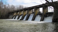 Burgess Falls Hydroelectric Stationlisted 1990
 Cookeville Railroad Depotlisted 1985
 First Presbyterian Churchlisted 2010
 Harding Studiolisted 1992
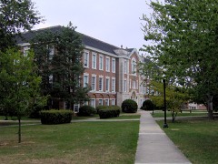 Henderson Halllisted 1985
 John's Placelisted 2011
 Science Building, Thelisted 2017
 United States Post Office and Court Houselisted 2014
 White Plainslisted 2009
- Ralph's Donut Shoplisted 2025
Population over time
2 figuresCookeville grew from 30,435 to 34,842 between 2010 and 2020. These are the recorded population figures Wikidata holds for this place, reached through the Geographic Names Information System number this page is keyed on rather than by name, so they belong to this place and not to another of the same name. Most are census counts, but not all are: an early figure may be a founding or settlement estimate, and an estimate published within five years of a census is left out. The change column is computed, and is left blank where more than 20 years separate a figure from the one before it, because a gap that long is not a change between two counts.
| Year | People | Change |
|---|---|---|
| 2010 | 30,435 | |
| 2020 | 34,842 | +4,407 (+14%) |
Topographic sheets covering this place
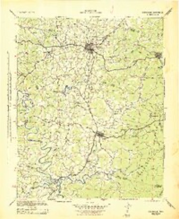
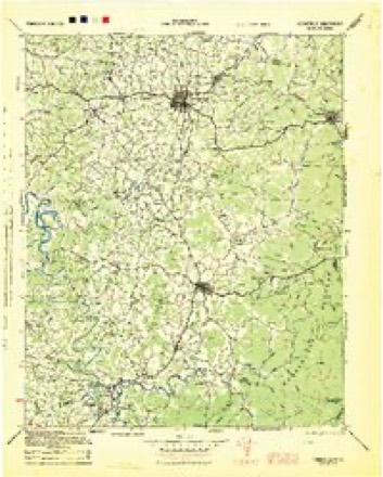
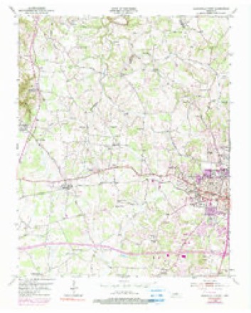
6 surveys from 13 printed sheetsMatched by testing this settlement's coordinate against the published boundary of every sheet in the United States Geological Survey's historical collection. Each opens the scanned sheet at the Survey.
- 1943 USGS Cookeville quadrangle1:100000
- 1944 USGS Cookeville quadrangle1:100000
- 1953 USGS Cookeville West quadrangle1:24000, 6 printings
- 1956 USGS Corbin quadrangle1:250000, 3 printings
- 1958 USGS Corbin quadrangle1:250000
- 1982 USGS Cookeville quadrangle1:100000
Fires near this place
22 since 1998Regional context, not property-specific evidence. The federal wildfire occurrence database lists 22 fires within 5 miles of Cookeville between 1998 and 2019, burning about 109 acres in total. None started naturally. 5 were recorded as arson. Distance is straight-line from the map coordinates, so a fire counted here may appear on a neighbouring settlement's page as well.
| Reported cause | Fires |
|---|---|
| Debris and open burning | 12 |
| Arson/incendiarism | 5 |
| Misuse of fire by a minor | 2 |
| Other causes | 1 |
| Equipment and vehicle use | 1 |
| Recreation and ceremony | 1 |
The most recent of them, most recent first, with the day each was reported and the service that recorded it.
| Date | Cause | Size | Reported by | Name on the report |
|---|---|---|---|---|
| 3 May 2012 | Debris and open burning | under an acre | Tennessee Division of Forestry | CRABTREE |
| 9 April 2007 | Debris and open burning | 14 acres | Tennessee Division of Forestry | TURNBERRY |
| 3 April 2011 | Debris and open burning | under an acre | Tennessee Division of Forestry | WESTERN HILLS DR |
| 26 April 2009 | Other causes | 3.7 acres | Tennessee Division of Forestry | DEERING |
| 18 April 2009 | Arson/incendiarism | 8.5 acres | Tennessee Division of Forestry | MAXWELL |
| 15 April 2016 | Debris and open burning | 2.5 acres | Tennessee Division of Forestry | SHEWMAKE |
| 11 April 2010 | Arson/incendiarism | under an acre | Tennessee Division of Forestry | ALLEN DRIVE |
| 26 March 2007 | Debris and open burning | 3.3 acres | Tennessee Division of Forestry | SPIVEY |
Settlements close enough to share some of these fires:
Mines and quarries near this place
5 within 5 milesRegional context, not property-specific evidence. The federal mineral resources record lists 5 workings within 5 miles of Cookeville: 5 producers. All of them still produce. What was taken out: Stone, Crushed/Broken, Stone, Crushed/Broken, Limestone, General. Distance is straight-line from the map coordinates, so a quarry counted here may appear on a neighbouring settlement's page as well.
| Where | Site | Commodity | Status | Recorded |
|---|---|---|---|---|
| Algood Quarry | Stone, Crushed/Broken, Limestone, General | Producer | Limestone | |
| Putnam Co. Hwy. Dept. Quarry Pit No. 183 | Stone, Crushed/Broken, Limestone, General | Producer | 1952 | |
| Algood Quarry | Stone, Crushed/Broken | Producer | ||
| Dacco Mine | Stone, Crushed/Broken | Producer | ||
| Putnam County Quarry | Stone, Crushed/Broken | Producer |
Storms near this place
60 of 150 shownRegional context, not property-specific evidence. The National Weather Service names Cookeville in 150 storm reports between 1994 and 2025: 71 thunderstorm wind, 49 hail, 17 flash flood, 7 lightning. The reports record 1 death and 5 injuries. Each account below is quoted exactly as the forecast office filed it, from the NOAA Storm Events Database, and each date opens the federal record of that event.
| When | Event | Place named | Harm | What the report says |
|---|---|---|---|---|
| March 2003 | Tornado (F1) | Cookeville | 1 killed, 1 hurt, $100,000 | The tornado touched down 1.5 miles east of exit #280 on I-40. The tornado continued for about 12.2 miles. One person was killed, and another person was injured inside a mobile home on Pippin Road and near Anderson Rd. The time of the fatality was around 11:15 AM CST. The storm ripped the trailer loose from its anchors and flung it over on its side at least 100 feet from its foundation. Numerous trees and power lines were down. The fallen trees and power lines blocked many roads. A total of 67 properties in the Pippin area reported damage. There was damage to houses, barns, trailers, garages, sheds, and at least one church. In the Buffalo Valley Road area, the tornado destroyed a barn and uprooted several huge trees.All six sirens in Cookeville sounded for the tornado warning, which was issued at 10:58 AM CST. |
| January 2002 | Flash Flood | Cookeville | 3 hurt | Culvert collapsed at Fisk and Old Kentucky Road. 3 people were injured in one car. 3 homes and one business were damaged. 10 roads and 2 bridges were closed. 2 people were killed while clearing a culvert during a heavy rain at 10 AM CST. There was no flooding occurring at that time. |
| July 2008 | Thunderstorm Wind | Cookeville | 1 hurt, $10,000 | A tree fell on a car injuring one person at the intersection of Burgess Falls road and River Rd. |
| April 2023 | Lightning | Cookeville | $5,000,000 | Lightning struck an apartment building at Eagle Summit Apartments at Tennessee Tech University along Willow Avenue near Cookeville, causing a fire. All occupants were evacuated, and firefighters put out the fire just after 7 AM local time. Four apartments were destroyed, impacting eleven occupants. No injuries were reported, and damages are a rough estimate. |
| June 2000 | Lightning | Cookeville | $1,000,000 | Lightning struck the Saxony's Apartments, one of the oldest apartment complexes in Cookeville. Flames raced through the common attic of a 10 apartment two story wood structure unit at a high rate of speed. 10 families were left homeless. The Saxony Apartment complex is about 30 years old. At that time, codes regulations did not require draft stop walls in the attic. |
| May 2020 | Thunderstorm Wind | Cookeville | $277,710 | Numerous trees and power lines were blown down across Putnam County with power outages. |
| February 2009 | Thunderstorm Wind | Cookeville | $50,000 | Numerous trees were downed along with several power line poles across the county. |
| August 2009 | Thunderstorm Wind | Cookeville | $50,000 | A large 50 to 60 foot oak tree crushed two trailer homes on West 12th Street, injuring one women and trapping a couple who had to wait for firefighters to rescue them. The one women sustained an ankle injury and the couple was not injured. It was reported to have just blown down, broke off right at the ground, and hit two trailers, smashing them all the way down to their frames. |
| June 1995 | Thunderstorm Wind | Cookeville | $50,000 | A few barn roofs were blown off. Many trees and power lines were blown down. Several homes and some vehicles were damaged when trees fell on them. |
| July 1997 | Lightning | Cookeville | $35,000 | Lightning struck a house while under construction and set fire to the attic. |
| July 2004 | Lightning | Cookeville | $30,000 | Lightning struck a barn in southeast Cookeville, about 100 yards from a house on Old Bridge Rd. The barn and its contents, which included a tractor, was totally destroyed. |
| July 2002 | Lightning | Cookeville | $30,000 | Lightning struck the top of a three-story brick house on Russell Strausse Rd. This started a fire in the attic and caused some damage to the sheetrock. |
| May 2025 | Thunderstorm Wind | Cookeville | $25,000 | Severe thunderstorm winds downed multiple trees across western and central Putnam County. Damages are a rough estimate. |
| July 2012 | Thunderstorm Wind | Cookeville | $25,000 | Trees and power lines were blown down county wide. Roads with trees down on them included Broad Street, Reeser Lane, and Benton Young Road in Cookeville. |
| April 2011 | Thunderstorm Wind | Cookeville | $25,000 | Roof damage occurred on the Tennessee Tech University Campus at Prescott Hall and minor roof damage also occured at Prescott Middle School. Specific details concerning the amount of roof damage and associated cost to Prescott Hall were unknown. |
| February 2008 | Thunderstorm Wind | Cookeville | $20,000 | Trees and power lines were down. Business signs damaged. Trees fell on 4 homes. |
| April 2003 | Thunderstorm Wind | Cookeville | $20,000 | EMA reported numerous trees down from Cookeville to Algood. One tree fell on a house, and several trees landed on cars. |
| July 2022 | Flash Flood | Cookeville | $10,000 | A car was stranded in flood waters on Willow Avenue between Spring Street and Broad Street. |
| March 2017 | Thunderstorm Wind | Cookeville | $10,000 | Putnam County Emergency Management reported several trees and power lines were blown down across Cookeville. A tree fell on a home on 9th Street, and another tree fell on a mobile home. |
| July 2016 | Thunderstorm Wind | Cookeville | $10,000 | Numerous trees, power lines, power poles were blown down all across Putnam County. One tree fell onto a home on Freeze Street in Cookeville and knocked down the chimney and front porch. Up to 6000 customers were without power. |
| September 2014 | Flash Flood | Cookeville | $10,000 | Heavy rainfall resulted in flash flooding across portions of Cookeville with several roadways flooded. Emergency management performed 3 water rescues of motorists in stranded vehicles at Willow Street at Broad Street, Willow Street at Veterans Drive, and Highway 111 and 10th Street. |
| June 2011 | Thunderstorm Wind | Cookeville | $10,000 | A roof was partially blown off a building at 265 South Jefferson Avenue in Cookeville. |
| January 2008 | Thunderstorm Wind | Cookeville | $10,000 | Wind gust measured 67 mph at the Putnam County EOC. A warehouse on Whitney Avenue had part of its roof blown away. The warehouse is about 3 blocks west of the EOC. |
| August 2008 | Thunderstorm Wind | Cookeville | $10,000 | Trees and power lines were down in Cookeville. |
| April 1998 | Flash Flood | Cookeville | $10,000 | EMA official reported major street flooding. Some homes were also flooded. |
| September 2013 | Flood | Cookeville | $8,000 | The Putnam County Sheriff's Office reported 3 feet of water covering the roadway at Highway 111 and East 10th Street. Also, flooding was reported in many other areas across Putnam County with some vehicles stranded. |
| July 2024 | Thunderstorm Wind | Cookeville | $5,000 | Severe thunderstorm winds downed trees and power lines across Putnam County, including on Gainesboro Road at Foster Circle near Cookeville. Damages are a rough estimate. |
| April 2022 | Thunderstorm Wind | Cookeville | $5,000 | Trees were blown down blocking roads in several areas across Putnam County. |
| September 2021 | Flood | Cookeville | $5,000 | Kinniard Road at Dodson Branch Road was flooded. 1999 Gainesboro Grade was also flooded with a vehicle stranded in water. |
| June 2019 | Thunderstorm Wind | Cookeville | $5,000 | Trees and power lines were blown down across Putnam County. |
| July 2017 | Flood | Cookeville | $5,000 | Putnam County Emergency Management reported flooding in parts of Cookeville which typically flood in heavy rainfall. One person was rescued from a stranded vehicle in high water on Neal Street, and one to two feet of water covered Walton Lane at East 12th Street. |
| July 2016 | Thunderstorm Wind | Cookeville | $5,000 | Trees and power lines were blown down across Putnam County. |
| July 2016 | Thunderstorm Wind | Cookeville | $5,000 | Numerous trees and power lines were blown down in and around Cookeville with widespread power outages. |
| June 2013 | Flash Flood | Cookeville | $5,000 | Flood waters covered the intersection of Willow Avenue at Broad Street and Willow Avenue at Spring Street with several water rescues conducted. |
| October 2010 | Thunderstorm Wind | Cookeville | $5,000 | A large tree fell on a house on East Hudgens Street, causing minor roof damage to the home. |
| July 2004 | Thunderstorm Wind | Cookeville | $5,000 | A tree was down on a car and house. |
| June 1994 | Thunderstorm Wind | Cookeville | $5,000 | Numerous trees and power lines were knocked down. |
| July 2022 | Thunderstorm Wind | Cookeville | $3,000 | Multiple social media reports indicated trees were blown down in Cookeville, including on South Jefferson Avenue. |
| June 2019 | Thunderstorm Wind | Cookeville | $3,000 | A tree was blown down onto a house on Gainesboro Grade. |
| July 2018 | Thunderstorm Wind | Cookeville | $3,000 | Several trees were blown down in Cookeville. |
| July 2016 | Thunderstorm Wind | Cookeville | $3,000 | Several trees down on power lines in Cookeville. |
| July 2016 | Thunderstorm Wind | Cookeville | $3,000 | Several trees were blown down in Cookeville. |
| June 2013 | Thunderstorm Wind | Cookeville | $3,000 | Trees and power lines were blown down in Cookeville. |
| June 2024 | Thunderstorm Wind | Cookeville | $2,000 | A powerline was downed across West Spring Street at Scott Avenue in Cookeville. A tree was also reported down on East Broad Street. Damages are a rough estimate. |
| July 2017 | Thunderstorm Wind | Cookeville | $2,000 | Trees were blown down on 7th Street and North Jefferson Avenue in Cookeville. |
| June 2011 | Thunderstorm Wind | Cookeville | $2,000 | Large tree branches were blown down. |
| March 2008 | Thunderstorm Wind | Cookeville | $2,000 | Trees were blown down on Gainesboro Highway. |
| December 2005 | Lightning | Cookeville | $2,000 | Utility pole was on fire after a lightning strike on Mine Lick Creek Rd. |
| May 1995 | Thunderstorm Wind | Cookeville | $2,000 | A few trees were knocked down. Northern Sections,14,0427CST,,,0,0,0.1K,0,Thunderstorm Winds Numerous trees down. |
| May 1995 | Thunderstorm Wind | Cookeville | $2,000 | A few trees were knocked down. |
| July 2014 | Thunderstorm Wind | Cookeville | $1,000 | A tree was reported down on power lines on the north side of Cookeville. |
| July 2008 | Thunderstorm Wind | Cookeville | $1,000 | Trees were blown down along Homestead Circle. |
| May 2006 | Flash Flood | Cookeville | $1,000 | Several streets were flooded in Cookeville. Rescue squad called to extract people from flooded vehicles near Cookeville Mall. |
| June 2006 | Flash Flood | Cookeville | $1,000 | Numerous roads flooded in Cookeville and Algood, some with 3 to 4 feet of water. |
| December 2005 | Lightning | Cookeville | $1,000 | Lightning struck a house on Grandiose Drive. Items in a crawl space caught on fire. |
| December 2004 | Flash Flood | Cookeville | $1,000 | Rising water was flooding Thomas Road near Cookeville. |
| May 2004 | Flash Flood | Cookeville | $1,000 | Several streets were flooded in Cookeville with stalled cars. |
| July 2000 | Thunderstorm Wind | Cookeville | $1,000 | A large tree fell on a picnic shelter. |
| May 1995 | Hail | Cookeville | $1,000 | no account filed |
| June 2022 | Hail | Cookeville | - | Twitter report and photo indicated silver dollar size hail fell on Willow Avenue in Cookeville. Hail was very jagged with spikes. |
Nearest settlements
The eight closest, with where each one stands in the county. Distances are straight-line, computed from the Geographic Names Information System coordinates.
| Map | Place | Distance | Sheets |
|---|---|---|---|
| The Lowlands | 0.8 miles | 21 | |
| Capshaw Woods | 0.9 miles | 21 | |
| Pleasant View | 1.0 miles | 21 | |
| Ensor Park | 1.0 miles | 13 | |
| Oaklawn | 1.1 miles | 21 | |
| Eastwood | 1.3 miles | 21 | |
| Green Acres | 1.3 miles | 13 | |
| Mount Vernon | 1.4 miles | 13 |
Elsewhere
Matched on this settlement's Geographic Names Information System number rather than its name, so it cannot be a different place of the same name in another state.
| Wikipedia article on Cookeville | An encyclopaedic summary. Its text is share-alike, so it is linked here rather than copied. |
| Wikidata item Q2456192 | The structured record the population and elevation above come from. Public domain (CC0). |
Provenance
This settlement is recorded in the Geographic Names Information System as feature 1647827. The sheet list is computed by point-in-boundary test against the United States Geological Survey's historical topographic inventory. Both are works of the United States government and carry no copyright under 17 U.S.C. 105.
Wildfire. Short, Karen C. 2022. Spatial wildfire occurrence data for the United States, 1992-2020 [FPA_FOD_20221014]. 6th Edition. Fort Collins, CO: Forest Service Research Data Archive. https://doi.org/10.2737/RDS-2013-0009.6 Collected with United States Government funding and usable without additional permissions or fees.
Mines and quarries. USGS Mineral Resources Data System (MRDS) https://mrdata.usgs.gov/mrds/ A work of the United States government, no copyright under 17 U.S.C. 105.
Storms. NOAA National Centers for Environmental Information, Storm Events Database https://www.ncei.noaa.gov/stormevents/ A work of the United States government, no copyright under 17 U.S.C. 105. Narratives are quoted verbatim from the National Weather Service report and are not edited or summarised.