 Block
From the record
5 National Register listings published here.
Sources: the National Register database, National Park Service
91 topographic sheets cover 47 settlements here, and 5 properties are on the National Register of Historic Places.
5 National Register listings published here.
Sources: the National Register database, National Park Service
Every property in this county listed on the National Register of Historic Places, with the year it was listed and the federal nomination document.
| Photograph | Property | Type | Listed | Reference |
|---|---|---|---|---|
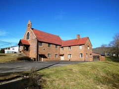 | Barton Chapel | building | 1984 | 84003679 |
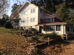 | Louis E. Bryant House | building | 1975 | 75001776 |
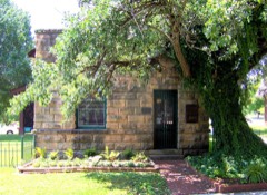 | First National Bank of Huntsville | building | 1985 | 85001510 |
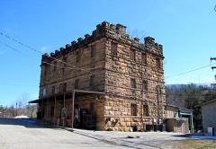 | Old Scott County Jail | building | 1974 | 74001927 |
| Oneida and Western Bridge | structure | 2025 | 100012393 |
Every wildfire the federal occurrence database records inside this county: 658 of them, burning about 20,274 acres. 6 started naturally and 362 were recorded as arson. Each settlement page carries the fires within five miles of it.
| Reported cause | Fires |
|---|---|
| Arson/incendiarism | 362 |
| Debris and open burning | 185 |
| Missing data/not specified/undetermined | 53 |
| Recreation and ceremony | 13 |
| Railroad operations and maintenance | 13 |
| Equipment and vehicle use | 7 |
| Smoking | 7 |
| Natural | 6 |
| Misuse of fire by a minor | 5 |
| Power generation/transmission/distribution | 5 |
| Other causes | 2 |
The five largest, by the area the report gives. 6 of them were set deliberately.
| Date | Cause | Size | Reported by | Name on the report |
|---|---|---|---|---|
| 9 March 2000 | Arson/incendiarism | 1,536 acres | Tennessee Division of Forestry | not named |
| 21 November 2012 | Arson/incendiarism | 998 acres | Tennessee Division of Forestry | SHACK CREEK |
| 6 April 2010 | Arson/incendiarism | 800 acres | Tennessee Division of Forestry | GRIFFITH MTN |
| 11 November 2005 | Arson/incendiarism | 704 acres | Tennessee Division of Forestry | CAP CHINE |
| 18 November 2016 | Debris and open burning | 603 acres | Big South Fork National River and Recreation Area | CHIMNEY ROCK |
| 9 November 1999 | Arson/incendiarism | 500 acres | Tennessee Division of Forestry | not named |
| 21 November 2012 | Arson/incendiarism | 488 acres | Tennessee Division of Forestry | LITTLE BULL |
| 25 October 2003 | Power generation/transmission/distribution | 449 acres | Big South Fork National River and Recreation Area | POWERLINE |
Every settlement page carries the fires within five miles of it - see the settlement index below.
The NOAA Storm Events Database holds 271 reports for this county, causing no deaths, 27 injuries and about $5,563,550 in recorded property damage. Each settlement page carries the reports that name it.
| Kind of event | Reports |
|---|---|
| Thunderstorm Wind | 172 |
| Hail | 50 |
| Flash Flood | 25 |
| Tornado | 11 |
| Flood | 10 |
| Lightning | 2 |
| Debris Flow | 1 |
The most serious of them, by death, then injury, then recorded damage. The accounts are quoted exactly as the forecast office filed them.
| When | Event | Place named | Harm | What the report says |
|---|---|---|---|---|
| April 1974 | Tornado (F3) | not stated | 21 hurt, $250,000 | no account filed |
| April 1974 | Tornado (F3) | not stated | 5 hurt | no account filed |
| March 1996 | Tornado (F0) | Oneida | 1 hurt, $160,000 | no account filed |
| February 2011 | Flood | Norma | $2,000,000 | Flooding occurred across much of the county with several roads having extensive damage due to up to two feet of water over the roads. |
| March 2021 | Flood | New River | $1,730,000 | Record flooding on the Big South Fork Cumberland River at Leatherwood Ford washed away a portion of the historic Burnt Mill Bridge in the Big South Fork Recreation Area. The river crested at 42.50 feet at 10:15 AM EST. For the entire flood event throughout Scott County, damages totaled $1.725 million. |
| April 2000 | Tornado (F1) | Huntsville | $200,000 | Twenty one homes in the Scenic Hills Estates subdivision received damage. One was totaled. The storm moved in from the southwest. The main damage came from straight-line winds, however, the one home that was totally destroyed was clearly from tornado damage. Winds were estimated in the 70-90 mph range. |
| November 2002 | Tornado (F1) | Winona | $130,000 | no account filed |
| November 2002 | Tornado (F1) | Elgin | $110,000 | no account filed |
| May 2009 | Tornado (EF2) | Winona | $90,000 | An EF2 tornado with a maximum wind speed of 135 miles an hour occurred around five miles southeast of Huntsville. The tornado initially touched down just west of the Fairview community with a maximum wind speed of 90 mph (EF-1) and a width of 100 yards. The tornado continued along an east path and increased in size and intensity to an EF-2 with a maximum wind speed at 135 mph and a width of 200 yards. Several large hardwood trees were snapped off near trunk level and a free standing cell phone tower was collapsed and twisted by the tornado winds. Extensive damage occurred in a concentrated path at least 80 yards in length at the 135 mph EF-2 level. The tornado continued east and finally weakened to an EF-1 with a maximum wind speed of 100 mph as it dissipated at the foothill of Gray Mountain. At least seven homes suffered minor to moderate wind damage along the 4.5 mile path of the tornado. |
| May 2024 | Thunderstorm Wind | Elva | $50,000 | A significant severe thunderstorm wind swath devastated portions of Scott County, including portions of Big South Fork National River and Recreation Area. Hundreds of trees were snapped or uprooted, with winds estimated up to 90 mph. A private lodge within the park incurred significant structural damage due to fallen trees. East of the park, blown down trees damaged powerlines in both Oneida and Winfield. |
| July 1994 | Thunderstorm Wind | Cleveland | $50,000 | A 100-foot strip of roof was peeled off of an elementary school. Several trees and power lines were knocked down as well. |
| April 2007 | Thunderstorm Wind | Huntsville | $25,000 | Numerous trees were reported down across the county. |
| September 2006 | Thunderstorm Wind | Huntsville | $25,000 | no account filed |
| April 2000 | Thunderstorm Wind | Countywide | $25,000 | no account filed |
| April 2012 | Thunderstorm Wind | Oneida | $20,000 | Law enforcement personnel reported numerous trees downed by thunderstorm wind countywide. |
| April 2011 | Thunderstorm Wind | Oneida | $20,000 | Law enforcement personnel reported numerous trees and powerlines downed by thunderstorm wind countywide. |
| June 2009 | Thunderstorm Wind | Winona | $20,000 | Law enforcement personnel reported numerous trees and powerlines downed by thunderstorm winds countywide. |
| May 2009 | Flash Flood | Oneida | $20,000 | Numerous roads were flooded with several inches of water over the roads. One person was rescued from a stranded and floating vehicle and another family was evacuated. The heavy rainfall also caused a mudslide in vicinity of Oneida. A portion of the road was destroyed and one vehicle was damaged. |
| March 2006 | Thunderstorm Wind | Countywide | $20,000 | no account filed |
| May 2006 | Thunderstorm Wind | Oneida | $20,000 | no account filed |
| July 2004 | Thunderstorm Wind | Countywide | $20,000 | no account filed |
| June 2002 | Thunderstorm Wind | Countywide | $20,000 | no account filed |
| May 2003 | Thunderstorm Wind | Countywide | $16,000 | no account filed |
| April 2011 | Thunderstorm Wind | Oneida | $15,000 | Law enforcement personnel reported trees and powerlines downed by thunderstorm wind in Oneida. |
| April 2011 | Thunderstorm Wind | Oneida | $15,000 | Law enforcement personnel reported many trees downed by thunderstorm wind in Oneida. |
| August 2010 | Flash Flood | Oneida | $15,000 | Highway department personnel reported numerous roads flooded in Oneida from slow moving thunderstorms. Some roads were under 2 feet of water. |
| June 2009 | Thunderstorm Wind | Huntsville | $15,000 | Law enforcement personnel reported numerous trees downed by thunderstorm winds countywide. |
| April 2006 | Thunderstorm Wind | Countywide | $15,000 | Trees and powerlines down across the county. |
| June 2005 | Thunderstorm Wind | Oneida | $15,000 | Several trees and powerlines down countywide. |
| August 2005 | Thunderstorm Wind | Oneida | $15,000 | Numerous trees down on powerlines across the northwest portions of county. Reported by Volunteer Electric. |
| June 2004 | Thunderstorm Wind | Oneida | $15,000 | Numerous trees down across the northern half of the county |
| June 2004 | Thunderstorm Wind | Oneida | $15,000 | Numerous trees down across mainly northern portions of the county |
| March 2006 | Thunderstorm Wind | Oneida | $15,000 | no account filed |
| May 2004 | Thunderstorm Wind | Oneida | $15,000 | no account filed |
| July 2004 | Thunderstorm Wind | Huntsville | $15,000 | no account filed |
| June 2008 | Thunderstorm Wind | Huntsville | $12,000 | The Plateau Electric Company reported several trees and powerlines downed by thunderstorm winds countywide. |
| April 2006 | Thunderstorm Wind | Oneida | $12,000 | Numerous trees and powerlines down the west half of the county. |
| June 2005 | Thunderstorm Wind | Oneida | $12,000 | A few trees down in North Oneida. |
| May 2006 | Thunderstorm Wind | Huntsville | $12,000 | no account filed |
| July 2006 | Thunderstorm Wind | Oneida | $12,000 | no account filed |
| June 2003 | Thunderstorm Wind | Oneida | $12,000 | no account filed |
| June 2003 | Thunderstorm Wind | Oneida | $12,000 | no account filed |
| May 2002 | Thunderstorm Wind | Black Oak | $12,000 | no account filed |
| August 2011 | Thunderstorm Wind | Huntsville | $10,000 | Law enforcement personnel reported a tree downed on a vehicle by thunderstorm wind in the Huntsville area. |
| August 2010 | Thunderstorm Wind | Oneida | $10,000 | Utility company reported a few trees and powerlines downed by thunderstorm winds 3 miles southeast of Oneida on Jerry Cotton Road. |
| February 2009 | Thunderstorm Wind | Oneida | $10,000 | Law enforcement personnel reported several trees downed by thunderstorm winds in Oneida and the remainder of the county as well. |
| June 2008 | Thunderstorm Wind | Huntsville | $10,000 | The Plateau Electric Company reported a few trees and powerlines downed by thunderstorm winds countywide. |
| April 2006 | Lightning | Oneida | $10,000 | Lightning struck an outbuilding in Oneida and was destroyed by fire. |
| April 2006 | Thunderstorm Wind | Oneida | $10,000 | A few trees down in Oneida. |
| October 2006 | Thunderstorm Wind | Oneida | $10,000 | A few trees and powerlines down countywide. |
| June 1997 | Thunderstorm Wind | Countywide | $10,000 | Numerous trees and powerlines down throughout county. |
| August 1995 | Thunderstorm Wind | Oneida | $10,000 | Several powerlines down. |
| June 2009 | Thunderstorm Wind | Helenwood | $8,000 | Law enforcement personnel reported several trees downed by thunderstorm winds in Helenwood. |
| June 2009 | Thunderstorm Wind | Norma | $8,000 | Law enforcement personnel reported several trees downed by thunderstorm winds across the southern half of the county. |
| June 2003 | Thunderstorm Wind | Helenwood | $8,000 | no account filed |
| May 2005 | Thunderstorm Wind | Winfield | $6,000 | no account filed |
| February 2014 | Thunderstorm Wind | Oneida | $5,000 | Law enforcement reported a few trees downed by thunderstorm wind across the county. |
| April 2014 | Thunderstorm Wind | Oneida | $5,000 | Law enforcement personnel reported a few trees downed by thunderstorm wind in Oneida. |
| April 2014 | Thunderstorm Wind | Oneida | $5,000 | Park service personnel reported a few trees downed by thunderstorm wind in the Oneida area. |
| April 2014 | Thunderstorm Wind | Huntsville | $5,000 | Law enforcement personnel reported a few trees downed by thunderstorm wind in Huntsville. |
Named settlements recorded in the Geographic Names Information System, each with the topographic sheets covering it. Villages, hamlets and abandoned places alike. Each is shown with the nearest named watercourse or landform and the survey quadrangle it falls on.
District 5 · 37841 · On Marcum Creek · Huntsville quadrangle
17 sheets, 1893 to 1979
No longer a settlement
District 5 · 37841 · On Browns Branch · Huntsville quadrangle
17 sheets, 1893 to 1979
No longer a settlement
District 7 · On Miller Branch · Barthell SW quadrangle
11 sheets, 1934 to 2000
No longer a settlement
District 7 · 37841 · Near Little Bill Slaven Knob · Oneida North quadrangle
10 sheets, 1934 to 1981
District 4 · 37841 · Near Phillips Hollow · Oneida South quadrangle
16 sheets, 1895 to 1979
District 2 · 37852 · Near Fork Ridge · Oneida South quadrangle
16 sheets, 1895 to 1979
District 1 · 37756 · On Straight Fork · Fork Mountain quadrangle
21 sheets, 1893 to 1979
No longer a settlement
District 3 · 37755 · Near Sugarcamp Hollow · Huntsville quadrangle
17 sheets, 1893 to 1979
District 4 · 37755 · Near Wolf Fork Hollow · Oneida South quadrangle
16 sheets, 1895 to 1979
District 7 · 37841 · On North Fork Pine Creek · Oneida South quadrangle
16 sheets, 1895 to 1979
District 2 · 37852 · Near Mary Bull Hollow · Robbins quadrangle
15 sheets, 1895 to 1979
The vanished settlements of Scott County: the places named above that are no longer on the map.