 Block
From the record
6 National Register listings published here.
Sources: the National Register database, National Park Service
29 topographic sheets cover 14 settlements here, and 6 properties are on the National Register of Historic Places.
6 National Register listings published here.
Sources: the National Register database, National Park Service
Every property in this county listed on the National Register of Historic Places, with the year it was listed and the federal nomination document.
| Photograph | Property | Type | Listed | Reference |
|---|---|---|---|---|
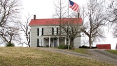 | Averitt-Herod House | building | 1996 | 96000411 |
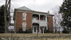 | James R. DeBow House | building | 1988 | 88002381 |
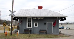 | Hartsville Depot | building | 1980 | 80003876 |
| Hartsville Historic District | district | 1993 | 93000568 | |
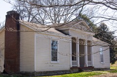 | Turney-Hutchins House | building | 1992 | 92000780 |
| Ward School | building | 2020 | 100005367 |
Every wildfire the federal occurrence database records inside this county: 28 of them, burning about 222 acres. None started naturally and 10 were recorded as arson. Each settlement page carries the fires within five miles of it.
| Reported cause | Fires |
|---|---|
| Debris and open burning | 15 |
| Arson/incendiarism | 10 |
| Missing data/not specified/undetermined | 2 |
| Equipment and vehicle use | 1 |
The five largest, by the area the report gives. Four of them were set deliberately.
| Date | Cause | Size | Reported by | Name on the report |
|---|---|---|---|---|
| 6 February 2001 | Debris and open burning | 50 acres | Tennessee Division of Forestry | not named |
| 3 March 2007 | Debris and open burning | 30 acres | Tennessee Division of Forestry | VICK FIRE |
| 21 October 2015 | Arson/incendiarism | 20 acres | Tennessee Division of Forestry | HERROD LANE FIRE |
| 12 March 2007 | Arson/incendiarism | 12 acres | Tennessee Division of Forestry | VICK FIRE #2 |
| 10 February 2007 | Debris and open burning | 10 acres | Tennessee Division of Forestry | DIAS FIRE |
| 17 November 1999 | Arson/incendiarism | 9.1 acres | Tennessee Division of Forestry | not named |
| 29 March 2006 | Arson/incendiarism | 8.5 acres | Tennessee Division of Forestry | not named |
| 14 March 2014 | Missing data/not specified/undetermined | 8.4 acres | Tennessee Division of Forestry | HWY 141 |
Every settlement page carries the fires within five miles of it - see the settlement index below.
The NOAA Storm Events Database holds 127 reports for this county, causing 2 deaths, 5 injuries and about $3,213,221 in recorded property damage. Each settlement page carries the reports that name it.
| Kind of event | Reports |
|---|---|
| Thunderstorm Wind | 75 |
| Hail | 17 |
| Flash Flood | 17 |
| Tornado | 14 |
| Flood | 3 |
| Heavy Rain | 1 |
The most serious of them, by death, then injury, then recorded damage. The accounts are quoted exactly as the forecast office filed them.
| When | Event | Place named | Harm | What the report says |
|---|---|---|---|---|
| February 2008 | Tornado (EF2) | Paynes Store | 2 killed, 5 hurt, $1,000 | Tornado ripped a gas plant and caused a gas leak and fire at the Columbia Gulf Transmission Company at 5422 Green Grove Road in Hartsville, TN. The fire eventually burned itself out. Two people were killed, and 5 people were injured. Ten homes were destroyed, and 23 homes had major damage. |
| May 2016 | Flash Flood | Templow | $2,000,000 | Major flash flooding affected much of Trousdale County. Numerous primary and secondary roads were flooded and closed or even washed out, including Highway 141 North, Highway 25 West, Browning Branch Road, and Hancock Road. Numerous homes and businesses were flooded, including several homes around Highway 141 and Highway 25, and several buildings and a storage facility in downtown Hartsville. The Hartsville city park and Trousdale County High School football and baseball fields along with their concession stands and bathrooms in downtown Hartsville were destroyed by flooding from Goose Creek. At least 3 water rescues from vehicles and homes were conducted across Trousdale County. |
| May 2010 | Flood | Hartsville | $250,000 | Numerous homes, numerous businesses, numerous non comercial buildings, along with several county, state, and federal roads across the county received damage due to the flood. |
| December 2023 | Tornado (EF2) | Templow | $200,000 | This strong EF-2 tornado touched down just to the east of I-24 on Brick Church Lane in Davidson County. There were a few trees down and shingle damage to several homes in this area. The tornado strengthened in the Madison area causing EF-2 damage with winds up to 120-125 mph. The heaviest damage was confined to two areas, off of East Campbell Road as well as Nesbitt Lane. Multiple mobile homes were destroyed on Nesbitt Lane, and this is where three fatalities occurred. Multiple single family homes and a church off of East Campbell Road were missing large sections of their roofs with some exterior walls collapsed. Several metal power poles in the area were bent as well. Nearby, an apartment complex off Palmer Avenue sustained damage. As the tornado moved further northeast, substantial damage was found to houses in a cul-de-sac on Stoney River Lane. Two buildings were toppled and several others damaged in an industrial complex off of Myatt Drive. The tornado then continued across the Cumberland River and Old Hickory Lake, coming onshore again in the immediate dam vicinity. It is this location in which the strongest winds were found, up to 130 miles per hour, due to substantial damage to a grove of hundreds of trees in which all of them were either snapped, uprooted, or missing major branches. The tornado persisted into Hendersonville, downing hundreds of trees and causing roof damage to multiple homes. It damaged many businesses along Main Street. The tornado continued northeast into Gallatin where EF-2 damage with maximum winds of 115 mph was found to a few homes in the Club at Foxland Harbor as we as the Foxland Harbor Golf and Country Club. At this point, the tornado began to weaken though EF-1 damage was found as it crossed Highway 109 and Steam Plant Road. Several trees were still found to be uprooted along with minor roof and shingle damage to a couple of homes as the tornado crossed Hartsville Pike. Scattered trees continued to be blown down along Lauderdale Lane and Homer Scott Road before the tornado crossed Highway 231 into Trousdale County. Trees continued to be blown down on Browning Branch Road and a home suffered significant roof and porch damage on Hawkins Branch Road. Trees continued to be blown down until the tornado lifted near Shephard Hollow Lane. Around 600 homes and businesses were damaged in Sumner County. |
| January 2013 | Tornado (EF1) | Antioch | $100,000 | An EF1 tornado moved into far southern Trousdale County from northern Wilson County. The tornado moved across Highway 231 and caused significant roof damage to homes and destroyed some outbuildings. Numerous trees were also snapped or uprooted. The tornado then crossed the Cumberland River back into northern Wilson County. |
| March 2023 | Tornado (EF0) | Beech Grove | $50,000 | A tornado touched down about 100 yards southwest of Pumpkin Branch Road in Trousdale County. Damages found before the tornado tracked northeast into Macon County were primarily snapped and uprooted trees. Damages are estimated for Trousdale County. |
| May 2003 | Thunderstorm Wind | Hartsville | $50,000 | News article about a barn destroyed on Rankin Road off U.S. Highway 231 south. A mobile home had a damaged room and another mobile home had its roof torn off. A 4X4 stud was thrust into a bedroom wall of a mobile home. A metal outbuilding was damaged. Trees were blown down in a 100-foot wide swath. |
| April 1998 | Thunderstorm Wind | North Portion | $50,000 | News article states strong winds damaged barns, downed trees and power lines from Templow to Willard. The Friendship Baptist Church had roof damage. There was also damage to a store building at Templow. |
| May 2020 | Thunderstorm Wind | Hartsville | $30,220 | Numerous trees and power lines were blown down across Trousdale County. |
| May 2024 | Thunderstorm Wind | Hartsville | $25,000 | Severe thunderstorm winds downed several trees in Hartsville. Damages are a rough estimate. |
| May 2024 | Thunderstorm Wind | Hartsville | $25,000 | Severe thunderstorm winds snapped power poles and broke tree limbs east of Hartsville. Damages are a rough estimate. |
| November 2017 | Tornado (EF0) | Paynes Store | $25,000 | A high-end EF-0 tornado touched down just east of Highway 231 in Trousdale County causing weak tree damage before intensifying on Walnut Grove Road and Sulphur College Road where dozens of trees were snapped and uprooted. A few homes sustained some minor roof damage with a few outbuildings and barns severely damaged. Additional trees were downed on Highway 141 and Halltown Road before the tornado lifted. The tornado passed just 1.5 miles north of the city of Hartsville. |
| January 2013 | Thunderstorm Wind | Templow | $25,000 | An NWS Storm Survey found straight line wind damage along Honeysuckle Road and Browning Branch Road northwest of Hartsville. Numerous trees were blown down and structural damage occurred to one home. Numerous outbuildings and barns were also damaged. Winds were estimated around 80 mph. |
| May 1999 | Thunderstorm Wind | Hartsville | $25,000 | Severe damage to home on Hwy 25 and Sulfur College Rd. |
| May 1967 | Tornado (F2) | not stated | $25,000 | no account filed |
| June 1966 | Tornado (F1) | not stated | $25,000 | no account filed |
| April 2025 | Thunderstorm Wind | Hartsville | $15,000 | Severe thunderstorm winds caused roof damage to a barn on Halltown Road in Hartsville. Damages are a rough estimate. |
| April 2025 | Thunderstorm Wind | Beech Grove | $15,000 | Severe thunderstorm winds caused roof damage to a barn on Pumpkin Branch Road in Hartsville. Damages are a rough estimate. |
| April 2025 | Thunderstorm Wind | Hartsville | $15,000 | Severe thunderstorm winds downed numerous trees across Hartsville. Damages are a rough estimate. |
| December 2021 | Tornado (EF0) | Paynes Store | $15,000 | An EF0 tornado touched down just east of Hankins Lane and continued eastward where it blew down several trees on Oldham Road. The tornado moved east along old Highway 25 where it toppled dozens of trees, destroyed a couple of barns and outbuildings, and blew an RV on top of a school bus. As the storm continued along its path, it downed trees south and southeast of downtown Hartsville. It weakened as it crossed Thompson Lane and Circle Lane, then lifted just south of Trousdale County Elementary School. This tornado is the first December tornado on record for Trousdale County. |
| May 2021 | Tornado (EF0) | Paynes Store | $15,000 | An EF-0 tornado touched down along Rock Springs Road south of Chenault Lane, heavily damaging a barn and blowing down numerous trees. The tornado then moved east across Lauderdale Lane and Homer Scott Road, continuing to blow down trees. Turning more southeast and entering Trousdale County, the tornado damaged several homes and blew down dozens of trees along Highway 231, Templow Road, Bass Road, Walnut Grove Road, and Gore Lane. Total path length of 5.05 miles. |
| May 2021 | Thunderstorm Wind | Antioch | $15,000 | A large, severe downburst blew down numerous trees and destroyed several barns in the area around Highway 231 and Davenport Lane. |
| May 2021 | Tornado (EF0) | Beech Grove | $15,000 | An EF-0 tornado touched down just west of the Cato community and moved southeast, damaging a business at Highway 10 and Fort Blount Road. The tornado continued through rural areas blowing down trees along Glasgow Branch Road and Lick Creek Road before lifting. |
| June 2014 | Thunderstorm Wind | Hartsville | $15,000 | The sheet metal roof of a large storage shed behind the sanitation department building in downtown Hartsville was blown off, damaging a nearby vehicle. Two people inside the storage shed were not injured. |
| January 2013 | Tornado (EF1) | Providence | $15,000 | An EF1 tornado moved back into southern Trousdale County from northern Wilson County for the second time. The tornado moved across Puryears Bend Road and Belcher Lane before crossing the Cumberland River for the fourth time. The tornado finally lifted after crossing Hartsville Pike north of Riadon Road. Dozens of trees were snapped or uprooted along the path with some minor damage to homes. |
| May 2012 | Thunderstorm Wind | Hartsville | $15,000 | Some trees were downed throughout the county. |
| May 2011 | Thunderstorm Wind | Hartsville | $15,000 | Several trees were downed along West Main Street and at the county jail. |
| May 2021 | Thunderstorm Wind | Hartsville | $10,000 | The EF-0 West Trousdale tornado dissipated into a large downburst that caused widespread straight-line wind damage along Highway 25 as well as in and around the city of Hartsville. |
| August 2018 | Flash Flood | Cato | $10,000 | A Facebook video showed high water covered Dixon Creek Road at Dog Branch Road, with a few homes and outbuildings also flooded. |
| May 2016 | Thunderstorm Wind | Hartsville | $10,000 | Several trees were blown down northeast of Hartsville with some down onto homes. |
| January 2013 | Thunderstorm Wind | Johntown | $10,000 | Numerous trees were uprooted along State Highway 25 East near the Smith County Line. |
| April 2011 | Thunderstorm Wind | Hartsville | $10,000 | Several trees were downed in Hartsville. |
| October 2010 | Thunderstorm Wind | Hartsville | $10,000 | A former NWS employee reported a few trees downed across the county. |
| July 2003 | Flash Flood | Hartsville | $10,000 | Newspaper account of flash flooding in Harstville. About 3.5 inches of rain fell in about an hour. Goose Creek came out of its banks, and crept to the base of the jail and turned City Park into a lake. 2 inches of water got into the offices of "The Hartsville Vidette". "The Hartsville Vidette" is a county newspaper. Deputies had to stop an SUV driver from driving through wheel-high water. Round bales of hay were floating from the field at the intersection of Highway 25 and Highway 141 and floating down Goose Creek. Rocks larger than footballs were strewn over Highway 25 West and adjacent properties across from Bubba's Market. Several people reported their homes were flooded. |
| February 2009 | Thunderstorm Wind | Hartsville | $6,000 | Several trees were blown down in the area. |
| March 2023 | Thunderstorm Wind | Hartsville | $5,000 | Severe thunderstorm winds downed trees in downtown Hartsville near the intersection of Hayes and Rodgers Streets. Damages are estimated for the trees. |
| March 2019 | Thunderstorm Wind | Hartsville | $5,000 | A building in downtown Hartsville suffered roof damage. |
| June 2019 | Thunderstorm Wind | Hartsville | $5,000 | Trees and power lines were blown down across Trousdale County, most numerous across the western half of the county. |
| March 2018 | Flash Flood | Templow | $5,000 | A few roads were closed due to flooding across Trousdale County, and one motorist was stranded in the flood waters. Several creeks and streams were also near bankful. |
| May 2017 | Thunderstorm Wind | Hartsville | $5,000 | Trees were blown down throughout Trousdale County with many roads were blocked and impassable. |
| June 2016 | Thunderstorm Wind | Templow | $5,000 | Tree down on a house two miles east of Highway 231/Highway 25 Intersection. |
| August 2008 | Thunderstorm Wind | Providence | $5,000 | Numerous trees, about 20-30 of them, were blown down on Highway 141. Highway 141 was blocked. |
| January 2008 | Thunderstorm Wind | Hartsville | $5,000 | Trees and power lines were down around Hartsville. |
| April 2003 | Thunderstorm Wind | Hartsville | $5,000 | Newspaper article mentioned that 2 barns were destroyed, and another barn and shed were damaged from strong thudnerstorm winds. A large tree was toppled across the street from his house on Lock Six Rd. |
| March 2017 | Thunderstorm Wind | Hartsville | $3,000 | A few trees were blown down scattered throughout Trousdale County. |
| July 2016 | Thunderstorm Wind | Templow | $3,000 | Many tree limbs were blown down across Trousdale County. Tree limbs fell on power lines on Honeysuckle Lane Road causing power outages in the area. |
| July 2016 | Thunderstorm Wind | Hartsville | $3,000 | Several trees were reportedly blown down across Trousdale County, including on Hall Town Road, Canoe Branch Road, and Thompson Lane. |
| December 2013 | Thunderstorm Wind | Providence | $2,000 | Power lines were blown down with power outages at the end of Puryears Bend Road near the Cumberland River. |
| June 1995 | Thunderstorm Wind | Hartsville | $2,000 | A few trees were knocked down. |
| July 2016 | Thunderstorm Wind | Hartsville | $1,000 | A large tree was blown down in the yard of a home in Hartsville. |
| November 2013 | Thunderstorm Wind | Hartsville | $1,000 | A tree was reported down on Halltown Road in Hartsville. |
| August 2012 | Thunderstorm Wind | Hartsville | $1,000 | A tree was blown down across Oldham Road. |
| April 2008 | Heavy Rain | Hartsville | $1,000 | Goose Creek overflowed its banks, resulting in the evacuation of 2 people from mobile homes. The Little League Fields at Hartsville's City Park also flooded. A field at the intersection of State Route 25 and 141 became a lake. |
| August 2008 | Thunderstorm Wind | Johntown | $1,000 | Large tree limbs were down 4 miles northeast of Hartswville at Highway 10 near Highway 25. |
| April 2005 | Flash Flood | Hartsville | $1,000 | Rankin Road was flooded by creek in two places. |
| December 2004 | Flash Flood | Hartsville | $1,000 | Highway 141N reported flooding. |
| March 1997 | Thunderstorm Wind | Hartsville | $1,000 | no account filed |
| May 1995 | Thunderstorm Wind | Hartsville | $1 | A Tennessee Valley Authority transmission tower along with several trees were blown down. |
| February 2025 | Flash Flood | Templow | - | Heavy rain across Trousdale County resulted in numerous flooded roadways. Damages are unknown. |
| April 2025 | Flash Flood | Templow | - | Heavy rain across Trousdale County resulted in widespread flash flooding, especially along waterways and across other low-lying areas. Several flooding reports were received from Hartsville where Little Goose Creek spilled out of its banks. Extent of damages is unknown. |
The Survey's mineral resources record lists 10 workings inside this county. None of them still produces: all are closed or unrecorded. Each settlement page carries the workings within five miles of it.
| Commodity | Workings |
|---|---|
| Barium-Barite | 3 |
| Zinc | 2 |
| Dolomite | 2 |
| Barium-Barite, Fluorine-Fluorite | 1 |
| Lead | 1 |
| Fluorine-Fluorite, Barium-Barite, Zinc, Sulfur-Pyrite | 1 |
| Barium-Barite, Fluorine-Fluorite, Calcium, Lead, Zinc | 1 |
| Barium-Barite, Calcium, Fluorine-Fluorite, Lead, Zinc | 1 |
| Zinc, Lead, Copper, Fluorine-Fluorite, Barium-Barite | 1 |
The least common of them first, because a county's hundredth gravel pit says nothing its first ten did not.
| Where | Site | Commodity | Status | Recorded |
|---|---|---|---|---|
| Armstrong Prospect | Barium-Barite, Fluorine-Fluorite | Occurrence | Vein | |
| Beasley Bend | Barium-Barite, Calcium, Fluorine-Fluorite, Lead, Zinc | Prospect | ||
| Beasley Bend Prospect | Barium-Barite, Fluorine-Fluorite, Calcium, Lead, Zinc | Occurrence | Barite, Fluorite, Sphalerite | |
| Seven Mile Bluff | Zinc, Lead, Copper, Fluorine-Fluorite, Barium-Barite | Prospect | ||
| Sevenmile Bluff Prospects | Lead, Fluorine-Fluorite, Barium-Barite, Zinc, Sulfur-Pyrite | Past Producer | 1890 | |
| Hartsville | Zinc, Dolomite | Prospect | 1970 | |
| Hartsville Area | Zinc, Dolomite | Prospect | 1970 | |
| Dalton Occurrance | Barium-Barite | Occurrence | Barite | |
| Dalton Occurrance | Barium-Barite | Occurrence | ||
| Sevenmile Bluff Prospect B | Barium-Barite | Prospect |
Named settlements recorded in the Geographic Names Information System, each with the topographic sheets covering it. Villages, hamlets and abandoned places alike. Each is shown with the nearest named watercourse or landform and the survey quadrangle it falls on.