 Block
From the record
One of 6 National Register listings published here for Trousdale County · listed in 1980 · category: Building · built in 1898.
Sources: the National Register database, National Park Service
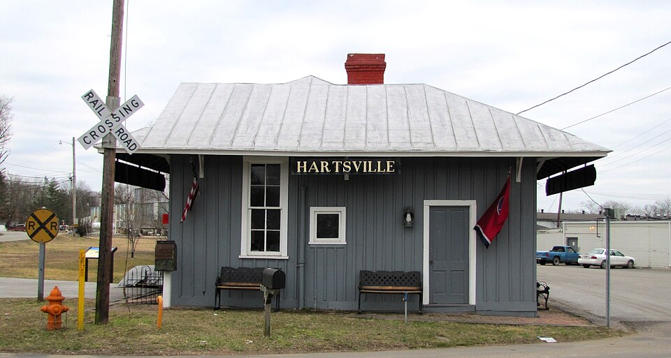
Built in 1898. Listed on the National Register of Historic Places in 1980.
One of 6 National Register listings published here for Trousdale County · listed in 1980 · category: Building · built in 1898.
Sources: the National Register database, National Park Service
Regional context, not property-specific evidence. The federal wildfire occurrence database lists 21 fires within 5 miles of Hartsville Depot between 1997 and 2019, burning about 134 acres in total. None started naturally. 8 were recorded as arson. Distance is straight-line from the map coordinates, so a fire counted here may appear on a neighbouring settlement's page as well.
| Reported cause | Fires |
|---|---|
| Debris and open burning | 9 |
| Arson/incendiarism | 8 |
| Missing data/not specified/undetermined | 3 |
| Equipment and vehicle use | 1 |
The most recent of them, most recent first, with the day each was reported and the service that recorded it.
| Date | Cause | Size | Reported by | Name on the report |
|---|---|---|---|---|
| 7 September 1999 | Arson/incendiarism | under an acre | Tennessee Division of Forestry | not named |
| 7 September 1999 | Arson/incendiarism | under an acre | Tennessee Division of Forestry | not named |
| 6 September 2007 | Debris and open burning | 1.0 acres | Tennessee Division of Forestry | KANE |
| 19 September 1999 | Arson/incendiarism | under an acre | Tennessee Division of Forestry | not named |
| 17 September 1999 | Missing data/not specified/undetermined | 8.3 acres | Tennessee Division of Forestry | not named |
| 14 September 1998 | Debris and open burning | 8.0 acres | Tennessee Division of Forestry | not named |
| 27 June 2012 | Debris and open burning | 3.0 acres | Tennessee Division of Forestry | CEDAR RIDGE |
| 14 April 1997 | Arson/incendiarism | under an acre | Tennessee Division of Forestry | not named |
Regional context, not property-specific evidence. The federal mineral resources record lists 8 workings within 5 miles of Hartsville Depot: 4 occurrences, 4 prospects. None of them still produces. What was taken out: Zinc, Dolomite, Barium-Barite, Barium-Barite, Fluorine-Fluorite, Calcium, Lead, Zinc. Distance is straight-line from the map coordinates, so a quarry counted here may appear on a neighbouring settlement's page as well.
| Where | Site | Commodity | Status | Recorded |
|---|---|---|---|---|
| Armstrong Prospect | Barium-Barite, Fluorine-Fluorite | Occurrence | Vein | |
| Beasley Bend | Barium-Barite, Calcium, Fluorine-Fluorite, Lead, Zinc | Prospect | ||
| Beasley Bend Prospect | Barium-Barite, Fluorine-Fluorite, Calcium, Lead, Zinc | Occurrence | Barite, Fluorite, Sphalerite | |
| Wynn Farm Prospect | Clay | Prospect | ||
| Dalton Occurrance | Barium-Barite | Occurrence | Barite | |
| Dalton Occurrance | Barium-Barite | Occurrence | ||
| Hartsville | Zinc, Dolomite | Prospect | 1970 | |
| Hartsville Area | Zinc, Dolomite | Prospect | 1970 |
Regional context, not property-specific evidence. The National Weather Service names Hartsville, the town this property stands in, in 68 storm reports between 1995 and 2025: 50 thunderstorm wind, 9 hail, 6 flash flood, 1 tornado. No death or injury is recorded in these reports. Each account below is quoted exactly as the forecast office filed it, from the NOAA Storm Events Database, and each date opens the federal record of that event.
| When | Event | Place named | Harm | What the report says |
|---|---|---|---|---|
| May 2010 | Flood | Hartsville | $250,000 | Numerous homes, numerous businesses, numerous non comercial buildings, along with several county, state, and federal roads across the county received damage due to the flood. |
| May 2003 | Thunderstorm Wind | Hartsville | $50,000 | News article about a barn destroyed on Rankin Road off U.S. Highway 231 south. A mobile home had a damaged room and another mobile home had its roof torn off. A 4X4 stud was thrust into a bedroom wall of a mobile home. A metal outbuilding was damaged. Trees were blown down in a 100-foot wide swath. |
| May 2020 | Thunderstorm Wind | Hartsville | $30,220 | Numerous trees and power lines were blown down across Trousdale County. |
| May 2024 | Thunderstorm Wind | Hartsville | $25,000 | Severe thunderstorm winds downed several trees in Hartsville. Damages are a rough estimate. |
| May 2024 | Thunderstorm Wind | Hartsville | $25,000 | Severe thunderstorm winds snapped power poles and broke tree limbs east of Hartsville. Damages are a rough estimate. |
| May 1999 | Thunderstorm Wind | Hartsville | $25,000 | Severe damage to home on Hwy 25 and Sulfur College Rd. |
| April 2025 | Thunderstorm Wind | Hartsville | $15,000 | Severe thunderstorm winds caused roof damage to a barn on Halltown Road in Hartsville. Damages are a rough estimate. |
| April 2025 | Thunderstorm Wind | Hartsville | $15,000 | Severe thunderstorm winds downed numerous trees across Hartsville. Damages are a rough estimate. |
| June 2014 | Thunderstorm Wind | Hartsville | $15,000 | The sheet metal roof of a large storage shed behind the sanitation department building in downtown Hartsville was blown off, damaging a nearby vehicle. Two people inside the storage shed were not injured. |
| May 2012 | Thunderstorm Wind | Hartsville | $15,000 | Some trees were downed throughout the county. |
| May 2011 | Thunderstorm Wind | Hartsville | $15,000 | Several trees were downed along West Main Street and at the county jail. |
| May 2021 | Thunderstorm Wind | Hartsville | $10,000 | The EF-0 West Trousdale tornado dissipated into a large downburst that caused widespread straight-line wind damage along Highway 25 as well as in and around the city of Hartsville. |
| May 2016 | Thunderstorm Wind | Hartsville | $10,000 | Several trees were blown down northeast of Hartsville with some down onto homes. |
| April 2011 | Thunderstorm Wind | Hartsville | $10,000 | Several trees were downed in Hartsville. |
| October 2010 | Thunderstorm Wind | Hartsville | $10,000 | A former NWS employee reported a few trees downed across the county. |
| July 2003 | Flash Flood | Hartsville | $10,000 | Newspaper account of flash flooding in Harstville. About 3.5 inches of rain fell in about an hour. Goose Creek came out of its banks, and crept to the base of the jail and turned City Park into a lake. 2 inches of water got into the offices of "The Hartsville Vidette". "The Hartsville Vidette" is a county newspaper. Deputies had to stop an SUV driver from driving through wheel-high water. Round bales of hay were floating from the field at the intersection of Highway 25 and Highway 141 and floating down Goose Creek. Rocks larger than footballs were strewn over Highway 25 West and adjacent properties across from Bubba's Market. Several people reported their homes were flooded. |
| February 2009 | Thunderstorm Wind | Hartsville | $6,000 | Several trees were blown down in the area. |
| March 2023 | Thunderstorm Wind | Hartsville | $5,000 | Severe thunderstorm winds downed trees in downtown Hartsville near the intersection of Hayes and Rodgers Streets. Damages are estimated for the trees. |
| March 2019 | Thunderstorm Wind | Hartsville | $5,000 | A building in downtown Hartsville suffered roof damage. |
| June 2019 | Thunderstorm Wind | Hartsville | $5,000 | Trees and power lines were blown down across Trousdale County, most numerous across the western half of the county. |
| May 2017 | Thunderstorm Wind | Hartsville | $5,000 | Trees were blown down throughout Trousdale County with many roads were blocked and impassable. |
| January 2008 | Thunderstorm Wind | Hartsville | $5,000 | Trees and power lines were down around Hartsville. |
| April 2003 | Thunderstorm Wind | Hartsville | $5,000 | Newspaper article mentioned that 2 barns were destroyed, and another barn and shed were damaged from strong thudnerstorm winds. A large tree was toppled across the street from his house on Lock Six Rd. |
| March 2017 | Thunderstorm Wind | Hartsville | $3,000 | A few trees were blown down scattered throughout Trousdale County. |
| July 2016 | Thunderstorm Wind | Hartsville | $3,000 | Several trees were reportedly blown down across Trousdale County, including on Hall Town Road, Canoe Branch Road, and Thompson Lane. |
| June 1995 | Thunderstorm Wind | Hartsville | $2,000 | A few trees were knocked down. |
| July 2016 | Thunderstorm Wind | Hartsville | $1,000 | A large tree was blown down in the yard of a home in Hartsville. |
| November 2013 | Thunderstorm Wind | Hartsville | $1,000 | A tree was reported down on Halltown Road in Hartsville. |
| August 2012 | Thunderstorm Wind | Hartsville | $1,000 | A tree was blown down across Oldham Road. |
| April 2008 | Heavy Rain | Hartsville | $1,000 | Goose Creek overflowed its banks, resulting in the evacuation of 2 people from mobile homes. The Little League Fields at Hartsville's City Park also flooded. A field at the intersection of State Route 25 and 141 became a lake. |
| April 2005 | Flash Flood | Hartsville | $1,000 | Rankin Road was flooded by creek in two places. |
| December 2004 | Flash Flood | Hartsville | $1,000 | Highway 141N reported flooding. |
| March 1997 | Thunderstorm Wind | Hartsville | $1,000 | no account filed |
| May 1995 | Thunderstorm Wind | Hartsville | $1 | A Tennessee Valley Authority transmission tower along with several trees were blown down. |
| March 2023 | Hail | Hartsville | - | Estimated quarter size hail fell from a severe thunderstorm near Highway 10 and Old Lafayette Road in Hartsville. |
| July 2005 | Thunderstorm Wind | Hartsville | - | Sheriff's office reported a tree down on U.S. Highway 231 just south of Hartsville. Also, tree limbs down in other areas of the county. |
| August 2005 | Thunderstorm Wind | Hartsville | - | Public estimated 50 knots of wind. Tree was down. |
| November 2005 | Thunderstorm Wind | Hartsville | - | Trees were down. |
| July 2004 | Thunderstorm Wind | Hartsville | - | Tree down across the road. |
| July 2004 | Thunderstorm Wind | Hartsville | - | Trees down along Starlight Road. |
| June 2004 | Thunderstorm Wind | Hartsville | - | Off duty NWS employee reported a large double posted sign was blown down on Oldham Rd. Also, large tree limbs were down as well. He estimated wind gusts to be around 60 mph. |
| May 2003 | Thunderstorm Wind | Hartsville | - | 911 center reported a few trees down around the county. |
| May 2003 | Thunderstorm Wind | Hartsville | - | Trees and power lines were down. |
| July 2003 | Thunderstorm Wind | Hartsville | - | Large tree limbs were covering a portion of U.S. Highway 231 south. |
| July 2003 | Thunderstorm Wind | Hartsville | - | Sheriff's office reported a power line down on a car. |
| July 2003 | Thunderstorm Wind | Hartsville | - | Large trees were uprooted, and there was moderate damage to a home according to a newspaper article. |
| September 2002 | Thunderstorm Wind | Hartsville | - | Law enforcement reported trees and power lines were down on Halltown Rd. |
| January 2002 | Flash Flood | Hartsville | - | 911 center reported a creek flooded a ball field. |
| January 2000 | Thunderstorm Wind | Hartsville | - | Sheriff's department reported trees were blown down along Sulphur College Road and Oldham Road in the southwest part of the county. |
| May 2000 | Hail | Hartsville | - | Sheriff's office reported dime size hail. |
| May 2000 | Thunderstorm Wind | Hartsville | - | Sheriff's office reported a few trees down. |
| June 2000 | Flash Flood | Hartsville | - | Law enforcement reported a few roads near S.R. 10 east of Hartsville flooded and impassable. |
| December 2000 | Flash Flood | Hartsville | - | Sheriff's office reported water overflowing culverts in Hartsville. |
| April 1999 | Hail | Hartsville | - | Newspaper account of golf ball size hail. |
| January 1999 | Thunderstorm Wind | Hartsville | - | Power lines and trees were down near Hartsville. |
| August 1999 | Thunderstorm Wind | Hartsville | - | Trees were blown down on road just west of Hartsville. |
| May 1999 | Thunderstorm Wind | Hartsville | - | Damage to bridge and home around U.S. Highway 231. |
| April 1998 | Tornado (F2) | Hartsville | - | Downed trees in rural areas. |
| June 1998 | Thunderstorm Wind | Hartsville | - | Sheriff's department reported trees blown down. |
| April 1998 | Thunderstorm Wind | Hartsville | - | Public reported trees were blown down along HWY 141 near Hartsville. |
No historic map-sheet match is published for this property yet. That does not mean no map exists. This record needs a coordinate-quality review before it can be joined to a sheet boundary. Browse the county's mapped places while that work is pending.
Other National Register properties close enough to walk or drive between, ordered by distance from this one. Both positions come from the same geocoding pass that matched these properties to their map sheets.
| Photograph | Property | Distance | Listed |
|---|---|---|---|
| Hartsville Historic District | 0.3 miles | 1993 | |
| Ward School | 0.3 miles | 2020 | |
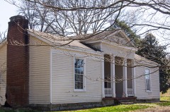 | Turney-Hutchins House | 0.7 miles | 1992 |
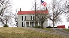 | Averitt-Herod House | 1.4 miles | 1996 |
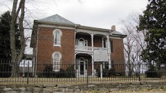 | James R. DeBow House | 2.6 miles | 1988 |
| National Archives record | The nomination case file for reference 80003876 in Record Group 79. |
| Trousdale County | All 6 listed properties in this county. |