 Block
From the record
7 National Register listings published here.
Sources: the National Register database, National Park Service
62 topographic sheets cover 51 settlements here, and 7 properties are on the National Register of Historic Places.
7 National Register listings published here.
Sources: the National Register database, National Park Service
Every property in this county listed on the National Register of Historic Places, with the year it was listed and the federal nomination document.
| Photograph | Property | Type | Listed | Reference |
|---|---|---|---|---|
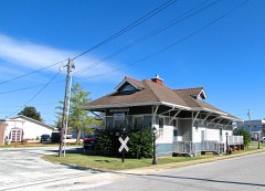 | Collinwood Railroad Station | building | 1988 | 88000264 |
| Evans Chapel United Methodist Church | building | 1999 | 99000757 | |
| First Presbyterian Church of Clifton | building | 1988 | 88000172 | |
| Hughes House | building | 2020 | 100005793 | |
| Water Street Historic District | district | 1992 | 92000829 | |
| Wayne County Courthouse | building | 2020 | 100005369 | |
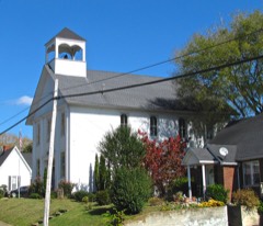 | Waynesboro Cumberland Presbyterian Church | building | 1987 | 87001877 |
Every wildfire the federal occurrence database records inside this county: 1,099 of them, burning about 7,246 acres. 13 started naturally and 439 were recorded as arson. Each settlement page carries the fires within five miles of it.
| Reported cause | Fires |
|---|---|
| Arson/incendiarism | 439 |
| Debris and open burning | 382 |
| Missing data/not specified/undetermined | 104 |
| Equipment and vehicle use | 84 |
| Smoking | 25 |
| Other causes | 17 |
| Natural | 13 |
| Misuse of fire by a minor | 11 |
| Power generation/transmission/distribution | 8 |
| Fireworks | 8 |
| Recreation and ceremony | 6 |
| Railroad operations and maintenance | 2 |
The five largest, by the area the report gives. Every one of them was set deliberately.
| Date | Cause | Size | Reported by | Name on the report |
|---|---|---|---|---|
| 2 September 1999 | Arson/incendiarism | 516 acres | Tennessee Division of Forestry | not named |
| 16 September 1999 | Arson/incendiarism | 244 acres | Tennessee Division of Forestry | not named |
| 24 February 2002 | Arson/incendiarism | 149 acres | Tennessee Division of Forestry | not named |
| 12 August 2000 | Arson/incendiarism | 140 acres | Tennessee Division of Forestry | not named |
| 16 February 1997 | Arson/incendiarism | 132 acres | Tennessee Division of Forestry | not named |
| 13 February 2011 | Arson/incendiarism | 125 acres | Tennessee Division of Forestry | CC ROAD |
| 1 April 1997 | Arson/incendiarism | 102 acres | Tennessee Division of Forestry | not named |
| 16 September 1999 | Arson/incendiarism | 100 acres | Tennessee Division of Forestry | not named |
Every settlement page carries the fires within five miles of it - see the settlement index below.
The NOAA Storm Events Database holds 282 reports for this county, causing 5 deaths, 28 injuries and about $27,291,750 in recorded property damage. Each settlement page carries the reports that name it.
| Kind of event | Reports |
|---|---|
| Thunderstorm Wind | 144 |
| Hail | 65 |
| Flash Flood | 44 |
| Tornado | 19 |
| Flood | 6 |
| Funnel Cloud | 2 |
| Lightning | 1 |
| Heavy Rain | 1 |
The most serious of them, by death, then injury, then recorded damage. The accounts are quoted exactly as the forecast office filed them.
| When | Event | Place named | Harm | What the report says |
|---|---|---|---|---|
| April 1998 | Tornado (F4) | Clifton | 3 killed, 6 hurt, $4,000,000 | The tornado killed 3 people in Wayne county. 2 females, their ages 75 and 57, were killed in a modular home on Lay Creek Rd. Another female, age 69, was killed on Chalk Creek Road in a wooden frame home. The tornado left nothing but the foundation. A lumber yard was destroyed. Many trees were down in the path of the tornado. Many houses and mobile homes were destroyed. 34 homes were completely destroyed, 14 homes had major damage and 22 had minor damage. . |
| November 1994 | Tornado (F3) | Lauderdale and | 1 killed, 3 hurt, $5,000,000 | The tornado first touched down about one mile west of the town of Woodville in Lauderdale County. The tornado then continued northeast in Crockett County. The towns of Chestnut Bluff and Crockett Mills were the hardest hit. One woman was killed as the tornado struck her house. Three other persons were injured. Twenty-seven homes were destroyed and eleven others were damaged. Several vehicles were destroyed as well. F75H |
| May 2003 | Flash Flood | Waynesboro | 1 killed | A Lawrence County man was killed on Buttermilk Ridge Road, about 3.3 miles from U.S. Highway 64 east. His 1996 Pontiac Sunfire suddenly came upon a section of road that was completely washed away by flood waters. About 40 feet of the road was completely gone. The vehicle went airborne and struck the far side of the washed out road, then came to rest in the rushing flood waters. 50 individuals had to be rescued from flooded homes or assisted in getting out of the flloded areas. 18 people had to be rescued from the Tennessee-Fitness Spa by airboat. On Cantrell Lane, just south of Waynesboro, several families were rescued by boat. 5 mentally challenged individuals had to be rescued by boat at Belew Hollow Rd. 100 homes were under water in Wayne County. 18 roads and bridges were washed out in southern Wayne County. |
| March 1964 | Tornado (F3) | not stated | 4 hurt, $2,500,000 | no account filed |
| December 2015 | Tornado (EF3) | Lutts | 4 hurt, $2,000,000 | This strong, long-track EF3 tornado touched down just east of the Hardin County/Wayne County line about 2.5 miles southwest of the town of Lutts. At touchdown, hundreds of trees were snapped and uprooted before the tornado reached its peak strength about one half mile west-southwest of Lutts along Lutts Road where the tornado reached a width of 800 yards and EF3 strength. A post office and church, both brick buildings, were destroyed along with multiple homes swept from their foundations. Four people were injured here in Lutts. As the tornado continued northeast, hundreds of trees were snapped and uprooted along its path to where a concentrated area of trees were destroyed about 5 miles north of Collinwood. The tornado continued snapping and uprooting trees until the Highway 64 and Natchez Trace Parkway intersection. At this location, an outbuilding was destroyed along with the roof of a mobile home. Further northeast into Lawrence County along Napier Road, a house was swept off its foundation where 3 people were injured. As the tornado traveled northeast, several homes with roofs completely removed or damaged heavily were found along Linville Road. The tornado weakened as it crossed Lewis County into Maury County where a barn was destroyed and many trees were snapped and uprooted along Joy Road, 2 miles southwest of Mount Pleasant. The total path length of the tornado across Wayne, Lawrence, Lewis and Maury Counties was 48.51 miles.||This is the first tornado on record to occur in Wayne County, Lewis County, and Maury County in the month of December. Lawrence County previously had one tornado in the month of December, which occurred on December 7, 1951. In addition, this was the strongest tornado to occur in the NWS Nashville county warning area since April 10, 2009. |
| March 1963 | Tornado (F2) | not stated | 4 hurt, $250,000 | no account filed |
| March 2023 | Tornado (EF2) | Clifton | 2 hurt, $550,000 | This major, long track tornado began in National Weather Service Memphis's area as an EF3 tornado in Hardeman, McNairy, and Hardin counties before entering Wayne County as an EF2 tornado. The tornado entered National Weather Service Nashville's area about two miles south of Clifton and continued northeast, passing across Highway 641 near Tom Holt Road where several homes and outbuildings were heavily damaged and dozens of trees blown down. Further northeast, the tornado struck the Leatherwood community along Beech Creek Road where a few poorly constructed homes were leveled and others heavily damaged. One person was critically injured in this area and airlifted to the hospital, and another person was also injured. The tornado then crossed Highway 13 about six miles north of Waynesboro before moving through the Topsy and Ashland communities, snapping and uprooting hundred of more trees. This tornado then continued into Lewis County. Damages are estimated for Wayne County. |
| March 1997 | Tornado (F2) | Waynesboro | 2 hurt, $100,000 | 2 houses were damaged and 2 trailers were destroyed in Wayne county. There were 2 injuries in Wayne county. The damage was on Buttermilk Ridge. |
| May 2004 | Thunderstorm Wind | Fairview | 1 hurt, $500,000 | Many homes, churches, farm buildings and businesses were damaged. Trees were blown down around the county. The greatest damage extended from around May Branch Loop near the Alabama State Line...extending 1/4 mile north of Highway 227...then east to 11/2 miles to the east side of Highway 13. There was damage reports from Fairview around Highway 13 and Highway 227. 47 houses and 8 mobile homes were damaged according to a newspaper article. One mobile home was completely destroyed and 8 homes had severe damage. The mobile home that was destroyed turned over and injured a woman. She was treated for broken bones. The Fairview Church of Christ had its roof torn off the foyer. McFall's Market, a community store located at the intersection of Highway 13 South and the Iron City Road, sustained heavy damage when the roof collapsed. 19 barns and outbuildings were destroyed. |
| March 2021 | Tornado (EF2) | Forty Eight Creek Br | 1 hurt, $300,000 | A strong EF-2 tornado touched down just northeast of the city of Waynesboro between Highway 64 and Highway 99. The tornado increased in intensity rapidly as it tracked through neighborhoods along Highway 99. A few trees and outbuildings were blown down and destroyed at the beginning of the track before the tornado moved across Steele Street, Hassell Drive, High Street, and Natural Bridge Road, taking the roofs off several homes and causing one minor injury. Five high power TVA electrical steel poles were bent to the ground in this area, knocking out power to all of Wayne County. Continuing northeastward, the tornado destroyed a barn on York Road and damaged several homes on Fortyeight Creek Road. The tornado then moved through rural, forested and hilly terrain with few roads for a total of 22.2 miles across northeast Wayne, extreme southern Lewis, and extreme northwestern Lawrence Counties, blowing down hundreds of trees before finally lifting around 4 miles northwest of Summertown. |
| November 2005 | Tornado (F2) | Collinwood | 1 hurt, $100,000 | The NWS Storm Survey found that a tornado first touched down just south of Collinwood along Highway 13 near Shackelford Funeral Home. The tornado moved northeast and damaged several homes and snapped off numerous large trees along Ayers Rd.A barn was destroyed near the intersection of Ayers Road and Millrock. Several homes near this intersection received significant structural damage. Two trailer homes were damaged and were moved off their foundations. The tornado contiued to move northeast and did significant damage to the Millrock Baptist Church. Along Shawnette Road, more homes were damaged and numerous trees were blown down. Between Little Shawnette Road and Double Branch Road, a home was nearly destroyed. This was the last evidence of damage from the tornado in Wayne County. One injury occurred while a woman was inside her house on Shawnettee Road when the tornado moved the house off the foundation. |
| August 2010 | Flash Flood | Waynesboro | $8,000,000 | Numerous county roads were closed county wide. A total of seven roads are impassable along with two roads being washed out. Public also reported extensive flooding on Flat Gap Creek Road with one house having a foot of water in the house.||Newspapers reported that flooding damaged six buildings on Houston Road, and two on Flat Gap Road. Three of these were homes which were virtually destroyed. From three to four inches of water invaded the homes, covering floors with water, debris, and mud. The rushing water was even forceful enough to completely lift two buildings of their foundations, depositing one 150 yards away, right in the middle of Indian Creek Road. The other was stopped when it crashed into some trees.||Newspapers also reported that a small white wood framed building that was as a family/community house of worship on Flat Gap Road was shoved off of its foundation and pushed some distance. The house collapsed in on itself as it came to rest against some trees in the Vickery yard. Other little outbuildings were also washed away. ||All of this damage was caused by total rainfall amounts of eight inches to as much|as one foot of water in the Flat Gap Creek/Houston Communities. |
| January 2002 | Flash Flood | Countywide | $1,000,000 | Water over roads due to stream overflow. 6 bridges and 2 roads were damaged or destroyed. 5 homes, 7 trailers and 2 businesses were damaged. One estimate of damage was about a million dollars. |
| May 2010 | Flood | Ashland | $600,000 | Buffalo River was reported to be out of its banks and still rising. Reported as the highest height seen in 20 years. Also, numerous homes, numerous businesses, numerous non comercial buildings, along with several county, state, and federal roads across the county received damage due to the flood. |
| April 2018 | Thunderstorm Wind | Crossroads | $250,000 | A storm survey by Wayne County Emergency Management, along with numerous photos of damage, indicate a severe 1/2 mile long by 300 yard wide microburst struck the area in the 2500 block of Highway 13 southeast of Collinwood. Damage began west of Stooksberry Road where a small hay barn was destroyed and the back porch was completely blown off a home. A large 50-foot tall antenna at the home was also bent in half. Further to the east, a home at the southwest corner of Volunteer Lane at Highway 13 suffered considerable roof and exterior siding damage, and the sheet metal roof of the detached carport was blown off. The worst damage occurred on the east side of Highway 13 at Volunteer Lane where the roof was almost completely ripped off a home and a nearby small garage was destroyed. A home to the north on Volunteer Lane had some minor exterior damage such as blown down porch columns, and another home to the southeast on Highway 13 just west of Bufford Moore Lane suffered shingle damage. Numerous trees were snapped or uprooted along the path. Winds were estimated up to 105 mph. Although too inconclusive to determine from photos and radar data, the degree of damage suggests this may have been a brief EF1 QLCS tornado. |
| March 1991 | Tornado (F1) | not stated | $250,000 | no account filed |
| November 1988 | Tornado (F2) | not stated | $250,000 | no account filed |
| January 2008 | Tornado (EF2) | North Highland | $200,000 | A National Weather Service Storm Survey indicated that an EF2|tornado with wind speeds of 111-135 MPH struck Wayne County.||The worst damage was at 9110 Buttermilk Ridge Rd. A 30 foot by 30|foot metal barn was completely destroyed. Other metal barns|received considerable damage with most of the roof blown off.||Some homes lost shingles on their roofs. A dog house that was|anchored onto a concrete platform was blown away. Several trees|were snapped at the trunk. A wooden plank was planted into the|ground.||Sheets of metal from the barn were carried about a half mile away|into some trees on the Natchez Trace Parkway...just across into|Lawrence county. Trees were lying in different directions on the|Natchez Trace Parkway. Numerous trees were also uprooted at this|location on the Natchez Trace. ||The EMA Director assessed the damage by the tornado at 200,000 dollars. |
| December 2015 | Tornado (EF1) | Ransom Stand | $100,000 | NWS Huntsville determined an EF2 tornado touched down initially near the intersection of County Road 14 and County Road 54 north of Waterloo, Alabama, in extreme Western Lauderdale County. Multiple trees were snapped and uprooted along the nearby creek and along CR 54. The next available damage was viewed along County Road 1 south of County Road 40. Many softwood and hardwood trees were snapped and uprooted along the hillside into the neighboring valley. The tornado damaged a single family home, removing large portions of the roofing material, and damaged the Williams Chapel Presbyterian church where nearby residents were taking shelter. The tornado crossed CR 1, leaving almost no tree untouched in a large stand of pine trees. The tornado continued over the hill to county road 40, where the most significant damage was observed. The tornado snapped numerous hardwood trees south of CR 40, caused minor damage to a single family residence, and pushed a mobile home off its foundation. Upon crossing CR 40, the tornado tore almost the entire roofing structure off a single family home, injuring one inhabitant, and tossing the debris into the trees behind it. The tornado continued over a small hill into a hollow, snapping and uprooting numerous trees along its path. The tornado was on the ground for 7.4 miles in Lauderdale County, Alabama.||NWS Nashville determined this tornado moved out of Lauderdale County, Alabama, and continued into Wayne County, Tennessee, where the tornado damage was rated EF1. One home was destroyed, and dozens of large trees were uprooted and snapped. Based on Landsat 8 satellite imagery from NASA Sport, the tornado continued blowing down trees for over 7 miles in Wayne County and crossed Highway 69 before lifting near David Patterson Road.||This is only the second tornado on record to occur in Wayne County in the month of December, with the first tornado being the EF3 tornado that struck central Wayne County earlier this same evening. |
| March 1997 | Flash Flood | Waynesboro | $100,000 | 2 bridges were closed, 2 roads closed and one road washed out. 8 roads still covered with high water.7.25 inches of rain fell from Friday, February, 28, 1997 through Monday, March 3, 1997. |
| May 2020 | Thunderstorm Wind | Waynesboro | $94,000 | Numerous trees and power lines were blown down across Wayne County, with several trees down across Waynesboro including at the golf course. |
| February 2023 | Thunderstorm Wind | Waynesboro | $50,000 | A narrow swath of wind damage affected western and central Waynesboro. A home on Highway 64 West to the west of Longvue Drive was heavily damaged from the roof of a nearby barn blowing into it with wood beams puncturing through the walls of the home and breaking windows. Several trees were also blown down near the home. Further to the east, more trees were blown down along Highway 64 West and South High Street, and a detached carport was turned upside down on Woodtown Street. More trees, power lines, and fences were knocked down on South Main Street with one large tree falling onto a small business and shifting it off its foundation. Damages are estimated. |
| July 2012 | Thunderstorm Wind | Waynesboro | $50,000 | Bank canopy damaged and gas station awning was blown down near the intersection of State Highway 99 and U.S. Highway 64. Numerous trees were also blown down in this area. |
| February 2009 | Thunderstorm Wind | Collinwood | $50,000 | Hughes Hardwood had its massive sliding doors of three dry kilns driven in by the wind, forcing operations in those facilities to shut down until repairs could be made. Large metal sections of the dry kilns'roof were also ripped up and deposited yards away. |
| June 2009 | Thunderstorm Wind | Clifton Hassell Arpt | $50,000 | Trees and power lines were reported down. |
| July 2009 | Flash Flood | Ashland | $50,000 | A few canoers were stranded overnight along the Buffalo River. Newspaper also reported that up to 8 inches of rain severely flooded the Buffalo and created havoc at Crazy Horse Canoes and RV Park and Clearwater Canoe Rental. Business owners said about 130 canoes were washed downstream but most could be recovered eventually. Five vehicles were either totally or partially submerged in flood waters awaiting salvage. |
| October 2004 | Flash Flood | Waynesboro | $50,000 | 50 homes had 18 to 20 inches of water in them in and around the city of Waynesboro. The Waynesboro water treatment plant was flooded with six feet of water. It was the second time in 2 years that the water plant was breached by flooding waters. The water plant lies along the Green River. On Oct. 19, Waynesboro was under a state of water emergency. Under a water emergency, water rationing is imposed. All non-essential businesses, factories and restaurants are closed. All residential customers are asked to voluntarily conserve water for essential uses only. It would take 2 or 3 days before water service could be restored. Donald Miller, who lives at 1751 Downing Hollow Road, which is about 6 miles south-sothwest of Waynesboro, measured 9.6 inches of rain in his rain gage during this rain event. |
| October 2004 | Flash Flood | North Portion | $50,000 | Flooding of 35 homes along the Green River in the northern half of the county. The hardest hit area was Green River Drive and Cantrell Lane in Waynesboro. The Green River came out of its banks and flooded the Waynesboro Water Treatment Plant with 4 feet of water. The water heavily damaged the plant, including the equipment and computers. Wayne County schools were closed because of high water on roads and drinking water problems. |
| June 1994 | Tornado (F1) | Topsy to 2 NE | $50,000 | A tornado touched down in the northeast corner of Wayne County. The tornado passed near the town of Ashland and lifted up near the Lewis County line. A mobile home was damaged and numerous trees were knocked down. |
| February 2009 | Thunderstorm Wind | Waynesboro | $40,000 | Numerous trees and power lines had fallen down across the county. |
| September 2009 | Flash Flood | Clifton | $30,000 | Major flooding occurred in low lying areas around Clifton. Several roads around Clifton became impassible, including Main Street and West Elm Street which were closed due to the flooding. Newspaper also reported that that the Hasti-Mart convenience store was flooded. The store suffered no major damage, only a clean up was needed of 3-4 inches of water that covered the floor. |
| May 2001 | Thunderstorm Wind | Waynesboro | $30,000 | Trees were down and damage was noted on U.S. Highway 64 and Long Hollow Road to U.S. Highway 64 and the Natchez Trace Parkway. An entire roof section was destroyed on a frame home at the South Forty Eight Creek Community. About 200 yards from this residence, a double wide mobile home was blown off its foundation and destroyed. At U.S. Highway 64 and the Natchez Trace Parkway, another home had its roof severely damaged. |
| February 1997 | Thunderstorm Wind | Countywide | $30,000 | no account filed |
| May 2025 | Thunderstorm Wind | Collinwood | $25,000 | Severe thunderstorm winds downed several large trees as well as caused damage to a few sheds in the Collinwood area. Damages are a rough estimate. |
| March 2024 | Thunderstorm Wind | South Highland | $25,000 | A thunderstorm uprooted or downed several trees northeast of Collinwood. Two premade sheds were destroyed, and a shed at a business under construction was destroyed. Damages are a rough estimate. |
| January 2013 | Tornado (EF1) | Moccasin | $25,000 | An EF1 tornado began near Green River Road just southeast of Highway 13 and moved eastward, blowing down dozens of trees along Phillips Chapel Road and Harris Road. 2 barns were heavily damaged and another barn was completely destroyed at a farm on the east end of Harris Road. Dozens of trees continued to be snapped and uprooted along the path as the tornado continued eastward into Lewis County. Aerial and street view imagery from Google Earth greatly assisted with this storm survey. |
| March 2012 | Hail | South Highland | $25,000 | Several homes and automobiles were damaged near the Sunny Acres Community. Specific details concerning damage to homes and automobiles were unknown. |
| April 2011 | Thunderstorm Wind | Woodlawn | $25,000 | Trees and power lines were reported downed across southern portions of the county. |
| August 2010 | Thunderstorm Wind | Woodlawn | $25,000 | Trees about 10 inches in diameter and power lines were reported down in the vicinity of the intersection of Holly Creek and Railroad Bed Iron City Roads. |
| April 2009 | Hail | Waynesboro | $25,000 | Baseball size hail was reported in Waynesboro. One report had large hailstones crashing through the decking of a mobile home and damaging a ceiling fan inside. Several other roofs of homes and vehicles received hail damage around Waynesboro. |
| September 2009 | Flash Flood | Clifton Hassell Arpt | $25,000 | Flash flooding totally washed-out over flooded tiles on several county road. |
| July 2009 | Thunderstorm Wind | Topsy | $25,000 | Trees were downed across State Highway 48 and State Highway 13. |
| March 2025 | Thunderstorm Wind | Houston | $20,000 | Severe thunderstorm winds downed trees and powerlines along Highway 64 near the Hardin County line. Damages are a rough estimate. |
| March 2022 | Thunderstorm Wind | Collinwood | $15,000 | Tennessee Valley Weather and Facebook reports, along with radar and satellite data, indicate a swath of wind damage occurred between Collinwood and Waynesboro. Numerous trees and power lines were blown down with power outages along Waterfall Creek Road, Chalk Creek Road, Sunny Acres Drive, and Johnson Hollow Road. A lumber yard on Chalk Creek Road also suffered minor damage. In addition, NASA satellite imagery indicates a 200 yard wide swath of trees was blown down in rural forests from Waterfall Creek Road to Chalk Creek Road, suggesting this may have been a weak QLCS tornado. However, the damage along with satellite and radar data are too inconclusive at this time. |
| July 2010 | Thunderstorm Wind | Houston | $15,000 | Trees were downed on Rayburn Road along with minor flooding being reported. |
| October 2010 | Thunderstorm Wind | Woodlawn | $15,000 | At least half of the tin roof was blown off of a cabin at 173 Daniel Lane. |
| May 2025 | Thunderstorm Wind | Waynesboro | $10,000 | Severe thunderstorm winds downed multiple trees across northern portions of Wayne County. Damages are a rough estimate. |
| April 2025 | Thunderstorm Wind | Collinwood | $10,000 | Severe thunderstorm winds downed several trees in the Collinwood area. Damages are a rough estimate. |
| April 2022 | Thunderstorm Wind | Collinwood | $10,000 | Numerous trees were blown down across Wayne County with many roads blocked. |
| May 2022 | Thunderstorm Wind | Waynesboro | $10,000 | Facebook reports indicate a few trees, tree limbs and power lines were blown down causing power outages around Waynesboro and Collinwood, including one tree that was blown down on Copeland Street. |
| November 2018 | Tornado (EF0) | Cypress Inn | $10,000 | This is a continuation of a tornado that started in Lauderdale County, Alabama. The tornado crossed into Tennessee and caused EF0 damage, blowing down dozens of trees and causing minor roof damage to a home on May Branch Loop. As the tornado moved northeast, it uprooted many trees and ended up destroying an outbuilding and causing minor roof damage to a home on Middle Cypress Creek Road. Finally, it crossed George Olive Road, did some minor shingle damage to a home and rolled several large bales of hay through a field before lifting. The total path length of the tornado in Alabama and Tennessee was 6.48 miles. The path length of this tornado was extended slightly and the max wind speed increased to 85 mph in May 2020 based on newly available high resolution satellite imagery. |
| August 2012 | Thunderstorm Wind | Cromwell Xrds | $10,000 | Several trees were blown down across the southwest part of Wayne County. |
| May 2011 | Thunderstorm Wind | Forty Eight Creek Br | $10,000 | Several trees were reported downed near the intersection of Hurricane Creek Road and Pine Ridge Road. |
| May 2011 | Thunderstorm Wind | Waynesboro | $10,000 | Several trees were reported downed on Old Highway 64 by the Wayne County Sheriffs Department. |
| October 2010 | Thunderstorm Wind | Forty Eight Creek Br | $10,000 | Trees were blown down in the Walnut Grove Cemetery. |
| June 2009 | Thunderstorm Wind | Woodlawn | $10,000 | A few trees were reported down. |
| June 2009 | Flash Flood | Houston | $10,000 | Minor flash flooding was reported in Waynesboro and the surrounding areas. |
| August 2009 | Flash Flood | Cypress Inn | $10,000 | Water was reported over roadways in southeast Wayne County by the Wayne County News. |
| July 2009 | Flash Flood | Mt Hope | $10,000 | Wayne County Sheriff Office reported several streets in Waynesboro and in the surrounding areas were flooded. |
| July 2009 | Thunderstorm Wind | Woodlawn | $10,000 | Trees were downed in Collinwood. |
The Survey's mineral resources record lists 64 workings inside this county. 4 still produce and 60 are closed or unrecorded. Each settlement page carries the workings within five miles of it.
| Commodity | Workings |
|---|---|
| Iron | 46 |
| Sand and Gravel, Construction | 5 |
| Manganese | 5 |
| Stone, Dimension | 2 |
| Stone, Crushed/Broken | 2 |
| Fluorine-Fluorite | 2 |
| Stone, Crushed/Broken, Limestone, General | 1 |
| Fire Clay (Refractory) | 1 |
The least common of them first, because a county's hundredth gravel pit says nothing its first ten did not.
| Where | Site | Commodity | Status | Recorded |
|---|---|---|---|---|
| Fireclay Pit | Fire Clay (Refractory) | Past Producer | ||
| Waynesboro Plant | Stone, Crushed/Broken, Limestone, General | Producer | Limestone | |
| Lull Mine | Stone, Dimension | Past Producer | ||
| Millstone Quarry | Stone, Dimension | Past Producer | ||
| Pruitt Mine | Fluorine-Fluorite | Past Producer | ||
| Quarry | Stone, Crushed/Broken | Past Producer | ||
| Van Leer Mine | Fluorine-Fluorite | Past Producer | ||
| Waynesboro Plant | Stone, Crushed/Broken | Producer | ||
| #1 Clifton Dredge Operation | Sand and Gravel, Construction | Producer | Unconsolidated Sediments | |
| Arnett Prospect | Manganese | Prospect | ||
| Gravel Pit | Sand and Gravel, Construction | Past Producer | ||
| Gravel Pit | Sand and Gravel, Construction | Past Producer | ||
| Hassel Prospect | Manganese | Past Producer | ||
| Helton Prospect | Manganese | Prospect | ||
| Long Property | Manganese | Prospect | 1944 | |
| Number 1 Clifton Mine | Sand and Gravel, Construction | Producer | ||
| The Josenhans Dredge | Sand and Gravel, Construction | Past Producer | ||
| Wape-Reynolds Prospect | Manganese | Prospect | ||
| Berlin Prospect | Iron | Prospect | ||
| Broach Mine | Iron | Past Producer | ||
| Bromly Mine | Iron | Past Producer | ||
| Buchanan Prospect | Iron | Prospect | ||
| Churchwell Prospect | Iron | Prospect | ||
| Crews Mine | Iron | Past Producer | ||
| Cypress Inn Prospect | Iron | Prospect | ||
| Double Branch Prospect | Iron | Prospect | ||
| East Furnace Ridge Mine | Iron | Past Producer | ||
| Elting Mine | Iron | Past Producer | ||
| Foster Hollow Prospect | Iron | Prospect | ||
| Gambrel Prospect | Iron | Prospect | ||
| Gresham Mine | Iron | Past Producer | ||
| Hardwick Mine | Iron | Past Producer | ||
| Hollis Prospect | Iron | Occurrence | 1917 | |
| Hollis Prospect | Iron | Occurrence | ||
| Hollis Prospect | Iron | Occurrence | ||
| Holt Prospect | Iron | Prospect | ||
| Hughes Prospect | Iron | Prospect | ||
| Irontop Mine | Iron | Past Producer | ||
| J.B. Powell Mine | Iron | Past Producer | ||
| J.B. Powell Prospect No. 1 | Iron | Prospect | ||
| J.B. Powell Prospect No. 2 | Iron | Prospect | ||
| Keaton Springs Mine | Iron | Past Producer | ||
| Lee Hollow Mines | Iron | Past Producer | ||
| Lee Ridge Mines | Iron | Past Producer | ||
| Littrell-White Prospect | Iron | Occurrence | ||
| Lull-White Prospect | Iron | Prospect | ||
| Mcdonald-Robinson Prospect | Iron | Occurrence | ||
| Murphy Mine | Iron | Past Producer | ||
| Napier Iron Works Prospect | Iron | Prospect | ||
| Negro Ridge Mine | Iron | Past Producer | ||
| North Louse Hollow Spurs | Iron | Prospect | ||
| Nutt Prospect | Iron | Prospect | ||
| Perigo Mine | Iron | Past Producer | ||
| Robinett Property | Iron | Prospect | ||
| Sanders Mine | Iron | Past Producer | ||
| Sapling Mine | Iron | Past Producer | ||
| Sheffield Iron Corp. Prospect | Iron | Prospect | ||
| Stults Prospect | Iron | Prospect | ||
| Tennessee Charcoal Iron Co. Mine | Iron | Past Producer | ||
| Unnamed Prospect | Iron | Prospect | ||
| Wayne County Land Co. Prospect | Iron | Prospect | ||
| West Furnace Ridge Mine | Iron | Past Producer | ||
| West Mine | Iron | Past Producer | ||
| White-Littrell Mine | Iron | Past Producer |
Named settlements recorded in the Geographic Names Information System, each with the topographic sheets covering it. Villages, hamlets and abandoned places alike. Each is shown with the nearest named watercourse or landform and the survey quadrangle it falls on.
District 5 · 38450 · On Browntown Ridge · Martins Mills quadrangle
13 sheets, 1905 to 1985
No longer a settlement
District 2 · 38425 · On Carrollville Hill · Clifton quadrangle
16 sheets, 1905 to 1985
No longer a settlement
District 5 · 38485 · Near Pitts Hollow · Eagle Creek quadrangle
14 sheets, 1905 to 1985
District 4 · 38450 · Near Bucksnort Ridge · Collinwood quadrangle
13 sheets, 1905 to 1985
District 6 · 38463 · On Blackwell Branch · Saint Joseph quadrangle
13 sheets, 1905 to 1985
No longer a settlement
District 5 · 38450 · Near Newburn Hollow · Three Churches quadrangle
13 sheets, 1905 to 1985
District 4 · 38450 · Near Haggerty Hollow · Collinwood quadrangle
13 sheets, 1905 to 1985
No longer a settlement
District 7 · 38485 · Near Belew Hollow · Waynesboro quadrangle
13 sheets, 1905 to 1985
District 5 · 38485 · Near Killburn Hollow · Waynesboro quadrangle
13 sheets, 1905 to 1985
District 7 · 38485 · On Chalk Creek · Waynesboro quadrangle
13 sheets, 1905 to 1985
No longer a settlement
District 6 · 38463 · Near Prince Hollow · Saint Joseph quadrangle
13 sheets, 1905 to 1985
No longer a settlement
District 6 · 38463 · On Blackwell Branch · Saint Joseph quadrangle
13 sheets, 1905 to 1985
District 3 · 38485 · On Leatherwood Branch · Leatherwood quadrangle
14 sheets, 1905 to 1985
District 6 · 38463 · On Mill Branch · Whitten quadrangle
13 sheets, 1905 to 1985
No longer a settlement
District 7 · 37096 · On Big Opossum Creek · Leatherwood quadrangle
14 sheets, 1905 to 1985
No longer a settlement
District 6 · 38463 · Near Prince Hollow · Saint Joseph quadrangle
13 sheets, 1905 to 1985
District 5 · 38450 · Near Lindsey Hollow · Martins Mills quadrangle
13 sheets, 1905 to 1985
District 4 · 38450 · Near Bucksnort Ridge · Collinwood quadrangle
13 sheets, 1905 to 1985
District 3 · 38485 · On East Prong Moccasin Creek · Topsy quadrangle
13 sheets, 1905 to 1985
District 4 · 38450 · On Cannon Branch · Collinwood quadrangle
13 sheets, 1905 to 1985
No longer a settlement
District 3 · 38485 · On Oldtown Branch · Waynesboro East quadrangle
14 sheets, 1905 to 1985
District 6 · 38463 · Whitten quadrangle
13 sheets, 1905 to 1985
No longer a settlement
District 5 · 38471 · Near Carroll Hollow · Ransom Stand quadrangle
13 sheets, 1905 to 1985
No longer a settlement
District 4 · 38450 · On Little Shawnette Creek · Collinwood quadrangle
13 sheets, 1905 to 1985
District 3 · 38485 · Near Bromley Hollow · Eagle Creek quadrangle
14 sheets, 1905 to 1985
No longer a settlement
District 6 · 38463 · On Middle Butler Creek · Whitten quadrangle
13 sheets, 1905 to 1985
No longer a settlement
District 6 · 38463 · On Williams Branch · Saint Joseph quadrangle
13 sheets, 1905 to 1985
District 5 · 38450 · Near Newburn Hollow · Three Churches quadrangle
13 sheets, 1905 to 1985
No longer a settlement
District 1 · 38485 · On Negro Hollow Branch · Waynesboro quadrangle
13 sheets, 1905 to 1985
District 5 · 38471 · On Johnson Mill Branch · Ransom Stand quadrangle
13 sheets, 1905 to 1985
No longer a settlement
District 5 · 38452 · Cypress Inn quadrangle
14 sheets, 1905 to 1985
No longer a settlement
District 4 · 38463 · In Yates Hollow · Collinwood quadrangle
13 sheets, 1905 to 1985
No longer a settlement
The vanished settlements of Wayne County: the places named above that are no longer on the map.