 Block
From the record
10 National Register listings published here.
Sources: the National Register database, National Park Service
84 topographic sheets cover 61 settlements here, and 10 properties are on the National Register of Historic Places.
10 National Register listings published here.
Sources: the National Register database, National Park Service
Every property in this county listed on the National Register of Historic Places, with the year it was listed and the federal nomination document.
| Photograph | Property | Type | Listed | Reference |
|---|---|---|---|---|
 | Community Building | building | 2002 | 02000085 |
 | Great Falls Hydroelectric Station | district | 1990 | 90001004 |
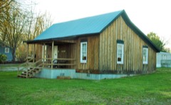 | Nashville, Chattanooga and St. Louis Railway Section House | building | 2011 | 11000421 |
| Ravenscroft Mine | site | 2015 | 15000449 | |
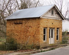 | Sparta Electric Building | building | 1993 | 93000238 |
| Sparta Hydroelectric Station | structure | 1990 | 90000306 | |
| Sparta Nashville, Chattanooga and St. Louis Railroad Depot | building | 1992 | 92001658 | |
| Sparta Residential Historic District | district | 2019 | 91001586 | |
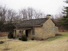 | Sparta Rock House | building | 1973 | 73001856 |
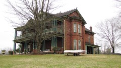 | Sperry-Smith House | building | 1996 | 96001357 |
Every wildfire the federal occurrence database records inside this county: 139 of them, burning about 2,792 acres. None started naturally and 60 were recorded as arson. Each settlement page carries the fires within five miles of it.
| Reported cause | Fires |
|---|---|
| Arson/incendiarism | 60 |
| Debris and open burning | 44 |
| Missing data/not specified/undetermined | 19 |
| Recreation and ceremony | 4 |
| Equipment and vehicle use | 4 |
| Other causes | 4 |
| Misuse of fire by a minor | 2 |
| Power generation/transmission/distribution | 1 |
| Railroad operations and maintenance | 1 |
The five largest, by the area the report gives. One of them was set deliberately.
| Date | Cause | Size | Reported by | Name on the report |
|---|---|---|---|---|
| 20 October 2016 | Recreation and ceremony | 800 acres | Tennessee Division of Forestry | SCOTT`S GULF FIRE |
| 18 March 2016 | Missing data/not specified/undetermined | 620 acres | Tennessee Division of Forestry | TWRA FIRE |
| 9 April 1999 | Debris and open burning | 250 acres | Tennessee Division of Forestry | not named |
| 26 November 2005 | Recreation and ceremony | 156 acres | Tennessee Division of Forestry | MUSIC CITY RANCH FIRE |
| 4 March 2006 | Recreation and ceremony | 76 acres | Tennessee Division of Forestry | not named |
| 23 October 2008 | Missing data/not specified/undetermined | 73 acres | Tennessee Division of Forestry | not named |
| 24 April 2008 | Missing data/not specified/undetermined | 52 acres | Tennessee Division of Forestry | not named |
| 1 September 1999 | Arson/incendiarism | 45 acres | Tennessee Division of Forestry | not named |
Every settlement page carries the fires within five miles of it - see the settlement index below.
The NOAA Storm Events Database holds 259 reports for this county, causing 1 death, 14 injuries and about $9,629,981 in recorded property damage. Each settlement page carries the reports that name it.
| Kind of event | Reports |
|---|---|
| Thunderstorm Wind | 160 |
| Hail | 47 |
| Flash Flood | 21 |
| Tornado | 20 |
| Flood | 7 |
| Heavy Rain | 2 |
| Lightning | 1 |
| Funnel Cloud | 1 |
The most serious of them, by death, then injury, then recorded damage. The accounts are quoted exactly as the forecast office filed them.
| When | Event | Place named | Harm | What the report says |
|---|---|---|---|---|
| March 1973 | Tornado (F2) | not stated | 1 killed, 3 hurt, $250,000 | no account filed |
| April 1974 | Tornado (F2) | not stated | 8 hurt, $25,000 | no account filed |
| March 1965 | Tornado (F1) | not stated | 2 hurt, $250,000 | no account filed |
| May 1983 | Tornado (F1) | not stated | 1 hurt, $25,000 | no account filed |
| March 2020 | Thunderstorm Wind | Mt Pisgah | $4,000,000 | A massive, severe 22 miles long by 5 miles wide macroburst moved across White County from the DeKalb County border 4 miles northwest of Walling to the Cumberland County border 4 miles west-southwest of Pleasant Hill. Significant and severe wind damage affected areas in and around Mt. Pisgah, Doyle, Mt. Gilead, Sparta, Bear Cove, Bon Air Mountain, De Rossett, and Ravenscroft, including on Petit Cove Road, Franks Ferry Road, Hensley Chapel Road, Thomas Street, Norene Road, Mt. Gilead Church Road, McMinnville Highway, Crawford Circle, Highway 111, Iris Drive, Brogden Road, Hickory Valley Road, Skyline Drive, Red Bud Trail, Baker Mountain Road, and Ravenscroft Road. With the large area of this macroburst, a few homes lost all or parts of their roofs and porches, and at least one mobile home was flipped over and destroyed. A stopped train was blown partially off the tracks on Iris Drive. Many barns and other outbuildings were destroyed. Hundreds of trees were snapped and uprooted, with many falling onto homes, barns, and outbuildings. Numerous roads were blocked by fallen trees, power lines, power poles, and other debris. Winds within the macroburst were estimated up to 95 mph. |
| April 1974 | Tornado (F4) | not stated | $2,500,000 | no account filed |
| March 2011 | Tornado (EF2) | Cassville | $350,000 | Damage began near the intersection of Indian Mound Road and Old Smithville Highway. Hundreds of trees were uprooted or snapped along a nearly continuous 9 mile path. Three homes had complete roof loss and a mobile home was completely destroyed with debris scattered over a large area. Around a dozen barns and outbuildings were destroyed. The last evidence of damage was just southwest of downtown Sparta on Iris Drive. Maximum wind speeds associated with this tornado were estimated to be around 115 mph. |
| April 1978 | Tornado (F1) | not stated | $250,000 | no account filed |
| February 2012 | Tornado (EF1) | Cassville | $200,000 | The EF1 tornado with maximum wind speeds around 95 mph moved out of DeKalb County into White County near Twilight Lane. A mobile home was damaged and a church steeple was blown off along Browntown Road near Wildcat Road, and two nearby outbuildings suffered roof damage. The roof of a barn was blown off southwest of the Browntown Road and Austin Road intersection, with debris blown for nearly one quarter mile across fields. A nearby home suffered minor roof damage. The tornado lifted just prior to reaching Austin Road. |
| March 2025 | Thunderstorm Wind | Joppa | $100,000 | Substantial wind damage was noted to a grove of trees near the Horseshoe Bend Marina. All trees were blown to the northeast. At the marina itself, an awning covering the dock was blown off, collapsing on some boats. Winds were up to 75 mph, a determination mainly made from the tree damage. Damages are a rough estimate. |
| March 2020 | Tornado (EF0) | Rockhouse | $100,000 | Embedded within the large macroburst that struck White County, an EF-0 tornado touched down near the Sparta Golf and Country Club on Baker Montain Road and moved northeast onto Bon Air Mountain, ending near Highway 70 at Eastland Road. Damage along the nearly 7 mile track showed a convergent pattern, with numerous large trees snapped and uprooted on Baker Mountain Road and Highway 70. Several farm barns and outbuildings were destroyed on Corolla Road, and a few homes had roof damage. Trees continued to be blown down along Highway 70 before the tornado lifted just before reaching the DeRossett community. Maximum winds in the tornado were estimated to be 85 mph. |
| July 2015 | Flash Flood | Old Zion | $100,000 | Major flash flooding affected much of northern and eastern White County from the evening hours on July 2 into the morning hours on July 3. Numerous roads were impassable and closed due to high water, mainly north and east of Sparta, including Highway 84 at River Bend Road, Mack Floyd Road, Milligan Road, Flat Rock Road, Blue Springs Road, Frank Sims, and Deer Run. One water rescue was performed by emergency personnel for a man stranded in a vehicle in high water at Cherry Creek Road and Dyer Cove Road. A CoCoRaHS observer 10.2 miles NNW of Sparta measured 7.45 inches of rain over the 24 hour period ending at 8:24am on July 3. |
| March 1995 | Thunderstorm Wind | not stated | $100,000 | Two mobile homes were destroyed and four others were damaged. Ten homes were damaged with some of these houses sustaining roof damage. Numerous trees and power lines were blown down. |
| May 2020 | Thunderstorm Wind | Sparta | $99,230 | Numerous trees and power lines were blown down across White County. |
| April 2023 | Thunderstorm Wind | Bakers Xrds | $90,000 | Severe thunderstorm winds downed several power lines, utility poles, and trees near Milk Plant Road. Numerous other trees were reportedly downed across western and northern White County. Damages are estimated. |
| May 2024 | Thunderstorm Wind | Sparta | $75,000 | A microburst occurred across portions of eastern White County. Main damage was uprooted trees and some tops of trees snapped off. Minor structural damage to a carport and fencing with trees on it was noted. Maximum wind gusts were estimated to be around 90 mph. Damages are a rough estimate. |
| March 2020 | Thunderstorm Wind | Old Zion | $50,000 | A severe microburst struck a 2.5 mile long stretch of Duck Pond Road between Old Kentucky Road and Earl Price Road. Numerous barns suffered major roof damage, several outbuildings were damaged or destroyed, and dozens of trees were blown down. Winds were estimated up to 85 mph. |
| April 2008 | Tornado (EF1) | Onward | $50,000 | Some homes were damaged. A power pole was snapped. One mobile home had roof torn off. Trees were snapped and uprooted. |
| December 2005 | Lightning | Sparta | $50,000 | Newspaper account of an old farm house being struck by lightning and set on fire. The house was unoccupied on Nash Road, off of Cookeville Boatdock Rd. The house was a complete loss. |
| May 1999 | Thunderstorm Wind | Sparta | $50,000 | Wind damage to a roof of a church. A large tree nearly split a house on Cummings Chapel Rd. Many trees were blown down around the Sparta Country Club. |
| July 2024 | Thunderstorm Wind | Sparta | $35,000 | Numerous trees and power lines were downed across White County. Roads with trees down included Lancaster Road, Golden Mountain Road, McMinnville Highway, Power House Road, Quebeck Road, Mackie Road, Moore Street, Hampton Crossroads, Horton Road, Pistole Road, Grandview Drive, and County House Road. Power lines were blown down on North Church Street, Sullivan Knowles Road, and Clark Street. Damages are a rough estimate. |
| April 2014 | Tornado (EF1) | Mobra | $30,000 | An EF1 tornado touched down just south of the intersection of Dumplin Knob Road and Eastland Road, then moved east for approximately 2.1 miles before lifting. Several trees were snapped and an occupied vehicle was thrown off the roadway near the touchdown point. Several homes on the north side of Eastland Road suffered minor roof damage. A grain silo was completely destroyed and dozens of hardwood trees were snapped and uprooted. |
| July 2023 | Flash Flood | Findlay | $25,000 | Heavy rain in the Sparta area caused flash flooding along Roosevelt Drive near White County High School. Damages are a rough estimate. |
| August 2023 | Thunderstorm Wind | Bon Air | $25,000 | Severe thunderstorm winds downed trees and powerlines across eastern and southeastern White County. Damages are a rough estimate. |
| February 2020 | Tornado (EF1) | Hensleys Chapel | $25,000 | This EF-1 tornado touched down on Gum Spring Mountain where a house completely lost its roof along with dozens of trees getting uprooted and snapped. An outbuilding and barn were also damaged. The tornado continued east bringing down trees and power lines before finally hitting the National Guard Armory on McMinnville Highway where numerous large pine trees were snapped. The tornado lifted just before reaching Highway 111. |
| May 2017 | Thunderstorm Wind | Shady Grove | $25,000 | A NWS Storm Survey found severe straight line winds caused significant damage in southwest White County from northwest of Doyle to southeast of Doyle. Numerous trees were snapped and uprooted with several roads blocked, including Highway 136 and Franks Ferry Road. Some trees fell on homes and vehicles, including one tree which crushed most of a house on Gooseneck Road in Doyle. Winds were estimated up to 80 mph. |
| January 2010 | Flash Flood | Bakers Xrds | $25,000 | Sheriffs office reported flooding along several roads across the county. |
| August 2010 | Thunderstorm Wind | Old Zion | $25,000 | Numerous trees and power lines were blown down all across the northern portion of the county. |
| June 2009 | Thunderstorm Wind | Sparta | $25,000 | Small trees were reported down county wide. |
| May 1966 | Tornado (F1) | not stated | $25,000 | no account filed |
| May 2024 | Thunderstorm Wind | Sparta | $20,000 | Severe thunderstorm winds downed several trees and power poles across White County. Damages are a rough estimate. |
| July 2023 | Thunderstorm Wind | Doyle | $20,000 | Severe thunderstorm winds downed a large tree near a home along McMinnville Highway. The tree also caused powerlines to fall which started a fire. No injuries were reported. Damages are a rough estimate. |
| July 2023 | Thunderstorm Wind | Doyle | $20,000 | Severe thunderstorm winds downed a large tree near a home along McMinnville Highway. The tree also caused powerlines to fall which started a fire. No injuries were reported. Damages are a rough estimate. |
| February 2009 | Thunderstorm Wind | Sparta | $20,000 | At least 15 trees reported down to E-911 Service. One downed electric line and several phone lines downed were also reported. |
| November 2007 | Tornado (EF0) | Bakers Xrds | $20,000 | Damage to a mobile home and to the Almyra Methodist Church. The mobile home blew off its foundation, rolled across the street, slamming into a brick home across the street. |
| August 1997 | Thunderstorm Wind | Countywide | $20,000 | 911 center reported several trees and larger limbs down around the county. A tree fell on a house in the Cherry Creek area, which is 5.7 miles NNE of Sparta. Also, an out building was demolished by the strong thunderstorm winds. |
| May 2024 | Thunderstorm Wind | Cummings | $15,000 | Severe thunderstorm winds downed large trees along Hickory Valley Road just south of Panther Road in Sparta. Damages are a rough estimate. |
| April 2023 | Thunderstorm Wind | Old Zion | $15,000 | Severe thunderstorm winds downed multiple trees along Liberty Road and John McCoin Road near Sparta. Damages are estimated. |
| July 2023 | Thunderstorm Wind | Yateston | $15,000 | Severe thunderstorm winds downed a tree and damaged an outbuilding along Old Kentucky Road near Central View Mark in Sparta. Damages are a rough estimate. |
| May 2021 | Thunderstorm Wind | Hensleys Chapel | $15,000 | Severe straight-line winds caused significant damage on the west side of Sparta along Old Smithville Highway and Highway 70 from Jerry Parker Road to Highway 111. Numerous trees were blown down, outbuildings were damaged or destroyed, and some homes suffered minor damage. |
| May 2021 | Tornado (EF0) | Findlay | $15,000 | This small EF-0 tornado touched down on the north side of Sparta near Franklin Avenue and Spring Street, Moving southeast, the tornado heavily damaged a barn on Roberts Matthews Highway and blew down several trees at the Sparta Drive-In Theatre. More trees were blown down on Edgewood Drive before the tornado lifted. |
| February 2020 | Tornado (EF1) | Yankeetown | $15,000 | This EF-1 tornado touched down just west of Blue Springs Road and snapped several trees along with destroying a barn. A covered porch was also destroyed at this location as well as the roof of a single story home. The tornado continued eastward across a holler/valley before causing extensive tree damage on James Lambert Road. Several outbuildings and barns were completely destroyed as well as extensive damage to a mobile home. The tornado went up a mountain and back down and then hit a barn/outbuilding on Cross Street. The tornado finally lifted near Viola Drive where further minor tree damage was observed. |
| November 2018 | Tornado (EF0) | Sparta White Co Arpt | $15,000 | This EF-0 tornado touched down on Josh Brown Road and Betty Lane where it snapped trees and broke several large branches. As it moved east it destroyed a barn on South Bunker Hill Road and overturned containers and a trailer at the Upper Cumberland Regional Airport. The KSRB AWOS located at the southwest end of the airport measured a northwest wind gust of 53 mph as the tornado passed just southeast of the weather station. Across Hwy 111 there was damage to an outbuildings metal roof and large branches broken. The path concluded on Post Oak Bridge Road where a tree fell onto a barn and large branches were snapped off trees. |
| July 2023 | Thunderstorm Wind | Hensleys Chapel | $10,000 | A thunderstorm tore the roof off of a barn along Old Smithville Highway North. Damages are a rough estimate. |
| August 2023 | Thunderstorm Wind | Sparta | $10,000 | Thunderstorm winds caused a tree to fall on a home near Sparta. Damages are a rough estimate. |
| August 2023 | Thunderstorm Wind | Sparta | $10,000 | Severe thunderstorm winds downed several trees at Skyline Drive and Redbud Trail in Sparta. Damages are a rough estimate. |
| May 2022 | Thunderstorm Wind | Bon Air | $10,000 | Numerous trees and power lines were blown down across White County. |
| May 2022 | Hail | Clarktown | $10,000 | Ping pong to golfball size hail damaged two vehicles on Lovejoy Road. |
| May 2022 | Hail | Clarktown | $10,000 | Facebook reports and photos showed hail up to quarter size and slightly larger broke windows, siding and lights on a home on Lovejoy Road. |
| March 2020 | Thunderstorm Wind | Old Zion | $10,000 | Several trees were uprooted, a flag pole was bent, and the front porch knocked off a home in Cassville near Old Zion Cemetery. |
| May 2017 | Thunderstorm Wind | Findlay | $10,000 | A tSpotter Twitter report and photo showed a the roof was blown off a business on North Spring Street in Sparta. |
| June 2016 | Thunderstorm Wind | Sparta | $10,000 | Several trees, power lines, and telephone wires down throughout White County. |
| July 2014 | Thunderstorm Wind | Sparta | $10,000 | A few trees were reported down across the county. A tree was blocking the roadway at the 2600 block of Oak Grove Road. Several trees were down at Terrace Drive and Cedar Lane in Sparta. A power pole was snapped in half across Fred Hill Road. Crossville Highway also had trees down along the roadway. Reports obtained from Emergency Management and Amateur Radio. |
| April 2014 | Thunderstorm Wind | Walling | $10,000 | An NWS Storm Survey determined a microburst with winds estimated up to 75 mph caused a camper to roll over and a garage to lose part of its roof southwest of Doyle. Several large trees were also uprooted. |
| February 2012 | Tornado (EF0) | Macedonia | $10,000 | An EF0 tornado with maximum wind speeds around 85 mph touched down near the Macedonia community northwest of Sparta, then moved rapidly eastward across Highway 111 before ending east of Walnut Grove Road. A home and barn suffered roof damage on Linville Road, and several trees were snapped or uprooted along the path. |
| August 2012 | Thunderstorm Wind | Sparta | $10,000 | Several trees and power lines were blown down across White County. |
| July 2012 | Thunderstorm Wind | Hensleys Chapel | $10,000 | Several trees were downed. |
| August 2011 | Thunderstorm Wind | De Rossett | $10,000 | NWS storm survey found straight line wind damage along Coal Bank Road near the Derossett community. Several large trees were snapped or uprooted and numerous large limbs were broken off. Winds were estimated between 70 and 80 mph. |
| June 2009 | Thunderstorm Wind | Key | $10,000 | Trees were reported down across Randolph Road. |
| January 2008 | Thunderstorm Wind | Sparta | $10,000 | The 911 Dispatch reported numerous trees and power lines were down around the county. |
The Survey's mineral resources record lists 10 workings inside this county. 5 still produce and 5 are closed or unrecorded. Each settlement page carries the workings within five miles of it.
| Commodity | Workings |
|---|---|
| Stone, Crushed/Broken | 4 |
| Limestone, General | 2 |
| Clay | 2 |
| Stone, Crushed/Broken, Limestone, General | 1 |
| Sand and Gravel, Construction | 1 |
The least common of them first, because a county's hundredth gravel pit says nothing its first ten did not.
| Where | Site | Commodity | Status | Recorded |
|---|---|---|---|---|
| Pit No.1 | Sand and Gravel, Construction | Producer | ||
| Sparta Limestone Quarry | Stone, Crushed/Broken, Limestone, General | Producer | Limestone | |
| Weinman Quarry | Limestone, General | Past Producer | Sedimentary | |
| White County Highway Dept. Quarry | Clay | Past Producer | Sedimentary | |
| White County Highway Dept. Quarry | Clay | Producer | ||
| White County Quarry | Limestone, General | Past Producer | Sedimentary | |
| Sparta Limestone Quarry | Stone, Crushed/Broken | Producer | ||
| Weinman Quarry | Stone, Crushed/Broken | Past Producer | ||
| White County Hwy. Dept. Quarry | Stone, Crushed/Broken | Producer | 1955 | |
| White County Quarry | Stone, Crushed/Broken | Past Producer |
Named settlements recorded in the Geographic Names Information System, each with the topographic sheets covering it. Villages, hamlets and abandoned places alike. Each is shown with the nearest named watercourse or landform and the survey quadrangle it falls on.
District 6 · 38587 · On Darkey Spring Branch · Cassville quadrangle
19 sheets, 1893 to 1981
District 6 · 38587 · On Darkey Spring Branch · Cassville quadrangle
19 sheets, 1893 to 1981
District 6 · 38583 · On Gleason Creek · Sligo Bridge quadrangle
20 sheets, 1893 to 1981
No longer a settlement
District 3 · 38583 · On Buck Creek · Monterey Lake quadrangle
20 sheets, 1897 to 1982
No longer a settlement
District 6 · 38583 · On Irvin Branch · Cassville quadrangle
19 sheets, 1893 to 1981
No longer a settlement
District 7 · 38583 · On Post Oak Creek · Burgess Falls quadrangle
11 sheets, 1943 to 1982
District 5 · 38583 · On Town Creek · Sparta quadrangle
21 sheets, 1892 to 1981
No longer a settlement
District 2 · 38583 · Near Walker Mountain · Sparta quadrangle
21 sheets, 1892 to 1981
District 6 · 38583 · On Lake Creek · Cassville quadrangle
19 sheets, 1893 to 1981
No longer a settlement
District 4 · 38583 · Near Hasting Cove · Sparta quadrangle
21 sheets, 1892 to 1981
No longer a settlement
District 6 · 38587 · On Cliff Creek · Doyle quadrangle
20 sheets, 1893 to 1981
No longer a settlement
District 4 · 38583 · On Hickory Valley Branch · Bald Knob quadrangle
21 sheets, 1892 to 1981
District 6 · 38587 · On Darkey Spring Branch · Cassville quadrangle
19 sheets, 1893 to 1981
District 4 · 38583 · Near Chestnut Mountain · De Rossett quadrangle
23 sheets, 1892 to 1981
District 6 · 38587 · On Darkey Spring Branch · Cassville quadrangle
19 sheets, 1893 to 1981
The vanished settlements of White County: the places named above that are no longer on the map.