 Block
Alexandria, Tennessee
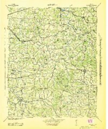
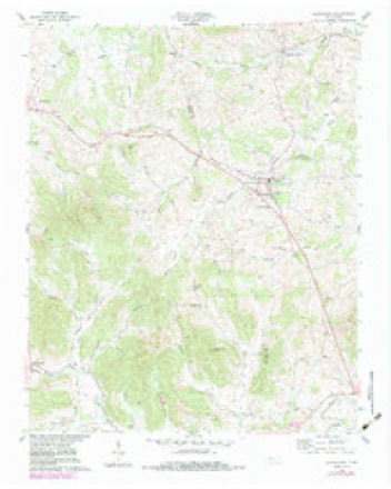
8 topographic sheets cover this place, the earliest surveyed in 1942 and the latest in 1984. It stands in District 1. It lies in ZIP code area 37012. The Survey maps it on the Alexandria quadrangle. 981 people lived here at the 2020 count. It stands 653 feet above sea level.
On record in Alexandria
Buildings and businesses the archive holds for this place. Each opens its own page, with the source record it came from.
On the National Register 2 records
- Alexandria Cemeteries Historic Districtlisted 2002
- Dekalb County Fairgroundslisted 1995
Population over time
2 figuresAlexandria grew from 966 to 981 between 2010 and 2020. These are the recorded population figures Wikidata holds for this place, reached through the Geographic Names Information System number this page is keyed on rather than by name, so they belong to this place and not to another of the same name. Most are census counts, but not all are: an early figure may be a founding or settlement estimate, and an estimate published within five years of a census is left out. The change column is computed, and is left blank where more than 20 years separate a figure from the one before it, because a gap that long is not a change between two counts.
| Year | People | Change |
|---|---|---|
| 2010 | 966 | |
| 2020 | 981 | +15 (+2%) |
Topographic sheets covering this place
5 surveys from 8 printed sheetsMatched by testing this settlement's coordinate against the published boundary of every sheet in the United States Geological Survey's historical collection. Each opens the scanned sheet at the Survey.
- 1942 USGS Statesville quadrangle1:100000
- 1956 USGS Nashville quadrangle1:250000, 2 printings
- 1958 USGS Alexandria quadrangle1:24000, 3 printings
- 1959 USGS Nashville quadrangle1:250000
- 1984 USGS Nashville quadrangle1:100000



Fires near this place
24 since 1997Regional context, not property-specific evidence. The federal wildfire occurrence database lists 24 fires within 5 miles of Alexandria between 1997 and 2018, burning about 132 acres in total. None started naturally. 7 were recorded as arson. Distance is straight-line from the map coordinates, so a fire counted here may appear on a neighbouring settlement's page as well.
| Reported cause | Fires |
|---|---|
| Debris and open burning | 11 |
| Arson/incendiarism | 7 |
| Power generation/transmission/distribution | 2 |
| Smoking | 2 |
| Equipment and vehicle use | 1 |
| Missing data/not specified/undetermined | 1 |
The most recent of them, most recent first, with the day each was reported and the service that recorded it.
| Date | Cause | Size | Reported by | Name on the report |
|---|---|---|---|---|
| 4 August 2005 | Debris and open burning | under an acre | Tennessee Division of Forestry | not named |
| 28 August 2007 | Debris and open burning | 1.0 acres | Tennessee Division of Forestry | HOLMES GAP RD |
| 20 August 2007 | Debris and open burning | 3.1 acres | Tennessee Division of Forestry | COOPER |
| 4 July 2009 | Arson/incendiarism | under an acre | Tennessee Division of Forestry | YOUNG DUMP FIRE |
| 8 June 2012 | Smoking | 67 acres | Tennessee Division of Forestry | HUDSON RD. FIRE |
| 26 June 2008 | Debris and open burning | under an acre | Tennessee Division of Forestry | not named |
| 2 April 1997 | Arson/incendiarism | 5.2 acres | Tennessee Division of Forestry | not named |
| 18 April 2001 | Debris and open burning | 1.0 acres | Tennessee Division of Forestry | not named |
Settlements close enough to share some of these fires:
Storms near this place
24 since 1997Regional context, not property-specific evidence. The National Weather Service names Alexandria in 24 storm reports between 1997 and 2025: 13 thunderstorm wind, 6 flash flood, 2 tornado, 2 hail. The reports record 1 injury. Each account below is quoted exactly as the forecast office filed it, from the NOAA Storm Events Database, and each date opens the federal record of that event.
| When | Event | Place named | Harm | What the report says |
|---|---|---|---|---|
| January 1997 | Tornado (F2) | Alexandria | 1 hurt, $5,000 | no account filed |
| May 2009 | Flash Flood | Alexandria | $30,000 | Heavy downpours caused creeks and streams to flow out of their banks, causing some|flooding and hazardous driving on local roadways due to flash flooding. In Alexandria the waters rose to cover the DeKalb County Fairgrounds, as well as making some vehicles and trailers in the area having at least three feet of water depth surrounding|them. A small bridge in the Tramel Branch area of DeKalb County was also overrun with flooding waters. |
| August 2014 | Thunderstorm Wind | Alexandria | $25,000 | A large downburst with winds estimated up to 75 mph struck the Alexandria area. Extensive roof damage was reported to buildings along east Main Street and to structures at the De Kalb County Fairgrounds. Numerous trees and power lines were also blown down. |
| May 2009 | Flash Flood | Alexandria | $25,000 | Over five inches fell in most part of DeKalb County, causing swollen creek banks, water-covered roadways, and localized flash flooding. |
| November 2017 | Flash Flood | Alexandria | $20,000 | Major flash flooding affected much of De Kalb County, with the flooding considered the worst since 1999 in the western part of the county. Numerous roads were covered by water and closed, including Highway 264, Highway 56, Highway 70, Smith Fork Road, Dismal Road, and Main Street in Liberty. Nine water rescues were conducted by emergency personnel in and near Dowelltown. Flood waters surrounded many homes and other buildings, including De Kalb West Elementary School and Salem Baptist Church. A USGS river gauge on Highway 264 at Smith Fork Creek crested at 27.5 feet, the second highest level on record. |
| April 2003 | Thunderstorm Wind | Alexandria | $20,000 | Newspaper article stated several homes, barns and outbuildings sustained roof damage from strong thunderstorm winds from Coon Branch Road to Pumpkin Hollow Road. A large tree fell on a house on Old Liberty Road. A garage behind the home was totally destroyed. |
| May 2021 | Tornado (EF0) | Alexandria | $15,000 | This small, brief tornado touched down on the south side of Alexandria. Security cameras at a home on Old Liberty Road captured the tornado on video as the roof and back porch were blown off the house. The tornado is estimated to have lifted east of Nashville Highway. |
| March 2017 | Thunderstorm Wind | Alexandria | $10,000 | TEMA reported four houses received some roof damage and trees were blown down in Alexandria. |
| July 2009 | Lightning | Alexandria | $10,000 | A house fire was the result of a lightning strike at 128 Smith Lane. The bolt of lightning struck the side of the house. The bolt hit the phone and electric lines and actually blew a two-foot wide by six-inch deep hole in the yard. Several fire crews arrived on the scene and found the home with thick smoke and fire smoldering in the walls of the home. Firefighters used axes and saws to cut the walls out in order to reach the blaze.|Though the home suffered some smoke and water damage, the house and all of its contents were saved. No injuries were reported during the incident. |
| July 2024 | Thunderstorm Wind | Alexandria | $5,000 | Severe thunderstorm winds downed a small tree onto a home in the Temperance Hall area. Damages are a rough estimate. |
| April 2011 | Thunderstorm Wind | Alexandria | $5,000 | Several trees were blown down. A spotter measured an 82 mph gust before his home wind equipment was destroyed. |
| May 2017 | Thunderstorm Wind | Alexandria | $3,000 | Several trees and power lines were blown down in Alexandria. |
| August 2015 | Thunderstorm Wind | Alexandria | $3,000 | Trees were blown down in Alexandria. |
| July 2020 | Thunderstorm Wind | Alexandria | $1,000 | One tree was blown down. |
| February 2014 | Thunderstorm Wind | Alexandria | $1,000 | A large tree was blown down at Church Street and High Street. |
| November 2004 | Flash Flood | Alexandria | $1,000 | U.S. Highway 70 was down to one lane becasue of high water near Alexandria. Schools were closed the following day on Wednesday Dec. 1. |
| May 2025 | Hail | Alexandria | - | Half dollar size hail was reported on Old Liberty Road in Alexandria. |
| September 2018 | Flash Flood | Alexandria | - | Several roads were closed and impassable due to flooding in the Alexandria area. |
| August 2014 | Thunderstorm Wind | Alexandria | - | A trained spotter estimated a wind gust of 60 mph in Alexandria. |
| June 2011 | Hail | Alexandria | - | Nickel size hail was reported and a wind gust to 57 mph was measured. |
| May 2005 | Thunderstorm Wind | Alexandria | - | Trees and power lines were down. |
| August 2003 | Thunderstorm Wind | Alexandria | - | News article stated that large trees and power lines were blown down near Alexandria. Road crews had to remove limbs and clear roadways from Alexnadria to Cookeville Hwy. |
| September 2003 | Flash Flood | Alexandria | - | Local Police Department reported 6 to 12 inches of water on roads. |
| November 2002 | Thunderstorm Wind | Alexandria | - | Newspaper story about a home having its roof peeled away by strong thunderstorm winds in Alexandria. There were several trees blown down and minor structural damage from Alexandria to Temperance Hall. |
Nearest settlements
The eight closest, with where each one stands in the county. Distances are straight-line, computed from the Geographic Names Information System coordinates.
| Map | Place | Distance | Sheets |
|---|---|---|---|
| Helton | 4.7 miles | 11 | |
| Liberty | 6.0 miles | 11 | |
| Dowelltown | 6.4 miles | 11 | |
| Temperance Hall | 7.0 miles | 11 | |
| Haleville (historical) | 7.5 miles | 18 | |
| Snows Hill | 10.5 miles | 18 | |
| Youngblood (historical) | 10.5 miles | 18 | |
| Laurel Hill | 11.8 miles | 12 |
Elsewhere
Matched on this settlement's Geographic Names Information System number rather than its name, so it cannot be a different place of the same name in another state.
| Wikipedia article on Alexandria | An encyclopaedic summary. Its text is share-alike, so it is linked here rather than copied. |
| Wikidata item Q2222666 | The structured record the population and elevation above come from. Public domain (CC0). |
Provenance
This settlement is recorded in the Geographic Names Information System as feature 1313829. The sheet list is computed by point-in-boundary test against the United States Geological Survey's historical topographic inventory. Both are works of the United States government and carry no copyright under 17 U.S.C. 105.
Wildfire. Short, Karen C. 2022. Spatial wildfire occurrence data for the United States, 1992-2020 [FPA_FOD_20221014]. 6th Edition. Fort Collins, CO: Forest Service Research Data Archive. https://doi.org/10.2737/RDS-2013-0009.6 Collected with United States Government funding and usable without additional permissions or fees.
Storms. NOAA National Centers for Environmental Information, Storm Events Database https://www.ncei.noaa.gov/stormevents/ A work of the United States government, no copyright under 17 U.S.C. 105. Narratives are quoted verbatim from the National Weather Service report and are not edited or summarised.