 Block
Berrys Chapel, Tennessee
15 topographic sheets cover this place, the earliest surveyed in 1909 and the latest in 1985. It stands in District 8. It lies in ZIP code area 37069. It sits by Wray Bluff. The Survey maps it on the Leipers Fork quadrangle.
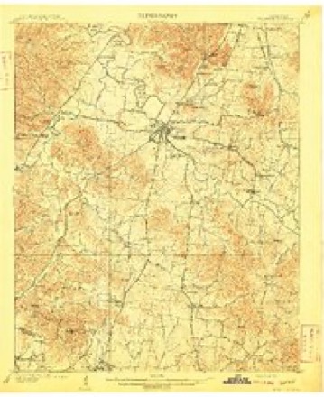
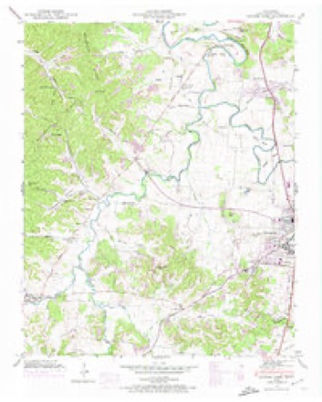
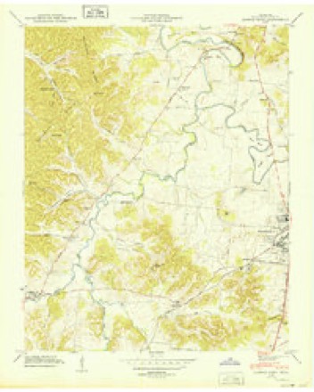
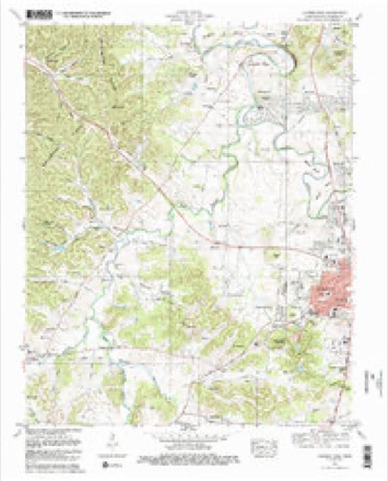
Topographic sheets covering this place
6 surveys from 15 printed sheetsMatched by testing this settlement's coordinate against the published boundary of every sheet in the United States Geological Survey's historical collection. Each opens the scanned sheet at the Survey.
- 1909 USGS Franklin quadrangle1:62500, 2 printings
- 1946 USGS Leipers Fork quadrangle1:24000, 2 printings
- 1949 USGS Leipers Fork quadrangle1:24000
- 1956 USGS Columbia quadrangle1:250000, 6 printings
- 1981 USGS Leipers Fork quadrangle1:24000, 3 printings
- 1985 USGS Murfreesboro quadrangle1:100000

Fires near this place
7 since 2000Regional context, not property-specific evidence. The federal wildfire occurrence database lists 7 fires within 5 miles of Berrys Chapel between 2000 and 2013, burning about 47 acres in total. None started naturally. 3 were recorded as arson. Distance is straight-line from the map coordinates, so a fire counted here may appear on a neighbouring settlement's page as well.
| Reported cause | Fires |
|---|---|
| Arson/incendiarism | 3 |
| Debris and open burning | 2 |
| Railroad operations and maintenance | 1 |
| Recreation and ceremony | 1 |
The most recent of them, most recent first, with the day each was reported and the service that recorded it.
| Date | Cause | Size | Reported by | Name on the report |
|---|---|---|---|---|
| 18 September 2008 | Railroad operations and maintenance | 28 acres | Tennessee Division of Forestry | not named |
| 16 April 2001 | Debris and open burning | 2.0 acres | Tennessee Division of Forestry | not named |
| 8 December 2008 | Arson/incendiarism | 6.3 acres | Natchez Trace Parkway | BIG TREE |
| 17 December 2013 | Arson/incendiarism | 2.6 acres | Natchez Trace Parkway | SHOOTING STAR |
| 12 November 2011 | Recreation and ceremony | 2.0 acres | Tennessee Division of Forestry | BRENTWOOD FIRE |
| 9 October 2007 | Debris and open burning | under an acre | Tennessee Division of Forestry | OLD HILLSBORO RD |
| 26 October 2000 | Arson/incendiarism | 6.0 acres | Tennessee Division of Forestry | not named |
Settlements close enough to share some of these fires:
Mines and quarries near this place
10 of 43 shownRegional context, not property-specific evidence. The federal mineral resources record lists 43 workings within 5 miles of Berrys Chapel: 15 past producers, 13 unknowns, 8 producers, 4 prospects. 8 still produce. What was taken out: Phosphorus-Phosphates, Stone, Crushed/Broken. Distance is straight-line from the map coordinates, so a quarry counted here may appear on a neighbouring settlement's page as well.
| Where | Site | Commodity | Status | Recorded |
|---|---|---|---|---|
| Franklin Quarry | Stone, Crushed/Broken | Producer | ||
| Amos | Phosphorus-Phosphates | Producer | 1920 | |
| Anthony Pit | Phosphorus-Phosphates | Past Producer | ||
| Anthony Pit | Phosphorus-Phosphates | Past Producer | ||
| Battlefield No. 580 Prospect | Phosphorus-Phosphates | Occurrence | ||
| Battlefield Number 1062 Pit | Phosphorus-Phosphates | Past Producer | ||
| Battlefield Number 697 Pit | Phosphorus-Phosphates | Past Producer | ||
| Battlefield Number 697 Pit | Phosphorus-Phosphates | Past Producer | ||
| Battlefield Pewitt #580 | Phosphorus-Phosphates | Occurrence | ||
| Battlefield Pit | Phosphorus-Phosphates | Producer |
Storms near this place
46 since 2008Regional context, not property-specific evidence. The National Weather Service names Berrys Chapel in 46 storm reports between 2008 and 2025: 30 thunderstorm wind, 6 hail, 5 lightning, 2 funnel cloud. No death or injury is recorded in these reports. Each account below is quoted exactly as the forecast office filed it, from the NOAA Storm Events Database, and each date opens the federal record of that event.
| When | Event | Place named | Harm | What the report says |
|---|---|---|---|---|
| March 2017 | Tornado (EF1) | Berrys Chapel | $7,270,000 | An EF-1 tornado touched down along Hillsboro Road just northwest of the city of Franklin, then moved rapidly east-northeast across the Cool Springs and Brentwood areas of northern Williamson County before lifting just west of the Davidson County line. The first evidence of damage was several trees blown down in the Monticello neighborhood on Poteat Place and Spencer Creek Road near Hillsboro Road. Two sheds were destroyed and more trees snapped and uprooted along South Berrys Chapel Road. Several more trees were blown down and an outbuilding damaged along Mallory Station Road and Jackson Lake Drive, and numerous homes suffered minor to moderate roof, siding, and chimney damage along Sunrise Circle and Brentwood Pointe. Several businesses suffered damage along Mallory Lane and Galleria Boulevard including blown out garage doors and roof damage, and a video of the tornado was taken from a car dashcam on Commerce Way. The tornado then weakened as it crossed Interstate 65, but still blew down seven interstate highway signs along the roadway. As the tornado moved through Brentwood, it continued to blow down trees and cause minor damage to homes and businesses on Westgate Circle, Gordon Petty Drive, Wilson Pike, Demery Court, Crockett Road, and in the Governor's Club neighborhood. The tornado then intensified as it traveled down Concord Road, with dozens of trees snapped and uprooted and numerous homes suffering roof and exterior damage. The tornado then lifted near Owl Creek Park along Chestnut Springs Road just before reaching the Davidson County line. Preliminary estimates from Williamson County Emergency Management indicated that 472 homes and businesses received minor damage, 49 sustained moderate damage, and one home on Sunrise Circle suffered major damage for a total of 522 damaged structures. Damage totals are estimated at 7.27 million dollars. |
| October 2010 | Thunderstorm Wind | Berrys Chapel | $50,000 | Tree limbs were downed on power lines on Panorama Drive. A gas meter was also on fire about ten houses down from where the limbs on power line were downed on Panorama Drive. A tree was also reported down on a car at Twin Springs Court. Power lines were downed at various locations across Brentwood resulting in power outages. |
| November 2025 | Thunderstorm Wind | Berrys Chapel | $25,000 | Severe thunderstorm winds broke or uprooted about eight to ten trees in the area of Chapel Court and Brookside Drive in Franklin. One home had minor tree where a tree fell on it and broke the wooden structure of the soffit. Damages are a rough estimate. |
| June 2016 | Lightning | Berrys Chapel | $25,000 | A house on Johnson Chapel Road was struck by lightning, destroying the chimney and damaging the roof. |
| June 2023 | Thunderstorm Wind | Berrys Chapel | $20,000 | Severe thunderstorm winds downed a tree and crushed part of a residence along Featherstone Drive in the Grassland community north of Franklin. Damages are a rough estimate. |
| September 2016 | Thunderstorm Wind | Berrys Chapel | $15,000 | A tree was blown down onto a power line at 313 Colt Lane, which caused the power line to be pulled out of a home causing substantial damage to the house. Red Cross was enroute to assist the family. |
| February 2023 | Lightning | Berrys Chapel | $10,000 | A lightning strike from a thunderstorm struck a home in Fieldstone Farms, causing minor siding damage. No injuries were reported. Damages are estimated. |
| June 2017 | Lightning | Berrys Chapel | $10,000 | A house was struck by lightning and the resulting fire damaged a home in Fieldstone Farms. |
| July 2015 | Lightning | Berrys Chapel | $10,000 | Lightning struck a home at 505 Granny White Pike and started a fire with minor damage. |
| July 2012 | Lightning | Berrys Chapel | $10,000 | A lightning strike resulted in an electrical transformer being damaged. |
| November 2025 | Thunderstorm Wind | Berrys Chapel | $5,000 | Severe thunderstorm winds downed trees near Highway 431 southeast of Bellevue. Damages are a rough estimate. |
| July 2023 | Thunderstorm Wind | Berrys Chapel | $5,000 | Severe thunderstorm winds downed a tree partially onto a house near Hillsboro Road and General J B Hood Drive in Forest Hills. Damages are a rough estimate. |
| July 2012 | Thunderstorm Wind | Berrys Chapel | $5,000 | Power lines were downed on Derby Glen Lane and Williamsburg Road. |
| April 2011 | Thunderstorm Wind | Berrys Chapel | $5,000 | A buildings roof was damaged by the wind. Specific details concerning amount of roof being damaged, type of roof damaged, and associated roof damage costs were unknown. |
| September 2016 | Thunderstorm Wind | Berrys Chapel | $3,000 | A few trees were blown down in the Grassland area. |
| January 2013 | Flash Flood | Berrys Chapel | $3,000 | Water was overflowing the creek bank and onto North Berry Chapel Road. The actual depth of the water over this roadway was unknown along with specific details concerning associated travel impacts. |
| June 2016 | Thunderstorm Wind | Berrys Chapel | $2,000 | A tSpotter Twitter report indicated a tree and power lines were blown down on Murray Lane. |
| July 2016 | Thunderstorm Wind | Berrys Chapel | $2,000 | Trees were blown down in the Fieldstone Farms subdivision in Franklin. |
| June 2013 | Thunderstorm Wind | Berrys Chapel | $2,000 | A tree was blown down on a building in the Grassland community. |
| July 2012 | Thunderstorm Wind | Berrys Chapel | $2,000 | A portion of a residential wood fence was blown down in the Fieldstone Farms Neighborhood. |
| March 2025 | Thunderstorm Wind | Berrys Chapel | $1,000 | Severe thunderstorm winds downed a large tree near Owl's Hill Nature Sanctuary. Damages are a rough estimate. |
| May 2025 | Thunderstorm Wind | Berrys Chapel | $1,000 | A tree was reported down on South Berrys Chapel Road near Lynwood Way, blocking the road. Damages are a rough estimate. |
| April 2025 | Thunderstorm Wind | Berrys Chapel | $1,000 | Severe thunderstorm winds downed a tree across Holly Tree Gap Road in Brentwood. Damages are a rough estimate. |
| July 2023 | Thunderstorm Wind | Berrys Chapel | $1,000 | Severe thunderstorm winds downed a large limb down near Harpeth Hills Drive and Hillsboro Road in Forest Hills. Damages are a rough estimate. |
| August 2023 | Thunderstorm Wind | Berrys Chapel | $1,000 | Severe thunderstorm winds downed a tree along South Berrys Chapel Road in Hillsboro. Damages are a rough estimate. |
| August 2023 | Thunderstorm Wind | Berrys Chapel | $1,000 | Severe thunderstorm winds snapped a pine tree in the Belle River area. Damages are a rough estimate. |
| May 2021 | Thunderstorm Wind | Berrys Chapel | $1,000 | A tree was blown down on Granny White Pike near Brentwood Academy. |
| June 2018 | Thunderstorm Wind | Berrys Chapel | $1,000 | A two and a half inch diameter tree was blown down that blocked Berrys Chapel Road near Lynnwood Way, and another tree was blown down on Lynnwood Way near Franklin Road. |
| March 2017 | Thunderstorm Wind | Berrys Chapel | $1,000 | A tSpotter Twitter photo showed a tree blown down in the Grassland area. |
| September 2016 | Thunderstorm Wind | Berrys Chapel | $1,000 | A tree was snapped on Murray Lane in Brentwood. |
| September 2016 | Thunderstorm Wind | Berrys Chapel | $1,000 | A Twitter photo showed a tree was blown down on Hillsboro Road. |
| July 2013 | Thunderstorm Wind | Berrys Chapel | $1,000 | Trees were reported down on Legends Club Lane. Report received via Twitter. |
| January 2012 | Thunderstorm Wind | Berrys Chapel | $1,000 | A large tree was reported downed at the intersection of Hillsboro Road and Bobby Drive. |
| July 2012 | Thunderstorm Wind | Berrys Chapel | $1,000 | A tree was downed onto High Lea Road. |
| July 2012 | Thunderstorm Wind | Berrys Chapel | $1,000 | A tree was downed across Shadowridge Court and also a few large tree limbs were downed in Brentwood. |
| April 2011 | Thunderstorm Wind | Berrys Chapel | $1,000 | A tree was reported downed on Hillsborough Road near Black Horse Parkway. |
| January 2008 | Thunderstorm Wind | Berrys Chapel | $1,000 | Law enforcement reported telephone wires were down. |
| May 2025 | Hail | Berrys Chapel | - | Estimated quarter size hail was reported at Fieldstone Farms in Franklin. |
| March 2021 | Hail | Berrys Chapel | - | TSpotter report of half dollar sized hail in Grassland. |
| May 2020 | Funnel Cloud | Berrys Chapel | - | Twitter photos showed a funnel cloud south of Old Natchez Golf Course. Time and location was estimated based on radar. No damage was reported. |
| April 2017 | Flood | Berrys Chapel | - | Williamson County Emergency Management reported several roads in Franklin were covered in water. The intersection of Arno Road at Trinity Road east of Franklin was also under water. |
| July 2016 | Hail | Berrys Chapel | - | Dime size hail was reported near Franklin. |
| July 2015 | Hail | Berrys Chapel | - | A TV meteorologist reported golf ball size hail in the Grassland area. |
| April 2011 | Funnel Cloud | Berrys Chapel | - | Funnel cloud was observed passing over the Mapco Gas Station just north of the intersection of U.S. Highway 31/Hillsboro Road and State Route 397/Mack C Hatcher Memorial Parkway just north of the city of Franklin. |
| May 2012 | Hail | Berrys Chapel | - | no account filed |
| March 2012 | Hail | Berrys Chapel | - | no account filed |
Nearest settlements
The eight closest, with where each one stands in the county. Distances are straight-line, computed from the Geographic Names Information System coordinates.
| Map | Place | Distance | Sheets |
|---|---|---|---|
| Berrys Chapel Heights | 0.3 miles | 15 | |
| Meadow Green Acres | 0.4 miles | 15 | |
| Hillsboro Acres | 0.4 miles | 15 | |
| Walnut Acres | 0.5 miles | 15 | |
| Farmington | 0.7 miles | 15 | |
| Battlewood Estates | 1.0 miles | 15 | |
| Cottonwood Estates | 1.1 miles | 15 | |
| Grassland | 1.4 miles | 15 |
Elsewhere
Matched on this settlement's Geographic Names Information System number rather than its name, so it cannot be a different place of the same name in another state.
| Wikidata item Q122539775 | The structured record the population and elevation above come from. Public domain (CC0). |
Provenance
This settlement is recorded in the Geographic Names Information System as feature 1647620. The sheet list is computed by point-in-boundary test against the United States Geological Survey's historical topographic inventory. Both are works of the United States government and carry no copyright under 17 U.S.C. 105.
Wildfire. Short, Karen C. 2022. Spatial wildfire occurrence data for the United States, 1992-2020 [FPA_FOD_20221014]. 6th Edition. Fort Collins, CO: Forest Service Research Data Archive. https://doi.org/10.2737/RDS-2013-0009.6 Collected with United States Government funding and usable without additional permissions or fees.
Mines and quarries. USGS Mineral Resources Data System (MRDS) https://mrdata.usgs.gov/mrds/ A work of the United States government, no copyright under 17 U.S.C. 105.
Storms. NOAA National Centers for Environmental Information, Storm Events Database https://www.ncei.noaa.gov/stormevents/ A work of the United States government, no copyright under 17 U.S.C. 105. Narratives are quoted verbatim from the National Weather Service report and are not edited or summarised.