 Block
From the record
135 National Register listings published here, 2 of them National Historic Landmarks.
Sources: the National Register database, National Park Service
121 topographic sheets cover 225 settlements here, and 135 properties are on the National Register of Historic Places.
135 National Register listings published here, 2 of them National Historic Landmarks.
Sources: the National Register database, National Park Service
Every property in this county listed on the National Register of Historic Places, with the year it was listed and the federal nomination document.
| Photograph | Property | Type | Listed | Reference |
|---|---|---|---|---|
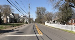 | Adams Street Historic District | district | 2000 | 00000233 |
| William Allison House | building | 1988 | 88000288 | |
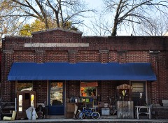 | Bank of College Grove, The | building | 1988 | 88000289 |
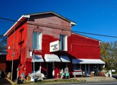 | Bank of Nolensville | building | 1988 | 88000287 |
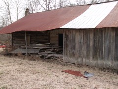 | Beasley-Parham House | building | 1988 | 88000286 |
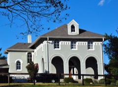 | Bostick Female Academy | building | 1982 | 82004070 |
| Boyd Mill Ruins | site | 1988 | 88000285 | |
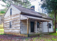 | William Boyd House | building | 1988 | 88000284 |
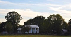 | Boyd-Wilson Farm | district | 1996 | 96000748 |
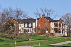 | Spencer Buford House | building | 88000346 | |
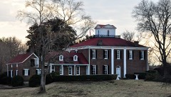 | William S. Campbell House | building | 1975 | 75001798 |
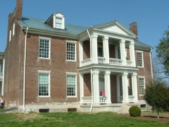 | Carnton | building | 1973 | 73001857 |
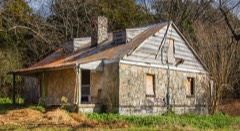 | John Henry Carothers House | building | 1989 | 89002028 |
| Cedarmont | building | 1984 | 84003747 | |
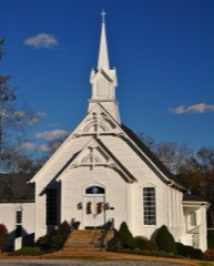 | College Grove Methodist Church | building | 1988 | 88000345 |
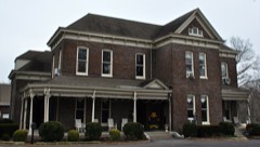 | Cox House | building | 1980 | 80003881 |
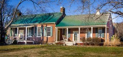 | John Crafton House | building | 1988 | 88000347 |
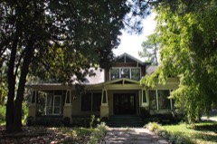 | Craig-Beasley House | building | 2003 | 03001342 |
| Jacob Critz House | building | 1988 | 88000343 | |
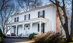 | Thomas L. Critz House | building | 1988 | 88000342 |
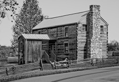 | Andrew Crockett House | building | 1988 | 88000302 |
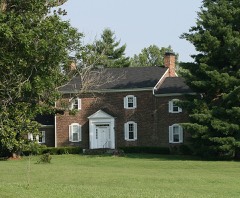 | Samuel Crockett House | building | 1988 | 88000296 |
| Stokely Davis House | building | 88000294 | ||
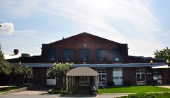 | Dortch Stove Works | building | 1997 | 97001438 |
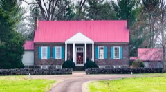 | Douglass-Reams House | building | 1988 | 88000293 |
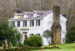 | Joseph Elliston House | building | 1988 | 88000291 |
| Fewkes Group Archeological Site | district | 1980 | 80003880 | |
| Fewkes Group Archeological Site (Boundary Increase) | site | 2012 | 12000121 | |
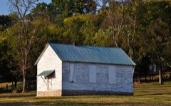 | Forest Hills School | building | 1988 | 88000290 |
 | Fort Granger | site | 1973 | 73001858 |
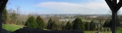 | Franklin Battlefield | district | 1966 | 66000734 |
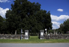 | Franklin City Cemetery | site | 2012 | 12000946 |
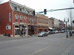 | Franklin Historic District | district | 1972 | 72001254 |
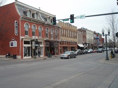 | Franklin Historic District (Boundary Increase) | district | 2000 | 00000232 |
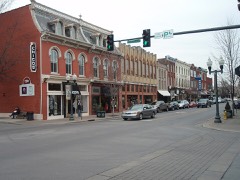 | Franklin Historic District (Boundary Increase) | district | 1988 | 88000378 |
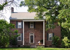 | John Frost House | building | 1988 | 88000308 |
| James Giddens House | building | 1988 | 88000301 | |
| Samuel F. Glass House | building | 1988 | 88000309 | |
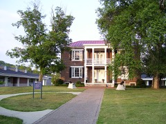 | Glen Echo | building | 1976 | 76001808 |
| Abram Glenn House | building | 1988 | 88000310 | |
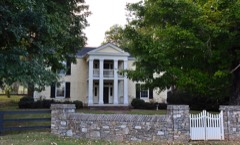 | Henry P. Gray House | building | 1988 | 88000313 |
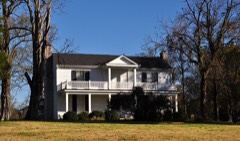 | Sherwood Green House | building | 1988 | 88000311 |
| Denny P. Hadley House | building | 1988 | 88000283 | |
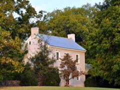 | Hamilton-Brown House | building | 2006 | 06000668 |
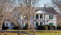 | Franklin Hardeman House | building | 1988 | 88000280 |
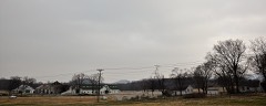 | Harlinsdale Farm | district | 2006 | 06000344 |
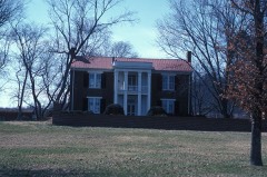 | Harrison House | building | 1975 | 75001799 |
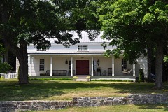 | John Herbert House | building | 1988 | 88000278 |
| Hincheyville Historic District | district | 2020 | 82004071 | |
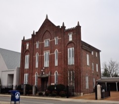 | Hiram Masonic Lodge No. 7 | building | 1973 | 73001859 |
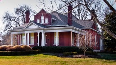 | Robert Hodge House | building | 2005 | 05001224 |
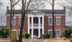 | Thomas Holt House | building | 1988 | 88000274 |
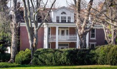 | Homestead Manor | building | 1977 | 77001300 |
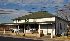 | Huff Store | building | 1988 | 88000321 |
| John Hunter House | building | 1988 | 88000319 | |
| Hartwell B. Hyde House | building | 1988 | 88000318 | |
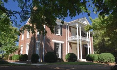 | James P. Johnson House | building | 1988 | 88000316 |
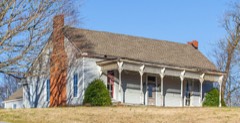 | William W. Johnson House | building | 1988 | 88000314 |
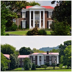 | James Johnston House | building | 1976 | 76001807 |
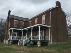 | Newton Jordan House | building | 1988 | 88000298 |
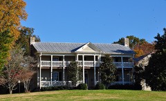 | Jordan-Williams House | building | 1988 | 88000341 |
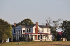 | Claiborne Kinnard House | building | 1988 | 88000355 |
| Knight-Moran House | building | 1988 | 88000295 | |
 | Knights of Pythias Pavilion | building | 1988 | 88000292 |
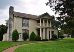 | William Leaton House | building | 1988 | 88000357 |
| Samuel B. Lee House | building | 1988 | 88000300 | |
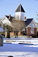 | Leipers Fork Historic District | district | 1998 | 98000818 |
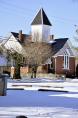 | Leipers Fork Historic District (Boundary Increase) | district | 2012 | 12000967 |
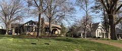 | Lewisburg Avenue Historic District | district | 1988 | 88000312 |
| Liberty Hill School | building | 1988 | 88000315 | |
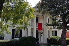 | Lotz House | building | 1976 | 76001809 |
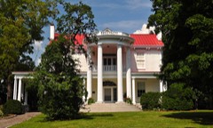 | Maney-Sidway House | building | 1988 | 88000333 |
| Maplewood Farm (Boundary Increase) | building | 1993 | 92001758 | |
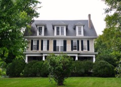 | William Martin House | building | 1988 | 88000334 |
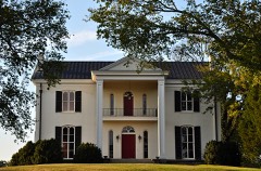 | H. G. W. Mayberry House | building | 1988 | 88000363 |
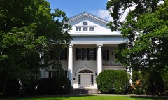 | Henry H. Mayberry House | building | 1988 | 88000335 |
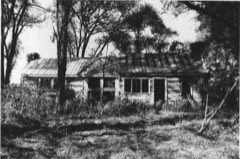 | David McEwen House | building | 1988 | 88000360 |
 | McGavock-Gaines House | building | 1988 | 88000329 |
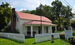 | McLemore House | building | 1999 | 99001372 |
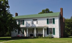 | Daniel McMahan House | building | 1988 | 88000331 |
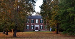 | Meeting-of-the-Waters | building | 1982 | 82004072 |
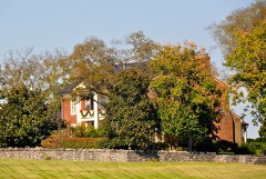 | Montpier | building | 1982 | 82004073 |
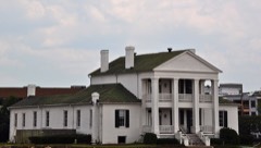 | Mooreland | building | 1975 | 75001797 |
| George W. Morton House | building | 1988 | 88000337 | |
| Samuel S. Morton House | building | 1988 | 88000365 | |
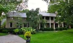 | John Motheral House | building | 1988 | 88000339 |
 | Mountview | building | 1986 | 86003293 |
| Natchez Street Historic District | district | 2004 | 04000030 | |
| John Neely House | building | 1988 | 88000366 | |
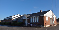 | Nolensville School | building | 2012 | 12000138 |
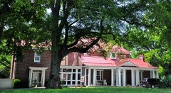 | Oak Hall | building | 1986 | 86000393 |
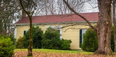 | Dr. Hezekiah Oden House | building | 1988 | 88000322 |
| William Ogilvie House | building | 1988 | 88000323 | |
| Old Town | building | 1988 | 88000324 | |
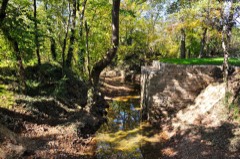 | Old Town Bridge | structure | 1988 | 88000325 |
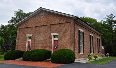 | Owen Chapel Church of Christ | building | 1986 | 86002914 |
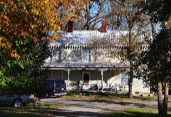 | Dr. Urban Owen House | building | 1988 | 88000326 |
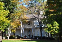 | Owen-Cox House | building | 1988 | 88000327 |
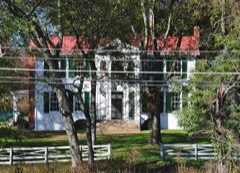 | Owen-Primm House | building | 1988 | 88000328 |
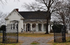 | Parks Place | building | 1984 | 84003753 |
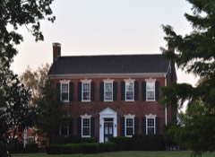 | Nicholas Tate Perkins House | building | 1988 | 88000330 |
| George Pollard House | building | 1988 | 88000336 | |
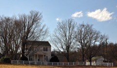 | John Pope House | building | 1988 | 88000338 |
| Mordecai Puryear House | building | 1988 | 88000340 | |
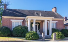 | Rainey House | building | 1970 | 70000621 |
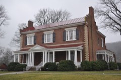 | Ravenswood | building | 1983 | 83003073 |
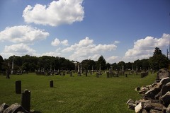 | Rest Haven Cemetery | site | 2012 | 12000947 |
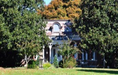 | Y. M. Rizer House | building | 1988 | 88000348 |
| Roper's Knob Fortifications | site | 2000 | 00000353 | |
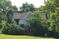 | James Scales House | building | 1988 | 88000350 |
| Joseph Scales House | building | 1988 | 88000351 | |
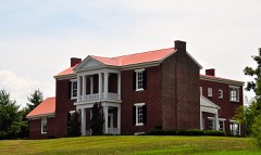 | John Seward House | building | 1988 | 88000352 |
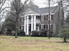 | Thomas Shute House | building | 1988 | 88000367 |
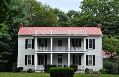 | Alexander Smith House | building | 2005 | 05000186 |
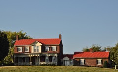 | Nathaniel Smithson House | building | 1988 | 88000353 |
| Smithson-McCall Farm | district | 2007 | 07000158 | |
| Constantine Sneed House | building | 1988 | 88000354 | |
| Sparkman-Skelley Farm | building | 2000 | 00000234 | |
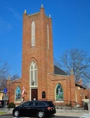 | St. Paul's Episcopal Church | building | 1972 | 72001255 |
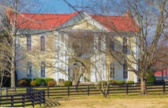 | William Steele House | building | 1988 | 88000356 |
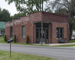 | Thompson Station Bank | building | 1988 | 88000358 |
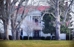 | Beverly Toon House | building | 1988 | 88000361 |
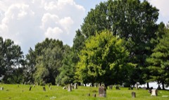 | Toussaint L'Overture County Cemetery | site | 1995 | 95001435 |
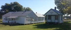 | Triangle School | building | 2007 | 07000663 |
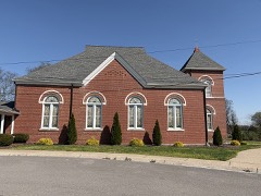 | Trinity United Methodist Curch | building | 1988 | 88000362 |
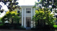 | Alpheus Truett House | building | 1988 | 88000364 |
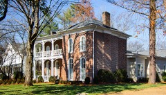 | Andrew C. Vaughn House | building | 1988 | 88000368 |
| WSM Radio Transmission Complex | district | 2011 | 11000087 | |
| James Webb House | building | 1988 | 88000369 | |
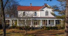 | James Wilhoite House | building | 1988 | 88000370 |
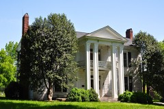 | Joseph Wilson House | building | 1988 | 88000372 |
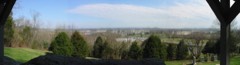 | Winstead Hill | site | 1974 | 74001930 |
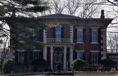 | Winstead House | building | 1979 | 79002486 |
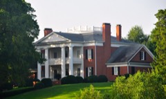 | John M. Winstead Houses | building | 1988 | 88000373 |
| Wyatt Hall | building | 1980 | 80003882 |
Every wildfire the federal occurrence database records inside this county: 49 of them, burning about 425 acres. 2 started naturally and 6 were recorded as arson. Each settlement page carries the fires within five miles of it.
| Reported cause | Fires |
|---|---|
| Debris and open burning | 19 |
| Equipment and vehicle use | 7 |
| Missing data/not specified/undetermined | 7 |
| Arson/incendiarism | 6 |
| Recreation and ceremony | 3 |
| Smoking | 3 |
| Natural | 2 |
| Misuse of fire by a minor | 1 |
| Railroad operations and maintenance | 1 |
The five largest, by the area the report gives. None of them was recorded as arson.
| Date | Cause | Size | Reported by | Name on the report |
|---|---|---|---|---|
| 9 September 1999 | Smoking | 93 acres | Tennessee Division of Forestry | not named |
| 17 March 2007 | Missing data/not specified/undetermined | 60 acres | Tennessee Division of Forestry | CCC ROAD |
| 13 November 2016 | Missing data/not specified/undetermined | 40 acres | Tennessee Division of Forestry | FERNVALE RD FIRE |
| 18 September 2008 | Railroad operations and maintenance | 28 acres | Tennessee Division of Forestry | not named |
| 10 January 2001 | Debris and open burning | 25 acres | Tennessee Division of Forestry | not named |
| 8 February 2009 | Debris and open burning | 25 acres | Tennessee Division of Forestry | OLD HWY 96 |
| 17 March 2000 | Natural | 25 acres | Natchez Trace Parkway | BIG TREE |
| 23 November 2016 | Missing data/not specified/undetermined | 20 acres | Tennessee Division of Forestry | 4820 HARPETH-PEYTONSE RS |
Every settlement page carries the fires within five miles of it - see the settlement index below.
The NOAA Storm Events Database holds 790 reports for this county, causing 6 deaths, 19 injuries and about $57,681,420 in recorded property damage. Each settlement page carries the reports that name it.
| Kind of event | Reports |
|---|---|
| Thunderstorm Wind | 430 |
| Hail | 197 |
| Flash Flood | 73 |
| Lightning | 31 |
| Tornado | 26 |
| Flood | 20 |
| Funnel Cloud | 8 |
| Heavy Rain | 5 |
The most serious of them, by death, then injury, then recorded damage. The accounts are quoted exactly as the forecast office filed them.
| When | Event | Place named | Harm | What the report says |
|---|---|---|---|---|
| December 1988 | Tornado (F4) | not stated | 1 killed, 7 hurt, $25,000,000 | no account filed |
| May 2010 | Flash Flood | Peytonsville | 1 killed, $50,000 | Flash flooding was reported along Peytonsville Road. Portions of Peytonsville Road had fallen into a nearby creek. Also, a fatality occurred when a man drove his vehicle into Garrison Creek at 12:30 PM CST. |
| October 2022 | Thunderstorm Wind | Forest Home | 1 killed, $10,000 | Strong thunderstorm winds downed a tree onto a vehicle on Old Natchez Trace northwest of Franklin. A 22-year-old woman who was driving at the time was killed. |
| May 2020 | Thunderstorm Wind | Harpeth | 1 killed | A tree fell onto and killed a man near Bethesda Road at Highway 431 who was outside playing with his daughter along a creek. |
| April 2011 | Thunderstorm Wind | Mudsink | 1 killed | A woman was struck in the head by a fallen tree limb and then died 24 hours later. |
| June 2003 | Thunderstorm Wind | Franklin | 1 killed | A large tree fell on a minivan during a severe thunderstorm. It killed a 58 year-old woman who was driving southbound on Liberty Church Road. |
| April 2012 | Tornado (EF0) | Franklin | 6 hurt, $75,000 | An NWS Storm Survey confirmed an EF0 tornado touched down in Franklin. Damage began near the intersection of Highway 96 and Founders Point Boulevard where several trees were snapped and minor roof damage occurred. Continuous damage was noted heading to the south-southeast through Jim Warren Park where several vehicles were flipped over causing 6 minor injuries. The tornado continued across a mobile home park along Highway 246 where trees fell onto three mobile homes causing major damage. Numerous other homes in the area suffered shingle, siding, and gutter damage and dozens of other trees were snapped and uprooted. The damage path then turned more to the southeast, moving over a quarry and crossing Highway 31 just north of Highway 397. Damage in this part of the path was confined to snapped trees and tree limbs along with some minor roof damage. The last evidence of damage was between Bluebell Way and Wynbrook Court where several softwood trees were snapped, a fence was blown down, and a patio covering was flipped. |
| April 1972 | Tornado (F1) | not stated | 3 hurt, $250,000 | no account filed |
| August 2001 | Lightning | Fairview | 2 hurt | 2 people were injured in their basement from ball lightning. They had to be life-flighted to a nearby hospital. The ball lightning peeled the bark off a tree, and then flashed through the crawl space of a nearby house under construction, hurting 2 workers. A plumber, who was under the house at the time, but not injured said, "I felt something slide by my arm, and it made my hair stand up. There was a big blue flame, and it rolled through the center of the house. It was like a big, blue ball." |
| May 2003 | Tornado (F3) | Franklin | 1 hurt, $2,200,000 | 43 homes were damaged and 3 homes were destroyed in Williamson County by the tornado. 28 units in the Executive House condominium complex in Franklin had to be evacuated after the roof was torn away. Crews worked Sunday to free people trapped inside their homes by fallen trees on Big East Fork Rd. Most of the damage to homes was roof damage and trees falling on houses.An 84-year-old grandmother was rescued from a demolished 3-story home at 1933 Old Hillsoboro Rd. She received a fractured pelvic bone. |
| May 2010 | Flood | Nolensville | $10,000,000 | Nolensville road, south of Nashville, was flooded. Some cars were left abandoned. Details concerning amount of damage to cars abandoned were unknown. Also, numerous homes, numerous businesses, numerous non comercial buildings, along with several county, state, and federal roads across the county received damage due to the flood. |
| March 2017 | Tornado (EF1) | Berrys Chapel | $7,270,000 | An EF-1 tornado touched down along Hillsboro Road just northwest of the city of Franklin, then moved rapidly east-northeast across the Cool Springs and Brentwood areas of northern Williamson County before lifting just west of the Davidson County line. The first evidence of damage was several trees blown down in the Monticello neighborhood on Poteat Place and Spencer Creek Road near Hillsboro Road. Two sheds were destroyed and more trees snapped and uprooted along South Berrys Chapel Road. Several more trees were blown down and an outbuilding damaged along Mallory Station Road and Jackson Lake Drive, and numerous homes suffered minor to moderate roof, siding, and chimney damage along Sunrise Circle and Brentwood Pointe. Several businesses suffered damage along Mallory Lane and Galleria Boulevard including blown out garage doors and roof damage, and a video of the tornado was taken from a car dashcam on Commerce Way. The tornado then weakened as it crossed Interstate 65, but still blew down seven interstate highway signs along the roadway. As the tornado moved through Brentwood, it continued to blow down trees and cause minor damage to homes and businesses on Westgate Circle, Gordon Petty Drive, Wilson Pike, Demery Court, Crockett Road, and in the Governor's Club neighborhood. The tornado then intensified as it traveled down Concord Road, with dozens of trees snapped and uprooted and numerous homes suffering roof and exterior damage. The tornado then lifted near Owl Creek Park along Chestnut Springs Road just before reaching the Davidson County line. Preliminary estimates from Williamson County Emergency Management indicated that 472 homes and businesses received minor damage, 49 sustained moderate damage, and one home on Sunrise Circle suffered major damage for a total of 522 damaged structures. Damage totals are estimated at 7.27 million dollars. |
| May 2003 | Tornado (F1) | Franklin | $3,000,000 | 85 homes were damaged, 2 barns were destroyed and 5 businesses were damaged. |
| October 2010 | Lightning | Mallorys | $1,750,000 | A lightning strike set fire to a house, whose original value was estimated to be near 2.45 million dollars, on Chatfield Way, resulting in a fire that initially broke through the roof and became visible from Cool Springs Boulevard before firefighters could get on the scene. This home received substantial fire damage. The home was located in Cool Springs in the Enclave at Cambridge Community. |
| March 2021 | Flash Flood | Clovercroft | $1,500,000 | Major flash flooding affected northern Williamson County, with many roadways flooded and closed, many homes and businesses flooded, and numerous water rescues conducted from vehicles and homes. Roads were flooded and closed and homes were flooded around Harpeth River Drive and Granny White Pike at Belle Rive Drive in Brentwood, the Fieldstone Farms and the Meadowgreen Acres subdivisions on Hillsboro Road in Franklin. A river gauge on the Little Harpeth River at Granny White Pike crested at 16.20 feet at 135 am CDT. |
| May 2020 | Thunderstorm Wind | Mallorys | $703,420 | Numerous trees and power lines were blown down across Williamson County. Multiple large trees were blown down 1 mile north of the Concord Road and Wilson Pike intersection, including one tree that fell onto a dog kennel. |
| May 1999 | Thunderstorm Wind | Fairview | $476,000 | Small trees were across the road. Some homes received damage to chimneys and roofs. |
| September 2020 | Flash Flood | Nolensville | $400,000 | Major flash flooding affected the Nolensville area. Several homes, businesses, and other buildings were flooded. Some of the buildings flooded included the Williamson County Parks and Recreation Center, located at 7250 Nolensville Road, which suffered damage estimated at $321,663.47; the Mill Creek Church of Christ at 7260 Nolensville Road; and the historic Nolensville School at 7248 Nolensville Road. Numerous roads were also flooded and closed including Baronswood Drive, Kidd Road, Nolensville Road, Sunset Road, York Road, Old Clovercroft Road, Summerlyn Drive, Oldham Drive, Concord Road, Rocky Springs Road, Rocky Ford Road, Stonebrook Blvd., Dortch Lane, McFarlin Road, Fly Road, and Brittain Lane. The Brittain Lane bridge over Mill Creek was damaged by the flooding and indefinitely closed. Five water rescues were conducted in the area with many vehicles submerged. |
| July 2024 | Lightning | Nolensville | $250,000 | House was stuck by lightning in Nolen Meade subdivision. Fire heavily damaged the attic and top floor. Four firefighters were injured due to smoke inhalation. Damages are a rough estimate. |
| February 2008 | Tornado (EF2) | Lampley Store | $250,000 | Homes damaged in Leaper Fork area. One house collapsed and another hit on Cold Water Rd. |
| February 1986 | Tornado (F0) | not stated | $250,000 | no account filed |
| February 1976 | Tornado (F1) | not stated | $250,000 | no account filed |
| May 2003 | Thunderstorm Wind | Fairview | $206,000 | A well built home was 75 percent destroyed by strong winds. |
| May 2003 | Lightning | Franklin | $141,000 | Lightning struck and burned down a home. The house was completely destroyed on Shady Glen Ct., near Franklin. |
| May 2024 | Lightning | Mudsink | $100,000 | A lightning strike was the likely cause of a house fire along Heritage Court in Franklin. Significant damage occurred to the garage of the home, and one resident was rescued. Damages are a rough estimate. |
| May 2024 | Hail | Leipers Fork | $100,000 | Three inch hail was reported in the Leipers Fork area. Many vehicles sustained damage due to broken windows and car dents. Damages are a rough estimate. |
| April 2023 | Lightning | Arno | $100,000 | Lightning struck a Williamson County home in The Grove subdivision in College Grove. Officials reported that the fire began in the attic, and the home was severely damaged. No injuries were reported, and damages are a rough estimate. |
| August 2023 | Tornado (EF0) | Ewingville | $100,000 | A brief, weak EF0 tornado touched down 1.2 miles northeast of downtown Franklin and moved southeast before lifting near Highway 96 at Royal Oaks Boulevard. The main damage was numerous trees being blown down along the intermittent damage path with some falling onto homes. A few homes suffered minor roof and exterior damage near the beginning of the path between Sycamore Drive and Chestnut Lane, and some businesses had minor roof and exterior damage along Highway 96. Maximum winds with this tornado were estimated 75 mph. Damages are a rough estimate. |
| February 2019 | Lightning | Fairview | $100,000 | A powerful positive cloud to ground lightning bolt struck four separate homes in Fairview. All four homes, which were located in the 7100 block of Glenhaven Drive, 7200 block of Dogwood Drive, 7300 block of Dogwood Drive, and the 1000 block of Brayden Drive, suffered minor to moderate fire and smoke damage. |
| January 2013 | Tornado (EF0) | Ewingville | $100,000 | An EF0 tornado touched down west of Fort Granger Drive just to the east of downtown Franklin. Two businesses on Fort Granger drive and two others on Eddy Lane received roof and siding damage with sheet metal blown into adjacent forests and fields. A pavilion was damaged by a falling tree at Liberty Elementary School. Several homes and a church had minor roof damage along Liberty Pike, Cadet Lane, and Flintlock Drive. Additional homes received minor roof and siding damage in the Liberty Hills Drive area including on Sedgewick Place before the tornado lifted. |
| July 2012 | Lightning | Mallorys | $100,000 | Lightning struck a home in the 5800 block of Cloverland Park Drive and started a fire that caused heavy damage to the home. |
| May 2000 | Flash Flood | Franklin | $100,000 | The flood waters were up to windows in an elementary school near Highway 96 and Nolensville Rd. 38 people at an assisted living center were evacuated. The living center received considerable water damage. |
| January 2013 | Tornado (EF0) | College Grove | $80,000 | An EF0 tornado touched down west of Horton Highway around 3 miles west of Eagleville. Farm buildings on the west side of Horton Highway were damaged with one outbuilding destroyed. Several trees were also snapped or uprooted. The tornado then crossed Horton Highway into Rutherford County. |
| January 2013 | Tornado (EF0) | Bending Chestnut | $60,000 | An EF0 tornado touched down near the intersection of Pinewood Road and Walker Hill Road in southwestern Williamson County where approximately 30 trees were snapped or uprooted and one outbuilding lost part of its roof. The path continued across Highway 840 into an inaccessible portion of Williamson County north of Highway 46. |
| October 2022 | Thunderstorm Wind | Fairview | $50,000 | Downed trees on Festival Ct in Fairview destroyed three trailer homes. No injuries are known, and damages are estimated. |
| June 2018 | Thunderstorm Wind | Southall | $50,000 | Numerous Twitter tSpotter photos showed around one dozen trees snapped and uprooted along King Lane. Two cars at a residence were destroyed by fallen trees. |
| June 2014 | Thunderstorm Wind | Parry | $50,000 | A microburst struck southern Franklin along Henpeck Lane and in the Oak Leaf subdivision. A power pole was snapped along Henpeck Lane and several homes suffered minor roof and siding damage. Dozens of trees were snapped or uprooted. Winds were estimated around 70 mph. |
| May 2012 | Lightning | Forest Home | $50,000 | Lightning struck a home on 401 Brickenhall Drive. Several bricks from a roof chimney were blown off, a nine inch whole occurred in the roof, electrical damage occurred to the home security system, garage door, and second story HDAC unit. |
| July 2012 | Lightning | Kingfield | $50,000 | A barn that was hit by lightning burned to the ground in Leipers Fork, and a car within that barn exploded. |
| February 2011 | Thunderstorm Wind | Mallorys | $50,000 | In the Carriage Hills Subdivision near Ravenwood High School, fences were blown down, play equipment was blown around and damaged, and minor roof damage to several homes occurred. Trees were also blown down in this area. |
| July 2011 | Flash Flood | Mallorys | $50,000 | Several cars were trapped on water-covered roads including Cool Springs Blvd., Bakers Bridge Avenue, and Duke Drive. Media also reported that water rescues occurred in this area, along with railroad trains having to be diverted following damage to the railroad tracks near Moores Lane in south Brentwood, where about four feet of floodwaters inundated Empire Beauty School and a BP gas station on either side of these tracks. Specific details on amount of damage and associated damage repair costs to the Empire Beauty School and the BP gas station where unknown. |
| May 2010 | Flash Flood | Cross Keys | $50,000 | Buchanan Road was completely washed out with trunks of trees floating in it. |
| October 2010 | Thunderstorm Wind | Berrys Chapel | $50,000 | Tree limbs were downed on power lines on Panorama Drive. A gas meter was also on fire about ten houses down from where the limbs on power line were downed on Panorama Drive. A tree was also reported down on a car at Twin Springs Court. Power lines were downed at various locations across Brentwood resulting in power outages. |
| June 2010 | Thunderstorm Wind | Arrington | $50,000 | Trees were reported down across the entire county. Most recent report received at this time was a tree blocking State Highway 96 just east of the Arrington Post Office. |
| June 1998 | Flash Flood | Franklin | $50,000 | News article reported 30 homes sustained water damage from flash flooding in Brentwood. |
| May 1997 | Flash Flood | Fairview | $50,000 | High water on roads, especially Old Franklin Road. The water caused some damage to the road. |
| May 1997 | Flash Flood | Fairview | $50,000 | Several stores suffered high water invasion. |
| May 1997 | Thunderstorm Wind | Fairview | $50,000 | Trees and wires were down. |
| November 1994 | Thunderstorm Wind | Burwood | $50,000 | Ten structures were damaged and five others were destroyed. |
| June 2019 | Thunderstorm Wind | Boston | $30,000 | Williamson County Public Safety employee reported 25-30 large trees uprooted and 15 trees with tops broken off along Sycamore Road. |
| January 2013 | Thunderstorm Wind | Reeds Store | $30,000 | An NWS Storm Survey found a two mile long by one half mile wide area of wind damage in far southeast Williamson County. Two barns were damaged on Flat Creek Road and two homes had roof and siding damage on Glenn Road. Numerous trees were snapped or uprooted on Comstock Road and Cross Keys Road. Winds were estimated around 80 mph. |
| May 2010 | Thunderstorm Wind | Forest Home | $30,000 | Numerous large trees were broken and uprooted. Trees fell and brought down power lines and poles along Old Natchez Trace. Only minor property damage was noted, including damage to fences. Damage at the intersection of Sneed and Old Natchez Trace was due to flooding of the Harpeth River. Some areas were inaccessible for close survey due to flooded conditions, but it appeared most of the damage was focused along Old Natchez Trace. Sporadic tree damage was also observed on Sawyer Bend Rd. and Vaughn Rd. |
| June 1999 | Lightning | Franklin | $30,000 | Lightning struck a subsation on Eddy Lane. The lightning damaged a breaker, insulators, and lightning arrestors. 8000 customers were without power. |
| June 1998 | Lightning | Franklin | $30,000 | News article states that lightning struck a home on 1221 Temple Ridge Dr. and started a fire on the roof. The fire on the roof then spread to the attic and walls of the house. |
| March 2025 | Tornado (EF0) | Craigfield | $25,000 | This narrative is a continuation of the EF-0 tornado that began in far eastern Hickman County. After crossing into far western Williamson County, the tornado snapped and uprooted several trees in the Pinewood Substation. The tornado crossed Interstate 840, causing additional timber damage along Liberty Road before dissipating as it crossed Valley Road. Damages are a rough estimate. |
| April 2025 | Thunderstorm Wind | Triune | $25,000 | Severe thunderstorm winds destroyed a pergola near the Kings Chapel Community. Damages are a rough estimate. |
| April 2025 | Thunderstorm Wind | Liberty Hill | $25,000 | A tree fell on a house and a carport on Pine Crest Court in Fairview from a tornado-warned thunderstorm. Damages are a rough estimate. |
| April 2025 | Thunderstorm Wind | Liberty Hill | $25,000 | Severe thunderstorm winds significantly damaged a metal workshop and outbuilding and caused nearby timber damage. Damages are a rough estimate. |
| November 2025 | Thunderstorm Wind | Berrys Chapel | $25,000 | Severe thunderstorm winds broke or uprooted about eight to ten trees in the area of Chapel Court and Brookside Drive in Franklin. One home had minor tree where a tree fell on it and broke the wooden structure of the soffit. Damages are a rough estimate. |
| June 2019 | Thunderstorm Wind | Calle | $25,000 | A NWS storm survey determined that an approximately 3.2 mile long by 1 mile wide microburst struck northeastern Thompson's Station and northern Spring Hill, from near I-840 at Highway 31 southeastward across Critz Lane, Thompson's Station Road, and Buckner Road to near I-65. Numerous trees were snapped and uprooted, power poles were blown down, and minor roof and exterior damage occurred to some homes, businesses, and other buildings including Summit High School. Winds were estimated at mainly 60 to 70 mph with pockets of higher winds reaching 80 to 85 mph. |
The Survey's mineral resources record lists 94 workings inside this county. 12 still produce and 82 are closed or unrecorded. Each settlement page carries the workings within five miles of it.
| Commodity | Workings |
|---|---|
| Phosphorus-Phosphates | 87 |
| Stone, Crushed/Broken | 3 |
| Stone, Crushed/Broken, Limestone, General | 2 |
| Lead | 1 |
| Zinc, Fluorine-Fluorite, Barium-Barite | 1 |
| Aluminum | 1 |
| Lead, Zinc, Fluorine-Fluorite, Barium-Barite | 1 |
The least common of them first, because a county's hundredth gravel pit says nothing its first ten did not.
| Where | Site | Commodity | Status | Recorded |
|---|---|---|---|---|
| Holt | Lead, Zinc, Fluorine-Fluorite, Barium-Barite | Past Producer | ||
| Holt Mine | Lead, Zinc, Fluorine-Fluorite, Barium-Barite | Past Producer | Vein | |
| Tillman No 113 | Aluminum, Phosphorus-Phosphates | Past Producer | ||
| Franklin Plant | Stone, Crushed/Broken, Limestone, General | Producer | Limestone | |
| Williamson County Highway Department Quarry | Stone, Crushed/Broken, Limestone, General | Producer | Limestone | |
| Franklin Pit & Plant | Stone, Crushed/Broken | Past Producer | ||
| Franklin Quarry | Stone, Crushed/Broken | Producer | ||
| Globe Quarry | Stone, Crushed/Broken | Producer | ||
| Adair/Hooker Phosphate Pit | Phosphorus-Phosphates | Producer | ||
| Amos | Phosphorus-Phosphates | Producer | 1920 | |
| Anthony Pit | Phosphorus-Phosphates | Past Producer | ||
| Anthony Pit | Phosphorus-Phosphates | Past Producer | ||
| Battlefield Hood #862 | Phosphorus-Phosphates | Occurrence | ||
| Battlefield No. 580 Prospect | Phosphorus-Phosphates | Occurrence | ||
| Battlefield No.862 Prospect | Phosphorus-Phosphates | Occurrence | ||
| Battlefield Number 1062 Pit | Phosphorus-Phosphates | Past Producer | ||
| Battlefield Number 422 Pit | Phosphorus-Phosphates | Past Producer | ||
| Battlefield Number 422 Pit | Phosphorus-Phosphates | Past Producer | ||
| Battlefield Number 697 Pit | Phosphorus-Phosphates | Past Producer | ||
| Battlefield Number 697 Pit | Phosphorus-Phosphates | Past Producer | ||
| Battlefield Pewitt #580 | Phosphorus-Phosphates | Occurrence | ||
| Battlefield Pit | Phosphorus-Phosphates | Producer | ||
| Calicott | Phosphorus-Phosphates | Past Producer | 1920, 1976 | |
| Dallas | Phosphorus-Phosphates | Prospect | 1920 | |
| Dallas Number 431 Pit | Phosphorus-Phosphates | Past Producer | ||
| Dallas Number 431 Pit | Phosphorus-Phosphates | Past Producer | ||
| Hooker Chemical Company No.4 | Phosphorus-Phosphates | Unknown | ||
| Huddleston #304 | Phosphorus-Phosphates | Occurrence | 1969 | |
| Momoco Number 343 Pit | Phosphorus-Phosphates | Past Producer | ||
| Monaco | Phosphorus-Phosphates | Producer | ||
| Monco Number 345 Pit | Phosphorus-Phosphates | Past Producer | ||
| Monoco | Phosphorus-Phosphates | Past Producer | 1920, 1960 | |
| Monoco No 343 Pit | Phosphorus-Phosphates | Past Producer | ||
| Monoco No 345 Pit | Phosphorus-Phosphates | Past Producer | ||
| Monoco No 349 Pit | Phosphorus-Phosphates | Past Producer | ||
| Monoco Number 349 Pit | Phosphorus-Phosphates | Past Producer | ||
| Monoco Number 361 Pit | Phosphorus-Phosphates | Past Producer | ||
| Monoco Number 361 Pit | Phosphorus-Phosphates | Past Producer | ||
| Monoco Number 392 Pit | Phosphorus-Phosphates | Past Producer | ||
| Monoco Number 392 Pit | Phosphorus-Phosphates | Past Producer | ||
| Monsanto Chemical Co. Tipple Site | Phosphorus-Phosphates | Past Producer | ||
| Monsanto Phosphate Deposit No. 13 | Phosphorus-Phosphates | Prospect | 1920 | |
| Monsanto Phosphate Deposit No.10 | Phosphorus-Phosphates | Unknown | ||
| Monsanto Phosphate Deposit No.11 | Phosphorus-Phosphates | Unknown | ||
| Monsanto Phosphate Deposit No.12 | Phosphorus-Phosphates | Unknown | ||
| Monsanto Phosphate Deposit No.17 | Phosphorus-Phosphates | Unknown | ||
| Monsanto Phosphate Deposit No.20 | Phosphorus-Phosphates | Unknown | ||
| Monsanto Phosphate Deposit No.21 | Phosphorus-Phosphates | Unknown | ||
| Monsanto Phosphate Deposit No.22 | Phosphorus-Phosphates | Unknown | ||
| Monsanto Phosphate Deposit No.23 | Phosphorus-Phosphates | Unknown | ||
| Monsanto Phosphate Deposit No.24 | Phosphorus-Phosphates | Unknown | ||
| Monsanto Phosphate Deposit No.25 | Phosphorus-Phosphates | Unknown | ||
| No. 304 Prospect | Phosphorus-Phosphates | Prospect | ||
| Pearre | Phosphorus-Phosphates | Prospect | 1920 | |
| Prospect Gasser #362 | Phosphorus-Phosphates | Occurrence | ||
| Prospect Harper #351 | Phosphorus-Phosphates | Occurrence | ||
| Prospect No. 362 | Phosphorus-Phosphates | Prospect | ||
| Prospect Number 351 | Phosphorus-Phosphates | Prospect | ||
| Short Estate Number 752 Pit | Phosphorus-Phosphates | Past Producer | ||
| Short Estate Number 752 Pit | Phosphorus-Phosphates | Past Producer | ||
| Short No. 1 Ps-22 | Phosphorus-Phosphates | Producer | 1970 | |
| Short Number 1 Pit Ps-22 | Phosphorus-Phosphates | Past Producer | ||
| Short Number 1 Pit Ps-22 | Phosphorus-Phosphates | Past Producer | ||
| Smithson Pit Ps-21 | Phosphorus-Phosphates | Past Producer | ||
| Smithson Pit Ps-21 | Phosphorus-Phosphates | Past Producer | ||
| Smithson Ps-21 | Phosphorus-Phosphates | Producer | 1971 | |
| Stauffer Phosphate Deposit No.1 | Phosphorus-Phosphates | Unknown | ||
| Stauffer Phosphate Deposit No.2 | Phosphorus-Phosphates | Unknown | ||
| Stauffer Phosphate Deposit No.3 | Phosphorus-Phosphates | Unknown | ||
| Stauffer Phosphate Deposit No.4 | Phosphorus-Phosphates | Unknown | ||
| Stauffer Phosphate Deposit No.5 | Phosphorus-Phosphates | Unknown | ||
| Truett Pit Ps-20 | Phosphorus-Phosphates | Past Producer | ||
| Truett Pit Ps-20 | Phosphorus-Phosphates | Past Producer | ||
| Truett Ps-20 | Phosphorus-Phosphates | Producer | 1962 | |
| Tva Phosphate Deposit No. 39 | Phosphorus-Phosphates | Unknown | ||
| Tva Phosphate Deposit No.30 | Phosphorus-Phosphates | Unknown | ||
| Tva Phosphate Deposit No.31 | Phosphorus-Phosphates | Unknown | ||
| Tva Phosphate Deposit No.33 | Phosphorus-Phosphates | Unknown | ||
| Tva Phosphate Deposit No.34 | Phosphorus-Phosphates | Unknown | ||
| Tva Phosphate Deposit No.36 | Phosphorus-Phosphates | Unknown | ||
| Tva Phosphate Deposit No.37 | Phosphorus-Phosphates | Unknown | ||
| Tva Phosphate Deposit No.38 | Phosphorus-Phosphates | Unknown | ||
| Tva Phosphate Deposit No.40 | Phosphorus-Phosphates | Unknown | ||
| Tva Phosphate Deposit No.41 | Phosphorus-Phosphates | Unknown | ||
| Unnamed | Phosphorus-Phosphates | Prospect | 1920 | |
| Unnamed | Phosphorus-Phosphates | Prospect | 1920 | |
| Wilco | Phosphorus-Phosphates | Producer | 1920 | |
| Wilco Number 252 Pit | Phosphorus-Phosphates | Past Producer | ||
| Wilco Number 252 Pit | Phosphorus-Phosphates | Past Producer | ||
| Wilco Number 253 Pit | Phosphorus-Phosphates | Past Producer | ||
| Wilco Number 253 Pit | Phosphorus-Phosphates | Past Producer | ||
| Wilco Number 258 Pit | Phosphorus-Phosphates | Past Producer | ||
| Wilco Number 258 Pit | Phosphorus-Phosphates | Past Producer | ||
| Williamson County | Phosphorus-Phosphates | Prospect | 1896 |
Named settlements recorded in the Geographic Names Information System, each with the topographic sheets covering it. Villages, hamlets and abandoned places alike. Each is shown with the nearest named watercourse or landform and the survey quadrangle it falls on.
District 5 · 37014 · On Arrington Creek · College Grove quadrangle
12 sheets, 1942 to 1985
District 8 · 37069 · Near Sweeney Hollow · Leipers Fork quadrangle
15 sheets, 1909 to 1985
District 8 · 37069 · On Fulton Creek · Oak Hill quadrangle
18 sheets, 1903 to 1997
District 8 · 37027 · On Beech Creek · Oak Hill quadrangle
18 sheets, 1903 to 1997
No longer a settlement
District 1 · 38476 · Near Hominy Ridge · Primm Springs quadrangle
16 sheets, 1901 to 1986
District 8 · 37069 · On Lynnwood Branch · Leipers Fork quadrangle
15 sheets, 1909 to 1985
District 11 · 37064 · On Quarry Branch · Leipers Fork quadrangle
15 sheets, 1909 to 1985
District 12 · 37067 · On Power Line Branch · Franklin quadrangle
15 sheets, 1909 to 1997
District 6 · 37027 · Near Boiling Springs Mounds · Franklin quadrangle
15 sheets, 1909 to 1997
District 6 · 37027 · On North Sliders Branch · Franklin quadrangle
15 sheets, 1909 to 1997
District 7 · 37027 · On Mallory Branch · Franklin quadrangle
15 sheets, 1909 to 1997
District 11 · 37064 · On Rogers Burn · Franklin quadrangle
15 sheets, 1909 to 1997
District 6 · 37027 · Near Boiling Springs Mounds · Franklin quadrangle
15 sheets, 1909 to 1997
No longer a settlement
District 4 · 37027 · On East Seward Hills Branch · Franklin quadrangle
15 sheets, 1909 to 1997
District 12 · 37064 · On Watson Branch · Franklin quadrangle
15 sheets, 1909 to 1997
District 4 · 37067 · On East Wilson Pike Creek · Franklin quadrangle
15 sheets, 1909 to 1997
District 5 · 37046 · On Grove Creek · College Grove quadrangle
12 sheets, 1942 to 1985
District 6 · 37027 · On Edmondson Branch · Nolensville quadrangle
12 sheets, 1942 to 1985
District 9 · 37069 · On Lynnwood Branch · Leipers Fork quadrangle
15 sheets, 1909 to 1985
District 8 · 37069 · On Parrish Spring Branch · Franklin quadrangle
15 sheets, 1909 to 1997
District 12 · 37064 · On Robinson Spring Branch · Franklin quadrangle
15 sheets, 1909 to 1997
District 6 · 37027 · Near Boiling Springs Mounds · Franklin quadrangle
15 sheets, 1909 to 1997
District 6 · 37027 · Near Boiling Springs Mounds · Franklin quadrangle
15 sheets, 1909 to 1997
District 4 · 37027 · Near Sliders Knob · Franklin quadrangle
15 sheets, 1909 to 1997
District 1 · 37062 · On Walker Branch · Craigfield quadrangle
16 sheets, 1901 to 1986
District 2 · 37174 · On West Fork Aenon Creek · Rally Hill quadrangle
12 sheets, 1936 to 1985
District 6 · 37027 · On North Sliders Branch · Franklin quadrangle
15 sheets, 1909 to 1997
District 10 · 37064 · On North Ewingville Creek · Franklin quadrangle
15 sheets, 1909 to 1997
District 1 · 37062 · On Hickman Branch · Craigfield quadrangle
16 sheets, 1901 to 1986
District 8 · 37069 · Near Lynnwood Hollow · Leipers Fork quadrangle
15 sheets, 1909 to 1985
District 1 · 37064 · Near Black Sulphur Hollow · Fairview quadrangle
16 sheets, 1901 to 1986
No longer a settlement
District 5 · 37046 · Near Rocky Hill · College Grove quadrangle
12 sheets, 1942 to 1985
No longer a settlement
District 9 · 37069 · Near High Point · Leipers Fork quadrangle
15 sheets, 1909 to 1985
District 7 · 37027 · Near Reed Hollow · Oak Hill quadrangle
18 sheets, 1903 to 1997
District 11 · 37064 · On Donelson Creek · Franklin quadrangle
15 sheets, 1909 to 1997
District 1 · 37062 · Near Mangrum Hollow · Fairview quadrangle
16 sheets, 1901 to 1986
District 8 · 37069 · Near Sweeney Hollow · Leipers Fork quadrangle
15 sheets, 1909 to 1985
District 8 · 37069 · On Fulton Creek · Bellevue quadrangle
17 sheets, 1903 to 1997
District 2 · 37064 · On Goose Creek · Bethesda quadrangle
17 sheets, 1909 to 1985
District 2 · 37064 · On Edgmon Branch · Bethesda quadrangle
17 sheets, 1909 to 1985
District 4 · 37067 · Near Molly Hollow · Nolensville quadrangle
12 sheets, 1942 to 1985
District 8 · 37069 · On Parrish Spring Branch · Franklin quadrangle
15 sheets, 1909 to 1997
District 8 · 37069 · Near Lynnwood Hollow · Leipers Fork quadrangle
15 sheets, 1909 to 1985
District 7 · 37027 · Near Reed Hollow · Oak Hill quadrangle
18 sheets, 1903 to 1997
District 4 · 37067 · On Herbert Branch · Nolensville quadrangle
12 sheets, 1942 to 1985
District 8 · 37221 · On Little Harpeth River · Bellevue quadrangle
17 sheets, 1903 to 1997
District 8 · 37069 · On Little Harpeth River · Bellevue quadrangle
17 sheets, 1903 to 1997
District 9 · 37069 · Near High Point · Leipers Fork quadrangle
15 sheets, 1909 to 1985
District 4 · 37027 · Near Boiling Springs Mounds · Franklin quadrangle
15 sheets, 1909 to 1997
District 5 · 37014 · Near Daddy Knob · Nolensville quadrangle
12 sheets, 1942 to 1985
District 1 · 37062 · Near Mangrum Hollow · Fairview quadrangle
16 sheets, 1901 to 1986
District 5 · 37064 · On Starnes Creek · College Grove quadrangle
12 sheets, 1942 to 1985
District 7 · 37027 · On Beech Creek · Oak Hill quadrangle
18 sheets, 1903 to 1997
District 9 · 37064 · Near Pewitt Hollow · Leipers Fork quadrangle
15 sheets, 1909 to 1985
District 8 · 37069 · Near Lynnwood Hollow · Franklin quadrangle
15 sheets, 1909 to 1997
District 10 · 37064 · On Reese Creek · Leipers Fork quadrangle
15 sheets, 1909 to 1985
District 11 · 37064 · Spring Hill quadrangle
14 sheets, 1909 to 1985
No longer a settlement
District 10 · 37064 · On Baugh Branch · Franklin quadrangle
15 sheets, 1909 to 1997
No longer a settlement
District 10 · 37064 · On Berrys Chapel Branch · Franklin quadrangle
15 sheets, 1909 to 1997
No longer a settlement
District 8 · 37069 · On Lynnwood Branch · Leipers Fork quadrangle
15 sheets, 1909 to 1985
District 10 · 37064 · On Monticello Creek · Leipers Fork quadrangle
15 sheets, 1909 to 1985
District 9 · 37069 · On Murray Branch · Leipers Fork quadrangle
15 sheets, 1909 to 1985
District 7 · 37027 · On Mallory Branch · Franklin quadrangle
15 sheets, 1909 to 1997
District 7 · 37027 · On Mallory Branch · Franklin quadrangle
15 sheets, 1909 to 1997
No longer a settlement
District 7 · 37027 · Near Reed Hollow · Oak Hill quadrangle
18 sheets, 1903 to 1997
District 1 · 37062 · On Ballard Spring Branch · White Bluff quadrangle
9 sheets, 1930 to 1985
District 11 · 37064 · Near Breezy Hill · Franklin quadrangle
15 sheets, 1909 to 1997
District 11 · 37064 · On Cotton Gin Branch · Franklin quadrangle
15 sheets, 1909 to 1997
District 9 · 37069 · On Brown Creek · Leipers Fork quadrangle
15 sheets, 1909 to 1985
No longer a settlement
District 10 · 37069 · On Reese Creek · Leipers Fork quadrangle
15 sheets, 1909 to 1985
District 6 · 37027 · Near Boiling Springs Mounds · Franklin quadrangle
15 sheets, 1909 to 1997
No longer a settlement
District 8 · 37069 · On Cartwright Creek · Bellevue quadrangle
17 sheets, 1903 to 1997
District 10 · 37064 · On Reese Creek · Leipers Fork quadrangle
15 sheets, 1909 to 1985
District 2 · 37046 · On East Fork Spring Creek · Chapel Hill quadrangle
12 sheets, 1936 to 1985
District 11 · 37064 · On Saw Mill Creek · Franklin quadrangle
15 sheets, 1909 to 1997
District 12 · 37064 · On Robinson Spring Branch · Franklin quadrangle
15 sheets, 1909 to 1997
District 1 · 37062 · Near Fish Pond Hollow · Fairview quadrangle
16 sheets, 1901 to 1986
District 11 · 37064 · On Willoughby Branch · Leipers Fork quadrangle
15 sheets, 1909 to 1985
District 12 · 37064 · On North Ewingville Creek · Franklin quadrangle
15 sheets, 1909 to 1997
District 5 · 37064 · On Starnes Creek · College Grove quadrangle
12 sheets, 1942 to 1985
District 9 · 37064 · On Boyd Mill Branch · Leipers Fork quadrangle
15 sheets, 1909 to 1985
District 8 · 37069 · On Cartwright Creek · Bellevue quadrangle
17 sheets, 1903 to 1997
District 8 · 37069 · On Little Harpeth River · Bellevue quadrangle
17 sheets, 1903 to 1997
District 10 · 37069 · On Glen Echo Branch · Franklin quadrangle
15 sheets, 1909 to 1997
District 8 · 37221 · On Little Harpeth River · Bellevue quadrangle
17 sheets, 1903 to 1997
District 7 · 37027 · Franklin quadrangle
15 sheets, 1909 to 1997
No longer a settlement
District 7 · 37027 · Near Reed Hollow · Franklin quadrangle
15 sheets, 1909 to 1997
District 12 · 37064 · On Saw Mill Creek · Franklin quadrangle
15 sheets, 1909 to 1997
District 8 · 37027 · On Cartwright Creek · Bellevue quadrangle
17 sheets, 1903 to 1997
District 8 · 37069 · On Trace Creek · Bellevue quadrangle
17 sheets, 1903 to 1997
District 8 · 37069 · On Little Harpeth River · Bellevue quadrangle
17 sheets, 1903 to 1997
District 1 · 37062 · On Hickman Branch · Craigfield quadrangle
16 sheets, 1901 to 1986
District 8 · 37069 · On Lynnwood Branch · Leipers Fork quadrangle
15 sheets, 1909 to 1985
District 10 · 37064 · On Carlisle Branch · Leipers Fork quadrangle
15 sheets, 1909 to 1985
District 1 · 37064 · On South Fork Lick Creek · Primm Springs quadrangle
16 sheets, 1901 to 1986
District 12 · 37064 · On North Ewingville Creek · Franklin quadrangle
15 sheets, 1909 to 1997
The vanished settlements of Williamson County: the places named above that are no longer on the map.