 Block
Camden, Tennessee
14 topographic sheets cover this place, the earliest surveyed in 1936 and the latest in 1986. It stands in District 5. It lies in ZIP code area 38320. It stands on Whitfield Creek. The Survey maps it on the Camden quadrangle. 3,674 people lived here at the 2020 count. It stands 449 feet above sea level.
Research this city
On record in Camden
Buildings and businesses the archive holds for this place. Each opens its own page, with the source record it came from.
On the National Register 4 records
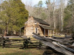 William Thompson Houselisted 1976
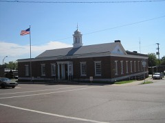 US Post Officelisted 1988
- Reynoldsburg-Paris Roadlisted 2005
- John Rushing Farmlisted 1999
Population over time
2 figuresCamden grew from 3,582 to 3,674 between 2010 and 2020. These are the recorded population figures Wikidata holds for this place, reached through the Geographic Names Information System number this page is keyed on rather than by name, so they belong to this place and not to another of the same name. Most are census counts, but not all are: an early figure may be a founding or settlement estimate, and an estimate published within five years of a census is left out. The change column is computed, and is left blank where more than 20 years separate a figure from the one before it, because a gap that long is not a change between two counts.
| Year | People | Change |
|---|---|---|
| 2010 | 3,582 | |
| 2020 | 3,674 | +92 (+3%) |
Topographic sheets covering this place
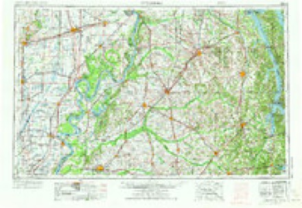
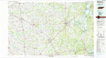
4 surveys from 14 printed sheetsMatched by testing this settlement's coordinate against the published boundary of every sheet in the United States Geological Survey's historical collection. Each opens the scanned sheet at the Survey.
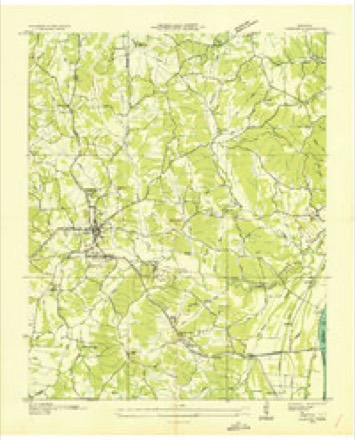
- 1936 USGS Camden quadrangle1:24000
- 1950 USGS Camden quadrangle1:24000, 6 printings
- 1956 USGS Dyersburg quadrangle1:250000, 4 printings
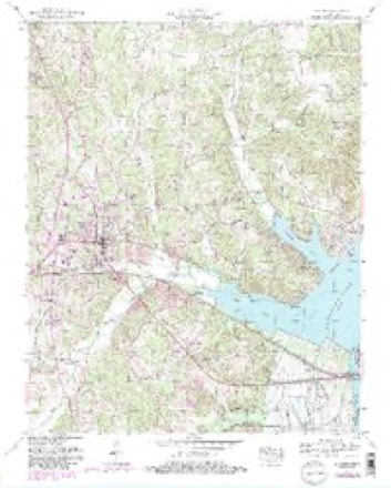
- 1986 USGS McKenzie quadrangle1:100000, 3 printings
Fires near this place
230 since 1997Regional context, not property-specific evidence. The federal wildfire occurrence database lists 230 fires within 5 miles of Camden between 1997 and 2019, burning about 588 acres in total. 1 started naturally. 51 were recorded as arson. Distance is straight-line from the map coordinates, so a fire counted here may appear on a neighbouring settlement's page as well.
| Reported cause | Fires |
|---|---|
| Debris and open burning | 103 |
| Arson/incendiarism | 51 |
| Equipment and vehicle use | 26 |
| Missing data/not specified/undetermined | 18 |
| Railroad operations and maintenance | 9 |
| Other causes | 8 |
| Power generation/transmission/distribution | 5 |
| Misuse of fire by a minor | 4 |
| Recreation and ceremony | 3 |
| Natural | 1 |
| Fireworks | 1 |
| Smoking | 1 |
The most recent of them, most recent first, with the day each was reported and the service that recorded it.
| Date | Cause | Size | Reported by | Name on the report |
|---|---|---|---|---|
| 8 September 2010 | Other causes | 1.0 acres | Tennessee Division of Forestry | REX |
| 7 September 2002 | Missing data/not specified/undetermined | 10 acres | Tennessee Division of Forestry | not named |
| 5 September 2005 | Debris and open burning | 1.0 acres | Tennessee Division of Forestry | not named |
| 5 September 2002 | Debris and open burning | 1.0 acres | Tennessee Division of Forestry | not named |
| 30 September 2010 | Arson/incendiarism | 1.0 acres | Tennessee Division of Forestry | EGGVILLE |
| 27 September 2010 | Arson/incendiarism | 1.0 acres | Tennessee Division of Forestry | 6735CYPRESS |
| 27 September 2010 | Arson/incendiarism | 1.0 acres | Tennessee Division of Forestry | BROWN |
| 27 September 2010 | Arson/incendiarism | 1.0 acres | Tennessee Division of Forestry | LATIMER |
Settlements close enough to share some of these fires:
Mines and quarries near this place
10 of 69 shownRegional context, not property-specific evidence. The federal mineral resources record lists 69 workings within 5 miles of Camden: 37 past producers, 31 producers, 1 plant. 32 still produce. What was taken out: Sand and Gravel, Construction, Silica, Zirconium, Titanium, REE. Distance is straight-line from the map coordinates, so a quarry counted here may appear on a neighbouring settlement's page as well.
| Where | Site | Commodity | Status | Recorded |
|---|---|---|---|---|
| Silica Mine | Silica, Zirconium, Titanium, REE | Producer | Surface | |
| #12 Sullins Pit | Silica | Producer | Unconsolidated Sediments | |
| #6 Brower & Wright Pit | Silica | Producer | Unconsolidated Sediments | |
| #7 Sullins Pit | Silica | Producer | Unconsolidated Sediments | |
| #8 Bobitt Pit | Silica | Producer | Unconsolidated Sediments | |
| Bonds Pit | Silica | Producer | Unconsolidated Sediments | |
| Bonds Pit | Silica | Past Producer | ||
| Hardy and Nunnley Pit | Silica | Producer | Unconsolidated Sediments | |
| Hardy and Nunnley Pit | Silica | Past Producer | ||
| Jordan Pit | Silica | Producer | Unconsolidated Sediments |
Storms near this place
60 of 100 shownRegional context, not property-specific evidence. The National Weather Service names Camden in 100 storm reports between 1993 and 2025: 46 thunderstorm wind, 27 hail, 18 flash flood, 7 tornado. The reports record 1 death and 5 injuries. Each account below is quoted exactly as the forecast office filed it, from the NOAA Storm Events Database, and each date opens the federal record of that event.
| When | Event | Place named | Harm | What the report says |
|---|---|---|---|---|
| January 1999 | Tornado (F3) | Camden | 1 killed, 5 hurt, $1,000,000 | This tornado resulted in the only fatality in Middle Tennessee from the severe weather outbreak of January 22,1999. The tornado killed a 50 year old woman who left her shelter in a brick ranch home located on Cedar Grove Road. She went outside to get her dogs inside her home, and that's when the tornado struck and killed her. Her husband remained inside the home and survived. There were 5 injuries from the tornado. A 1600 square foot frame home was moved 10 to 12 feet from its foundation. 12 homes were destroyed, 33 homes sustained damage and 5 businesses were damaged. Power lines and trees were blown down. The winds picked up a 7500 pound Cadillac, and hurled its engine 300-400 yards into a field. The chassis, its empty metal skin, was hurled even further. |
| November 2005 | Tornado (F2) | Camden | $400,000 | Home destroyed. Roof was gone and walls left standing on a home on French Store Rd. |
| June 2004 | Thunderstorm Wind | Camden | $278,000 | Numerous trees and power lines were blown down. 3 homes had damage because trees fell on them. A 75-foot oak tree, whcih was probably more than 100 years old, fell into another tree, and they both fell on a carport and on a 1995 Ford Aerostar van. The hardest hit areas was in northeast Camden on Wren Avenue, Rowsey Street, and Flatwoods Road. A 500 foot TV tower belonging to Charter Cable fell to the ground. The tower will not be erected, and the metal will be sold for scrap. Dollar damage estimate was from Benton County EMA director. |
| April 2006 | Tornado (F2) | Camden | $250,000 | One home was destroyed, and 15 other homes and businesses had major damage. One home lost its entire roof on Conley Branch Rd. Other homes had roof damage. Numerous large trees were snapped, uprooted or blown down. |
| July 1997 | Thunderstorm Wind | Camden | $100,000 | Local law enforcement reported 2 or 3 trees were blown down on an electrical transformer and one tree fell on a house. |
| March 1997 | Flash Flood | Camden | $80,000 | 4 roads were closed or washed away due to high water. |
| July 1996 | Thunderstorm Wind | Camden | $75,000 | no account filed |
| August 2009 | Thunderstorm Wind | Camden | $50,000 | Trees were reported down countywide, especially in the Camden area. |
| November 2005 | Tornado (F1) | Camden | $50,000 | Home damaged. Part of roof was gone. This storm complex came from Carroll County. This tornado touched done again in Benton County. |
| February 1997 | Thunderstorm Wind | Camden | $50,000 | no account filed |
| March 2023 | Thunderstorm Wind | Camden | $25,000 | Straight-line winds uprooted and snapped trees. A roof was blown off. |
| May 1996 | Thunderstorm Wind | Camden | $20,000 | no account filed |
| May 2012 | Flash Flood | Camden | $10,000 | Several roads flooded northeast of Camden including Ebenezer Road, Joe Corbitt Road, Flatwoods Road, and Cuff Road. Within this area, CoCoRaHS reports measured 5.75 inches of rainfall between 4:45 am and 8:22 am. |
| May 2012 | Thunderstorm Wind | Camden | $10,000 | Several trees were downed in and around Camden. |
| April 2005 | Lightning | Camden | $10,000 | Lightning struck the satellite dish and receiver to radio station WFWL in Camden. The radio station's production control board was also damaged. A new board costs about $2000 to $3000. There was damage to the station's telephone and computer systems as well. |
| February 1997 | Thunderstorm Wind | Camden | $10,000 | no account filed |
| March 2022 | Thunderstorm Wind | Camden | $5,000 | Trees and powerlines down causing power outages. |
| June 2012 | Thunderstorm Wind | Camden | $5,000 | Several trees were blown down on Industrial Road in Camden. |
| April 2006 | Tornado (F1) | Camden | $5,000 | Near U.S. Highway 641, about one mile south of the city limits, a substantial building at the King Trucking Company was destroyed. The roof was gone, and no walls were standing. Debris from this damage was found 2 miles east of this site. |
| June 1997 | Thunderstorm Wind | Camden | $5,000 | A few trees and power lines were down. |
| February 1993 | Thunderstorm Wind | Camden | $5,000 | A mobile home was turned over and several trees were knocked down. |
| May 2003 | Thunderstorm Wind | Camden | $3,000 | Sheriff's office reported roof damage to a restaurant. |
| December 2013 | Thunderstorm Wind | Camden | $2,000 | Trees were blown down on Birdsong Road in Camden. |
| June 2011 | Thunderstorm Wind | Camden | $2,000 | A couple of trees were blown down southwest of Camden. |
| June 1995 | Thunderstorm Wind | Camden | $2,000 | Some tree limbs and power poles were blown down. |
| July 1995 | Thunderstorm Wind | Camden | $2,000 | A few trees and power lines were knocked down. |
| May 2016 | Thunderstorm Wind | Camden | $1,000 | Sign blown down near Birdsong Marina. |
| June 2011 | Thunderstorm Wind | Camden | $1,000 | One tree was blown down in Camden. |
| July 2009 | Lightning | Camden | $1,000 | A large tree was struck by lightning, with several large limbs falling to the ground. |
| January 2006 | Flash Flood | Camden | $1,000 | One and a half feet of water was over Hately Rd. Road was impassable. By 0740 PM CST, several roads were flooded in the southern part of the county. One lady had to be rescued from her vehicle. |
| April 2004 | Flash Flood | Camden | $1,000 | Bethel Church Road was closed due to flooding. |
| June 1997 | Thunderstorm Wind | Camden | $1,000 | A few power lines were down. |
| January 1996 | Thunderstorm Wind | Camden | $100 | no account filed |
| April 2025 | Flash Flood | Camden | - | Multiple roads across Camden and Benton County are flooded and closed due to high water. |
| February 2025 | Hail | Camden | - | Public reports quarter sized hail in downtown Camden. |
| April 2025 | Hail | Camden | - | Golf ball sized hail, about a quarter mile east of the courthouse. |
| May 2024 | Flash Flood | Camden | - | Over 13 roadways in and around the city of Camden that are inundated with water closed to flash flooding. |
| June 2022 | Hail | Camden | - | Dime to nickel sized hail in Camden. |
| June 2022 | Hail | Camden | - | Measured hail of 1.50 inches fell three miles southeast of Camden. |
| June 2022 | Hail | Camden | - | Spotter reports of quarter-sized hail southeast of Camden. |
| December 2019 | Flash Flood | Camden | - | Numerous roads in Camden were flooded due to heavy rainfall. |
| February 2019 | Flash Flood | Camden | - | Several roads in Camden and southern Benton County are covered with 6-8 inches of water and are impassable. |
| March 2017 | Thunderstorm Wind | Camden | - | Large tree uprooted. |
| July 2014 | Thunderstorm Wind | Camden | - | Straight line winds knocked down trees and power lines in and around Camden. |
| June 2014 | Thunderstorm Wind | Camden | - | Straight line winds knocked down trees and power lines in Camden and surrounding areas of Benton County. |
| April 2009 | Hail | Camden | - | As the storm moved across the county, golf ball size hail was reported at multiple locations. Emergency manager report received through newspaper article. |
| February 2009 | Thunderstorm Wind | Camden | - | At the Tennessee National Wildlife Refuge Duck River Unit, a 50 kt wind gust was measured. |
| May 2006 | Thunderstorm Wind | Camden | - | Trees were down at Highway 69 and Mt. Carmel Rd. |
| April 2006 | Hail | Camden | - | Golf ball size hail covering the ground. |
| March 2004 | Thunderstorm Wind | Camden | - | Electric company reported a tree down on a powerline on U.S. Hwy 64, just south of Camden. |
| June 2004 | Tornado (F1) | Camden | - | A NWS trained spotter identified a tornado at the Birdsong Marina. The tornado snapped a tree and uprooted another tree. Wind estimate was 80 to 90 mph. |
| May 2004 | Thunderstorm Wind | Camden | - | Law enforcement reported trees down on U.S. Highway 70 just west of Camden. |
| July 2004 | Thunderstorm Wind | Camden | - | Sheriff's office reported trees were blown down on Eva Rd. |
| August 2003 | Thunderstorm Wind | Camden | - | Camden Police Department reported one tree down and power lines down on West Main in Camden. |
| August 2003 | Hail | Camden | - | Sheriff's office reported golf ball size hail. |
| November 2003 | Flash Flood | Camden | - | EMA reported Bivers-Cypress Creek Road was closed due to high water over the road. |
| April 2003 | Hail | Camden | - | Golf ball size hail reported. |
| May 2003 | Thunderstorm Wind | Camden | - | Spotter reported trees were blown down. |
| December 2002 | Flash Flood | Camden | - | TDOT reported creeks out of their banks. Roads were closed around Camden. |
| January 2002 | Flash Flood | Camden | - | Sheriff reported several streets in Camden were flooded. |
Nearest settlements
The eight closest, with where each one stands in the county. Distances are straight-line, computed from the Geographic Names Information System coordinates.
| Map | Place | Distance | Sheets |
|---|---|---|---|
| Tin Cup | 0.9 miles | 14 | |
| Black Center | 1.0 miles | 14 | |
| Post Oak | 2.3 miles | 11 | |
| Liberty | 2.9 miles | 14 | |
| Bethel | 3.2 miles | 14 | |
| Sandy Point | 3.8 miles | 11 | |
| Prospect | 3.9 miles | 11 | |
| Lipe | 4.5 miles | 11 |
Elsewhere
Matched on this settlement's Geographic Names Information System number rather than its name, so it cannot be a different place of the same name in another state.
| Wikipedia article on Camden | An encyclopaedic summary. Its text is share-alike, so it is linked here rather than copied. |
| Wikidata item Q1208446 | The structured record the population and elevation above come from. Public domain (CC0). |
Provenance
This settlement is recorded in the Geographic Names Information System as feature 1305616. The sheet list is computed by point-in-boundary test against the United States Geological Survey's historical topographic inventory. Both are works of the United States government and carry no copyright under 17 U.S.C. 105.
Wildfire. Short, Karen C. 2022. Spatial wildfire occurrence data for the United States, 1992-2020 [FPA_FOD_20221014]. 6th Edition. Fort Collins, CO: Forest Service Research Data Archive. https://doi.org/10.2737/RDS-2013-0009.6 Collected with United States Government funding and usable without additional permissions or fees.
Mines and quarries. USGS Mineral Resources Data System (MRDS) https://mrdata.usgs.gov/mrds/ A work of the United States government, no copyright under 17 U.S.C. 105.
Storms. NOAA National Centers for Environmental Information, Storm Events Database https://www.ncei.noaa.gov/stormevents/ A work of the United States government, no copyright under 17 U.S.C. 105. Narratives are quoted verbatim from the National Weather Service report and are not edited or summarised.