 Block
Clarksville, Tennessee
11 topographic sheets cover this place, the earliest surveyed in 1944 and the latest in 1997. It stands in District 5. It lies in ZIP code area 37040. It lies near Gallows Hollow. The Survey maps it on the Clarksville quadrangle. 166,722 people lived here at the 2020 count. It stands 476 feet above sea level.
Research this city
On record in Clarksville
Buildings and businesses the archive holds for this place. Each opens its own page, with the source record it came from.
On the National Register 12 of 38 shown
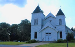 Bethlehem Methodist Church and Cemeterylisted 1994
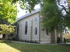 Catholic Church and Rectorylisted 1982
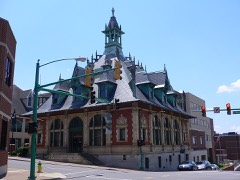 Clarksville Federal Buildinglisted 1972
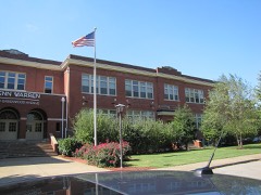 Clarksville High Schoollisted 1983
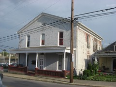 Clarksville Methodist Churchlisted 1982
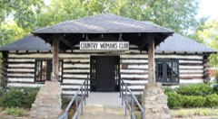 Country Woman's Clublisted 2006
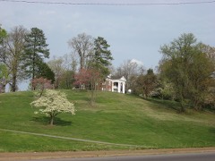 Emerald Hilllisted 1971
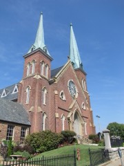 First Presbyterian Churchlisted 1976
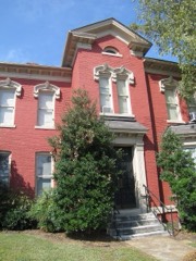 First Presbyterian Church Manselisted 2001
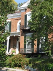 Forbes-Mabry Houselisted 1995
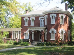 Johnson-Hach Houselisted 1998
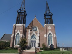 Madison Street Methodist Churchlisted 1976
Population over time
2 figuresClarksville grew from 132,929 to 166,722 between 2010 and 2020. These are the recorded population figures Wikidata holds for this place, reached through the Geographic Names Information System number this page is keyed on rather than by name, so they belong to this place and not to another of the same name. Most are census counts, but not all are: an early figure may be a founding or settlement estimate, and an estimate published within five years of a census is left out. The change column is computed, and is left blank where more than 20 years separate a figure from the one before it, because a gap that long is not a change between two counts.
| Year | People | Change |
|---|---|---|
| 2010 | 132,929 | |
| 2020 | 166,722 | +33,793 (+25%) |
Topographic sheets covering this place
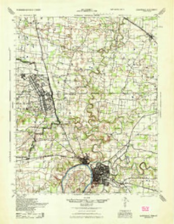
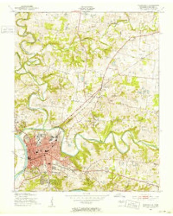
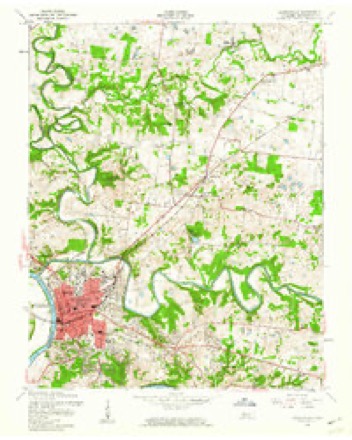
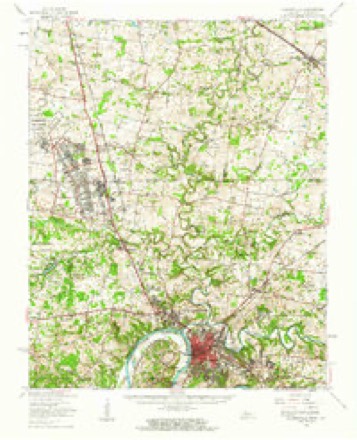
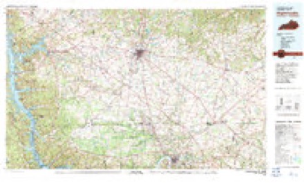
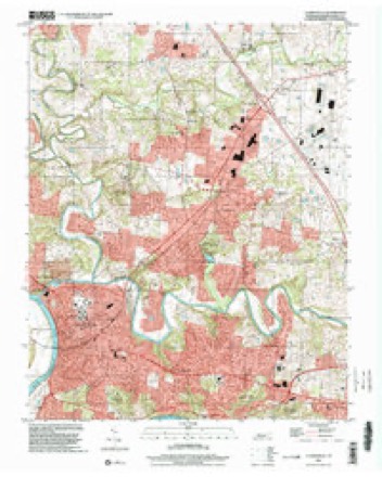
8 surveys from 11 printed sheetsMatched by testing this settlement's coordinate against the published boundary of every sheet in the United States Geological Survey's historical collection. Each opens the scanned sheet at the Survey.
- 1944 USGS Clarksville quadrangle1:50000
- 1951 USGS Clarksville quadrangle1:24000
- 1956 USGS Nashville quadrangle1:250000, 2 printings
- 1957 USGS Clarksville quadrangle1:24000, 3 printings
- 1957 USGS Clarksville quadrangle1:62500
- 1959 USGS Nashville quadrangle1:250000
- 1980 USGS Hopkinsville quadrangle1:100000
- 1997 USGS Clarksville quadrangle1:24000


Fires near this place
6 since 1998Regional context, not property-specific evidence. The federal wildfire occurrence database lists 6 fires within 5 miles of Clarksville between 1998 and 2006, burning about 70 acres in total. None started naturally. None was recorded as arson. Distance is straight-line from the map coordinates, so a fire counted here may appear on a neighbouring settlement's page as well.
| Reported cause | Fires |
|---|---|
| Debris and open burning | 4 |
| Equipment and vehicle use | 1 |
| Recreation and ceremony | 1 |
The most recent of them, most recent first, with the day each was reported and the service that recorded it.
| Date | Cause | Size | Reported by | Name on the report |
|---|---|---|---|---|
| 19 August 1999 | Debris and open burning | 1.0 acres | Tennessee Division of Forestry | not named |
| 15 June 2006 | Equipment and vehicle use | 8.0 acres | Tennessee Division of Forestry | not named |
| 21 March 1999 | Debris and open burning | 46 acres | Tennessee Division of Forestry | not named |
| 17 March 1999 | Debris and open burning | 10 acres | Tennessee Division of Forestry | not named |
| 12 March 2005 | Debris and open burning | 5.0 acres | Tennessee Division of Forestry | not named |
| 3 February 1998 | Recreation and ceremony | under an acre | Tennessee Division of Forestry | not named |
Settlements close enough to share some of these fires:
Mines and quarries near this place
5 within 5 milesRegional context, not property-specific evidence. The federal mineral resources record lists 5 workings within 5 miles of Clarksville: 2 producers, 2 past producers, 1 plant. 3 still produce. What was taken out: Stone, Crushed/Broken, Stone, Crushed/Broken, Limestone, General, Limestone, General, Zinc, Refiner. Distance is straight-line from the map coordinates, so a quarry counted here may appear on a neighbouring settlement's page as well.
| Where | Site | Commodity | Status | Recorded |
|---|---|---|---|---|
| (Facility) Clarksville Smelter | Zinc, Refiner, Sulfur, Sulfuric Acid, Cobalt | Plant | ||
| Clarksville Stone Co. Quarry | Limestone, General | Past Producer | Sedimentary | |
| Simpson Stone Plant | Stone, Crushed/Broken, Limestone, General | Producer | Limestone | |
| Clarksville Stone Co. Quarry | Stone, Crushed/Broken | Past Producer | ||
| Simpson Stone Plant | Stone, Crushed/Broken | Producer |
Storms near this place
60 of 198 shownRegional context, not property-specific evidence. The National Weather Service names Clarksville in 198 storm reports between 1993 and 2025: 121 thunderstorm wind, 41 hail, 19 flash flood, 7 tornado. The reports record 1 death and 9 injuries. Each account below is quoted exactly as the forecast office filed it, from the NOAA Storm Events Database, and each date opens the federal record of that event.
| When | Event | Place named | Harm | What the report says |
|---|---|---|---|---|
| September 2002 | Flood | Clarksville | 1 killed | A 23 year-old-male ignored high water signs and barricades and attempted to drive through standing water of 8 to 10 feet at the intersection of Ashbury Road and Shanee Terrace. The vehicle was submerged under water, and he drowned. Scuba divers had to retrieve the body from the vehicle. |
| January 1999 | Tornado (F3) | Clarksville | 5 hurt, $72,700,000 | An F3 tornado struck Clarksville at 415 AM, travelled through the downtown area and dissipated near St. Bethlehem. There were 5 injuries, 2 of them were for broken bones. Clarksville has a population of 89,000 people is Tennessee's fifth largest city. 25,000 people were without power. The Tornado Warning was issued by the NWS at 354 AM CST. The NOAA Weather Radio alerted the sleepy resident s of Clarksville and urge them to take cover immediately. The tornado ripped apart a 5 block area of downtown Clarksville and teared up buildings in Austin Peay State University. Once the tornado ravaged the city, downtown Clarksville resembled bombed-out London during World War 2. Bricks and glass were strewn everywhere. The photo editor of the Leaf-Chronicle newspaper s, Fred Dye, said "It looked like somebody walked through with a broom and knocked over whatever was loose enough to knock down." The Montgomery county court house was in ruins. The City Fathers planned on rebuilding the court house. It was last rebuilt after a fire in 1878. The Leaf-Chronicle newspaper office was severely damaged. The newspaper had to set up a temporary office in Hopkinsville, KY. 22 buildings were heavily damaged at Austin Peay State University. Also, several old churches were heavily damaged in Clarksville. The Madison Street United Methodist Church lost its spires and roof. It will take about 2 years to rebuild the church. The Trinity Episcopal Church lost its roof. Police closed off downtown Clarksville from 6 PM-6 AM in order to prevent looting. The National Guard was on duty as well. On January 23, FEMA Director James Lee Whitt toured the devastation. He exclaimed, "Wow!" "It's like someone dropped a bomb on it. That's just what it look like." There was a total of 124 buildings destroyed and 562 buildings damaged. These figures included residential, commercial, government, public and buildings at Austin Peay. |
| April 2010 | Thunderstorm Wind | Clarksville | 2 hurt, $18,000 | Tree fell on a car on Trenton road near exit one on I-24. Two people were taken to the hospital with injuries. Extent of injuries was unknown. Shutters were blown off of a house in the same area. |
| May 2003 | Tornado (F3) | Clarksville | 1 hurt, $750,000 | A tornado affected the southeast part of Montgomery County and did damage from Roberts Road, to Fredonia and to Albright Road. 108 homes were damaged. Estimated loss is about 3/4 of a million dollars. The tornado destroyed 2 brick homes on state Highway 12 near Fredonia and a mobile home on Albright Rd. One woman was injured in the mobile home. The Frazier family in the brick home took their 3 children to the basement. Their brick home was ripped to pieces and blown into the nearby woods. A man on Roberts Road said 3 large oak trees were ripped out of the ground and thrown on top of his house. A neighbor's garage from about a 1/4 of a mile away landed on the back of his house. Montgomery County EMA reported 108 homes were damaged by the tornado. |
| May 2005 | Thunderstorm Wind | Clarksville | 1 hurt, $50,000 | Roof was partially blown off an apartment building in the New Providence area of Clarksville. A large oak tree fell on a 108-year-old house on Old Russell Pike. A police officer received minor injuries when his patrol car was struck by a falling tree on Basham Lane. |
| May 2020 | Thunderstorm Wind | Clarksville | $661,750 | Numerous trees and power lines were blown down across Montgomery County including several across Clarksville. |
| November 2005 | Tornado (F2) | Clarksville | $500,000 | Well built brick home lost roof. Very large oak trees snapped around home. This storm complex came from Houston County. |
| March 1997 | Flash Flood | Clarksville | $500,000 | no account filed |
| May 2009 | Flash Flood | Clarksville | $300,000 | Twenty five homes received water damage. One family was trapped in their home, but was eventually rescued. Most homes had water damage in basements and crawl|areas, with three to four homes receiving major water damage of which details of damage unkown. Emergency management officials reported an event total of 5.05 inches of rainfall. Newspaper reported that several roads were impassible due to the|water depth on them. |
| May 2003 | Thunderstorm Wind | Clarksville | $250,000 | Spotter estimated wind gusts around 60 mph near the Tennessee and Kentucky state line. There was damage to the roof over the gymnasium of St. Bethlehem Elementary School on Old Russellville Pk. |
| July 2002 | Lightning | Clarksville | $200,000 | One home in Colonial Estate off Rossview Road was destroyed after a lightning strike. Also, a second home on Lillian Drive was severely damaged by lightning. |
| May 2009 | Thunderstorm Wind | Clarksville | $100,000 | Straight line wind damage occurred in the Hampton and Sango Road areas of Clarksville. Tree fell on school bus and caused major damage to bus. Numerous other trees and power lines down across this area. |
| February 2008 | Thunderstorm Wind | Clarksville | $100,000 | Five houses were destroyed, and 8 mobile homes were damaged. |
| May 1998 | Thunderstorm Wind | Clarksville | $80,000 | Local EMA officials reported trees were blown down county wide. Clarksville Department of Electricity, according to newspaper accounts, said it would cost $80,000 to repair downed power lines by trees. |
| July 2009 | Lightning | Clarksville | $75,000 | About 200 households lost power in northern portions of Clarksville when the Edgeton substation was struck by lightning. Power lines and transformers associated with the substation were damaged also. |
| July 2024 | Thunderstorm Wind | Clarksville | $50,000 | A few trees fell in Clarksville with some falling on mobile homes in New Providence. Damages are a rough estimate. |
| May 2010 | Flash Flood | Clarksville | $50,000 | One and a half feet of water was over Meadow Green Drive and Cloverdale Drive. There was also water ponding in several yards. |
| June 2009 | Thunderstorm Wind | Clarksville | $50,000 | Trees and power lines were downed county wide. |
| July 2009 | Thunderstorm Wind | Clarksville | $50,000 | Trees were reported down across the entire county. |
| May 1999 | Flash Flood | Clarksville | $50,000 | Flooding was reported around Mallard Drive and Minor Drive off Tiny Town Road. Some homes and cars were flooded. There was also flooding at Dunbar Cave Road and S.R. 374, along U.S. Hwy 41-A near Ft. Campbell, on Trenton Road and Power Street. |
| July 1998 | Flash Flood | Clarksville | $50,000 | Sheriff's department reported 10-15 houses flooded in the northern part of town. |
| September 2006 | Tornado (F0) | Clarksville | $40,000 | An F0 tornado with winds about 70 mph snapped and blew down a few trees. A utility pole was snapped. A shed was destroyed at 1990 Old Oak Plains Rd. Trees were down at 1992 and 1989 Oak Plains Rd. |
| May 2025 | Thunderstorm Wind | Clarksville | $25,000 | Severe thunderstorm winds downed multiple trees and powerlines across Montgomery County. One tree fell onto a home in Clarksville. Damages are a rough estimate. |
| May 2024 | Thunderstorm Wind | Clarksville | $25,000 | Severe thunderstorm winds downed trees and power lines near Clarksville. A couple trees fell onto homes, and one tree fell onto an apartment building. No injuries were reported. Damages are a rough estimate. |
| February 2018 | Thunderstorm Wind | Clarksville | $25,000 | A small section of the Dunn Center arena at Austin Peay State University was blown off, leaving a small hole in the roof. An ongoing Austin Peay/Murray State basketball game was delayed by debris from the roof damage and rain water leaking onto the arena floor. One girl was struck by debris falling from the roof and taken to the hospital as a precaution but was uninjured. Near the campus, a grocery store had windows blown out. |
| January 2012 | Thunderstorm Wind | Clarksville | $25,000 | Several trees and power lines were downed across the county. |
| July 2012 | Thunderstorm Wind | Clarksville | $25,000 | Several trees were downed across the county. |
| July 2012 | Thunderstorm Wind | Clarksville | $25,000 | Numerous trees and power lines were blown down across Clarksville. Roads with trees down on them included Paradise Hill Road, Cumberland Drive, Crossland Avenue, and Tanglewood Drive. A power pole fell on a building on Golf Club Lane also. Specific details concerning if any damage occurred to the building were unknown. |
| May 2011 | Thunderstorm Wind | Clarksville | $25,000 | Trees were reported downed across the county. |
| April 2025 | Thunderstorm Wind | Clarksville | $20,000 | Severe thunderstorm winds downed several trees and powerlines in the Clarksville area. Damages are a rough estimate. |
| June 1997 | Thunderstorm Wind | Clarksville | $20,000 | Several trees were blown down. 2 homes sustained roof damage. |
| June 2019 | Thunderstorm Wind | Clarksville | $15,000 | Trees and power lines were blown down across Montgomery County, with many roadways blocked and one tree falling onto a house trailer. A few barns and sheds were also damaged. Power was knocked out to 16,000 people. |
| June 2010 | Thunderstorm Wind | Clarksville | $15,000 | Several trees and street signs were downed. |
| July 1997 | Thunderstorm Wind | Clarksville | $15,000 | Amateur radio operator reported one home loss a roof in the Liberty Church area. |
| July 2023 | Thunderstorm Wind | Clarksville | $10,000 | Severe thunderstorm winds downed several trees across Clarksville. An estimated 5,700 customers were without power. Damages are a rough estimate. |
| May 2022 | Thunderstorm Wind | Clarksville | $10,000 | Multiple trees, power lines and power poles were blown down across Clarksville. |
| June 2022 | Thunderstorm Wind | Clarksville | $10,000 | Twitter tSpotter reports indicate several trees were blown down with numerous power outages in Clarksville. |
| December 2021 | Thunderstorm Wind | Clarksville | $10,000 | Trees and tree limbs were blown down throughout Montgomery County. A wind gust of 53 mph was measured at Clarksville Outlaw Field at 433 AM CST. |
| June 2016 | Thunderstorm Wind | Clarksville | $10,000 | Widespread trees and power lines were blown down across Montgomery County with up to 4000 residents without power. |
| January 2012 | Thunderstorm Wind | Clarksville | $10,000 | A carport was reported to have collapsed. |
| July 2008 | Thunderstorm Wind | Clarksville | $10,000 | A tree was blown onto a house on Fairway Dr. Also another tree was blocking the road. |
| August 2004 | Flash Flood | Clarksville | $10,000 | Providence Boulevard was flooded. Newspaper story about several cars in the Ft. Campbell Boulevard area were carried off by rising water. Rescue workers assisted a woman who was trapped in her vehicle on Power Street. First responders had pulled occupants from 4 different vehicles trapped by high water. Several buildings were flooded, including Cafe 541 on Franklin Street in downtown Clarksville. A server at Cafe 541 estimated 1000 gallons of water were bucketed out of the restaurant. |
| June 1997 | Flash Flood | Clarksville | $10,000 | High water on several roads. One car was submerged. Water got into a basement. |
| July 1995 | Thunderstorm Wind | Clarksville | $10,000 | Numerous trees and power lines were knocked down. |
| May 1995 | Hail | Clarksville | $10,000 | Several cars had windows broken by hail. |
| February 1997 | Flash Flood | Clarksville | $10,000 | no account filed |
| April 2022 | Thunderstorm Wind | Clarksville | $5,000 | Numerous trees and power lines were blown down on Marion Street. |
| April 2022 | Thunderstorm Wind | Clarksville | $5,000 | A large tree was blown down onto a house in Clarksville. |
| July 2022 | Lightning | Clarksville | $5,000 | Social media reports indicated a house was struck by lightning on Haynes Street and another was struck on Guthrie Highway, but only minor damage resulted. |
| June 2021 | Thunderstorm Wind | Clarksville | $5,000 | A few trees were blown down in Clarksville including one that fell into a house on Glenwood Drive at Madison Street. |
| June 2019 | Thunderstorm Wind | Clarksville | $5,000 | A tree was blown down onto a car. |
| June 2019 | Thunderstorm Wind | Clarksville | $5,000 | Several trees and power lines were blown down across the city of Clarksville. |
| May 2017 | Thunderstorm Wind | Clarksville | $5,000 | Several trees were blown down throughout Montgomery County. A wind gust of 45 knots (52 mph) was measured at the Clarksville Outlaw Field ASOS. |
| May 2012 | Thunderstorm Wind | Clarksville | $5,000 | Some trees were downed behind the target shopping center off of Dunlop Lane. |
| April 2006 | Thunderstorm Wind | Clarksville | $5,000 | Roof damage and trees down on Highway 12. |
| July 2004 | Thunderstorm Wind | Clarksville | $5,000 | Trees and power lines were down. 15 trees were cleared from St. Bethlehem and South Clarksville roadways. There were 20 areas where power lines were down. Winds destroyed 2 traffic signals on Wilma Rudolph Blvd. One was at the intersection of Needmore Road and the other at Forrest Hills Drive. Newspaper estimated winds to be around 90 mph. |
| August 2001 | Thunderstorm Wind | Clarksville | $5,000 | Newspaper article related a story about a 75 foot oak tree falling onto a house located at 570 Lorie Lane. There were no injuries. |
| May 2000 | Thunderstorm Wind | Clarksville | $5,000 | Spotter reported trees down in Clarksville. A tree fell on a house in St. Bethlehem. |
| January 1999 | Thunderstorm Wind | Clarksville | $5,000 | Several trees broken in half and front porch of home destroyed. |
| July 1995 | Thunderstorm Wind | Clarksville | $5,000 | Several trees were knocked down. |
Nearest settlements
The eight closest, with where each one stands in the county. Distances are straight-line, computed from the Geographic Names Information System coordinates.
| Map | Place | Distance | Sheets |
|---|---|---|---|
| New Providence | 1.7 miles | 11 | |
| Willow Bend | 1.7 miles | 11 | |
| Grasslands | 1.8 miles | 11 | |
| Hillwood | 2.0 miles | 11 | |
| Cardinal Acres | 2.1 miles | 11 | |
| West Creek | 2.1 miles | 11 | |
| Endsville | 2.1 miles | 11 | |
| Cedarbrook | 2.2 miles | 11 |
Elsewhere
Matched on this settlement's Geographic Names Information System number rather than its name, so it cannot be a different place of the same name in another state.
| Wikipedia article on Clarksville | An encyclopaedic summary. Its text is share-alike, so it is linked here rather than copied. |
| Wikidata item Q328941 | The structured record the population and elevation above come from. Public domain (CC0). |
Provenance
This settlement is recorded in the Geographic Names Information System as feature 1269467. The sheet list is computed by point-in-boundary test against the United States Geological Survey's historical topographic inventory. Both are works of the United States government and carry no copyright under 17 U.S.C. 105.
Wildfire. Short, Karen C. 2022. Spatial wildfire occurrence data for the United States, 1992-2020 [FPA_FOD_20221014]. 6th Edition. Fort Collins, CO: Forest Service Research Data Archive. https://doi.org/10.2737/RDS-2013-0009.6 Collected with United States Government funding and usable without additional permissions or fees.
Mines and quarries. USGS Mineral Resources Data System (MRDS) https://mrdata.usgs.gov/mrds/ A work of the United States government, no copyright under 17 U.S.C. 105.
Storms. NOAA National Centers for Environmental Information, Storm Events Database https://www.ncei.noaa.gov/stormevents/ A work of the United States government, no copyright under 17 U.S.C. 105. Narratives are quoted verbatim from the National Weather Service report and are not edited or summarised.