 Block
From the record
45 National Register listings published here.
Sources: the National Register database, National Park Service
53 topographic sheets cover 155 settlements here, and 45 properties are on the National Register of Historic Places.
45 National Register listings published here.
Sources: the National Register database, National Park Service
Every property in this county listed on the National Register of Historic Places, with the year it was listed and the federal nomination document.
| Photograph | Property | Type | Listed | Reference |
|---|---|---|---|---|
| Allen House | building | 1978 | 78002619 | |
| Allen House (Boundary Increase) | district | 2013 | 13000123 | |
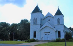 | Bethlehem Methodist Church and Cemetery | site | 1994 | 94000576 |
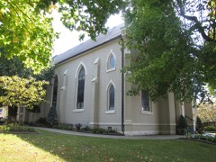 | Catholic Church and Rectory | building | 1982 | 82004032 |
| Clarksville Architectural District | district | 1976 | 76001791 | |
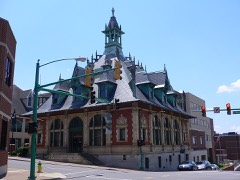 | Clarksville Federal Building | building | 1972 | 72001246 |
| Clarksville Foundry and Machine Works Office | building | 1987 | 87002007 | |
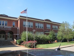 | Clarksville High School | building | 1983 | 83004281 |
| Clarksville Industrial District | district | 1976 | 76002295 | |
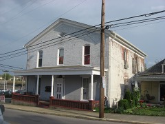 | Clarksville Methodist Church | building | 1982 | 82004033 |
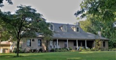 | Cloverlands | building | 1979 | 79002451 |
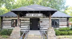 | Country Woman's Club | building | 2006 | 06000549 |
| Dog Hill Architectural District | district | 1980 | 80003849 | |
| Dunlop House | building | 2025 | 100012390 | |
| Dunlop Milling Company | building | 1999 | 99000213 | |
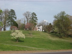 | Emerald Hill | building | 1971 | 71000826 |
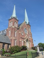 | First Presbyterian Church | building | 1976 | 76001793 |
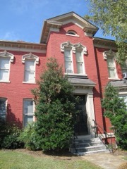 | First Presbyterian Church Manse | building | 2001 | 01000929 |
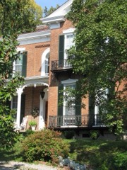 | Forbes-Mabry House | building | 1995 | 94001544 |
| Glenwood Historic District | district | 1996 | 96001405 | |
| Golden Hill Cemetery | site | 2001 | 01001261 | |
| Guildfield Missionary Baptist Church | building | 2003 | 03000151 | |
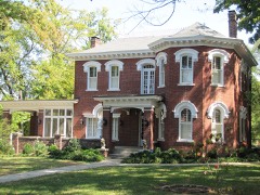 | Johnson-Hach House | building | 1998 | 98001507 |
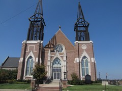 | Madison Street Methodist Church | building | 1976 | 76001794 |
| McCauley Hill Farm | district | 1995 | 95000268 | |
| Mt. Olive Cemetery | site | 2020 | 100005789 | |
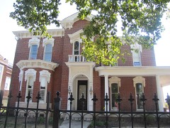 | Northington-Beach House | building | 2001 | 01000758 |
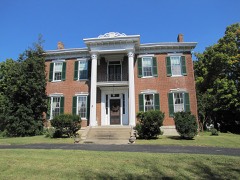 | Oak Top | building | 1980 | 80003850 |
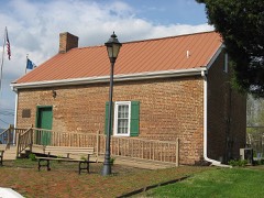 | Old Post House | building | 1978 | 78002621 |
| Port Royal Road | structure | 2006 | 06001131 | |
| Port Royal Road | structure | 2006 | 06001131 | |
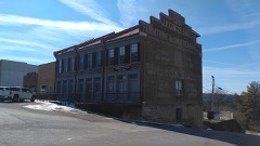 | Poston Block | building | 1972 | 72001247 |
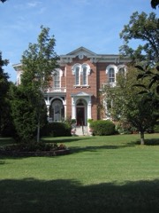 | Samuel Rexinger House | building | 1977 | 77001284 |
| Riverview | building | 1979 | 79002450 | |
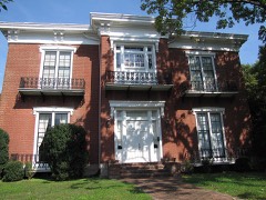 | Alfred A. Robb House | building | 2000 | 00001162 |
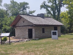 | Sevier Station | building | 1971 | 71000827 |
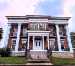 | Christopher H. Smith House | building | 1988 | 88000173 |
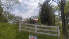 | Smith-Hoffman House | building | 1977 | 77001285 |
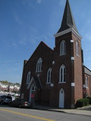 | St. Peter African Methodist Church | building | 1982 | 82004034 |
| Sulphur Fork Bridge | structure | 2020 | 100005366 | |
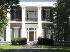 | Tip Top | building | 1998 | 97001566 |
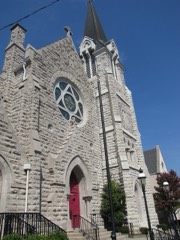 | Trinity Church and Rectory | building | 1982 | 82004035 |
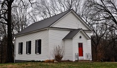 | White Chapel | building | 1986 | 86001395 |
| Whitehall | building | 1978 | 78002622 | |
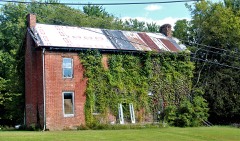 | Sanford Wilson House | building | 1978 | 78002623 |
Every wildfire the federal occurrence database records inside this county: 78 of them, burning about 580 acres. 1 started naturally and 9 were recorded as arson. Each settlement page carries the fires within five miles of it.
| Reported cause | Fires |
|---|---|
| Debris and open burning | 35 |
| Missing data/not specified/undetermined | 10 |
| Equipment and vehicle use | 9 |
| Arson/incendiarism | 9 |
| Smoking | 5 |
| Power generation/transmission/distribution | 2 |
| Misuse of fire by a minor | 2 |
| Recreation and ceremony | 2 |
| Other causes | 2 |
| Natural | 1 |
| Fireworks | 1 |
The five largest, by the area the report gives. One of them was set deliberately.
| Date | Cause | Size | Reported by | Name on the report |
|---|---|---|---|---|
| 12 March 2000 | Equipment and vehicle use | 80 acres | Tennessee Division of Forestry | not named |
| 21 March 1999 | Debris and open burning | 46 acres | Tennessee Division of Forestry | not named |
| 10 November 1999 | Missing data/not specified/undetermined | 44 acres | Tennessee Division of Forestry | not named |
| 17 August 2007 | Equipment and vehicle use | 41 acres | Tennessee Division of Forestry | MT HERMAN RD |
| 20 August 2007 | Power generation/transmission/distribution | 27 acres | Tennessee Division of Forestry | RYE CHAPEL RD |
| 10 March 2009 | Debris and open burning | 25 acres | Tennessee Division of Forestry | DARNELL |
| 18 March 2006 | Arson/incendiarism | 25 acres | Tennessee Division of Forestry | not named |
| 9 April 2001 | Smoking | 20 acres | Tennessee Division of Forestry | not named |
Every settlement page carries the fires within five miles of it - see the settlement index below.
The NOAA Storm Events Database holds 534 reports for this county, causing 8 deaths, 81 injuries and about $123,081,350 in recorded property damage. Each settlement page carries the reports that name it.
| Kind of event | Reports |
|---|---|
| Thunderstorm Wind | 318 |
| Hail | 84 |
| Flash Flood | 58 |
| Tornado | 36 |
| Flood | 14 |
| Funnel Cloud | 10 |
| Lightning | 7 |
| Heavy Rain | 7 |
The most serious of them, by death, then injury, then recorded damage. The accounts are quoted exactly as the forecast office filed them.
| When | Event | Place named | Harm | What the report says |
|---|---|---|---|---|
| December 2023 | Tornado (EF3) | Woodlawn | 4 killed, 62 hurt, $20,000,000 | This EF-3 tornado first touched down on Fort Campbell just north of the Sabre Airfield with mostly minor tree damage. It quickly intensified as it crossed Walnut Grove Road and destroyed a building next to a church. The tornado then continued northeast and damaged dozens of homes in a neighborhood along Garrettsburg Road near Purple Heart Highway. The tornado then went through a heavily wooded neighborhood south of Britton Springs Road where dozens of mobile and manufactured homes were destroyed. The tornado crossed into another neighborhood, causing heavy damage in and near Eva Drive with several houses shifted off their foundations that were only attached with straight nails (EF-2 damage). The tornado intensified to EF-3 with maximum winds of 140 mph as it crossed Highway 41 and struck several commercial businesses, including a vacant fast food restaurant and strip mall where only the interior remained. Just east of Highway 41 north of Ringgold Road, another neighborhood was struck with several homes sustaining significant damage. As the tornado continued northeast, it strengthened further to EF-3 with maximum winds of 150 mph, destroying four two-story brick and vinyl siding homes on Henry Place Boulevard. Debris was blown across the field towards West Creek Elementary School where the school sustained roof damage. As the tornado cross Preachers Mill Road, two dozen brand new two-story brick apartment homes were severely damaged with roofs missing on at least a dozen of these structures. Dozens more houses suffered significant roof damage along and near Needmore Road and Tiny Town Road with EF-2 damage. The tornado then crossed I-24 at Trenton Road where numerous cedar trees were uprooted. Continuing across Tylertown Road, the tornado caused EF-1 to EF-2 roof and siding damage to dozens of homes across three neighborhoods before moving into Kentucky. A total of nearly 1,000 homes were impacted by the tornado, including 114 homes destroyed and 268 homes with major damage. Unfortunately, four people were killed and 62 others were injured. |
| November 2002 | Tornado (F1) | Port Royal | 2 killed, $100,000 | The husband, Dennis Tooby and his wife, Karen Tooby, were killed when their mobile home was blown off its foundation at the 3400 block of Port Royal Rd. Mr. Tooby was a Australian national and a welder. Mrs. Tooby taught first grade at Hazelwood Elementary School in Clarksville. Two mobile homes were lifted off their foundation and hurled across the road. The tornado damaged 60 homes and one public building. Most of the damages were minor. |
| May 2010 | Flood | Ft Campbell | 1 killed, $1,900,000 | Flooding was reported along Salem Road. Flooding was also reported along Yellow Creek and East Fork Creek located southwest of Clarksville. Also, numerous homes, numerous businesses, numerous non comercial buildings, along with several county, state, and federal roads across the county received damage due to the flood. A fatality occurred when a woman drove into the Cumberland River at 8 PM CST on May 3rd. |
| September 2002 | Flood | Clarksville | 1 killed | A 23 year-old-male ignored high water signs and barricades and attempted to drive through standing water of 8 to 10 feet at the intersection of Ashbury Road and Shanee Terrace. The vehicle was submerged under water, and he drowned. Scuba divers had to retrieve the body from the vehicle. |
| January 1999 | Tornado (F3) | Clarksville | 5 hurt, $72,700,000 | An F3 tornado struck Clarksville at 415 AM, travelled through the downtown area and dissipated near St. Bethlehem. There were 5 injuries, 2 of them were for broken bones. Clarksville has a population of 89,000 people is Tennessee's fifth largest city. 25,000 people were without power. The Tornado Warning was issued by the NWS at 354 AM CST. The NOAA Weather Radio alerted the sleepy resident s of Clarksville and urge them to take cover immediately. The tornado ripped apart a 5 block area of downtown Clarksville and teared up buildings in Austin Peay State University. Once the tornado ravaged the city, downtown Clarksville resembled bombed-out London during World War 2. Bricks and glass were strewn everywhere. The photo editor of the Leaf-Chronicle newspaper s, Fred Dye, said "It looked like somebody walked through with a broom and knocked over whatever was loose enough to knock down." The Montgomery county court house was in ruins. The City Fathers planned on rebuilding the court house. It was last rebuilt after a fire in 1878. The Leaf-Chronicle newspaper office was severely damaged. The newspaper had to set up a temporary office in Hopkinsville, KY. 22 buildings were heavily damaged at Austin Peay State University. Also, several old churches were heavily damaged in Clarksville. The Madison Street United Methodist Church lost its spires and roof. It will take about 2 years to rebuild the church. The Trinity Episcopal Church lost its roof. Police closed off downtown Clarksville from 6 PM-6 AM in order to prevent looting. The National Guard was on duty as well. On January 23, FEMA Director James Lee Whitt toured the devastation. He exclaimed, "Wow!" "It's like someone dropped a bomb on it. That's just what it look like." There was a total of 124 buildings destroyed and 562 buildings damaged. These figures included residential, commercial, government, public and buildings at Austin Peay. |
| May 2008 | Tornado (EF1) | Palmyra | 3 hurt, $20,000 | The tornado rolled a mobile home across the road on Harris Circle. Numerous trees were snapped. There were 3 minor injuries from folks inside the mobile home. |
| February 2018 | Tornado (EF2) | St Bethlehem | 2 hurt, $7,000,000 | An EF-2 tornado touched down in eastern Clarksville on Dunbar Cave Road and moved east-northeast across Interstate 24 north of Rossview Road before ending on Kirkwood Road. Several trees were blown down at the beginning of the path north of Dunbar Cave Road. Continuing northeast, several outbuildings were damaged at the Rossview High School football stadium. The tornado crossed I-24 and struck an industrial complex where three buildings were damaged and 75 cars in a parking lot sustained minor damage. The tornado intensified as it crossed Rollow Lane, blowing the roof off one home and downing numerous trees. Four duplexes lost their roofs on Holland Drive and many others were severely damaged. Dozens of homes sustained roof and exterior damage in the Farmington subdivision along Covey Rise Circle, Bainbridge Drive, Green Grove Way, and Edgewater Lane, and one home on Green Grove Way at Covey Rise Circle was shifted off its foundation and completely destroyed, causing two injuries. Another home was heavily damaged west of Gardenia Lane in an area of new homes before the tornado moved across open fields. The last damage was some uprooted trees on Kirkwood Road. Maximum winds were estimated to be 125 mph. Montgomery County Emergency Management estimated the damage from this tornado at 7 million dollars. |
| March 2017 | Thunderstorm Wind | Bel Air Estates | 2 hurt, $40,000 | An 8 mile long swath of wind damage struck the north side of Clarksville in association with a small mesovortex on HPX radar. The Montgomery County EOC received 26 reports of trees and power lines blown down across the city with 9 roads blocked by fallen trees or power poles. One tree fell onto a home on Parker Drive, and another tree fell on a garage on Dalewood Drive. A large tree fell through a mobile home on Riley Road, injuring a mother as well as her 12 year old son, and another tree fell and damaged a nearby mobile home and cars. A tree also fell on a home on Rossview Road, and a preschool suffered minor damage on Old Russellville Pike. |
| April 1961 | Tornado (F2) | not stated | 2 hurt, $25,000 | no account filed |
| April 2010 | Thunderstorm Wind | Clarksville | 2 hurt, $18,000 | Tree fell on a car on Trenton road near exit one on I-24. Two people were taken to the hospital with injuries. Extent of injuries was unknown. Shutters were blown off of a house in the same area. |
| May 2003 | Tornado (F3) | Clarksville | 1 hurt, $750,000 | A tornado affected the southeast part of Montgomery County and did damage from Roberts Road, to Fredonia and to Albright Road. 108 homes were damaged. Estimated loss is about 3/4 of a million dollars. The tornado destroyed 2 brick homes on state Highway 12 near Fredonia and a mobile home on Albright Rd. One woman was injured in the mobile home. The Frazier family in the brick home took their 3 children to the basement. Their brick home was ripped to pieces and blown into the nearby woods. A man on Roberts Road said 3 large oak trees were ripped out of the ground and thrown on top of his house. A neighbor's garage from about a 1/4 of a mile away landed on the back of his house. Montgomery County EMA reported 108 homes were damaged by the tornado. |
| May 2005 | Thunderstorm Wind | Clarksville | 1 hurt, $50,000 | Roof was partially blown off an apartment building in the New Providence area of Clarksville. A large oak tree fell on a 108-year-old house on Old Russell Pike. A police officer received minor injuries when his patrol car was struck by a falling tree on Basham Lane. |
| July 1970 | Tornado (F1) | not stated | 1 hurt, $25,000 | no account filed |
| October 2019 | Thunderstorm Wind | Shiloh | $4,090,000 | A 5-10 mile wide swath of severe downburst winds struck western Montgomery County, including the northwest half of Clarksville. Dozens of power lines and power poles were blown down and thousands of trees were snapped or uprooted, with some falling on homes. Two houses and five mobile homes were reportedly destroyed, mainly by falling trees. Other homes and businesses received minor structural damage from the high winds, especially in northwest Clarksville, such as the grandstands at the Clarksville Speedway on Needmore Road which were toppled over, and the Clarksville Outlaw Field airport which had one hangar destroyed and a few planes damaged. A nursing home in Palmyra also suffered roof damage. Power outages lasted up to 2 weeks, with most Montgomery County schools closed during this 2 week period. Damage estimates from the Tennessee Emergency Management Agency across Montgomery County reached $4.09 million. Winds were estimated up to 90 mph. |
| April 1970 | Tornado (F4) | not stated | $2,500,000 | no account filed |
| February 2025 | Flash Flood | Kennedy | $1,000,000 | Heavy rain across Montgomery County caused flooding in the Woodstock Estates subdivision, located off Trenton Road. Approximately fourteen homes in the subdivision were inundated with six to eight feet of water. Emergency responders had to assist in evacuating several of the residents. Damages are a rough estimate. |
| February 2025 | Flash Flood | Kenwood | $1,000,000 | Heavy rain across Montgomery County caused flooding and significant damage to Northwood Apartments in Clarksville. All floor level apartments were inundated with four to five feet of water. In total, 66 apartment units were impacted. Damages are a rough estimate. |
| May 2024 | Flash Flood | Ft Campbell | $1,000,000 | Numerous reports of flash flooding were received across Montgomery County, especially in the Clarksville area. Several roadways across the county were reported to be flooded and impassable, including Trenton Road. Damages are a rough estimate. |
| February 2018 | Tornado (EF1) | Dotsonville | $1,000,000 | An EF-1 tornado touched down near the Dotsonville community just east of Dotsonville Road and south of Bradley A. Martin Road then moved northeast. Trees were blown down and a few homes suffered minor roof damage on Gip Manning Road and Hunting Creek Road. Hundreds of trees were snapped or uprooted and 12 to 15 homes were damaged on Martin Road, Deepwood Drive, and Deepwood Trail with two homes severely damaged. Dozens of more trees were blown down east of Rustys Lane and on High Point Road. The tornado then crossed the Cumberland River, continuing to blow down trees before lifting north of Hilltop Road. Montgomery County Emergency Management estimated damage at 1 million dollars. The beginning point, ending point, and path of this tornado were adjusted slightly in May 2019 based on new high resolution satellite data available in Google Earth. |
| July 2016 | Flash Flood | Oakwood | $1,000,000 | Major flash flooding affected much of Montgomery County, with several homes, businesses, vehicles and roads damaged by flooding. Several water rescues were also conducted for people trapped in flooded homes and vehicles in Clarksville. Homes that were flooded included at least one on Central Avenue in Clarksville, where 2 people were rescued from a flooded home, and others on Golf Club Lane. Businesses damaged by flooding in Clarksville included Swan Lake Golf Course on Dunbar Cave Road and the Tabernacle Church on Golf Club Lane. Roads that were flooded and closed in Clarksville included Liberty Parkway, Crossland Avenue, Central Avenue, Golf Club Lane, Madison Street, University Avenue, Riverside Drive, Highway 41A near Eva Lane, and Saratoga Drive, where one person was rescued from a flooded car. The flooding also caused large sinkholes to open on Spencer Lane at Jackson Road, and Mossrose Road between West Happy Hollow Drive and Woody Hills Drive, forcing the closure of both roads. Flooded and closed roads elsewhere in Montgomery County, mainly western portions of the county, included Cooper Creek Road, Lylewood Road, Lake Road, Moore Hollow Road, and Dotsonville Road, which had a bridge damaged by flooding. Numerous parks were flooded and closed in Clarksville as well, which encompassed Billy Dunlop Park, Clarksville Greenway, Heritage Park, Kleeman Recreation Center, McGregor Park, and the New Providence Pool. No injuries or fatalities were reported. |
| April 2013 | Flash Flood | Oakwood | $1,000,000 | Repeated development of thunderstorms across Montgomery County resulted in 5 to 7 inches of rain falling during the evening hours on April 27 into the early morning hours on April 28. Significant flash flooding resulted from the heavy rainfall, with numerous roadways flooded, impassable, and closed across the county. Flooded roadways included Trenton Road, Highway 76 at Port Royal Road, Madison Street in Clarksville, and many other secondary and low-lying roadways. Over the next several days following the flash flood, a few large sinkholes formed on some roadways, such as Fort Campbell Boulevard in Clarksville, which resulted in additional road closures. |
| May 2020 | Thunderstorm Wind | Clarksville | $661,750 | Numerous trees and power lines were blown down across Montgomery County including several across Clarksville. |
| November 2005 | Tornado (F1) | Cunningham | $600,000 | Damage to mobile home. Roof was taken off the Cunningham Market on Marion Rd. |
| November 2005 | Tornado (F2) | Clarksville | $500,000 | Well built brick home lost roof. Very large oak trees snapped around home. This storm complex came from Houston County. |
| November 2005 | Tornado (F1) | Shiloh | $500,000 | Mobile home is completely demolished. It was overturned on Thorne Hollow Road. |
| March 1997 | Flash Flood | Clarksville | $500,000 | no account filed |
| May 2009 | Flash Flood | Clarksville | $300,000 | Twenty five homes received water damage. One family was trapped in their home, but was eventually rescued. Most homes had water damage in basements and crawl|areas, with three to four homes receiving major water damage of which details of damage unkown. Emergency management officials reported an event total of 5.05 inches of rainfall. Newspaper reported that several roads were impassible due to the|water depth on them. |
| May 2025 | Tornado (EF0) | Excell | $250,000 | An EF-0 tornado touched down along E Old Ashland City Road, causing a few trees to lean or fall down. The tornado moved northeast, uprooting and snapping trees and causing minor house damage along streets north of Madison Street. The tornado lifted prior to reaching Trough Springs Road and Interstate 24. Damages are a rough estimate. |
| May 2025 | Tornado (EF0) | Woodlawn | $250,000 | An EF-0 tornado touches down along 101st Airborne Division Road, causing minor tree damage. The tornado moved northeast, causing minor tree damage in neighborhoods north of Purple Heart Parkway. Several trees were uprooted and tree tops were snapped near Britton Springs Road and Norris Drive. The tornado continued northeast after crossing Highway 41A continuing to snap large tree branches. The tornado lifted north of West Creek Middle School and south of Tiny Town Road. Damages are a rough estimate. |
| May 2003 | Thunderstorm Wind | Clarksville | $250,000 | Spotter estimated wind gusts around 60 mph near the Tennessee and Kentucky state line. There was damage to the roof over the gymnasium of St. Bethlehem Elementary School on Old Russellville Pk. |
| July 2002 | Lightning | Clarksville | $200,000 | One home in Colonial Estate off Rossview Road was destroyed after a lightning strike. Also, a second home on Lillian Drive was severely damaged by lightning. |
| July 2012 | Lightning | Sango | $175,000 | Lightning struck a home on Ellsworth Court, with the resulting fire completely destroying the home. |
| July 2012 | Lightning | Sango | $175,000 | Lightning struck a house on Oak Glen Lane, with the resulting fire completely destroying the home. |
| May 2009 | Thunderstorm Wind | Round Pond | $150,000 | Numerous trees were blown down with damage to several houses. |
| June 1997 | Tornado (F0) | Ft Campbell | $130,000 | A tornado touched down on the Tennessee side of Ft. Campbell, about a mile from the Kentucky border. The tornado tore into some buildings in the vicinity of the Directorate of Logistics, which is just inside of Gate 3 and near the Florence A. Blanchfield Army Community Hospital. It took some paneling off a few buildings and tore the siding off a multi-purpose warehouse. The tornado left Ft. Campbell via Gate 3, taking with it some tents that had been hanging out to dry. Most of this account of the tornado came from the Leaf-Chronicle newspaper in Clarksville.This tornado did not form from a supercell thunderstorm. The dynamics of this tornado were similar to a landspout.The path length and path width are approximations. |
| March 2026 | Tornado (EF0) | Ringgold | $100,000 | An EF-0 tornado impacted portions of Clarksville. The tornado began in a neighborhood in Fort Campbell. Damage consisted of shingles off of roofs as well as some small tree limbs snapped. The tornado continued east toward Highway 41 where an overhang structure was blown down at a car wash. The tornado then moved northeast through additional neighborhoods and across Outlaw Airfield. Damage in the neighborhoods included rotten trees downed, tree branches snapped, downed fences, shingles blown off roofs, and occasional vinyl siding and metal fascia damage. The tornado crossed Outlaw Field and uprooted a few trees on a farm just northeast of the airfield. The tornado then continued northeast into a large residential neighborhood causing additional minor structural and roof damage to several homes and snapping small tree limbs. The tornado dissipated somewhere near the Tennessee and Kentucky state line in an open field south of Interstate 24 as no additional damage was found of Allen Road. Damages are a rough estimate. |
| November 2010 | Thunderstorm Wind | Hampton Station | $100,000 | Montgomery County EMA reported damage to a house. This damage to the house included a large carport broke off from the house that went airborne and eventually crashed onto the homes roof, demolishing that part of the roof and two outer walls. A power pole was snapped and two old barns were also demolished. A NWS inspection team estimated winds speeds around 80 mph. |
| May 2009 | Thunderstorm Wind | Clarksville | $100,000 | Straight line wind damage occurred in the Hampton and Sango Road areas of Clarksville. Tree fell on school bus and caused major damage to bus. Numerous other trees and power lines down across this area. |
| February 2008 | Thunderstorm Wind | Clarksville | $100,000 | Five houses were destroyed, and 8 mobile homes were damaged. |
| May 2008 | Tornado (EF1) | Cumberland Hgts | $100,000 | A pavilion was destroyed at the Montgomery County Fairgrounds, which is about 2 miles south-southwest of downtown Clarksville. Telephone poles were snapped in half. A wooden utility pole was leaning. ||There was damage to the bleachers at the fairgrounds. ||Fairground bleachers were deemed unsafe and closed by Clarksville Park and Recreation officials.||Fencing was blown away along the top bleachers. ||Clarksville Park and Recreation officials said that there were cracks in the bleacher's cinder block supports. They also found that portions of the structure had moved at least 2 inches by the tornado. |
| April 1998 | Tornado (F2) | Hilltop | $100,000 | 67 homes were damaged in the Hilltop area, and about 7 homes received major damage. Most of the damage was to roofs. Trees were blown down. |
| April 1998 | Thunderstorm Wind | Hilltop | $100,000 | Ham radio operator reported homes damaged and large trees uprooted. |
| July 2016 | Lightning | Clarksville Arpt | $95,000 | A home on Rafiki Drive in Clarksville was struck by lightning. The resulting fire destroyed much of the second floor causing $95,000 in damage. |
| May 1998 | Thunderstorm Wind | Clarksville | $80,000 | Local EMA officials reported trees were blown down county wide. Clarksville Department of Electricity, according to newspaper accounts, said it would cost $80,000 to repair downed power lines by trees. |
| July 2009 | Lightning | Clarksville | $75,000 | About 200 households lost power in northern portions of Clarksville when the Edgeton substation was struck by lightning. Power lines and transformers associated with the substation were damaged also. |
| July 2024 | Thunderstorm Wind | Clarksville | $50,000 | A few trees fell in Clarksville with some falling on mobile homes in New Providence. Damages are a rough estimate. |
| December 2023 | Tornado (EF0) | Oakwood | $50,000 | The tornado first touched down just east of the Cumberland River near Cross Creeks National Wildlife Refuge off of Commissary Hollow Road. Minor damage was observed to trees with a home sustaining significant roof damage. the tornado continued east-northeast where dozens more trees were snapped and uprooted along Lower Cross Creek Road. Once the tornado entered Indian Mound, more trees were either uprooted or snapped along Highway 46. The tornado then intensified on Red Top Road and Gillum Hollow Road where a church overhang awning and greenhouses were damaged. A few more barns and outbuildings were damaged along Gillum Hollow Road with several instances of uprooted and snapped trees along its path including a tree falling onto a residence. The tornado finally began to weaken as it entered into far western portions of Montgomery County where only a few trees and large branches were broken. The tornado then lifted southeast of the Indian Mound Road and Liverpool Road intersection. |
| May 2015 | Thunderstorm Wind | St Bethlehem | $50,000 | Substantial wind damage was reported in eastern Clarksville just east of Interstate 24. The Rainbow Incorporated building at 1051 Industrial Park Road lost 60,000 square feet of roof and siding. Part of a tall warehouse structure at the Florim USA plant at 300 International Blvd was blown inward. Five power poles were snapped or blown over on Highway 79 around 1 mile east of Interstate 24, with power lines trapping vehicles. Winds were estimated up to 70 mph. |
| October 2014 | Tornado (EF1) | Excell | $50,000 | A NWS storm survey team found an EF1 tornado touched down a few miles southeast of Clarksville. The tornado began around 609 pm along Highway 76 near Chesterfield Drive and caused sporadic damage as it traveled northeast 3.4 miles to Powell Road just west of I-24. Several homes along the path experienced minor roof damage and others were damaged from falling trees. An anemometer on the roof of Clarksville High School was bent in half and destroyed. A large porch overhang on a farmhouse on Memorial Drive was blown off. Several trees were uprooted and snapped along the path. Max winds were estimated around 90 mph. |
| July 2012 | Thunderstorm Wind | Excell | $50,000 | Trees fell on 7 homes around Post Road, North Meadow Drive, and Belmont Drive in Clarksville. One home at the intersection of Post Road and Maxwell Drive recieved significant damage after a tree fell on it. A carport was also blown off of a building at Harley-Davidson on the State Highway 12 Bypass. |
| April 2011 | Thunderstorm Wind | Woodlawn | $50,000 | Numerous trees were downed across the northwestern portion of the county. A newspaper also reported that six homes received damage in the county. Specific details concerning the type of damage and associated costs were unknown. |
| August 2011 | Thunderstorm Wind | New Providence | $50,000 | A one mile wide microburst struck Clarksville from northwest to southeast, causing considerable wind damage across the western and southern portions of the city. Roofs were blown off several businesses along Fort Campbell Boulevard and Dover Road east of Darlene Drive, including an apartment complex, pet store, and lumber store. Numerous trees and power lines were blown down throughout the city, with some trees falling on houses. Several business signs were also blown down. Winds were estimated from 60 to 70 mph. |
| May 2010 | Flash Flood | Clarksville | $50,000 | One and a half feet of water was over Meadow Green Drive and Cloverdale Drive. There was also water ponding in several yards. |
| July 2010 | Thunderstorm Wind | Salem | $50,000 | Trees were downed in the Woodlawn Community near Ashland City Road. Trees were also reported downed in the Clarksville area at the following locations: Edmondson Ferry Road, Liberty Parkway, Riverwood Place, Swift Drive, and Richardson, Daniel, Clark, Cloverdale, Green Leaf, and South 12th Streets. |
| June 2009 | Thunderstorm Wind | Clarksville | $50,000 | Trees and power lines were downed county wide. |
| July 2009 | Thunderstorm Wind | Clarksville | $50,000 | Trees were reported down across the entire county. |
| September 2006 | Thunderstorm Wind | Cunningham | $50,000 | Straight line winds demolished and leveled a tobacco barn valued at $50,000. The barn was on a tobacco and strawberry farm located at 400 Seven Mile Ferry Rd. The six acres of tobacco valued at $80,000 was also damaged by the strong winds, for a total damage of $130,000 according to a newspaper article. |
| July 1999 | Thunderstorm Wind | Countywide | $50,000 | TEMA reported straight line wind damage to 15 homes. |
| May 1999 | Flash Flood | Clarksville | $50,000 | Flooding was reported around Mallard Drive and Minor Drive off Tiny Town Road. Some homes and cars were flooded. There was also flooding at Dunbar Cave Road and S.R. 374, along U.S. Hwy 41-A near Ft. Campbell, on Trenton Road and Power Street. |
| July 1998 | Flash Flood | Clarksville | $50,000 | Sheriff's department reported 10-15 houses flooded in the northern part of town. |
The Survey's mineral resources record lists 19 workings inside this county. 3 still produce and 16 are closed or unrecorded. Each settlement page carries the workings within five miles of it.
| Commodity | Workings |
|---|---|
| Iron | 14 |
| Stone, Crushed/Broken | 2 |
| Stone, Crushed/Broken, Limestone, General | 1 |
| Limestone, General | 1 |
| Zinc, Refiner | 1 |
| Sulfur, Sulfuric Acid | 1 |
| Cobalt | 1 |
The least common of them first, because a county's hundredth gravel pit says nothing its first ten did not.
| Where | Site | Commodity | Status | Recorded |
|---|---|---|---|---|
| (Facility) Clarksville Smelter | Zinc, Refiner, Sulfur, Sulfuric Acid, Cobalt | Plant | ||
| Clarksville Stone Co. Quarry | Limestone, General | Past Producer | Sedimentary | |
| Simpson Stone Plant | Stone, Crushed/Broken, Limestone, General | Producer | Limestone | |
| Clarksville Stone Co. Quarry | Stone, Crushed/Broken | Past Producer | ||
| Simpson Stone Plant | Stone, Crushed/Broken | Producer | ||
| Bryans Bank | Iron | Past Producer | ||
| Dunn Mines | Iron | Past Producer | ||
| Lone Oak Mines | Iron | Past Producer | ||
| Louise Mines | Iron | Past Producer | ||
| Marion Mine | Iron | Past Producer | ||
| Marion Prospect | Iron | Past Producer | ||
| Marion Prospect | Iron | Past Producer | ||
| Oakwood Prospects | Iron | Past Producer | ||
| Poplar Spring Prospects | Iron | Past Producer | ||
| Sailors Rest Prospects | Iron | Past Producer | ||
| Steele Ore Bank | Iron | Past Producer | ||
| Taber Ore Bank | Iron | Prospect | ||
| Vernon Furnace Mines | Iron | Past Producer | ||
| Vernon Furnace Prospects | Iron | Prospect |
Named settlements recorded in the Geographic Names Information System, each with the topographic sheets covering it. Villages, hamlets and abandoned places alike. Each is shown with the nearest named watercourse or landform and the survey quadrangle it falls on.
District 7 · 37191 · On Bascomb Eldrige Creek · Needmore quadrangle
8 sheets, 1931 to 1985
No longer a settlement
District 10 · On Piney Fork · Woodlawn quadrangle
9 sheets, 1951 to 1980
No longer a settlement
District 16 · 37042 · On Fletchers Fork · New Providence quadrangle
11 sheets, 1944 to 1980
District 4 · 37040 · Near Seven Mile Island · Clarksville quadrangle
11 sheets, 1944 to 1997
District 14 · 37040 · On West Fork Red River · Clarksville quadrangle
11 sheets, 1944 to 1997
District 16 · 37042 · On Little West Fork · New Providence quadrangle
11 sheets, 1944 to 1980
District 5 · 37040 · Near Gallows Hollow · Clarksville quadrangle
11 sheets, 1944 to 1997
District 21 · 37043 · By King and Queens Bluff · Clarksville quadrangle
11 sheets, 1944 to 1997
District 4 · 37040 · Near Seven Mile Island · Excell quadrangle
7 sheets, 1956 to 1985
District 13 · 37042 · On Little West Fork · New Providence quadrangle
11 sheets, 1944 to 1980
District 21 · 37043 · By King and Queens Bluff · Clarksville quadrangle
11 sheets, 1944 to 1997
District 14 · 37040 · On West Fork Red River · Clarksville quadrangle
11 sheets, 1944 to 1997
District 3 · 37043 · On Little McAdoo Creek · Excell quadrangle
7 sheets, 1956 to 1985
No longer a settlement
District 1 · 37043 · On West Fork Red River · Clarksville quadrangle
11 sheets, 1944 to 1997
District 4 · 37040 · Near Seven Mile Island · Excell quadrangle
7 sheets, 1956 to 1985
District 1 · 37043 · On West Fork Red River · Clarksville quadrangle
11 sheets, 1944 to 1997
District 10 · 37042 · On Fletchers Fork · New Providence quadrangle
11 sheets, 1944 to 1980
District 21 · 37043 · On Wall Branch · Clarksville quadrangle
11 sheets, 1944 to 1997
District 13 · 37042 · On Red River · New Providence quadrangle
11 sheets, 1944 to 1980
District 10 · On Moss Creek · Woodlawn quadrangle
9 sheets, 1951 to 1980
No longer a settlement
District 13 · 37042 · On Little West Fork · New Providence quadrangle
11 sheets, 1944 to 1980
District 21 · 37043 · By King and Queens Bluff · Clarksville quadrangle
11 sheets, 1944 to 1997
District 4 · 37040 · Near Seven Mile Island · Excell quadrangle
7 sheets, 1956 to 1985
District 6 · 37171 · Near Sugar Hollow · Cumberland Furnace quadrangle
7 sheets, 1956 to 1985
District 16 · 37042 · On Fletchers Fork · New Providence quadrangle
11 sheets, 1944 to 1980
District 13 · 37042 · On Little West Fork · New Providence quadrangle
11 sheets, 1944 to 1980
District 6 · 37051 · On Indian Creek · Cumberland Furnace quadrangle
7 sheets, 1956 to 1985
District 13 · 37042 · On Red River · New Providence quadrangle
11 sheets, 1944 to 1980
District 7 · 37191 · On Blooming Grove Creek · Needmore quadrangle
8 sheets, 1931 to 1985
No longer a settlement
District 16 · 37042 · On Fletchers Fork · New Providence quadrangle
11 sheets, 1944 to 1980
District 13 · 37042 · On Little West Fork · Clarksville quadrangle
11 sheets, 1944 to 1997
District 16 · 37042 · On Little West Fork · New Providence quadrangle
11 sheets, 1944 to 1980
District 7 · 37042 · On Donaldson Creek · New Providence quadrangle
11 sheets, 1944 to 1980
District 13 · 37042 · On Little West Fork · New Providence quadrangle
11 sheets, 1944 to 1980
District 19 · 37010 · On Sulphur Fork Red River · Sango quadrangle
9 sheets, 1956 to 1980
District 16 · 37042 · On Fletchers Fork · New Providence quadrangle
11 sheets, 1944 to 1980
District 10 · 37042 · On Fletchers Fork · New Providence quadrangle
11 sheets, 1944 to 1980
District 10 · On Elk Fork Creek · Woodlawn quadrangle
9 sheets, 1951 to 1980
No longer a settlement
District 6 · 37051 · On Cave Spring Branch · Ellis Mills quadrangle
8 sheets, 1931 to 1985
No longer a settlement
District 12 · 37042 · On Fletchers Fork · New Providence quadrangle
11 sheets, 1944 to 1980
District 4 · 37040 · Near Seven Mile Island · Excell quadrangle
7 sheets, 1956 to 1985
District 4 · 37171 · By Pinnacle Point · Cumberland Furnace quadrangle
7 sheets, 1956 to 1985
District 12 · 37042 · On Fletchers Fork · New Providence quadrangle
11 sheets, 1944 to 1980
District 13 · 37042 · On Little West Fork · Clarksville quadrangle
11 sheets, 1944 to 1997
District 14 · 37040 · On West Fork Red River · Clarksville quadrangle
11 sheets, 1944 to 1997
District 10 · 37042 · On Fletchers Fork · New Providence quadrangle
11 sheets, 1944 to 1980
District 1 · 37043 · On West Fork Red River · Clarksville quadrangle
11 sheets, 1944 to 1997
District 1 · 37043 · On West Fork Red River · Clarksville quadrangle
11 sheets, 1944 to 1997
The vanished settlements of Montgomery County: the places named above that are no longer on the map.