 Block
Columbia, Tennessee
20 topographic sheets cover this place, the earliest surveyed in 1901 and the latest in 1986. It stands in District 3. It lies in ZIP code area 38401. It lies near The Knob. The Survey maps it on the Columbia quadrangle. 41,690 people lived here at the 2020 count. It stands 643 feet above sea level.
Research this city
On record in Columbia
Buildings and businesses the archive holds for this place. Each opens its own page, with the source record it came from.
On the National Register 12 of 38 shown
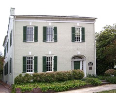 James K. Polk HouseNational Historic Landmark · listed 1966
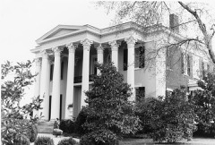 Rattle and SnapNational Historic Landmark · listed 1971
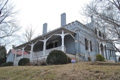 Athenaeum, Thelisted 1973
 Blythewoodlisted 1973
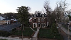 Church Houselisted 1978
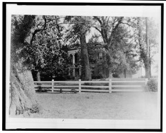 Clifton Placelisted 1970
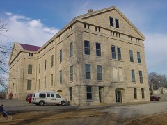 Columbia Arsenallisted 1977
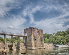 Columbia Hydroelectric Stationlisted 1990
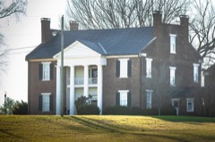 Elm Springslisted 1986
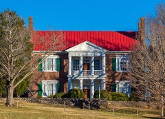 Fairmontlisted 1983
 First United Methodist Church of Columbialisted 1984
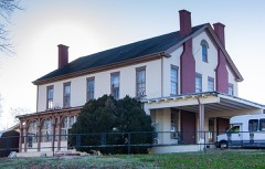 Patrick Maguire Houselisted 1983
Population over time
2 figuresColumbia grew from 34,681 to 41,690 between 2010 and 2020. These are the recorded population figures Wikidata holds for this place, reached through the Geographic Names Information System number this page is keyed on rather than by name, so they belong to this place and not to another of the same name. Most are census counts, but not all are: an early figure may be a founding or settlement estimate, and an estimate published within five years of a census is left out. The change column is computed, and is left blank where more than 20 years separate a figure from the one before it, because a gap that long is not a change between two counts.
| Year | People | Change |
|---|---|---|
| 2010 | 34,681 | |
| 2020 | 41,690 | +7,009 (+20%) |
Topographic sheets covering this place
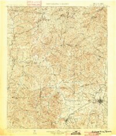
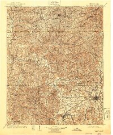
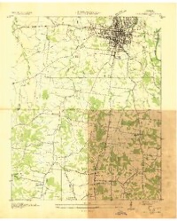
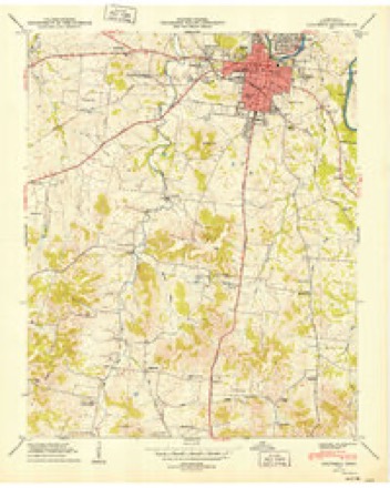
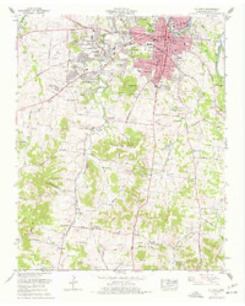
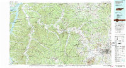
7 surveys from 20 printed sheetsMatched by testing this settlement's coordinate against the published boundary of every sheet in the United States Geological Survey's historical collection. Each opens the scanned sheet at the Survey.
- 1901 USGS Colombia quadrangle1:125000, 2 printings
- 1901 USGS Columbia quadrangle1:125000
- 1936 USGS Columbia quadrangle1:24000, 2 printings
- 1949 USGS Columbia quadrangle1:24000, 2 printings
- 1956 USGS Columbia quadrangle1:250000, 6 printings
- 1965 USGS Columbia quadrangle1:24000, 4 printings
- 1986 USGS Hohenwald quadrangle1:100000, 3 printings

What the histories say of this town
7,881 words1 chapter about Columbia from the published histories of the county, public domain and reproduced complete.
| Chapter | From | Length |
|---|---|---|
| Maury County, the Blue-grass Region of Tennessee. Its Agricultural and | Maury County, the Blue-grass Region of Tennessee. Its Agricultural and Mineralogical Resources, Including a View of the County Seat, the City of Columbia. Her Commerce and Industries, Schools and Churches, Past Development and Future Possibilities. Facts for Practical Minds (1884) | 7,881 words |
Fires near this place
21 since 1999Regional context, not property-specific evidence. The federal wildfire occurrence database lists 21 fires within 5 miles of Columbia between 1999 and 2016, burning about 85 acres in total. None started naturally. 6 were recorded as arson. Distance is straight-line from the map coordinates, so a fire counted here may appear on a neighbouring settlement's page as well.
| Reported cause | Fires |
|---|---|
| Debris and open burning | 9 |
| Arson/incendiarism | 6 |
| Misuse of fire by a minor | 3 |
| Fireworks | 1 |
| Equipment and vehicle use | 1 |
| Railroad operations and maintenance | 1 |
The most recent of them, most recent first, with the day each was reported and the service that recorded it.
| Date | Cause | Size | Reported by | Name on the report |
|---|---|---|---|---|
| 15 September 1999 | Arson/incendiarism | under an acre | Tennessee Division of Forestry | not named |
| 30 June 2010 | Misuse of fire by a minor | under an acre | Tennessee Division of Forestry | CEMETARY AVE |
| 23 May 2007 | Equipment and vehicle use | under an acre | Tennessee Division of Forestry | MCKINLEY JOYCE RD |
| 6 April 2001 | Railroad operations and maintenance | 1.0 acres | Tennessee Division of Forestry | not named |
| 29 April 2001 | Debris and open burning | under an acre | Tennessee Division of Forestry | not named |
| 8 March 2006 | Debris and open burning | under an acre | Tennessee Division of Forestry | not named |
| 7 March 2002 | Arson/incendiarism | under an acre | Tennessee Division of Forestry | not named |
| 7 March 2000 | Debris and open burning | 5.0 acres | Tennessee Division of Forestry | not named |
Settlements close enough to share some of these fires:
Mines and quarries near this place
10 of 82 shownRegional context, not property-specific evidence. The federal mineral resources record lists 82 workings within 5 miles of Columbia: 36 unknowns, 27 past producers, 13 producers, 4 prospects. 14 still produce. What was taken out: Phosphorus-Phosphates, Stone, Crushed/Broken, Stone, Crushed/Broken, Limestone, General, Iron. Distance is straight-line from the map coordinates, so a quarry counted here may appear on a neighbouring settlement's page as well.
| Where | Site | Commodity | Status | Recorded |
|---|---|---|---|---|
| Columbia Rock Products Corp. Quarry | Stone, Crushed/Broken, Limestone, General | Producer | 1953 | |
| Hooker Chemical 507 | Iron, Phosphorus-Phosphates | Past Producer | ||
| Hooker Chemical Properties | Phosphorus-Phosphates, Fluorine-Fluorite | Past Producer | 1893, 1941 | |
| Monsanto - Columbia Plant | Phosphorus-Phosphates, Iron | Past Producer | ||
| Occidental Chem. Corp. Properties | Phosphorus-Phosphates, Iron, Aluminum, Water, Free, Calcium, Fluorine-Fluorite | Producer | 1893, 1941 | |
| Union Carbide/ Columbia, Tn. | Graphite | Plant | ||
| Xps 17m Pit | Aluminum | Past Producer | ||
| Blue Springs Rock, Inc. | Stone, Crushed/Broken | Producer | 1976 | |
| Blue Srpings Qy | Stone, Crushed/Broken | Producer | ||
| Columbia No. 2 Mine | Stone, Crushed/Broken | Producer |
Storms near this place
60 of 131 shownRegional context, not property-specific evidence. The National Weather Service names Columbia in 131 storm reports between 1993 and 2025: 67 thunderstorm wind, 45 hail, 9 flash flood, 7 lightning. The reports record 4 injuries. Each account below is quoted exactly as the forecast office filed it, from the NOAA Storm Events Database, and each date opens the federal record of that event.
| When | Event | Place named | Harm | What the report says |
|---|---|---|---|---|
| June 2005 | Thunderstorm Wind | Columbia | 1 hurt, $20,000 | Newspaper story about trees and power lines being down in Columbia. Trees knocked down at least 6 power lines. One tree fell on a house at 514 West 12th St. Mr. James Pillow, Jr., who was in the home at the time, was treated and released for falling drywall in the house. The tree sliced the home from corner-to- corner. |
| November 2017 | Thunderstorm Wind | Columbia | 1 hurt, $2,000 | Windows were reportedly blown out of a home at 100 Hallmark Road in Columbia causing one minor injury due to flying glass. |
| June 2006 | Lightning | Columbia | 1 hurt | Lightning struck Parks Motor Company, injuring one employee who was repairing a computer during the storm. He was taken to Maury Regional Hospital in fair condition. |
| August 2002 | Lightning | Columbia | 1 hurt | A 16-year-old girl was struck by lightning. She was working at the Taco Bell, and when it began to rain, she ran outside to roll up the windows on her pickup truck. After she rolled the windows up, she began to lock the door, then the lightning struck the truck. The electrical charge went through her arm and knocked her down. She was taken across the street to Maury Regional Hospital. She was kept overnight as a precaution. Ms. Ruby Nicole Byrd's comment after her ordeal was "I would like to tell everyone that if it's thundering and lightning, don't go out in it." |
| January 1999 | Thunderstorm Wind | Columbia | $4,000,000 | About 350 homes and 25 businesses received damage from the straight line winds in Columbia. A large tree fell on a house. 30 to 40 homes and businesses received serious damage. At Columbia's Shady Brook Mall huge panes of glass at the entrance were blown in, and there was extensive roof damage. 40 mature trees were uprooted at the Graymere Country Club. There was $400,000 worth of damage to the Pepsi Cola plant alone. |
| May 2020 | Thunderstorm Wind | Columbia | $717,630 | Numerous trees and power lines were blown down with power outages across Maury County, including across Columbia where one tree fell onto a house on Mockingbird Lane. |
| July 2007 | Lightning | Columbia | $150,000 | Lightning struck the roof of a house in the Stoneybrook subdivision, located at 106 Hogan Lane. Firefighters responded within 15 minutes, but the fire had already spread quickly through the house. Firefighters spent 6 hours fighting the fire and securing the area. The fire fully-engulfed the house, and a 1964 Lincoln Continental in the driveway with 102,000 miles. There were no injuries in this blaze. |
| August 2010 | Thunderstorm Wind | Columbia | $30,000 | Numerous trees were blown down in Culleoka. Roof damage was also reported to a home in this area, along with a trailer that was moved off of its cement blocks. Type of trailer and degree of damage to trailer was unknown.||Newspapers also reported that some fencing was taken out at a farm on fronting Frank Moore Road. |
| July 2005 | Lightning | Columbia | $21,000 | Sheriff said that lightning strikes damaged a dishwasher at the jail which cost $16,000 and destroyed a transformer, the lighting and communications systems at the jail. |
| June 2023 | Thunderstorm Wind | Columbia | $15,000 | Multiples trees and power lines were reported downed across Maury County from thunderstorm outflow. Damages are a rough estimate. |
| April 2011 | Thunderstorm Wind | Columbia | $12,000 | Several trees needed to be cleared from area roads. |
| July 2023 | Thunderstorm Wind | Columbia | $10,000 | The emergency manager reported that numerous trees were downed across Maury County due to severe thunderstorm winds. Damages are a rough estimate. |
| April 2022 | Thunderstorm Wind | Columbia | $10,000 | More than 2,000 customers were without power due to snapped power poles and downed power lines. Several roads were also blocked due to downed trees across the road. |
| May 2021 | Thunderstorm Wind | Columbia | $10,000 | Trees and power lines were blown down across the county with power outages county-wide. Approximately 2,700 people were without power. |
| June 2019 | Thunderstorm Wind | Columbia | $10,000 | Trees and power lines were blown down across Maury County with power outages county-wide. Fire and sheriff departments were assisting in removing trees from main roadways. |
| October 2014 | Thunderstorm Wind | Columbia | $10,000 | Trees were blown down all across Maury County including on Neeley Hollow Road, Campbellsville Pike, Santa Fe Pike, and Mt. Pleasant Pike. |
| June 2014 | Thunderstorm Wind | Columbia | $10,000 | Numerous trees were blown down all across Maury County. |
| May 2011 | Thunderstorm Wind | Columbia | $10,000 | A few trees were downed on a carport near the intersection of U.S. Highway 91 and U.S. Highway 31. Specific details concerning any damage to the carport and associated damage costs were unknown. |
| August 2010 | Thunderstorm Wind | Columbia | $10,000 | A few trees were downed in Columbia. |
| July 2004 | Lightning | Columbia | $10,000 | Lightning struck a home at 1818 Sunset Avenue and another home across the street at 1815 Sunset Ave. The lightning did set fire to the homes. |
| August 1995 | Thunderstorm Wind | Columbia | $10,000 | A tree fell on house. |
| February 1997 | Thunderstorm Wind | Columbia | $10,000 | no account filed |
| September 2024 | Thunderstorm Wind | Columbia | $5,000 | Strong winds from a thunderstorm caused a power pole to lean near Columbia. Damages are a rough estimate. |
| September 2022 | Flash Flood | Columbia | $5,000 | A Facebook report showed flooding at the Brookwood Apartments in Columbia on West 7th Street and Academy Lane with several cars flooded. Damages are estimated for the flooded cars. |
| May 2017 | Thunderstorm Wind | Columbia | $5,000 | Trees were blown down across multiple roads in Maury County. Some trees fell on power lines and caused fires. |
| June 2014 | Thunderstorm Wind | Columbia | $5,000 | Trees and power lines were blown down all across Maury County. |
| June 2011 | Thunderstorm Wind | Columbia | $5,000 | Power lines were blown down on West 17th Street at Woodland Park. |
| August 2010 | Lightning | Columbia | $5,000 | Expert Tire at 509 North Garden Street was struck by lightning, burning the motor in the building's central heating and cooling unit. Otherwise, no other damage to the building was reported. |
| March 2006 | Thunderstorm Wind | Columbia | $5,000 | Trees were blown down. Some of the trees landed on cars |
| July 2006 | Thunderstorm Wind | Columbia | $5,000 | The Columbia Fire Department reported to the newspaper that several trees had fallen in Columbia. One tree limb struck a SUV on Carmack Boulevard in Columbia. |
| April 2002 | Thunderstorm Wind | Columbia | $5,000 | News article account of strong thunderstorm winds that ripped vinyl siding from the eaves of an attic from a home located in the Wishire Subdivision. The strong winds smashed a childrens' swingset, and blew down a large tree in the front yard of this home. |
| November 1994 | Thunderstorm Wind | Columbia | $5,000 | Three large trees were blown down on to electrical transformers. |
| April 2006 | Thunderstorm Wind | Columbia | $4,000 | Large trees were down. |
| March 2017 | Lightning | Columbia | $3,000 | Maury County emergency management reported three lightning strikes to buildings in the Columbia city limits on Polk Street, Scott Hollow Drive, and Haylong Avenue. Minimal damage was reported to all structures. |
| June 2016 | Thunderstorm Wind | Columbia | $3,000 | A few trees blown down in Columbia. |
| March 2012 | Hail | Columbia | $3,000 | Some minor damage to vehicles observed. Details concerning specific minor damage to specific vehichles were unknown. |
| June 2011 | Thunderstorm Wind | Columbia | $3,000 | A few trees were blown down in and around Columbia. |
| October 2014 | Thunderstorm Wind | Columbia | $2,000 | A large tree was blown down which crushed an iron fence on the Colubia Academy Campus at West 7th Street and Academy Lane. |
| October 2014 | Thunderstorm Wind | Columbia | $2,000 | A tree fell on a home on Crestview Drive, and a transformer was on fire on Owen Avenue. The Maury County EMA office measured a wind gust of 54 mph. |
| January 2012 | Thunderstorm Wind | Columbia | $2,000 | A couple of trees were reported downed across county roads. |
| March 2020 | Thunderstorm Wind | Columbia | $1,000 | A tree was blown down in the backyard of a home in Columbia. |
| August 2016 | Thunderstorm Wind | Columbia | $1,000 | A tree was blown down in Columbia. |
| May 2003 | Thunderstorm Wind | Columbia | $1,000 | Law enforcement reported trees were blown down. There was roof damage at a Home Depot. |
| April 2007 | Thunderstorm Wind | Columbia | $500 | Trees were blown down on U.S. Highway 43 and Columbia Highway, and also at Johnso Hollow and Sycamore. |
| August 1993 | Thunderstorm Wind | Columbia | $500 | A few trees and power lines were knocked down. |
| November 1994 | Hail | Columbia | $500 | no account filed |
| June 2007 | Thunderstorm Wind | Columbia | $300 | A tree was down on McClanahan Rd. |
| September 1995 | Thunderstorm Wind | Columbia | $100 | Several power lines were down. Report was by local electric company. |
| May 1995 | Thunderstorm Wind | Columbia | $1 | ,Many trees were blown down. A stock barn was damaged. |
| May 2025 | Hail | Columbia | - | Estimated half dollar size hail was reported in Columbia from a tornado-warned thunderstorm. |
| May 2025 | Hail | Columbia | - | Ping pong size hail was reported in Columbia from a tornado-warned thunderstorm. |
| May 2024 | Hail | Columbia | - | Penny size hail was reported just west of Columbia. |
| February 2023 | Flash Flood | Columbia | - | Heavy rain in the Columbia area caused flash flooding. The Columbia Fire and Rescue shared photos of a flooded parking lot at the Brookwood Apartments near 7th Street and Academy. Damages are not known. |
| April 2023 | Hail | Columbia | - | A tspotter on Twitter reported quarter size hail near Columbia. |
| February 2019 | Flash Flood | Columbia | - | Riverside Drive in Columbia was reportedly flooded and closed. |
| March 2017 | Hail | Columbia | - | A tSpotter Twitter report indicated nickel size hail fell in Columbia. |
| June 2014 | Heavy Rain | Columbia | - | Public reported 5.50 inches of rain fell from midnight through 1155 AM CDT. |
| May 2010 | Thunderstorm Wind | Columbia | - | Spotter working at the Columbia Mall estimated wind gusts near 60 mph. |
| June 2010 | Thunderstorm Wind | Columbia | - | A 60 mph wind gust was measured by a spotter in Columbia. |
| June 2009 | Hail | Columbia | - | Nickel size hail was reported by the public. |
Nearest settlements
The eight closest, with where each one stands in the county. Distances are straight-line, computed from the Geographic Names Information System coordinates.
| Map | Place | Distance | Sheets |
|---|---|---|---|
| Fairview Heights | 0.5 miles | 20 | |
| Highland Park | 0.7 miles | 20 | |
| Riverside | 0.7 miles | 20 | |
| Bel Air | 1.0 miles | 18 | |
| Forrest Hills | 1.1 miles | 20 | |
| Idlewild | 1.3 miles | 20 | |
| Sharon Park | 1.3 miles | 20 | |
| Rolling Fields | 1.4 miles | 20 |
Elsewhere
Matched on this settlement's Geographic Names Information System number rather than its name, so it cannot be a different place of the same name in another state.
| Wikipedia article on Columbia | An encyclopaedic summary. Its text is share-alike, so it is linked here rather than copied. |
| Wikidata item Q5675279 | The structured record the population and elevation above come from. Public domain (CC0). |
Provenance
This settlement is recorded in the Geographic Names Information System as feature 1269483. The sheet list is computed by point-in-boundary test against the United States Geological Survey's historical topographic inventory. Both are works of the United States government and carry no copyright under 17 U.S.C. 105.
Wildfire. Short, Karen C. 2022. Spatial wildfire occurrence data for the United States, 1992-2020 [FPA_FOD_20221014]. 6th Edition. Fort Collins, CO: Forest Service Research Data Archive. https://doi.org/10.2737/RDS-2013-0009.6 Collected with United States Government funding and usable without additional permissions or fees.
Mines and quarries. USGS Mineral Resources Data System (MRDS) https://mrdata.usgs.gov/mrds/ A work of the United States government, no copyright under 17 U.S.C. 105.
Storms. NOAA National Centers for Environmental Information, Storm Events Database https://www.ncei.noaa.gov/stormevents/ A work of the United States government, no copyright under 17 U.S.C. 105. Narratives are quoted verbatim from the National Weather Service report and are not edited or summarised.