Block
From the record
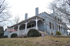
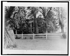
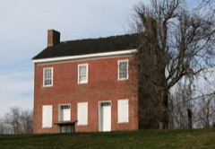
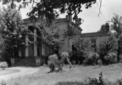
68 National Register listings published here, 2 of them National Historic Landmarks.
Sources: the county history on the Internet Archive · the National Register database, National Park Service
100 topographic sheets cover 136 settlements here, and 68 properties are on the National Register of Historic Places.
68 National Register listings published here, 2 of them National Historic Landmarks.
Sources: the county history on the Internet Archive · the National Register database, National Park Service
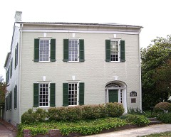
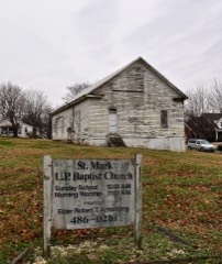
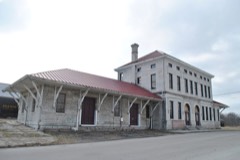
Every property in this county listed on the National Register of Historic Places, with the year it was listed and the federal nomination document.
Every wildfire the federal occurrence database records inside this county: 229 of them, burning about 1,650 acres. None started naturally and 35 were recorded as arson. Each settlement page carries the fires within five miles of it.
| Reported cause | Fires |
|---|---|
| Debris and open burning | 124 |
| Arson/incendiarism | 35 |
| Equipment and vehicle use | 27 |
| Missing data/not specified/undetermined | 18 |
| Smoking | 13 |
| Misuse of fire by a minor | 4 |
| Power generation/transmission/distribution | 3 |
| Recreation and ceremony | 2 |
| Fireworks | 2 |
| Railroad operations and maintenance | 1 |
The five largest, by the area the report gives. Three of them were set deliberately.
| Date | Cause | Size | Reported by | Name on the report |
|---|---|---|---|---|
| 9 April 1999 | Arson/incendiarism | 82 acres | Tennessee Division of Forestry | not named |
| 22 November 2000 | Arson/incendiarism | 75 acres | Tennessee Division of Forestry | not named |
| 6 December 2001 | Arson/incendiarism | 75 acres | Tennessee Division of Forestry | not named |
| 17 December 2006 | Recreation and ceremony | 75 acres | Tennessee Division of Forestry | not named |
| 26 April 2001 | Equipment and vehicle use | 70 acres | Tennessee Division of Forestry | not named |
| 18 August 1999 | Debris and open burning | 60 acres | Tennessee Division of Forestry | not named |
| 16 September 1999 | Equipment and vehicle use | 55 acres | Tennessee Division of Forestry | not named |
| 6 November 2005 | Debris and open burning | 50 acres | Tennessee Division of Forestry | not named |
Every settlement page carries the fires within five miles of it - see the settlement index below.
The NOAA Storm Events Database holds 523 reports for this county, causing 6 deaths, 46 injuries and about $29,368,238 in recorded property damage. Each settlement page carries the reports that name it.
| Kind of event | Reports |
|---|---|
| Thunderstorm Wind | 284 |
| Hail | 115 |
| Flash Flood | 68 |
| Tornado | 22 |
| Lightning | 15 |
| Flood | 12 |
| Funnel Cloud | 5 |
| Heavy Rain | 2 |
The most serious of them, by death, then injury, then recorded damage. The accounts are quoted exactly as the forecast office filed them.
| When | Event | Place named | Harm | What the report says |
|---|---|---|---|---|
| December 2015 | Flash Flood | Mt Joy | 3 killed, $20,000 | Heavy rainfall resulted in localized flash flooding across central portions of Maury County. One car was found submerged in Carters Creek near Carters Creek Pike and Darks Mill Road intersection north of Columbia, and three teenagers inside the vehicle drowned. Other low lying roads and areas of Columbia and Mount Pleasant were reportedly flooded. |
| May 2024 | Tornado (EF3) | Union Grove | 1 killed, 12 hurt, $10,000,000 | This EF-3 tornado touched down along the Duck River east of Columbia and moved northeast causing tree damage and minor structure damage on Mount Olivet Road. Multiple homes received damage along Cothran Road and Cranford Hollow Road before the tornado moved north of Highway 412. More intense damage began to occur on Old Highway 99 and Blackburn Lane where large sections of roofs were removed and hundreds of trees were snapped or uprooted. The tornado reached its maximum strength along Blackburn Road and Lasea Road where large transmission power trusses were collapsed, a house was destroyed with only small interior walls still standing, and a mobile home was swept away. The tornado continued northeast damaging additional homes before crossing Interstate 65 near mile marker 47. More homes were damaged along Rally Hill Cutoff Road and Kedron Road. The tornado crossed Highway 431 near Kedron Road before lifting in Marshall County. Damages are a rough estimate. |
| March 2021 | Flash Flood | Bethel | 1 killed, $334,900 | Significant flash flooding affected far northern Maury County. A woman attempting to clear debris blocking a drainage culvert on her property at 6415 Leipers Creek Road was swept through the culvert and drowned. Several roads were flooded and closed, including Fairview Road at Les Robinson Road west of Spring Hill, and Duplex Road between Highway 31 and Miles Johnson Parkway in Spring Hill. Flood waters also reportedly covered the parking lot of Walmart in Spring Hill on Highway 31. |
| June 2023 | Thunderstorm Wind | Kedron | 1 killed, $1,000 | Severe thunderstorm winds downed a tree along Kedron Road in Spring Hill. The fallen tree killed a 52-year-old woman named Nikki when she was in her yard. Her boyfriend found her and tried to perform CPR, but she was pronounced dead. |
| June 1994 | Thunderstorm Wind | Spring Hill | 11 hurt, $5,000 | A large tent was blown over during a homecoming event for Saturn automobile owners. Eleven people were injured at the event. Tipton County Brighton,26,0701CST,,,0,0,0,0,Hail (0.75) |
| April 1998 | Tornado (F3) | Culleoka | 8 hurt, $4,000,000 | The heaviest damage was in the Culleola-Tice Town area. An 18 wheeler was blown over. Many homes were damaged, trees and power lines were down. Several trailers were destroyed or damaged. |
| January 1963 | Tornado (F3) | not stated | 4 hurt, $2,500,000 | no account filed |
| July 2023 | Thunderstorm Wind | Westwood | 2 hurt, $15,000 | Severe thunderstorm winds downed trees along Campbellsville Pike in Columbia. One of these trees fell on a truck, causing minor injuries to two people inside the truck. Damages are a rough estimate. |
| January 2002 | Flash Flood | Countywide | 1 hurt, $2,000,000 | Water was over some roads and threatening residences. Several auto accidents reported due to flooding.20 homes, 10 trailers, 27 businesses received damage. 50 people were evacuated. 25 bridges and 30 roads were closed. 50 hay bales were destroyed. $2,000,000 worth of damage was estimated by Maury County EMA. |
| May 2009 | Flash Flood | Monsanto | 1 hurt, $250,000 | Portions of Trotwood Avenue closed due to several feet of water covering the road. Additional newspaper reports added that several additional area roads were closed because of the rising water and numerous secondary roads were closed. Police and fire fighters helped several residents from their homes as water poured into basements, especially in neighborhoods near creeks. Several cars were washed away near Brookwood Apartments off West 7th and Academy Lane. Safety officials helped several stranded motorists who were trapped in floodwaters. Several homes were damaged near Napier Lake Road off the Natchez Trace due to flash flooding. One resident suffered a broken arm and another was cut on the leg, but no major injuries were reported. Columbia Academy's baseball field was flooded and this resulted in the postponement of numerous games, including the District 11-A Baseball Tournament at the Academy. Flash flooding also caused a runoff that produced a hole underneath the|tennis courts at Columbia Academy. |
| July 1966 | Tornado (F1) | not stated | 1 hurt, $25,000 | no account filed |
| June 2005 | Thunderstorm Wind | Columbia | 1 hurt, $20,000 | Newspaper story about trees and power lines being down in Columbia. Trees knocked down at least 6 power lines. One tree fell on a house at 514 West 12th St. Mr. James Pillow, Jr., who was in the home at the time, was treated and released for falling drywall in the house. The tree sliced the home from corner-to- corner. |
| March 2018 | Flash Flood | Water Vly | 1 hurt, $5,000 | Maury County Emergency Management reported numerous roads were closed across the county especially the southern half. Roads that were flooded and closed including Stoneybrook Road, Luke Moser Road at Gilespee Lane, Rally Hill Road, Cleaborne Road, North Cross Bridges Road, South Cross Bridges Road, and Mt. Joy Road. In addition, flood waters entered an aluminum smelting facility in Mount Pleasant, causing an explosion that injured one person. |
| November 2017 | Thunderstorm Wind | Columbia | 1 hurt, $2,000 | Windows were reportedly blown out of a home at 100 Hallmark Road in Columbia causing one minor injury due to flying glass. |
| June 2010 | Lightning | Williamsport | 1 hurt | Man was struck by lightning in Williamsport. Details conerning the type and extent of injuries associated with the lightning strike were unkown. |
| June 2006 | Lightning | Columbia | 1 hurt | Lightning struck Parks Motor Company, injuring one employee who was repairing a computer during the storm. He was taken to Maury Regional Hospital in fair condition. |
| August 2002 | Lightning | Columbia | 1 hurt | A 16-year-old girl was struck by lightning. She was working at the Taco Bell, and when it began to rain, she ran outside to roll up the windows on her pickup truck. After she rolled the windows up, she began to lock the door, then the lightning struck the truck. The electrical charge went through her arm and knocked her down. She was taken across the street to Maury Regional Hospital. She was kept overnight as a precaution. Ms. Ruby Nicole Byrd's comment after her ordeal was "I would like to tell everyone that if it's thundering and lightning, don't go out in it." |
| January 1999 | Thunderstorm Wind | Columbia | $4,000,000 | About 350 homes and 25 businesses received damage from the straight line winds in Columbia. A large tree fell on a house. 30 to 40 homes and businesses received serious damage. At Columbia's Shady Brook Mall huge panes of glass at the entrance were blown in, and there was extensive roof damage. 40 mature trees were uprooted at the Graymere Country Club. There was $400,000 worth of damage to the Pepsi Cola plant alone. |
| May 2010 | Flood | Oakland | $1,400,000 | Numerous streets were reported flooded in Columbia. Also, numerous homes, numerous businesses, numerous non comercial buildings, along with several county, state, and federal roads across the county received damage due to the flood. |
| May 2020 | Thunderstorm Wind | Columbia | $717,630 | Numerous trees and power lines were blown down with power outages across Maury County, including across Columbia where one tree fell onto a house on Mockingbird Lane. |
| March 2025 | Tornado (EF2) | Hampshire | $500,000 | An EF-2 tornado touched down in western Maury County, just northeast of Hampshire near U.S. Highway 412. It was here that timber damage occurred as well as damage to at least one barn on Old State Road and Roy Thompson Road. The tornado crossed into an inaccessible wooded area thereafter then emerged onto Rippey Lake Road, causing additional damage to trees. The tornado then caused significant damage to a home, removing almost the entire roof section and collapsing most walls. The tornado weakened as it moved southeast, causing additional timber damage on South Bridges Road before dissipating on Ashwood Road. Damages are a rough estimate. |
| February 1997 | Thunderstorm Wind | Porters Chapel | $300,000 | no account filed |
| March 2026 | Tornado (EF1) | Columbia Maury Arpt | $250,000 | An EF-1 tornado began along Highway 43 in Mount Pleasant. Many trees were uprooted or had broken limbs along the highway and Interstate. A few homes and barns had metal roofing blown off. The tornado continued northeast into Columbia, impacting neighborhoods and Columbia State Community College. Tree damage was noted frequently. Structural damage to homes was also noted, mainly to vinyl siding, shingles, and metal fascia. There was one building on Columbia State Community College that sustained roof damage as well as fencing on the ball fields. Next in the damage path was an industrial area along the Duck River. Many trees were uprooted, snapped, or sustained many broken branches. Several buildings lost metal roofing, and one larger metal building system had a portion of the south facing wall caved in. The tornado then moved back into residential areas, causing occasional trees down or branches broken, shingle damage, and damage to vinyl siding. The tornado ended along Green Mills Road in northern Maury County, just prior to reaching Spring Hill. Damages are a rough estimate. |
| June 2025 | Tornado (EF0) | Spring Hill | $250,000 | A tornado moved through portions of Spring Hill during the evening of June 6th. The tornado started just west of Ray Williams Drive, producing damage throughout a subdivision just north of Saturn Parkway along Reserve Boulevard. The tornado then crossed Saturn Parkway, moving east along Jim Warren Road. It crossed I-65 and ended along Jim Warren Road just prior to Crafton Road. Damage along the path consisted primarily of trees uprooted or snapped as well as missing large branches. A few instances of structural damage were noted, mainly some shingles off of roofs, small pieces of metal fascia torn off, a few broken windows, and damage to siding due to blown debris. Damages are a rough estimate. |
| May 2024 | Thunderstorm Wind | Culleoka | $250,000 | Straight line winds impacted the Culleoka area in southern Maury county early Thursday morning. A NWS storm survey team found numerous trees blown down in a northwest to southeast direction across a wide area in and around Culleoka. Some of these trees fell onto homes and buildings. Maximum winds were estimated up to 75 mph. Damages are a rough estimate. |
| July 2007 | Lightning | Columbia | $150,000 | Lightning struck the roof of a house in the Stoneybrook subdivision, located at 106 Hogan Lane. Firefighters responded within 15 minutes, but the fire had already spread quickly through the house. Firefighters spent 6 hours fighting the fire and securing the area. The fire fully-engulfed the house, and a 1964 Lincoln Continental in the driveway with 102,000 miles. There were no injuries in this blaze. |
| June 2025 | Flash Flood | Hollywood | $100,000 | Heavy rain of four to five inches in the Culleoka and McCain areas caused flash flooding. Pulaski Highway was reported to be impassable along with Stockard Road. Damage to roadways was reported as roads were washed out. Homes along area creeks were in danger of being inundated with water. Damages are a rough estimate. |
| June 2018 | Thunderstorm Wind | Mt Pleasant | $100,000 | Numerous trees were blown down in and around Mount Pleasant with one tree falling onto a home making it uninhabitable. |
| June 2018 | Thunderstorm Wind | Kedron | $100,000 | Maury County Emergency Management received numerous reports of trees blown down across Spring Hill. One tree fell through a house on Neeleys Bend leaving it uninhabitable, and a large tree branch fell onto another house on Neeleys Bend causing significant roof damage. |
| December 2015 | Tornado (EF1) | Rockdale | $100,000 | This strong, long-track EF3 tornado touched down just east of the Hardin County/Wayne County line about 2.5 miles southwest of the town of Lutts. At touchdown, hundreds of trees were snapped and uprooted before the tornado reached its peak strength about one half mile west-southwest of Lutts along Lutts Road where the tornado reached a width of 800 yards and EF3 strength. A post office and church, both brick buildings, were destroyed along with multiple homes swept from their foundations. Four people were injured here in Lutts. As the tornado continued northeast, hundreds of trees were snapped and uprooted along its path to where a concentrated area of trees were destroyed about 5 miles north of Collinwood. The tornado continued snapping and uprooting trees until the Highway 64 and Natchez Trace Parkway intersection. At this location, an outbuilding was destroyed along with the roof of a mobile home. Further northeast into Lawrence County along Napier Road, a house was swept off its foundation where 3 people were injured. As the tornado traveled northeast, several homes with roofs completely removed or damaged heavily were found along Linville Road. The tornado weakened as it crossed Lewis County into Maury County where a barn was destroyed and many trees were snapped and uprooted along Joy Road, 2 miles southwest of Mount Pleasant. The total path length of the tornado across Wayne, Lawrence, Lewis and Maury Counties was 48.51 miles.||This is the first tornado on record to occur in Wayne County, Lewis County, and Maury County in the month of December. Lawrence County previously had one tornado in the month of December, which occurred on December 7, 1951. In addition, this was the strongest tornado to occur in the NWS Nashville county warning area since April 10, 2009. |
| April 2009 | Thunderstorm Wind | Glendale | $100,000 | Multiple trees were reported down county wide. The most concentrated damage was on Valley Creek Road west of Culleoka where numerous trees were snapped off aloft and siding of a roof of a house was taken off. |
| July 2007 | Lightning | Mt Pleasant | $100,000 | Emergency Management official said lightning struck a house. There was roof and structural damage to the house, costing about $100k. |
| April 2006 | Hail | Spring Hill | $100,000 | Hail the size of a hen egg was reported. Newspaper story related that 100 homes were damaged by the hail in Spring Hill, causing $100,000 worth of damage. |
| January 2013 | Thunderstorm Wind | Screamer | $60,000 | Microburst with maximum winds around 85 mph caused significant roof damage to a residence along Ashwood rd and downed approximately 100 trees from Ashwood rd to Canaan rd.||Elsewhere, a lot of trees were downed across the county especially in and around Mount Pleasant. |
| March 2025 | Tornado (EF1) | Westwood | $50,000 | An EF-1 tornado touched down near Trotwood Avenue and Old Sunny Lane south of Columbia in Maury County. Here the tornado caused timber damage by uprooting trees. The tornado continued east-southeast across a residential area in Sunnyside where mainly minor timber damage was observed. The tornado continued east-southeast, causing additional minor timber damage as it crossed Campbellsville Pike before dissipating shortly after crossing U.S. Highway 31. Damages are a rough estimate. |
| May 2024 | Thunderstorm Wind | Isom | $50,000 | Facebook user reported garage doors blown out of a shop and significant tree damage to a farm along Stephenson Schoolhouse Road southwest of Williamsport. Damages are a rough estimate. |
| August 2023 | Thunderstorm Wind | Spring Hill | $50,000 | Severe thunderstorm winds damaged the roof of a Shell Gas Station along Main Street in Spring Hill. Part of the roof fell on a car that was parked at a gas pump. No injuries reported. Damages are a rough estimate. |
| March 2013 | Tornado (EF0) | Scribner | $50,000 | An EF0 Tornado with maximum sustained winds of 80 mph touched down on McKnight Road east of Culleoka where several trees were blown down and one mobile home had minor siding damage. A few more trees were blown down on Old Brush Creek Road. Numerous trees were snapped or uprooted in all directions along side roads north of Old Brush Creek Road. A few more trees were blown down on Joe Reeves Road and an old barn lost part of its roof. |
| May 2010 | Flash Flood | Rockdale | $50,000 | A section of Old Leipers Creek Road, north of Columbia, had been washed out. Several other roads were closed across the county due to flooding. Several water rescues were made of people trapped in their homes and stores. Several trees were blocking roads across the county. |
| May 2009 | Flash Flood | Spring Hill | $50,000 | Highway 431 was flooded with numerous secondary roads in the county flooded also. Newspaper reported that a home had been damaged on Mooresville Pike in Columbia as a nearby creek rose and left several inches of water deep inside the house, causing carpet to be pulled out along with several pieces of damaged furniture. |
| July 2009 | Thunderstorm Wind | Darks Mill | $50,000 | Numerous trees were downed. One tree fell on a barn. Several trees blocked area roadways. Power lines were downed. |
| March 2006 | Lightning | Mt Pleasant | $50,000 | A home was struck by lightning and received moderate to heavy damage. No one was home at the time of the blaze. |
| January 2005 | Thunderstorm Wind | Santa Fe | $35,000 | Sheriff's office reported wind damage to buildings. Newspaper article stated that 2 metal sheds were picked up and thrown by the wind at 2315 Arthur Hutcherson Road. One shed was 10 feet long and the other was 130 feet long. The larger shed was hurled 150 feet. Damage to the sheds alone were about $30,000. Shingles were blown off roofs, and other sheds were damaged in the Knob Creek area as well. Knob Creek is near Arthur Hutcherson Rd. There was minor damage to the Cytec Industries building at Mt. Pleasant. News article stated that there was moderate damage to 6 homes and mild damage to 12 homes. Areas affected were Knob Creek, Theta, Chestnut Ridge, and Mount Joy. |
| August 2010 | Thunderstorm Wind | Columbia | $30,000 | Numerous trees were blown down in Culleoka. Roof damage was also reported to a home in this area, along with a trailer that was moved off of its cement blocks. Type of trailer and degree of damage to trailer was unknown.||Newspapers also reported that some fencing was taken out at a farm on fronting Frank Moore Road. |
| October 2004 | Lightning | Spring Hill | $30,000 | 20 heads of cattle were killed by a lightning strike at the University of Tennessee Experimental Farm. |
| March 2019 | Thunderstorm Wind | Kedron | $25,000 | A NWS storm survey determined a 1 mile long by 300 yards wide microburst caused significant wind damage in southern Spring Hill just south of Saturn Parkway. A few trees were blown down along Timberline Drive at the start of the path. One barn was destroyed, several others were damaged, a farm house suffered broken windows, fences were blown down, and numerous trees were snapped and uprooted along John Lunn Road between Timberline Road and Tom Lunn Road. Winds were estimated up to 80 mph. |
| June 2019 | Thunderstorm Wind | Lanton | $25,000 | Tree fell onto and destroyed a mobile home on Greens Mill Road. Occupant was not injured. |
| October 2015 | Flash Flood | Kleburne | $25,000 | Maury County Emergency Management reported numerous roads flooded and closed from Spring Hill to Columbia, especially in the Neapolis community. Roads that were flooded and closed included Frye Road, Cleaborne Road, Carter Creek Station Road, Petty Lane, Experiment Station Lane at Lion Parkway, Katie Lane, Witherspoon Road, Green Mills Road, and Darks Mill Road. Several water rescues of people from flooded vehicles were conducted between Spring Hill and Columbia. Although no homes reportedly flooded, the Neapolis COOP Observer reported two buildings at the University of Tennessee Experimental Farm in Neapolis were flooded. In addition, the Neapolis COOP Observer also measured total rainfall of 6.35. OHX dual-pol radar estimated up to 9 inches of rain fell just west of Neapolis. |
| April 2011 | Thunderstorm Wind | Spring Hill | $25,000 | Roof was blown off a building. Specific details concerning the type of building was unknown. |
| April 2011 | Thunderstorm Wind | Sandy Hook | $25,000 | A tree were blown down on a house on William and Earl Road near Mt. Pleasant. Other trees were blown down countywide. Specific details concerning any damage to the home was unknown. |
| May 2011 | Thunderstorm Wind | Westwood | $25,000 | Multiple trees were uprooted with two houses having trees on them near Hidden Lake Circle. Specific details concerning any damage to the two houses along with any associated damage cost were unknown. |
| April 1974 | Tornado (F1) | not stated | $25,000 | no account filed |
| April 2007 | Thunderstorm Wind | Mt Pleasant | $22,000 | A newspaper article reported roof damage in the downtown area. There was damage to a chain link fence. Also, a stop sign was blown down. The roof was blown off a building housing Attorney Gary Howell and the State Probation Office on North Main St. The roof blew across the street and hit two parked cars. Then, the roof crashed through Jim Bailey's vacant drug store. There were several trees down on Main St. Power lines were down at one house. Trees were down on Mt. Zion Road. A tree fell near a house on Mt. Joy Road and damaged some electrical lines. |There was minor roof damage to a school in Mt. Pleasant. In Columbia, the severe thunderstorm took off a section of the red tin roof covering the second and third grade hall at Woodward Elementary School. No one was in class at the time because of spring break. |
| July 2005 | Lightning | Columbia | $21,000 | Sheriff said that lightning strikes damaged a dishwasher at the jail which cost $16,000 and destroyed a transformer, the lighting and communications systems at the jail. |
| October 2015 | Lightning | Kedron | $20,000 | Lightning struck a home on Clara Mathis Drive in Spring Hill around 3:00 PM CDT and started a fire. As emergency crews were fighting the fire, lightning struck the home again around 4:00 PM CDT. The amount of fire damage to the home is unknown. |
| May 2008 | Thunderstorm Wind | Neapolis | $20,000 | A few trees were uprooted in a microburst. There was damage to some gas pumps at a Shell gasoline station. |
| June 2023 | Thunderstorm Wind | Columbia | $15,000 | Multiples trees and power lines were reported downed across Maury County from thunderstorm outflow. Damages are a rough estimate. |
| June 2018 | Thunderstorm Wind | Westwood | $15,000 | Numerous trees and power lines were blown down on the south side of Columbia with some trees falling on houses. |
| April 2017 | Flash Flood | Kettle Mills | $15,000 | Maury County Emergency Management reported flash flooding in western and southern parts of Maury County. Greenfield Bend Road near Williamsport was down to one lane due to a road washout. Flooding knocked down a large tree, two power poles, and power lines at 8625 Dry Creek Road south of Mount Pleasant blocking the roadway. Giilespie Lane east of Culleoka was closed due to Dry Creek overflowing the road, and one car was swept off the road due to the flooding but was uninjured. |
| June 2014 | Thunderstorm Wind | Spring Hill | $15,000 | A microburst blew down numerous trees and power lines on the Maury County side of Spring Hill. Trees were blown down on Beechcroft Road and Kedron Parkway, and a tree fell on a car on Main Street. 11 power poles were blown down near the GM Plant on Highway 31. Winds were estimated up to 70 mph. |
The Survey's mineral resources record lists 273 workings inside this county. 26 still produce and 247 are closed or unrecorded. Each settlement page carries the workings within five miles of it.
| Commodity | Workings |
|---|---|
| Phosphorus-Phosphates | 265 |
| Stone, Crushed/Broken | 4 |
| Aluminum, Calcium, Fluorine-Fluorite, Iron, Water, Free | 3 |
| Stone, Crushed/Broken, Limestone, General | 1 |
| Iron | 1 |
| Iron, Phosphorus-Phosphates | 1 |
| Graphite | 1 |
| Iron, Aluminum, Water, Free, Calcium, Fluorine-Fluorite | 1 |
| Aluminum | 1 |
| Water, Free, Aluminum, Calcium, Fluorine-Fluorite, Iron | 1 |
| Iron, Aluminum, Calcium, Fluorine-Fluorite | 1 |
The least common of them first, because a county's hundredth gravel pit says nothing its first ten did not.
| Where | Site | Commodity | Status | Recorded |
|---|---|---|---|---|
| Columbia Rock Products Corp. Quarry | Stone, Crushed/Broken, Limestone, General | Producer | 1953 | |
| Hickman-Maury Counties Properties | Phosphorus-Phosphates, Water, Free, Aluminum, Calcium, Fluorine-Fluorite, Iron | Producer | 1980 | |
| Hooker Chemical 507 | Iron, Phosphorus-Phosphates | Past Producer | ||
| Monsanto - Columbia Plant | Phosphorus-Phosphates, Iron | Past Producer | ||
| Occidental Chem. Corp. Properties | Phosphorus-Phosphates, Iron, Aluminum, Water, Free, Calcium, Fluorine-Fluorite | Producer | 1893, 1941 | |
| Stauffer Chemical Co. Properties | Phosphorus-Phosphates, Iron, Aluminum, Calcium, Fluorine-Fluorite | Producer | 1893, 1936 | |
| Union Carbide/ Columbia, Tn. | Graphite | Plant | ||
| Xps 17m Pit | Aluminum | Past Producer | ||
| Mobil Chemical Company | Phosphorus-Phosphates, Aluminum, Calcium, Fluorine-Fluorite, Iron, Water, Free | Past Producer | 1896, 1898 | |
| Monsanto Properties | Phosphorus-Phosphates, Aluminum, Calcium, Fluorine-Fluorite, Iron, Water, Free | Past Producer | 1935, 1937 | |
| Tennessee Valley Authority Reserves | Phosphorus-Phosphates, Aluminum, Calcium, Fluorine-Fluorite, Iron, Water, Free | Past Producer | 1893, 1942 | |
| Blue Springs Rock, Inc. | Stone, Crushed/Broken | Producer | 1976 | |
| Blue Srpings Qy | Stone, Crushed/Broken | Producer | ||
| Columbia No. 2 Mine | Stone, Crushed/Broken | Producer | ||
| Theta Pike Mine | Stone, Crushed/Broken | Producer | ||
| Attkison | Phosphorus-Phosphates | Prospect | ||
| Chappel-Gardner | Phosphorus-Phosphates | Past Producer | 1896, 1952 | |
| Church Mine Ps-17 | Phosphorus-Phosphates | Past Producer | ||
| Church Mine Ps-17 | Phosphorus-Phosphates | Past Producer | ||
| Church Ps-17 | Phosphorus-Phosphates | Producer | 1964 | |
| Cliff Harris | Phosphorus-Phosphates | Past Producer | 1856, 1974 | |
| Darks Mill Mumber 100 Mine | Phosphorus-Phosphates | Past Producer | ||
| Darks Mill Mumber 100 Mine | Phosphorus-Phosphates | Past Producer | ||
| Duggar 223-32 | Phosphorus-Phosphates | Past Producer | 1972 | |
| Duggar Mine 223-32 | Phosphorus-Phosphates | Past Producer | ||
| Duggar Mine 223-32 | Phosphorus-Phosphates | Past Producer | ||
| Globe Mill | Phosphorus-Phosphates | Plant | ||
| Godwin Washer | Phosphorus-Phosphates | Past Producer | ||
| Graff | Phosphorus-Phosphates | Prospect | ||
| Graff Pit | Phosphorus-Phosphates | Past Producer | ||
| Hill Tract | Phosphorus-Phosphates | Past Producer | ||
| Hooker #139 Ingrams | Phosphorus-Phosphates | Producer | 1974 | |
| Hooker #507 Gardner | Phosphorus-Phosphates | Producer | Surface | |
| Hooker #509 Mangrum | Phosphorus-Phosphates | Producer | Surface | |
| Hooker #515 E. C. Fox | Phosphorus-Phosphates | Producer | Surface | |
| Hooker #516 Fraser | Phosphorus-Phosphates | Past Producer | Surface | |
| Hooker #6 | Phosphorus-Phosphates | Past Producer | Surface | |
| Hooker 001 | Phosphorus-Phosphates | Past Producer | ||
| Hooker 001 Pit | Phosphorus-Phosphates | Past Producer | ||
| Hooker 005 | Phosphorus-Phosphates | Past Producer | ||
| Hooker 005 Mine | Phosphorus-Phosphates | Past Producer | ||
| Hooker 007 | Phosphorus-Phosphates | Past Producer | ||
| Hooker 007 Mine | Phosphorus-Phosphates | Past Producer | ||
| Hooker 007 Mine | Phosphorus-Phosphates | Past Producer | ||
| Hooker 011 | Phosphorus-Phosphates | Past Producer | ||
| Hooker 011 Mine | Phosphorus-Phosphates | Past Producer | ||
| Hooker 063 | Phosphorus-Phosphates | Past Producer | ||
| Hooker 063 Mine | Phosphorus-Phosphates | Past Producer | ||
| Hooker 063 Mine | Phosphorus-Phosphates | Past Producer | ||
| Hooker 094 | Phosphorus-Phosphates | Past Producer | ||
| Hooker 094 Mine | Phosphorus-Phosphates | Past Producer | ||
| Hooker 103 | Phosphorus-Phosphates | Past Producer | ||
| Hooker 103 Mine | Phosphorus-Phosphates | Past Producer | ||
| Hooker 104 | Phosphorus-Phosphates | Past Producer | ||
| Hooker 104 Mine | Phosphorus-Phosphates | Past Producer | ||
| Hooker 105 | Phosphorus-Phosphates | Past Producer | ||
| Hooker 105 Mine | Phosphorus-Phosphates | Past Producer | ||
| Hooker 105 Mine | Phosphorus-Phosphates | Past Producer | ||
| Hooker 162 | Phosphorus-Phosphates | Past Producer | ||
| Hooker 162 Mine | Phosphorus-Phosphates | Past Producer | ||
| Hooker 501 | Phosphorus-Phosphates | Past Producer | ||
| Hooker 501 Mine | Phosphorus-Phosphates | Past Producer | ||
| Hooker 507 Mine | Phosphorus-Phosphates | Past Producer | ||
| Hooker 508 | Phosphorus-Phosphates | Past Producer | ||
| Hooker 508 Mine | Phosphorus-Phosphates | Past Producer | ||
| Hooker 509 Mine | Phosphorus-Phosphates | Past Producer | ||
| Hooker 509 Mine | Phosphorus-Phosphates | Past Producer | ||
| Hooker 512 | Phosphorus-Phosphates | Occurrence | ||
| Hooker 512 Mine | Phosphorus-Phosphates | Prospect | ||
| Hooker 513 | Phosphorus-Phosphates | Past Producer | ||
| Hooker 513 Mine | Phosphorus-Phosphates | Past Producer | ||
| Hooker 540 | Phosphorus-Phosphates | Past Producer | ||
| Hooker Chemical Company No.7 | Phosphorus-Phosphates | Unknown | ||
| Hooker Chemical No.8 | Phosphorus-Phosphates | Unknown | ||
| Kleeco Number 450 Mine | Phosphorus-Phosphates | Past Producer | ||
| Kleeco Number 450 Mine | Phosphorus-Phosphates | Past Producer | ||
| Kleeco Number 779 Mine | Phosphorus-Phosphates | Past Producer | ||
| Kleeco Number 779 Mine | Phosphorus-Phosphates | Past Producer | ||
| Local Fite-West #2471 | Phosphorus-Phosphates | Past Producer | 1969 | |
| Local No. 3027 Mine/Howell Mine | Phosphorus-Phosphates | Past Producer | ||
| Local No.22471 Mine | Phosphorus-Phosphates | Past Producer | ||
| Local Number 165 Mine | Phosphorus-Phosphates | Past Producer | ||
| Local Number 165 Mine | Phosphorus-Phosphates | Past Producer | ||
| Local Number 2497 Mine | Phosphorus-Phosphates | Past Producer | ||
| Local Number 2497 Mine | Phosphorus-Phosphates | Past Producer | ||
| Local Number 3005 Mine | Phosphorus-Phosphates | Past Producer | ||
| Local Number 3005 Mine | Phosphorus-Phosphates | Past Producer | ||
| Local Number 3027 Mine | Phosphorus-Phosphates | Past Producer | ||
| Local Number 42 Mine | Phosphorus-Phosphates | Past Producer | ||
| Local Number 42 Mine | Phosphorus-Phosphates | Past Producer | ||
| Local Number 79 Mine | Phosphorus-Phosphates | Past Producer | ||
| Local Number 79 Mine | Phosphorus-Phosphates | Past Producer | ||
| Local Number 878 Mine | Phosphorus-Phosphates | Past Producer | ||
| Local Number 878 Mine | Phosphorus-Phosphates | Past Producer | ||
| Maury County - Godwin | Phosphorus-Phosphates | Producer | ||
| Maury County Mine | Phosphorus-Phosphates | Producer | ||
| Maury County Mines | Phosphorus-Phosphates | Past Producer | ||
| Mitchell | Phosphorus-Phosphates | Prospect | 1906 | |
| Mobil Hubbel Phosphate Pit | Phosphorus-Phosphates | Producer | ||
| Mobil Phosphate Deposit No.1 | Phosphorus-Phosphates | Unknown | ||
| Mobil Phosphate Deposit No.10 | Phosphorus-Phosphates | Unknown | ||
| Mobil Phosphate Deposit No.11 | Phosphorus-Phosphates | Unknown | ||
| Mobil Phosphate Deposit No.12 | Phosphorus-Phosphates | Unknown | ||
| Mobil Phosphate Deposit No.13 | Phosphorus-Phosphates | Unknown | ||
| Mobil Phosphate Deposit No.14 | Phosphorus-Phosphates | Unknown | ||
| Mobil Phosphate Deposit No.15 | Phosphorus-Phosphates | Unknown | ||
| Mobil Phosphate Deposit No.16 | Phosphorus-Phosphates | Unknown | ||
| Mobil Phosphate Deposit No.17 | Phosphorus-Phosphates | Unknown | ||
| Mobil Phosphate Deposit No.18 | Phosphorus-Phosphates | Unknown | ||
| Mobil Phosphate Deposit No.2 | Phosphorus-Phosphates | Unknown | ||
| Mobil Phosphate Deposit No.3 | Phosphorus-Phosphates | Unknown | ||
| Mobil Phosphate Deposit No.4 | Phosphorus-Phosphates | Unknown | ||
| Mobil Phosphate Deposit No.6 | Phosphorus-Phosphates | Unknown | ||
| Mobil Phosphate Deposit No.7 | Phosphorus-Phosphates | Unknown | ||
| Mobil Phosphate Deposit No.8 | Phosphorus-Phosphates | Unknown | ||
| Mobil Phosphate Deposit No.9 | Phosphorus-Phosphates | Unknown | ||
| Mobil Phosphate No.5 | Phosphorus-Phosphates | Unknown | ||
| Mobil Thomas Tract | Phosphorus-Phosphates | Past Producer | ||
| Monsanto No.100 Mine | Phosphorus-Phosphates | Past Producer | ||
| Monsanto No.42 Mine | Phosphorus-Phosphates | Past Producer | ||
| Monsanto No.450 Mine | Phosphorus-Phosphates | Past Producer | ||
| Monsanto No.79 Mine | Phosphorus-Phosphates | Past Producer | ||
| Monsanto Phosphate Deposit No.1 | Phosphorus-Phosphates | Unknown | ||
| Monsanto Phosphate Deposit No.2 | Phosphorus-Phosphates | Unknown | ||
| Monsanto Phosphate Deposit No.4 | Phosphorus-Phosphates | Unknown | ||
| Monsanto Phosphate Deposit No.5 | Phosphorus-Phosphates | Unknown | ||
| Monsanto Phosphate Deposit No.6 | Phosphorus-Phosphates | Unknown | ||
| Monsanto Phosphate Deposit No.7 | Phosphorus-Phosphates | Unknown | ||
| Monsanto Phosphate Deposit No.8 | Phosphorus-Phosphates | Unknown | ||
| Monsanto Phosphate Deposit No.9 | Phosphorus-Phosphates | Unknown | ||
| Mount Pleasant | Phosphorus-Phosphates | Producer | 1893 | |
| Mount Pleasant Number 1 Pit | Phosphorus-Phosphates | Past Producer | ||
| Mount Pleasant Number 2 Pit | Phosphorus-Phosphates | Past Producer | ||
| Mount Pleasant Phosacid Plant | Phosphorus-Phosphates | Plant | ||
| Murphy-Haynes Haven Mine | Phosphorus-Phosphates | Producer | ||
| Parks | Phosphorus-Phosphates | Prospect | ||
| Pearson | Phosphorus-Phosphates | Prospect | ||
| Pressnell Mine Number 1 | Phosphorus-Phosphates | Producer | ||
| Scott | Phosphorus-Phosphates | Prospect | 1900 | |
| Stauffer #223-154 1mcc-Thurman | Phosphorus-Phosphates | Past Producer | ||
| Stauffer #223-178 Sara England | Phosphorus-Phosphates | Past Producer | ||
| Stauffer #223-186 Frierson | Phosphorus-Phosphates | Past Producer | ||
| Stauffer #223-23brown | Phosphorus-Phosphates | Past Producer | ||
| Stauffer #223-24 J. W. Frierson | Phosphorus-Phosphates | Past Producer | ||
| Stauffer #223-25 Mc Kissack | Phosphorus-Phosphates | Past Producer | ||
| Stauffer #223-26c. Harris | Phosphorus-Phosphates | Producer | ||
| Stauffer #223-27 Witherspoon | Phosphorus-Phosphates | Producer | 1974 | |
| Stauffer #223-31 D'Heur | Phosphorus-Phosphates | Producer | ||
| Stauffer #223-33 Waddy | Phosphorus-Phosphates | Occurrence | ||
| Stauffer 223-109 | Phosphorus-Phosphates | Past Producer | ||
| Stauffer 223-14 | Phosphorus-Phosphates | Past Producer | ||
| Stauffer 223-155 | Phosphorus-Phosphates | Past Producer | ||
| Stauffer 223-156 | Phosphorus-Phosphates | Past Producer | ||
| Stauffer 223-158 | Phosphorus-Phosphates | Past Producer | ||
| Stauffer 223-159 | Phosphorus-Phosphates | Past Producer | ||
| Stauffer 223-161 | Phosphorus-Phosphates | Past Producer | ||
| Stauffer 223-18 | Phosphorus-Phosphates | Past Producer | ||
| Stauffer 223-180 | Phosphorus-Phosphates | Past Producer | ||
| Stauffer 223-180 Pit | Phosphorus-Phosphates | Past Producer | ||
| Stauffer 223-182 | Phosphorus-Phosphates | Past Producer | ||
| Stauffer 223-182 Mine | Phosphorus-Phosphates | Past Producer | ||
| Stauffer 223-183 | Phosphorus-Phosphates | Past Producer | ||
| Stauffer 223-184 | Phosphorus-Phosphates | Past Producer | ||
| Stauffer 223-29 | Phosphorus-Phosphates | Past Producer | ||
| Stauffer 223-29 Mine | Phosphorus-Phosphates | Past Producer | ||
| Stauffer 223-3 | Phosphorus-Phosphates | Past Producer | ||
| Stauffer 223-7 | Phosphorus-Phosphates | Past Producer | ||
| Stauffer Mine | Phosphorus-Phosphates | Past Producer | ||
| Stauffer Mine | Phosphorus-Phosphates | Past Producer | ||
| Stauffer Mine 223-109 | Phosphorus-Phosphates | Past Producer | ||
| Stauffer Mine 223-14 | Phosphorus-Phosphates | Past Producer | ||
| Stauffer Mine 223-14 | Phosphorus-Phosphates | Past Producer | ||
| Stauffer Mine 223-154 | Phosphorus-Phosphates | Past Producer | ||
| Stauffer Mine 223-155 | Phosphorus-Phosphates | Past Producer | ||
| Stauffer Mine 223-155 | Phosphorus-Phosphates | Past Producer | ||
| Stauffer Mine 223-156 | Phosphorus-Phosphates | Past Producer | ||
| Stauffer Mine 223-156 | Phosphorus-Phosphates | Past Producer | ||
| Stauffer Mine 223-158 | Phosphorus-Phosphates | Past Producer | ||
| Stauffer Mine 223-158 | Phosphorus-Phosphates | Past Producer | ||
| Stauffer Mine 223-159 | Phosphorus-Phosphates | Past Producer | ||
| Stauffer Mine 223-159 | Phosphorus-Phosphates | Past Producer | ||
| Stauffer Mine 223-161 | Phosphorus-Phosphates | Past Producer | ||
| Stauffer Mine 223-161 | Phosphorus-Phosphates | Past Producer | ||
| Stauffer Mine 223-18 | Phosphorus-Phosphates | Past Producer | ||
| Stauffer Mine 223-18 | Phosphorus-Phosphates | Past Producer | ||
| Stauffer Mine 223-183 | Phosphorus-Phosphates | Past Producer | ||
| Stauffer Mine 223-183 | Phosphorus-Phosphates | Past Producer | ||
| Stauffer Mine 223-184 | Phosphorus-Phosphates | Past Producer | ||
| Stauffer Mine 223-29 | Phosphorus-Phosphates | Past Producer | ||
| Stauffer Mine 223-29 | Phosphorus-Phosphates | Past Producer | ||
| Stauffer Mine 223-3 | Phosphorus-Phosphates | Past Producer | ||
| Stauffer Mine 223-3 | Phosphorus-Phosphates | Past Producer | ||
| Stauffer Mine 223-7 | Phosphorus-Phosphates | Past Producer | ||
| Stauffer Mine 223-7 | Phosphorus-Phosphates | Past Producer | ||
| Stauffer Mine 233-184 | Phosphorus-Phosphates | Past Producer | ||
| Stauffer Phosphate Deposit No. 30 | Phosphorus-Phosphates | Unknown | ||
| Stauffer Phosphate Deposit No. 37 | Phosphorus-Phosphates | Unknown | ||
| Stauffer Phosphate Deposit No.14 | Phosphorus-Phosphates | Unknown | ||
| Stauffer Phosphate Deposit No.15 | Phosphorus-Phosphates | Unknown | ||
| Stauffer Phosphate Deposit No.16 | Phosphorus-Phosphates | Unknown | ||
| Stauffer Phosphate Deposit No.19 | Phosphorus-Phosphates | Unknown | ||
| Stauffer Phosphate Deposit No.20 | Phosphorus-Phosphates | Unknown | ||
| Stauffer Phosphate Deposit No.21 | Phosphorus-Phosphates | Unknown | ||
| Stauffer Phosphate Deposit No.22 | Phosphorus-Phosphates | Unknown | ||
| Stauffer Phosphate Deposit No.23 | Phosphorus-Phosphates | Unknown | ||
| Stauffer Phosphate Deposit No.24 | Phosphorus-Phosphates | Unknown | ||
| Stauffer Phosphate Deposit No.25 | Phosphorus-Phosphates | Unknown | ||
| Stauffer Phosphate Deposit No.26 | Phosphorus-Phosphates | Unknown | ||
| Stauffer Phosphate Deposit No.29 | Phosphorus-Phosphates | Unknown | ||
| Stauffer Phosphate Deposit No.33 | Phosphorus-Phosphates | Unknown | ||
| Stauffer Phosphate Deposit No.34 | Phosphorus-Phosphates | Unknown | ||
| Stauffer Phosphate Deposit No.35 | Phosphorus-Phosphates | Unknown | ||
| Stauffer Phosphate Deposit No.40 | Phosphorus-Phosphates | Unknown | ||
| Stauffer Phosphate Deposit No.41 | Phosphorus-Phosphates | Unknown | ||
| Stauffer Phosphate Deposit No.44 | Phosphorus-Phosphates | Unknown | ||
| Stauffer Phosphate Deposit No.46 | Phosphorus-Phosphates | Unknown | ||
| Stauffer Phosphate Deposit No.48 | Phosphorus-Phosphates | Unknown | ||
| Stauffer Phosphate Deposit No.49 | Phosphorus-Phosphates | Unknown | ||
| Stauffer Phosphate Deposit No.50 | Phosphorus-Phosphates | Unknown | ||
| Stone | Phosphorus-Phosphates | Prospect | 1900 | |
| Tva Harris Mine | Phosphorus-Phosphates | Past Producer | ||
| Tva Phosphate Deposit No. 44 | Phosphorus-Phosphates | Unknown | ||
| Tva Phosphate Deposit No. 51 | Phosphorus-Phosphates | Unknown | ||
| Tva Phosphate Deposit No.42 | Phosphorus-Phosphates | Unknown | ||
| Tva Phosphate Deposit No.43 | Phosphorus-Phosphates | Unknown | ||
| Tva Phosphate Deposit No.45 | Phosphorus-Phosphates | Unknown | ||
| Tva Phosphate Deposit No.47 | Phosphorus-Phosphates | Unknown | ||
| Tva Phosphate Deposit No.48 | Phosphorus-Phosphates | Unknown | ||
| Tva Phosphate Deposit No.49 | Phosphorus-Phosphates | Unknown | ||
| Tva Phosphate Deposit No.50 | Phosphorus-Phosphates | Unknown | ||
| Tva Phosphate Deposit No.52 | Phosphorus-Phosphates | Unknown | ||
| Tva Phosphate Deposit No.53 | Phosphorus-Phosphates | Unknown | ||
| Tva Phosphate Deposit No.54 | Phosphorus-Phosphates | Unknown | ||
| Tva Phosphate Deposit No.55 | Phosphorus-Phosphates | Unknown | ||
| Tva Phosphate Deposit No.56 | Phosphorus-Phosphates | Unknown | ||
| Tva Phosphate Deposit No.57 | Phosphorus-Phosphates | Unknown | ||
| Tva Phosphate Deposit No.58 | Phosphorus-Phosphates | Unknown | ||
| Tva Phosphate Deposit No.59 | Phosphorus-Phosphates | Unknown | ||
| Tva Phosphate Deposit No.60 | Phosphorus-Phosphates | Unknown | ||
| Tva Phosphate Deposit No.61 | Phosphorus-Phosphates | Unknown | ||
| Tva Phosphate Deposit No.62 | Phosphorus-Phosphates | Unknown | ||
| Tva Phosphate Deposit No.63 | Phosphorus-Phosphates | Unknown | ||
| Tva Phosphate Deposit No.64 | Phosphorus-Phosphates | Unknown | ||
| Tva Phosphate Deposit No.65 | Phosphorus-Phosphates | Unknown | ||
| Tva Phosphate Deposit No.66 | Phosphorus-Phosphates | Unknown | ||
| Tva Phosphate Deposit No.67 | Phosphorus-Phosphates | Unknown | ||
| Tva Phosphate Deposit No.68 | Phosphorus-Phosphates | Unknown | ||
| Tva Phosphate Deposit No.69 | Phosphorus-Phosphates | Unknown | ||
| Tva Phosphate Deposit No.70 | Phosphorus-Phosphates | Unknown | ||
| Tva Phosphate Deposit No.71 | Phosphorus-Phosphates | Unknown | ||
| Tva Phosphate Deposit No.72 | Phosphorus-Phosphates | Unknown | ||
| Tva Phosphate Deposit No.73 | Phosphorus-Phosphates | Unknown | ||
| Tva Phosphate Deposit No.74 | Phosphorus-Phosphates | Unknown | ||
| Tva Phosphate Deposit No.75 | Phosphorus-Phosphates | Unknown | ||
| Unnamed | Phosphorus-Phosphates | Prospect | ||
| Unnamed | Phosphorus-Phosphates | Prospect | 1918 | |
| Unnamed | Phosphorus-Phosphates | Prospect | ||
| Unnamed | Phosphorus-Phosphates | Prospect | 1895 | |
| Unnamed | Phosphorus-Phosphates | Prospect | 1896 | |
| Unnamed | Phosphorus-Phosphates | Prospect | ||
| Unnamed | Phosphorus-Phosphates | Prospect | 1896 | |
| Unnamed | Phosphorus-Phosphates | Prospect | 1897 | |
| Unnamed | Phosphorus-Phosphates | Prospect | 1900 | |
| Unnamed | Phosphorus-Phosphates | Prospect | ||
| Unnamed | Phosphorus-Phosphates | Prospect | 1920 | |
| Unnamed | Phosphorus-Phosphates | Prospect | ||
| Webster and Hanson | Phosphorus-Phosphates | Prospect | 1900 | |
| West | Phosphorus-Phosphates | Prospect | 1900 | |
| Wetherford 223-68 | Phosphorus-Phosphates | Past Producer | ||
| Wetherford Mine 223-68 | Phosphorus-Phosphates | Past Producer | ||
| Wetherford Mine 223-69 | Phosphorus-Phosphates | Past Producer | ||
| Williamsport Washer | Phosphorus-Phosphates | Plant | ||
| Woody | Phosphorus-Phosphates | Prospect |
The part of each published history that is about one town: 1 chapter, each reproduced complete.
| Town | Chapter | From | Length |
|---|---|---|---|
| Columbia | Maury County, the Blue-grass Region of Tennessee. Its Agricultural and | Maury County, the Blue-grass Region of Tennessee. Its Agricultural and Mineralogical Resources, Including a View of the County Seat, the City of Columbia. Her Commerce and Industries, Schools and Churches, Past Development and Future Possibilities. Facts for Practical Minds (1884) | 7,881 words |
Named settlements recorded in the Geographic Names Information System, each with the topographic sheets covering it. Villages, hamlets and abandoned places alike. Each is shown with the nearest named watercourse or landform and the survey quadrangle it falls on.
District 7 · 38401 · Near Monument Hill · Williamsport quadrangle
16 sheets, 1901 to 1986
District 7 · 38401 · Near Tea Hill · Godwin quadrangle
18 sheets, 1901 to 1986
No longer a settlement
District 10 · 38474 · On Dog Branch · Mount Pleasant quadrangle
16 sheets, 1901 to 1986
No longer a settlement
District 9 · 38401 · On East Fork Little Bigby Creek · Columbia quadrangle
20 sheets, 1901 to 1986
District 9 · 38451 · On Campbells Station Branch · Campbells Station quadrangle
12 sheets, 1936 to 1981
District 7 · 38487 · Near Dorsett Island · Williamsport quadrangle
16 sheets, 1901 to 1986
No longer a settlement
District 10 · 38474 · Near Rockdale Hill · Summertown quadrangle
12 sheets, 1936 to 1985
No longer a settlement
District 6 · 38401 · On Terrell Branch · Carters Creek quadrangle
12 sheets, 1936 to 1985
District 7 · 38474 · Near Negro Hill · Greenfield Bend quadrangle
16 sheets, 1901 to 1986
District 7 · 38487 · Near Love Hollow · Williamsport quadrangle
16 sheets, 1901 to 1986
District 7 · 38487 · Near Love Hollow · Williamsport quadrangle
16 sheets, 1901 to 1986
District 4 · 38401 · Near Perkins Hill · Columbia quadrangle
20 sheets, 1901 to 1986
District 7 · 38401 · On Gin Branch · Godwin quadrangle
18 sheets, 1901 to 1986
No longer a settlement
District 9 · 38451 · Near Buzzard Roost · Glendale quadrangle
14 sheets, 1936 to 1985
No longer a settlement
District 9 · 38451 · On Johnson Branch · Campbells Station quadrangle
12 sheets, 1936 to 1981
District 3 · 38401 · Near Golston Hill · Columbia quadrangle
20 sheets, 1901 to 1986
No longer a settlement
District 4 · 38401 · Near Ginger Hill · Columbia quadrangle
20 sheets, 1901 to 1986
No longer a settlement
District 7 · 38487 · Near Beasley Hollow · Williamsport quadrangle
16 sheets, 1901 to 1986
38401 · On Carters Creek · Godwin quadrangle
18 sheets, 1901 to 1986
No longer a settlement
District 9 · 38401 · On Hurricane Creek · Glendale quadrangle
14 sheets, 1936 to 1985
District 10 · 38474 · Near Mayhorn Hollow · Mount Pleasant quadrangle
16 sheets, 1901 to 1986
District 7 · 38487 · By Peddler Bluff · Greenfield Bend quadrangle
16 sheets, 1901 to 1986
District 8 · 38401 · Near Marsh Ford Island · Verona quadrangle
14 sheets, 1936 to 1985
District 3 · 38401 · Near Rainey Hill · Columbia quadrangle
20 sheets, 1901 to 1986
District 10 · 38474 · Near Institute Hill · Mount Pleasant quadrangle
16 sheets, 1901 to 1986
No longer a settlement
District 7 · 38461 · On Kettle Branch · Greenfield Bend quadrangle
16 sheets, 1901 to 1986
District 7 · 38401 · On Ranel Branch · Godwin quadrangle
18 sheets, 1901 to 1986
No longer a settlement
District 7 · 38401 · On Dowell Branch · Godwin quadrangle
18 sheets, 1901 to 1986
No longer a settlement
District 7 · 38487 · Near Tunnel Hollow · Primm Springs quadrangle
16 sheets, 1901 to 1986
No longer a settlement
District 8 · 38401 · Near Branch Islands · Glendale quadrangle
14 sheets, 1936 to 1985
No longer a settlement
District 6 · 38401 · On Little Carters Creek · Theta quadrangle
17 sheets, 1901 to 1986
No longer a settlement
District 6 · 38476 · On Potts Branch · Primm Springs quadrangle
16 sheets, 1901 to 1986
No longer a settlement
District 6 · 38482 · Near Jenny Patch Hollow · Primm Springs quadrangle
16 sheets, 1901 to 1986
District 6 · 37174 · On Little Carters Creek · Spring Hill quadrangle
14 sheets, 1909 to 1985
No longer a settlement
District 7 · 38401 · On Mount Nebo Hill · Williamsport quadrangle
16 sheets, 1901 to 1986
District 10 · 38474 · Near Institute Hill · Mount Pleasant quadrangle
16 sheets, 1901 to 1986
District 6 · 38401 · On Romantown Branch · Godwin quadrangle
18 sheets, 1901 to 1986
No longer a settlement
District 6 · 38482 · Near Hogan Hollow · Primm Springs quadrangle
16 sheets, 1901 to 1986
District 5 · 37174 · Near Hunter Hill · Carters Creek quadrangle
12 sheets, 1936 to 1985
No longer a settlement
District 9 · 38451 · Near Mount Ida · Campbells Station quadrangle
12 sheets, 1936 to 1981
District 7 · 38487 · By Dorsett Bluff · Williamsport quadrangle
16 sheets, 1901 to 1986
District 7 · 38401 · On East Fork Greenlick Creek · Mount Pleasant quadrangle
16 sheets, 1901 to 1986
District 10 · 38401 · Near Wheeler Hollow · Mount Pleasant quadrangle
16 sheets, 1901 to 1986
District 8 · 38401 · On Little Flat Creek · Rally Hill quadrangle
12 sheets, 1936 to 1985
District 10 · 38474 · Near Institute Hill · Mount Pleasant quadrangle
16 sheets, 1901 to 1986
District 10 · 38474 · Near Sheepneck Hollow · Sandy Hook quadrangle
11 sheets, 1936 to 1985
District 6 · 38482 · On Fitzgerald Branch · Williamsport quadrangle
16 sheets, 1901 to 1986
District 6 · 37174 · On McMeen Branch · Spring Hill quadrangle
14 sheets, 1909 to 1985
No longer a settlement
District 10 · 38474 · On Terrapin Branch · Sandy Hook quadrangle
11 sheets, 1936 to 1985
District 9 · 38451 · On Howells Mill Branch · Lynnville quadrangle
11 sheets, 1936 to 1985
District 9 · 38451 · Near Tanyard Hollow · Lynnville quadrangle
11 sheets, 1936 to 1985
District 6 · 38401 · Near Chestnut Ridge · Theta quadrangle
17 sheets, 1901 to 1986
No longer a settlement
District 7 · 38461 · On Cave Spring Branch · Greenfield Bend quadrangle
16 sheets, 1901 to 1986
District 8 · 38401 · On Shade Loftin Branch · Glendale quadrangle
14 sheets, 1936 to 1985
District 7 · 38487 · On Holmes Branch · Williamsport quadrangle
16 sheets, 1901 to 1986
District 7 · 38487 · By Bratton Bluff · Williamsport quadrangle
16 sheets, 1901 to 1986
The vanished settlements of Maury County: the places named above that are no longer on the map.