 Block
Dickson, Tennessee
8 topographic sheets cover this place, the earliest surveyed in 1936 and the latest in 1985. It stands in District 8. It lies in ZIP code area 37055. It lies near Center Avenue Hill. The Survey maps it on the Dickson quadrangle. 16,058 people lived here at the 2020 count. It stands 804 feet above sea level.
Research this city
On record in Dickson
Buildings and businesses the archive holds for this place. Each opens its own page, with the source record it came from.
On the National Register 5 records
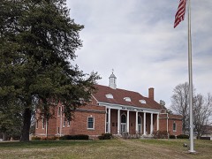 Dickson County War Memorial Buildinglisted 1999
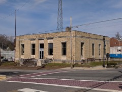 Dickson Post Officelisted 1996
 First National Bank of Dicksonlisted 1986
 Halbrook Hotellisted 1990
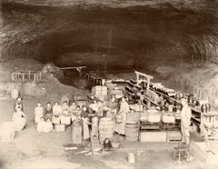 Ruskin Colony Groundslisted 1974
Population over time
2 figuresDickson grew from 14,538 to 16,058 between 2010 and 2020. These are the recorded population figures Wikidata holds for this place, reached through the Geographic Names Information System number this page is keyed on rather than by name, so they belong to this place and not to another of the same name. Most are census counts, but not all are: an early figure may be a founding or settlement estimate, and an estimate published within five years of a census is left out. The change column is computed, and is left blank where more than 20 years separate a figure from the one before it, because a gap that long is not a change between two counts.
| Year | People | Change |
|---|---|---|
| 2010 | 14,538 | |
| 2020 | 16,058 | +1,520 (+10%) |
Topographic sheets covering this place
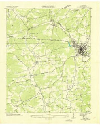
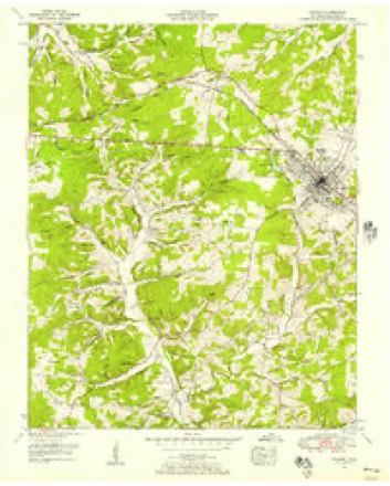
5 surveys from 8 printed sheetsMatched by testing this settlement's coordinate against the published boundary of every sheet in the United States Geological Survey's historical collection. Each opens the scanned sheet at the Survey.
- 1936 USGS Dickson quadrangle1:24000
- 1953 USGS Dickson quadrangle1:24000, 3 printings
- 1956 USGS Nashville quadrangle1:250000, 2 printings
- 1959 USGS Nashville quadrangle1:250000
- 1985 USGS Dickson quadrangle1:100000


Fires near this place
51 since 1998Regional context, not property-specific evidence. The federal wildfire occurrence database lists 51 fires within 5 miles of Dickson between 1998 and 2020, burning about 113 acres in total. 1 started naturally. 8 were recorded as arson. Distance is straight-line from the map coordinates, so a fire counted here may appear on a neighbouring settlement's page as well.
| Reported cause | Fires |
|---|---|
| Debris and open burning | 27 |
| Arson/incendiarism | 8 |
| Missing data/not specified/undetermined | 4 |
| Equipment and vehicle use | 3 |
| Fireworks | 2 |
| Railroad operations and maintenance | 2 |
| Power generation/transmission/distribution | 1 |
| Other causes | 1 |
| Misuse of fire by a minor | 1 |
| Natural | 1 |
| Smoking | 1 |
The most recent of them, most recent first, with the day each was reported and the service that recorded it.
| Date | Cause | Size | Reported by | Name on the report |
|---|---|---|---|---|
| 4 September 2007 | Arson/incendiarism | 1.0 acres | Tennessee Division of Forestry | HORNER FIRE |
| 21 September 2010 | Debris and open burning | 1.5 acres | Tennessee Division of Forestry | NANCY SHAW RD |
| 21 September 2010 | Missing data/not specified/undetermined | 6.0 acres | Tennessee Division of Forestry | SHAW FIRE |
| 19 September 2007 | Debris and open burning | under an acre | Tennessee Division of Forestry | WARDEN FIRE |
| 19 September 2000 | Equipment and vehicle use | 4.0 acres | Tennessee Division of Forestry | not named |
| 31 August 1999 | Smoking | 4.0 acres | Tennessee Division of Forestry | not named |
| 21 August 1999 | Equipment and vehicle use | 1.0 acres | Tennessee Division of Forestry | not named |
| 15 August 2007 | Other causes | under an acre | Tennessee Division of Forestry | COVINGTON FIRE |
Settlements close enough to share some of these fires:
Mines and quarries near this place
7 within 5 milesRegional context, not property-specific evidence. The federal mineral resources record lists 7 workings within 5 miles of Dickson: 5 past producers, 2 producers. 2 still produce. What was taken out: Iron, Stone, Crushed/Broken, Sand and Gravel, Construction. Distance is straight-line from the map coordinates, so a quarry counted here may appear on a neighbouring settlement's page as well.
| Where | Site | Commodity | Status | Recorded |
|---|---|---|---|---|
| Burns Stone Company Quarry | Sand and Gravel, Construction | Past Producer | Sedimentary | |
| Burns Stone Co. Quarry | Stone, Crushed/Broken | Producer | Limestone | |
| Dickson Mine | Stone, Crushed/Broken | Producer | ||
| Cavill Tract | Iron | Past Producer | ||
| Lyle and Clifton Prospects | Iron | Past Producer | ||
| Worley Branch Mine | Iron | Past Producer | ||
| Worley Furnace Mines | Iron | Past Producer |
Storms near this place
60 of 147 shownRegional context, not property-specific evidence. The National Weather Service names Dickson in 147 storm reports between 1995 and 2026: 86 thunderstorm wind, 38 hail, 17 flash flood, 2 lightning. No death or injury is recorded in these reports. Each account below is quoted exactly as the forecast office filed it, from the NOAA Storm Events Database, and each date opens the federal record of that event.
| When | Event | Place named | Harm | What the report says |
|---|---|---|---|---|
| February 2005 | Thunderstorm Wind | Dickson | $1,000,000 | Damage was first noted about 3/4 of a mile west of the high school. A pool house was moved about 4 inches at Buckner Park. A few trees were blown down as well. Also...a barn was completely destroyed near the high school. Roof damage was observed at the high school, and several windows were broken. Bleachers in a nearby ball field were ripped from their concrete base. Dickson County High School was closed for several days due to clean up efforts. The school reopened on Friday, later in the week. The storm struck on Monday, Feb. 21, on President's Day. Fortunately, classes were not in session, and there were no injuries. |
| May 2020 | Thunderstorm Wind | Dickson | $667,500 | Numerous trees and power lines were blown down with widespread power outages throughout Dickson County including on Hummingbird Lane, Walnut Grove Road, and Yellow Creek Road. A tree was also blown down onto a house on Walnut Grove Road. |
| April 2025 | Tornado (EF0) | Dickson | $250,000 | A brief EF-0 tornado touched down in Dickson. The tornado caused siding and roof damage to several structures on Cowan Road, Remington Drive, and Archway Drive. Damages are a rough estimate. |
| May 1999 | Thunderstorm Wind | Dickson | $230,000 | EMA reported trees down and trailer home split in half by fallen tree. TEMA reported main cost was for the restoration of utility service. |
| July 1999 | Lightning | Dickson | $200,000 | The home of a prominent Dickson physician burned to the ground after lightning struck the house. The family was out of town when the lightning hit the house. The house was located at 198 Farrar Lane in Druid Hills. |
| March 2023 | Thunderstorm Wind | Dickson | $75,000 | Severe thunderstorm winds resulted in significant damage in Dickson. A large billboard sign was blown over along with several trees and power lines. Structure and property damage was also reported at Dickson County Equipment along Tennessee State Route 46. Damages are a rough estimate. |
| April 2008 | Tornado (EF1) | Dickson | $75,000 | EF1 tornado flattened two barns, trees were snapped and uprooted, and outbuilding was destroyed. A 6 feet by 10 feet section of vinyl siding came off a house. Damage was in the Jones Creek Road and Rock Church Road areas. |
| August 2023 | Thunderstorm Wind | Dickson | $50,000 | Severe thunderstorm winds snapped two trees along Myatt Street in downtown Dickson. Numerous other fallen trees were also reported in the city with some falling on top of homes. Damages are a rough estimate. |
| February 2011 | Thunderstorm Wind | Dickson | $50,000 | Trees were downed on Crab Creek Road. On State Route 1, a transformer was blown off a poll, resulting in power outages across this area. |
| June 2009 | Thunderstorm Wind | Dickson | $50,000 | Trees were reported down with a measured gust of 72 MPH. Newspaper also reported that additional thunderstorm related wind damage was located in the north of the county and the southeast, including Cumberland Furnance, Vanleer, and White Bluff. This thunderstorm related wind damage included downed trees and five downed power lines. |
| March 1997 | Thunderstorm Wind | Dickson | $50,000 | no account filed |
| March 1996 | Thunderstorm Wind | Dickson | $30,000 | no account filed |
| April 2025 | Thunderstorm Wind | Dickson | $25,000 | Severe thunderstorm winds downed several trees and powerlines in the Dickson area. Damages are a rough estimate. |
| July 2012 | Thunderstorm Wind | Dickson | $25,000 | Numerous trees were downed in the city of Dickson. |
| February 2011 | Thunderstorm Wind | Dickson | $25,000 | Near the intersection of State Route 48 (Main Stret) and Harmon Springs Road West, a tree fell down into a house. Details concerning the extent of damage to the house and associated damage cost were unknown. |
| February 2009 | Thunderstorm Wind | Dickson | $25,000 | Numerous trees were downed across the county causing over more than 2,000 power outages. |
| October 2009 | Thunderstorm Wind | Dickson | $25,000 | EMA reported that trees were downed in the Dickson and Charlotte areas. |
| October 2004 | Flash Flood | Dickson | $20,000 | The Hidden Valley Aparments in Dickson were flooded with 18 to 20 inches of water due to heavy rains. 16 units of the apartment had water. The Hidden Valley Aparments is located at 405 Spring Street. 2 feet of water jumped a retaining wall and rolled into the apartments. Soem residents were evacuated and placed at a nearby Holiday Inn by the Red Cross. |
| March 1996 | Thunderstorm Wind | Dickson | $20,000 | no account filed |
| June 2019 | Thunderstorm Wind | Dickson | $15,000 | Trees and power lines were blown down across Dickson County with several roadways blocked. Around 11000 people were without power. |
| January 2008 | Thunderstorm Wind | Dickson | $12,000 | Ham radio operator said that trees were down in the city, At least one tree fell on a building. A newspaper reported a metal roof was taken off a barn and carried several yards away. |
| August 2023 | Thunderstorm Wind | Dickson | $10,000 | Severe thunderstorm winds downed numerous trees across Dickson County. Damages are a rough estimate. |
| February 2018 | Thunderstorm Wind | Dickson | $10,000 | Several trees were blown down throughout Dickson County. |
| July 2015 | Thunderstorm Wind | Dickson | $10,000 | Several trees were blown down in Dickson with one tree falling onto a house. |
| August 2013 | Thunderstorm Wind | Dickson | $10,000 | Dickson police and social media reports indicate numerous trees and large tree limbs were blown down in and around the city of Dickson. One tree was blown down onto a car. |
| February 2011 | Thunderstorm Wind | Dickson | $10,000 | Numerous trees were reported downed at the intersection of U.S Highway 70 and State Route 1 in Dickson. |
| April 2011 | Thunderstorm Wind | Dickson | $10,000 | Several trees were downed in Dickson. |
| May 2011 | Thunderstorm Wind | Dickson | $10,000 | Several trees were reported downed in Dickson. |
| July 2010 | Thunderstorm Wind | Dickson | $10,000 | One tree was reported down in Dickson while other trees were reported down over the southwestern part of county. |
| November 2025 | Thunderstorm Wind | Dickson | $5,000 | Severe thunderstorm winds downed a tree onto a house on W 1st Street in Dickson. Damages are a rough estimate. |
| January 2020 | Thunderstorm Wind | Dickson | $5,000 | A carport was torn apart and blown into the front yard of a home. |
| January 2020 | Thunderstorm Wind | Dickson | $5,000 | Considerable wind damage occurred at Dickson High School. The softball scoreboard was damaged, a trailer was blown onto its side, and several trees and fences were blown down. |
| June 2018 | Thunderstorm Wind | Dickson | $5,000 | Trees were blown down across Dickson County. |
| July 2016 | Thunderstorm Wind | Dickson | $5,000 | Numerous trees and power lines were blown down across Dickson County. |
| October 2014 | Thunderstorm Wind | Dickson | $5,000 | Facebook reports indicate a large tree limb was blown down onto and damaged a car along with wind gusts estimated up to 60 mph in Dickson. |
| June 2010 | Thunderstorm Wind | Dickson | $5,000 | Public reported a few large tree limbs blown off. |
| March 2006 | Thunderstorm Wind | Dickson | $5,000 | Several trees were snapped and uprooted. One mobile home was blown off its foundation at Abiff Road and Old Highway 46 in southeast Dickson County. |
| April 2003 | Thunderstorm Wind | Dickson | $5,000 | Damage to a log cabin at a flea market. |
| June 2003 | Thunderstorm Wind | Dickson | $5,000 | Spotter reported numerous trees were down. A large pavilion partially collapsed. There was roof damage to one home and 2 windows were blown out of another home. A tree fell on a home in Dickson. |
| January 1999 | Thunderstorm Wind | Dickson | $5,000 | Spotter reported 60 mph wind gust. Newspaper account of metal outbuilding destroyed on Bellwood Drive, and also damage was reported to aluminum bleachers at Tennsco Park. The bleachers were picked up by high winds and hung on a fence. |
| June 1995 | Thunderstorm Wind | Dickson | $5,000 | Several trees were knocked down across some power lines. |
| July 1995 | Thunderstorm Wind | Dickson | $5,000 | Several trees and large tree branches were blown down. |
| February 1997 | Thunderstorm Wind | Dickson | $5,000 | no account filed |
| May 1995 | Hail | Dickson | $5,000 | no account filed |
| March 2017 | Thunderstorm Wind | Dickson | $4,000 | Trees and power poles were blown down at Spring Street and Henslee Drive in Dickson. |
| January 2020 | Thunderstorm Wind | Dickson | $3,000 | Trees were blown down onto power lines along Highway 48 South. |
| January 2020 | Thunderstorm Wind | Dickson | $3,000 | Trees were blown down in Henslee Park. |
| January 2020 | Thunderstorm Wind | Dickson | $3,000 | Trees were blown down along Highway 48 South. |
| July 2015 | Thunderstorm Wind | Dickson | $3,000 | Trees were blown down along Eno Road at Highway 48 South. |
| August 2007 | Thunderstorm Wind | Dickson | $3,000 | The 911 dispatch relayed to the NWS that trees, electric and cable wires were down on West Piney Rd. |
| July 2016 | Thunderstorm Wind | Dickson | $2,000 | Tree limbs and power lines were blown down with power outages on Highway 48 South in Dickson. |
| June 2015 | Thunderstorm Wind | Dickson | $2,000 | Power lines were blown down with power outages. |
| July 2013 | Thunderstorm Wind | Dickson | $2,000 | A couple trees were reported down inside the Dickson city limit. |
| June 1995 | Thunderstorm Wind | Dickson | $2,000 | Five trees were blown down. |
| July 1995 | Thunderstorm Wind | Dickson | $2,000 | Several trees and tree limbs were blown down. |
| July 2020 | Thunderstorm Wind | Dickson | $1,000 | A tree was blown down in the roadway on Beasley Drive. |
| June 2018 | Thunderstorm Wind | Dickson | $1,000 | A tree was blown down that completely blocked Cowan Road near Remington Drive. |
| August 2012 | Thunderstorm Wind | Dickson | $1,000 | Large tree limbs were blown down in Dickson. |
| April 2010 | Thunderstorm Wind | Dickson | $1,000 | Trained spotter estimated 60 to 65 mph wind gust along i-40 and hwy 46. |
| February 2005 | Flash Flood | Dickson | $1,000 | Highway 48 North was impassable due to high water on road. |
Nearest settlements
The eight closest, with where each one stands in the county. Distances are straight-line, computed from the Geographic Names Information System coordinates.
| Map | Place | Distance | Sheets |
|---|---|---|---|
| West Dickson | 0.7 miles | 8 | |
| East Dickson | 0.8 miles | 8 | |
| Colesburg | 2.4 miles | 10 | |
| Pond | 2.9 miles | 8 | |
| Pomona | 3.7 miles | 10 | |
| Eno | 3.7 miles | 8 | |
| Burns | 4.3 miles | 10 | |
| Robinsons Chapel | 4.6 miles | 8 |
Elsewhere
Matched on this settlement's Geographic Names Information System number rather than its name, so it cannot be a different place of the same name in another state.
| Wikipedia article on Dickson | An encyclopaedic summary. Its text is share-alike, so it is linked here rather than copied. |
| Wikidata item Q2354539 | The structured record the population and elevation above come from. Public domain (CC0). |
Provenance
This settlement is recorded in the Geographic Names Information System as feature 1303436. The sheet list is computed by point-in-boundary test against the United States Geological Survey's historical topographic inventory. Both are works of the United States government and carry no copyright under 17 U.S.C. 105.
Wildfire. Short, Karen C. 2022. Spatial wildfire occurrence data for the United States, 1992-2020 [FPA_FOD_20221014]. 6th Edition. Fort Collins, CO: Forest Service Research Data Archive. https://doi.org/10.2737/RDS-2013-0009.6 Collected with United States Government funding and usable without additional permissions or fees.
Mines and quarries. USGS Mineral Resources Data System (MRDS) https://mrdata.usgs.gov/mrds/ A work of the United States government, no copyright under 17 U.S.C. 105.
Storms. NOAA National Centers for Environmental Information, Storm Events Database https://www.ncei.noaa.gov/stormevents/ A work of the United States government, no copyright under 17 U.S.C. 105. Narratives are quoted verbatim from the National Weather Service report and are not edited or summarised.