 Block
Donelson, Tennessee
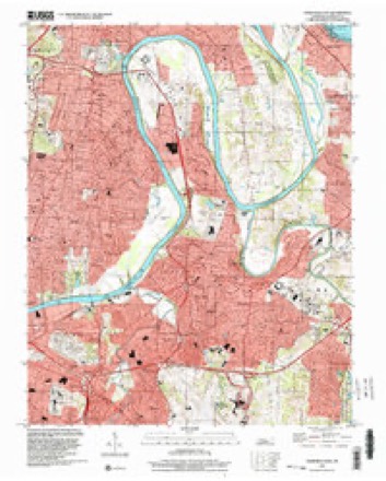
21 topographic sheets cover this place, the earliest surveyed in 1903 and the latest in 1997. It stands in District 15. It lies in ZIP code area 37214. It lies near Todd Knob. The Survey maps it on the Nashville East quadrangle.
On record in Donelson
Buildings and businesses the archive holds for this place. Each opens its own page, with the source record it came from.
On the National Register within a mile 2 records
The National Register names another town for these. They stand within one mile of this settlement's coordinate.
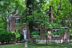 Hall-Harding-McCampbell Houselisted 2010 · 0.5 miles away
- Bluefields Historic Districtlisted 2016 · 0.2 miles away
Topographic sheets covering this place
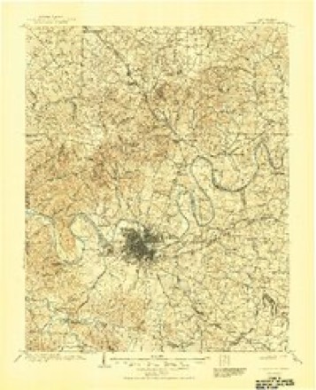
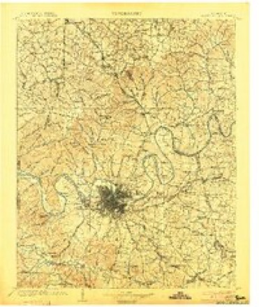
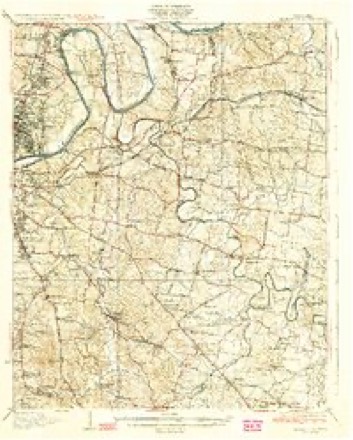
11 surveys from 21 printed sheetsMatched by testing this settlement's coordinate against the published boundary of every sheet in the United States Geological Survey's historical collection. Each opens the scanned sheet at the Survey.
- 1903 USGS Greenbrier quadrangle1:125000, 2 printings
- 1903 USGS Nashville quadrangle1:125000, 2 printings
- 1932 USGS Hermitage quadrangle1:62500, 3 printings
- 1942 USGS Lebanon quadrangle1:100000
- 1952 USGS Nashville East quadrangle1:24000
- 1956 USGS Nashville quadrangle1:250000, 2 printings
- 1957 USGS Nashville East quadrangle1:24000, 2 printings
- 1959 USGS Nashville quadrangle1:250000
- 1968 USGS Nashville East quadrangle1:24000, 5 printings
- 1984 USGS Nashville quadrangle1:100000
- 1997 USGS Nashville East quadrangle1:24000



Fires near this place
4 since 1997Regional context, not property-specific evidence. The federal wildfire occurrence database lists 4 fires within 5 miles of Donelson between 1997 and 2000, burning about 42 acres in total. None started naturally. None was recorded as arson. Distance is straight-line from the map coordinates, so a fire counted here may appear on a neighbouring settlement's page as well.
| Reported cause | Fires |
|---|---|
| Debris and open burning | 3 |
| Missing data/not specified/undetermined | 1 |
The most recent of them, most recent first, with the day each was reported and the service that recorded it.
| Date | Cause | Size | Reported by | Name on the report |
|---|---|---|---|---|
| 2 December 1998 | Missing data/not specified/undetermined | 15 acres | Tennessee Division of Forestry | not named |
| 14 December 1997 | Debris and open burning | under an acre | Tennessee Division of Forestry | not named |
| 11 December 2000 | Debris and open burning | 1.0 acres | Tennessee Division of Forestry | not named |
| 1 November 1998 | Debris and open burning | 26 acres | Tennessee Division of Forestry | not named |
Settlements close enough to share some of these fires:
Mines and quarries near this place
6 within 5 milesRegional context, not property-specific evidence. The federal mineral resources record lists 6 workings within 5 miles of Donelson: 5 producers, 1 past producer. 5 still produce. What was taken out: Stone, Crushed/Broken, Stone, Crushed/Broken, Limestone, General, Limestone, General. Distance is straight-line from the map coordinates, so a quarry counted here may appear on a neighbouring settlement's page as well.
| Where | Site | Commodity | Status | Recorded |
|---|---|---|---|---|
| Glencliff Quarry | Limestone, General | Past Producer | Sedimentary | |
| Donelson Pike Quarry | Stone, Crushed/Broken, Limestone, General | Producer | Limestone | |
| Hermitage Plant #506 | Stone, Crushed/Broken, Limestone, General | Producer | Limestone | |
| Donelson Pike Quarry | Stone, Crushed/Broken | Producer | ||
| Glencliff Quarry | Stone, Crushed/Broken | Producer | ||
| Hermitage Quarry | Stone, Crushed/Broken | Producer |
Storms near this place
45 since 1993Regional context, not property-specific evidence. The National Weather Service names Donelson in 45 storm reports between 1993 and 2026: 30 thunderstorm wind, 8 hail, 4 lightning, 2 flash flood. The reports record 2 injuries. Each account below is quoted exactly as the forecast office filed it, from the NOAA Storm Events Database, and each date opens the federal record of that event.
| When | Event | Place named | Harm | What the report says |
|---|---|---|---|---|
| August 2021 | Lightning | Donelson | 2 hurt | Two adults were reportedly struck by lightning at Hickman Elementary School on Stewarts Ferry Pike, but only suffered minor injuries. |
| June 2019 | Tornado (EF0) | Donelson | $100,000 | A brief EF0 tornado touched down In the Stones River Bend Park and moved southeast, snapping several trees along the river. Moving through the Standford Estates subdivsion, the tornado blew down numerous large trees in a convergent pattern on Edgemont Drive, Myrick Drive, Stanford Drive, Belding Drive, and Jenry Drive, with some trees falling onto and severely damaging homes. Many of these same homes were also damaged in a severe microburst on April 18, 2017. The tornado continued southeast and blew down many more trees on Wellington Square, Lebanon Pike, and along the Stones River Greenway before lifting. |
| April 2017 | Thunderstorm Wind | Donelson | $50,000 | A NWS storm survey along with Nashville OEM determined an intense 3 mile long by 1/2 mile wide microburst caused significant wind damage in parts of Donelson and Hermitage. The worst damage was in the Stanford Estates neighborhood in Donelson on Lebanon Pike, where dozens of trees and large tree limbs were snapped or uprooted, with many falling onto homes. A total of 6 homes had significant damage due to downed trees. The roof of a dugout was also partially blown off at the Donelson Christian Academy, and several fences were blown down in the area. Damage was in a clear starburst pattern from the west to the north-northeast across Stanford Estates. Farther to the northeast, more trees were blown down in Hermitage along the Stones River Greenway and in the Ravenwood and Hermitage Hills neighborhoods. A few more trees were blown down in Rotary Park in Hermitage and a baseball field backstop was damaged. Winds were estimated up to 75 mph. |
| June 1994 | Thunderstorm Wind | Donelson | $50,000 | Several trees were knocked down. One fell on the roof of an apartment building. Twenty-five people were evacuated from the building. |
| March 2018 | Lightning | Donelson | $25,000 | Lightning struck a house at 3201 Toddway Court in Donelson causing damage to the home. |
| April 2011 | Thunderstorm Wind | Donelson | $25,000 | A railroad signal gate was blown down near the intersection of Stewarts Ferry Pike and McCampbell Road. |
| June 2009 | Thunderstorm Wind | Donelson | $25,000 | Trees and power lines were downed in Donelson. |
| July 2003 | Thunderstorm Wind | Donelson | $15,000 | Trees was blown down on a vehicle. |
| April 2011 | Thunderstorm Wind | Donelson | $10,000 | Several one to two foot diameter trees were snapped in half at Clover Bottom Mansion near the intersection of Lebanon Road and Disspayne Drive. |
| June 2009 | Thunderstorm Wind | Donelson | $10,000 | Large trees were reported down in Donelson at Goodlin Drive. |
| April 2009 | Thunderstorm Wind | Donelson | $10,000 | Numerous large trees down at Kippling, Woodbury, Harold Drives in Donelson. 1,000 customers were without power for several hours. |
| August 2019 | Thunderstorm Wind | Donelson | $5,000 | A tree was blown down onto a car. |
| July 2017 | Lightning | Donelson | $5,000 | Several tSpotter Twitter reports, photos and video showed lightning struck a Comfort Suites hotel on Stewarts Ferry Pike near I-40 causing a fire in the tower of the building. |
| July 2014 | Lightning | Donelson | $5,000 | Lightning struck a garage on Percy Priest Drive causing a fire. |
| April 2011 | Thunderstorm Wind | Donelson | $5,000 | Trees were downed at the intersection of Bluefield Avenue and Donelson Pike. One tree fell on a home critically injuring a man. At Nashville International Airport two workers were injured by flying debris and transported to a local hospital. |
| April 2009 | Flash Flood | Donelson | $5,000 | Street flash flooding was reported in Donelson. |
| May 2021 | Thunderstorm Wind | Donelson | $3,000 | Trees were blown down near the YMCA along Lebanon Road. |
| March 2026 | Thunderstorm Wind | Donelson | $2,000 | Severe thunderstorm winds downed a tree in a backyard near Lakeland and Donelson Pike in Hermitage. Damages are a rough estimate. |
| August 2012 | Thunderstorm Wind | Donelson | $2,000 | Trees were blown down at the intersection of Lakeland Drive and Ironwood Drive in Donelson. |
| June 2009 | Thunderstorm Wind | Donelson | $2,000 | Twelve inch tree limbs were reported down on Downeymeade Drive in Standford Estates Subdivision. |
| April 2025 | Thunderstorm Wind | Donelson | $1,000 | Severe thunderstorm winds downed a tree onto Donelson Pike in Hermitage. Damages are a rough estimate. |
| July 2023 | Thunderstorm Wind | Donelson | $1,000 | Severe thunderstorm winds downed a tree near Old Lebanon Pike and Benson Road in Donelson. Damages are a rough estimate. |
| August 2019 | Thunderstorm Wind | Donelson | $1,000 | A tree was blown down across Graylynn Drive. |
| April 2017 | Thunderstorm Wind | Donelson | $1,000 | A Facebook report indicated a large tree was uprooted on Teakwood Drive in Donelson. |
| June 2016 | Thunderstorm Wind | Donelson | $1,000 | Large tree was blown down in Donelson. |
| July 2015 | Thunderstorm Wind | Donelson | $1,000 | A large tree was blown down at Stewarts Ferry Pike at Lebanon Pike in Donelson. |
| July 2015 | Thunderstorm Wind | Donelson | $1,000 | A Twitter tSpotter report indicated a power line was blown down on Elm Hill Pike at I-40 blocking the roadway. |
| August 2012 | Thunderstorm Wind | Donelson | $1,000 | A tree was blown down at Lebanon Road at Stewarts Ferry Pike in Hermitage. |
| July 2012 | Flash Flood | Donelson | $1,000 | Water over roadway near the intersection of McCampbell Avenue and Stewarts Ferry Pike. |
| March 1993 | Thunderstorm Wind | Donelson | $500 | A few trees were knocked down. |
| August 2020 | Hail | Donelson | - | Twitter tSpotter photos showed penny to nickel size hail fell on Stewarts Ferry Pike near the northwest side of Percy Priest Lake. |
| May 2006 | Thunderstorm Wind | Donelson | - | Trees reported blown down near the intersection of McGavock Pike and Lebanon Pike. |
| June 2006 | Hail | Donelson | - | Trained spotter reported golf ball size hail at the Opryland Hotel parking lot. |
| May 2005 | Thunderstorm Wind | Donelson | - | NWS Trained Spotter estimated wind gusts to be 65 to 70 mph. |
| May 2005 | Thunderstorm Wind | Donelson | - | Trees and power lines were down. |
| April 2004 | Hail | Donelson | - | Public reported penny size hail in Donelson at I-40. |
| August 2003 | Hail | Donelson | - | Penny size hail was reported near BNA airport. |
| June 2003 | Thunderstorm Wind | Donelson | - | Ham radio operator reported trees down and one power line down. |
| May 2000 | Thunderstorm Wind | Donelson | - | Spotter reported 60 mph wind gusts and trees down. |
| April 1999 | Hail | Donelson | - | Spotter reported golf ball size hail near Opryland on Briley Parkway. |
| August 1999 | Hail | Donelson | - | Golf ball size hail covering the ground. |
| April 1998 | Thunderstorm Wind | Donelson | - | Local law enforcement reported trees and powerlines down. |
| April 1998 | Thunderstorm Wind | Donelson | - | Local law enforcement reported 2 trees blown down. |
| June 2018 | Hail | Donelson | - | no account filed |
| March 2011 | Hail | Donelson | - | no account filed |
Nearest settlements
The eight closest, with where each one stands in the county. Distances are straight-line, computed from the Geographic Names Information System coordinates.
| Map | Place | Distance | Sheets |
|---|---|---|---|
| Cloverhill | 0.7 miles | 21 | |
| Merry Oaks | 0.8 miles | 21 | |
| Hite (historical) | 1.0 miles | 21 | |
| Lincoya Hills | 1.2 miles | 21 | |
| Mudtavern | 1.4 miles | 21 | |
| Glenview | 2.9 miles | 21 | |
| Rosebank | 3.0 miles | 21 | |
| Gertrude (historical) | 3.2 miles | 18 |
Provenance
This settlement is recorded in the Geographic Names Information System as feature 1306381. The sheet list is computed by point-in-boundary test against the United States Geological Survey's historical topographic inventory. Both are works of the United States government and carry no copyright under 17 U.S.C. 105.
Wildfire. Short, Karen C. 2022. Spatial wildfire occurrence data for the United States, 1992-2020 [FPA_FOD_20221014]. 6th Edition. Fort Collins, CO: Forest Service Research Data Archive. https://doi.org/10.2737/RDS-2013-0009.6 Collected with United States Government funding and usable without additional permissions or fees.
Mines and quarries. USGS Mineral Resources Data System (MRDS) https://mrdata.usgs.gov/mrds/ A work of the United States government, no copyright under 17 U.S.C. 105.
Storms. NOAA National Centers for Environmental Information, Storm Events Database https://www.ncei.noaa.gov/stormevents/ A work of the United States government, no copyright under 17 U.S.C. 105. Narratives are quoted verbatim from the National Weather Service report and are not edited or summarised.