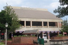
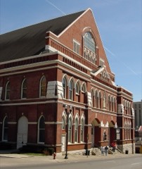
| May 2010 | Flood | Rural Hill | 10 killed, $1,500,000,000 | At U.S. Highway 431 near the Robertson/Davidson County Line at Sycamore Creek, water was overflowing its banks, resulting in flooding of low lying areas. At least one home and farm was reported to be covered with flood waters. At the time of this report, U.S. Highway 431 was still open, although the water level near the base of the road and bridge was rising fast. No additional information was provided concerning any damage to the road or bridge. Also, flooding was reported along Charlotte Road just west of downtown Nashville by the public. Emergency Manager reported closing of Bluff Road due to water covering the road. Water was reported over Culbertson Road along Mill Creek near Nolensville. This made the road impassible to traffic. On Estes Road, approximately one mile west of Green Hills, a creek was flowing over the road. Depth was estimated at three to six inches. This caused the road to become impassible to traffic. Water was running over Old Harding Pike from the Harpeth River near Morton Mill Road. Also, numerous homes, numerous businesses, numerous non comercial buildings, along with several county, state, and federal roads across the county received damage due to the flood. This damage also included major damage to the Opryland Hotel, Grand Ole Opry House, and Opry Mills shopping mall. |
| March 2021 | Flash Flood | Stone River | 5 killed, $20,000,000 | Major and historic flash flooding affected southern and eastern Davidson County, with the worst flooding affecting areas along and near Sevenmile Creek and Mill Creek in south Nashville. Hundreds of homes and businesses were flooded, numerous roadways were flooded and closed including I-24, I-40, and I-440, and over 130 water rescues were conducted from people stranded in flooded vehicles and homes. Homes and businesses that were flooded included a hotel at 95 Wallace Road near I-24 at Harding Place, the South Brooke Apartments on Linbar Drive, many homes around Edmondson Pike at Blackman Road, the Walmart on Nolensville Pike at Harding Place with vehicles in the parking lot submerged up to their windows, a home on Truxton Court in Donelson, and the Kroger on Old Hickory Blvd in Hermitage which also had cars stalled in flood waters in the parking lot. Residents were trapped and rescued from the second stories of homes on Paragon Mills Road, and the attics of homes on Currey Road and also on Suter Drive near Edmondson Pike. Other people were rescued clinging to trees or in flood waters in the 400 block of Hogan Road, on Milner Drive, and in the 400 block of Harding Place. Interstate 24 near Antioch Pike was submerged with many vehicles stranded and around one dozen drivers rescued, and Interstate 40 and Interstate 440 were also flooded in a few areas. Other roads that were flooded and impassable included Rosa Parks Blvd near the Farmers Market, Highway 70 near White Bridge Road, Dodson Chapel Road, Tulip Grove Road, and Chandler Road. A total of 5 people were killed, 3 of which were swept away from a homeless camp along Sevenmile Creek near Edmondson Pike at Nolensville Pike. Another man drowned when he left his submerged vehicle and was swept away near the Nashboro Village Golf Course at Nashboro Blvd at Flintlock Court, and another man drowned in his vehicle behind the Walmart near Harding Place at Nolensville Pike. |
| December 2023 | Tornado (EF2) | Madison | 3 killed, 21 hurt, $10,000,000 | This strong EF-2 tornado touched down just to the east of I-24 on Brick Church Lane in Davidson County. There were a few trees down and shingle damage to several homes in this area. The tornado strengthened in the Madison area causing EF-2 damage with winds up to 120-125 mph. The heaviest damage was confined to two areas, off of East Campbell Road as well as Nesbitt Lane. Multiple mobile homes were destroyed on Nesbitt Lane, and this is where three fatalities occurred. Multiple single family homes and a church off of East Campbell Road were missing large sections of their roofs with some exterior walls collapsed. Several metal power poles in the area were bent as well. Nearby, an apartment complex off Palmer Avenue sustained damage. As the tornado moved further northeast, substantial damage was found to houses in a cul-de-sac on Stoney River Lane. Two buildings were toppled and several others damaged in an industrial complex off of Myatt Drive. The tornado then continued across the Cumberland River and Old Hickory Lake, coming onshore again in the immediate dam vicinity. It is this location in which the strongest winds were found, up to 130 miles per hour, due to substantial damage to a grove of hundreds of trees in which all of them were either snapped, uprooted, or missing major branches. The tornado persisted into Hendersonville, downing hundreds of trees and causing roof damage to multiple homes. It damaged many businesses along Main Street. The tornado continued northeast into Gallatin where EF-2 damage with maximum winds of 115 mph was found to a few homes in the Club at Foxland Harbor as we as the Foxland Harbor Golf and Country Club. At this point, the tornado began to weaken though EF-1 damage was found as it crossed Highway 109 and Steam Plant Road. Several trees were still found to be uprooted along with minor roof and shingle damage to a couple of homes as the tornado crossed Hartsville Pike. Scattered trees continued to be blown down along Lauderdale Lane and Homer Scott Road before the tornado crossed Highway 231 into Trousdale County. Trees continued to be blown down on Browning Branch Road and a home suffered significant roof and porch damage on Hawkins Branch Road. Trees continued to be blown down until the tornado lifted near Shephard Hollow Lane. Around 600 homes and businesses were damaged in Sumner County. |
| March 2020 | Tornado (EF3) | Scottsboro | 2 killed, 170 hurt, $1,090,000,000 | An historic, long-track, strong EF-3 tornado began in western Davidson County then tracked eastward for over 60 miles through Wilson County into Smith County before lifting, causing 5 deaths and 220 injuries. This tornado touched down west of River Road Pike then moved eastward across Bells Bend, destroying a barn and blowing down numerous trees. The tornado strengthened significantly and widened to 0.65 miles wide as it crossed the Cumberland River into the John C. Tune Airport area, causing strong EF-2 damage to numerous planes, hangers, warehouses, and other buildings from Cockrill Bend Way to Briley Parkway. Around $200 million in damage was reported at John C. Tune Airport alone. Continuing eastward, the tornado caused severe damage to the Tennessee State Prison and blew down numerous high-tension transmission towers as it again crossed the Cumberland River into North Nashville, with up to EF-2 damage to farm facilities at Tennessee State University and dozens of homes between I-40 and Buchanan Street. EF-2 damage continued across the Germantown neighborhood just 1/2 mile north of downtown Nashville with several damaged and destroyed apartment complexes, homes, and businesses. The tornado intensified further as it tracked through East Nashville, with EF-3 damage to businesses and other buildings in the Five Points area and EF-2 damage to homes in the Lockeland Springs and Barclay Drive neighborhoods. Two people were killed in Five Points after leaving a bar and going outside as the tornado struck. After crossing the Cumberland River yet again, the tornado weakened as it moved northeast through the Donelson Hills and Lincoya Hills neighborhoods of Donelson, but strengthened again to a strong EF-3 in the Standford Estates area where several homes were leveled. The tornado weakened slightly but continued to cause EF-2 damage to homes and businesses as it turned southeast and passed through Hermitage into Wilson County. ||Dozens of homes continued to sustain up to EF-2 damage as the tornado moved across the Chandler Road and Triple Crown Parkway neighborhoods of Mount Juliet. Turning more to the northeast, the tornado strenghtened to strong EF-3 and leveled numerous homes in the Catalpa Drive and Clearview Drive neighborhoods, with one elderly couple killed on Catalpa Drive at Dogwood Drive. Crossing Mount Juliet Road, the tornado severely damaged West Wilson Middle School and Stoner Creek Elementary School, both of which will have to be torn down and rebuilt. The tornado reached its peak intensity of high-end EF-3 and peak size of 0.9 miles wide as it moved across Golden Bear Parkway and along Eastgate Blvd, leveling several large warehouses and killing a security guard at the CEVA warehouse on Athletes Way North. Crossing Highway 109 into Lebanon, the tornado weakened to EF-2 but continued damaging dozens of homes and businesses as it moved through southern sections of the city. Further to the east, buildings on both sides of I-40 in Tuckers Crossroads received up to EF-2 damage before the tornado turned southeast and crossed into Smith County. Weakening and shrinking in size, the tornado caused EF-1 damage to numerous homes and businesses in Grant, New Middleton, and just south of Gordonsville. The tornado finally lifted east of Highway 141 and north of Judkins Lane after a continuous 60.13 miles on the ground. |
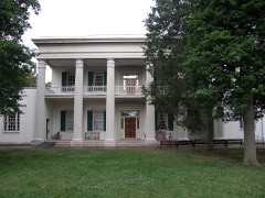
| April 1998 | Tornado (F3) | Nashville | 1 killed, 60 hurt, $100,000,000 | This Nashville tornado on April 16, 1998 took a very similar path to another F3 tornado that occurred on March 14, 1933, which killed 11 people in Nashville. The tornado touched down at 330 PM one mile west of Charlotte Pike and I-440. A tree fell on an ROTC student at Centennial Park. He was attending an ROTC picnic. He died later on May 4 from his injuries. The tornado went through downtown Nashville at 340 PM and on toward East Nashville, Donelson and Hermitage. The tornado blew out many windows on office buildings. The Nations Bank Office Towers were one of the hardest hit buildings in Nashville. Tennessee Performance Arts Center (TPAC) and the Tennessee Towers sustained damage. TPAC had over 100 windows blown out. NOAA Weather Radio broadcasts from the Tennessee Towers and was off the air for about 24 hours. 30 private airplanes were damaged at Cornelia Fort Airport. Estimated damage to the airplanes was 3 million dollars. 35 buildings in downtown Nashville were "red tagged", meaning these buildings were structurally unsound. Many signs in Davidson county were blown down or severely damaged. The tornado blew down 3 out of 10 construction cranes on the construction site of the Tennessee Oiler's Football Stadium near the Cumberland River. The tornado continued east and hit the residential section of East Nashville. At least 300 homes were damaged in East Nashville. Many homes lost a good part of their roofs, trees were uprooted, telephone poles were knocked down. St. Ann's Episcopal Church, which is well over 100 years old, received major damage. Uprooted trees, damaged roofs to many homes was the story across Donelson and Hermitage. Numerous windows were blown out from the Gaylord Building in Donelson. About half the trees, that is over a thousand trees, were blown down at Andrew Jackson's home, The Hermitage. The Hermitage is a 600 acre estate of the former President. Some of those trees were well over 200 years old, and a few of those trees that were destroyed were planted by Andrew Jackson himself. Mayor Phil Bredesen closed downtown Nashville of Friday, April 17. Many workers had an unscheduled holiday. The downtown area was reopened Monday, April 20. This gave time for cleanup crews to remove broken glass and repair downed power lines. Nashville Electric Service said 75,000 customers were without power. |
| April 1974 | Tornado (F2) | not stated | 1 killed, 12 hurt, $2,500 | no account filed |
| July 2006 | Thunderstorm Wind | Nashville | 1 killed, 3 hurt, $10,000 | Gust front ahead of an area of thunderstorms had wind gusts of 40 to 50 mph. Some of these wind gusts were measured or estimated by trained spotters in Davidson County. As this gust front entered Davidson County, a tree limb from a rotted tree fell on a vehicle, a Jeep Grand Cherokee, killing the driver and slightly injuring his wife and his 2 young children. The gust front exited the county at 1630 CST. Over 25,000 people were without power in Davidson County according to Nashville Electric Service. Wind gusts were measured up to 47 mph at Nashville International Airport at 1620 CST. The fatality occurred at the intersection of Robertson Road and Nall Avenue in the western part of Nashville. |
| May 2010 | Flash Flood | Walnut Grove | 1 killed, $25,000,000 | Dozens of cars and trucks were trapped by flash flooding along Mill Creek near the Bell Rd. exit on I-24. A portable classroom trailer from a school half a mile away floated to the Interstate and was destroyed as it was sucked into a culvert. A 21 year old man was killed attempting to cross water in the Bell Rd. area. |
| January 2013 | Thunderstorm Wind | Bordeaux | 1 killed, $5,000 | A man was killed when a tree fell onto a shed he was taking cover in on Abernathy Road in Bordeaux. |
| April 1972 | Tornado (F2) | not stated | 15 hurt, $250,000 | no account filed |
| April 2006 | Tornado (F3) | Goodlettsville | 7 hurt, $10,000,000 | The tornado destroyed many residential homes in Goodlettsville. Significant damage was done to the Metro Baptist Church with part of the roof blown off and front of church blown away. This tornado destroyed 25 homes, 13 homes or businesses with major damage and 31 with moderate damage/. |
| January 1957 | Tornado (F2) | not stated | 4 hurt, $2,500,000 | no account filed |
| August 2003 | Thunderstorm Wind | Nashville | 4 hurt, $50,000 | Law enforcement and newspaper articles reported 20 to 30 boats were overturned and part of the Elm Hill Marina was destroyed. 4 people were injured, and 2 of them had to be hospitalized. The storms struck during a fishing tournament. |
| April 1991 | Thunderstorm Wind | not stated | 4 hurt | no account filed |
| May 1971 | Tornado (F0) | not stated | 3 hurt, $250,000 | no account filed |
| January 1997 | Thunderstorm Wind | Madison | 2 hurt, $500,000 | no account filed |
| August 2012 | Thunderstorm Wind | Amqui | 2 hurt, $15,000 | A tree fell onto a car on Anderson Lane in Madison. Two people were trapped in the car and injured before being rescued and transported to the hospital. |
| June 1998 | Thunderstorm Wind | Hermitage | 2 hurt, $10,000 | A tree fell on a car which injured 2 people. |
| August 2021 | Lightning | Donelson | 2 hurt | Two adults were reportedly struck by lightning at Hickman Elementary School on Stewarts Ferry Pike, but only suffered minor injuries. |
| May 2020 | Thunderstorm Wind | Vaughns Gap | 2 hurt | A tree fell onto and severely injured two hikers near the Indian Springs shelter in Percy Warner Park. |
| April 2009 | Tornado (EF1) | Glencliff | 1 hurt, $500,000 | An EF1 Tornado with maximum estimated wind speed around 90 to 100 mph touched down in the Nashville Metro Area.||The tornado touched down south of Briley Parkway and Murfreesboro |Pike, where it caused minor damage to houses and downed several|trees. As the tornado crossed Murfreesboro Pike and it damaged several |businesses, some significantly. The tornado continued north and |caused minor damage to houses and downed trees, some very large,|then crossed Interstate 40 west of Briley Parkway and lifted near Elm Hill Pike. The path length of the tornado was almost two miles, and the maximum width was 50 to 100 yards wide. One minor injury was reported but no additional information was provided. Additional details provided by the public, trained spotters, and amateur radio included |2 overturned semi-trucks at Interstate 40 and Briley Parkway and at 1204 Murfreesboro Road roof damage to a building with 20 to 30 cars damaged in the parking lot. A newspaper reported an exterior wall collapsed onto a car at Bridgestone Firestone Tire Store, with two large power lines snapped and leaning over Murfreesboro Road and tires were tossed more than 300 yards. |
| February 2000 | Tornado (F1) | Nashville | 1 hurt, $500,000 | About 50 homes and 20 businesses received damage from this tornado. A 25 foot hackberry tree fell on a house. An oak tree crashed into the side of a building. A school trailer was destroyed at St. Vincent De Paul School. There was 15 rooftop damage at an apartment complex on Delta Street. The hardest hit area of downtown Nashville was the Eight Avenue North and Bordeaux . The tornado started around Scovel Street and 28th Avenue North. Extensive damage occurred from this location and to the eastnortheast for just over a mile in length. Numerous trees were uprooted or snapped. Powerlines were down. A number of homes suffered roof damage. The tornado crossed I-265 , moving eastnortheast reaching Arthur Avenue, 10th Ave. and 9th Ave. North, crossed the Cumberland River and then reaching Dickerson Pike and Ellington Parkway, finally dissipating around Petway Avenue and Gallatin Road.One woman was injured when an interstate sign blew into her car and caused her to wreck. |
| January 2013 | Tornado (EF0) | Inglewood | 1 hurt, $150,000 | An EF0 tornado touched down just northeast of the I-65 and Trinity Lane interchange and moved eastward along a narrow intermittent path through East Nashville before ending around McGavock Pike in Inglewood just to the west of the Cumberland River. Several mobile homes were heavily damaged by falling trees along Dickerson Pike, with one woman receiving a minor injury in the Ranchwood Mobile Home Park. Numerous homes had minor roof and exterior damage along Donald Street, Gordon Terrace, Woodyhill Drive, and Jones Avenue, and several large trees were blown down. Some roof damage was noted to health department buildings on RS Gass drive south of Hart Lane. Dozens of more homes suffered minor roof and exterior damage from the Gillock Street and Gallatin Pike area eastward to near McGavock Pike, with numerous trees and fences blown down. |
| March 2023 | Thunderstorm Wind | Antioch | 1 hurt, $20,000 | Severe thunderstorm winds caused a tree to fall on a house along Bess Court north of Ocala Drive near Antioch. A child who was in the home suffered minor injuries. Damages are estimated. |
| June 2016 | Thunderstorm Wind | Richland | 1 hurt, $20,000 | A large scaffolding structure at a construction site for a water tower collapsed on Morrow Road in The Nations area of west Nashville. A worker on the scaffolding reportedly fell 70 feet and was injured. |
| June 2016 | Thunderstorm Wind | Antioch | 1 hurt, $3,000 | A large tree fell onto a car on Waikiki Blvd at Richards Road in Antioch. One woman in the vehicle reportedly suffered minor injuries. |
| February 2021 | Thunderstorm Wind | Nashville | 1 hurt, $1,000 | A child was injured after coming into contact with a downed power line on University Court near downtown Nashville. |
| April 2025 | Lightning | Oak Hill | 1 hurt | Media reports Metro Police dispatch confirms the victim was outside when they were struck at the Hilton on Cleghorn Avenue in Nashville's Green Hills neighborhood. Victim was awake and alert, and did not require medical transport to a hospital. |
| September 2024 | Lightning | Una | 1 hurt | Lightning reportedly struck and injured a 25-year-old man in the chest near Antioch. The man refused medical attention and exact injuries are unknown. |
| May 2020 | Thunderstorm Wind | Couchville | 1 hurt | A tree fell onto and severely injured a hiker on Volunteer Trail in Long Hunter State Park. |
| August 2014 | Flash Flood | Little Creek | 1 hurt | Heavy rainfall resulted in flash flooding across parts of Nashville. A man was swept away into a creek around 7pm in Madison between 2nd Avenue and Elm Street. He was rescued at 1245am on August 31 but only had minor injuries. In southeast Nashville, Murfreesboro Road was flooded between Vultee Drive and Glengarry Drive. |
| June 2013 | Lightning | Richland | 1 hurt | One person was reportedly struck by lightning and injured in Sylvan Park. Reported via tspotter on Twitter. |
| July 1991 | Thunderstorm Wind | not stated | 1 hurt | no account filed |
| July 1987 | Thunderstorm Wind | not stated | 1 hurt | no account filed |
| August 2013 | Flash Flood | Scottsboro | $50,000,000 | More than 100 homes and businesses were damaged and a couple homes destroyed by significant flash flooding across metro Nashville. There were dozens of water rescues across the city, including along Interstate 24 and Briley Parkway where several motorists had to be rescued. All told, Nashville OEM responded to over 200 calls for help from residents. |
| March 2012 | Hail | Berry Hill | $25,000,000 | no account filed |
| May 2020 | Thunderstorm Wind | Nashville | $7,580,000 | Hundreds of trees and power lines were blown down across Davidson County with some falling onto cars and houses. Over 130,000 customers lost power due to the storms, which is the largest power outage in the history of the Nashville Electric Service. Some customers were without electricity for up to 1 week. Total damage across Davidson County was estimated at $7,583,701 by the Tennessee Emergency Management Agency. |
| June 1994 | Thunderstorm Wind | Western Davidson | $5,000,000 | The roof was blown off of a harbor marina producing around $1 million in damage. Several trees were blown down as well. |
| May 1999 | Thunderstorm Wind | Nashville Metro Arpt | $2,700,000 | FAA wind equipment clocked a 99 mph wind gust in the strong thunderstorm downdrafts. 70 planes were damaged, and 2 hangars were destroyed. Many trees and power lines were down around the county. Debris and jet fuel was scattered across the runway. The airport was closed for several hours. The hardest hit area in Davidson county were Pennington Bend, Elysian Fields, Antioch, Old Hickory, east Nashville and Radnor lake. Part of a roof was lifted off Stratford H.S. Metro schools were cancelled on May 6 so crews could restore power and clean up debris around the county. |
| April 1974 | Tornado (F2) | not stated | $2,500,000 | no account filed |
| December 1964 | Tornado (F1) | not stated | $2,500,000 | no account filed |
| May 2024 | Flash Flood | Vaughns Gap | $2,000,000 | Numerous reports of major flooding were received across Davidson County. In Goodlettsville, the Interstate 65 onramp at Long Hollow Pike and Caldwell Drive was flooded. In Antioch, Culbertson Road was underwater while in Hermitage, Stones River Walkway was also underwater. Interstate 24 East after exit 52 was forced to close due to flooding. Damages are a rough estimate. |
| December 2021 | Thunderstorm Wind | Nashville | $2,000,000 | Trees and power lines were blown down across Davidson County. Around 80,000 customers lost power. Nashville Electric Service reported $2,875,057 in damage to utilities across Davidson County, with much of this damage done by the 5 tornadoes and large severe downburst that struck the county. |
| December 2021 | Thunderstorm Wind | Brentwood | $1,000,000 | Severe straight-line winds caused sporadic wind damage throughout a roughly 6 mile wide swath across much of the southeast Nashville areas of Brentwood, Crieve Hall, the Ellington Ag Center, Nippers Corner, Antioch, Nashboro village, and around the nashville intl airport. Numerous trees were snapped and uprooted, and several homes and apartment complexes suffered roof damage. Winds were estimated between 60-80 mph. |
| February 2019 | Flash Flood | Richland | $1,000,000 | Davidson County Emergency Management reported major flash flooding affected central portions of Nashville during the evening hours on February 6, with numerous roads flooded and closed, vehicles stranded in flood waters with water rescues conducted, and several homes, businesses, and schools flooded. Roadways that were flooded and closed including the two right lanes of westbound I-440 just east of the Nolensville Pike exit, James Kay Lane at Dodsons Chapel Road in Hermitage, Harding Pike at Woodmont Boulevard in Belle Meade, Dartmouth Avenue at Woodmont Boulevard, and numerous other streets around Vanderbilt University and in Hillsboro Village. Flash flooding from Browns Creek near the Fairgrounds stranded numerous vehicles on Nolensville Road between Moore Avenue and Polk Avenue, with several water rescues conducted. Homes and businesses in this same area were also flooded, including a used car dealership on Nolensville Road and an apartment building on Lewis Street. Elsewhere, St. Bernard Academy was flooded with four inches of water inside the school, and several homes flooded in the Inglewood area of East Nashville. |
| March 2021 | Thunderstorm Wind | Nashville | $500,000 | A 6 mile long by 1/2 mile wide microburst caused severe wind damage from the Napier area just southeast of downtown Nashville NNE across East Nashville and Inglewood. Numerous large trees were blown down, including several that fell onto and blocked I-40/I-24 near Fairfield Avenue. Other trees fell onto homes, including one house in the Napier area that completely collapsed from the weight of a fallen tree. Another historic home under renovation in East Nashville was blown down. Many warehouse buildings and other businesses also sustained significant roof and exterior damage, and several power poles and lines were also blown down. Winds were estimated up to 85 mph. |
| July 2021 | Thunderstorm Wind | Brentwood | $500,000 | A small but severe 1.4 mile long by 0.6 mile wide microburst struck the Oak Hill area from the northeast side of Radnor Lake State Park eastward to I-65. The worst damage occurred in neighborhoods along Franklin Pike between Tyne Blvd and Hogan Road, where dozens of trees were uprooted and two homes were destroyed by fallen trees crushing them. Based on radar data and damage photos, winds were estimated up to 65 mph. |
| October 2014 | Lightning | Inglewood | $500,000 | Two apartment buildings on Pennington Avenue in east Nashville were struck by lightning and damaged by fire with 40 residents displaced. |
| February 2011 | Tornado (EF2) | Una | $500,000 | Damaged occurred in the Smith Springs Area of southeast Davidson County. Damage began near the intersection of Butler and Smith Springs Road where two churches experienced significant roof damage. Damage continued to the northeast across the Priest Lake Forecast Community where approximately ten homes suffered significant roof damage. A couple of homes had complete roof loss including a two story home which lost most of its second floor. Damage continued northeast across Percy Priest Lake and eventually into Wilson County. The last evidence of damage was near the intersection of Gladieville Circle and Stewarts Ferry Pike. |
| May 2010 | Tornado (EF1) | Little Creek | $500,000 | The initial touchdown was near the intersection of South Dickerson Pike and Old Dickerson Pike in northeast Davidson county. Trees were snapped, trailers suffered roof and underpinning damage, and an old building had its roof removed.||Damage, which continued to the northeast for over 3.5 miles, consisted of minor roof uplifting along with hundreds of snapped trees. The tornado crossed Rivergate Parkway at the Rivergate Mall. It blew over power poles and business signs. Several large projectiles impacted the Malls facade, leaving craters as high as 30 feet off the ground. The last evidence of damage was to business signs just east of Rivergate Mall on Gallatin Pike.||Maximum wind speeds in the tornado were estimated to be around 105 mph. |
| May 2003 | Tornado (F1) | Nashville | $500,000 | There was damage to the roofs of homes and businesses. Several businesses had their signs damaged as well. The Davidson County tornado started about 5.3 miles northeast of downtown Nashville near Riverwood Drive. The tornado crossed the Cumberland River and affected the Opryland area and dissipated around Bonnameade Road or about 8.9 miles east northeast of downtown Nashville. |
| April 1998 | Tornado (F2) | Nashville | $500,000 | EMA official reported a tornado touchdowns at 12th and Charlotte and 6th and Union. Damage was mainly blown out windows and downed trees and power lines. |
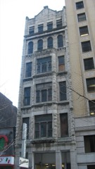
| July 2003 | Thunderstorm Wind | Countywide | $493,000 | EMA office reported trees and power lines were down around the county. The historic building "The Cannery" in downtown Nashville lost part of its roof, and the fourth floor was damaged. The four-story 120-year-old building was located at Eighth Avenue South. The historic building had to be torn down. The huge building started as the home of Liberty Mills in 1883. Wheat was ground into flour in the old building. The building and the land it was on was worth $493,200. |
| December 2023 | Tornado (EF2) | Scottsboro | $250,000 | This tornado touched down in the Claylick community in eastern Dickson County, snapping and uprooting several trees and destroyed an outbuilding. It quickly intensified to low-end EF-2 strength as it crossed Nosegay Road and demolished a single-story manufactured home. The tornado continued to Pack Annex Road where it did minor damage to the tops of high-tension powerlines and continued to snap large trees as it moved northeast into Cheatham County. The tornado weakened and caused sporadic tree damage as it moved into Cheatham Wildlife Management Area. It strengthened once more, causing prolific tree damage and structure damage to homes along Dry Creek Road south of Ashland City. Just before leaving Cheatham County, the tornado caused minor outbuilding damage and snapped a few trees near River Road. At this point, the tornado Crossed into Davidson County and crossed the Cumberland River. On Pecan Valley Road, some structural damage was observed, but damage was consistent with a weakening tornado with maximum winds of 90 mph. The tornado lifted after crossing Old Hickory Boulevard, just north of Ashland City Highway. |
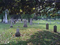
| December 2021 | Thunderstorm Wind | Maplewood | $250,000 | Severe straight-line winds caused significant damage in Madison across a roughly 1/2 mile wide by 2 mile long swath from Briley Parkway at Gallatin Pike northeastward to Neelys Bend Road. Numerous trees were snapped and uprooted, especially in the National Cemetery and Spring Hill Cemetery. The roof was blown off part of the St. Joseph School, and a large sign was blown down on Gallatin Pike. Several homes also suffered minor roof damage. Winds were estimated up to 85 mph. |
| December 2021 | Tornado (EF0) | Old Hickory | $250,000 | An EF-1 tornado touched down in Old Hickory on Martingale Drive and moved northeast across Fowler Street, Orchard Drive, Wilmington Street, Richmond Street, 4th Street, and Jones Circle, uprooting several large trees, causing roof damage to multiple homes, and damaging outbuildings. The tornado then moved across Old Hickory Lake and downed power lines and trees from Walton Ferry to Sanders Ferry Road in Hendersonville. The heaviest damage occurred on Private Drive, Cumberland Hills Drive and Lake Valley Road where numerous trees were snapped or uprooted and homes received significant roof damage. The tornado continued east, crossing Old Hickory Lake once again and downing trees and power lines on Carter Lane in north Mt. Juliet. The storm weakened and lifted on Saundersville Ferry Road near Crosswinds Drive. Total path length of this tornado was 6.82 miles. |
| December 2021 | Tornado (EF0) | Hermitage | $250,000 | This brief tornado touched down near the Stones River at I-40 in Hermitage and moved northeast, causing minor roof and siding damage to numerous homes in the Riverwood and adjacent subdivisions. More homes were damaged on Seville Drive, several trees were uprooted, and multiple buildings at the Cherry Creek and Canyon Ridge apartments suffered roof and exterior damage. The roof of a medical building on Central Pike at Old Hickory Blvd was also damaged before the tornado lifted. |
| December 2021 | Tornado (EF0) | Scottsboro | $250,000 | This wide but weak tornado touched down in western Davidson County near Cub Creek Road and moved eastward across Bells Bend and Cockrill Bend just north of John Tune Airport, crossing the Cumberland River twice and blowing down numerous trees. Moving across the Cumberland River a third time, the tornado moved into the Bordeaux area of northwest Nashville where it caused major roof damage to a church, damaged a nursery, and damaged the roofs of numerous homes from Briley Parkway northeastward across Highway 12, Clarksville Pike, and Buena Vista Pike before lifting near Whites Creek Pike. |
| December 2021 | Tornado (EF0) | Seven Pts | $250,000 | This EF-1 tornado touched down on the east side of Percy Priest Lake near Cooks Landing Court and Stewarts Ferry Pike in Davidson County, and moved north-northeast generally along New Hope Road. Many trees were uprooted with EF-0 roof and siding damage to several homes in Davidson County. The tornado strengthened to EF-1 and turned more northeastward as it crossed into Wilson County, causing minor to moderate damage to numerous homes in the Cobblestone Landing and Eagle Trace subdivisions. One home on Partridge Drive suffered severe damage with the garage and east side of the house being blown out. Further to the northeast, dozens of trees were uprooted along Old Lebanon Dirt Road and Division Street, and Mount Juliet Elementary School suffered minor roof damage. The most significant damage occurred in the Willoughby Station subdivision as dozens of homes between Melbourne Terrace and Greenhill Road received minor to moderate roof and exterior damage, and one person was injured by flying glass. The tornado weakened as it continued northeast, but continued to blown down trees and cause EF-0 damage to homes in the Vernon Hills subdivision and along Wilson Drive and Tate Lane. The tornado apparently lifted after crossing Lebanon Road west of Mount Juliet Road. Wilson County Emergency Management reported a total of 163 homes were damaged in Wilson County. Total path length of this tornado was 7.67 miles. |
| February 2019 | Flash Flood | Little Creek | $250,000 | TDOT and local media reported a large landslide covered both lanes of I-24 eastbound between Old Hickory Boulevard and Briley Parkway in north Nashville. The interstate was closed for nearly 3 weeks through March 15 to remove debris and repair the roadway. |
 Block