 Block
Fayetteville, Tennessee
11 topographic sheets cover this place, the earliest surveyed in 1936 and the latest in 1981. It stands in District 3. It lies in ZIP code area 37334. It stands on Tanyard Branch. The Survey maps it on the Fayetteville quadrangle. 7,068 people lived here at the 2020 count. It stands 705 feet above sea level.
Research this city
On record in Fayetteville
Buildings and businesses the archive holds for this place. Each opens its own page, with the source record it came from.
On the National Register 10 records
 Borden Powdered Milk Plantlisted 1988
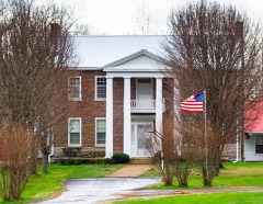 Childress Houselisted 1982
 Isaac Conger Houselisted 1973
 Hugh Bright Douglas Houselisted 1982
 McDonald-Bolner Houselisted 1984
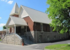 Mount Zion Missionary Baptist Churchlisted 2000
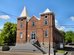 St. Paul African Methodist Episcopal Churchlisted 2003
- Harms Mill Hydroelectric Stationlisted 1990
- Mulbery-Washington-Lincoln Historic Districtlisted 1984
- South Elk Street Historic Districtlisted 1989
Population over time
2 figuresFayetteville grew from 6,827 to 7,068 between 2010 and 2020. These are the recorded population figures Wikidata holds for this place, reached through the Geographic Names Information System number this page is keyed on rather than by name, so they belong to this place and not to another of the same name. Most are census counts, but not all are: an early figure may be a founding or settlement estimate, and an estimate published within five years of a census is left out. The change column is computed, and is left blank where more than 20 years separate a figure from the one before it, because a gap that long is not a change between two counts.
| Year | People | Change |
|---|---|---|
| 2010 | 6,827 | |
| 2020 | 7,068 | +241 (+4%) |
Topographic sheets covering this place
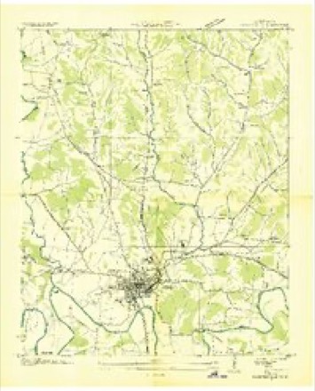
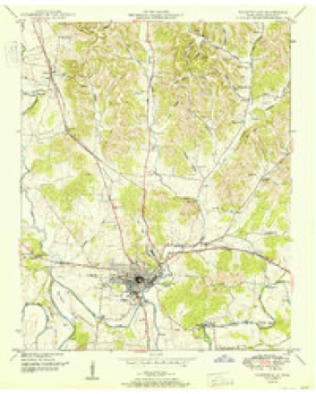
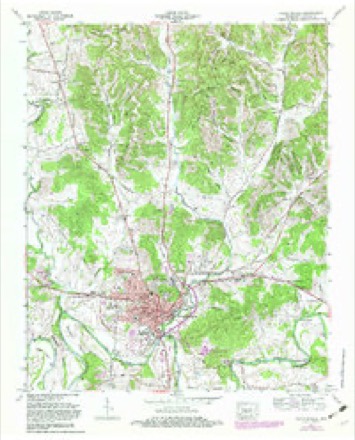
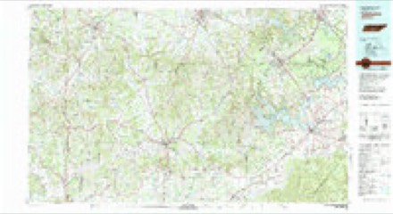
5 surveys from 11 printed sheetsMatched by testing this settlement's coordinate against the published boundary of every sheet in the United States Geological Survey's historical collection. Each opens the scanned sheet at the Survey.
- 1936 USGS Fayetteville quadrangle1:24000
- 1951 USGS Fayetteville quadrangle1:24000
- 1956 USGS Columbia quadrangle1:250000, 6 printings
- 1966 USGS Fayetteville quadrangle1:24000, 2 printings
- 1981 USGS Tullahoma quadrangle1:100000

Fires near this place
112 since 1997Regional context, not property-specific evidence. The federal wildfire occurrence database lists 112 fires within 5 miles of Fayetteville between 1997 and 2014, burning about 225 acres in total. 1 started naturally. 6 were recorded as arson. Distance is straight-line from the map coordinates, so a fire counted here may appear on a neighbouring settlement's page as well.
| Reported cause | Fires |
|---|---|
| Debris and open burning | 75 |
| Smoking | 8 |
| Equipment and vehicle use | 8 |
| Missing data/not specified/undetermined | 8 |
| Arson/incendiarism | 6 |
| Power generation/transmission/distribution | 2 |
| Recreation and ceremony | 2 |
| Natural | 1 |
| Fireworks | 1 |
| Misuse of fire by a minor | 1 |
The most recent of them, most recent first, with the day each was reported and the service that recorded it.
| Date | Cause | Size | Reported by | Name on the report |
|---|---|---|---|---|
| 8 September 1999 | Debris and open burning | under an acre | Tennessee Division of Forestry | not named |
| 8 September 1999 | Missing data/not specified/undetermined | under an acre | Tennessee Division of Forestry | not named |
| 7 September 2002 | Debris and open burning | 8.0 acres | Tennessee Division of Forestry | not named |
| 5 September 2005 | Debris and open burning | 2.0 acres | Tennessee Division of Forestry | not named |
| 29 September 1999 | Smoking | 3.5 acres | Tennessee Division of Forestry | not named |
| 27 September 2001 | Debris and open burning | 1.1 acres | Tennessee Division of Forestry | not named |
| 19 September 1999 | Equipment and vehicle use | under an acre | Tennessee Division of Forestry | not named |
| 18 September 1999 | Smoking | under an acre | Tennessee Division of Forestry | not named |
Settlements close enough to share some of these fires:
Mines and quarries near this place
8 within 5 milesRegional context, not property-specific evidence. The federal mineral resources record lists 8 workings within 5 miles of Fayetteville: 5 producers, 3 past producers. 5 still produce. What was taken out: Stone, Crushed/Broken, Sand and Gravel, Construction, Stone, Crushed/Broken, Limestone, General, Limestone, General. Distance is straight-line from the map coordinates, so a quarry counted here may appear on a neighbouring settlement's page as well.
| Where | Site | Commodity | Status | Recorded |
|---|---|---|---|---|
| Clark and Stephenson Quarry | Sand and Gravel, Construction | Past Producer | Sedimentary | |
| Lincoln County Highway Department Quarry | Stone, Crushed/Broken, Limestone, General | Producer | Limestone | |
| Lincoln County Quarry | Limestone, General | Past Producer | Sedimentary | |
| Clark & Stephenson Quarry | Stone, Crushed/Broken | Producer | Limestone | |
| Clark and Stephenson Quarry | Stone, Crushed/Broken | Producer | ||
| Fayetteville Mine and Mill | Stone, Crushed/Broken | Producer | ||
| Lincoln County Mine and Millquarry | Stone, Crushed/Broken | Producer | ||
| Lincoln County Quarry | Stone, Crushed/Broken | Past Producer |
Storms near this place
60 of 93 shownRegional context, not property-specific evidence. The National Weather Service names Fayetteville in 93 storm reports between 1995 and 2025: 57 thunderstorm wind, 18 hail, 16 flash flood, 2 tornado. No death or injury is recorded in these reports. Each account below is quoted exactly as the forecast office filed it, from the NOAA Storm Events Database, and each date opens the federal record of that event.
| When | Event | Place named | Harm | What the report says |
|---|---|---|---|---|
| February 1997 | Thunderstorm Wind | Fayetteville | $50,000 | no account filed |
| July 2011 | Thunderstorm Wind | Fayetteville | $30,000 | Trees were blown down and a horse barn was destroyed on the county fairgrounds in Fayetteville. Many of these trees fell on cars, houses, and power lines. |
| October 2009 | Tornado (EF1) | Fayetteville | $30,000 | An EF-1 tornado with maximum winds of 100 mph struck the south side of Fayetteville, tracking east before lifting shortly beyond Timber Lake. The most extensive damage occurred in the Timber Lake community between Diemer Road and Timberlake Trail. Numerous large trees were uprooted, some snapped at their bases. Roof and minor structural damage occurred at a residence along Timberlake Drive where a male occupant was injured due to a fall while taking shelter. One person sustained a minor injury at their residence. Additional trees were uprooted and snapped along Eldad and Grisham Roads east of Timber Lake. |
| May 2011 | Thunderstorm Wind | Fayetteville | $25,000 | Thunderstorm winds knocked many trees down and produced structural damage to buildings in the Fayetteville area. |
| June 2011 | Thunderstorm Wind | Fayetteville | $15,000 | A tree was blown down onto a house. Winds also badly damaged a tin structure near the house as well. |
| May 2025 | Thunderstorm Wind | Fayetteville | $10,000 | A tree was knocked down onto a vehicle at 509 Polk Street. Time estimated by radar. |
| July 2021 | Thunderstorm Wind | Fayetteville | $10,000 | Several trees were knocked down in the city of Fayetteville, including one onto a truck. Time estimated by radar. |
| December 2013 | Thunderstorm Wind | Fayetteville | $10,000 | A few trees were downed by thunderstorm winds onto West Campbell Street and also on Eldad Road. A few powerlines were also downed by thunderstorm winds across these areas. |
| July 2011 | Thunderstorm Wind | Fayetteville | $10,000 | Trees and power lines were knocked down along Amana Avenue in Fayetteville. |
| July 2011 | Thunderstorm Wind | Fayetteville | $10,000 | A mobile home was blown over in Fayetteville. |
| August 2009 | Thunderstorm Wind | Fayetteville | $10,000 | Thunderstorm winds along and behind a gust front knocked down several trees and limbs throughout the city of Fayetteville. Power outages were also reported. |
| May 2003 | Thunderstorm Wind | Fayetteville | $10,000 | News article about a tree falling on a car on Calhoun Ave. |
| July 2013 | Thunderstorm Wind | Fayetteville | $7,000 | A tree was downed by thunderstorm winds on Old Huntsville highway and another tree was downed onto Highway 231. |
| March 2009 | Thunderstorm Wind | Fayetteville | $7,000 | Thunderstorm winds blew a tree down into a house near Fayetteville. |
| August 2024 | Thunderstorm Wind | Fayetteville | $6,000 | The metal roof of a church was partially blown off. Time was estimated from radar. |
| February 2011 | Thunderstorm Wind | Fayetteville | $6,000 | Trees were blown down on Shelbyville Highway. Power outages were reported in the Vann Town area. |
| July 2011 | Thunderstorm Wind | Fayetteville | $5,000 | A roof to a building was damaged on Hedgemont Avenue near Robertson Street. |
| January 2008 | Thunderstorm Wind | Fayetteville | $5,000 | A line of severe thunderstorms damaged a barn roof and blew the barn debris over road on US Highway 64. This occurred 1 mile outside the city of Fayetteville. |
| May 2025 | Thunderstorm Wind | Fayetteville | $2,000 | A large tree was blown down at 2010 Thornton Taylor Parkway. Time was estimated from radar data. |
| April 1995 | Thunderstorm Wind | Fayetteville | $2,000 | Two trees were blown down. |
| May 1995 | Thunderstorm Wind | Fayetteville | $2,000 | Several trees were blown down. |
| April 2025 | Thunderstorm Wind | Fayetteville | $1,000 | A tree was knocked down onto the roadway at 1307 Woodland Drive in Fayetteville. |
| April 2025 | Thunderstorm Wind | Fayetteville | $1,000 | Tin was blown off of a house and is near the road at 300 Market Street West in Fayetteville. |
| June 2025 | Thunderstorm Wind | Fayetteville | $1,000 | A tree was knocked down partially blocking the roadway on Blankenship Hollow Road and Molino Road. Time estimated by radar. |
| June 2025 | Thunderstorm Wind | Fayetteville | $1,000 | A tree was knocked down across Shelbyville Highway. Time estimated by radar. |
| June 2025 | Thunderstorm Wind | Fayetteville | $1,000 | A tree was knocked down blocking a lane on Eldad Road. Time estimated by radar. |
| December 2025 | Thunderstorm Wind | Fayetteville | $1,000 | A tree was reported down at 39 Diemer road. |
| August 2024 | Thunderstorm Wind | Fayetteville | $1,000 | A tree was knocked down into the roadway at 1000 Washington Street in Fayetteville. Time was estimated from radar. |
| April 2011 | Thunderstorm Wind | Fayetteville | $1,000 | Thunderstorm winds tore tin off of a home at the 300 block of West Market Street in Fayetteville. |
| June 2009 | Thunderstorm Wind | Fayetteville | $1,000 | Thunderstorm winds knocked a tree down onto Chenault Road. |
| December 2021 | Thunderstorm Wind | Fayetteville | $500 | A tree was knocked down on Clay Avenue in Fayetteville. |
| July 2017 | Thunderstorm Wind | Fayetteville | $500 | A tree was knocked down onto Morton Drive. |
| May 2017 | Thunderstorm Wind | Fayetteville | $200 | A tree was knocked down at 159 Shelbyville Highway. |
| March 2023 | Tornado (EF2) | Fayetteville | - | The tornado formed on Amana Avenue with minor roof and shingle damage to single family homes. It tracked due east into the Fairgrounds where it uplifted reinforced roofing to horse stalls, and destroyed a large outdoor shed approximately 80 ft. by 30 ft. that had several 4x4 support beams anchored with concrete snapped near the base. The tornado then rolled a large horse trailer next to the building approximately 80 yards. It continued to snap trees and power lines heading east. As it approached Hedgemont Avenue, several residential and commercial structures had roofing and siding damage. The tornado crossed Main Avenue South and snapped several bradford pear trees, then crossed Highway 231. At the Lincoln Medical Center, power poles were snapped, debris collided with the front of the building, several cars were lifted and had their windows blown out, and an exterior wall was disconnected but not collapsed. The HVAC system was also toppled on the roof. After damaging Lincoln Medical Center, the tornado went through open fields and wooded areas where numerous trees were snapped and uprooted.|Before lifting, an awning that was reinforced with 4x4s in concrete was flipped. Just west of Winchester Highway, the tornado lifted. |
| February 2020 | Thunderstorm Wind | Fayetteville | - | Significant unspecified damage was report at the Masonic Lodge at 110 Edge Hill Road. |
| March 2017 | Thunderstorm Wind | Fayetteville | - | A widespread area of trees were knocked down on Shelbyville Highway and along U.S. 431. |
| July 2017 | Thunderstorm Wind | Fayetteville | - | Power lines were knocked down in the Twin Oaks subdivision. |
| June 2016 | Thunderstorm Wind | Fayetteville | - | Trees were knocked down. |
| June 2015 | Thunderstorm Wind | Fayetteville | - | Several large trees were downed by thunderstorm winds. |
| April 2014 | Flash Flood | Fayetteville | - | Several roads around downtown Fayetteville deemed impassible due to flood waters. |
| January 2010 | Hail | Fayetteville | - | Baseball size hail was reported. |
| May 2009 | Hail | Fayetteville | - | Nickel size hail was reported in Fayetteville. |
| May 2009 | Hail | Fayetteville | - | Penny size hail was reported 1 mile northeast of Fayetteville. |
| April 2009 | Hail | Fayetteville | - | Nickel size hail was reported in Fayetteville. |
| May 2009 | Hail | Fayetteville | - | Nickel size hail was reported at the intersection of Hwy 231 and the Hwy 64 bypass. |
| December 2008 | Flash Flood | Fayetteville | - | Heavy rainfall caused significant flash flooding with reports of up to a foot of water over roads in downtown Fayetteville. Other roads affected by significant flash flooding included: Old Huntsville Highway, Mulberry Road, and Old Lincoln Road. |
| May 2006 | Hail | Fayetteville | - | Penny sized hail was reported. |
| May 2006 | Thunderstorm Wind | Fayetteville | - | Trees and power lines were blown down on Highway 231. |
| May 2006 | Hail | Fayetteville | - | Nickel sized hail was reported. |
| May 2006 | Thunderstorm Wind | Fayetteville | - | Power lines were blown down across the city of Fayetteville. |
| May 2006 | Hail | Fayetteville | - | Quarter sized hail reported on Thornton Taylor Parkway. |
| August 2006 | Thunderstorm Wind | Fayetteville | - | Strong winds tore siding off of a church along Highway 431. Roof damage was also reported at a residence on Icy Bank Road. |
| August 2006 | Thunderstorm Wind | Fayetteville | - | Power lines were blown down on College Street. Numerous trees were blown down on several roads and onto two homes. Damage unknown. |
| July 2006 | Thunderstorm Wind | Fayetteville | - | Large tree limbs were blown down one mile north of downtown. |
| July 2006 | Thunderstorm Wind | Fayetteville | - | Numerous trees were blown down. |
| February 2005 | Hail | Fayetteville | - | Penny size hail reported. |
| April 2005 | Thunderstorm Wind | Fayetteville | - | A tree and power pole were blown down by thunderstorm winds in Park City. |
| May 2005 | Thunderstorm Wind | Fayetteville | - | Two trees blown down by thunderstorm winds. |
| December 2004 | Flash Flood | Fayetteville | - | Flash flooding resulted in water covering the road in and around Fayetteville. |
| December 2004 | Flash Flood | Fayetteville | - | Flash flooding initially started in Fayetteville and increased countywide through the event. Numerous roads had several inches of water over them through early on 7 December. |
Nearest settlements
The eight closest, with where each one stands in the county. Distances are straight-line, computed from the Geographic Names Information System coordinates.
| Map | Place | Distance | Sheets |
|---|---|---|---|
| Madden Homes | 0.3 miles | 11 | |
| Mayberry Courts | 0.4 miles | 11 | |
| Elmwood Terrace | 0.7 miles | 11 | |
| Elk Mill Village | 0.7 miles | 11 | |
| Creson | 1.5 miles | 11 | |
| Liberty | 3.1 miles | 12 | |
| Wells Hill (historical) | 3.4 miles | 12 | |
| Gethsemane (historical) | 3.5 miles | 11 |
Elsewhere
Matched on this settlement's Geographic Names Information System number rather than its name, so it cannot be a different place of the same name in another state.
| Wikipedia article on Fayetteville | An encyclopaedic summary. Its text is share-alike, so it is linked here rather than copied. |
| Wikidata item Q588257 | The structured record the population and elevation above come from. Public domain (CC0). |
Provenance
This settlement is recorded in the Geographic Names Information System as feature 1647829. The sheet list is computed by point-in-boundary test against the United States Geological Survey's historical topographic inventory. Both are works of the United States government and carry no copyright under 17 U.S.C. 105.
Wildfire. Short, Karen C. 2022. Spatial wildfire occurrence data for the United States, 1992-2020 [FPA_FOD_20221014]. 6th Edition. Fort Collins, CO: Forest Service Research Data Archive. https://doi.org/10.2737/RDS-2013-0009.6 Collected with United States Government funding and usable without additional permissions or fees.
Mines and quarries. USGS Mineral Resources Data System (MRDS) https://mrdata.usgs.gov/mrds/ A work of the United States government, no copyright under 17 U.S.C. 105.
Storms. NOAA National Centers for Environmental Information, Storm Events Database https://www.ncei.noaa.gov/stormevents/ A work of the United States government, no copyright under 17 U.S.C. 105. Narratives are quoted verbatim from the National Weather Service report and are not edited or summarised.