 Block
Forest Home, Tennessee
15 topographic sheets cover this place, the earliest surveyed in 1909 and the latest in 1985. It stands in District 9. It lies in ZIP code area 37069. It stands on Murray Branch. The Survey maps it on the Leipers Fork quadrangle.
On record in Forest Home
Buildings and businesses the archive holds for this place. Each opens its own page, with the source record it came from.
On the National Register within a mile 2 records
The National Register names another town for these. They stand within one mile of this settlement's coordinate.
 Meeting-of-the-Waterslisted 1982 · 0.6 miles away
 Montpierlisted 1982 · 0.6 miles away
Topographic sheets covering this place
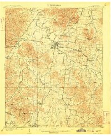
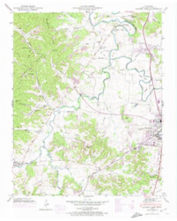
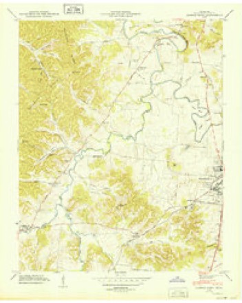
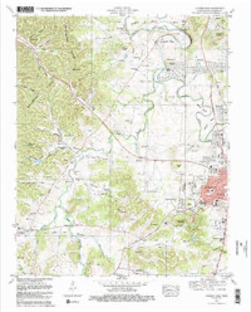
6 surveys from 15 printed sheetsMatched by testing this settlement's coordinate against the published boundary of every sheet in the United States Geological Survey's historical collection. Each opens the scanned sheet at the Survey.
- 1909 USGS Franklin quadrangle1:62500, 2 printings
- 1946 USGS Leipers Fork quadrangle1:24000, 2 printings
- 1949 USGS Leipers Fork quadrangle1:24000
- 1956 USGS Columbia quadrangle1:250000, 6 printings
- 1981 USGS Leipers Fork quadrangle1:24000, 3 printings
- 1985 USGS Murfreesboro quadrangle1:100000


Fires near this place
15 since 1992Regional context, not property-specific evidence. The federal wildfire occurrence database lists 15 fires within 5 miles of Forest Home between 1992 and 2019, burning about 85 acres in total. 2 started naturally. 5 were recorded as arson. Distance is straight-line from the map coordinates, so a fire counted here may appear on a neighbouring settlement's page as well.
| Reported cause | Fires |
|---|---|
| Arson/incendiarism | 5 |
| Debris and open burning | 3 |
| Missing data/not specified/undetermined | 2 |
| Natural | 2 |
| Railroad operations and maintenance | 1 |
| Smoking | 1 |
| Recreation and ceremony | 1 |
The most recent of them, most recent first, with the day each was reported and the service that recorded it.
| Date | Cause | Size | Reported by | Name on the report |
|---|---|---|---|---|
| 8 September 1998 | Missing data/not specified/undetermined | under an acre | Natchez Trace Parkway | BACKBONE |
| 6 September 2019 | Smoking | under an acre | Natchez Trace Parkway | SMOKING |
| 23 September 2000 | Natural | under an acre | Natchez Trace Parkway | MP 440 |
| 23 September 1999 | Missing data/not specified/undetermined | under an acre | Natchez Trace Parkway | HWY 100 |
| 18 September 2008 | Railroad operations and maintenance | 28 acres | Tennessee Division of Forestry | not named |
| 16 April 2001 | Debris and open burning | 2.0 acres | Tennessee Division of Forestry | not named |
| 3 March 1992 | Debris and open burning | under an acre | Natchez Trace Parkway | TVA 2 |
| 20 March 1994 | Recreation and ceremony | 9.0 acres | Natchez Trace Parkway | BIG TREE |
Settlements close enough to share some of these fires:
Mines and quarries near this place
10 of 39 shownRegional context, not property-specific evidence. The federal mineral resources record lists 39 workings within 5 miles of Forest Home: 16 past producers, 11 unknowns, 5 producers, 4 occurrences. 5 still produce. What was taken out: Phosphorus-Phosphates, Aluminum, Stone, Crushed/Broken. Distance is straight-line from the map coordinates, so a quarry counted here may appear on a neighbouring settlement's page as well.
| Where | Site | Commodity | Status | Recorded |
|---|---|---|---|---|
| Franklin Quarry | Stone, Crushed/Broken | Producer | ||
| Tillman No 113 | Aluminum, Phosphorus-Phosphates | Past Producer | ||
| Anthony Pit | Phosphorus-Phosphates | Past Producer | ||
| Anthony Pit | Phosphorus-Phosphates | Past Producer | ||
| Battlefield Hood #862 | Phosphorus-Phosphates | Occurrence | ||
| Battlefield No. 580 Prospect | Phosphorus-Phosphates | Occurrence | ||
| Battlefield No.862 Prospect | Phosphorus-Phosphates | Occurrence | ||
| Battlefield Number 1062 Pit | Phosphorus-Phosphates | Past Producer | ||
| Battlefield Number 697 Pit | Phosphorus-Phosphates | Past Producer | ||
| Battlefield Number 697 Pit | Phosphorus-Phosphates | Past Producer |
Storms near this place
23 since 2009Regional context, not property-specific evidence. The National Weather Service names Forest Home in 23 storm reports between 2009 and 2025: 12 thunderstorm wind, 3 hail, 3 flash flood, 3 flood. The reports record 1 death. Each account below is quoted exactly as the forecast office filed it, from the NOAA Storm Events Database, and each date opens the federal record of that event.
| When | Event | Place named | Harm | What the report says |
|---|---|---|---|---|
| October 2022 | Thunderstorm Wind | Forest Home | 1 killed, $10,000 | Strong thunderstorm winds downed a tree onto a vehicle on Old Natchez Trace northwest of Franklin. A 22-year-old woman who was driving at the time was killed. |
| May 2012 | Lightning | Forest Home | $50,000 | Lightning struck a home on 401 Brickenhall Drive. Several bricks from a roof chimney were blown off, a nine inch whole occurred in the roof, electrical damage occurred to the home security system, garage door, and second story HDAC unit. |
| May 2010 | Thunderstorm Wind | Forest Home | $30,000 | Numerous large trees were broken and uprooted. Trees fell and brought down power lines and poles along Old Natchez Trace. Only minor property damage was noted, including damage to fences. Damage at the intersection of Sneed and Old Natchez Trace was due to flooding of the Harpeth River. Some areas were inaccessible for close survey due to flooded conditions, but it appeared most of the damage was focused along Old Natchez Trace. Sporadic tree damage was also observed on Sawyer Bend Rd. and Vaughn Rd. |
| September 2016 | Thunderstorm Wind | Forest Home | $10,000 | A large downburst up to 3 miles wide struck far northwest Williamson County. Scattered trees were snapped or uprooted and large tree limbs blown down from the Natchez Trace Parkway eastward across Temple Road, Old Natchez Trace Parkway, and Old Hillsboro Road. One tree fell across and blocked the Old Natchez Trace Parkway. Maximum winds were estimated around 60 mph. |
| April 2016 | Thunderstorm Wind | Forest Home | $5,000 | Several trees were blown down in the Pasquo and Temple Hills area. |
| July 2013 | Thunderstorm Wind | Forest Home | $3,000 | Several trees were blown down on Moran Road in Franklin. |
| July 2016 | Thunderstorm Wind | Forest Home | $2,000 | A large tree and power lines were blown down on Timberline Drive. |
| June 2019 | Thunderstorm Wind | Forest Home | $1,000 | A tree was blown down at Temple Road and Sneed Road. |
| November 2017 | Thunderstorm Wind | Forest Home | $1,000 | A tree was blown down on Old Hillsboro Road. |
| November 2017 | Thunderstorm Wind | Forest Home | $1,000 | A tree was blown down at Old Natchez Trace Road and Natchez Road. |
| March 2017 | Thunderstorm Wind | Forest Home | $1,000 | Tree down at Sneed Road and Temple Road. |
| September 2016 | Thunderstorm Wind | Forest Home | $1,000 | A tree was blown down and blocked the Natchez Trace parkway north of the Highway 96 bridge. |
| June 2013 | Thunderstorm Wind | Forest Home | $1,000 | A tree was blown down in the Temple Hills area. Reported via tspotter on Twitter. |
| April 2025 | Hail | Forest Home | - | Estimated quarter size hail was reported at Temple Hills. |
| February 2019 | Flash Flood | Forest Home | - | Several roads were flooded and closed across Williamson County, including 3rd Avenue, West Harpeth Road at Hunter Road, Boyd Mill Pike, Floyd Road, Old Natchez Trace, 2089 Kidd Road, 2084 Wilson Pike, Clovercroft Road, and Moran Road. |
| May 2018 | Flood | Forest Home | - | Several tSpotter Twitter photos and videos showed considerable street flooding in the Temple Hills area, with street flooding along portions of Temple Road from Sneed Road to Highway 100 and flooding on the Temple Hills Golf Course. |
| April 2017 | Flash Flood | Forest Home | - | Temple Road, Old Natchez Trace, and Old Hillsboro Road were all flooded in places and impassable. |
| November 2017 | Heavy Rain | Forest Home | - | CoCoRaHS station Forest Hills 4.3 WSW measured a 24 hour rainfall total of 5.50 inches. |
| May 2015 | Flood | Forest Home | - | Twitter photos and reports indicated minor flooding across areas in and east of Franklin. Water covered several yards and driveways along with a few streets, including east McEwen Drive. |
| July 2015 | Hail | Forest Home | - | Twitter reports indicated quarter to golf ball size hail fell at the Old Natchez Country Club. |
| February 2014 | Flood | Forest Home | - | Williamson County Emergency Management reported numerous flooded roads across the county, generally near the Harpeth River basin to the west and northwest of Franklin. Roads that were flooded included Floyd Road, Southall Road, Blazer Road, Boyd Mill Pike, Del Rio Pike, and Cotton Lane. |
| April 2013 | Flash Flood | Forest Home | - | Moderate rainfall of 1 to 2 inches during the morning of April 27 was followed by heavy thunderstorms that produced an additional 2 to 4 inches of rainfall during the evening and into the early morning hours on April 28. The result was widespread flash flooding of roadways across Williamson County. Roadways that were flooded in Franklin included Carothers Road at Williamson Medical Center, Alpha Drive, Lewisburg Pike, Oxford Glen Drive at McEwen Road, Sycamore Road at Liberty Road, and the Breezeway subdivision near Clovercroft Elementary School. Several roadways were also flooded in Nolensville, including Nolensville Road. |
| May 2009 | Hail | Forest Home | - | Penny size hail occurred at Temple Hill Golf Course. |
Nearest settlements
The eight closest, with where each one stands in the county. Distances are straight-line, computed from the Geographic Names Information System coordinates.
| Map | Place | Distance | Sheets |
|---|---|---|---|
| Montpier Farms | 0.9 miles | 15 | |
| Cottonwood Estates | 1.0 miles | 15 | |
| Forest Home Farms | 1.3 miles | 15 | |
| Old Town (historical) | 1.3 miles | 15 | |
| Walnut Acres | 1.5 miles | 15 | |
| Meadow Green Acres | 1.8 miles | 15 | |
| Berrys Chapel Heights | 1.8 miles | 15 | |
| Hunting Creek Farms | 1.9 miles | 15 |
Provenance
This settlement is recorded in the Geographic Names Information System as feature 1284601. The sheet list is computed by point-in-boundary test against the United States Geological Survey's historical topographic inventory. Both are works of the United States government and carry no copyright under 17 U.S.C. 105.
Wildfire. Short, Karen C. 2022. Spatial wildfire occurrence data for the United States, 1992-2020 [FPA_FOD_20221014]. 6th Edition. Fort Collins, CO: Forest Service Research Data Archive. https://doi.org/10.2737/RDS-2013-0009.6 Collected with United States Government funding and usable without additional permissions or fees.
Mines and quarries. USGS Mineral Resources Data System (MRDS) https://mrdata.usgs.gov/mrds/ A work of the United States government, no copyright under 17 U.S.C. 105.
Storms. NOAA National Centers for Environmental Information, Storm Events Database https://www.ncei.noaa.gov/stormevents/ A work of the United States government, no copyright under 17 U.S.C. 105. Narratives are quoted verbatim from the National Weather Service report and are not edited or summarised.