 Block
Huntland, Tennessee
12 topographic sheets cover this place, the earliest surveyed in 1936 and the latest in 1981. It stands in District 3. It lies in ZIP code area 37345. It stands on Mathias Branch. The Survey maps it on the Huntland quadrangle. 886 people lived here at the 2020 count. It stands 942 feet above sea level.
On record in Huntland
Buildings and businesses the archive holds for this place. Each opens its own page, with the source record it came from.
On the National Register 3 records
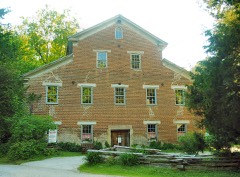 Falls Milllisted 1972
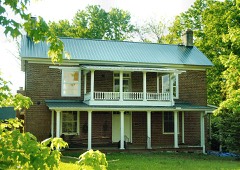 Hunt-Moore Houselisted 2005
- Falls Mills Historic Districtlisted 1987
Population over time
2 figuresHuntland grew from 872 to 886 between 2010 and 2020. These are the recorded population figures Wikidata holds for this place, reached through the Geographic Names Information System number this page is keyed on rather than by name, so they belong to this place and not to another of the same name. Most are census counts, but not all are: an early figure may be a founding or settlement estimate, and an estimate published within five years of a census is left out. The change column is computed, and is left blank where more than 20 years separate a figure from the one before it, because a gap that long is not a change between two counts.
| Year | People | Change |
|---|---|---|
| 2010 | 872 | |
| 2020 | 886 | +14 (+2%) |
Topographic sheets covering this place
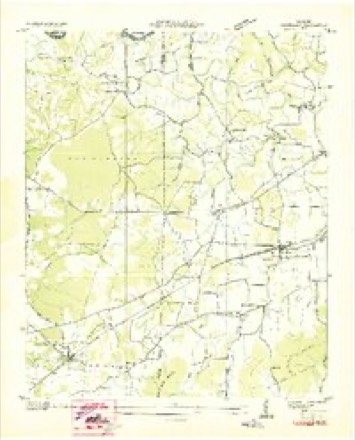
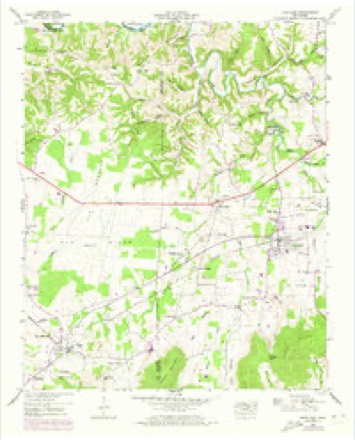
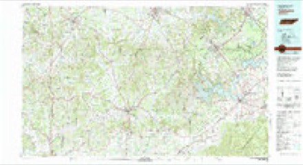
4 surveys from 12 printed sheetsMatched by testing this settlement's coordinate against the published boundary of every sheet in the United States Geological Survey's historical collection. Each opens the scanned sheet at the Survey.
- 1936 USGS Huntland quadrangle1:24000
- 1947 USGS Huntland quadrangle1:24000, 4 printings
- 1956 USGS Columbia quadrangle1:250000, 6 printings
- 1981 USGS Tullahoma quadrangle1:100000

Fires near this place
56 since 1998Regional context, not property-specific evidence. The federal wildfire occurrence database lists 56 fires within 5 miles of Huntland between 1998 and 2016, burning about 135 acres in total. None started naturally. 7 were recorded as arson. Distance is straight-line from the map coordinates, so a fire counted here may appear on a neighbouring settlement's page as well.
| Reported cause | Fires |
|---|---|
| Missing data/not specified/undetermined | 21 |
| Debris and open burning | 19 |
| Arson/incendiarism | 7 |
| Equipment and vehicle use | 6 |
| Smoking | 2 |
| Misuse of fire by a minor | 1 |
The most recent of them, most recent first, with the day each was reported and the service that recorded it.
| Date | Cause | Size | Reported by | Name on the report |
|---|---|---|---|---|
| 7 September 2002 | Equipment and vehicle use | 40 acres | Tennessee Division of Forestry | not named |
| 6 September 2013 | Missing data/not specified/undetermined | under an acre | Alabama Forestry Commission | NOR-20130906-001 |
| 4 September 1998 | Arson/incendiarism | under an acre | Tennessee Division of Forestry | not named |
| 19 September 2015 | Missing data/not specified/undetermined | under an acre | Alabama Forestry Commission | NOR-20150919-001 |
| 18 September 2000 | Equipment and vehicle use | under an acre | Tennessee Division of Forestry | not named |
| 25 August 1999 | Smoking | 2.0 acres | Tennessee Division of Forestry | not named |
| 24 August 2007 | Smoking | 1.3 acres | Tennessee Division of Forestry | BRADLEY |
| 1 August 2015 | Missing data/not specified/undetermined | under an acre | Alabama Forestry Commission | NOR-20150801-001 |
Settlements close enough to share some of these fires:
Storms near this place
39 since 1996Regional context, not property-specific evidence. The National Weather Service names Huntland in 39 storm reports between 1996 and 2024: 21 thunderstorm wind, 8 hail, 5 tornado, 3 flash flood. The reports record 1 injury. Each account below is quoted exactly as the forecast office filed it, from the NOAA Storm Events Database, and each date opens the federal record of that event.
| When | Event | Place named | Harm | What the report says |
|---|---|---|---|---|
| November 1996 | Tornado (F2) | Huntland | 1 hurt, $500,000 | no account filed |
| May 1997 | Tornado (F2) | Huntland | $60,000 | A half dozen farm related buildings sustained damage. About 100 big trees were blown down in an apple orchard on White Gap Road. The trees were lying in different directions. |
| June 2011 | Thunderstorm Wind | Huntland | $12,000 | Trees and power lines were blown down. |
| March 2012 | Tornado (EF0) | Huntland | $5,000 | A tornado tracking northeast from Jackson County weakened to EF-0 intensity producing wind speeds up to 80 mph before dissipating. The tornado snapped and uprooted a few additional trees just east of Highway 97. |
| May 2024 | Thunderstorm Wind | Huntland | $2,000 | Large softwood tree trunks were snapped along Greasy Cove Road at J.D. Lane. |
| July 2008 | Thunderstorm Wind | Huntland | $2,000 | A few trees were downed by thunderstorm winds five miles southeast of Huntland. |
| May 1997 | Thunderstorm Wind | Huntland | $500 | A SKYWARN Spotter reported a tree was blown down in her back yard. |
| June 2008 | Thunderstorm Wind | Huntland | $200 | Downburst winds snapped a large tree limb onto a residential street in Huntland. |
| September 2021 | Flash Flood | Huntland | - | Elora Road was closed due to Flash Flooding between Greasy Cove Road and Stewart Road. Time estimated. |
| March 2017 | Thunderstorm Wind | Huntland | - | Trees were knocked down across Huntland. |
| July 2015 | Thunderstorm Wind | Huntland | - | A few trees were downed by thunderstorm winds. |
| April 2014 | Flash Flood | Huntland | - | Four to five inches of water reported over Oakwood Drive. |
| April 2011 | Tornado (EF3) | Huntland | - | A long track tornado continued from southeast Lincoln County. The tornado produced damage south of Huntland. Isolated and minor EF-0 tree damage was noted at the intersection of John Hunter Highway (State Route 122) and Limestone Road near the Lincoln/Franklin County line.||More significant damage was noted, starting about 1.4 miles south southwest of Huntland. A cinder block building suffered damage to its flat adobe roof, with some of blocks near the roof (around 20 feet off of the ground) pushed out, resulting in EF-2 damage. Surveyors could not directly examine the roof given this building was on the highest ground in the vicinity. Nearby, a single family home of cinder block construction had its roof totally removed, with another home about 1000 feet away having significant roof damage, with over one half of its roof removed, and some shifting off of its foundation. Damage with the latter was consistent with high end EF-2 damage. A chicken building with metal girding, nearby the second home, was completely flattened, consistent with EF-2 damage. A farm complex south of Hickory Grove Road had damage to a number of structures there. The home and the main car garage had part of their roofs removed. A barn that was protecting bales of hay was destroyed, with a few bales blown approximately 100-200 feet from their original location. The worst damage was noted with lower end EF-3 damage to a cinder block utility building about 200 feet south of the primary residence. Most of its roof was removed, with over half of its downwind wall pushed outward. An older barn nearby suffered lesser EF-0 damage to its roof, while the top half of a silo near that barn was missing. Another barn structure was completely destroyed northwest of the primary home. The width at this point was approximately 1/4 mile. Other damage was noted near the intersection of Hickory Grove Road and Sugar Cove Road, with EF-1 damage to some heavy farm equipment and EF-0 roof damage to a nearby barn. Scattered trees were downed to the northeast, with 8 inch fence posts, anchored 18 inches deep, pulled up near Hickory Grove and Buncombe Road. There was evidence the tornado continued toward the mountains a few miles further east, with some trees damaged along the ridge. |
| March 2009 | Hail | Huntland | - | Nickel sized hail was reported along state highway 121, about 4 miles north of the Tennessee-Alabama state line. |
| March 2008 | Hail | Huntland | - | Nickel sized hail was reported in Huntland. The hail slightly covered the ground. |
| January 2008 | Thunderstorm Wind | Huntland | - | A line of severe thunderstorms produced winds in excess of 60 mph in the Huntland community. |
| April 2008 | Thunderstorm Wind | Huntland | - | A severe thunderstorm produced wind gusts estimated at 70 mph in the Huntland community. |
| August 2007 | Heavy Rain | Huntland | - | A TVA rain gage measured 5.64 inches of rainfall between 9:30 pm and 12:45 am. Rain was still falling at the time of the last available report. 0.94 inches of this rain fell between 11:15 pm and 1130 pm. |
| August 2007 | Heavy Rain | Huntland | - | A National Weather Service Backyard Observer measured 4.05 inches of rain at Midnight and an additional inch of rain estimated between Midnight and 12:15 am. |
| March 2006 | Thunderstorm Wind | Huntland | - | An estimated wind gust of 60 mph was reported. |
| May 2006 | Hail | Huntland | - | Quarter sized hail was reported. |
| April 2006 | Thunderstorm Wind | Huntland | - | A trained spotter estimated a wind gust around 60 miles an hour. |
| April 2006 | Hail | Huntland | - | Penny size hail was reported. |
| April 2005 | Thunderstorm Wind | Huntland | - | Estimated thunderstorm wind gust of 60 mph was reported in Huntland. |
| April 2005 | Hail | Huntland | - | Penny size hail was reported. |
| August 2005 | Thunderstorm Wind | Huntland | - | An estimated wind gust to 60 mph was reported along with several large tree limbs being blown down. |
| July 2005 | Thunderstorm Wind | Huntland | - | A 60mph wind gust was reported. |
| July 2005 | Thunderstorm Wind | Huntland | - | A few trees and power lines were blown down. |
| May 2004 | Tornado (F1) | Huntland | - | F1 tornado continued out of Lincoln County and into southwest Franklin County. The tornado snapped numerous trees and power lines as it passed just south of Huntland. |
| May 2004 | Thunderstorm Wind | Huntland | - | Thunderstorm winds knocked power lines on to a house in Huntland. |
| July 2004 | Thunderstorm Wind | Huntland | - | Several trees and power lines blown down due to a line of severe thunderstorms moving southeast through the county. |
| July 2004 | Thunderstorm Wind | Huntland | - | A few trees blown down due to thunderstorm winds. |
| August 2003 | Flash Flood | Huntland | - | Water was in the basement of a home, and the well was overflowing. |
| April 2003 | Hail | Huntland | - | Spotter reported penny size hail. |
| June 2002 | Thunderstorm Wind | Huntland | - | Police reported large tree limbs were down. |
| February 2001 | Thunderstorm Wind | Huntland | - | Spotter reported 60 mph wind gust. |
| September 2000 | Thunderstorm Wind | Huntland | - | Law enforcement reported several trees down. |
| May 1998 | Hail | Huntland | - | Dime size hail reported. |
| March 1997 | Hail | Huntland | - | no account filed |
Nearest settlements
The eight closest, with where each one stands in the county. Distances are straight-line, computed from the Geographic Names Information System coordinates.
| Map | Place | Distance | Sheets |
|---|---|---|---|
| Beans Creek | 1.4 miles | 14 | |
| Mount Carmel | 1.4 miles | 12 | |
| Branchville | 1.5 miles | 12 | |
| Old Salem | 2.5 miles | 12 | |
| Brown Mill | 2.6 miles | 12 | |
| Neil | 2.7 miles | 12 | |
| Hickory Grove | 2.8 miles | 14 | |
| Falls Mill | 3.3 miles | 12 |
Elsewhere
Matched on this settlement's Geographic Names Information System number rather than its name, so it cannot be a different place of the same name in another state.
| Wikipedia article on Huntland | An encyclopaedic summary. Its text is share-alike, so it is linked here rather than copied. |
| Wikidata item Q1850378 | The structured record the population and elevation above come from. Public domain (CC0). |
Provenance
This settlement is recorded in the Geographic Names Information System as feature 1288762. The sheet list is computed by point-in-boundary test against the United States Geological Survey's historical topographic inventory. Both are works of the United States government and carry no copyright under 17 U.S.C. 105.
Wildfire. Short, Karen C. 2022. Spatial wildfire occurrence data for the United States, 1992-2020 [FPA_FOD_20221014]. 6th Edition. Fort Collins, CO: Forest Service Research Data Archive. https://doi.org/10.2737/RDS-2013-0009.6 Collected with United States Government funding and usable without additional permissions or fees.
Storms. NOAA National Centers for Environmental Information, Storm Events Database https://www.ncei.noaa.gov/stormevents/ A work of the United States government, no copyright under 17 U.S.C. 105. Narratives are quoted verbatim from the National Weather Service report and are not edited or summarised.