 Block
From the record
22 National Register listings published here.
Sources: the National Register database, National Park Service
126 topographic sheets cover 69 settlements here, and 22 properties are on the National Register of Historic Places.
22 National Register listings published here.
Sources: the National Register database, National Park Service
Every property in this county listed on the National Register of Historic Places, with the year it was listed and the federal nomination document.
| Photograph | Property | Type | Listed | Reference |
|---|---|---|---|---|
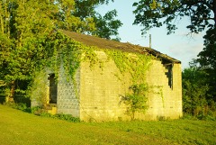 | Asia School | building | 2011 | 11000456 |
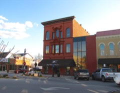 | Bank of Winchester Building | building | 1978 | 78002589 |
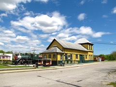 | Cowan Depot | building | 1978 | 78002588 |
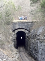 | Cumberland Mountain Tunnel | structure | 1977 | 77001270 |
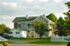 | Estill-Fite House | building | 1979 | 79002429 |
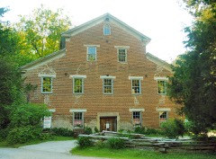 | Falls Mill | building | 1972 | 72001240 |
| Falls Mills Historic District | district | 1987 | 87001158 | |
 | Franklin County Courthouse | building | 1995 | 95000345 |
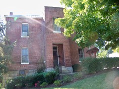 | Franklin County Jail | building | 1979 | 79002430 |
| Isaac Gray House | building | 1976 | 76001776 | |
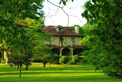 | Haynes House | building | 2005 | 05000359 |
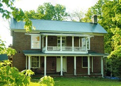 | Hunt-Moore House | building | 2005 | 05001223 |
 | R. N. Mann House | building | 1977 | 77001271 |
| Saint Margaret Mary Catholic Mission | building | 2017 | 100001305 | |
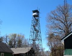 | Sewanee Fire Lookout Tower | building | 2015 | 15000116 |
| Shook-Vanzant Farm | district | 1998 | 98000954 | |
| Peter Simmons House | building | 1977 | 77001272 | |
| Tims Ford Hydroelectric Project | district | 2017 | 100001465 | |
| Townsend School | building | 2024 | 100010260 | |
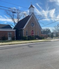 | Trinity Episcopal Church | building | 1980 | 80003796 |
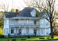 | Valentine Square | building | 1984 | 84000375 |
| Zaugg Bank Barn | building | 1973 | 73001764 |
Every wildfire the federal occurrence database records inside this county: 184 of them, burning about 1,325 acres. 1 started naturally and 57 were recorded as arson. Each settlement page carries the fires within five miles of it.
| Reported cause | Fires |
|---|---|
| Debris and open burning | 80 |
| Arson/incendiarism | 57 |
| Equipment and vehicle use | 14 |
| Missing data/not specified/undetermined | 10 |
| Recreation and ceremony | 6 |
| Railroad operations and maintenance | 5 |
| Smoking | 5 |
| Power generation/transmission/distribution | 2 |
| Misuse of fire by a minor | 2 |
| Natural | 1 |
| Other causes | 1 |
| Fireworks | 1 |
The five largest, by the area the report gives. Four of them were set deliberately.
| Date | Cause | Size | Reported by | Name on the report |
|---|---|---|---|---|
| 5 April 2005 | Arson/incendiarism | 144 acres | Tennessee Division of Forestry | not named |
| 25 March 2001 | Arson/incendiarism | 70 acres | Tennessee Division of Forestry | not named |
| 15 September 1999 | Equipment and vehicle use | 65 acres | Tennessee Division of Forestry | not named |
| 13 March 2012 | Arson/incendiarism | 63 acres | Tennessee Division of Forestry | GOAT TRACK 2 |
| 27 October 2000 | Arson/incendiarism | 50 acres | Tennessee Division of Forestry | not named |
| 14 November 1999 | Debris and open burning | 50 acres | Tennessee Division of Forestry | not named |
| 1 October 2008 | Railroad operations and maintenance | 45 acres | Tennessee Division of Forestry | not named |
| 7 September 2002 | Equipment and vehicle use | 40 acres | Tennessee Division of Forestry | not named |
Every settlement page carries the fires within five miles of it - see the settlement index below.
The NOAA Storm Events Database holds 452 reports for this county, causing 9 deaths, 59 injuries and about $2,214,900 in recorded property damage. Each settlement page carries the reports that name it.
| Kind of event | Reports |
|---|---|
| Thunderstorm Wind | 259 |
| Hail | 86 |
| Flash Flood | 52 |
| Tornado | 36 |
| Lightning | 10 |
| Heavy Rain | 5 |
| Funnel Cloud | 2 |
| Flood | 2 |
The most serious of them, by death, then injury, then recorded damage. The accounts are quoted exactly as the forecast office filed them.
| When | Event | Place named | Harm | What the report says |
|---|---|---|---|---|
| April 1974 | Tornado (F4) | not stated | 5 killed, 21 hurt, $250,000 | no account filed |
| February 1952 | Tornado (F4) | not stated | 3 killed, 35 hurt, $250,000 | no account filed |
| February 2011 | Tornado (EF0) | Awalt | 1 killed, $40,000 | The worst damage occurred in western portions of Franklin county. In these locations mobile homes were destroyed, multiple power poles and trees were snapped, and homes sustained significant roof damage. A 79 year old man was killed near Estill Springs, along UT Farm road, when the mobile home he occupied was picked up and thrown 70 yards. |
| January 2008 | Thunderstorm Wind | Winchester | 2 hurt, $1,000 | A line of severe thunderstorms produced damaging winds, which hurled debris through the air injuring two people. |
| November 1996 | Tornado (F2) | Huntland | 1 hurt, $500,000 | no account filed |
| April 1995 | Tornado (F1) | Belvedere | $100,000 | A tornado touched down between Belvedere and Walnut Grove. Two farms were damaged. Half of one farmhouse along with several outbuildings were destroyed. A barn at the other farm was moved 1000 feet. A few houses suffered shingle damage to their roofs. Several hundred trees were uprooted. |
| July 1995 | Thunderstorm Wind | Winchester | $100,000 | Two storage buildings lost their roofs. Several homes and business were damaged. Numerous trees, power lines and telephone poles were blown down. |
| May 1997 | Tornado (F2) | Huntland | $60,000 | A half dozen farm related buildings sustained damage. About 100 big trees were blown down in an apple orchard on White Gap Road. The trees were lying in different directions. |
| August 2006 | Lightning | Estill Spgs | $50,000 | Lightning struck a mobile home on Holt Road engulfing the structure in flames. Damage is estimated. |
| June 1994 | Tornado (F1) | Keith Springs Mountai | $50,000 | A tornado touched down near Keith Springs Mountain. A house and a barn was damaged. Several trees and power lines were knocked down. |
| April 1996 | Thunderstorm Wind | Winchester | $50,000 | no account filed |
| March 2009 | Tornado (EF1) | Branchville | $30,000 | A tornado snapped numerous trees and uprooted several cedar tree trunks along a 1.5 mile path north of U.S. highway 64 between Huntland and Maxwell. Shingles and roof panels of a home and a barn were peeled back along Stratton Road and Pleasant Ridge Road near Branchville. |
| March 1996 | Thunderstorm Wind | Winchester | $30,000 | no account filed |
| April 2011 | Lightning | Estill Spgs Arpt | $25,000 | Lightning struck a home at the 100 block of Tanglewood Trail in Estill Springs. The lightning penetrated the roof and ceiling of the home in multiple locations and caused significant damage. 911 call at 649 pm CST, but CG lightning data from NCDC/Severe Weather Data Inventory at this location was at 642 pm CST. |
| February 1990 | Tornado (F1) | not stated | $25,000 | no account filed |
| April 1974 | Tornado (F3) | not stated | $25,000 | no account filed |
| June 2006 | Lightning | Belvidere | $20,000 | Lightning sparked a fire at a local church causing considerable damage in the church sanctuary. Another separate fire was sparked at a residence in Hopkins Point, but no other information was available. Time range estimated. |
| June 2005 | Hail | Sherwood | $20,000 | Golf ball size hail was reported. Damage occurred to several automobiles. |
| July 2004 | Thunderstorm Wind | Winchester | $20,000 | Two trees were blown down onto a house. |
| July 2002 | Lightning | Winchester | $20,000 | News article stated that lightning struck a home at 251 Brandi Cir. The wiring inside of the wall caught fire and caused the insulation to ignite. There was some damage to the home. |
| July 1999 | Thunderstorm Wind | Cowan | $20,000 | Tree was blown down on 2 cars. |
| February 1997 | Thunderstorm Wind | Winchester | $20,000 | no account filed |
| July 2024 | Thunderstorm Wind | Winchester Spgs | $15,000 | Widespread trees and power lines reported down in the Estill Springs area. |
| July 2024 | Thunderstorm Wind | Winchester | $15,000 | Widespread trees and power lines were reported down in the Winchester area. |
| August 2012 | Lightning | Estill Spgs | $15,000 | A bolt from the blue lightning strike occurred and hit a nearby tree to a home, resulting in lightning damage to the home as the lightning strike spread into the home from the tree. The lightning damage resulted in a few broken windows, televisions, air conditioning, and electrical and phone outlets. |
| June 2009 | Thunderstorm Wind | Bruner Crossing | $15,000 | Numerous trees were blown down, some of which caused minor damage to a house. |
| June 2011 | Thunderstorm Wind | Huntland | $12,000 | Trees and power lines were blown down. |
| June 2011 | Thunderstorm Wind | Alto | $12,000 | Trees and power lines were blown down in Alto. |
| July 2010 | Thunderstorm Wind | Winchester | $12,000 | Several trees and power lines were blown down in the Winchester area. |
| June 2025 | Thunderstorm Wind | Owl Hollow | $10,000 | Multiple large trees were uprooted, large limbs were snapped and structural damage to boat docks and walkways along Tims Ford Lake. Time estimated by radar. |
| March 2024 | Tornado (EF0) | Belvidere | $10,000 | Drone imagery indicated a narrow and brief tornado touched down on a farm adjacent to U.S. Highway 64 southwest of Belvidere. The tornado snapped and uprooted a few trees on the farm before traveling east to a neighboring building materials company. Here, a number of small unsecured manufactured portable barns were shifted about, including one that was toppled over. |
| July 2024 | Thunderstorm Wind | Winchester | $10,000 | Several trees and powerlines were reported down across the entire county. |
| December 2021 | Thunderstorm Wind | Sewanee | $10,000 | Sewanee Police reported numerous trees and some power lines down on University Avenue. Time estimated by radar. |
| August 2014 | Thunderstorm Wind | Winchester | $10,000 | Several trees were downed by thunderstorm winds from Eastbrook road near Estill Springs, Tennessee to Iron Gap road and then along Keith Springs Mountain road, south of Winchester, Tennessee. |
| April 2013 | Thunderstorm Wind | Belvidere | $10,000 | A tree was downed by thunderstorm winds on Owl road and Belvidere road. |
| August 2012 | Thunderstorm Wind | Winchester | $10,000 | A few trees and power lines were downed by gust front winds along and ahead of thunderstorms moving through the area. |
| January 2006 | Lightning | Sewanee | $10,000 | Lightning struck a satellite dish which travelled along wiring into electronic equipment in a house which sparked a fire producing considerable damage to the interior of the home. |
| May 2004 | Tornado (F1) | Center Grove | $10,000 | A F1 tornado moved eastward out of Moore County across parts of Tims Ford Lake and into northwest Franklin County before dissipating near Center Grove. While most of the damage was confined to trees, a few boats were overturned in Tims Ford Lake. |
| May 2004 | Thunderstorm Wind | Winchester | $10,000 | Thunderstorm winds overturned a couple of boats in Tims Ford Lake near Winchester. |
| July 1999 | Thunderstorm Wind | Cowan | $10,000 | Sheriff's department reported damage to al large metal building. |
| July 1997 | Thunderstorm Wind | Estill Spgs | $10,000 | Local law enforcement reported several trees were blown down. There was damage to a concrete block building at a ball field and to a scoreboard. |
| July 1997 | Thunderstorm Wind | Decherd | $10,000 | Strong thunderstorm winds blew the roof off a commercial building that houses Movie World, Donut Palace and Paul's Pizza. |
| February 1997 | Thunderstorm Wind | Penile Hill | $10,000 | no account filed |
| March 1996 | Thunderstorm Wind | Cowan | $10,000 | no account filed |
| June 2011 | Thunderstorm Wind | Sewanee | $9,000 | Large trees and tree limbs were knocked down on the campus of the University of the South. |
| June 2011 | Thunderstorm Wind | Franklin Co Arpt | $8,000 | Large trees were knocked down on Jump Off road in the St. Andrews community. |
| June 2011 | Thunderstorm Wind | Gum Creek | $8,000 | Trees were knocked down onto a home in the capital Hill community. |
| June 2011 | Thunderstorm Wind | St Andrews | $8,000 | Large trees were knocked down on Highway 41 in the St. Andrews community. |
| July 2010 | Thunderstorm Wind | Estill Spgs | $8,000 | A few trees were blown down on highway 41A. |
| June 2010 | Thunderstorm Wind | Winchester | $7,000 | Law enforcement reported several trees and power lines down in Winchester and Decherd. |
| July 1996 | Lightning | Winchester | $6,300 | no account filed |
| May 2025 | Thunderstorm Wind | Decherd | $5,000 | Several trees were reported down in the city of Decherd. |
| May 2025 | Thunderstorm Wind | Capitol Hill | $5,000 | A tree was knocked down onto a house at 2394 Penile Hill Road. |
| May 2025 | Thunderstorm Wind | Winchester | $5,000 | Several trees were reported down in the city of Winchester. |
| March 2023 | Thunderstorm Wind | Branchville | $5,000 | Emergency management reported a few trees were knocked down and had to be removed from roadways. Damage occurred to two residential electrical services in the Broadview community. |
| December 2021 | Thunderstorm Wind | Franklin Co Arpt | $5,000 | Sewanee Police reported numerous trees down on Airport Road near Highway 156. Time estimated by radar. |
| August 2014 | Thunderstorm Wind | Cowan | $5,000 | A few trees and power lines were downed by thunderstorm winds on Georgia Crossing road, just north of Cowan, Tennessee. |
| July 2013 | Thunderstorm Wind | Winchester | $5,000 | A tree was downed by thunderstorm winds near the intersection of 12th street and North High street in Winchester, Tennessee. |
| July 2013 | Thunderstorm Wind | Estill Spgs | $5,000 | A large tree was downed by thunderstorm winds on Rock Creek Road, just northwest of Estill Springs, Tennessee. |
| April 2013 | Thunderstorm Wind | Gum Creek | $5,000 | A tree was downed by thunderstorm winds along Prairie Chapel Road near Decherd, Tennessee. |
The Survey's mineral resources record lists 21 workings inside this county. 15 still produce and 6 are closed or unrecorded. Each settlement page carries the workings within five miles of it.
| Commodity | Workings |
|---|---|
| Sand and Gravel, Construction | 7 |
| Stone, Crushed/Broken | 6 |
| Limestone, General | 2 |
| Stone, Crushed/Broken, Limestone, General | 2 |
| Silica | 2 |
| Clay | 2 |
The least common of them first, because a county's hundredth gravel pit says nothing its first ten did not.
| Where | Site | Commodity | Status | Recorded |
|---|---|---|---|---|
| Anderson Quarry | Limestone, General | Producer | Limestone | |
| Bostick Quarry | Stone, Crushed/Broken, Limestone, General | Producer | Limestone | |
| Cowan Quarry | Stone, Crushed/Broken, Limestone, General | Producer | Limestone | |
| Cowan Quarry Cement | Limestone, General | Producer | Limestone | |
| Marquette Clay Pit | Clay | Past Producer | Sedimentary | |
| Marquette Clay Pit | Clay | Producer | ||
| Sewanee Mine | Silica | Past Producer | ||
| Sewanee Silica Company Pit | Silica | Producer | Sandstone | |
| Anderson Minery Quarry | Stone, Crushed/Broken | Producer | ||
| Bostick Quarry | Stone, Crushed/Broken | Producer | ||
| Cowan Quarry | Stone, Crushed/Broken | Producer | ||
| Cowan Quarry Cement | Stone, Crushed/Broken | Producer | ||
| Marquette Cement Plant | Stone, Crushed/Broken | Plant | ||
| Mid-America Lime & Stone Co.Quarry | Stone, Crushed/Broken | Producer | ||
| Estill Springs Pit Number 7 | Sand and Gravel, Construction | Producer | ||
| Estill Springs Pit Number 77 | Sand and Gravel, Construction | Past Producer | Sedimentary | |
| Estill Springs Sand and Gravel Pit #77 | Sand and Gravel, Construction | Producer | Unconsolidated Sediments | |
| Glasner #1 Pit | Sand and Gravel, Construction | Producer | Unconsolidated Sediments | |
| Glasner Number 1 Pit | Sand and Gravel, Construction | Past Producer | Sedimentary | |
| Glasner Number 1 Pit | Sand and Gravel, Construction | Past Producer | ||
| Jump Off Mine No. 1 | Sand and Gravel, Construction | Past Producer |
Named settlements recorded in the Geographic Names Information System, each with the topographic sheets covering it. Villages, hamlets and abandoned places alike. Each is shown with the nearest named watercourse or landform and the survey quadrangle it falls on.
District 7 · 37388 · On Fall Lick Creek · Lynchburg East quadrangle
15 sheets, 1936 to 1981
No longer a settlement
District 2 · 37398 · On Wagner Creek · Winchester quadrangle
15 sheets, 1928 to 1981
District 8 · 37398 · On Hessey Branch · Winchester quadrangle
15 sheets, 1928 to 1981
District 6 · 37330 · Near Lawson Hollow · Capitol Hill quadrangle
17 sheets, 1936 to 1981
No longer a settlement
District 6 · 37324 · Near Elder Island · Capitol Hill quadrangle
17 sheets, 1936 to 1981
District 5 · 37306 · Near Crane Top · Pitcher Ridge quadrangle
15 sheets, 1928 to 1981
District 4 · 37398 · On Stewart Creek · Belvidere quadrangle
17 sheets, 1928 to 1981
District 8 · 37330 · On Sarvis Branch · Tullahoma quadrangle
17 sheets, 1936 to 1981
District 3 · 37398 · Near Leatherwood Island · Belvidere quadrangle
17 sheets, 1928 to 1981
No longer a settlement
District 2 · 37398 · On Wagner Creek · Winchester quadrangle
15 sheets, 1928 to 1981
District 2 · 37398 · On Bear Branch · Belvidere quadrangle
17 sheets, 1928 to 1981
District 6 · 37324 · By Brakefield Point · Capitol Hill quadrangle
25 sheets, 1895 to 1988
District 7 · 37388 · On South Fork Blue Creek · Tullahoma quadrangle
17 sheets, 1936 to 1981
District 3 · 37345 · On Rattlesnake Spring Branch · Huntland quadrangle
12 sheets, 1936 to 1981
District 6 · 37324 · Near Little Mountain · Capitol Hill quadrangle
17 sheets, 1936 to 1981
District 5 · 37375 · Near Shakerag Hollow · Sewanee quadrangle
22 sheets, 1895 to 1988
District 5 · 37375 · Near Pumplog Hollow · Sinking Cove quadrangle
20 sheets, 1895 to 1988
District 5 · 37306 · Near Cedar Ridge · Pitcher Ridge quadrangle
15 sheets, 1928 to 1981
District 7 · 37398 · On Long Branch · Belvidere quadrangle
17 sheets, 1928 to 1981
The vanished settlements of Franklin County: the places named above that are no longer on the map.