 Block
Knoxville, Tennessee
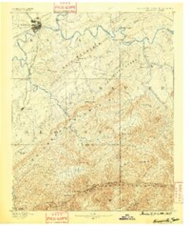
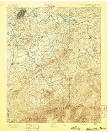
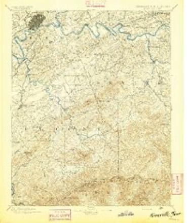
28 topographic sheets cover this place, the earliest surveyed in 1886 and the latest in 1983. It stands in District 1. It lies in ZIP code area 37902. It stands on Second Creek. The Survey maps it on the Knoxville quadrangle. 190,740 people lived here at the 2020 count. It stands 886 feet above sea level.
Research this city
On record in Knoxville
Buildings and businesses the archive holds for this place. Each opens its own page, with the source record it came from.
On the National Register 12 of 116 shown
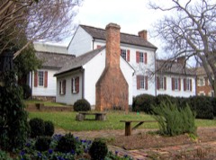 William Blount MansionNational Historic Landmark · listed 1966
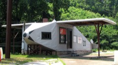 Airplane Service Stationlisted 2004
 Asbury Methodist Episcopal Church, Southlisted 1997
 Ayres Halllisted 2012
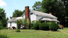 Alexander Bishop Houselisted 1997
 Bleak Houselisted 1984
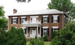 Boyd-Harvey Houselisted 1985
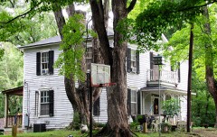 Alfred Buffat Homesteadlisted 1975
 Burwell Building Tennessee Theaterlisted 1982
 Camp Houselisted 1973
 Candoro Marble Workslisted 2005
 Central United Methodist Churchlisted 2005
Population over time
2 figuresKnoxville grew from 178,874 to 190,740 between 2010 and 2020. These are the recorded population figures Wikidata holds for this place, reached through the Geographic Names Information System number this page is keyed on rather than by name, so they belong to this place and not to another of the same name. Most are census counts, but not all are: an early figure may be a founding or settlement estimate, and an estimate published within five years of a census is left out. The change column is computed, and is left blank where more than 20 years separate a figure from the one before it, because a gap that long is not a change between two counts.
| Year | People | Change |
|---|---|---|
| 2010 | 178,874 | |
| 2020 | 190,740 | +11,866 (+7%) |
Topographic sheets covering this place
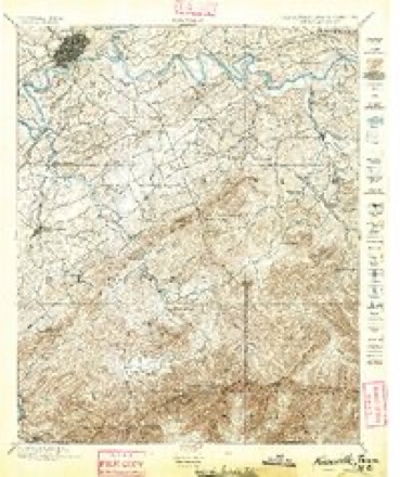
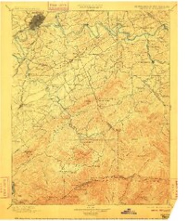
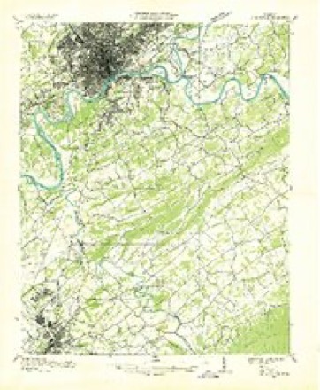
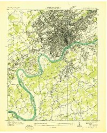
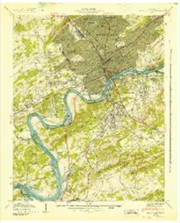
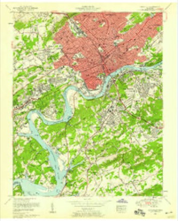
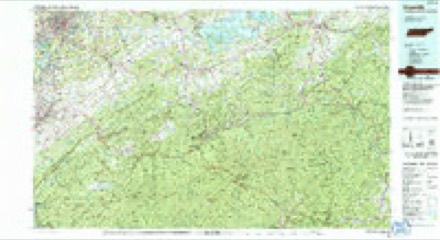
16 surveys from 28 printed sheetsMatched by testing this settlement's coordinate against the published boundary of every sheet in the United States Geological Survey's historical collection. Each opens the scanned sheet at the Survey.
- 1886 USGS Knoxville quadrangle1:125000
- 1892 USGS Knoxville quadrangle1:125000
- 1894 USGS Knoxville quadrangle1:125000
- 1895 USGS Knoxville quadrangle1:125000, 2 printings
- 1901 USGS Knoxville quadrangle1:125000, 5 printings
- 1935 USGS Knoxville quadrangle1:48000
- 1936 USGS Knoxville quadrangle1:24000
- 1942 USGS Knoxville quadrangle1:24000
- 1953 USGS Knoxville quadrangle1:24000, 2 printings
- 1955 USGS Knoxville quadrangle1:250000
- 1957 USGS Knoxville quadrangle1:250000, 4 printings
- 1960 USGS Knoxville quadrangle1:250000, 2 printings
- 1964 USGS Knoxville quadrangle1:250000
- 1966 USGS Knoxville quadrangle1:24000, 2 printings
- 1978 USGS Knoxville quadrangle1:24000, 2 printings
- 1983 USGS Knoxville quadrangle1:100000
What the histories say of this town
184,795 words1 chapter about Knoxville from the published histories of the county, public domain and reproduced complete.
| Chapter | From | Length |
|---|---|---|
| Standard History of Knoxville, Tennessee, with Full Outline of the Nat | Standard History of Knoxville, Tennessee, with Full Outline of the Natural Advantages, Early Settlement, Territorial Government, Indian Troubles and General and Particular History of the City Down to the Present Time (1900) | 184,795 words in 12 parts |
Fires near this place
20 since 1999Regional context, not property-specific evidence. The federal wildfire occurrence database lists 20 fires within 5 miles of Knoxville between 1999 and 2020, burning about 194 acres in total. 1 started naturally. 7 were recorded as arson. Distance is straight-line from the map coordinates, so a fire counted here may appear on a neighbouring settlement's page as well.
| Reported cause | Fires |
|---|---|
| Arson/incendiarism | 7 |
| Debris and open burning | 2 |
| Missing data/not specified/undetermined | 2 |
| Recreation and ceremony | 2 |
| Smoking | 2 |
| Natural | 1 |
| Equipment and vehicle use | 1 |
| Other causes | 1 |
| Power generation/transmission/distribution | 1 |
| Railroad operations and maintenance | 1 |
The most recent of them, most recent first, with the day each was reported and the service that recorded it.
| Date | Cause | Size | Reported by | Name on the report |
|---|---|---|---|---|
| 2 August 2015 | Smoking | under an acre | Tennessee Division of Forestry | ARBOR PLACE |
| 4 June 2011 | Arson/incendiarism | 4.0 acres | Tennessee Division of Forestry | SMITH EVANS LN |
| 1 May 2007 | Debris and open burning | 1.0 acres | Tennessee Division of Forestry | CHAPMAN HWY |
| 9 April 2009 | Power generation/transmission/distribution | 30 acres | Tennessee Division of Forestry | CHEROKEE TRAIL |
| 5 April 2020 | Debris and open burning | 2.0 acres | Tennessee Division of Forestry | BROWN |
| 23 April 2007 | Railroad operations and maintenance | 100 acres | Tennessee Division of Forestry | SHARPS RIDGE TOWER |
| 14 April 2014 | Recreation and ceremony | 5.0 acres | Tennessee Division of Forestry | LIPPENCOTT |
| 7 March 2000 | Smoking | 2.0 acres | Tennessee Division of Forestry | not named |
Settlements close enough to share some of these fires:
Mines and quarries near this place
10 of 82 shownRegional context, not property-specific evidence. The federal mineral resources record lists 82 workings within 5 miles of Knoxville: 71 past producers, 7 producers, 2 plants, 1 occurrence. 9 still produce. What was taken out: Marble, Dimension, Stone, Crushed/Broken, Limestone, Dimension, Limestone, General. Distance is straight-line from the map coordinates, so a quarry counted here may appear on a neighbouring settlement's page as well.
| Where | Site | Commodity | Status | Recorded |
|---|---|---|---|---|
| Asbury Quarry | Stone, Crushed/Broken, Limestone, High Calcium | Producer | Limestone | |
| City Quarry Knoxville | Stone, Crushed/Broken, Limestone, General | Producer | 1850 | |
| Knoxville Sand & Gravel Plant | Sand and Gravel, Construction | Producer | Unconsolidated Sediments | |
| Lead Prospect | Lead | Occurrence | ||
| O.K. Quarry | Calcium, Limestone, General | Past Producer | Calcite | |
| Williams Quarry | Limestone, High Calcium | Producer | Limestone | |
| Asbury Pit | Calcium | Plant | ||
| Broadway Mine | Clay | Past Producer | Sedimentary | |
| Dixie Lee Quarry | Limestone, General | Past Producer | Sedimentary | |
| Freeway Quarry | Limestone, General | Past Producer | Sedimentary |
Storms near this place
60 of 293 shownRegional context, not property-specific evidence. The National Weather Service names Knoxville in 293 storm reports between 1993 and 2026: 196 thunderstorm wind, 62 hail, 16 flash flood, 14 flood. The reports record 2 deaths. Each account below is quoted exactly as the forecast office filed it, from the NOAA Storm Events Database, and each date opens the federal record of that event.
| When | Event | Place named | Harm | What the report says |
|---|---|---|---|---|
| November 2000 | Thunderstorm Wind | Knoxville | 2 killed, $3,000 | no account filed |
| May 2003 | Flash Flood | Knoxville | $2,800,000 | Kingston Pike and Gleason Road flooded and closed. |
| February 2011 | Flood | Knoxville | $1,960,000 | Broadcast media reported that heavy rain from a thunderstorm caused flooding countywide. |
| May 1996 | Thunderstorm Wind | Knoxville | $500,000 | no account filed |
| May 2003 | Tornado (F1) | Knoxville | $200,000 | no account filed |
| May 2003 | Tornado (F1) | Knoxville | $150,000 | no account filed |
| July 2004 | Thunderstorm Wind | Knoxville | $70,000 | no account filed |
| June 2011 | Tornado (EF0) | West Knoxville | $40,000 | A NWS storm surveyed reported an EF-0 tornado touched along Western Avenue in Knoxville. It had a path length of around 1 mile and a path width of 100 yards. The max wind of 80 mph downed several trees and powerlines along with causing slight roof damage on 2 homes. |
| May 2006 | Thunderstorm Wind | Knoxville | $35,000 | no account filed |
| July 2002 | Thunderstorm Wind | Knoxville | $35,000 | no account filed |
| April 2011 | Thunderstorm Wind | Knoxville | $30,000 | Amateur radio personnel reported several buildings damaged or destroyed by thunderstorm wind at the University of Tennessee hospital property in Knoxville. |
| June 2011 | Thunderstorm Wind | Knoxville | $30,000 | Amateur radio personnel reported numerous trees downed by thunderstorm wind in Knoxville. Wind also downed a tree on a house. |
| April 2011 | Hail | Knoxville | $30,000 | The public reported thunderstorms produced baseball-size hail 2 miles southeast of Knoxville damaging vehicles in the area. |
| July 2004 | Thunderstorm Wind | Knoxville | $30,000 | no account filed |
| April 2011 | Thunderstorm Wind | Knoxville | $25,000 | Amateur radio personnel reported numerous trees downed by thunderstorm wind at the Martha Washington Heights subdivision in Knoxville. |
| August 2006 | Lightning | Knoxville | $25,000 | Lightning struck and damaged an apartment building on Middle Brook Pike in Knoxville. One unit was destroyed as the roof caught fire. |
| July 2006 | Thunderstorm Wind | Knoxville | $25,000 | no account filed |
| May 2004 | Thunderstorm Wind | Knoxville | $25,000 | no account filed |
| July 2022 | Flood | Knoxville | $20,000 | Vehicles submerged along 23rd Street. A few residents were rescued from nearby apartments. |
| June 2011 | Flash Flood | Knoxville | $20,000 | Law enforcement personnel reported heavy rain from thunderstorm caused flooding on many roads across the county. |
| April 2011 | Thunderstorm Wind | Knoxville | $20,000 | Law enforcement personnel reported numerous trees and powerlines downed by thunderstorm wind countywide. |
| June 2009 | Thunderstorm Wind | Knoxville | $20,000 | Law enforcement officials reported numerous trees downed by thunderstorm winds countywide. |
| June 2008 | Thunderstorm Wind | South Knoxville | $20,000 | Dispatch reported several trees downed by thunderstorm winds in the Knoxville area. A tree fell on home in Knoxville damaging the roof. |
| June 2007 | Thunderstorm Wind | Knoxville | $20,000 | Thunderstorm winds downed several trees and powerlines in Knoxville and the surrounding areas. |
| August 2006 | Thunderstorm Wind | Knoxville | $20,000 | Numerous trees and powerlines down across the southeast half of the county. Over 17,000 homes lost power. |
| June 2005 | Thunderstorm Wind | Knoxville | $20,000 | Numerous trees down in city and county-wide. |
| August 2005 | Thunderstorm Wind | Knoxville | $20,000 | Several trees down in and around the Halls Crossroads area. Reported by Knox County Highway Dept. |
| August 2005 | Thunderstorm Wind | Knoxville | $20,000 | A few trees down on powerlines in north Knox County. Reported by Clinton Utilities. |
| August 2005 | Thunderstorm Wind | Knoxville | $20,000 | Numerous trees and powerlines down. |
| October 2005 | Thunderstorm Wind | Knoxville | $20,000 | Numerous trees and powerlines downed across north Knox County. |
| June 2004 | Thunderstorm Wind | Knoxville | $20,000 | Several trees down across east half of county |
| June 2004 | Thunderstorm Wind | Knoxville | $20,000 | Tree down on automobile on Asheville Hwy |
| May 2005 | Thunderstorm Wind | Knoxville | $20,000 | no account filed |
| July 2004 | Thunderstorm Wind | Knoxville | $20,000 | no account filed |
| February 1998 | Thunderstorm Wind | Knoxville | $20,000 | no account filed |
| October 2001 | Thunderstorm Wind | Knoxville | $19,000 | Trees and power lines down. |
| June 2009 | Thunderstorm Wind | West Knoxville | $18,000 | The local television station reported numerous trees downed by thunderstorm winds across the county. A few homes and a church in Knoxville were also damaged by the winds. |
| April 2006 | Thunderstorm Wind | Knoxville | $18,000 | Numerous trees down in Knoxville. |
| June 2006 | Thunderstorm Wind | Knoxville | $18,000 | Several trees and powerlines down in Knoxville. |
| June 2005 | Thunderstorm Wind | Knoxville | $18,000 | One tree down in Knoxville and a few other trees across the rest of the county. |
| June 2005 | Thunderstorm Wind | Knoxville | $18,000 | Several trees and a powerline down in and around the city of Knoxville. |
| December 2005 | Thunderstorm Wind | Knoxville | $18,000 | Several trees down countywide |
| March 2004 | Thunderstorm Wind | Knoxville | $18,000 | no account filed |
| February 2026 | Thunderstorm Wind | South Knoxville | $15,000 | Strips of green tin roof were peeled off an inn on Chapman Highway by severe thunderstorm wind gusts. |
| April 2015 | Thunderstorm Wind | Knoxville | $15,000 | Dispatch personnel reported multiple trees and few powerlines downed by thunderstorm wind across the county. |
| April 2014 | Thunderstorm Wind | Knoxville | $15,000 | Law enforcement personnel reported numerous trees downed by thunderstorm wind countywide. |
| February 2011 | Thunderstorm Wind | Knoxville | $15,000 | Law enforcement personnel reported five trees and two powerlines downed by thunderstorm wind in and around Knoxville. |
| February 2011 | Thunderstorm Wind | Knoxville | $15,000 | A trained spotter reported several trees and a small carport downed by thunderstorm wind six miles north of Knoxville on Conner Drive. |
| June 2011 | Thunderstorm Wind | Knoxville | $15,000 | Amateur radio personnel reported several trees and limbs downed by thunderstorm wind in Knoxville. |
| June 2009 | Thunderstorm Wind | Knoxville | $15,000 | Law enforcement personnel reported several trees and powerlines downed by thunderstorm winds in Knoxville. |
| June 2009 | Thunderstorm Wind | Knoxville | $15,000 | The newspaper reported several trees and powerlines downed by thunderstorm winds in Knoxville. In addition, the roof of a home in Knoxville was damaged by the wind. |
| June 2007 | Thunderstorm Wind | Knoxville | $15,000 | Thunderstorm winds downed four trees in west Knoxville. |
| June 2004 | Thunderstorm Wind | Knoxville | $15,000 | Numerous trees down throughout the city |
| September 1995 | Thunderstorm Wind | Knoxville | $15,000 | A thunderstorm knocked down trees and electrical wires around the Knoxville area. |
| July 2005 | Thunderstorm Wind | Knoxville | $15,000 | no account filed |
| July 2004 | Thunderstorm Wind | Knoxville | $15,000 | no account filed |
| July 2004 | Thunderstorm Wind | Knoxville | $15,000 | no account filed |
| November 2002 | Thunderstorm Wind | North Knoxville | $15,000 | no account filed |
| July 1999 | Thunderstorm Wind | Knoxville | $15,000 | no account filed |
| June 2014 | Thunderstorm Wind | Knoxville | $12,000 | Law enforcement personnel reported many trees downed by thunderstorms wind countywide. |
Nearest settlements
The eight closest, with where each one stands in the county. Distances are straight-line, computed from the Geographic Names Information System coordinates.
| Map | Place | Distance | Sheets |
|---|---|---|---|
| South Knoxville | 1.7 miles | 28 | |
| Island Home | 1.9 miles | 28 | |
| West Knoxville | 1.9 miles | 28 | |
| Coster Yards | 2.2 miles | 28 | |
| Park City | 2.3 miles | 28 | |
| Vestal | 2.3 miles | 28 | |
| West View | 2.3 miles | 28 | |
| Marble City | 2.4 miles | 28 |
Elsewhere
Matched on this settlement's Geographic Names Information System number rather than its name, so it cannot be a different place of the same name in another state.
| Wikipedia article on Knoxville | An encyclopaedic summary. Its text is share-alike, so it is linked here rather than copied. |
| Wikidata item Q185582 | The structured record the population and elevation above come from. Public domain (CC0). |
Provenance
This settlement is recorded in the Geographic Names Information System as feature 1648562. The sheet list is computed by point-in-boundary test against the United States Geological Survey's historical topographic inventory. Both are works of the United States government and carry no copyright under 17 U.S.C. 105.
Wildfire. Short, Karen C. 2022. Spatial wildfire occurrence data for the United States, 1992-2020 [FPA_FOD_20221014]. 6th Edition. Fort Collins, CO: Forest Service Research Data Archive. https://doi.org/10.2737/RDS-2013-0009.6 Collected with United States Government funding and usable without additional permissions or fees.
Mines and quarries. USGS Mineral Resources Data System (MRDS) https://mrdata.usgs.gov/mrds/ A work of the United States government, no copyright under 17 U.S.C. 105.
Storms. NOAA National Centers for Environmental Information, Storm Events Database https://www.ncei.noaa.gov/stormevents/ A work of the United States government, no copyright under 17 U.S.C. 105. Narratives are quoted verbatim from the National Weather Service report and are not edited or summarised.