BlockBefore

Knox County, Tennessee

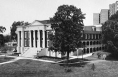
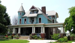
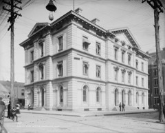
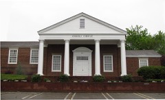
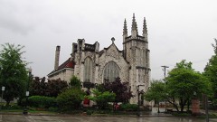
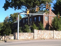
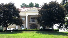
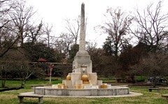
183 topographic sheets cover 295 settlements here, and 120 properties are on the National Register of Historic Places.

Research this county

From the record

120 National Register listings published here, 1 of them a National Historic Landmark · the county-history sources tell 1 story and name 3 people · people the book names include Miss Emily L. Austin (Knoxville, 1900) (machine-read).

Sources: the county history on the Internet Archive · the National Register database, National Park Service

Tennessee within the United States
Knox County within Tennessee

What the record shows

  • 6,951 topographic sheet readings cover the county's settlements.
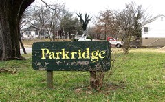
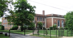
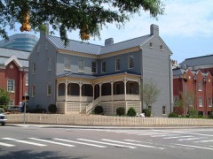
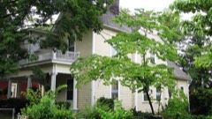
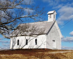
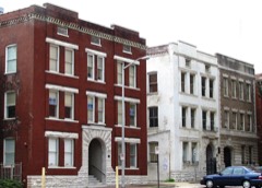
  • 120 properties here are on the National Register of Historic Places: 81 buildings, 30 districts, 7 sites and 2 structures.
  • 20 of the 120 listings were added during the 1970s.
  • The Geographic Names Information System records 296 populated places in this county; 295 are covered by at least one topographic sheet.

What happened here

1 accounts

Among them: Military History. These passages come from the identified county-history source books. Each inset names its own source and opens the exact section it comes from.

From Standard History of Knoxville, Tennessee, with Full Outline of the Natural Advantages, Early Settlement, Territorial Government, Indian Troubles and General and Particular History of the City Down to the Present Time, published 1900 - Knoxville

Military History

Early Indian Wars - Col. John Williams' Regiment - The Mexican War - Volunteers for Both the Union and the Confederate Service - Sanders' Raid - Knoxville Receives Gen. Burnside - Is Besieged by Gen. Longstreet - A Sanguinary Battle - Fort Sanders - Knoxville Pension Agency - In the Spanish War - Warm Welcome to Returning Volunteer Soldiers 148

Read the rest of this passage

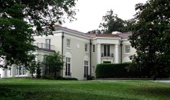
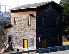
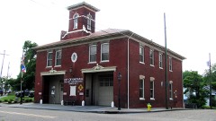
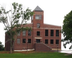
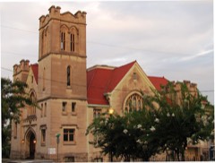
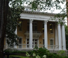
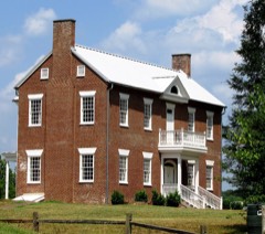
Places on the National Register

120

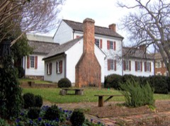
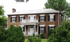
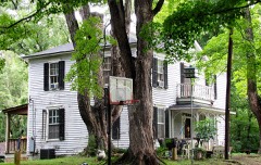
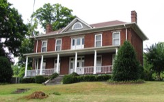
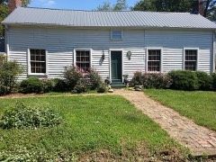
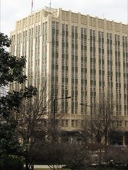
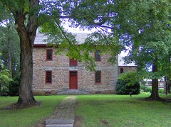
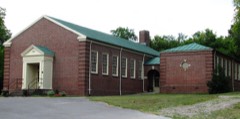
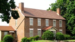
Every property in this county listed on the National Register of Historic Places, with the year it was listed and the federal nomination document.

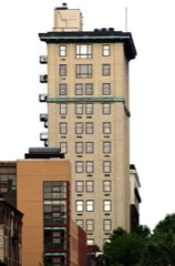
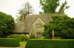
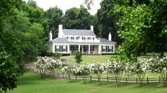
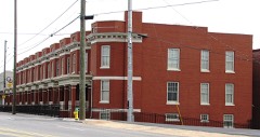
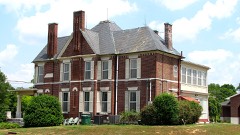
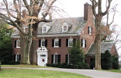
Photograph PropertyType ListedReference
Adair Gardens Historic Districtdistrict199494001136
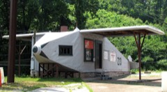
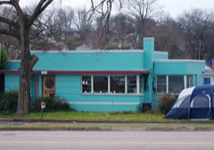
Airplane Service Stationbuilding200404000198
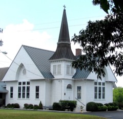
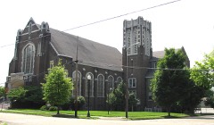
Asbury Methodist Episcopal Church, Southbuilding199797000222
Ayres Hallbuilding201212000466
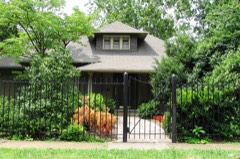
George F. Barber Cottagebuilding2025100011618
Bethel Confederate Cemetery and Winstead Cottagedistrict201515000117
Alexander Bishop Housebuilding199797000953
Bleak Housebuilding198484000369
William Blount Mansionbuilding196666000726
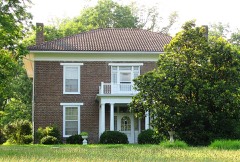
Boyd-Harvey Housebuilding198585002774
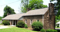
Alfred Buffat Homesteadbuilding197575001761
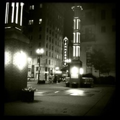
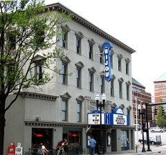
Burwell Building Tennessee Theaterbuilding198282003979
Camp Housebuilding197373001800
Candoro Marble Worksdistrict200596001399
Central United Methodist Churchbuilding200505001225
Chesterfieldbuilding197777001276
Christenberry Club Roombuilding199797000242
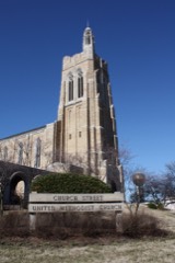
Church Street Methodist Churchbuilding200909000115
Concord Village Historic Districtdistrict198787001888
Contractor's Supply, Inc.building201111000457
Cowan, McClung and Company Buildingbuilding198484003566
Craighead-Jackson Housebuilding197373001801
Daniel Housebuilding199898000240
Daylight Buildingbuilding200909000956
H. L. Dulin Housebuilding197474002265
Ebenezer Millbuilding198787001037
Emory Place Historic Districtdistrict199494001259
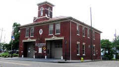
Fire Station No. 5building197878002602
First Baptist Churchbuilding199797000223
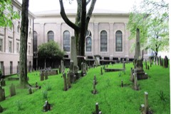
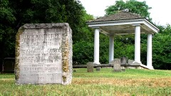
First Presbyterian Church Cemeterysite199696001400
Forest Hills Boulevard Historic Districtdistrict199292000350
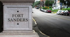
Fort Sanders Historic Districtdistrict198080003839
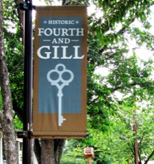
Fourth and Gill Historic Districtdistrict198585000948
Gay Street Commercial Historic Districtdistrict198686002912
Gay Street Commercial Historic District (Boundary Increase)building201515000542
General Buildingbuilding198888000174
Gibbs Drive Historic Districtdistrict200000001354
Nicholas Gibbs Housedistrict198888001447
Giffin Grammar Schoolbuilding201616000788
Happy Holler Historic Districtdistrict201414000185
Hilltopbuilding201616000119
Holston National Bankbuilding197979002446
Hopecotebuilding201212000137
Hotpoint Living-Conditioned Homebuilding201010000086
Howell Nurseriesdistrict2022100007965
Island Home Park Historic Districtdistrict199494001260
Jackson Avenue Warehouse Districtdistrict197373001802
Jackson Avenue Warehouse District Extensiondistrict197575002148
Andrew Johnson Hotelbuilding198080003840
Leroy Keener Housebuilding199797001440
Kern's Bakerybuilding2017100000979
Kingston Pike Historic Districtdistrict199696001404
Knollwoodbuilding197575001762
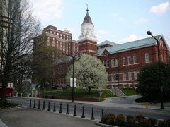
Knox County Courthousebuilding197373001803
Knoxville Business Collegebuilding198383003042
Knoxville College Historic Districtdistrict198080003841
Knoxville Iron Foundry Complex-Nail Factory and Warehousebuilding198282003980
Knoxville National Cemeterysite199696000966
Knoxville Post Officebuilding198484003567
Knoxville YMCA Buildingbuilding198383004256
Lamar House Hotelbuilding197575001763
Charles L. Lawhon Cottagebuilding2019100004685
Lebanon in the Forks Cemeterysite201010000934
Lincoln Park United Methodist Churchbuilding200505000695
Lindbergh Forest Historic Districtdistrict199894001261
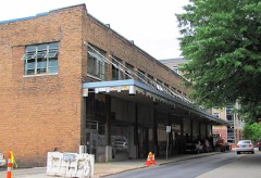
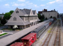
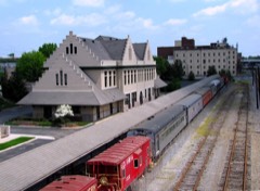
Louisville and Nashville Freight Depotbuilding198282003981
Louisville and Nashville Passenger Stationbuilding198282003982
Joseph Alexander Mabry Jr. Housebuilding198989001974
Mall Buildingbuilding198282003983
Marble Springsbuilding197171000823
Market Square Commercial Historic Districtdistrict198484001138
Maxwell-Kirby Housebuilding199999001446
Samuel McCammon Housebuilding198484003571
Alexander McMillan Housebuilding200101000504
Mead Marble Quarrysite201414000085
Mechanics' Bank and Trust Company Buildingbuilding198383003043
Mechanicsville Historic Districtdistrict198080003842
Medical Arts Buildingbuilding198484003573
Middlebrookbuilding197474001920
Minvillabuilding201010001046
Monday Housebuilding200101000394
Benjamin Morton Housebuilding200404001233
Murphy Springs Farmbuilding201514001034
New Salem United Methodist Churchbuilding198383003044
Capt. James Newman Housebuilding199898001304
North Hills Historic Districtdistrict200808000677
Old Gray Cemeterysite199696001402
Old Knoxville City Hallbuilding197272001241
Old North Knoxville Historic Districtdistrict199292000506
Old Post Office Buildingbuilding197373001804
Ossoli Circle Clubhousebuilding198585000620
Park City Historic Districtdistrict199090001578
Park City Junior High Schoolbuilding198383003045
Park, James, Housebuilding197272001242
Peters Housebuilding199999000364
Ivan Racheff Housebuilding200202000810
Ramsey Housebuilding196969000180
Riverdale Historic Districtdistrict199794001258
Riverdale Millbuilding198787000464
Riverdale Schoolbuilding199797000243
Ross Marble Quarrysite201414000086
Avery Russell Housebuilding197575001759
Savage House and Gardendistrict199797001230
Seven Islands Methodist Churchbuilding199797000244
South Market Historic Districtdistrict199696001403
Southern Terminal and Warehouse Historic Districtdistrict198585002909
Southern Terminal and Warehouse Historic District (Boundary Increase)district200404000153
St. John's Lutheran Churchbuilding198585000700
Statesviewbuilding197373001805
Stratfordbuilding200909000536
Talahi Improvementssite197979002447
Tennessee School for the Deaf Historic Districtdistrict199696001401
Trinity Methodist Episcopal Churchbuilding198282003984
Tyson Junior High Schoolbuilding199898000821
Gen. Lawrence D. Tyson Housebuilding201212000467
Westmoreland Water Wheel and Gatepoststructure201313000949
Westwoodbuilding198484000366
Gen. John T. Wilder Housebuilding199797001463
Col. John Williams Housebuilding198080003843

Wildfire, 1997 to 2020

143 fires

Every wildfire the federal occurrence database records inside this county: 143 of them, burning about 1,991 acres. 3 started naturally and 31 were recorded as arson. Each settlement page carries the fires within five miles of it.

Reported cause Fires
Debris and open burning56
Arson/incendiarism31
Missing data/not specified/undetermined20
Smoking9
Power generation/transmission/distribution6
Equipment and vehicle use5
Recreation and ceremony4
Misuse of fire by a minor4
Natural3
Other causes3
Railroad operations and maintenance2

The five largest, by the area the report gives. One of them was set deliberately.

DateCause SizeReported by Name on the report
25 March 2007Smoking167 acresTennessee Division of ForestryHOUSE MTN
25 April 2001Arson/incendiarism150 acresTennessee Division of Forestrynot named
26 March 2007Missing data/not specified/undetermined150 acresTennessee Division of ForestryHOUSE MTN
22 November 2012Debris and open burning120 acresTennessee Division of ForestryMILLER
23 April 2007Railroad operations and maintenance100 acresTennessee Division of ForestrySHARPS RIDGE TOWER
19 April 2004Missing data/not specified/undetermined100 acresTennessee Division of ForestryKEYSTOWN ROAD
3 March 2007Debris and open burning80 acresTennessee Division of ForestryFLINT GAP RD
17 May 2001Debris and open burning75 acresTennessee Division of Forestrynot named

Every settlement page carries the fires within five miles of it - see the settlement index below.

Storms, 1955 to 2026

60 of 774 shown

The NOAA Storm Events Database holds 774 reports for this county, causing 6 deaths, 37 injuries and about $57,412,303 in recorded property damage. Each settlement page carries the reports that name it.

Kind of event Reports
Thunderstorm Wind488
Hail169
Flash Flood68
Flood29
Tornado15
Heavy Rain4
Lightning1

The most serious of them, by death, then injury, then recorded damage. The accounts are quoted exactly as the forecast office filed them.

WhenEvent Place namedHarm What the report says
April 1974Tornado (F1)not stated2 killed, 21 hurt, $25,000no account filed
November 2000Thunderstorm WindKnoxville2 killed, $3,000no account filed
February 2019FloodHalls Xrds1 killed, $32,500,000Numerous roadways and structures were flooded. East Emory Road near Hallbrook Road near Halls Crossroads was closed. Flooding also reported on Northshore Drive near Ebenezer Road. South Peters Road was closed by flooding late in the evening, but a motorist still became submerged and, after being taken to a hospital, died shortly after midnight. All told, there was about 32.5 million dollars in damages across Knox County from this flooding event.
July 2016Thunderstorm WindRocky Hill1 killedA 66 year old female was killed by a falling tree outside of her residence in West Knoxville. Numerous trees were downed in the area by the thunderstorm winds.
April 1965Tornado (F2)not stated6 hurt, $2,500,000no account filed
February 1993Tornado (F3)Oak Ridge to3 hurt, $5,000,000The tornado started near Oak Ridge, moved through the Bull Run Steam Plant and went through the town of Claxton. Fifty homes were damaged and six mobile homes were destroyed. Two business were destroyed and another 10 were damaged including a weapons plant. Twelve electric transmission towers were knocked down.
April 1991Thunderstorm Windnot stated3 hurtno account filed
December 2021Thunderstorm WindByrds Chapel1 hurtA tree was blown down and injured one person off Campbell Station Road.
February 2003Flash FloodCountywide1 hurtno account filed
May 2000Tornado (F1)Powell1 hurtno account filed
August 1986Thunderstorm Windnot stated1 hurtno account filed
February 1993Tornado (F3)Northbrook$5,000,000The tornado that went through Anderson County continued into Knox County affecting the towns of Powell and Northbrook. Eleven homes were destroyed and another 75 homes were damaged. Numerous trees were knocked down as well.
August 2023Tornado (EF2)Byrds Chapel$3,700,000The tornado started on Yarnell Road, then reached peak intensity and width as it passed the Lovell Crossing apartment complex. Significant roof damage was noted to several of the homes and apartments in Lovell Cove and Crossing, with partial roof loss and uplift of roof decking common to several apartments. In addition to roof damage, a complete collapse of a garage at Lovell Crossing was noted, along with wooden boards driven into the ground and a large gash in the side of apartment complex office from the impact of a large, but unknown object. Numerous trees in the apartment complex suffered damage from the tornado. The tornado then crossed Pellissippi Parkway, and continued along and north of Bob Gray Road. A driver on Pellissippi Parkway recorded a video of the tornado crossing the parkway. Significant tree damage was observed along Bob Gray Road, with a narrow path of snapped hardwood trees as the tornado progressed eastward. The tornado appears to have dissipated at the intersection of Bob Gray Road and Middlebrook Pike.
May 2003Flash FloodKnoxville$2,800,000Kingston Pike and Gleason Road flooded and closed.
February 2011FloodKnoxville$1,960,000Broadcast media reported that heavy rain from a thunderstorm caused flooding countywide.
May 1996Thunderstorm WindKnoxville$500,000no account filed
June 2004Flash FloodBearden$300,000"Shoulder deep" water covered the parking of an apartment complex in Bearden, covering some vehicles and invading several units. Also, water filled the parking of a popular restaurant in Bearden, completely submerging several vehicles.
May 2003Tornado (F1)Knoxville$200,000no account filed
May 2003Tornado (F1)Knoxville$150,000no account filed
February 2026Thunderstorm WindKnoxville Downtown I$100,000Multiple trees and powerlines were blown down across Knoxville by severe thunderstorm winds, with at least one tree falling on a home in East Knoxville.
December 2025Thunderstorm WindSequoyah Hills$100,000A 36 inch diameter oak tree was felled by severe thunderstorm winds and sliced through the side of a home, requiring the fire department to extricate 1 person. No confirmed injuries. Fire department reported another tree falling on a separate house in Knoxville as well as several other incidents of tree damage across the city.
July 2004Thunderstorm WindKnoxville$70,000no account filed
October 2005Thunderstorm WindCountywide$50,000Storm blew the cover off a roof-top air conditioner unit of a grocery store in Knoxville, as well as destroying an awning at a gas station. Numerous trees and powerlines downed in Knoxville and across the eastern half of the county. Local newspaper reported nearly 18,000 people in the county lost power.
July 1997Thunderstorm WindCountywide$50,000no account filed
June 2011Tornado (EF0)West Knoxville$40,000A NWS storm surveyed reported an EF-0 tornado touched along Western Avenue in Knoxville. It had a path length of around 1 mile and a path width of 100 yards. The max wind of 80 mph downed several trees and powerlines along with causing slight roof damage on 2 homes.
May 2006Thunderstorm WindKnoxville$35,000no account filed
July 2005Thunderstorm WindCountywide$35,000no account filed
July 2002Thunderstorm WindKnoxville$35,000no account filed
August 1996Thunderstorm WindEast Part$35,000no account filed
April 2011Thunderstorm WindKnoxville$30,000Amateur radio personnel reported several buildings damaged or destroyed by thunderstorm wind at the University of Tennessee hospital property in Knoxville.
June 2011Thunderstorm WindKnoxville$30,000Amateur radio personnel reported numerous trees downed by thunderstorm wind in Knoxville. Wind also downed a tree on a house.
April 2011HailKnoxville$30,000The public reported thunderstorms produced baseball-size hail 2 miles southeast of Knoxville damaging vehicles in the area.
July 2004Thunderstorm WindKnoxville$30,000no account filed
August 2002Thunderstorm WindCountywide$30,000no account filed
April 2011Thunderstorm WindKnoxville$25,000Amateur radio personnel reported numerous trees downed by thunderstorm wind at the Martha Washington Heights subdivision in Knoxville.
June 2009Thunderstorm WindCorryton$25,000An individual reported several trees and powerlines downed by thunderstorm winds in the Corryton area. A roof of a building was damaged by thunderstorm winds in the Corryton area near the Corryton Baptist Church.
April 2007Thunderstorm WindFountain City$25,000Several trees were reported down across the northern half of the county.
August 2006LightningKnoxville$25,000Lightning struck and damaged an apartment building on Middle Brook Pike in Knoxville. One unit was destroyed as the roof caught fire.

July 2006Thunderstorm WindKnoxville$25,000no account filed
July 2005Thunderstorm WindCountywide$25,000no account filed
May 2004Thunderstorm WindKnoxville$25,000no account filed
November 2002Thunderstorm WindCountywide$25,000no account filed
July 1999Thunderstorm WindCountywide$25,000no account filed
May 1981Tornado (F0)not stated$25,000no account filed
July 2022FloodKnoxville$20,000Vehicles submerged along 23rd Street. A few residents were rescued from nearby apartments.
March 2012Tornado (EF0)Wooddale$20,000An EF0 tornado with maximum winds of 80 mph and maximum width of 100 yards produced a damage track 2.1 miles in length three miles south of Mascot. Along the path, sporadic tree damage was noted. Also, a mobile home was pushed over on its side.
April 2011Tornado (EF1)Sequoyah Hills$20,000Alcoa Highway Tornado. A NWS storm survey reported an EF1 tornado touched down in south Knoxville. It formed near Old Settlers Road and tracked to near Wye Way and River Oak Drive before dissipating. It had a path width of 50 yards and a path length of 1 mile. The 90 mph wind downed numerous trees.
June 2011Flash FloodKnoxville$20,000Law enforcement personnel reported heavy rain from thunderstorm caused flooding on many roads across the county.
April 2011Thunderstorm WindKnoxville$20,000Law enforcement personnel reported numerous trees and powerlines downed by thunderstorm wind countywide.
June 2009Thunderstorm WindKnoxville$20,000Law enforcement officials reported numerous trees downed by thunderstorm winds countywide.
June 2008Thunderstorm WindSouth Knoxville$20,000Dispatch reported several trees downed by thunderstorm winds in the Knoxville area. A tree fell on home in Knoxville damaging the roof.
June 2007Thunderstorm WindKnoxville$20,000Thunderstorm winds downed several trees and powerlines in Knoxville and the surrounding areas.
August 2006Thunderstorm WindKnoxville$20,000Numerous trees and powerlines down across the southeast half of the county. Over 17,000 homes lost power.
June 2005Thunderstorm WindKnoxville$20,000Numerous trees down in city and county-wide.
August 2005Thunderstorm WindKnoxville$20,000Several trees down in and around the Halls Crossroads area. Reported by Knox County Highway Dept.
August 2005Thunderstorm WindKnoxville$20,000A few trees down on powerlines in north Knox County. Reported by Clinton Utilities.
August 2005Thunderstorm WindKnoxville$20,000Numerous trees and powerlines down.
October 2005Thunderstorm WindCountywide$20,000Numerous trees and powerlines down across the western half of the county.
October 2005Thunderstorm WindKnoxville$20,000Numerous trees and powerlines downed across north Knox County.
June 2004Thunderstorm WindKnoxville$20,000Several trees down across east half of county

Mines and quarries

192 recorded

The Survey's mineral resources record lists 192 workings inside this county. 28 still produce and 164 are closed or unrecorded. Each settlement page carries the workings within five miles of it.

Commodity Workings
Limestone, Dimension58
Marble, Dimension50
Stone, Crushed/Broken37
Limestone, General10
Zinc9
Clay8
Sand and Gravel, Construction4
Stone, Crushed/Broken, Limestone, General3
Calcium3
Manganese3
Bloating Material2
Stone, Crushed/Broken, Limestone, High Calcium1
Lead, Copper1
Calcium, Limestone, General1

The least common of them first, because a county's hundredth gravel pit says nothing its first ten did not.

Where SiteCommodity StatusRecorded
Asbury QuarryStone, Crushed/Broken, Limestone, High CalciumProducerLimestone
Chert PitSilicaPast Producer
Immel Zinc MineZinc, Stone, Crushed/Broken, Lead, CopperProducer1968
Knoxville Quarry & Cement MillStoneProducer
Lead ProspectLeadOccurrence
O.K. QuarryCalcium, Limestone, GeneralPast ProducerCalcite
UnnamedCopperOccurrence
Unnamed ProspectBarium-BariteOccurrence
Williams QuarryLimestone, High CalciumProducerLimestone
KnoxvilleBloating MaterialProducerSedimentary
Shalite Quarry No. 1Bloating MaterialProducer1950
Asbury PitCalciumPlant
City Quarry KnoxvilleStone, Crushed/Broken, Limestone, GeneralProducer1850
Giezentanner ProspectManganeseProspect
Green ProspectsManganeseOccurrence
Haworth ProspectManganeseOccurrence
ImmelZinc, Stone, Crushed/Broken, Limestone, GeneralProducer1953, 1968
Marbledale QuarryStone, Crushed/Broken, Limestone, GeneralProducerLimestone
Plant No. 1CalciumPlant
Williams QuarryCalcium, Stone, Crushed/BrokenPast Producer
Creswell Bros. DredgeSand and Gravel, ConstructionProducer
Knoxville Sand & Gravel PlantSand and Gravel, ConstructionProducerUnconsolidated Sediments
Sand DredgeSand and Gravel, ConstructionProducer
Sand Machine No 1Sand and Gravel, ConstructionProducer
Broadway MineClayPast ProducerSedimentary
Knoxville PitClayPast ProducerSedimentary
Knoxville PitClayProducer
Knoxville QuarryClayUnknown
Millertown A MineClayPast ProducerSedimentary
Millertown A MineClayProducer
Shale PitClayPast Producer
Shalite Quarry No. 1ClayProducer
Loves CreekZincProspect
Mcmillan EastZincProspect
Mcmillan WestZincProspect
Spout Hollow PitZincPast Producer
Woods CreekZincProspect
Zinc ProspectZincOccurrence
Biagiotti QuarryLimestone, GeneralPast ProducerSedimentary
Crippen MineLimestone, GeneralProducer
Dixie Lee QuarryLimestone, GeneralPast ProducerSedimentary
Forks of the River QuarryLimestone, GeneralPast ProducerSedimentary
Freeway QuarryLimestone, GeneralPast ProducerSedimentary
Ideal Cement QuarryLimestone, GeneralProducerLimestone
Kennedy QuarryLimestone, GeneralPast ProducerSedimentary
Kincaid QuarryLimestone, GeneralPast ProducerSedimentary
Lamon QuarryLimestone, GeneralPast ProducerSedimentary
Midway QuarryLimestone, GeneralPast ProducerSedimentary
A B Long QuarriesStone, Crushed/BrokenProducer
Biagiotti QuarryStone, Crushed/BrokenPast Producer
Burkhart QuarryStone, Crushed/BrokenPast Producer
City Quarry KnoxvilleStone, Crushed/BrokenPast Producer
Dixie Lee QuarryStone, Crushed/BrokenProducer
Dredge HerbertStone, Crushed/BrokenPast Producer
Foote QuarryStone, Crushed/BrokenPast Producer
Forks of the River QuarryStone, Crushed/BrokenProducer
Freeway QuarryStone, Crushed/BrokenPast Producer
Holston QuarryStone, Crushed/BrokenPast Producer
Ideal Cement QuarryStone, Crushed/BrokenPast Producer
Kennedy QuarryStone, Crushed/BrokenPast Producer
Kincaid QuarryStone, Crushed/BrokenProducer
Knoxville Marble Company QuarryStone, Crushed/BrokenPast Producer
Knoxville Mine - Millertown AStone, Crushed/BrokenProducerSedimentary
Knoxville Mine-BroadwayStone, Crushed/BrokenProducerSedimentary
Lamon QuarryStone, Crushed/BrokenPast Producer
Limestone QuarryStone, Crushed/BrokenPast Producer
Marble QuarryStone, Crushed/BrokenPast Producer
Midway QuarryStone, Crushed/BrokenProducer
O.K. QuarryStone, Crushed/BrokenPast Producer
Riverside MineStone, Crushed/BrokenProducer
Sand PitStone, Crushed/BrokenPast Producer
Sandstone QuarryStone, Crushed/BrokenPast Producer
South Knoxville Macadam QuarryStone, Crushed/BrokenPast Producer
Appalachian Marble Co. ProspectMarble, DimensionProspect
Appalachian QuarryMarble, DimensionPast Producer
Asbury QuarryMarble, DimensionPast Producer
Atlas QuarryMarble, DimensionPast Producer
Bluegrass QuarryMarble, DimensionPast Producer
Eagle QuarryMarble, DimensionPast Producer
Ford's QuarryMarble, DimensionPast Producer
Gray Eagle Quarry Pit #2Marble, DimensionPast Producer
Gray Knox QuarryMarble, DimensionPast Producer
Graystone QuarryMarble, DimensionPast Producer
J.M. Ross QuarryMarble, DimensionPast Producer
John M. Ross QuarryMarble, DimensionPast Producer
Jones QuarryMarble, DimensionPast Producer
Marble QuarryMarble, DimensionPast Producer
Maxey QuarryMarble, DimensionPast Producer
Mcmullen QuarryMarble, DimensionPast Producer
Neubert QuarryMarble, DimensionPast Producer
QuarryMarble, DimensionPast Producer
Ross-Republic QuarryMarble, DimensionPast Producer
Royal Marble Co. QuarryMarble, DimensionPast Producer
Tadpole QuarryMarble, DimensionPast Producer
Thrasher's QuarryMarble, DimensionPast Producer
Victoria QuarryMarble, DimensionPast Producer
LimestoneLimestone, DimensionPast Producer
Limestone QuarryLimestone, DimensionPast Producer

Town by town, in the county's histories

184,795 words

The part of each published history that is about one town: 1 chapter, each reproduced complete.

TownChapter FromLength
KnoxvilleStandard History of Knoxville, Tennessee, with Full Outline of the NatStandard History of Knoxville, Tennessee, with Full Outline of the Natural Advantages, Early Settlement, Territorial Government, Indian Troubles and General and Particular History of the City Down to the Present Time (1900)184,795 words in 12 parts

The people it describes

3 named

Everyone Standard History of Knoxville, Tennessee, with Full Outline of the Natural Advantages, Early Settlement, Territorial Government, Indian Troubles and General and Particular History of the City Down to the Present Time stops to write about, with the section that describes them. Among them are the men who founded the place and governed the Territory. Each name opens the passage itself, in the words of 1900.

Every populated place in the county

296

Named settlements recorded in the Geographic Names Information System, each with the topographic sheets covering it. Villages, hamlets and abandoned places alike. Each is shown with the nearest named watercourse or landform and the survey quadrangle it falls on.

The vanished settlements of Knox County: the places named above that are no longer on the map.

Provenance

  • Topographic sheets. USGS Historical Topographic Map Collection, county index, measured from the bulk metadata.
  • Fire insurance maps. Library of Congress Sanborn collection, faceted to this county.
  • Photographs. Each place queried individually against the Library of Congress Prints and Photographs search.
  • Wildfire. Short, Karen C. 2022. Spatial wildfire occurrence data for the United States, 1992-2020 [FPA_FOD_20221014]. 6th Edition. Fort Collins, CO: Forest Service Research Data Archive. https://doi.org/10.2737/RDS-2013-0009.6 Collected with United States Government funding and usable without additional permissions or fees.
  • Mines and quarries. USGS Mineral Resources Data System (MRDS) https://mrdata.usgs.gov/mrds/ A work of the United States government, no copyright under 17 U.S.C. 105.
  • Storms. NOAA National Centers for Environmental Information, Storm Events Database https://www.ncei.noaa.gov/stormevents/ A work of the United States government, no copyright under 17 U.S.C. 105. Narratives are quoted verbatim from the National Weather Service report and are not edited or summarised.