 Block
Laguardo, Tennessee
10 topographic sheets cover this place, the earliest surveyed in 1942 and the latest in 1984. It lies in ZIP code area 37087. It stands on Dry Fork Branch. The Survey maps it on the Laguardo quadrangle. It stands 499 feet above sea level.
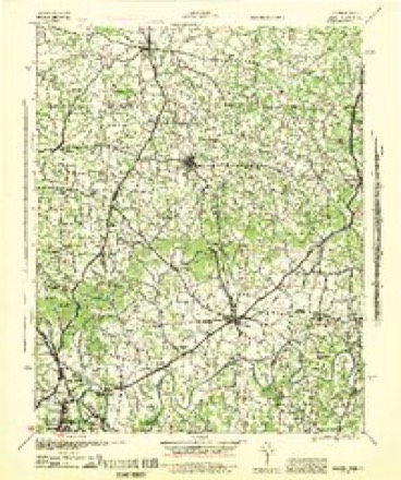
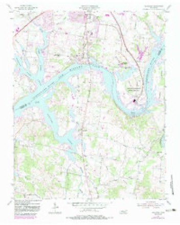
Topographic sheets covering this place
5 surveys from 10 printed sheetsMatched by testing this settlement's coordinate against the published boundary of every sheet in the United States Geological Survey's historical collection. Each opens the scanned sheet at the Survey.
- 1942 USGS Gallatin quadrangle1:100000
- 1955 USGS Laguardo quadrangle1:24000, 5 printings
- 1956 USGS Nashville quadrangle1:250000, 2 printings
- 1959 USGS Nashville quadrangle1:250000
- 1984 USGS Nashville quadrangle1:100000



Fires near this place
1 since 2002Regional context, not property-specific evidence. The federal wildfire occurrence database lists 1 fire within 5 miles of Laguardo in 2002, burning under an acre in total. None started naturally. None was recorded as arson. Distance is straight-line from the map coordinates, so a fire counted here may appear on a neighbouring settlement's page as well.
| Reported cause | Fires |
|---|---|
| Missing data/not specified/undetermined | 1 |
The most recent of them, most recent first, with the day each was reported and the service that recorded it.
| Date | Cause | Size | Reported by | Name on the report |
|---|---|---|---|---|
| 5 September 2002 | Missing data/not specified/undetermined | under an acre | Tennessee Division of Forestry | not named |
Settlements close enough to share some of these fires:
Mines and quarries near this place
3 within 5 milesRegional context, not property-specific evidence. The federal mineral resources record lists 3 workings within 5 miles of Laguardo: 2 past producers, 1 producer. 1 still produces. What was taken out: Stone, Crushed/Broken, Limestone, General. Distance is straight-line from the map coordinates, so a quarry counted here may appear on a neighbouring settlement's page as well.
| Where | Site | Commodity | Status | Recorded |
|---|---|---|---|---|
| Ralph Rogers and Company Quarry | Limestone, General | Past Producer | Sedimentary | |
| Ralph Rogers & Company Quarry - Oak | Stone, Crushed/Broken | Past Producer | ||
| Sumner County Rock | Stone, Crushed/Broken | Producer |
Storms near this place
17 since 1996Regional context, not property-specific evidence. The National Weather Service names Laguardo in 17 storm reports between 1996 and 2025: 13 thunderstorm wind, 1 tornado, 1 lightning, 1 flash flood. No death or injury is recorded in these reports. Each account below is quoted exactly as the forecast office filed it, from the NOAA Storm Events Database, and each date opens the federal record of that event.
| When | Event | Place named | Harm | What the report says |
|---|---|---|---|---|
| April 1998 | Tornado (F1) | Laguardo | $250,000 | The tornado clipped the Cherokee Marina and took out 16 docks, 14 of them completely to pieces. There was damage to 100 boats. |
| June 2023 | Thunderstorm Wind | Laguardo | $50,000 | Video shared by FOX17 shows severe thunderstorm wind damage at the Cedar Creek Yacht Club in Mount Juliet with damaging winds knocking down an outbuilding wall. Damages are a rough estimate. |
| December 2016 | Thunderstorm Wind | Laguardo | $25,000 | A NWS storm survey found an intense 1/4 mile wide by 1/2 mile long microburst struck Laguardo. One home was severely damaged by a fallen tree on Northview Circle. Another home lost most of its west facing shingles on Dana Drive which were blown up to 150 yards eastward. A third home was damaged by a fallen tree on Westview Drive. A boat dock on Dana Drive was blown 130 yards to the northeast. Dozens of large trees were snapped or uprooted from Dana Drive and Northview Circle to near Highway 109. Winds were estimated up to 80 mph. |
| April 2011 | Thunderstorm Wind | Laguardo | $20,000 | At the Boxwell Reservation, the roof was taken off of the main dining hall. |
| April 2025 | Thunderstorm Wind | Laguardo | $10,000 | Severe thunderstorm winds downed trees and powerlines along Highway 109 in Laguardo. Damages are a rough estimate. |
| December 2016 | Thunderstorm Wind | Laguardo | $10,000 | A tree was blown down onto a house at 617 Westview Drive in the Laguardo area. |
| July 2016 | Thunderstorm Wind | Laguardo | $10,000 | Tree snapped and fell through a house on Davis Corner Drive in Mount Juliet causing moderate damage to the home. |
| July 2013 | Lightning | Laguardo | $5,000 | Lightning was reported to have struck a home in the Laguardo area. The lightning strike resulted in a fire that significantly damaged the home. |
| January 2013 | Thunderstorm Wind | Laguardo | $5,000 | Woods Ferry Road was blocked by fallen trees. |
| July 2016 | Thunderstorm Wind | Laguardo | $2,000 | A Facebook post and photos indicated two large white oak trees were uprooted in the yard of a home on Lakeview Drive. |
| November 2017 | Thunderstorm Wind | Laguardo | $1,000 | A tree was blown down into the road at 2024 Woods Ferry Road. |
| December 2016 | Thunderstorm Wind | Laguardo | $1,000 | A tree was blown down onto Benders Ferry Road at Crestview Drive. |
| July 2016 | Thunderstorm Wind | Laguardo | $1,000 | A tree was blown down and blocked the roadway at Woods Ferry Road and Creighton Lane. |
| July 2016 | Thunderstorm Wind | Laguardo | $1,000 | A tree was blown down on Burton Road at Davis Corner Road west of Laguardo. |
| February 2021 | Hail | Laguardo | - | A Facebook report indicated half dollar size hail fell on Burton Road. |
| December 2019 | Flash Flood | Laguardo | - | Numerous roads were flooded and closed across Wilson County including Big Springs Road, Old Rome Pike, Quary Road, Central Pike at Leeville Road, Bellwood Road, Trousdale Ferry Pike, Old Laguardo Road, Mays Chapel Road, Beckwith Road, Bluebird Road, and Highway 231 between Newby Street and Gay Street. Timberline Campground south of Lebanon on Highway 231 was also flooded with all campers evacuated. |
| May 1996 | Thunderstorm Wind | Laguardo | - | no account filed |
Nearest settlements
The eight closest, with where each one stands in the county. Distances are straight-line, computed from the Geographic Names Information System coordinates.
| Map | Place | Distance | Sheets |
|---|---|---|---|
| Cairo Bend | 4.6 miles | 9 | |
| Odum (historical) | 4.6 miles | 10 | |
| Martha | 4.7 miles | 9 | |
| Melrose (historical) | 4.8 miles | 10 | |
| Nonaville | 4.9 miles | 13 | |
| Cedar Grove | 5.4 miles | 13 | |
| Lindsley (historical) | 5.5 miles | 13 | |
| Muncie (historical) | 5.6 miles | 9 |
Elsewhere
Matched on this settlement's Geographic Names Information System number rather than its name, so it cannot be a different place of the same name in another state.
| Wikipedia article on Laguardo | An encyclopaedic summary. Its text is share-alike, so it is linked here rather than copied. |
| Wikidata item Q6460762 | The structured record the population and elevation above come from. Public domain (CC0). |
Provenance
This settlement is recorded in the Geographic Names Information System as feature 1306658. The sheet list is computed by point-in-boundary test against the United States Geological Survey's historical topographic inventory. Both are works of the United States government and carry no copyright under 17 U.S.C. 105.
Wildfire. Short, Karen C. 2022. Spatial wildfire occurrence data for the United States, 1992-2020 [FPA_FOD_20221014]. 6th Edition. Fort Collins, CO: Forest Service Research Data Archive. https://doi.org/10.2737/RDS-2013-0009.6 Collected with United States Government funding and usable without additional permissions or fees.
Mines and quarries. USGS Mineral Resources Data System (MRDS) https://mrdata.usgs.gov/mrds/ A work of the United States government, no copyright under 17 U.S.C. 105.
Storms. NOAA National Centers for Environmental Information, Storm Events Database https://www.ncei.noaa.gov/stormevents/ A work of the United States government, no copyright under 17 U.S.C. 105. Narratives are quoted verbatim from the National Weather Service report and are not edited or summarised.