Block
From the record
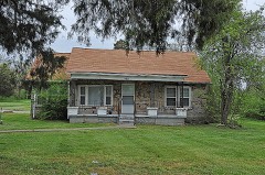
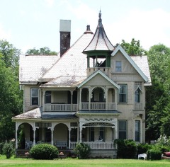
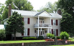
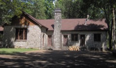
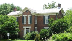
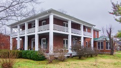
24 National Register listings published here.
Sources: the National Register database, National Park Service
89 topographic sheets cover 102 settlements here, and 24 properties are on the National Register of Historic Places.
24 National Register listings published here.
Sources: the National Register database, National Park Service
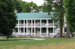
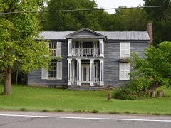
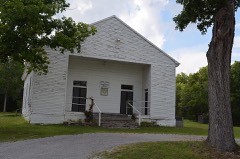
Every property in this county listed on the National Register of Historic Places, with the year it was listed and the federal nomination document.
Every wildfire the federal occurrence database records inside this county: 103 of them, burning about 741 acres. None started naturally and 13 were recorded as arson. Each settlement page carries the fires within five miles of it.
| Reported cause | Fires |
|---|---|
| Debris and open burning | 55 |
| Arson/incendiarism | 13 |
| Equipment and vehicle use | 11 |
| Smoking | 8 |
| Missing data/not specified/undetermined | 6 |
| Misuse of fire by a minor | 4 |
| Power generation/transmission/distribution | 3 |
| Other causes | 2 |
| Fireworks | 1 |
The five largest, by the area the report gives. One of them was set deliberately.
| Date | Cause | Size | Reported by | Name on the report |
|---|---|---|---|---|
| 8 June 2012 | Smoking | 67 acres | Tennessee Division of Forestry | HUDSON RD. FIRE |
| 16 August 2007 | Debris and open burning | 57 acres | Tennessee Division of Forestry | BLUEBIRD ROAD |
| 30 March 1998 | Debris and open burning | 49 acres | Tennessee Division of Forestry | not named |
| 31 March 2014 | Equipment and vehicle use | 47 acres | Tennessee Division of Forestry | MIRES ROAD FIRE |
| 13 March 2000 | Debris and open burning | 26 acres | Tennessee Division of Forestry | not named |
| 6 July 2012 | Other causes | 26 acres | Tennessee Division of Forestry | COMMERCE RD FIRE |
| 10 September 2002 | Debris and open burning | 24 acres | Tennessee Division of Forestry | not named |
| 5 March 2006 | Arson/incendiarism | 23 acres | Tennessee Division of Forestry | not named |
Every settlement page carries the fires within five miles of it - see the settlement index below.
The NOAA Storm Events Database holds 889 reports for this county, causing 4 deaths, 78 injuries and about $473,878,830 in recorded property damage. Each settlement page carries the reports that name it.
| Kind of event | Reports |
|---|---|
| Thunderstorm Wind | 549 |
| Hail | 129 |
| Flash Flood | 82 |
| Tornado | 46 |
| Lightning | 34 |
| Heavy Rain | 22 |
| Flood | 17 |
| Funnel Cloud | 10 |
The most serious of them, by death, then injury, then recorded damage. The accounts are quoted exactly as the forecast office filed them.
| When | Event | Place named | Harm | What the report says |
|---|---|---|---|---|
| March 2020 | Tornado (EF3) | Mt Juliet | 3 killed, 50 hurt, $409,000,000 | An historic, long-track, strong EF-3 tornado began in western Davidson County then tracked eastward for over 60 miles through Wilson County into Smith County before lifting, causing 5 deaths and 220 injuries. This tornado touched down west of River Road Pike then moved eastward across Bells Bend, destroying a barn and blowing down numerous trees. The tornado strengthened significantly and widened to 0.65 miles wide as it crossed the Cumberland River into the John C. Tune Airport area, causing strong EF-2 damage to numerous planes, hangers, warehouses, and other buildings from Cockrill Bend Way to Briley Parkway. Around $200 million in damage was reported at John Tune Airport alone. Continuing eastward, the tornado caused severe damage to the Tennessee State Prison and blew down numerous high-tension transmission towers as it again crossed the Cumberland River into North Nashville, with up to EF-2 damage to farm facilities at Tennessee State University and dozens of homes between I-40 and Buchanan Street. EF-2 damage continued across the Germantown neighborhood just 1/2 mile north of downtown Nashville with several damaged and destroyed apartment complexes, homes, and businesses. The tornado intensified further as it tracked through East Nashville, with EF-3 damage to businesses and other buildings in the Five Points area and EF-2 damage to homes in the Lockeland Springs and Barclay Drive neighborhoods. Two people were killed in Five Points after leaving a bar and going outside as the tornado struck. After crossing the Cumberland River yet again, the tornado weakened as it moved northeast through the Donelson Hills and Lincoya Hills neighborhoods of Donelson, but strengthened again to a strong EF-3 in the Standford Estates area where several homes were leveled. The tornado weakened slightly but continued to cause EF-2 damage to homes and businesses as it turned southeast and passed through Hermitage into Wilson County. ||Dozens of homes continued to sustain up to EF-2 damage as the tornado moved across the Chandler Road and Triple Crown Parkway neighborhoods of Mount Juliet. Turning more to the northeast, the tornado strenghtened to strong EF-3 and leveled numerous homes in the Catalpa Drive and Clearview Drive neighborhoods, with one elderly couple killed on Catalpa Drive at Dogwood Drive. Crossing Mount Juliet Road, the tornado severely damaged West Wilson Middle School and Stoner Creek Elementary School, both of which will have to be torn down and rebuilt. The tornado reached its peak intensity of high-end EF-3 and peak size of 0.9 miles wide as it moved across Golden Bear Parkway and along Eastgate Blvd, leveling several large warehouses and killing a security guard at the CEVA warehouse on Athletes Way North. Crossing Highway 109 into Lebanon, the tornado weakened to EF-2 but continued damaging dozens of homes and businesses as it moved through southern sections of the city. Further to the east, buildings on both sides of I-40 in Tuckers Crossroads received up to EF-2 damage before the tornado turned southeast and crossed into Smith County. Weakening and shrinking in size, the tornado caused EF-1 damage to numerous homes and businesses in Grant, New Middleton, and just south of Gordonsville. The tornado finally lifted east of Highway 141 and north of Judkins Lane after a continuous 60.13 miles on the ground. |
| January 2002 | Flash Flood | Countywide | 1 killed | Sheriff's office reported several roads were flooded around the county. A Knox county woman, age 31, fell into or tried to wade across a fast moving creek between 1030 AM-1100 AM CST at Sue Warren Trail at Cedars of Lebanon State Park. |
| May 2003 | Thunderstorm Wind | Lebanon | 7 hurt | Spotter reported trailer overturned and a vehicle flipped over from strong thunderstorm winds. 7 people were injured. About 200 trees were blown down on a nearby 100 acre farm located on Patton Hollow Rd.It was a quarter mile of destruction with several century old cedar trees ripped up out of the ground. |
| April 1974 | Tornado (F1) | not stated | 4 hurt, $2,500,000 | no account filed |
| April 1971 | Tornado (F3) | not stated | 3 hurt, $250,000 | no account filed |
| April 2020 | Tornado (EF1) | Commerce | 3 hurt, $15,000 | This tornado quickly developed and strengthened to EF-1 intensity along Bell Road in far eastern Wilson County where several trees were downed and roof and siding damage occurred to a two story house. The tornado traveled northeast and hit another house on Bluebird Road causing roof damage. Nearly the entire tree line along the driveway to this house was shredded with tree limbs and debris covering the ground. The tornado then crossed Interstate 40 where an 18-wheeler was flipped on its side causing a traffic accident where 3 injuries were reported. Additional damage was observed on North Commerce Road and Dawson Lane where additional trees were damaged. Crossing into Smith County, the tornado caused minor damage to a few roofs, trees, and a trampoline in a neighborhood along Winding Hills Lane at Colby Lane. Further to the northeast, minor tree damage was once again observed on Opossum Hollow Road and an outbuilding was destroyed. On Grant Highway, several buildings were damaged at the Grant Cedar Mill, which also sustained damage from the EF-3 Nashville/Mount Juliet/Lebanon Tornado on March 3, 2020. From there, the tornado path became very difficult to determine as it crossed the wide damage path from the March 3rd EF-3 tornado into an area with no public roadways, and is estimated to have ended east of Grant Highway where some damaged trees could be seen. However, the tornado path may be extended eastward in the future once high resolution satellite imagery is available. The combined tornado path across Wilson and Smith Counties was estimated to be 3.81 miles. |
| April 1991 | Thunderstorm Wind | not stated | 3 hurt | no account filed |
| February 2011 | Tornado (EF2) | Gladeville | 2 hurt, $500,000 | An EF2 tornado touchdown just south of Central Pike along Gladieville Road. Damage continued northeast for eight miles with the last evidence of damage near Interstate 40 and Cumberland Street South of Lebanon. The most significant damage occurred between Franklin Road and State Highway 840. Several warehouse buildings suffered significant roof and wall damage, and a consturction trailer was completely destroyed with debris spread out over hundreds of yards. A 500kv TVA high tension metal truss tower was completely bent over. Hundreds of hardwood trees were either snapped and uprooted. |
| December 2021 | Tornado (EF1) | Green Hill | 1 hurt, $1,000,000 | This EF-1 tornado touched down on the east side of Percy Priest Lake near Cooks Landing Court and Stewarts Ferry Pike in Davidson County, and moved north-northeast generally along New Hope Road. Many trees were uprooted with EF-0 roof and siding damage to several homes in Davidson County. The tornado strengthened to EF-1 and turned more northeastward as it crossed into Wilson County, causing minor to moderate damage to numerous homes in the Cobblestone Landing and Eagle Trace subdivisions. One home on Partridge Drive suffered severe damage with the garage and east side of the house being blown out. Further to the northeast, dozens of trees were uprooted along Old Lebanon Dirt Road and Division Street, and a fire station and Mount Juliet Elementary School suffered minor roof damage. The most significant damage occurred in the Willoughby Station subdivision as dozens of homes between Melbourne Terrace and Greenhill Road received minor to moderate roof and exterior damage, and one person was injured by flying glass. The tornado weakened as it continued northeast, but continued to blown down trees and cause EF-0 damage to homes in the Vernon Hills subdivision and along Wilson Drive and Tate Lane. The tornado apparently lifted after crossing Lebanon Road west of Mount Juliet Road. Wilson County Emergency Management reported a total of 163 homes were damaged in Wilson County. Total path length of this tornado was 7.67 miles. |
| May 1980 | Tornado (F1) | not stated | 1 hurt, $250,000 | no account filed |
| June 2014 | Thunderstorm Wind | Taylorsville | 1 hurt, $5,000 | A tree was blown down onto a car at Big Springs Road and Goshen Road. One person in the vehicle was injured. |
| October 2004 | Thunderstorm Wind | Lebanon | 1 hurt, $5,000 | Two mobile home trailers and a guard shack were blown over near Nashville Superspeedway off of U.S. Highway 231. The guard was treated and released from U.M.C. |
| May 2005 | Thunderstorm Wind | Mt Juliet | 1 hurt | Emergency Manager reported a sugar maple tree was down and fell on a truck at Central Pike and Adams Lane in Mt. Juliet. One person was injured. |
| June 1998 | Thunderstorm Wind | West Portion | 1 hurt | Off duty NWS employee reported trees blocking a westbound lane of I-40 between Highway 109 and Mt. Juliet. A newspaper article reported that the strong thunderstorm winds overturned campers at a campground near I-40 and Highway 109. One man suffered a broken leg after the camper he was in overturned. |
| August 2010 | Flash Flood | Mt Juliet | $22,000,000 | Several homes and businesses were impacted by flooding during the early morning of August 18th. Numerous roads were closed and there were several water rescues. |
| August 2013 | Flash Flood | Mt Juliet | $10,000,000 | Major flash flooding impacted much of northern Wilson County during the morning and early afternoon hours on August 8 after 5 to 7 inches of rain fell across the area. The worst flooding was across Mount Juliet, where dozens of roads were covered by several feet of water and closed, and some homes and businesses were flooded. Road that were closed included Needmore Road, Division Street, Woodridge Place, Curd Road, Old Lebanon Dirt Road, Mount Juliet Road, Cairo Bend Road, York Road, Cooks Road, and Northern Road. Businesses flooded included the Valley Center strip mall on Mount Juliet Road at Division Street. Homes were flooded along *INSERT INFO HERE*. |
| August 2010 | Flood | Green Hill | $5,000,000 | Two feet of standing water occurred between Newby Street and East Spring Street, and also on South Cumberland Street, for a brief period during the morning hours of Thursday, August 19th, resulting from flooding along Sinking Creek. Stoner Creek, one mile west of Mt. Juliet, went over bank full and resulted in flooding. Several water rescues, per water rising in their yards blocking them in their homes, were also required in Mt. Juliet. ||Newspapers reported that the railroad track that carries a commuter train, the Music City Star, between Nashville an Lebanon had been washed out between Mt. Juliet and Lebanon. Several business, along with public buildings, in Mt. Juliet experienced flood damage, including David Deaton Karate Studio in the Valley Center on North Mt. Juliet Road and a Fire and Rescue station which is primarily used to houses ambulances behind Mt. Juliet City Hall. Extent of damage to these business were unkown. Floodwaters also covered little league baseball and football fields and also knocked over the new fencing around Charlie Daniels Football Field in Mt. Juliet. Heavy rains closed the Wilson County Fair, the largest fair in Tennessee, for the first time in its 157 year history, for Wednesday night, August 18th.||All of this damage was the result of four inches, to as much as one foot in some locations, of rainfall across areas mainly along and north of Interstate 40. |
| April 1998 | Tornado (F2) | Green Hill | $3,000,000 | This tornado travelled just south of Lebanon Pike and did damage to homes and businesses in West Lebanon. The TRW plant received some damage on HWY 70 Bypass. Trees were uprooted and homes sustained roof damage. There was extensive agricultural losses. Approximately $60,000 worth of fencing was destroyed or damaged. 20 hogs were killed. Farmers lost 26 outbuildings, and 21 vehicles were damaged. |
| April 1974 | Tornado (F2) | not stated | $2,500,000 | no account filed |
| May 2023 | Thunderstorm Wind | Lebanon | $2,000,000 | A suspected microburst in Lebanon caused significant wind damage with multiple downed trees and power lines across the city. Along Oak Street, numerous downed trees were reported with damages to vehicles. Also along Oak Street, a tree at a residential house fell, clipping the corner of the house before falling onto a car detailing building and a car. Along Darlenes Way, a screened-in back porch was demolished while the tin roof of an outbuilding was blown off. A garage door was destroyed while another residence reported ceiling and drywall damage. Finally, at Lebanon City Hall, two marble monuments weighing 3,500 to 4,500 pounds were tipped over. Damages are a rough estimate. |
| January 1997 | Tornado (F2) | Vine | $2,000,000 | no account filed |
| August 2023 | Lightning | Mt Juliet | $1,000,000 | Lightning struck the 400 building at the Glass Creek Apartments in Mount Juliet. A fire began on the roof and quickly spread. The residents of all 24 units were safely evacuated, but one firefighter was critically injured when a part of the building collapsed. The 400 building was a total loss. Damages are a rough estimate. |
| March 2021 | Flash Flood | Suggs Creek | $1,000,000 | Major flash flooding affected Mount Juliet, with most roadways flooded and closed, numerous water rescues conducted from vehicles and homes, and many homes and businesses flooded. Homes were flooded on Creedwood Drive and West Division Street with people rescued. The Valley Center Mall shopping center on Mount Juliet Road at Old Lebanon Dirt Road was also flooded. |
| January 2013 | Tornado (EF2) | Green Hill | $1,000,000 | National Weather Service Nashville personnel and Wilson County Emergency Management confirmed an EF2 tornado touched down in Mount Juliet on Glenwood Drive, then moved east-northeast through the city before lifting near Cooks Church Road. The heaviest damage occurred in a commercial district around Lebanon Road and Mount Juliet Road, where a Dollar General store and an automotive warehouse were heavily damaged. A distribution warehouse for the Tennessean newspaper on Lineberry Boulevard was nearly completely destroyed, and the roof, third story, and several walls of an adjacent three-story building were blown off. Dozens of other businesses in the area received minor to moderate structural damage and debris impacts from nearby damaged buildings. Significant damage to outbuildings, fences, and power poles also occurred at the Mount Juilet Ballpark. Dozens of trees and power lines were blown down and many homes received minor damage along the path. |
| April 1998 | Tornado (F2) | Green Hill | $1,000,000 | This tornado was the same one that struck downtown Nashville. The tornado was seen moving from west to east about a mile south of the NWS office. The tornado caused many trees to be uprooted, power lines were knocked down, signs damaged or blown down, and there was roof damage to homes. The Mt. Juliet Little League field was littered with aluminum and lumber blown from Marvin's Lumber Yard. Part of a roof was taken off First Bank in Mt. Juliet. The tornado continued into southern Trousdale county. |
| January 2013 | Tornado (EF1) | Oakland | $800,000 | An EF1 tornado touched down in far northern Wilson County and moved northeast along the Wilson/Trousdale County line for over 10 miles, crossing the Cumberland River four times. Initial damage occurred along Mann Road in northern Wilson County where numerous trees were snapped and minor roof damage was noted. Significant roof damage to homes and some destroyed outbuildings occurred along Canoe Branch Road. The tornado then crossed the Cumberland River into Trousdale County. |
| June 1996 | Thunderstorm Wind | Countywide | $600,000 | no account filed |
| May 2024 | Flash Flood | Lebanon | $500,000 | Heavy rain caused flash flooding in Lebanon with property flooding reported along Lovers Lane in northeast Lebanon. Damages are a rough estimate. |
| May 2016 | Lightning | Silver Bottom | $500,000 | Lightning struck a strip mall along Lebanon Road in Mount Juliet. The resulting fire destroyed half of the strip mall which included several businesses and a church. Time of the lightning strike is estimated. |
| May 2003 | Tornado (F1) | Mt Juliet | $500,000 | This was part of the same storm complex that struck Davidson County. This tornado travelled down Lebanon Pike. Many trees were blown down. A car wash was demolished. There was damage to roofs and business signs. Mt. Juliet does not have any tornado sirens, but 3 sirens have been ordered. |
| May 2020 | Thunderstorm Wind | Lebanon | $437,730 | Numerous trees and power lines were blown down in Lebanon and across much of the rest of Wilson County with widespread power outages. |
| March 2017 | Lightning | Suggs Creek | $300,000 | A house in the 800 block of Harrisburg Lane in Mount Juliet was struck by lightning, and the resulting fire completely destroyed the home. |
| April 2025 | Tornado (EF1) | Vine | $250,000 | An EF-1 tornado touched down in Wilson County. This tornado began near Vesta Road just east of the Nashville Superspeedway, causing timber damage and minor structural damage. The tornado continued northeast, causing additional damage near Flatwoods Road and Murfreesboro Road. Some homes sustained minor damage, including fences and adjacent trees snapped. The tornado then crossed E Richmond Shop Road, continuing damage to trees and structures. Continuing northeast, the tornado crossed over Cedar Forest Road where notable timber damage was found using satellite imagery. Here, swaths of hardwoods were snapped and uprooted near Steeplechase Drive. Some homes sustained minor roof damage. The tornado continued northeast, crossing Chicken Road and SE Tater Peeler Road, continuing damage to trees with at least minor structure damage. The tornado continued northeast, crossing Cainsville Road and Sparta Pike, causing additional timber damage and damaging some farm structures. The tornado then dissipated near Shop Springs Road. Damages are a rough estimate. |
| February 2019 | Flash Flood | Green Hill | $250,000 | Wilson County Emergency Management reported continued widespread flash flooding across much of Wilson County, including the Mount Juliet and Lebanon areas. Roads that were flooded and closed in Mount Juliet included Woodridge Place near Golden Bear Gateway, West Division Street near Mt. Juliet Elementary School, Old Lebanon Dirt Road near Page Drive, Cedar Drive, and York Road near Lebanon Road. In Lebanon, Highway 231 was flooded with one vehicle stranded requiring a water rescue. Several streets in downtown Lebanon were also flooded including Highway 231 and West Spring Street, and flood waters entered several downtown businesses. |
| July 2016 | Lightning | Cairo Bend | $250,000 | Lightning struck a home at 121 Cairo Bend Road. The resulting fire completely destroyed the home. |
| April 1998 | Tornado (F1) | Laguardo | $250,000 | The tornado clipped the Cherokee Marina and took out 16 docks, 14 of them completely to pieces. There was damage to 100 boats. |
| March 1976 | Tornado (F1) | not stated | $250,000 | no account filed |
| February 1976 | Tornado (F1) | not stated | $250,000 | no account filed |
| March 2011 | Tornado (EF1) | Holmes Gap | $200,000 | Damage consisted of hundreds of trees being uprooted or snapped along a nearly continuous path. Several homes suffered significant roof damage, along with a couple of barns and outbuildings being destroyed. The tornado clipped the far southwestern tip of Smith County as it moved into DeKalb County. The tornado moved across the north side of the town of Alexandria where tree and roof damage was noted. The last evidence of damage was along Lower Helton Road 2 miles east of Alexandria. Maximum wind speeds associated with this tornado were estimated to be around 100 mph. |
| March 2010 | Thunderstorm Wind | Commerce | $150,000 | On South Commerce Road, 8 miles east southeast of Lebanon, for a length of one mile and a width of 100 yards, damage associated with a microburst was evident. This damage included a barn being completely destroyed and another barn with significant roof damage. There were also two dozen mostly soft wood trees snapped or uprooted. Elsewhere in this vicinity, there was minor property damage. |
| June 1996 | Tornado (F1) | Lebanon | $150,000 | no account filed |
| January 2013 | Tornado (EF1) | Hunters Pt | $125,000 | An EF1 tornado moved back into far northern Wilson County from Trousdale County. The tornado moved across Dickerson Chapel Road and Beasleys Bend Road and caused significant roof damage to homes and destroyed some outbuildings. Dozens of trees were also snapped or uprooted. The tornado then crossed the Cumberland River back into southern Trousdale County. |
| September 2025 | Lightning | Mt Juliet | $100,000 | A lightning strike caused a structure fire in the 500 building of Glass Creek Apartments. The fire was contained to a small portion of the roof. No injuries were reported, and no residents were displaced. Damages are a rough estimate. |
| March 2017 | Tornado (EF1) | Cherry Vly | $100,000 | An NWS Storm Survey along with Google Earth high resolution satellite data and radar data determined a high end EF-1 tornado touched down in Wilson County just north of Highway 70 (Sparta Pike) in far western Watertown, then curved northeast and east across the northern fringes of the town. One home suffered considerable roof damage at 7077 Sparta Pike and a carport was destroyed at a neighboring home. Another mobile home had most of its metal roof blown off on Linwood Road and several trees were blown down on both sides of the roadway. The tornado intensified as it crossed New Town Road where 2 homes suffered roof damage and dozens of trees were snapped or uprooted in all directions. Another home had roof damage on Parkenson Road where many more trees were snapped and uprooted. The most severe damage occurred along South Commerce Road, where one home suffered considerable roof and siding damage, and the attached garage was knocked off the slab foundation and collapsed. However, the garage was not properly attached to the foundation. An adjacent barn was completely destroyed with debris blown over 200 yards to the southeast. Another barn further south on South Commerce Road was heavily damaged, and the wastewater plant across the road received minor damage. East of South Commerce Road, two wooden TVA high transmission power poles were snapped. A home sustained minor roof damage and a greenhouse was destroyed on the west side of Holmes Gap Road, while another home suffered heavy roof damage and an outbuilding was destroyed on the east side of the roadway. The tornado then weakened as it continued eastward, but still continued to blow down dozens of trees. An outbuilding suffered minor damage south of Hudson Road, and a large outbuilding was destroyed farther east at 850 Haley Road. Numerous more trees continued to be blown down across rural forests and fields to the east before the tornado crossed into Smith County.||In Smith County, the tornado caused EF-0 damage as it crossed Holmes Gap Road around 2 miles southwest of Brush Creek. Two old barns sustained damage on the west side of the roadway, while another barn on the east side was destroyed. Numerous tree were also blown down in the area. The tornado continued to blow down trees in forests to the north of Switchboard Road before dissipating into a large downburst that affected areas south of Brush Creek. |
| July 2016 | Flash Flood | Greenlawn | $100,000 | Significant flash flooding affected much of Wilson County, with several vehicles and roads damaged by flooding and some water rescues conducted. Roads that were flooded and closed in Mount Juliet included John Wright Road, Phillis Road between Chandler Road and Lebanon Road, Old Lebanon Dirt Road north of Weston Drive, Old Lebanon Dirt Road near Page Road, and Belinda Parkway at Southeast Springdale Street where a car stalled in the flood waters. In Lebanon, roadways that were flooded and closed included Callis Lane at Wooddall Road and Bluebird Road near Peyton Road where a man drove into the floodwaters and had to be rescued. Other flooded roads were the 3600 block of Sparta Pike in Watertown, the 12000 block of Stewarts Ferry Pike in Gladeville, and Central Pike at Stewarts Ferry Pike in Gladeville. The Timberline Campground on Murfreesboro Road at Hartmann Drive in Lebanon was also flooded. No injuries or fatalities were reported. |
| May 2011 | Thunderstorm Wind | Silver Spgs | $100,000 | A National Weather Service surveyed damage across Belinda City and found that dozens of trees were damaged. The heaviest damage occurred near Stone Hill Road and Belinda Parkway. Several trees were uprooted and several houses received significant roof damage. Winds were estimated to be near 80 mph. |
| May 2009 | Flash Flood | West End Hgts | $100,000 | People were evacuated from their homes due to flash flooding. |
| May 2009 | Lightning | Lebanon | $75,000 | About 6,000 customers were without power when a lightning strike struck equipment at a power station in Lebannon. |
| April 2006 | Thunderstorm Wind | Lebanon | $70,000 | Winds estimated to be around 70 mph blew down a press box on the west end of a football field at Lebanon High School. The press box was blown off its supports and into the aluminum bleachers. The press box was only 2 years old and was 115 feet long. The damage to the press box and bleachers was $55,000. Also, the scoreboard at Cumberland University was bent over due to strong winds estimated at 60 mph. 3 mobile homes had a tree blown down on top of each in a smalll mobile home park on the south side of Webster Street, which is located off North Cumberland Road in the northern part of Lebanon. |
| July 2018 | Lightning | Lebanon | $60,000 | Wilson County EMA reported a barn was struck by lightning and destroyed by fire at 1701 Hartsville Pike. The barn was a total loss with damage estimated at $60,000. |
| April 2025 | Thunderstorm Wind | La Guardo | $50,000 | Severe thunderstorm winds downed numerous trees, caused damage to carports, and blew shingles off of homes south of Gallatin. Damages are a rough estimate. |
| May 2024 | Thunderstorm Wind | Taylorsville | $50,000 | Very strong straight line winds were found by a NWS storm survey team in the Taylorsville area, north of Lebanon in Wilson County. Several trees were snapped and uprooted along Hamilton Chambers Road, and a few outbuildings were damaged as well. The most intense damage was found along Taylorsville Road where estimated 85 mph winds uprooted numerous trees. Damages are a rough estimate. |
| May 2024 | Thunderstorm Wind | Tuckers Xrds | $50,000 | Straight-line winds resulted in multiple uprooted trees in Lebanon off of Carthage Highway. Damages are a rough estimate. |
| June 2023 | Thunderstorm Wind | Laguardo | $50,000 | Video shared by FOX17 shows severe thunderstorm wind damage at the Cedar Creek Yacht Club in Mount Juliet with damaging winds knocking down an outbuilding wall. Damages are a rough estimate. |
| July 2023 | Thunderstorm Wind | Mt Juliet | $50,000 | Severe thunderstorm winds downed numerous trees and powerlines across Mount Juliet. Damages are a rough estimate. |
| March 2021 | Tornado (EF0) | Vesta | $50,000 | A brief EF-0 tornado touched down near the Nashville Superspeedway and continued northeast, lifting just before reaching Highway 231 and the Cedars of Lebanon State Park. Mostly downed trees and broken large branches were observed. Several outbuildings had some minor roof damage including a few barns. |
| February 2019 | Flash Flood | Mt Juliet | $50,000 | Wilson County Emergency Management reported widespread flash flooding affected much of northwest Wilson County, including in and around Mount Juliet. Several roads were flooded and closed including Central Pike at Chandler Road, Central Pike at Earhart Road, 2253 Beckwith Road, 7294 Hickory Ridge Road, 791 East Old Laguardo Road, Mays Chapel Road at Benders Ferry Road, Golden Bear Gateway near Stonehollow Way, Belinda Parkway near Southeast Springdale Drive, Maricourt Street near Colfax Drive, Old Lebanon Dirt Road near Kelsey Glen Drive, and Due West Drive near Mount Juliet Rd. Several cars were stranded in flooding in the 2800 block of Quarry Road, on Plowson Road, at 1538 Mays Chapel Road, and at Martha-Leeville Road at Eastgate Boulevard. Several businesses in the Valley Center strip mall at Mount Juliet Road and Old Lebanon Dirt Road in Mount Juliet were flooded. |
| November 2017 | Tornado (EF1) | Suggs Creek | $50,000 | An EF-1 tornado began in far southeast Davidson County where weak tree and roof damage (EF-0) was noted on Hampton Blvd in the Villages of Long Hunter subdivision of Antioch. The tornado then crossed Percy Priest Lake into far northwest Rutherford County where numerous trees were blown down and the roofs of a few homes suffered minor damage. Moving into Wilson County, the tornado intensified to EF-1, snapping or uprooting dozens of trees and destroying several outbuildings on Fellowship Road and Underwood Road. The worst damage was in Gladeville where a few homes suffered roof damage on Cobblestone Way and Stonefield Drive, several fences were blown down, and a few outbuildings were destroyed. The steeple of a church on McCreary Road collapsed into the sanctuary, and part of an exterior brick wall was blown down. An RV carport across the street from the church was also destroyed. Another outbuilding was destroyed on Odum Lane and several more trees were blown down before the tornado lifted in inaccessible areas south of Highway 265. The ending point, ending time, and path length of the Wilson County portion of this tornado were updated in July 2018 based on newly available high resolution satellite imagery in Google Earth, giving an updated total path length across Davidson, Rutherford, and Wilson Counties of 10.93 miles. |
| July 2014 | Thunderstorm Wind | Watertown | $50,000 | A tree fell onto a house and car on Cornwell Avenue in Watertown causing significant damage. |
| April 2011 | Thunderstorm Wind | Silver Bottom | $50,000 | Several homes with windows blown out in Oak Hill Subdivision, one home was off of its foundation, and damage also occurred to a local police department building. |
The Survey's mineral resources record lists 29 workings inside this county. 5 still produce and 24 are closed or unrecorded. Each settlement page carries the workings within five miles of it.
| Commodity | Workings |
|---|---|
| Zinc | 6 |
| Stone, Crushed/Broken | 5 |
| Barium-Barite, Fluorine-Fluorite, Lead, Zinc | 3 |
| Stone, Crushed/Broken, Limestone, General | 2 |
| Barium-Barite, Lead, Fluorine-Fluorite | 2 |
| Calcium, Zinc | 1 |
| Barium-Barite, Fluorine-Fluorite, Zinc, Calcium | 1 |
| Calcium, Lead, Fluorine-Fluorite | 1 |
| Limestone, General | 1 |
| Calcium | 1 |
| Fluorine-Fluorite, Lead | 1 |
| Barium-Barite | 1 |
| Zinc, Fluorine-Fluorite, Calcium, Barium-Barite | 1 |
| Lead, Zinc, Fluorine-Fluorite, Barium-Barite | 1 |
The least common of them first, because a county's hundredth gravel pit says nothing its first ten did not.
| Where | Site | Commodity | Status | Recorded |
|---|---|---|---|---|
| Brown | Lead, Zinc, Fluorine-Fluorite, Barium-Barite | Prospect | ||
| Dillard | Zinc, Lead, Barium-Barite, Fluorine-Fluorite | Prospect | ||
| Limestone Quarry | Limestone, Dimension | Past Producer | ||
| Macey Prospect | Fluorine-Fluorite, Barium-Barite, Lead | Past Producer | ||
| Martha Quarry Cement | Limestone, General | Producer | Limestone | |
| Medling | Zinc, Fluorine-Fluorite, Calcium, Barium-Barite | Prospect | ||
| Medling Prospect | Barium-Barite, Fluorine-Fluorite, Zinc, Calcium | Occurrence | Barite, Fluorite | |
| Nichols Farm Deposit | Manganese, Iron | Occurrence | ||
| Reed Prospect | Barium-Barite | Prospect | ||
| Robinson Prospect | Calcium, Zinc | Occurrence | Calcite, Sphalerite | |
| Unnamed Prospect | Calcium, Lead, Fluorine-Fluorite | Occurrence | Calcite, Fluorite, Galena | |
| Unnamed Prospect | Calcium, Fluorine-Fluorite, Lead | Occurrence | ||
| Knight Mine | Zinc, Barium-Barite, Lead, Fluorine-Fluorite | Past Producer | 1889 | |
| Lebanon Quarry - Plant #1 | Stone, Crushed/Broken, Limestone, General | Producer | Limestone | |
| Lebanon Quarry - Plant #2 | Stone, Crushed/Broken, Limestone, General | Producer | Limestone | |
| Macey Prospect | Barium-Barite, Lead, Fluorine-Fluorite | Occurrence | 1850 | |
| Brown Prospect | Barium-Barite, Fluorine-Fluorite, Lead, Zinc | Occurrence | 1907 | |
| Dillard Prospect | Barium-Barite, Fluorine-Fluorite, Lead, Zinc | Occurrence | 1916 | |
| Knight | Barium-Barite, Fluorine-Fluorite, Lead, Zinc | Prospect | ||
| Lebanon Quarry - Plant #1 | Stone, Crushed/Broken | Producer | ||
| Lebanon Quarry - Plant #2 | Stone, Crushed/Broken | Producer | ||
| Limestone Quarry | Stone, Crushed/Broken | Past Producer | ||
| Martha Quarry | Stone, Crushed/Broken | Past Producer | ||
| Quarry | Stone, Crushed/Broken | Past Producer | ||
| Bairds Mill | Zinc | Prospect | 1972 | |
| Deep Well-Sphalerite Occurrence | Zinc | Occurrence | Sphalerite | |
| Deep Well-Sphalerite Occurrence | Zinc | Occurrence | ||
| Norene | Zinc | Prospect | ||
| Robinson | Zinc | Prospect |
Named settlements recorded in the Geographic Names Information System, each with the topographic sheets covering it. Villages, hamlets and abandoned places alike. Each is shown with the nearest named watercourse or landform and the survey quadrangle it falls on.
District 15 · 37087 · On Young Branch · Shop Springs quadrangle
8 sheets, 1942 to 1994
No longer a settlement
District 7 · 37090 · On Middle Fork Spring Creek · Watertown quadrangle
8 sheets, 1942 to 1994
No longer a settlement
District 9 · 37095 · Near Anderson Hollow · Auburntown quadrangle
14 sheets, 1908 to 1985
District 10 · 37122 · On Silver Springs Branch · Hermitage quadrangle
18 sheets, 1903 to 1997
District 6 · 37087 · On Nancy Branch · Bellwood quadrangle
8 sheets, 1956 to 1994
No longer a settlement
District 7 · 37090 · On Middle Fork Spring Creek · Watertown quadrangle
8 sheets, 1942 to 1994
District 16 · 37122 · On Wright Branch · Hermitage quadrangle
18 sheets, 1903 to 1997
No longer a settlement
District 5 · 37087 · On Horn Springs Branch · Hunters Point quadrangle
10 sheets, 1942 to 1994
No longer a settlement
District 7 · 37090 · On Shop Springs Branch · Shop Springs quadrangle
8 sheets, 1942 to 1994
District 8 · 37138 · On Schutes Branch · Hermitage quadrangle
18 sheets, 1903 to 1997
District 3 · 37122 · On Silver Springs Branch · Hermitage quadrangle
18 sheets, 1903 to 1997
District 6 · 37087 · On Cedar Creek · Hunters Point quadrangle
10 sheets, 1942 to 1994
District 22 · 37122 · On Silver Springs Branch · Hermitage quadrangle
18 sheets, 1903 to 1997
District 7 · 37090 · On East Fork Hurricane Creek · Vine quadrangle
8 sheets, 1942 to 1994
District 8 · 37138 · On Schutes Branch · Hermitage quadrangle
18 sheets, 1903 to 1997
District 15 · 37090 · On Jennings Fork · New Middleton quadrangle
10 sheets, 1942 to 1994
No longer a settlement
District 7 · 37090 · Near Pultight Hill · Vine quadrangle
8 sheets, 1942 to 1994
No longer a settlement
District 1 · 37138 · On Schutes Branch · Hermitage quadrangle
18 sheets, 1903 to 1997
District 7 · 37090 · On Dedman Branch · Shop Springs quadrangle
8 sheets, 1942 to 1994
District 14 · 37122 · Near Posey Hill · Martha quadrangle
9 sheets, 1942 to 1984
No longer a settlement
District 18 · 37122 · On Smith Branch · Hendersonville quadrangle
13 sheets, 1903 to 1984
No longer a settlement
District 7 · 37184 · On West Prong Jennings Fork · Shop Springs quadrangle
8 sheets, 1942 to 1994
District 9 · 37184 · Near Hearn Hill · Alexandria quadrangle
8 sheets, 1942 to 1984
No longer a settlement
District 5 · 37087 · Near Cunningham Island · Hunters Point quadrangle
10 sheets, 1942 to 1994
No longer a settlement
District 12 · 37090 · On Cave Creek · Vine quadrangle
8 sheets, 1942 to 1994
No longer a settlement
District 7 · 37090 · Near Edwards Hill · Vine quadrangle
8 sheets, 1942 to 1994
No longer a settlement
District 5 · 37087 · On Horn Springs Branch · Hunters Point quadrangle
10 sheets, 1942 to 1994
District 5 · 37087 · Near Cunningham Island · Hunters Point quadrangle
10 sheets, 1942 to 1994
No longer a settlement
District 19 · 37087 · On Sinking Creek · Lebanon quadrangle
9 sheets, 1942 to 1984
No longer a settlement
District 9 · 37085 · Near Grandfather Knob · Lascassas quadrangle
13 sheets, 1916 to 1985
District 15 · 37090 · On Little Caney Branch · New Middleton quadrangle
10 sheets, 1942 to 1994
District 7 · 37184 · Near Jennings Knob · Shop Springs quadrangle
8 sheets, 1942 to 1994
District 7 · 37090 · On Shop Springs Branch · Shop Springs quadrangle
8 sheets, 1942 to 1994
No longer a settlement
District 13 · 37122 · On North Fork Suggs Creek · Gladeville quadrangle
10 sheets, 1942 to 1984
District 12 · 37090 · Near Pultight Hill · Vine quadrangle
8 sheets, 1942 to 1994
No longer a settlement
District 23 · 37090 · Near Seay Hill · Martha quadrangle
9 sheets, 1942 to 1984
No longer a settlement
District 15 · 37087 · On Johnson Branch · Bellwood quadrangle
8 sheets, 1956 to 1994
No longer a settlement
The vanished settlements of Wilson County: the places named above that are no longer on the map.