 Block
Lewisburg, Tennessee
11 topographic sheets cover this place, the earliest surveyed in 1936 and the latest in 1981. It stands in District 9. It lies in ZIP code area 37091. It stands on Collins Creek. The Survey maps it on the Lewisburg quadrangle. 12,288 people lived here at the 2020 count. It stands 738 feet above sea level.
Research this city
On record in Lewisburg
Buildings and businesses the archive holds for this place. Each opens its own page, with the source record it came from.
On the National Register 6 records
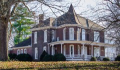 Joe Chase Adams Houselisted 1993
 Ewing Farmlisted 1984
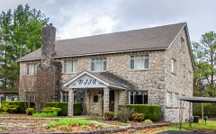 WJJM Radio Station and Towerlisted 2017
- Dixie Theatrelisted 2021
- Ladies Rest Roomlisted 1995
- Presbyterian Church, U.S.A.listed 2019
Population over time
2 figuresLewisburg grew from 11,100 to 12,288 between 2010 and 2020. These are the recorded population figures Wikidata holds for this place, reached through the Geographic Names Information System number this page is keyed on rather than by name, so they belong to this place and not to another of the same name. Most are census counts, but not all are: an early figure may be a founding or settlement estimate, and an estimate published within five years of a census is left out. The change column is computed, and is left blank where more than 20 years separate a figure from the one before it, because a gap that long is not a change between two counts.
| Year | People | Change |
|---|---|---|
| 2010 | 11,100 | |
| 2020 | 12,288 | +1,188 (+11%) |
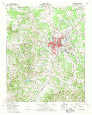
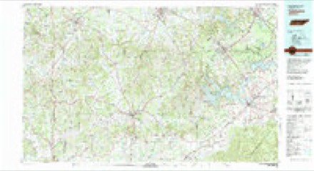
Topographic sheets covering this place
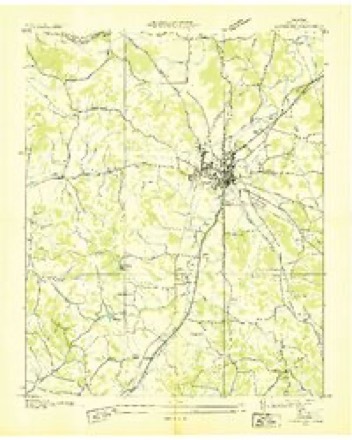
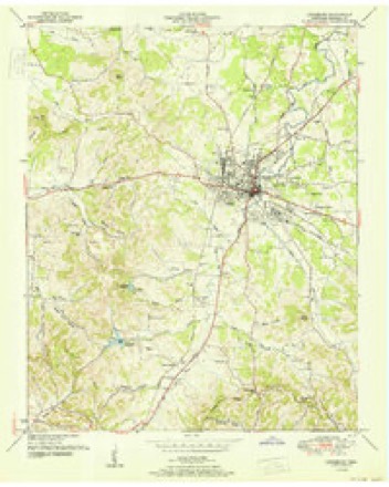
5 surveys from 11 printed sheetsMatched by testing this settlement's coordinate against the published boundary of every sheet in the United States Geological Survey's historical collection. Each opens the scanned sheet at the Survey.
- 1936 USGS Lewisburg quadrangle1:24000
- 1951 USGS Lewisburg quadrangle1:24000
- 1956 USGS Columbia quadrangle1:250000, 6 printings
- 1966 USGS Lewisburg quadrangle1:24000, 2 printings
- 1981 USGS Tullahoma quadrangle1:100000

Fires near this place
67 since 1997Regional context, not property-specific evidence. The federal wildfire occurrence database lists 67 fires within 5 miles of Lewisburg between 1997 and 2019, burning about 231 acres in total. 1 started naturally. 8 were recorded as arson. Distance is straight-line from the map coordinates, so a fire counted here may appear on a neighbouring settlement's page as well.
| Reported cause | Fires |
|---|---|
| Debris and open burning | 37 |
| Arson/incendiarism | 8 |
| Equipment and vehicle use | 6 |
| Smoking | 6 |
| Missing data/not specified/undetermined | 5 |
| Misuse of fire by a minor | 3 |
| Railroad operations and maintenance | 1 |
| Natural | 1 |
The most recent of them, most recent first, with the day each was reported and the service that recorded it.
| Date | Cause | Size | Reported by | Name on the report |
|---|---|---|---|---|
| 6 September 2000 | Debris and open burning | under an acre | Tennessee Division of Forestry | not named |
| 6 September 1999 | Debris and open burning | 25 acres | Tennessee Division of Forestry | not named |
| 5 September 1999 | Smoking | 77 acres | Tennessee Division of Forestry | not named |
| 5 September 1998 | Debris and open burning | 1.0 acres | Tennessee Division of Forestry | not named |
| 28 September 1999 | Debris and open burning | under an acre | Tennessee Division of Forestry | not named |
| 18 September 2000 | Arson/incendiarism | under an acre | Tennessee Division of Forestry | not named |
| 18 September 1999 | Missing data/not specified/undetermined | under an acre | Tennessee Division of Forestry | not named |
| 17 September 1998 | Equipment and vehicle use | 1.0 acres | Tennessee Division of Forestry | not named |
Settlements close enough to share some of these fires:
Mines and quarries near this place
6 within 5 milesRegional context, not property-specific evidence. The federal mineral resources record lists 6 workings within 5 miles of Lewisburg: 3 producers, 2 unknowns, 1 past producer. 3 still produce. What was taken out: Stone, Crushed/Broken, Phosphorus-Phosphates, Limestone, High Calcium, Stone, Crushed/Broken, Limestone, General. Distance is straight-line from the map coordinates, so a quarry counted here may appear on a neighbouring settlement's page as well.
| Where | Site | Commodity | Status | Recorded |
|---|---|---|---|---|
| Belfast Rock Products Quarry | Stone, Crushed/Broken, Limestone, High Calcium | Producer | Limestone | |
| Lewisburg Limestone Co. Quarry | Stone, Crushed/Broken, Limestone, General | Producer | Limestone | |
| Monsanto Phosphate Deposit No.47 | Phosphorus-Phosphates | Unknown | ||
| Monsanto Phosphate Deposit No.48 | Phosphorus-Phosphates | Unknown | ||
| Belfast Rock Products Quarry | Stone, Crushed/Broken | Past Producer | ||
| Lewisburg Limestone Company Quarry | Stone, Crushed/Broken | Producer |
Storms near this place
60 of 70 shownRegional context, not property-specific evidence. The National Weather Service names Lewisburg in 70 storm reports between 1993 and 2025: 31 thunderstorm wind, 27 hail, 5 flash flood, 4 lightning. No death or injury is recorded in these reports. Each account below is quoted exactly as the forecast office filed it, from the NOAA Storm Events Database, and each date opens the federal record of that event.
| When | Event | Place named | Harm | What the report says |
|---|---|---|---|---|
| May 2020 | Thunderstorm Wind | Lewisburg | $117,570 | Numerous trees and power lines were blown down across Marshall County. |
| January 1997 | Tornado (F1) | Lewisburg | $100,000 | no account filed |
| July 2009 | Thunderstorm Wind | Lewisburg | $50,000 | Trees were downed county wide. |
| August 2002 | Lightning | Lewisburg | $50,000 | Lightning bolt hit a home at the end of Woodlawn Ave. Two people were inside the home, but they were able to leave the house before the fire spread. The home was a total loss. |
| March 2000 | Flash Flood | Lewisburg | $30,000 | EMA officials reported 5.5 inches of rain in 11/2 hours in the Lewisburg area. Many roads were flooded, and 6 cars were damaged. There were 3 feet of water on some spots on the roads. A man had to be rescued from his vehicle on Belfast Ave. Local Tennessee National Guard members were called in to assist in the evacuation of about 30 children from the Wee Care Day Care Center. There was about 21/2 feet of water inside the day care center. |
| May 2000 | Lightning | Lewisburg | $26,000 | A newspaper article reported that lightning struck a home over 100 years old at 2119 Franklin Pike. The 2 story home burned to the ground. This same house was hit by a tornado in 1913. The tax assessor said the home was worth $26,452. |
| June 1999 | Lightning | Lewisburg | $20,000 | Lightning struck a tree. The tree fell on 3 vehicles, a 1999 Dodge Caravan, 1989 Plymouth Reliant, and a 1979 Chrysler Le Baron. |
| March 2022 | Thunderstorm Wind | Lewisburg | $15,000 | Marshall County EMA reported a 3 mile long by 1/2 mile wide swath of wind damage occurred across the northeast side of Lewisburg. A mobile home on Verona Road lost much of its roof and several trees were blown down with one falling onto a house. Along Nashville Highway from Ellington Parkway to Old Farmington Road, several businesses suffered minor roof and siding damage and a pole barn collapsed. Further to the northeast, several trees were blown down and a barn was heavily damaged on Holly Grove Road and Long Distance Road. The Marshall County EOC just southwest of where the damage began measured a peak wind gust of 54 mph. |
| June 2019 | Thunderstorm Wind | Lewisburg | $15,000 | Trees and power lines were blown down across Marshall County with widespread power outages. Some vehicles had trees fall on them. |
| February 2009 | Thunderstorm Wind | Lewisburg | $12,000 | Trees snapped at I-65 Exit. |
| May 2025 | Thunderstorm Wind | Lewisburg | $10,000 | Severe thunderstorm winds downed a couple trees and caused power outages on the south and southwest side of Lewisburg. Damages are a rough estimate. |
| June 2018 | Thunderstorm Wind | Lewisburg | $10,000 | Several trees were blown down across Lewisburg, and the roof was blown off the restroom facilities at Jones Park. |
| August 2017 | Flash Flood | Lewisburg | $10,000 | Several roads were flooded and closed in Lewisburg with water rescues of people from vehicles conducted on Old Columbia Road at Silver Creek Road, Hopkins Avenue, and Franklin Avenue at Silver Creek. |
| March 2017 | Hail | Lewisburg | $10,000 | Photos and videos showed hail up to small orange sized hail fell across Lewisburg with hail covering the ground. Numerous vehicles sustained damage and windows were broken in some buildings and homes. |
| August 1997 | Thunderstorm Wind | Lewisburg | $10,000 | Part of a tree fell on a house. |
| July 1995 | Thunderstorm Wind | Lewisburg | $10,000 | Numerous trees were blown down. |
| July 2013 | Thunderstorm Wind | Lewisburg | $6,000 | The Marshall County 911 Center reported 6 trees blown down across the county. |
| March 2020 | Thunderstorm Wind | Lewisburg | $5,000 | Trees and power lines were blown down on Cornersville Road. |
| March 2017 | Thunderstorm Wind | Lewisburg | $5,000 | Several trees were blown down across Marshall County and a small barn roof was blown off into a roadway. |
| June 1995 | Thunderstorm Wind | Lewisburg | $5,000 | Several trees were knocked down. |
| March 2020 | Thunderstorm Wind | Lewisburg | $3,000 | Several large trees were blown down in the 900 block of Galloway Street. |
| December 2019 | Thunderstorm Wind | Lewisburg | $3,000 | Trees were blown down on Mooresville Highway and Cornersville Highway in Lewisburg. |
| June 2016 | Thunderstorm Wind | Lewisburg | $3,000 | A few trees were blown down across Marshall county. |
| June 2016 | Thunderstorm Wind | Lewisburg | $3,000 | A few trees were blown down throughout Marshall County. |
| July 2016 | Thunderstorm Wind | Lewisburg | $3,000 | Numerous trees were blown down across Lewisburg. |
| June 2011 | Thunderstorm Wind | Lewisburg | $3,000 | A few trees were blown down in and around Lewisburg. |
| March 2006 | Thunderstorm Wind | Lewisburg | $2,000 | Winds tore off siding from an awning outside the Marshall County Courthouse Annex. A tree was down in the Chapel Hill area and also in the Verona-Caney area. Winds ripped off the roof from a mobile home in Embers East Park. |
| July 2015 | Thunderstorm Wind | Lewisburg | $1,000 | A Facebook photo showed a tree blown down in Lewisburg. |
| April 2010 | Thunderstorm Wind | Lewisburg | $1,000 | Marshall county sheriffs office reports a few trees down across county back roads across the county. |
| April 2008 | Tornado (EF0) | Lewisburg | $1,000 | A helicopter crew reported a tornado at the intersection of Highway 343 and Interstate 65. A NWS employee reported just a few trees were down. |
| March 2005 | Flash Flood | Lewisburg | $1,000 | Flooding was occurring on Old Lake Road near Lewisburg. By 715 PM CST...several streets in Lewisburg had water flowing across the roads. |
| December 2004 | Flash Flood | Lewisburg | $1,000 | Reports of Old Columbia Road and Yell Road were flooded in several places. Newspaper story stated that Fox Lane and Old Lake Road were closed due to flooding. |
| August 2001 | Lightning | Lewisburg | $500 | Lightning struck a storage building on Verona Caney Rd. The building was engulfed in flames in a matter of minutes. The storage building was located about 100 feet from a house. |
| May 1993 | Thunderstorm Wind | Lewisburg | $500 | Several trees were blown down. |
| February 1993 | Thunderstorm Wind | Lewisburg | $500 | no account filed |
| April 1994 | Hail | Lewisburg | $50 | no account filed |
| May 2025 | Hail | Lewisburg | - | Estimated quarter size hail was reported just west of Lewisburg. |
| April 2009 | Hail | Lewisburg | - | Quarter inch hail was reported by Lewisburg COOP Observer. |
| August 2007 | Hail | Lewisburg | - | Trained spotter reported quarter size hail in Lewisburg. |
| April 2007 | Hail | Lewisburg | - | Penny size hail reported near Mooresville Highway and Webb Rd. |
| March 2006 | Thunderstorm Wind | Lewisburg | - | Trees were down. |
| May 2006 | Hail | Lewisburg | - | Penny size hail reported at the Quik Trip market in Lewisburg. |
| May 2005 | Thunderstorm Wind | Lewisburg | - | Sheriff's office reported a tree down on Old Farmington Rd. |
| September 2005 | Thunderstorm Wind | Lewisburg | - | Sheriff's office reported a tree down on Tally Rd. |
| May 2004 | Thunderstorm Wind | Lewisburg | - | Trees down north of Lewsiburg on Highway 99. |
| May 2004 | Hail | Lewisburg | - | Penny size hail was reported. |
| July 2004 | Thunderstorm Wind | Lewisburg | - | Trees down in the city, and several roofs were damaged according to the Lewisburg Police Department. |
| May 2003 | Hail | Lewisburg | - | Half dollar size hail observed. |
| May 2003 | Hail | Lewisburg | - | Penny size hail observed. |
| May 2003 | Hail | Lewisburg | - | Nickel size hail observed. |
| November 2002 | Hail | Lewisburg | - | Spotter reported dime size hail. |
| November 2002 | Hail | Lewisburg | - | Spotter reported golfball size hail. |
| November 2002 | Hail | Lewisburg | - | Spotter reported golfball size hail. A Lewisburg body shop performed 50 car estimates for hail damage by 10 AM. The Ridgetop Apartments on Mooresville Highway sustained damage from golf ball size hail. The hail damaged cars, broke lamps and the apartment building sidings were filled with holes . |
| April 2002 | Hail | Lewisburg | - | Spotter reported hail the size of golf balls. At one point, hail about the size of golf balls, covered parts of I-65 in Marshall and Maury counties to a depth of 2 inches. |
| August 2002 | Hail | Lewisburg | - | EMA reported dime size hail. |
| July 2001 | Hail | Lewisburg | - | Spotter reported dime size hail. |
| February 2000 | Hail | Lewisburg | - | Quarter size hail reported by Sheriff's office. |
| March 2000 | Hail | Lewisburg | - | EMA reported dime size hail. |
| May 2000 | Flood | Lewisburg | - | Sheriff reported flooding in low lying areas. |
| December 2000 | Flash Flood | Lewisburg | - | SKYWARN Spotter reported several roads flooded in Lewisburg. |
Nearest settlements
The eight closest, with where each one stands in the county. Distances are straight-line, computed from the Geographic Names Information System coordinates.
| Map | Place | Distance | Sheets |
|---|---|---|---|
| Coleman Heights | 0.5 miles | 11 | |
| Marshall Heights | 0.7 miles | 11 | |
| Fairview | 0.9 miles | 11 | |
| Hillcrest | 0.9 miles | 11 | |
| Needmore | 0.9 miles | 11 | |
| Wallace Acres | 0.9 miles | 11 | |
| Forest Hills | 1.0 miles | 11 | |
| Hickory Heights | 1.2 miles | 11 |
Elsewhere
Matched on this settlement's Geographic Names Information System number rather than its name, so it cannot be a different place of the same name in another state.
| Wikipedia article on Lewisburg | An encyclopaedic summary. Its text is share-alike, so it is linked here rather than copied. |
| Wikidata item Q2355638 | The structured record the population and elevation above come from. Public domain (CC0). |
Provenance
This settlement is recorded in the Geographic Names Information System as feature 1291094. The sheet list is computed by point-in-boundary test against the United States Geological Survey's historical topographic inventory. Both are works of the United States government and carry no copyright under 17 U.S.C. 105.
Wildfire. Short, Karen C. 2022. Spatial wildfire occurrence data for the United States, 1992-2020 [FPA_FOD_20221014]. 6th Edition. Fort Collins, CO: Forest Service Research Data Archive. https://doi.org/10.2737/RDS-2013-0009.6 Collected with United States Government funding and usable without additional permissions or fees.
Mines and quarries. USGS Mineral Resources Data System (MRDS) https://mrdata.usgs.gov/mrds/ A work of the United States government, no copyright under 17 U.S.C. 105.
Storms. NOAA National Centers for Environmental Information, Storm Events Database https://www.ncei.noaa.gov/stormevents/ A work of the United States government, no copyright under 17 U.S.C. 105. Narratives are quoted verbatim from the National Weather Service report and are not edited or summarised.