Block
From the record
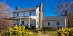
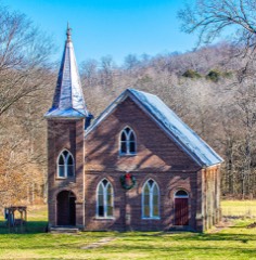
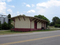
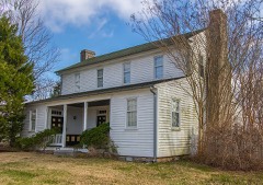
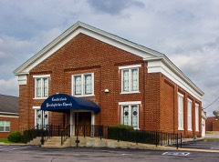
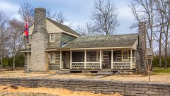
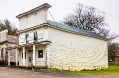
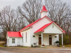
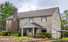
22 National Register listings published here.
Sources: the National Register database, National Park Service
53 topographic sheets cover 60 settlements here, and 22 properties are on the National Register of Historic Places.
22 National Register listings published here.
Sources: the National Register database, National Park Service
Every property in this county listed on the National Register of Historic Places, with the year it was listed and the federal nomination document.
Every wildfire the federal occurrence database records inside this county: 290 of them, burning about 951 acres. 2 started naturally and 34 were recorded as arson. Each settlement page carries the fires within five miles of it.
| Reported cause | Fires |
|---|---|
| Debris and open burning | 158 |
| Arson/incendiarism | 34 |
| Smoking | 31 |
| Missing data/not specified/undetermined | 27 |
| Equipment and vehicle use | 25 |
| Railroad operations and maintenance | 5 |
| Misuse of fire by a minor | 4 |
| Power generation/transmission/distribution | 2 |
| Natural | 2 |
| Other causes | 1 |
| Recreation and ceremony | 1 |
The five largest, by the area the report gives. None of them was recorded as arson.
| Date | Cause | Size | Reported by | Name on the report |
|---|---|---|---|---|
| 5 September 1999 | Smoking | 77 acres | Tennessee Division of Forestry | not named |
| 21 February 2010 | Debris and open burning | 50 acres | Tennessee Division of Forestry | OLIVER / WELL RD |
| 29 August 1999 | Debris and open burning | 49 acres | Tennessee Division of Forestry | not named |
| 13 April 1998 | Equipment and vehicle use | 40 acres | Tennessee Division of Forestry | not named |
| 1 November 2016 | Smoking | 29 acres | Tennessee Division of Forestry | CORTNER HOLLOW |
| 16 January 1999 | Equipment and vehicle use | 25 acres | Tennessee Division of Forestry | not named |
| 6 September 1999 | Debris and open burning | 25 acres | Tennessee Division of Forestry | not named |
| 7 January 2006 | Equipment and vehicle use | 25 acres | Tennessee Division of Forestry | not named |
Every settlement page carries the fires within five miles of it - see the settlement index below.
The NOAA Storm Events Database holds 265 reports for this county, causing 4 deaths, 182 injuries and about $5,868,365 in recorded property damage. Each settlement page carries the reports that name it.
| Kind of event | Reports |
|---|---|
| Thunderstorm Wind | 132 |
| Hail | 65 |
| Flash Flood | 32 |
| Tornado | 20 |
| Lightning | 7 |
| Flood | 6 |
| Funnel Cloud | 3 |
The most serious of them, by death, then injury, then recorded damage. The accounts are quoted exactly as the forecast office filed them.
| When | Event | Place named | Harm | What the report says |
|---|---|---|---|---|
| February 1952 | Tornado (F1) | not stated | 3 killed, 166 hurt, $25,000 | no account filed |
| March 2002 | Flash Flood | Countywide | 1 killed | Flooding of many highways across the county. At 215 AM, according to TEMA, a 17 year-old male was swept away as he and two other teens tried to push a stalled pick up truck across flooded Old Belfast Rd. The teen either slipped off the side of the road or stepped off the side of the road. His body was found 200 yards away in a drain pipe. |
| January 2002 | Flash Flood | Farmington | 9 hurt | Sheriff reported back roads still closed. 14 homes, 27 trailers, and 3 businesses were damaged. 88 people had to be evacuated. |
| August 1992 | Tornado (F0) | not stated | 4 hurt, $2,500 | no account filed |
| April 1974 | Tornado (F1) | not stated | 2 hurt, $25,000 | no account filed |
| March 1960 | Tornado (F2) | not stated | 1 hurt, $25,000 | no account filed |
| April 2023 | Tornado (EF1) | Thick | $1,000,000 | An EF1 tornado with estimated peak winds of 110 mph touched down about four miles northwest of Chapel Hill near Moss Road in northern Marshall County. Moving northeast, the tornado blew down several trees and caused minor to moderate damage to homes on Thick Road, Egypt Road, Smiley Road, and Blackwell Road. The tornado intensified as it continued northeast, blowing five train cars off a track along Highway 31A and heavily damaging homes on Beasley Road and Tennessee Central Road. The tornado then continued into Rutherford County. Damages are estimated for Marshall County. |
| May 2024 | Thunderstorm Wind | Cochran | $500,000 | Along Experiment Farm Road, the University of Tennessee Farm Dairy Research and Education Center had damage from straight-line winds. One barn was partially destroyed, one barn had its roof ripped off, and another had heavy roof damage. A nearby home also had roof damage. Numerous trees and powerlines were also downed. Damages are a rough estimate. |
| May 2024 | Flash Flood | Chapel Hill | $500,000 | Heavy rain across Marshall County caused flash flooding in the area. Beasley Road in Chapel Hill was closed due to being washed out. Two water rescues had to be performed with one at a residence and the other in a vehicle. Damages are a rough estimate. |
| May 2003 | Flash Flood | Countywide | $324,000 | Flash flooding occurred in Cornersville where some homes had as much as one and a half foot of water in them. Many roads were damaged by the flood waters. 3 school buses were stranded in the southern part of the county on gravel roads. Damage was estimated to be at $324,000. |
| May 2009 | Flash Flood | Hardison Mill | $300,000 | Old Highway 99 was flooded. Several homes in the area were being threatened by flood waters. Newspaper reported that Perry's Home Town Grocery on South Ellington Parkway received major water damage and water was standing at the ambulance station under construction in Chapel Hill due to flash flooding. |
| May 2025 | Tornado (EF0) | Verona | $250,000 | An EF-0 tornado touched down just west of Verona Caney Road in Cowden where it unrooted several trees and lifted a roof off of a barn. It continued northeast, crossed Big Rock Creek, and damaged the roof and some trees on a homestead. The tornado continued towards and crossed Wade Brown Road where it unrooted and snapped several more trees until it lifted north of Wade Brown Road. Damages are a rough estimate. |
| May 2024 | Tornado (EF3) | Lunns Store | $250,000 | This EF-3 tornado touched down along the Duck River east of Columbia and moved northeast causing tree damage and minor structure damage on Mount Olivet Road. Multiple homes received damage along Cothran Road and Cranford Hollow Road before the tornado moved north of Highway 412. More intense damage began to occur on Old Highway 99 and Blackburn Lane where large sections of roofs were removed and hundreds of trees were snapped or uprooted. The tornado reached its maximum strength along Blackburn Road and Lasea Road where large transmission power trusses were collapsed, a house was destroyed with only small interior walls still standing, and a mobile home was swept away. The tornado continued northeast damaging additional homes before crossing Interstate 65 near mile marker 47. More homes were damaged along Rally Hill Cutoff Road and Kedron Road. The tornado crossed Highway 431 near Kedron Road before lifting in Marshall County. Damages are a rough estimate. |
| May 1984 | Tornado (F1) | not stated | $250,000 | no account filed |
| April 1974 | Tornado (F1) | not stated | $250,000 | no account filed |
| February 2019 | Flash Flood | Lunns Store | $209,940 | Media reports indicated 10 to 15 roads across Marshall County were impassable, and another 15 to 20 roads were covered with high water or debris. Flood waters from Rock Creek and the Duck River were threatening several homes between Lewisburg and Chapel Hill. |
| September 2009 | Lightning | Chapel Hill | $150,000 | Lightning from a thunderstorm struck a utility pole at the end of a 83 year old man's driveway. The lightning's charge went to the man's house and started a fire, that destroyed most of the home, and also killed the man. |
| May 2020 | Thunderstorm Wind | Lewisburg | $117,570 | Numerous trees and power lines were blown down across Marshall County. |
| May 2024 | Thunderstorm Wind | Hickory Hgts | $100,000 | Numerous trees were downed along Springplace Road in Lewisburg. One house also sustained structural damage. Damages are a rough estimate. |
| May 2024 | Thunderstorm Wind | Mooresville | $100,000 | Straight-line winds resulted in numerous trees being snapped and uprooted along Mooresville Highway in Lewisburg. A large carport was also destroyed. Damages are a rough estimate. |
| January 1997 | Tornado (F1) | Lewisburg | $100,000 | no account filed |
| May 2010 | Flood | Chapel Hill | $83,000 | Numerous homes, numerous businesses, numerous non comercial buildings, along with several county, state, and federal roads across the county received damage due to the flood. |
| May 2024 | Thunderstorm Wind | Belfast | $75,000 | Severe thunderstorm winds downed several trees between Cornersville and Belfast. Along Fishing Ford Road, falling trees caused property damage with one house reporting damage to their screened-in porch and their chimney. Damages are a rough estimate. |
| May 2024 | Thunderstorm Wind | Luna | $75,000 | Numerous trees were downed along Early Twitty Road in Lewisburg and one barn was destroyed. Damages are a rough estimate. |
| March 2017 | Thunderstorm Wind | Duncanville | $75,000 | A NWS storm survey found a large, severe 18 mile long by 1 to 2.5 mile wide downburst struck areas in Marshall County from southern Lewisburg east-southeastward across Belfast, then continued into southwestern Bedford County before ending near Highway 231 south of Shelbyville. Widespread straight line wind damage occurred across the southern half of Lewisburg, with a tall radio tower bent in half on Skyline Drive. Part of the poorly-attached metal roof on a home on Gina Lynn Drive was blown up to 3/4 mile away. Another home had numerous shingles blown off on Midway Street near Scenic Drive, and a neighboring home had its metal carport destroyed. A barn lost part of its roof on Cornersville Road, and another carport was destroyed on Cornersville Road north of Highway 31A. An old warehouse building was heavily damaged on Old Belfast Road just west of Garrett Parkway, with much of the roof blown off and one wall collapsed. In addition, dozens of large trees were snapped and uprooted on Lakehill Drive, Green Valley Drive, Fox Lane, Midway Street, and others in southern Lewisburg. Farther to the east just west of Belfast, a barn lost much of its roof and a carport was destroyed on Old Belfast Road. Another barn was destroyed and numerous trees uprooted south of Belfast on Highway 431. Winds within the 1 mile wide downburst across Marshall County were estimated mainly in the 60-80 mph range, although pockets of damage such as the bent radio tower indicated winds reached 80 to 100 mph in some areas.||In Bedford County, the porch was blown off a home on Cortner Hollow Road, and a barn had significant roof damage on Pickle Road. In the Richmond area, the sheet metal roof and walls were blown off an outbuilding on Sinking Creek Road, the roof was blown off a barn on Highway 130, and a gas station canopy collapsed on Highway 130 at Gant Hollow Road. Further to the east, another small barn was destroyed on Bluestocking Hollow Road at D Martin Road. Winds within the downburst across southwestern Bedford County, which was up to 2.5 miles wide, were estimated from 60 to 80 mph. |
| April 2011 | Tornado (EF1) | Holtland | $75,000 | An EF1 tornado with maximum winds 90 to 100 mph touched down around 540 am in northeast Marshall county. Damage began just west of the intersection of U.S. Highway 31a and Thick Road. The damage path was approximately 3 miles long. Maximum path width was 100 yards. Hundreds of trees were snapped or uprooted and several homes suffered roof damage. |
| May 2024 | Thunderstorm Wind | Cochran | $50,000 | Straight-line winds resulted in numerous trees being snapped and uprooted along Old Lake Road in Lewisburg. Damages are a rough estimate. |
| May 2024 | Thunderstorm Wind | Mooresville | $50,000 | Straight-line winds resulted in numerous trees being snapped and uprooted along Fitzpatrick Road in Lewisburg. Damages are a rough estimate. |
| February 2023 | Tornado (EF1) | Verona | $50,000 | A low end EF-1 tornado touched down near Big Rock Creek northwest of Farmington and moved northeast, damaging a barn and blowing down dozens of trees west of Bethbirei Road. A home on Bethbirei Road was damaged by a large uprooted tree falling on it, and several nearby outbuildings were also damaged. Further northeast, dozens more trees were snapped and uprooted south of Wade Brown Road, and an RV was blown over with a horse trailed partially|blown on top of it. A home further east of Wade Brown Road suffered minor exterior damage, while several nearby barns were damaged or destroyed. Other trees and a nearby barn on Stegall Road were heavily damage, with tree limbs and debris from the barn blown up to 600 yards away across adjacent farm fields before the tornado lifted. Damages are estimated. |
| June 2018 | Thunderstorm Wind | Hickory Hgts | $50,000 | Marshall County Emergency Managment reported and social media photos showed the front of an auto parts store in Lewisburg was heavily damaged. |
| July 2009 | Thunderstorm Wind | Lewisburg | $50,000 | Trees were downed county wide. |
| August 2002 | Lightning | Lewisburg | $50,000 | Lightning bolt hit a home at the end of Woodlawn Ave. Two people were inside the home, but they were able to leave the house before the fire spread. The home was a total loss. |
| March 2000 | Flash Flood | Lewisburg | $30,000 | EMA officials reported 5.5 inches of rain in 11/2 hours in the Lewisburg area. Many roads were flooded, and 6 cars were damaged. There were 3 feet of water on some spots on the roads. A man had to be rescued from his vehicle on Belfast Ave. Local Tennessee National Guard members were called in to assist in the evacuation of about 30 children from the Wee Care Day Care Center. There was about 21/2 feet of water inside the day care center. |
| May 2000 | Lightning | Lewisburg | $26,000 | A newspaper article reported that lightning struck a home over 100 years old at 2119 Franklin Pike. The 2 story home burned to the ground. This same house was hit by a tornado in 1913. The tax assessor said the home was worth $26,452. |
| March 2023 | Thunderstorm Wind | Cornersville | $25,000 | A severe thunderstorm near Cornersville downed several trees in the area and also tore the roof off an unknown building. Damages are estimated. |
| March 2017 | Tornado (EF0) | Belfast | $25,000 | A brief EF-0 tornado touched down just south of the Belfast community, on the leading edge of the large downburst that struck southern Marshall County. The tornado damaged roofs on a few houses on Fishing Ford Road, destroyed several outbuildings, and snapped several trees. A large tree fell onto a home on Highway 431 and several more trees were snapped and uprooted. The tornado continued eastward where additional damage occurred to several homes, outbuildings, and trees on Valley Lane, Liberty Valley Road, and Pickle Road before the tornado quickly lifted before crossing the Bedford County line. |
| April 1982 | Tornado (F1) | not stated | $25,000 | no account filed |
| April 1978 | Tornado (F1) | not stated | $25,000 | no account filed |
| February 2014 | Thunderstorm Wind | Chapel Hill | $20,000 | A tree fell onto and crushed a car in Chapel Hill. No injuries were reported. |
| July 2012 | Thunderstorm Wind | Caney Spg | $20,000 | Several trees along with a fireworks tent was blown down. |
| June 1999 | Lightning | Lewisburg | $20,000 | Lightning struck a tree. The tree fell on 3 vehicles, a 1999 Dodge Caravan, 1989 Plymouth Reliant, and a 1979 Chrysler Le Baron. |
| December 2025 | Thunderstorm Wind | Chapel Hill | $15,000 | Several trees were blown down in the Chapel Hill area along with a blown in garage. Damages are a rough estimate. |
| May 2024 | Thunderstorm Wind | Cornersville | $15,000 | Severe thunderstorm winds downed several trees along McConnell Road and Cunningham Road in Cornersville. Damages are a rough estimate. |
| May 2024 | Thunderstorm Wind | Cornersville | $15,000 | Severe thunderstorm winds downed several trees along Coleman Road. There was also minor property damage to a fence at the Cornersville High School baseball field. Damages are a rough estimate. |
| May 2024 | Thunderstorm Wind | Cornersville | $15,000 | Severe thunderstorm winds lifted a carport along Main Street in Cornersville. Damages are a rough estimate. |
| January 2023 | Thunderstorm Wind | Mooresville | $15,000 | Straight-line winds caused damage near Mooresville. The emergency manager as well as local broadcast media reported that damage included a destroyed storage shed, downed trees, metal roofing torn off a barn and silo, and siding and roof damage to homes and businesses in the area. Damages are a rough estimate. |
| March 2022 | Thunderstorm Wind | Lewisburg | $15,000 | Marshall County EMA reported a 3 mile long by 1/2 mile wide swath of wind damage occurred across the northeast side of Lewisburg. A mobile home on Verona Road lost much of its roof and several trees were blown down with one falling onto a house. Along Nashville Highway from Ellington Parkway to Old Farmington Road, several businesses suffered minor roof and siding damage and a pole barn collapsed. Further to the northeast, several trees were blown down and a barn was heavily damaged on Holly Grove Road and Long Distance Road. The Marshall County EOC just southwest of where the damage began measured a peak wind gust of 54 mph. |
| June 2019 | Thunderstorm Wind | Lewisburg | $15,000 | Trees and power lines were blown down across Marshall County with widespread power outages. Some vehicles had trees fall on them. |
| December 2019 | Tornado (EF0) | Yell | $15,000 | This EF-0 tornado touched down along Hatchet Hollow Road and traveled eastward uprooting trees sporadically. Tree damage was more significant along Yell Road where a 50 yard section of a tree line was uprooted or snapped. The tornado collapsed an outbuilding on Bivins Road and removed a large number of shingles on a house. A nearby metal carport had the metal roofing and siding removed as well before the tornado lifted prior to crossing Monte Murrey Road. |
| June 2013 | Thunderstorm Wind | Cornersville | $15,000 | Marshall County Emergency Management and the public reported considerable downburst wind damage from southwest to east of Cornersville. Residents southwest of Cornersville reported strong north to south winds that blew down numerous trees on several properties. Other trees were reported blown down in and to the east of town. Estimates from home video taken of the downburst on Cunningham Road southwest of Cornersville indicate wind speeds of 60 to 70 mph. |
| July 2011 | Thunderstorm Wind | Clay Hill | $15,000 | Several large trees were split along with numerous branches and limbs strewn throughout the grounds of Henry Horton State Park. |
| February 2009 | Thunderstorm Wind | Lewisburg | $12,000 | Trees snapped at I-65 Exit. |
| April 2026 | Thunderstorm Wind | Chapel Hill | $10,000 | Severe thunderstorm winds downed a tree onto a house in Chapel Hill. Damages are a rough estimate. |
| March 2025 | Thunderstorm Wind | Cornersville | $10,000 | Severe thunderstorm winds snapped a tree and power pole on Blue Creek Road southwest of Cornersville. Damages are a rough estimate. |
| May 2025 | Thunderstorm Wind | Lewisburg | $10,000 | Severe thunderstorm winds downed a couple trees and caused power outages on the south and southwest side of Lewisburg. Damages are a rough estimate. |
| August 2023 | Thunderstorm Wind | Chapel Hill | $10,000 | Severe thunderstorm winds downed several trees in the Chapel Hill area. Damages are a rough estimate. |
| February 2020 | Thunderstorm Wind | Cornersville | $10,000 | One home and a few carports were damaged and several trees were blown down in southern Cornersville on Front View Street, Bicentennial Street, and April Lane. Winds were estimated up to 75 mph. |
| June 2018 | Thunderstorm Wind | Lewisburg | $10,000 | Several trees were blown down across Lewisburg, and the roof was blown off the restroom facilities at Jones Park. |
| March 2017 | Flood | Chapel Hill | $10,000 | Two elderly men drove a car into a flooded low-lying railroad underpass on Depot Street in Chapel Hill, which frequently floods during heavy rain according to local residents. The car became submerged and the two men were rescued by a local officer. No injuries. Time estimated based on radar. |
| August 2017 | Flash Flood | Lewisburg | $10,000 | Several roads were flooded and closed in Lewisburg with water rescues of people from vehicles conducted on Old Columbia Road at Silver Creek Road, Hopkins Avenue, and Franklin Avenue at Silver Creek. |
The Survey's mineral resources record lists 9 workings inside this county. 3 still produce and 6 are closed or unrecorded. Each settlement page carries the workings within five miles of it.
| Commodity | Workings |
|---|---|
| Stone, Crushed/Broken | 4 |
| Phosphorus-Phosphates | 3 |
| Limestone, High Calcium | 1 |
| Stone, Crushed/Broken, Limestone, General | 1 |
| Stone | 1 |
The least common of them first, because a county's hundredth gravel pit says nothing its first ten did not.
| Where | Site | Commodity | Status | Recorded |
|---|---|---|---|---|
| Belfast Rock Products Quarry | Stone, Crushed/Broken, Limestone, High Calcium | Producer | Limestone | |
| Chapel Hill Plant | Stone | Past Producer | ||
| Lewisburg Limestone Co. Quarry | Stone, Crushed/Broken, Limestone, General | Producer | Limestone | |
| Monsanto Phhosphate Deposit No.49 | Phosphorus-Phosphates | Unknown | ||
| Monsanto Phosphate Deposit No.47 | Phosphorus-Phosphates | Unknown | ||
| Monsanto Phosphate Deposit No.48 | Phosphorus-Phosphates | Unknown | ||
| Belfast Rock Products Quarry | Stone, Crushed/Broken | Past Producer | ||
| Chapel Hill Plant | Stone, Crushed/Broken | Past Producer | Limestone | |
| Lewisburg Limestone Company Quarry | Stone, Crushed/Broken | Producer |
Named settlements recorded in the Geographic Names Information System, each with the topographic sheets covering it. Villages, hamlets and abandoned places alike. Each is shown with the nearest named watercourse or landform and the survey quadrangle it falls on.
District 9 · 37091 · On Sanders Creek · Lewisburg quadrangle
11 sheets, 1936 to 1981
No longer a settlement
District 9 · 37091 · On Collins Creek · Lewisburg quadrangle
11 sheets, 1936 to 1981
District 4 · 37047 · Near Hatchett Hollow · Cornersville quadrangle
11 sheets, 1936 to 1981
District 4 · 37047 · Near Porter Hollow · Cornersville quadrangle
11 sheets, 1936 to 1981
District 1 · 37034 · On West Fork Spring Creek · Chapel Hill quadrangle
12 sheets, 1936 to 1985
District 6 · 37091 · Near Slick Shoals Island · Verona quadrangle
14 sheets, 1936 to 1985
District 9 · 37091 · On Collins Creek · Lewisburg quadrangle
11 sheets, 1936 to 1981
District 4 · 38451 · Near Lambert Hollow · Campbells Station quadrangle
12 sheets, 1936 to 1981
District 6 · 37091 · Near Mouth of Creek Island · Verona quadrangle
14 sheets, 1936 to 1985
District 9 · 37091 · In Wilson Hill Hollow · Lewisburg quadrangle
11 sheets, 1936 to 1981
The vanished settlements of Marshall County: the places named above that are no longer on the map.