 Block
Manchester, Tennessee
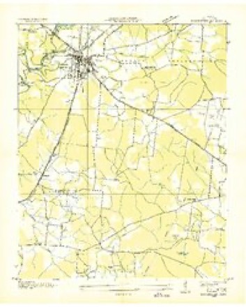
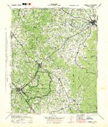
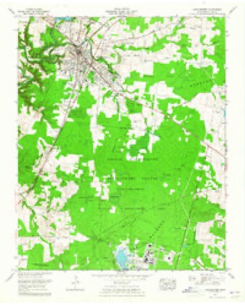
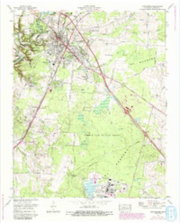
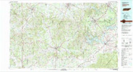
17 topographic sheets cover this place, the earliest surveyed in 1936 and the latest in 1981. It stands in District 1. It lies in ZIP code area 37355. It stands on Goodman Spring Branch. The Survey maps it on the Manchester quadrangle. 12,212 people lived here at the 2020 count. It stands 1,060 feet above sea level.
Research this city
On record in Manchester
Buildings and businesses the archive holds for this place. Each opens its own page, with the source record it came from.
On the National Register 5 records
 Coffee County Courthouselisted 1974
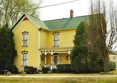 John H. Leming Houselisted 2011
 Old Stone Fortlisted 1973
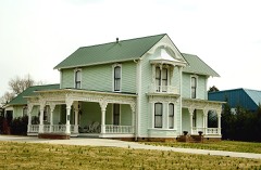 Wilkinson-Keele Houselisted 2006
- Manchester Cumberland Presbyterian Churchlisted 1992
Population over time
2 figuresManchester grew from 10,102 to 12,212 between 2010 and 2020. These are the recorded population figures Wikidata holds for this place, reached through the Geographic Names Information System number this page is keyed on rather than by name, so they belong to this place and not to another of the same name. Most are census counts, but not all are: an early figure may be a founding or settlement estimate, and an estimate published within five years of a census is left out. The change column is computed, and is left blank where more than 20 years separate a figure from the one before it, because a gap that long is not a change between two counts.
| Year | People | Change |
|---|---|---|
| 2010 | 10,102 | |
| 2020 | 12,212 | +2,110 (+21%) |
Topographic sheets covering this place
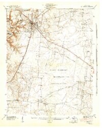
7 surveys from 17 printed sheetsMatched by testing this settlement's coordinate against the published boundary of every sheet in the United States Geological Survey's historical collection. Each opens the scanned sheet at the Survey.
- 1936 USGS Manchester quadrangle1:24000
- 1941 USGS Manchester quadrangle1:24000, 3 printings
- 1943 USGS Mc Minnville quadrangle1:100000
- 1956 USGS Columbia quadrangle1:250000, 6 printings
- 1963 USGS Manchester quadrangle1:24000
- 1972 USGS Manchester quadrangle1:24000, 4 printings
- 1981 USGS Tullahoma quadrangle1:100000

Fires near this place
164 since 1997Regional context, not property-specific evidence. The federal wildfire occurrence database lists 164 fires within 5 miles of Manchester between 1997 and 2017, burning about 454 acres in total. None started naturally. 16 were recorded as arson. Distance is straight-line from the map coordinates, so a fire counted here may appear on a neighbouring settlement's page as well.
| Reported cause | Fires |
|---|---|
| Debris and open burning | 110 |
| Arson/incendiarism | 16 |
| Equipment and vehicle use | 14 |
| Missing data/not specified/undetermined | 8 |
| Railroad operations and maintenance | 4 |
| Misuse of fire by a minor | 4 |
| Other causes | 3 |
| Recreation and ceremony | 2 |
| Fireworks | 1 |
| Power generation/transmission/distribution | 1 |
| Smoking | 1 |
The most recent of them, most recent first, with the day each was reported and the service that recorded it.
| Date | Cause | Size | Reported by | Name on the report |
|---|---|---|---|---|
| 6 September 2010 | Debris and open burning | under an acre | Tennessee Division of Forestry | HODGE |
| 5 September 1999 | Arson/incendiarism | under an acre | Tennessee Division of Forestry | not named |
| 4 September 1999 | Debris and open burning | 4.5 acres | Tennessee Division of Forestry | not named |
| 4 September 1999 | Debris and open burning | 1.0 acres | Tennessee Division of Forestry | not named |
| 24 September 2010 | Power generation/transmission/distribution | under an acre | Tennessee Division of Forestry | HASTINGS |
| 23 September 2005 | Debris and open burning | under an acre | Tennessee Division of Forestry | not named |
| 23 September 2005 | Debris and open burning | under an acre | Tennessee Division of Forestry | not named |
| 17 September 1999 | Debris and open burning | under an acre | Tennessee Division of Forestry | not named |
Settlements close enough to share some of these fires:
Mines and quarries near this place
5 within 5 milesRegional context, not property-specific evidence. The federal mineral resources record lists 5 workings within 5 miles of Manchester: 3 past producers, 2 occurrences. None of them still produces. What was taken out: Uranium, Oil Shale, Uranium, Oil Shale, Sand and Gravel, Construction. Distance is straight-line from the map coordinates, so a quarry counted here may appear on a neighbouring settlement's page as well.
| Where | Site | Commodity | Status | Recorded |
|---|---|---|---|---|
| Chert Pit | Silica | Past Producer | ||
| Cumberland Mountain Sand Co. Pit | Stone, Crushed/Broken | Past Producer | Sedimentary | |
| Gravel Pit | Sand and Gravel, Construction | Past Producer | ||
| Outcrop Sample For Uranium | Uranium, Oil Shale | Occurrence | ||
| Outcrop Sample For Uranium | Uranium, Oil Shale | Occurrence |
Storms near this place
60 of 110 shownRegional context, not property-specific evidence. The National Weather Service names Manchester in 110 storm reports between 1995 and 2026: 63 thunderstorm wind, 33 hail, 7 flash flood, 5 tornado. The reports record 3 injuries. Each account below is quoted exactly as the forecast office filed it, from the NOAA Storm Events Database, and each date opens the federal record of that event.
| When | Event | Place named | Harm | What the report says |
|---|---|---|---|---|
| April 1996 | Thunderstorm Wind | Manchester | 2 hurt, $500,000 | no account filed |
| January 1999 | Thunderstorm Wind | Manchester | 1 hurt | A metal roof from an H&R Block building was lifted and hurled into vehicles in downtown Manchester. There was one injury. The roof was estimated to be 20 feet by 20 feet, was made of aluminum and 2 by 4s. |
| October 2001 | Tornado (F2) | Manchester | $3,000,000 | Roof and one wall to a factory was blown off at Manchester Industrial Park. There was structural damage to other buildings in the Joint Industrial Park. Also, several trees were down. One estimate for damage from the combination of straight line winds and the tornadoes, which extended from the commercial vehicle weigh station at I-24 to the Manchester Industrial Park, continuing to Old Airport Road and the Ashbury community, were in the several millions of dollars. |
| August 2007 | Thunderstorm Wind | Manchester | $556,000 | Spotter reported roof debris along I-24 at exit #114. Report was verified by sheriff dispatcher. Newspaper articles said major roof damage was done to several hotels with about $550,000 worth of damage. The article stated that damage occurred to the roofs of the Days Inn, Ramada Inn, the Super 8 Motel, and Huddle House. 85 percent of the roof was gone from these businesses. Several vehicles were damaged in nearby parking lots. The Days Inn and Ramada Inn hotels were right off the I-24 exit. ||More than 50 people were displaced at the hotels. The displaced people were moved to nearby hotels. ||Also, a large tree was blown down in Manchester in front of the courthouse. Trees and power lines were also down in other parts of Manchester as well. 2000 people were without power because of the storm.||The article also mentioned that the Quik-Mart located at 2400 Hillsboro Blvd. sustained $2000 worth of damage from aluminum siding that was ripped off the building. |
| August 2005 | Thunderstorm Wind | Manchester | $500,000 | Strong thunderstorm winds tore away half of the gymnasium roof at the Coffee County Middle School in Manchester. Rains from the thunderstorms left pools of water on the gym floor. The old foam roof was found to be less than the 2 inches thick the contract had called for, and is no longer under warranty. |
| January 1998 | Tornado (F1) | Manchester | $250,000 | The Coffee county EMA director surveyed the damage. 5 homes had some roof damage, but a brick home lost an entire roof. Some outbuildings were destroyed. There were no injuries. A woman did see a funnel before the tornado struck. Trees and power lines were down on Ragsdale Road. |
| August 2023 | Thunderstorm Wind | Manchester | $100,000 | Sentinel satellite imagery along with damage photos indicate an intense microburst struck the Manchester area, causing a 1/2 mile wide swath of damage along a roughly 7 mile path across southern and southeastern Manchester. Scattered trees were blown down in this area with several trees falling onto homes and businesses. Some roads reported impacted included Highway 55, Highway 41, Perry Road, Old Pocahontas Road, Royal Trail, Doak Road, Ragsdale Road, and Vaughn Hollow. Winds were estimated up to 75 mph. Damages are a rough estimate. |
| October 2022 | Thunderstorm Wind | Manchester | $50,000 | An intense microburst about one half mile long by 250 yards wide struck an area along Interstate Drive from around Monogard Drive southeastward to Highway 55. Sheet metal was blown off a building into a street sign on Monogard Drive. Large sections of the sheet metal roof were also blown off the Coffee Farmers Co-Op building on the west side of Interstate Drive, and a BP gas station canopy lost metal panels. On the east side of the roadway, one home lost a large section of its roof and a front porch column, and several trees were snapped and uprooted in the yard. Another gas station also suffered roof damage, and a nearby warehouse building lost part of its roof and had a cinder block wall collapse. Damage was blown from northwest to southeast, and winds were estimated up to 85 mph. Damages are a rough estimate. |
| January 2013 | Tornado (EF0) | Manchester | $50,000 | Based on a survey completed by Coffee County Emergency Management, an EF0 tornado was confirmed in and near Manchester. The sheet metal roof of a home was partially blown off on Walker Road in Manchester and a tree was blown down in the yard. A few trees were blown down and the press box was destroyed at the Coffee County Middle School. Intermittent damage consisting of dozens of snapped trees and damaged roofs continued for approximately 5 miles to the northeast. The last evidence of damage was on Shining Star Lane just off Ragsdale Road where a home had minor damage and a few trees were blown down. |
| April 1998 | Tornado (F1) | Manchester | $50,000 | 911 center reported numerous roofs off of buildings in downtown Manchester and also widespread wind damage. |
| October 2022 | Thunderstorm Wind | Manchester | $25,000 | Very strong thunderstorm winds in Manchester downed numerous trees in the city, including at Dave King Park, a trailer court on Oakdale Street, Woodland Street, South Spring Street, and other areas. Damages are a rough estimate. |
| March 2011 | Thunderstorm Wind | Manchester | $25,000 | Downed power lines and trees occurred across the city of Manchester. |
| February 1999 | Lightning | Manchester | $25,000 | Lightning hit the Coffee County Consolidated Communications Center and knocked out emergency 911 calls for about an hour. The Center also handles dispatch calls for area law enforcement, fire and ambulance services. Emergency calls had to be routed through the jail. This was the second time in 12 years that the Communications Center was hit this bad by lightning. |
| July 2013 | Thunderstorm Wind | Manchester | $20,000 | The Coffee County 911 Center reported 18 trees down across Coffee County. Roads blocked by trees included Cascade Hollow Road, Noah Road, Ferry Hill Road, and Woodbury Highway. |
| June 1995 | Thunderstorm Wind | Manchester | $20,000 | A mobile home lost its roof. Numerous trees and power lines were knocked down. |
| April 2026 | Thunderstorm Wind | Manchester | $15,000 | Severe thunderstorm winds downed trees across Coffee County and caused roof damage to the library in Manchester. Damages are a rough estimate. |
| February 2025 | Thunderstorm Wind | Manchester | $15,000 | Severe thunderstorm winds downed a tree onto a home on East Harp Street in Manchester. Damages are a rough estimate. |
| August 2023 | Thunderstorm Wind | Manchester | $15,000 | Severe thunderstorm winds downed a tree on top of a home at Bond Street and Hills Chapel Road in Manchester. Damages are a rough estimate. |
| October 2022 | Thunderstorm Wind | Manchester | $15,000 | Thunderstorm winds in Manchester tore off a large section of the Raider Academy gym. Damages are estimated. |
| March 2017 | Thunderstorm Wind | Manchester | $15,000 | Facebook and tSpotter Twitter reports and photos indicated widespread wind damage occurred across Manchester. Several buildings suffered roof damage including Raider Academy on Highway 55, Garners Furniture in downtown Manchester, and an old pool hall on Highway 41. Numerous trees and power lines were also blown down across Manchester blocking several roadways including Highway 41 near Old Stone Fort, Powers Bridge Road near Beechwood Drive, West Moor Street, and Forrestwood Drive. |
| July 2012 | Thunderstorm Wind | Manchester | $15,000 | Numerous trees were downed in Manchester. |
| June 2010 | Thunderstorm Wind | Manchester | $15,000 | Strong winds roared through the Blanton's Chapel area as well as the downtown Manchester area. Emergency dispatchers said fallen trees blocked parts of North Woodland, Hendrickson Drive, Hills Chapel, Hillcrest and Iris Drive areas. A tree also blocked a section of Doak Road at Hills Chapel Road. Because of a power failure the traffic lights at the intersection of State Highway 51 and State Highway 53 in Manchester were out for a time. |
| April 2022 | Thunderstorm Wind | Manchester | $10,000 | Social media reports indicated the Manchester Recreation Complex roof was partially blown off. |
| September 2015 | Thunderstorm Wind | Manchester | $10,000 | A 0.5 mile wide by 1.5 mile long microburst struck Manchester from the Westwood Middle School area northeast to near Coffee County Middle School. The roof of a dugout at Westwood Middle School was blown off across Westwood School Road to the east knocking down a fence. Several trees and power lines were also blown down, including across Fred Deadman Park and Dave King Park. One tree fell onto a house on Taylor Street. Up to 2,300 people were without power at one time. |
| May 2011 | Thunderstorm Wind | Manchester | $10,000 | Multiple trees were uprooted or snapped on State Highway 53 north of Manchester. |
| April 2006 | Thunderstorm Wind | Manchester | $10,000 | High winds blew the roof off of A&G Equipment on Woodbury Highway. Pieces of the roof were hurled 300 feet. The storm blew out the window of Green's Bestway grocery store. An awning was damaged at New Union Elementary School. |
| July 2004 | Thunderstorm Wind | Manchester | $10,000 | 70 to 80 feet of roof was blown off of Westwood Junior High School. |
| August 1997 | Lightning | Manchester | $10,000 | Fire damaged a home after it was struck by lightning. |
| March 2026 | Thunderstorm Wind | Manchester | $5,000 | Severe thunderstorm winds downed a few powerlines in Manchester. Damages are a rough estimate. |
| May 2024 | Thunderstorm Wind | Manchester | $5,000 | A Facebook user reported a downed tree on Taylor Street in Manchester. Damages are a rough estimate. |
| July 2023 | Thunderstorm Wind | Manchester | $5,000 | Severe thunderstorm winds downed a tree onto a car in the Cracker Barrel parking lot near Interstate 24 and Woodbury Highway. No injuries were reported. Damages are a rough estimate. |
| June 2019 | Thunderstorm Wind | Manchester | $5,000 | Several trees were blown down damaging cars along Highway 55 near the Batesville Casket Company. |
| August 2012 | Thunderstorm Wind | Manchester | $5,000 | A few trees were blown down in Manchester. |
| October 2011 | Hail | Manchester | $5,000 | Half dollar to golfball size hail was reported in Manchester. Videos showed the hail fell for around five minutes. |
| August 2010 | Thunderstorm Wind | Manchester | $5,000 | Spotter reported several broken tree limbs, trash cans blown down along a few streets, along with one tree uprooted. |
| April 2009 | Flash Flood | Manchester | $5,000 | Storm spotters reported several roads covered with water in Manchester and Hillsboro. |
| May 2008 | Thunderstorm Wind | Manchester | $5,000 | Strong winds were estimated by trained spotter to be 60 mph. Also, trees were blown down. |
| April 1998 | Thunderstorm Wind | Manchester | $5,000 | Trees were blown down at Manchester. A large tree fell at the corner of Main and Church Streets near the First United Methodist Church and knocked out electricity. Property damage iincluded a portion of an awning at Jiffy Burger blown off and minor damage to homes from downed trees and limbs. |
| June 1995 | Thunderstorm Wind | Manchester | $5,000 | One tree was knocked over and fell on a truck and mobile home. |
| October 2022 | Thunderstorm Wind | Manchester | $3,000 | Thunderstorm winds blew down a sign and fence and also tore off a mailbox at a home on Bashaw Creek Road. Damages are estimated. |
| December 2013 | Thunderstorm Wind | Manchester | $3,000 | A few trees were blown down across Coffee County. |
| February 2008 | Thunderstorm Wind | Manchester | $3,000 | Trees were blown down. |
| May 2019 | Thunderstorm Wind | Manchester | $2,000 | A large tree was uprooted and a power pole was snapped. |
| March 2017 | Thunderstorm Wind | Manchester | $2,000 | Facebook reports and photos indicated a TVA transmission pole was blown over onto other power lines on Ragsdale Road near Beans Creek Winery, knocking out power to 4500 customers in Coffee County. |
| August 2011 | Thunderstorm Wind | Manchester | $2,000 | Trees and power lines were blown down. |
| June 2011 | Thunderstorm Wind | Manchester | $2,000 | Tree limbs were blown down across southern Coffee County. |
| May 2011 | Thunderstorm Wind | Manchester | $2,000 | A large tree was blown down near intersection of U.S. Highway 41 and State Highway 53. |
| May 2025 | Thunderstorm Wind | Manchester | $1,000 | Severe thunderstorm winds downed a tree on Woodbury Highway in Manchester. Damages are a rough estimate. |
| June 2022 | Thunderstorm Wind | Manchester | $1,000 | A report from mPing indicated 1 inch tree limbs were blown down and shingles blown off homes 5 miles north of Manchester. |
| August 2018 | Thunderstorm Wind | Manchester | $1,000 | A Twitter tSpotter report and photo showed a tree was blown down on Ingram Street in Manchester. |
| June 2016 | Thunderstorm Wind | Manchester | $1,000 | A tSpotter Twitter report indicated a tree was blown down on Ingram Street in Manchester. |
| June 2016 | Thunderstorm Wind | Manchester | $1,000 | Tree down in yard of home near center of town. |
| July 2016 | Thunderstorm Wind | Manchester | $1,000 | Scattered tree limbs down and some brief power outages reported around Coffee County. |
| June 2005 | Thunderstorm Wind | Manchester | $1,000 | Trees down and roof damage to house. |
| July 2004 | Flash Flood | Manchester | $1,000 | Widespread flooding was reported along Ragsdale Road in Manchester. |
| October 2004 | Flash Flood | Manchester | $1,000 | Flooding was occurring on U.S. Highway 41A in Manchester with 6 to 8 inches of water. |
| May 1997 | Thunderstorm Wind | Manchester | $1,000 | Local law enforcement reported a few trees and power lines down. |
| April 1995 | Thunderstorm Wind | Manchester | $1,000 | A power poles along with some power lines were knocked down. |
| May 1995 | Tornado (F0) | Manchester | $1 | A house trailer was overturned. Several large trees were blown down. |
| May 2024 | Hail | Manchester | - | A Facebook user reported estimated two inch hail near Manchester. |
Nearest settlements
The eight closest, with where each one stands in the county. Distances are straight-line, computed from the Geographic Names Information System coordinates.
| Map | Place | Distance | Sheets |
|---|---|---|---|
| Glenview | 0.5 miles | 17 | |
| Westwood | 0.9 miles | 17 | |
| Melrose Park | 1.1 miles | 17 | |
| West Meade | 1.2 miles | 17 | |
| Westwood Homes | 1.4 miles | 17 | |
| Shady Acres | 1.7 miles | 17 | |
| White Oaks | 2.0 miles | 17 | |
| Royal Oaks | 2.1 miles | 17 |
Elsewhere
Matched on this settlement's Geographic Names Information System number rather than its name, so it cannot be a different place of the same name in another state.
| Wikipedia article on Manchester | An encyclopaedic summary. Its text is share-alike, so it is linked here rather than copied. |
| Wikidata item Q1012255 | The structured record the population and elevation above come from. Public domain (CC0). |
Provenance
This settlement is recorded in the Geographic Names Information System as feature 1292561. The sheet list is computed by point-in-boundary test against the United States Geological Survey's historical topographic inventory. Both are works of the United States government and carry no copyright under 17 U.S.C. 105.
Wildfire. Short, Karen C. 2022. Spatial wildfire occurrence data for the United States, 1992-2020 [FPA_FOD_20221014]. 6th Edition. Fort Collins, CO: Forest Service Research Data Archive. https://doi.org/10.2737/RDS-2013-0009.6 Collected with United States Government funding and usable without additional permissions or fees.
Mines and quarries. USGS Mineral Resources Data System (MRDS) https://mrdata.usgs.gov/mrds/ A work of the United States government, no copyright under 17 U.S.C. 105.
Storms. NOAA National Centers for Environmental Information, Storm Events Database https://www.ncei.noaa.gov/stormevents/ A work of the United States government, no copyright under 17 U.S.C. 105. Narratives are quoted verbatim from the National Weather Service report and are not edited or summarised.