 Block
Mitchellville, Tennessee
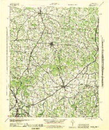
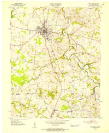
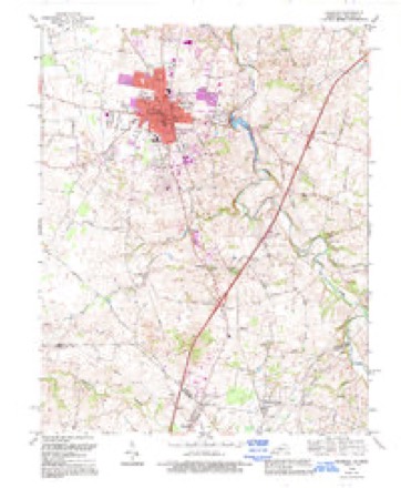
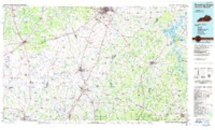
13 topographic sheets cover this place, the earliest surveyed in 1942 and the latest in 1985. It stands in District 3. It lies in ZIP code area 37148. The Survey maps it on the Franklin quadrangle. 163 people lived here at the 2020 count. It stands 778 feet above sea level.
Population over time
3 figuresMitchellville fell from 207 to 163 between 2000 and 2020. These are the recorded population figures Wikidata holds for this place, reached through the Geographic Names Information System number this page is keyed on rather than by name, so they belong to this place and not to another of the same name. Most are census counts, but not all are: an early figure may be a founding or settlement estimate, and an estimate published within five years of a census is left out. The change column is computed, and is left blank where more than 20 years separate a figure from the one before it, because a gap that long is not a change between two counts.
| Year | People | Change |
|---|---|---|
| 2000 | 207 | |
| 2010 | 189 | -18 (-9%) |
| 2020 | 163 | -26 (-14%) |
Topographic sheets covering this place
6 surveys from 13 printed sheetsMatched by testing this settlement's coordinate against the published boundary of every sheet in the United States Geological Survey's historical collection. Each opens the scanned sheet at the Survey.
- 1942 USGS Gallatin quadrangle1:100000
- 1951 USGS Franklin quadrangle1:24000, 2 printings
- 1956 USGS Nashville quadrangle1:250000, 2 printings
- 1959 USGS Nashville quadrangle1:250000
- 1968 USGS Franklin quadrangle1:24000, 4 printings
- 1985 USGS Bowling Green quadrangle1:100000, 3 printings


Fires near this place
2 since 2001Regional context, not property-specific evidence. The federal wildfire occurrence database lists 2 fires within 5 miles of Mitchellville between 2001 and 2006, burning about 3 acres in total. None started naturally. None was recorded as arson. Distance is straight-line from the map coordinates, so a fire counted here may appear on a neighbouring settlement's page as well.
| Reported cause | Fires |
|---|---|
| Debris and open burning | 2 |
The most recent of them, most recent first, with the day each was reported and the service that recorded it.
| Date | Cause | Size | Reported by | Name on the report |
|---|---|---|---|---|
| 7 March 2006 | Debris and open burning | 1.0 acres | Tennessee Division of Forestry | not named |
| 26 February 2001 | Debris and open burning | 2.0 acres | Tennessee Division of Forestry | not named |
Settlements close enough to share some of these fires:
Storms near this place
13 since 1996Regional context, not property-specific evidence. The National Weather Service names Mitchellville in 13 storm reports between 1996 and 2025: 8 flash flood, 2 thunderstorm wind, 1 hail, 1 funnel cloud. The reports record 1 injury. Each account below is quoted exactly as the forecast office filed it, from the NOAA Storm Events Database, and each date opens the federal record of that event.
| When | Event | Place named | Harm | What the report says |
|---|---|---|---|---|
| May 2016 | Flash Flood | Mitchellville | 1 hurt, $3,000,000 | Major flash flooding affected northern and central Sumner County, especially the Portland, Oak Grove, and Bethpage areas. Numerous primary and secondary roads were flooded and closed or even washed out, including Highway 52, Highway 259, William Mack Lane, Harper Road, North Corinth Road, Cora Street, Harper Road, Jim Courtney Road, and Airport Road in Portland; Duffer Hollow Road, Rock Bridge Road, Chipman Road, Red Tuttle Road, Rogana Road, Alexander Road, and Rock Springs Road in Bethpage; and Highway 25 at the Bledsoe Creek Bridge in Castalian Springs. Several homes and businesses were flooded, including several homes in the Richland subdivision on William Mack Lane in Portland. At least 12 water rescues from vehicles and homes were conducted across Sumner County, and one 90 year old man that was rescued was reportedly transported to the Portland ER Hospital with hypothermia. The flooding across Sumner County was reportedly the worst since the historic May 2010 floods. |
| July 2016 | Flash Flood | Mitchellville | $5,000,000 | Major flash flooding affected much of Sumner County, especially in and near Cottontown, Bethpage, Hendersonville, Gallatin, and Castalian Springs, with numerous homes, businesses, vehicles and roads damaged by flooding. TEMA reported 30 homes were damaged and 4 bridges severely damaged by the flash flooding. Homes were flooded in locations such as Tyree Springs Road in Hendersonville, where residents were trapped by flood waters; Stoneridge Farms Apartments at 2325 Nashville Pike in Gallatin; and on Old Douglas Road in Gallatin, where one home was inundated by three feet of water. Businesses that were flooded included Long Hollow Nursery around 6 miles west of Gallatin. Roads that were flooded and closed in Hendersonville included Lower Station Camp Creek Road between Saundersville Road and Jenkins Lane, Indian Lake Road and Drakes Creek Road at Stop Thirty Road. In Cottontown, roads that were impassable due to flood waters included Bugg Hollow Road where Briggance Branch and Station Camp Creek flooded the roadway, and Pee Dee Branch Road at Upper Station Camp Creek Road. Other flooded roadways were Old Douglas Road in Gallatin, Old Hopewell Road near Lauderdale Lane in Bethpage which was washed out, Deshea Creek Road northeast of Gallatin which was washed out, and Saddle Club Road in Westmoreland which was also washed out. One man had to be rescued from clinging to a tree after his vehicle was washed away in flood waters on Liberty Lane about 5 miles northwest of Gallatin. Another man was rescued after driving into flood waters in Castalian Springs. No injuries or fatalities were reported. |
| May 2024 | Thunderstorm Wind | Mitchellville | $50,000 | NWS storm survey found a large 1.5 mile wide by 11 mile long downburst that blew down dozens of trees and power lines across northern Sumner County, from west of Mitchellville to the Kentucky border north of Westmoreland. Some trees fell onto homes causing substantial damage. Max winds were estimated up to 75 mph. Damages are a rough estimate. |
| September 1996 | Thunderstorm Wind | Mitchellville | $30,000 | no account filed |
| June 2017 | Flood | Mitchellville | $5,000 | Numerous tSpotter Twitter and Facebook reports, photos and videos showed minor flooding across parts of Sumner County due to the earlier heavy rainfall. One video showed West Fork Drakes Creek covering Butler Bridge Road. Another video showed water flowing over Madison Creek Road in Goodlettsville with a stranded vehicle in the flood waters. Other videos and photos showed minor street flooding in Hendersonville on Drakes Creek Road, and on Lower Station Camp Creek Road where Station Camp Creek was out of its banks. Several yards were also flooded due to the earlier heavy rainfall. |
| May 2016 | Flash Flood | Mitchellville | $5,000 | Flash flooding affected portions of western Sumner County, especially the Millersville and Portland areas. At least one road was flooded in Millersville. Numerous roads were flooded in Portland, including McGlothlin Street and Cody Street, and one water rescue was conducted from a stalled vehicle. No significant damage was reported. |
| February 2025 | Flash Flood | Mitchellville | - | Heavy rain in the Portland area caused flooding along several area roadways, including Jim Courtney Road, Coker Ford Road, and Highway 259. Damages are unknown. |
| April 2025 | Flash Flood | Mitchellville | - | Heavy rain across Sumner County caused widespread flash flooding, especially along waterways and across other low-lying areas. Numerous roads were reported closed, including N Russell Street at Westland Street, Stop Thirty at Creekmore Road, S Latter Creek Road, TGT Road, Penny Morris Road at Wilson Road, the 1700 block of Old Gallatin Road, and Liberty Lane. Extent of damages is unknown. |
| April 2025 | Flash Flood | Mitchellville | - | Heavy rain across Sumner County caused widespread flash flooding, especially along waterways and across other low-lying areas. Numerous roads were reported closed, including Drakes Creek and Stop Thirty Road as well as Saundersville Road. By the end of this event, observations and radar estimates showed 5 to 7 inches of rain had fallen across Sumner County. Extent of damages is unknown. |
| June 2017 | Flash Flood | Mitchellville | - | Sumner County Sheriffs Office reported heavy rain caused flash flooding in parts of northern Sumner County with many roads flooded and closed. Several roads were flooded in Portland including Cora Street. Other roads that were flooded and closed included Dry Fork Creek at Dry Fork Road, and Old Gallatin Road. |
| December 2017 | Flash Flood | Mitchellville | - | Ten roads were flooded and closed across Sumner County, including Saundersville Road near George A. Whitten Elementary School in Hendersonville. |
| June 2015 | Hail | Mitchellville | - | Half-dollar size hail fell on the KY/TN State Line in Mitchellville. |
| July 2015 | Funnel Cloud | Mitchellville | - | The public shared video on Facebook of a funnel cloud along Highway 109 north of Portland. |
Nearest settlements
The eight closest, with where each one stands in the county. Distances are straight-line, computed from the Geographic Names Information System coordinates.
| Map | Place | Distance | Sheets |
|---|---|---|---|
| Scattersville | 3.2 miles | 11 | |
| Portland | 3.7 miles | 11 | |
| Highland Rim Terrace | 5.2 miles | 11 | |
| Pipers Chapel | 5.2 miles | 11 | |
| Sengtown | 5.6 miles | 11 | |
| Fountain Head | 6.1 miles | 11 | |
| Chestnut Grove | 6.7 miles | 11 | |
| Corinth | 7.2 miles | 11 |
Elsewhere
Matched on this settlement's Geographic Names Information System number rather than its name, so it cannot be a different place of the same name in another state.
| Wikipedia article on Mitchellville | An encyclopaedic summary. Its text is share-alike, so it is linked here rather than copied. |
| Wikidata item Q3292358 | The structured record the population and elevation above come from. Public domain (CC0). |
Provenance
This settlement is recorded in the Geographic Names Information System as feature 1306760. The sheet list is computed by point-in-boundary test against the United States Geological Survey's historical topographic inventory. Both are works of the United States government and carry no copyright under 17 U.S.C. 105.
Wildfire. Short, Karen C. 2022. Spatial wildfire occurrence data for the United States, 1992-2020 [FPA_FOD_20221014]. 6th Edition. Fort Collins, CO: Forest Service Research Data Archive. https://doi.org/10.2737/RDS-2013-0009.6 Collected with United States Government funding and usable without additional permissions or fees.
Storms. NOAA National Centers for Environmental Information, Storm Events Database https://www.ncei.noaa.gov/stormevents/ A work of the United States government, no copyright under 17 U.S.C. 105. Narratives are quoted verbatim from the National Weather Service report and are not edited or summarised.