 Block
Morristown, Tennessee
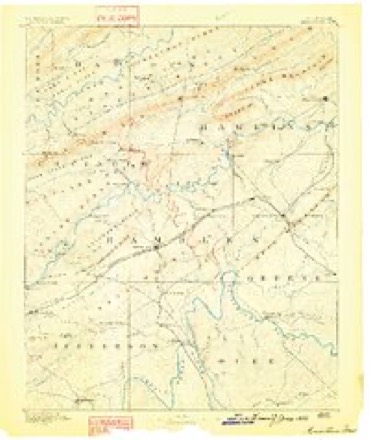
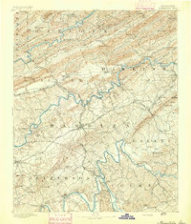
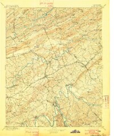
20 topographic sheets cover this place, the earliest surveyed in 1883 and the latest in 1981. It stands in District 1. It lies in ZIP code area 37814. It stands on West Fork Creek. The Survey maps it on the Morristown quadrangle. 30,431 people lived here at the 2020 count. It stands 1,302 feet above sea level.
Research this city
On record in Morristown
Buildings and businesses the archive holds for this place. Each opens its own page, with the source record it came from.
On the National Register 12 records
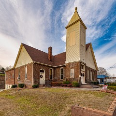 Bethel Methodist Churchlisted 2018
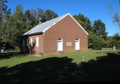 Bethesda Presbyterian Churchlisted 1973
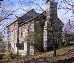 Crockett Tavern Museumlisted 2013
 Hamblen County Courthouselisted 1973
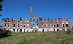 Morristown College Historic Districtlisted 1983
 Morristown Main Street Historic Districtlisted 2016
 Phillips Houselisted 1996
 Rose Schoollisted 1976
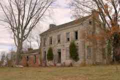 Rural Mountlisted 1975
 U. S. Post Officelisted 1983
- Barton Springslisted 1978
- Southern Bell Telephone and Telegraph Buildinglisted 2025
Population over time
2 figuresMorristown grew from 29,137 to 30,431 between 2010 and 2020. These are the recorded population figures Wikidata holds for this place, reached through the Geographic Names Information System number this page is keyed on rather than by name, so they belong to this place and not to another of the same name. Most are census counts, but not all are: an early figure may be a founding or settlement estimate, and an estimate published within five years of a census is left out. The change column is computed, and is left blank where more than 20 years separate a figure from the one before it, because a gap that long is not a change between two counts.
| Year | People | Change |
|---|---|---|
| 2010 | 29,137 | |
| 2020 | 30,431 | +1,294 (+4%) |
Topographic sheets covering this place
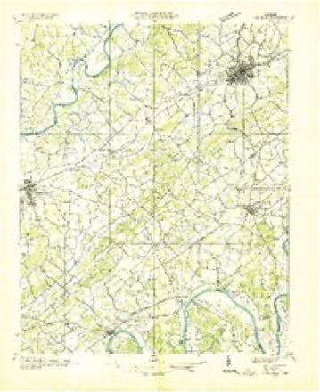
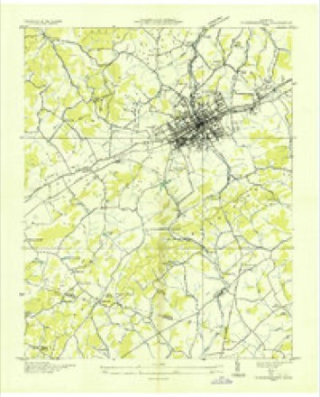
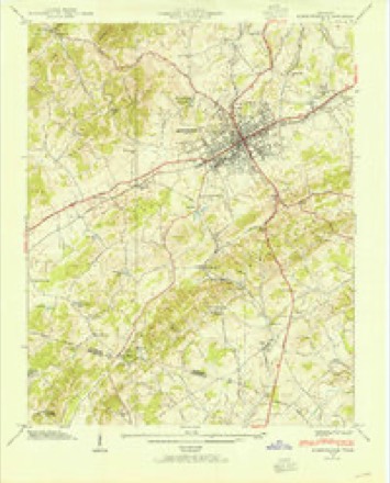
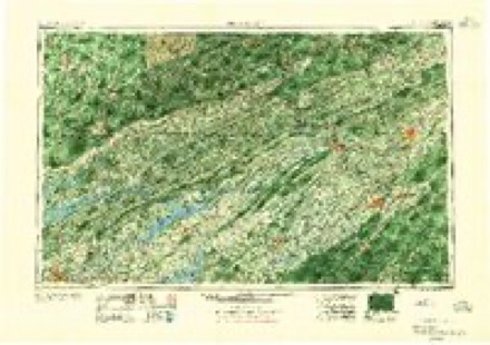
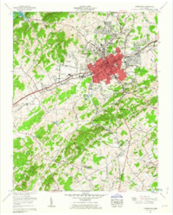
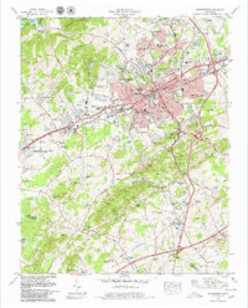
13 surveys from 20 printed sheetsMatched by testing this settlement's coordinate against the published boundary of every sheet in the United States Geological Survey's historical collection. Each opens the scanned sheet at the Survey.
- 1883 USGS Morristown quadrangle1:125000
- 1893 USGS Morristown quadrangle1:125000
- 1895 USGS Morristown quadrangle1:125000, 5 printings
- 1935 USGS Dandridge quadrangle1:48000
- 1935 USGS Morristown quadrangle1:24000
- 1939 USGS Morristown quadrangle1:24000, 2 printings
- 1955 USGS Johnson City quadrangle1:250000
- 1957 USGS Johnson City quadrangle1:250000
- 1960 USGS Johnson City quadrangle1:250000
- 1961 USGS Morristown quadrangle1:24000, 2 printings
- 1963 USGS Johnson City quadrangle1:250000
- 1979 USGS Morristown quadrangle1:24000, 2 printings
- 1981 USGS Morristown quadrangle1:100000
Fires near this place
27 since 2005Regional context, not property-specific evidence. The federal wildfire occurrence database lists 27 fires within 5 miles of Morristown between 2005 and 2018, burning about 89 acres in total. None started naturally. 5 were recorded as arson. Distance is straight-line from the map coordinates, so a fire counted here may appear on a neighbouring settlement's page as well.
| Reported cause | Fires |
|---|---|
| Debris and open burning | 11 |
| Arson/incendiarism | 5 |
| Missing data/not specified/undetermined | 4 |
| Smoking | 3 |
| Power generation/transmission/distribution | 1 |
| Equipment and vehicle use | 1 |
| Misuse of fire by a minor | 1 |
| Other causes | 1 |
The most recent of them, most recent first, with the day each was reported and the service that recorded it.
| Date | Cause | Size | Reported by | Name on the report |
|---|---|---|---|---|
| 21 September 2007 | Arson/incendiarism | under an acre | Tennessee Division of Forestry | SKEEN |
| 11 August 2007 | Missing data/not specified/undetermined | under an acre | Tennessee Division of Forestry | SAWDUST |
| 8 July 2007 | Arson/incendiarism | under an acre | Tennessee Division of Forestry | FERNWOOD FIRE |
| 8 May 2007 | Arson/incendiarism | under an acre | Tennessee Division of Forestry | MOUNTAIN VIEW FIRE |
| 24 May 2018 | Debris and open burning | 8.0 acres | Tennessee Division of Forestry | GRIGSBY RD |
| 9 April 2007 | Debris and open burning | 8.4 acres | Tennessee Division of Forestry | CROCKETTS RIDGE FIRE |
| 8 April 2010 | Missing data/not specified/undetermined | 3.0 acres | Tennessee Division of Forestry | HOLTS CHURCH |
| 28 April 2009 | Missing data/not specified/undetermined | 10 acres | Tennessee Division of Forestry | LOWLAND |
Settlements close enough to share some of these fires:
Mines and quarries near this place
10 within 5 milesRegional context, not property-specific evidence. The federal mineral resources record lists 10 workings within 5 miles of Morristown: 8 past producers, 2 occurrences. None of them still produces. What was taken out: Iron, Manganese, Sulfur-Pyrite, Sulfur. Distance is straight-line from the map coordinates, so a quarry counted here may appear on a neighbouring settlement's page as well.
| Where | Site | Commodity | Status | Recorded |
|---|---|---|---|---|
| Williams Iron Bank | Iron, Sulfur-Pyrite | Past Producer | Limonite, Pyrite | |
| Williams Iron Bank | Sulfur | Past Producer | ||
| Lotspiech Prospect | Manganese | Past Producer | 1918 | |
| Noeton Prospect | Manganese | Occurrence | ||
| Young Prospect | Manganese | Occurrence | ||
| Vinyard Fe Bank | Iron | Past Producer | Residual | |
| Vinyard Iron Bank | Iron | Past Producer | Limonite, Pyrite | |
| Vinyard Iron Bank | Iron | Past Producer | ||
| Williams Fe Bank | Iron | Past Producer | Residual | |
| Wilson and Corlew Pits | Iron | Past Producer |
Storms near this place
60 of 126 shownRegional context, not property-specific evidence. The National Weather Service names Morristown in 126 storm reports between 1994 and 2024: 83 thunderstorm wind, 32 hail, 6 flash flood, 4 flood. No death or injury is recorded in these reports. Each account below is quoted exactly as the forecast office filed it, from the NOAA Storm Events Database, and each date opens the federal record of that event.
| When | Event | Place named | Harm | What the report says |
|---|---|---|---|---|
| July 2004 | Thunderstorm Wind | Morristown | $40,000 | no account filed |
| April 2007 | Thunderstorm Wind | Morristown | $30,000 | Numerous trees were reported down on Buffalo Trail road and Springs road. |Also, two power poles two feet in diameter snapped in the eastern part of Morristown. |
| June 1998 | Thunderstorm Wind | Morristown | $30,000 | no account filed |
| April 2005 | Thunderstorm Wind | Morristown | $25,000 | A roof was blown off a house on Kidwells Ridge Road. |
| July 2006 | Thunderstorm Wind | Morristown | $25,000 | no account filed |
| June 2011 | Thunderstorm Wind | Morristown | $20,000 | Law enforcement personnel reported numerous trees downed by thunderstorm wind in Morristown. |
| April 2011 | Thunderstorm Wind | Morristown | $20,000 | Law enforcement personnel reported several trees downed by thunderstorm wind in Morristown. One tree fell on home. |
| June 2009 | Thunderstorm Wind | Morristown | $20,000 | Law enforcement personnel reported numerous trees downed by thunderstorm winds countywide. |
| August 2006 | Lightning | Morristown | $20,000 | Lightning struck a vehicle on Highway 160 in Morristown. The electrical surge disabled the vehicle and put a small hole in the windshield. |
| May 2002 | Thunderstorm Wind | Morristown | $20,000 | no account filed |
| April 2000 | Thunderstorm Wind | Morristown | $20,000 | no account filed |
| November 1998 | Thunderstorm Wind | Morristown | $20,000 | no account filed |
| June 2009 | Thunderstorm Wind | Morristown | $15,000 | Law enforcement personnel reported numerous trees downed by thunderstorm winds countywide. |
| June 2007 | Thunderstorm Wind | Morristown | $15,000 | Thunderstorm winds downed a few trees and powerlines countywide. |
| June 2007 | Thunderstorm Wind | Morristown | $15,000 | Thunderstorm winds downed about a dozen large oak trees near Morristown. |
| June 2005 | Thunderstorm Wind | Morristown | $15,000 | Several trees down countywide |
| June 2007 | Thunderstorm Wind | Morristown | $12,000 | Thunderstorm winds downed several trees countywide. |
| July 1999 | Thunderstorm Wind | Morristown | $12,000 | no account filed |
| February 2014 | Thunderstorm Wind | Morristown | $10,000 | Law enforcement reported several power poles and lines downed by thunderstorm wind in Morristown. |
| June 2014 | Thunderstorm Wind | Morristown | $10,000 | Law enforcement personnel reported many trees downed by thunderstorms wind countywide. |
| February 2011 | Flood | Morristown | $10,000 | A NWS employee reported heavy rain from a thunderstorm caused flooding along Panther Creek Road. |
| August 2006 | Thunderstorm Wind | Morristown | $10,000 | Numerous trees down across the east side of Morristown. |
| July 2002 | Thunderstorm Wind | Morristown | $10,000 | no account filed |
| June 1999 | Thunderstorm Wind | Morristown | $10,000 | no account filed |
| June 2008 | Thunderstorm Wind | Morristown | $8,000 | Dispatch reported several trees downed by thunderstorm winds across the western portions of the county. |
| May 2003 | Thunderstorm Wind | Morristown | $8,000 | no account filed |
| May 2003 | Thunderstorm Wind | Morristown | $6,000 | no account filed |
| February 2011 | Flood | Morristown | $5,000 | Mesonet reported 2.26 inches of rain in a 3 hour period from a thunderstorm producing minor flooding. |
| June 2011 | Thunderstorm Wind | Morristown | $5,000 | A trained spotter reported a few trees downed by thunderstorm wind in the Talbott area. |
| April 2006 | Thunderstorm Wind | Morristown | $5,000 | Two trees down in Morristown |
| June 2006 | Thunderstorm Wind | Morristown | $5,000 | A few trees and powerlines down. A barn was also slightly damaged. |
| April 2005 | Thunderstorm Wind | Morristown | $5,000 | A power pole and several powerlines down in Alpha near intersection of Highway 11E and Highway 160. |
| August 1995 | Thunderstorm Wind | Morristown | $5,000 | A few trees were knocked down. |
| August 1995 | Thunderstorm Wind | Morristown | $5,000 | Several trees knocked down. |
| August 1995 | Thunderstorm Wind | Morristown | $5,000 | Some trees were blown down. |
| April 2002 | Hail | Morristown | $5,000 | no account filed |
| April 2002 | Hail | Morristown | $5,000 | no account filed |
| August 1999 | Thunderstorm Wind | Morristown | $4,000 | no account filed |
| June 1996 | Thunderstorm Wind | Morristown | $4,000 | no account filed |
| May 2004 | Thunderstorm Wind | Morristown | $3,000 | no account filed |
| June 1999 | Thunderstorm Wind | Morristown | $3,000 | no account filed |
| June 2013 | Thunderstorm Wind | Morristown | $2,000 | Dispatch personnel reported 1 tree downed by thunderstorm wind on Jenkins Road in Morristown. |
| August 2010 | Thunderstorm Wind | Morristown | $2,000 | An NWS employee reported numerous large limbs downed by thunderstorm winds on Miginnis Road in west Morristown. |
| January 2002 | Thunderstorm Wind | Morristown | $2,000 | Trees down. |
| May 1995 | Thunderstorm Wind | Morristown | $2,000 | Several trees were knocked down. |
| May 2004 | Thunderstorm Wind | Morristown | $2,000 | no account filed |
| May 2004 | Thunderstorm Wind | Morristown | $2,000 | no account filed |
| July 2004 | Thunderstorm Wind | Morristown | $2,000 | no account filed |
| July 2004 | Thunderstorm Wind | Morristown | $2,000 | no account filed |
| July 2004 | Thunderstorm Wind | Morristown | $2,000 | no account filed |
| August 1999 | Thunderstorm Wind | Morristown | $2,000 | no account filed |
| June 1996 | Thunderstorm Wind | Morristown | $2,000 | no account filed |
| June 1996 | Thunderstorm Wind | Morristown | $2,000 | no account filed |
| August 2010 | Thunderstorm Wind | Morristown | $1,000 | An NWS employee reported 1 large tree downed by thunderstorm winds in Hickory Shadows subdivision in Morristown. |
| February 1998 | Thunderstorm Wind | Morristown | $1,000 | no account filed |
| June 1994 | Thunderstorm Wind | Morristown | $500 | A few trees were knocked down. |
| May 1995 | Hail | Morristown | $5 | Several cars were damaged and windows were broken. |
| August 2024 | Thunderstorm Wind | Morristown | - | Multiple trees were blown down, including one landing on a powerline, due to severe thunderstorm wind gusts in Morristown. |
| August 2023 | Thunderstorm Wind | Morristown | - | Numerous trees were blown down by powerful thunderstorm wind gusts in Morristown. |
| February 2022 | Flash Flood | Morristown | - | Flooding near the intersection of White Avenue and Colonial Drive. The road was being monitored for possible closure. |
Nearest settlements
The eight closest, with where each one stands in the county. Distances are straight-line, computed from the Geographic Names Information System coordinates.
| Map | Place | Distance | Sheets |
|---|---|---|---|
| Hillcrest | 1.0 miles | 20 | |
| Havley Springs | 1.3 miles | 20 | |
| Greenwood Acres | 1.5 miles | 20 | |
| Rolling Hills | 1.5 miles | 20 | |
| Dalton Heights | 1.5 miles | 20 | |
| Tigertown | 1.5 miles | 20 | |
| The Colonies | 1.6 miles | 20 | |
| Vantage View | 1.6 miles | 20 |
Elsewhere
Matched on this settlement's Geographic Names Information System number rather than its name, so it cannot be a different place of the same name in another state.
| Wikipedia article on Morristown | An encyclopaedic summary. Its text is share-alike, so it is linked here rather than copied. |
| Wikidata item Q2330995 | The structured record the population and elevation above come from. Public domain (CC0). |
Provenance
This settlement is recorded in the Geographic Names Information System as feature 1269815. The sheet list is computed by point-in-boundary test against the United States Geological Survey's historical topographic inventory. Both are works of the United States government and carry no copyright under 17 U.S.C. 105.
Wildfire. Short, Karen C. 2022. Spatial wildfire occurrence data for the United States, 1992-2020 [FPA_FOD_20221014]. 6th Edition. Fort Collins, CO: Forest Service Research Data Archive. https://doi.org/10.2737/RDS-2013-0009.6 Collected with United States Government funding and usable without additional permissions or fees.
Mines and quarries. USGS Mineral Resources Data System (MRDS) https://mrdata.usgs.gov/mrds/ A work of the United States government, no copyright under 17 U.S.C. 105.
Storms. NOAA National Centers for Environmental Information, Storm Events Database https://www.ncei.noaa.gov/stormevents/ A work of the United States government, no copyright under 17 U.S.C. 105. Narratives are quoted verbatim from the National Weather Service report and are not edited or summarised.