 Block
From the record
15 National Register listings published here.
Sources: the National Register database, National Park Service
49 topographic sheets cover 142 settlements here, and 15 properties are on the National Register of Historic Places.
15 National Register listings published here.
Sources: the National Register database, National Park Service
Every property in this county listed on the National Register of Historic Places, with the year it was listed and the federal nomination document.
| Photograph | Property | Type | Listed | Reference |
|---|---|---|---|---|
| Barton Springs | building | 1978 | 78002594 | |
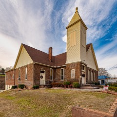 | Bethel Methodist Church | building | 2018 | 100002260 |
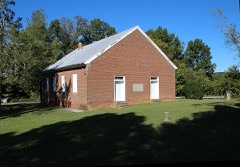 | Bethesda Presbyterian Church | building | 1973 | 73001771 |
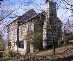 | Crockett Tavern Museum | district | 2013 | 13000948 |
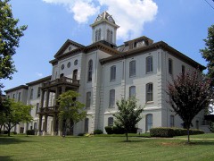 | Hamblen County Courthouse | building | 1973 | 73001770 |
| Leeper Farm | district | 2007 | 07000174 | |
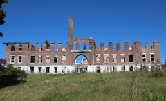 | Morristown College Historic District | district | 1983 | 83003036 |
 | Morristown Main Street Historic District | district | 2016 | 16000120 |
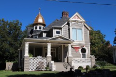 | Phillips House | building | 1996 | 96000384 |
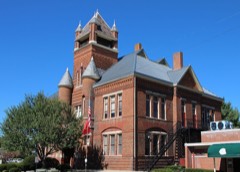 | Rose School | building | 1976 | 76001778 |
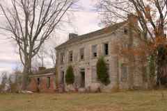 | Rural Mount | building | 1975 | 75001757 |
| Southern Bell Telephone and Telegraph Building | building | 2025 | 100011502 | |
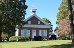 | St. Paul Presbyterian Church | building | 1979 | 79002434 |
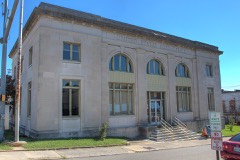 | U. S. Post Office | building | 1983 | 83003037 |
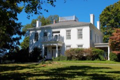 | Watkins-Witt House | building | 1991 | 90001752 |
Every wildfire the federal occurrence database records inside this county: 65 of them, burning about 1,103 acres. None started naturally and 24 were recorded as arson. Each settlement page carries the fires within five miles of it.
| Reported cause | Fires |
|---|---|
| Arson/incendiarism | 24 |
| Debris and open burning | 22 |
| Missing data/not specified/undetermined | 12 |
| Smoking | 3 |
| Power generation/transmission/distribution | 1 |
| Equipment and vehicle use | 1 |
| Misuse of fire by a minor | 1 |
| Other causes | 1 |
The five largest, by the area the report gives. 6 of them were set deliberately.
| Date | Cause | Size | Reported by | Name on the report |
|---|---|---|---|---|
| 18 November 2016 | Missing data/not specified/undetermined | 400 acres | Tennessee Division of Forestry | LEE VALLEY |
| 17 April 2014 | Arson/incendiarism | 110 acres | Tennessee Division of Forestry | ANDERSON BEND COVE FIRE |
| 10 April 2014 | Arson/incendiarism | 85 acres | Tennessee Division of Forestry | POWER LINE 2 FIRE |
| 23 February 2014 | Arson/incendiarism | 75 acres | Tennessee Division of Forestry | THREE SPRINGS BLUFF FIRE |
| 14 December 2017 | Debris and open burning | 60 acres | Tennessee Division of Forestry | MULLINS ROAD FIRE |
| 7 December 2012 | Arson/incendiarism | 48 acres | Tennessee Division of Forestry | THREE SPRINGS FIRE |
| 11 April 2017 | Arson/incendiarism | 36 acres | Tennessee Division of Forestry | SHERIFFS FIRE |
| 25 April 2007 | Arson/incendiarism | 31 acres | Tennessee Division of Forestry | DEAD GOAT FIRE #2 |
Every settlement page carries the fires within five miles of it - see the settlement index below.
The NOAA Storm Events Database holds 270 reports for this county, causing no deaths, 1 injury and about $13,213,605 in recorded property damage. Each settlement page carries the reports that name it.
| Kind of event | Reports |
|---|---|
| Thunderstorm Wind | 191 |
| Hail | 54 |
| Flash Flood | 14 |
| Flood | 8 |
| Tornado | 2 |
| Lightning | 1 |
The most serious of them, by death, then injury, then recorded damage. The accounts are quoted exactly as the forecast office filed them.
| When | Event | Place named | Harm | What the report says |
|---|---|---|---|---|
| July 2016 | Thunderstorm Wind | Alpha | 1 hurt | A tree was downed onto a car on Greenbriar Road. |
| September 2024 | Flood | Lowland | $11,000,000 | Flooding on the Hamblen County side from the massive flood wave on the Nolichucky River near Lowland. The Lowland river gauge was above its previous record crest for nearly 20 hours, cresting at 35.16 feet at 10:15 am EST on the 28th, 9 feet above its previous record. Damaging flooding occurred, but in mostly rural and agricultural areas. |
| February 2019 | Flood | Russellville | $1,230,000 | Hwy 11E closed at Russellville Elementary School due to flooding. All told, Emergency Management estimated that individual and public flood damages for Hamblen County together combined for $1.23 million for the overall event. |
| May 1998 | Thunderstorm Wind | Witt | $50,000 | no account filed |
| July 2004 | Thunderstorm Wind | Morristown | $40,000 | no account filed |
| June 2011 | Flash Flood | Barton Spgs | $30,000 | Law enforcement personnel reported heavy rain from thunderstorms produced flooding near Morristown. Bethesda Road and portions of east 11E Highway were closed by officers for flooding. |
| August 2009 | Thunderstorm Wind | Russellville | $30,000 | Newspaper reporters reported numerous trees and powerlines downed by thunderstorm winds on Beth Drive in Russellville. A tree fell on a vehicle. The winds also damaged a roofs on a few homes. |
| April 2007 | Thunderstorm Wind | Morristown | $30,000 | Numerous trees were reported down on Buffalo Trail road and Springs road. |Also, two power poles two feet in diameter snapped in the eastern part of Morristown. |
| June 1998 | Thunderstorm Wind | Morristown | $30,000 | no account filed |
| August 2006 | Thunderstorm Wind | Countywide | $25,000 | Numerous trees and powerlines down countywide. 5000 homes and businesses lost power. One tree fell on a vehicle on West Fourth North Street in Morristown. |
| April 2005 | Thunderstorm Wind | Morristown | $25,000 | A roof was blown off a house on Kidwells Ridge Road. |
| July 2006 | Thunderstorm Wind | Morristown | $25,000 | no account filed |
| November 1985 | Tornado (F1) | not stated | $25,000 | no account filed |
| February 2011 | Thunderstorm Wind | Russellville | $20,000 | Law enforcement personnel reported a roof from a barn was blown off by thunderstorm wind at the intersection of Carlyle Avenue and Cedar Creek Road near Russellville. |
| June 2011 | Thunderstorm Wind | Morristown | $20,000 | Law enforcement personnel reported numerous trees downed by thunderstorm wind in Morristown. |
| April 2011 | Thunderstorm Wind | Morristown | $20,000 | Law enforcement personnel reported several trees downed by thunderstorm wind in Morristown. One tree fell on home. |
| February 2009 | Thunderstorm Wind | Russellville | $20,000 | A trained spotter reported several trees downed by thunderstorm winds in the northeast portion of the county. Several roofs were also damaged. |
| June 2009 | Thunderstorm Wind | Morristown | $20,000 | Law enforcement personnel reported numerous trees downed by thunderstorm winds countywide. |
| August 2006 | Lightning | Morristown | $20,000 | Lightning struck a vehicle on Highway 160 in Morristown. The electrical surge disabled the vehicle and put a small hole in the windshield. |
| July 2005 | Thunderstorm Wind | Countywide | $20,000 | no account filed |
| May 2004 | Thunderstorm Wind | Countywide | $20,000 | no account filed |
| May 2002 | Thunderstorm Wind | Morristown | $20,000 | no account filed |
| April 2000 | Thunderstorm Wind | Morristown | $20,000 | no account filed |
| November 1998 | Thunderstorm Wind | Morristown | $20,000 | no account filed |
| May 1997 | Thunderstorm Wind | Countywide | $20,000 | no account filed |
| July 1996 | Thunderstorm Wind | South Part | $20,000 | no account filed |
| June 2009 | Thunderstorm Wind | Morristown | $15,000 | Law enforcement personnel reported numerous trees downed by thunderstorm winds countywide. |
| June 2007 | Thunderstorm Wind | Morristown | $15,000 | Thunderstorm winds downed a few trees and powerlines countywide. |
| June 2007 | Thunderstorm Wind | Morristown | $15,000 | Thunderstorm winds downed about a dozen large oak trees near Morristown. |
| June 2005 | Thunderstorm Wind | Morristown | $15,000 | Several trees down countywide |
| June 2003 | Thunderstorm Wind | Countywide | $15,000 | no account filed |
| June 2003 | Thunderstorm Wind | Countywide | $15,000 | no account filed |
| May 2003 | Thunderstorm Wind | Countywide | $15,000 | no account filed |
| February 2000 | Thunderstorm Wind | Countywide | $15,000 | no account filed |
| June 2007 | Thunderstorm Wind | Morristown | $12,000 | Thunderstorm winds downed several trees countywide. |
| April 2006 | Thunderstorm Wind | Countywide | $12,000 | Several trees and powerlines down across the eastern third of the county. |
| July 1999 | Thunderstorm Wind | Morristown | $12,000 | no account filed |
| February 2026 | Thunderstorm Wind | Alpha | $10,000 | An old barn was blown down by powerful thunderstorm wind gusts. |
| February 2014 | Thunderstorm Wind | Morristown | $10,000 | Law enforcement reported several power poles and lines downed by thunderstorm wind in Morristown. |
| June 2014 | Thunderstorm Wind | Morristown | $10,000 | Law enforcement personnel reported many trees downed by thunderstorms wind countywide. |
| April 2011 | Tornado (EF0) | Alpha | $10,000 | An NWS employee reported an EF-0 tornado touched down near Panther State Park in Morristown. It had a path length of one third of a mile and a path width of 50 yards. The max wind speed of 70 mph downed several trees starting from the overlook at the north end of the park. |
| February 2011 | Flood | Morristown | $10,000 | A NWS employee reported heavy rain from a thunderstorm caused flooding along Panther Creek Road. |
| June 2007 | Thunderstorm Wind | Russellville | $10,000 | A spotter reported several trees down near Russellville. |
| August 2006 | Thunderstorm Wind | Morristown | $10,000 | Numerous trees down across the east side of Morristown. |
| May 2001 | Thunderstorm Wind | Countywide | $10,000 | Numerous trees and power lines down. Electricity was out for about 2 hours for around 1000 customers. Power was restored to all by 11 pm. |
| July 2002 | Thunderstorm Wind | Morristown | $10,000 | no account filed |
| June 1999 | Thunderstorm Wind | Morristown | $10,000 | no account filed |
| June 2008 | Thunderstorm Wind | Morristown | $8,000 | Dispatch reported several trees downed by thunderstorm winds across the western portions of the county. |
| May 2003 | Thunderstorm Wind | Morristown | $8,000 | no account filed |
| May 2003 | Thunderstorm Wind | Morristown | $6,000 | no account filed |
| December 2025 | Thunderstorm Wind | Alpha | $5,000 | Security fencing blown down by strong thunderstorm wind gusts at the Avenue Church in Morristown. |
| August 2013 | Thunderstorm Wind | Russellville | $5,000 | Two separate callers from the public reported several trees were snapped by the thunderstorm wind along Cane Mill Road 1 mile north of Russellville. One of the callers also reported an above ground pool was flipped into the neighbors yard. |
| February 2011 | Flood | Morristown | $5,000 | Mesonet reported 2.26 inches of rain in a 3 hour period from a thunderstorm producing minor flooding. |
| June 2011 | Thunderstorm Wind | Morristown | $5,000 | A trained spotter reported a few trees downed by thunderstorm wind in the Talbott area. |
| September 2009 | Thunderstorm Wind | Alpha | $5,000 | Convective wind gusts removed the roofs of seven rental storage units in the western section of Morristown. |
| June 2008 | Thunderstorm Wind | Russellville | $5,000 | Dispatch reported a few trees downed by thunderstorm winds in the Russellville area. |
| April 2006 | Thunderstorm Wind | Morristown | $5,000 | Two trees down in Morristown |
| June 2006 | Thunderstorm Wind | Morristown | $5,000 | A few trees and powerlines down. A barn was also slightly damaged. |
| April 2005 | Thunderstorm Wind | Morristown | $5,000 | A power pole and several powerlines down in Alpha near intersection of Highway 11E and Highway 160. |
| August 1995 | Thunderstorm Wind | Morristown | $5,000 | A few trees were knocked down. |
The Survey's mineral resources record lists 15 workings inside this county. 2 still produce and 13 are closed or unrecorded. Each settlement page carries the workings within five miles of it.
| Commodity | Workings |
|---|---|
| Iron | 5 |
| Manganese | 5 |
| Stone, Crushed/Broken | 2 |
| Stone, Crushed/Broken, Limestone, General | 1 |
| Sulfur-Pyrite | 1 |
| Limestone, General | 1 |
| Sulfur | 1 |
The least common of them first, because a county's hundredth gravel pit says nothing its first ten did not.
| Where | Site | Commodity | Status | Recorded |
|---|---|---|---|---|
| Hamblen County Plant #514 | Stone, Crushed/Broken, Limestone, General | Producer | 1968 | |
| White Pine Stone Company Quarry | Limestone, General | Past Producer | Sedimentary | |
| Williams Iron Bank | Iron, Sulfur-Pyrite | Past Producer | Limonite, Pyrite | |
| Williams Iron Bank | Sulfur | Past Producer | ||
| Morristown Quarry | Stone, Crushed/Broken | Producer | ||
| White Pine Stone Co. Quarry | Stone, Crushed/Broken | Past Producer | ||
| Currier Prospect | Manganese | Prospect | 1951 | |
| Ivy and Mays Prospect | Manganese | Prospect | 1951 | |
| Lotspiech Prospect | Manganese | Past Producer | 1918 | |
| Noeton Prospect | Manganese | Occurrence | ||
| Ridley Prospect | Manganese | Prospect | 1954 | |
| Vinyard Fe Bank | Iron | Past Producer | Residual | |
| Vinyard Iron Bank | Iron | Past Producer | Limonite, Pyrite | |
| Vinyard Iron Bank | Iron | Past Producer | ||
| Williams Fe Bank | Iron | Past Producer | Residual |
Named settlements recorded in the Geographic Names Information System, each with the topographic sheets covering it. Villages, hamlets and abandoned places alike. Each is shown with the nearest named watercourse or landform and the survey quadrangle it falls on.
District 8 · 37813 · On Thompson Creek · Springvale quadrangle
19 sheets, 1883 to 1981
District 8 · 37814 · On Cedar Creek · Russellville quadrangle
19 sheets, 1883 to 1981
No longer a settlement
District 8 · 37813 · Near Little Mountain · Springvale quadrangle
19 sheets, 1883 to 1981
District 2 · 37814 · On Stubblefield Creek · Morristown quadrangle
20 sheets, 1883 to 1981
District 14 · 37814 · Near Murrell Hill · Morristown quadrangle
20 sheets, 1883 to 1981
District 7 · 37814 · On Robinson Branch · Bean Station quadrangle
21 sheets, 1883 to 1981
District 10 · 37860 · On Silver City Branch · Springvale quadrangle
19 sheets, 1883 to 1981
No longer a settlement
District 7 · 37814 · On Stubblefield Creek · Bean Station quadrangle
21 sheets, 1883 to 1981
District 6 · 37814 · Near Crockett Ridge · Morristown quadrangle
20 sheets, 1883 to 1981
District 5 · 37814 · On Crockett Ridge · Morristown quadrangle
20 sheets, 1883 to 1981
District 1 · 37814 · On Havley Springs Branch · Morristown quadrangle
20 sheets, 1883 to 1981
District 14 · 37814 · Near Long Ridge · Morristown quadrangle
20 sheets, 1883 to 1981
District 6 · 37814 · On Springs Branch · Morristown quadrangle
20 sheets, 1883 to 1981
District 7 · 37814 · On Stubblefield Creek · Bean Station quadrangle
21 sheets, 1883 to 1981
District 8 · 37813 · Near Little Mountain · Springvale quadrangle
19 sheets, 1883 to 1981
District 8 · 37814 · On Cedar Creek · Russellville quadrangle
19 sheets, 1883 to 1981
District 11 · 37813 · Near Aunt Jane Hollow · Morristown quadrangle
20 sheets, 1883 to 1981
District 11 · 37813 · Near Aunt Jane Hollow · Morristown quadrangle
20 sheets, 1883 to 1981
District 4 · 37813 · On West Fork Turkey Creek · Morristown quadrangle
20 sheets, 1883 to 1981
District 10 · 37813 · On Bailey Branch · Morristown quadrangle
20 sheets, 1883 to 1981
District 14 · 37814 · Near Ivey Hollow · Morristown quadrangle
20 sheets, 1883 to 1981
District 5 · 37814 · Near Crockett Ridge · Morristown quadrangle
20 sheets, 1883 to 1981
District 3 · 37813 · On West Fork Turkey Creek · Morristown quadrangle
20 sheets, 1883 to 1981
District 10 · 37813 · Near Little Mountain · Springvale quadrangle
19 sheets, 1883 to 1981
District 9 · 37860 · Near McGhee Hollow · Russellville quadrangle
19 sheets, 1883 to 1981
District 6 · 37814 · Near Cave Spring Valley · Bean Station quadrangle
21 sheets, 1883 to 1981
District 7 · 37814 · On Stubblefield Creek · Russellville quadrangle
19 sheets, 1883 to 1981
District 10 · 37813 · Near Little Mountain · Springvale quadrangle
19 sheets, 1883 to 1981
District 8 · 37814 · On Cedar Creek · Russellville quadrangle
19 sheets, 1883 to 1981
District 13 · 37877 · Near Poplar Hill · Talbott quadrangle
19 sheets, 1883 to 1981
District 7 · 37814 · On Stubblefield Creek · Bean Station quadrangle
21 sheets, 1883 to 1981
District 8 · 37814 · On Thompson Creek · Springvale quadrangle
19 sheets, 1883 to 1981
District 5 · 37814 · Near Crockett Ridge · Morristown quadrangle
20 sheets, 1883 to 1981
District 2 · 37814 · On Thompson Creek · Morristown quadrangle
20 sheets, 1883 to 1981
District 13 · 37877 · On Poplar Spring Branch · Talbott quadrangle
19 sheets, 1883 to 1981
District 7 · 37814 · On Stubblefield Creek · Bean Station quadrangle
21 sheets, 1883 to 1981
District 7 · 37814 · On Spring Creek · Bean Station quadrangle
21 sheets, 1883 to 1981
District 7 · 37814 · On Stubblefield Creek · Morristown quadrangle
20 sheets, 1883 to 1981
District 7 · 37814 · On Stubblefield Creek · Russellville quadrangle
19 sheets, 1883 to 1981
District 12 · 37814 · Near Murrell Hill · Talbott quadrangle
19 sheets, 1883 to 1981
No longer a settlement
District 13 · 37877 · Near Allen Hollow · Talbott quadrangle
19 sheets, 1883 to 1981
District 11 · 37813 · Near Aunt Jane Hollow · Morristown quadrangle
20 sheets, 1883 to 1981
District 4 · 37813 · On West Fork Turkey Creek · Morristown quadrangle
20 sheets, 1883 to 1981
District 10 · 37813 · Near Little Mountain · Springvale quadrangle
19 sheets, 1883 to 1981
District 4 · 37813 · On West Fork Turkey Creek · Morristown quadrangle
20 sheets, 1883 to 1981
District 5 · 37814 · On Williams Branch · Morristown quadrangle
20 sheets, 1883 to 1981
District 12 · 37814 · Near Murrell Hill · Morristown quadrangle
20 sheets, 1883 to 1981
District 4 · 37813 · On West Fork Turkey Creek · Morristown quadrangle
20 sheets, 1883 to 1981
District 4 · 37813 · On West Fork Turkey Creek · Morristown quadrangle
20 sheets, 1883 to 1981
District 6 · 37814 · Near Cave Spring Valley · Bean Station quadrangle
21 sheets, 1883 to 1981
District 5 · 37814 · Near Crockett Ridge · Morristown quadrangle
20 sheets, 1883 to 1981
District 13 · 37877 · Near Allen Hollow · Talbott quadrangle
19 sheets, 1883 to 1981
District 5 · 37814 · On Williams Branch · Morristown quadrangle
20 sheets, 1883 to 1981
District 9 · 37891 · On Whitesburg Branch · Russellville quadrangle
19 sheets, 1883 to 1981
District 10 · 37813 · Near Little Mountain · Springvale quadrangle
19 sheets, 1883 to 1981
District 10 · 37813 · Near Little Mountain · Springvale quadrangle
19 sheets, 1883 to 1981
District 14 · 37814 · Near Ore Mine Hill · Talbott quadrangle
19 sheets, 1883 to 1981
The vanished settlements of Hamblen County: the places named above that are no longer on the map.