 Block
Napier, Tennessee
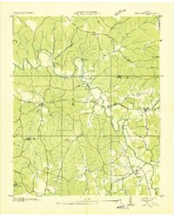
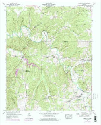
12 topographic sheets cover this place, the earliest surveyed in 1936 and the latest in 1985. It stands in District 5. It lies in ZIP code area 38462. It stands on Natchez Branch. The Survey maps it on the Henryville quadrangle.
On record in Napier
Buildings and businesses the archive holds for this place. Each opens its own page, with the source record it came from.
On the National Register 1 record
- Netherland Tait Houselisted 1984
Topographic sheets covering this place
4 surveys from 12 printed sheetsMatched by testing this settlement's coordinate against the published boundary of every sheet in the United States Geological Survey's historical collection. Each opens the scanned sheet at the Survey.
- 1936 USGS Henryville quadrangle1:24000
- 1951 USGS Henryville quadrangle1:24000, 3 printings
- 1956 USGS Columbia quadrangle1:250000, 6 printings
- 1985 USGS Lawrenceburg quadrangle1:100000, 2 printings

Fires near this place
133 since 1993Regional context, not property-specific evidence. The federal wildfire occurrence database lists 133 fires within 5 miles of Napier between 1993 and 2020, burning about 867 acres in total. 3 started naturally. 27 were recorded as arson. Distance is straight-line from the map coordinates, so a fire counted here may appear on a neighbouring settlement's page as well.
| Reported cause | Fires |
|---|---|
| Debris and open burning | 55 |
| Arson/incendiarism | 27 |
| Missing data/not specified/undetermined | 21 |
| Equipment and vehicle use | 10 |
| Other causes | 5 |
| Power generation/transmission/distribution | 4 |
| Recreation and ceremony | 4 |
| Smoking | 3 |
| Natural | 3 |
| Misuse of fire by a minor | 1 |
The most recent of them, most recent first, with the day each was reported and the service that recorded it.
| Date | Cause | Size | Reported by | Name on the report |
|---|---|---|---|---|
| 27 September 1999 | Arson/incendiarism | 1.0 acres | Tennessee Division of Forestry | not named |
| 25 September 2001 | Equipment and vehicle use | 3.0 acres | Tennessee Division of Forestry | not named |
| 19 September 2000 | Debris and open burning | 2.0 acres | Tennessee Division of Forestry | not named |
| 5 August 2015 | Equipment and vehicle use | 2.0 acres | Tennessee Division of Forestry | SMITH FIRE |
| 28 August 2000 | Debris and open burning | 1.0 acres | Tennessee Division of Forestry | not named |
| 23 August 1999 | Missing data/not specified/undetermined | under an acre | Natchez Trace Parkway | STOMPER |
| 22 August 1999 | Debris and open burning | 179 acres | Tennessee Division of Forestry | not named |
| 22 August 1999 | Equipment and vehicle use | under an acre | Tennessee Division of Forestry | not named |
Settlements close enough to share some of these fires:
Mines and quarries near this place
10 of 13 shownRegional context, not property-specific evidence. The federal mineral resources record lists 13 workings within 5 miles of Napier: 9 prospects, 3 past producers, 1 occurrence. None of them still produces. What was taken out: Iron. Distance is straight-line from the map coordinates, so a quarry counted here may appear on a neighbouring settlement's page as well.
| Where | Site | Commodity | Status | Recorded |
|---|---|---|---|---|
| Booker Prospect | Iron | Prospect | ||
| Brown Prospect | Iron | Prospect | ||
| Christian Prospect No. 2 | Iron | Prospect | ||
| Christian-Floyd Property | Iron | Prospect | ||
| Dubowich Prospect | Iron | Prospect | ||
| Hale Bank | Iron | Prospect | ||
| Morton Property | Iron | Occurrence | ||
| Napier Mine No. 1 | Iron | Past Producer | ||
| Napier Mine No. 2 | Iron | Past Producer | ||
| Old Mays Place Prospect | Iron | Prospect |
Storms near this place
12 since 1997Regional context, not property-specific evidence. The National Weather Service names Napier in 12 storm reports between 1997 and 2025: 5 thunderstorm wind, 4 tornado, 2 hail, 1 funnel cloud. The reports record 1 injury. Each account below is quoted exactly as the forecast office filed it, from the NOAA Storm Events Database, and each date opens the federal record of that event.
| When | Event | Place named | Harm | What the report says |
|---|---|---|---|---|
| September 2025 | Thunderstorm Wind | Napier | 1 hurt, $5,000 | A tree fell onto a car along Natchez Trace Parkway southeast of Hohenwald. There was one injury from the occupant of the car. Damages are a rough estimate. |
| March 1997 | Tornado (F2) | Napier | $100,000 | 5 homes were damaged and a barn was destroyed. Path length and width of tornado are approximations. |
| March 2021 | Tornado (EF0) | Napier | $20,000 | A strong EF-2 tornado touched down just northeast of the city of Waynesboro between Highway 64 and Highway 99. The tornado increased in intensity rapidly as it tracked through neighborhoods along Highway 99. A few trees and outbuildings were blown down and destroyed at the beginning of the track before the tornado moved across Steele Street, Hassell Drive, High Street, and Natural Bridge Road, taking the roofs off several homes and causing one minor injury. Five high power TVA electrical steel poles were bent to the ground in this area, knocking out power to all of Wayne County. Continuing northeastward, the tornado destroyed a barn on York Road and damaged several homes on Fortyeight Creek Road. The tornado then moved through rural, forested and hilly terrain with few roads for a total of 22.2 miles across northeast Wayne, extreme southern Lewis, and extreme northwestern Lawrence Counties, blowing down hundreds of trees before finally lifting around 4 miles northwest of Summertown. |
| April 2011 | Thunderstorm Wind | Napier | $10,000 | Trees were downed on State Highway 241 near the Lawrence County line. |
| May 2018 | Thunderstorm Wind | Napier | $5,000 | Several trees were blown down with minor exterior damage to homes in the 600 block of Metal Ford Road. Although no storm survey was conducted for this damage, radar data indicates this may have been a brief EF0 tornado. |
| June 2014 | Thunderstorm Wind | Napier | $3,000 | Trees were blown down on Gandy Road near the Lawrence and Lewis County line.LINE. |
| December 2015 | Tornado (EF1) | Napier | - | This strong, long-track EF3 tornado touched down just east of the Hardin County/Wayne County line about 2.5 miles southwest of the town of Lutts. At touchdown, hundreds of trees were snapped and uprooted before the tornado reached its peak strength about one half mile west-southwest of Lutts along Lutts Road where the tornado reached a width of 800 yards and EF3 strength. A post office and church, both brick buildings, were destroyed along with multiple homes swept from their foundations. Four people were injured here in Lutts. As the tornado continued northeast, hundreds of trees were snapped and uprooted along its path to where a concentrated area of trees were destroyed about 5 miles north of Collinwood. The tornado continued snapping and uprooting trees until the Highway 64 and Natchez Trace Parkway intersection. At this location, an outbuilding was destroyed along with the roof of a mobile home. Further northeast into Lawrence County along Napier Road, a house was swept off its foundation where 3 people were injured. As the tornado traveled northeast, several homes with roofs completely removed or damaged heavily were found along Linville Road. The tornado weakened as it crossed Lewis County into Maury County where a barn was destroyed and many trees were snapped and uprooted along Joy Road, 2 miles southwest of Mount Pleasant. The total path length of the tornado across Wayne, Lawrence, Lewis and Maury Counties was 48.51 miles.||This is the first tornado on record to occur in Wayne County, Lewis County, and Maury County in the month of December. Lawrence County previously had one tornado in the month of December, which occurred on December 7, 1951. In addition, this was the strongest tornado to occur in the NWS Nashville county warning area since April 10, 2009. |
| May 2011 | Funnel Cloud | Napier | - | A funnel cloud was reported near Napier. |
| June 2001 | Thunderstorm Wind | Napier | - | Highway department reported trees down near the Napier Lake area. |
| April 2011 | Hail | Napier | - | no account filed |
| April 2011 | Hail | Napier | - | no account filed |
| March 1997 | Tornado (F1) | Napier | - | no account filed |
Nearest settlements
The eight closest, with where each one stands in the county. Distances are straight-line, computed from the Geographic Names Information System coordinates.
| Map | Place | Distance | Sheets |
|---|---|---|---|
| Metal Ford | 1.7 miles | 12 | |
| Oak Grove | 3.5 miles | 14 | |
| Voorhies | 4.5 miles | 14 | |
| Providence | 5.7 miles | 14 | |
| Kitchens | 5.7 miles | 14 | |
| Springer Ridge (historical) | 6.1 miles | 15 | |
| McLean (historical) | 6.3 miles | 14 | |
| Newburg (historical) | 6.3 miles | 15 |
Provenance
This settlement is recorded in the Geographic Names Information System as feature 1309449. The sheet list is computed by point-in-boundary test against the United States Geological Survey's historical topographic inventory. Both are works of the United States government and carry no copyright under 17 U.S.C. 105.
Wildfire. Short, Karen C. 2022. Spatial wildfire occurrence data for the United States, 1992-2020 [FPA_FOD_20221014]. 6th Edition. Fort Collins, CO: Forest Service Research Data Archive. https://doi.org/10.2737/RDS-2013-0009.6 Collected with United States Government funding and usable without additional permissions or fees.
Mines and quarries. USGS Mineral Resources Data System (MRDS) https://mrdata.usgs.gov/mrds/ A work of the United States government, no copyright under 17 U.S.C. 105.
Storms. NOAA National Centers for Environmental Information, Storm Events Database https://www.ncei.noaa.gov/stormevents/ A work of the United States government, no copyright under 17 U.S.C. 105. Narratives are quoted verbatim from the National Weather Service report and are not edited or summarised.