 Block
New Hope, Tennessee
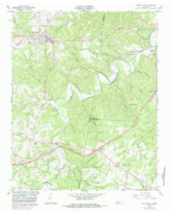
9 topographic sheets cover this place, the earliest surveyed in 1930 and the latest in 1985. It stands in District 1. It lies in ZIP code area 37062. It stands on Ballard Spring Branch. The Survey maps it on the White Bluff quadrangle.
Topographic sheets covering this place
6 surveys from 9 printed sheetsMatched by testing this settlement's coordinate against the published boundary of every sheet in the United States Geological Survey's historical collection. Each opens the scanned sheet at the Survey.
- 1930 USGS White Bluff quadrangle1:62500
- 1933 USGS White Bluff quadrangle1:62500
- 1956 USGS Nashville quadrangle1:250000, 2 printings
- 1959 USGS Nashville quadrangle1:250000
- 1966 USGS White Bluff quadrangle1:24000, 3 printings
- 1985 USGS Dickson quadrangle1:100000





Fires near this place
23 since 1997Regional context, not property-specific evidence. The federal wildfire occurrence database lists 23 fires within 5 miles of New Hope between 1997 and 2019, burning about 151 acres in total. None started naturally. 1 was recorded as arson. Distance is straight-line from the map coordinates, so a fire counted here may appear on a neighbouring settlement's page as well.
| Reported cause | Fires |
|---|---|
| Debris and open burning | 12 |
| Equipment and vehicle use | 7 |
| Missing data/not specified/undetermined | 2 |
| Arson/incendiarism | 1 |
| Smoking | 1 |
The most recent of them, most recent first, with the day each was reported and the service that recorded it.
| Date | Cause | Size | Reported by | Name on the report |
|---|---|---|---|---|
| 19 September 2019 | Equipment and vehicle use | under an acre | Tennessee Division of Forestry | MILE MARKER 177 #2 |
| 18 September 2019 | Equipment and vehicle use | 3.0 acres | Tennessee Division of Forestry | MILE MARKER 177 |
| 28 June 2012 | Equipment and vehicle use | under an acre | Tennessee Division of Forestry | I-40 MM 178 |
| 9 April 2011 | Debris and open burning | 1.0 acres | Tennessee Division of Forestry | PACK FIRE |
| 17 April 2001 | Debris and open burning | 1.0 acres | Tennessee Division of Forestry | not named |
| 17 April 1997 | Arson/incendiarism | 1.0 acres | Tennessee Division of Forestry | not named |
| 9 March 2017 | Debris and open burning | 6.0 acres | Tennessee Division of Forestry | MANGRUM |
| 26 March 2000 | Missing data/not specified/undetermined | under an acre | Tennessee Division of Forestry | not named |
Settlements close enough to share some of these fires:
Storms near this place
16 since 1993Regional context, not property-specific evidence. The National Weather Service names New Hope in 16 storm reports between 1993 and 2025: 7 thunderstorm wind, 3 hail, 3 flash flood, 1 funnel cloud. No death or injury is recorded in these reports. Each account below is quoted exactly as the forecast office filed it, from the NOAA Storm Events Database, and each date opens the federal record of that event.
| When | Event | Place named | Harm | What the report says |
|---|---|---|---|---|
| August 2023 | Thunderstorm Wind | New Hope | $5,000 | Severe thunderstorm winds downed three large oak trees at Interstate 40 and Highway 96. Damages are a rough estimate. |
| February 2019 | Tornado (EF0) | New Hope | $5,000 | This small, brief, and weak EF-0 tornado touched down just north of I-40 in extreme eastern Dickson County about 5.4 miles SSE of White Bluff. The tornado snapped and uprooted numerous trees in all directions as it moved northeast across Highway 96, passing between several homes and businesses and causing no reported damage. Crossing into extreme northwest Williamson County, the tornado moved over County Line Road and continued blowing down trees before lifting about 0.6 miles NNW of the I-40 and Highway 96 interchange. Total path length was 1.4 miles with path width up to 50 yards. The damage path from this tornado was found using a combination of high resolution Google Earth satellite imagery that became available in December 2019, as well as OHX radar data which showed strong rotation and a tornado debris signature. |
| November 2017 | Flood | New Hope | $5,000 | Minor flooding affected parts of northern Williamson County. Street flooding was reported near Scales Elementary School in Brentwood, as well as in Nolensville. The basement of a home was also reportedly flooded north of Fairview. |
| July 2016 | Thunderstorm Wind | New Hope | $2,000 | Two trees down were blown down in Fairview on Horn Tavern Road at Cleveland Drive and Highway 96 at Dice Lampley Road. |
| November 2017 | Thunderstorm Wind | New Hope | $1,000 | A tree was blown down on Crow Cut Road near Fairview. |
| March 2017 | Thunderstorm Wind | New Hope | $1,000 | A 60 foot tall tree was blown down and blocked the road at the intersection of Brush Creek Road and CCC Road. |
| July 2016 | Thunderstorm Wind | New Hope | $1,000 | Tree limbs were blown down on Kingston Road at Highway 96 near Fairview. |
| August 2012 | Thunderstorm Wind | New Hope | $1,000 | A two foot diameter tree was blown down on Horn Tavern Road at Bahne Road. |
| May 1993 | Thunderstorm Wind | New Hope | $500 | A few trees were knocked down. |
| April 2025 | Flash Flood | New Hope | - | Heavy rain across Williamson County resulted in widespread flash flooding, particularly along waterways and across other low-lying areas. In Pegram, flash flooding was reported at Pasquo Road and Natchez Bend Road. Extent of damages is unknown. |
| August 2017 | Flash Flood | New Hope | - | Flash flooding affected much of western Williamson County. Several roads were flooded and closed, including Highway 100 at Glenhaven Drive, Chester Road, Cumberland Drive, Horn Tavern Drive, Sleepy Hollow Road, and Cox Pike in Fairview; Lewisburg Pike in Franklin; and Granny White Pike in Brentwood. |
| May 2016 | Hail | New Hope | - | A #tSpotter Twitter report indicated quarter size hail fell at the I-40 and Highway 96 exit. Numerous other reports of pea to dime size hail were received from Kingston Springs southeast to the north side of Franklin. |
| October 2014 | Flash Flood | New Hope | - | Water covered Horn Tavern Road and Lakewood Club Road in Fairview. |
| March 2012 | Funnel Cloud | New Hope | - | Spotter reported a funnel cloud near Interstate 40 north of Fairview. |
| June 2009 | Hail | New Hope | - | Penny size hail was reported. |
| March 2009 | Hail | New Hope | - | CoCoRAHS Observer reported nickel size hail. |
Nearest settlements
The eight closest, with where each one stands in the county. Distances are straight-line, computed from the Geographic Names Information System coordinates.
| Map | Place | Distance | Sheets |
|---|---|---|---|
| Kenny Brook | 2.0 miles | 16 | |
| Clement Lake Estates | 2.1 miles | 16 | |
| Valley Green Estates | 2.3 miles | 16 | |
| Hallview Meadows | 2.5 miles | 16 | |
| Liberty Hill | 2.8 miles | 16 | |
| Loriland | 2.9 miles | 16 | |
| Lake Road | 2.9 miles | 16 | |
| Fairview | 3.2 miles | 16 |
Provenance
This settlement is recorded in the Geographic Names Information System as feature 1295505. The sheet list is computed by point-in-boundary test against the United States Geological Survey's historical topographic inventory. Both are works of the United States government and carry no copyright under 17 U.S.C. 105.
Wildfire. Short, Karen C. 2022. Spatial wildfire occurrence data for the United States, 1992-2020 [FPA_FOD_20221014]. 6th Edition. Fort Collins, CO: Forest Service Research Data Archive. https://doi.org/10.2737/RDS-2013-0009.6 Collected with United States Government funding and usable without additional permissions or fees.
Storms. NOAA National Centers for Environmental Information, Storm Events Database https://www.ncei.noaa.gov/stormevents/ A work of the United States government, no copyright under 17 U.S.C. 105. Narratives are quoted verbatim from the National Weather Service report and are not edited or summarised.