 Block
Oak Grove, Tennessee
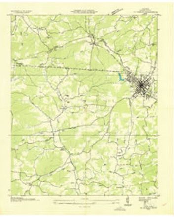
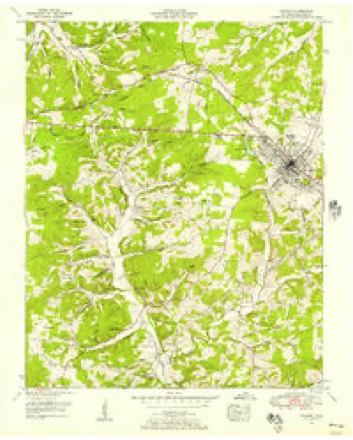
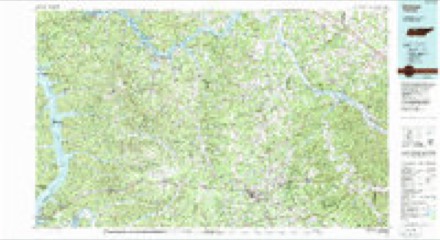
8 topographic sheets cover this place, the earliest surveyed in 1936 and the latest in 1985. It stands in District 2. It lies in ZIP code area 37055. The Survey maps it on the Dickson quadrangle.
Topographic sheets covering this place
5 surveys from 8 printed sheetsMatched by testing this settlement's coordinate against the published boundary of every sheet in the United States Geological Survey's historical collection. Each opens the scanned sheet at the Survey.
- 1936 USGS Dickson quadrangle1:24000
- 1953 USGS Dickson quadrangle1:24000, 3 printings
- 1956 USGS Nashville quadrangle1:250000, 2 printings
- 1959 USGS Nashville quadrangle1:250000
- 1985 USGS Dickson quadrangle1:100000


Fires near this place
85 since 1998Regional context, not property-specific evidence. The federal wildfire occurrence database lists 85 fires within 5 miles of Oak Grove between 1998 and 2020, burning about 259 acres in total. 1 started naturally. 7 were recorded as arson. Distance is straight-line from the map coordinates, so a fire counted here may appear on a neighbouring settlement's page as well.
| Reported cause | Fires |
|---|---|
| Debris and open burning | 39 |
| Equipment and vehicle use | 13 |
| Missing data/not specified/undetermined | 12 |
| Arson/incendiarism | 7 |
| Smoking | 5 |
| Other causes | 3 |
| Misuse of fire by a minor | 2 |
| Power generation/transmission/distribution | 1 |
| Fireworks | 1 |
| Natural | 1 |
| Railroad operations and maintenance | 1 |
The most recent of them, most recent first, with the day each was reported and the service that recorded it.
| Date | Cause | Size | Reported by | Name on the report |
|---|---|---|---|---|
| 9 September 1999 | Equipment and vehicle use | 10 acres | Tennessee Division of Forestry | not named |
| 6 September 1999 | Smoking | 2.2 acres | Tennessee Division of Forestry | not named |
| 30 September 2010 | Debris and open burning | 1.0 acres | Tennessee Division of Forestry | FELTS FIRE |
| 21 September 2010 | Equipment and vehicle use | 4.0 acres | Tennessee Division of Forestry | PLUNDER CREEK RD |
| 18 September 2008 | Missing data/not specified/undetermined | 13 acres | Tennessee Division of Forestry | not named |
| 16 September 1998 | Missing data/not specified/undetermined | under an acre | Tennessee Division of Forestry | not named |
| 16 September 1998 | Missing data/not specified/undetermined | under an acre | Tennessee Division of Forestry | not named |
| 31 August 2008 | Missing data/not specified/undetermined | under an acre | Tennessee Division of Forestry | not named |
Settlements close enough to share some of these fires:
Mines and quarries near this place
3 within 5 milesRegional context, not property-specific evidence. The federal mineral resources record lists 3 workings within 5 miles of Oak Grove: 2 prospects, 1 past producer. None of them still produces. What was taken out: Iron. Distance is straight-line from the map coordinates, so a quarry counted here may appear on a neighbouring settlement's page as well.
| Where | Site | Commodity | Status | Recorded |
|---|---|---|---|---|
| Clifton Prospect | Iron | Prospect | ||
| Harris Prospecat | Iron | Prospect | ||
| Worley Branch Mine | Iron | Past Producer |
Storms near this place
29 since 1997Regional context, not property-specific evidence. The National Weather Service names Oak Grove in 29 storm reports between 1997 and 2026: 11 thunderstorm wind, 8 hail, 7 flash flood, 2 heavy rain. The reports record 3 injuries. Each account below is quoted exactly as the forecast office filed it, from the NOAA Storm Events Database, and each date opens the federal record of that event.
| When | Event | Place named | Harm | What the report says |
|---|---|---|---|---|
| December 2021 | Tornado (EF2) | Oak Grove | 2 hurt, $2,000,000 | This strong EF-2 tornado began in extreme northern Hickman County south of I-40, then tracked northeast across Plunders Creek Road and Brambling Springs Road where it blew down numerous trees. The tornado crossed I-40 near mile marker 166 along Piney Road where it snapped and uprooted dozens of trees on N Mount Sinai Road. The most intense damage occurred on Murrell Drive where multiple homes were heavily damaged or destroyed as they shifted off of their foundations, experienced extensive roof damage, or had exterior walls collapse. In addition to the structural damage, hundreds of trees were snapped or uprooted in the same area. The tornado continued northeast damaging trees on Lena Road, and causing roof damage to homes on Stephen Street and Ridgecrest Drive. The storm crossed Highway 46, damaging the roof and exterior of the Renaissance Center and snapping electric poles along Printwood Drive. It weakened from that point, damaging multiple trees before dissipating just south of downtown Burns. The track of this tornado was extended using high resolution NASA satellite imagery, with a total path length of 10.87 miles. |
| June 2022 | Thunderstorm Wind | Oak Grove | 1 hurt, $5,000 | A tree fell onto the porch of a house in the 600 block of Lucas Road, pinning a women underneath and causing her serious injuries. She was hospitalized for several days. |
| February 2019 | Flash Flood | Oak Grove | $1,330,000 | Dickson County Emergency Management reported major flash flooding affected central and southern portions of Dickson County. Several roads and bridges were washed out including bridges on Coon Creek Road and on Willow Branch Road at Liberty Road near Charlotte. Numerous other roads were flooded and closed including Shady Hollow Road between College Street and Luther Road in Dickson. Vehicles were stranded in flooding in some areas with water rescues conducted, including on Eno Road and on Harris Road near Tennessee City. Total damage from the flash flooding was estimated at $1,329,000. |
| February 2014 | Thunderstorm Wind | Oak Grove | $15,000 | Several trees and large tree limbs were blown down blocking roads across southwest Dickson County, including on CCC Road, Garners Creek Road, Highway 48 two miles north of I-40, and Cowen Road. Some power outages were also reported. |
| April 2011 | Thunderstorm Wind | Oak Grove | $10,000 | Several large trees were downed blocking State Highway 48. |
| April 2011 | Thunderstorm Wind | Oak Grove | $10,000 | Several large trees were downed near Interstate 40 and State Highway 48. |
| January 2020 | Thunderstorm Wind | Oak Grove | $5,000 | An outbuilding was destroyed on Highway 48 South at Grindstone Hollow Road. |
| January 2020 | Thunderstorm Wind | Oak Grove | $5,000 | A well house was crushed by a fallen tree on Moore Hollow Road. |
| January 2013 | Flash Flood | Oak Grove | $5,000 | The west fork of the Piney River had risen out of its banks and into low lying fields a few miles southwest of Dickson. This also caused roads around this area to be closed off as they become impassible due to high water on them. |
| June 2018 | Thunderstorm Wind | Oak Grove | $3,000 | Trees were blown down near Camp Garners Creek on Garners Creek Road. |
| February 2011 | Flash Flood | Oak Grove | $1,000 | Spotter reported flooding over roads connected to State Highway 48 South. A weather related wreck was also reported. Any extent of injuries to the driver or if there were any passengers, and if they received any injuries, was unknown. |
| May 1997 | Thunderstorm Wind | Oak Grove | $1,000 | A few power lines were down at Oak Grove. |
| March 2026 | Hail | Oak Grove | - | Quarter size hail was reported southeast of McEwen. |
| March 2026 | Hail | Oak Grove | - | Estimated ping pong size hail was reported near Dickson. |
| June 2023 | Hail | Oak Grove | - | Photos received via social media showed pea to nickel size hail around the area of Exit 163 along Interstate 40 southwest of Dickson. |
| November 2022 | Hail | Oak Grove | - | A social media user reported quarter size hail on Lucas Drive southwest of Dickson. |
| February 2021 | Flash Flood | Oak Grove | - | Several roads were flooded and closed across Dickson County including Yellow Creek Road at Bishop Slab, South Eno Road, Piney Creek at Double Branch Road, and Gamers Creek at Sam Hollow Road. |
| March 2021 | Flash Flood | Oak Grove | - | Numerous roads were flooded and closed across the county, including I-40 at mile marker 178, South Bear Creek, Hogan Road at Porter Road, Double Branch Road, and Highway 48 N at R Owen Road. |
| August 2021 | Flash Flood | Oak Grove | - | Water covered the roadways at Highway 48 and Brazzell Road. |
| August 2021 | Flash Flood | Oak Grove | - | A home was flooded at Highway 48 South and I-40. |
| April 2020 | Hail | Oak Grove | - | Penny to nickel size hail was reported on East Humphreys County Line Road. |
| February 2019 | Heavy Rain | Oak Grove | - | CoCoRaHS station Dickson 6.3 WSW measured a 24 hour rainfall total of 5.89 inches. |
| March 2017 | Thunderstorm Wind | Oak Grove | - | A trained spotter near the I-40 and Highway 48 intersection estimated winds gusts of 60 to 65 mph and also reported half inch diameter size hail. |
| June 2014 | Thunderstorm Wind | Oak Grove | - | A wind gust estimated near 60 mph was reported in extreme southwest Dickson County near Interstate 40. |
| April 2014 | Hail | Oak Grove | - | Hail up to 1 inch in diameter fell briefly over southwest Dickson County. |
| April 2014 | Hail | Oak Grove | - | Facebook photos from the public showed quarter size hail feel southeast of Tennessee City. |
| January 2012 | Thunderstorm Wind | Oak Grove | - | An estimated 60 mph wind gust was reported by a trained spotter one mile north of mile marker 163 on Interstate 40. |
| March 2010 | Heavy Rain | Oak Grove | - | One to two inches of rain was reported in 30 minutes, with water covering Spindle Road. |
| July 2012 | Hail | Oak Grove | - | no account filed |
Nearest settlements
The eight closest, with where each one stands in the county. Distances are straight-line, computed from the Geographic Names Information System coordinates.
| Map | Place | Distance | Sheets |
|---|---|---|---|
| Hillcrest | 0.5 miles | 8 | |
| Beasley (historical) | 1.9 miles | 8 | |
| Fewville (historical) | 1.9 miles | 8 | |
| Forks of Piney (historical) | 2.0 miles | 8 | |
| Water Valley (historical) | 2.3 miles | 8 | |
| Redden (historical) | 2.6 miles | 16 | |
| Robinsons Chapel | 2.7 miles | 8 | |
| Beech Grove (historical) | 3.2 miles | 8 |
Provenance
This settlement is recorded in the Geographic Names Information System as feature 1296056. The sheet list is computed by point-in-boundary test against the United States Geological Survey's historical topographic inventory. Both are works of the United States government and carry no copyright under 17 U.S.C. 105.
Wildfire. Short, Karen C. 2022. Spatial wildfire occurrence data for the United States, 1992-2020 [FPA_FOD_20221014]. 6th Edition. Fort Collins, CO: Forest Service Research Data Archive. https://doi.org/10.2737/RDS-2013-0009.6 Collected with United States Government funding and usable without additional permissions or fees.
Mines and quarries. USGS Mineral Resources Data System (MRDS) https://mrdata.usgs.gov/mrds/ A work of the United States government, no copyright under 17 U.S.C. 105.
Storms. NOAA National Centers for Environmental Information, Storm Events Database https://www.ncei.noaa.gov/stormevents/ A work of the United States government, no copyright under 17 U.S.C. 105. Narratives are quoted verbatim from the National Weather Service report and are not edited or summarised.