 Block
Rockvale, Tennessee
10 topographic sheets cover this place, the earliest surveyed in 1942 and the latest in 1985. It stands in District 8. It lies in ZIP code area 37153. It lies near Douglas Hollow. The Survey maps it on the Rockvale quadrangle. 1,279 people lived here at the 2020 count. It stands 745 feet above sea level.
On record in Rockvale
Buildings and businesses the archive holds for this place. Each opens its own page, with the source record it came from.
On the National Register 1 record
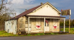 Rockvale Storelisted 1995
Topographic sheets covering this place
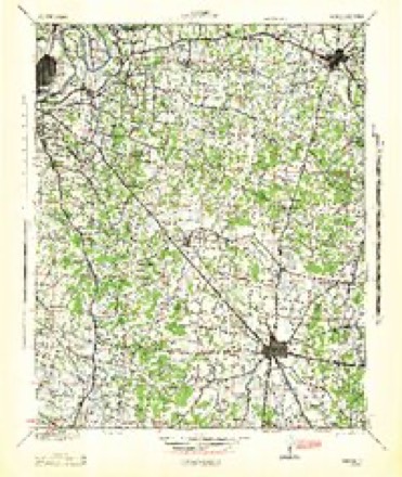
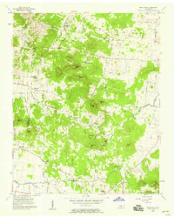
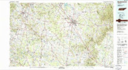
4 surveys from 10 printed sheetsMatched by testing this settlement's coordinate against the published boundary of every sheet in the United States Geological Survey's historical collection. Each opens the scanned sheet at the Survey.
- 1942 USGS Lebanon quadrangle1:100000
- 1956 USGS Columbia quadrangle1:250000, 6 printings
- 1957 USGS Rockvale quadrangle1:24000, 2 printings
- 1985 USGS Murfreesboro quadrangle1:100000

Fires near this place
7 since 1997Regional context, not property-specific evidence. The federal wildfire occurrence database lists 7 fires within 5 miles of Rockvale between 1997 and 2012, burning about 92 acres in total. None started naturally. 3 were recorded as arson. Distance is straight-line from the map coordinates, so a fire counted here may appear on a neighbouring settlement's page as well.
| Reported cause | Fires |
|---|---|
| Arson/incendiarism | 3 |
| Smoking | 2 |
| Equipment and vehicle use | 1 |
| Debris and open burning | 1 |
The most recent of them, most recent first, with the day each was reported and the service that recorded it.
| Date | Cause | Size | Reported by | Name on the report |
|---|---|---|---|---|
| 7 September 1998 | Debris and open burning | 2.0 acres | Tennessee Division of Forestry | not named |
| 3 July 2012 | Smoking | 15 acres | Tennessee Division of Forestry | WINDROW |
| 2 March 2006 | Arson/incendiarism | 27 acres | Tennessee Division of Forestry | not named |
| 22 February 1997 | Equipment and vehicle use | under an acre | Tennessee Division of Forestry | not named |
| 3 November 2005 | Smoking | 27 acres | Tennessee Division of Forestry | not named |
| 31 October 2005 | Arson/incendiarism | 3.8 acres | Tennessee Division of Forestry | not named |
| 8 January 2006 | Arson/incendiarism | 17 acres | Tennessee Division of Forestry | not named |
Settlements close enough to share some of these fires:
Mines and quarries near this place
2 within 5 milesRegional context, not property-specific evidence. The federal mineral resources record lists 2 workings within 5 miles of Rockvale: 1 occurrence, 1 past producer. None of them still produces. What was taken out: Barium-Barite, Fluorine-Fluorite, Lead, Fluorine-Fluorite, Lead, Barium-Barite. Distance is straight-line from the map coordinates, so a quarry counted here may appear on a neighbouring settlement's page as well.
| Where | Site | Commodity | Status | Recorded |
|---|---|---|---|---|
| Arthur Hudson Prospect | Barium-Barite, Fluorine-Fluorite, Lead | Occurrence | 1919 | |
| Arthur Hudson Prospect | Fluorine-Fluorite, Lead, Barium-Barite | Past Producer |
Storms near this place
9 since 1994Regional context, not property-specific evidence. The National Weather Service names Rockvale in 9 storm reports between 1994 and 2022: 6 hail, 1 tornado, 1 thunderstorm wind, 1 flash flood. No death or injury is recorded in these reports. Each account below is quoted exactly as the forecast office filed it, from the NOAA Storm Events Database, and each date opens the federal record of that event.
| When | Event | Place named | Harm | What the report says |
|---|---|---|---|---|
| January 1995 | Tornado (F1) | Rockvale | $50,000 | Two houses, one mobile home, and a barn was destroyed. A barn collapsed on a man who was feeding his calf. Several trees were blown down. |
| March 2017 | Thunderstorm Wind | Rockvale | $3,000 | Several trees were blown down in Rockvale. |
| January 1995 | Hail | Rockvale | $500 | no account filed |
| May 2022 | Hail | Rockvale | - | Quarter size hail was reported by the family of a NWS employee in Rockvale. |
| March 2021 | Flash Flood | Rockvale | - | Several roads were flooded and impassable in southwest Rutherford County, including areas around Rockvale where water rescues were conducted from vehicles, Armstrong Valley near Yeargan Road, and Barfield Road along the Stones River. |
| March 2017 | Hail | Rockvale | - | Photos show quarter size hail fell in Rockvale. |
| August 2011 | Hail | Rockvale | - | no account filed |
| June 1994 | Hail | Rockvale | - | no account filed |
| June 1994 | Hail | Rockvale | - | no account filed |
Nearest settlements
The eight closest, with where each one stands in the county. Distances are straight-line, computed from the Geographic Names Information System coordinates.
| Map | Place | Distance | Sheets |
|---|---|---|---|
| Concord | 1.7 miles | 13 | |
| Versailles | 2.0 miles | 13 | |
| Jackson Ridge | 2.2 miles | 10 | |
| Link | 3.1 miles | 13 | |
| Windrow | 3.1 miles | 10 | |
| Pleasant Hill | 3.6 miles | 10 | |
| Salem | 4.6 miles | 15 | |
| Mount Vernon | 4.6 miles | 13 |
Elsewhere
Matched on this settlement's Geographic Names Information System number rather than its name, so it cannot be a different place of the same name in another state.
| Wikipedia article on Rockvale | An encyclopaedic summary. Its text is share-alike, so it is linked here rather than copied. |
| Wikidata item Q7355617 | The structured record the population and elevation above come from. Public domain (CC0). |
Provenance
This settlement is recorded in the Geographic Names Information System as feature 1299832. The sheet list is computed by point-in-boundary test against the United States Geological Survey's historical topographic inventory. Both are works of the United States government and carry no copyright under 17 U.S.C. 105.
Wildfire. Short, Karen C. 2022. Spatial wildfire occurrence data for the United States, 1992-2020 [FPA_FOD_20221014]. 6th Edition. Fort Collins, CO: Forest Service Research Data Archive. https://doi.org/10.2737/RDS-2013-0009.6 Collected with United States Government funding and usable without additional permissions or fees.
Mines and quarries. USGS Mineral Resources Data System (MRDS) https://mrdata.usgs.gov/mrds/ A work of the United States government, no copyright under 17 U.S.C. 105.
Storms. NOAA National Centers for Environmental Information, Storm Events Database https://www.ncei.noaa.gov/stormevents/ A work of the United States government, no copyright under 17 U.S.C. 105. Narratives are quoted verbatim from the National Weather Service report and are not edited or summarised.