Block
From the record
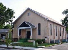
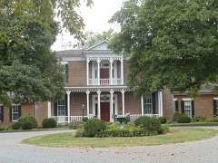
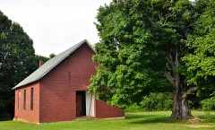
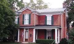
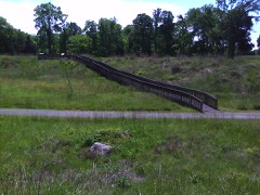
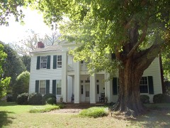
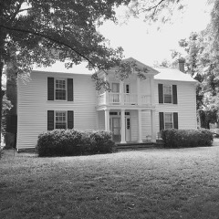
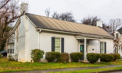
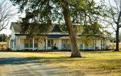
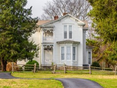
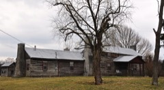
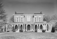
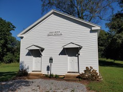
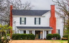
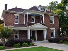
50 National Register listings published here.
Sources: the National Register database, National Park Service
97 topographic sheets cover 226 settlements here, and 50 properties are on the National Register of Historic Places.
50 National Register listings published here.
Sources: the National Register database, National Park Service
Every property in this county listed on the National Register of Historic Places, with the year it was listed and the federal nomination document.
Every wildfire the federal occurrence database records inside this county: 43 of them, burning about 1,193 acres. None started naturally and 8 were recorded as arson. Each settlement page carries the fires within five miles of it.
| Reported cause | Fires |
|---|---|
| Debris and open burning | 15 |
| Missing data/not specified/undetermined | 8 |
| Arson/incendiarism | 8 |
| Smoking | 7 |
| Equipment and vehicle use | 4 |
| Misuse of fire by a minor | 1 |
The five largest, by the area the report gives. One of them was set deliberately.
| Date | Cause | Size | Reported by | Name on the report |
|---|---|---|---|---|
| 16 March 2016 | Missing data/not specified/undetermined | 328 acres | Natchez Trace Parkway | TDEC |
| 10 March 2014 | Missing data/not specified/undetermined | 170 acres | Natchez Trace Parkway | STRI -SW WOODLANDS |
| 23 November 2016 | Equipment and vehicle use | 116 acres | Tennessee Division of Forestry | GUM RD FIRE |
| 10 September 1999 | Debris and open burning | 97 acres | Tennessee Division of Forestry | not named |
| 16 April 2014 | Missing data/not specified/undetermined | 54 acres | Natchez Trace Parkway | STRI-NORTHERN FIELD |
| 11 December 2006 | Equipment and vehicle use | 50 acres | Tennessee Division of Forestry | not named |
| 30 November 1998 | Arson/incendiarism | 44 acres | Tennessee Division of Forestry | not named |
| 28 February 2014 | Debris and open burning | 43 acres | Tennessee Division of Forestry | BRADLEY CREEK |
Every settlement page carries the fires within five miles of it - see the settlement index below.
The NOAA Storm Events Database holds 765 reports for this county, causing 5 deaths, 136 injuries and about $139,868,250 in recorded property damage. Each settlement page carries the reports that name it.
| Kind of event | Reports |
|---|---|
| Thunderstorm Wind | 418 |
| Hail | 194 |
| Flash Flood | 50 |
| Tornado | 47 |
| Flood | 21 |
| Lightning | 18 |
| Funnel Cloud | 11 |
| Heavy Rain | 5 |
| Dust Devil | 1 |
The most serious of them, by death, then injury, then recorded damage. The accounts are quoted exactly as the forecast office filed them.
| When | Event | Place named | Harm | What the report says |
|---|---|---|---|---|
| April 2009 | Tornado (EF4) | Allisona | 2 killed, 58 hurt, $100,000,000 | An EF-4 Tornado...with maximum estimated wind speed around 170 mph, was reached in the Highland Park Drive Neighborhood as well as the|Tomahawk Trace Area. Several well constructed homes were destroyed|in those areas, hardwood trees were debarked, and vehicles were tossed|considerable distances. There were two fatalities, a 30 year old women and her 9 week old daughter, and 58 injuries per newspaper reports, of which at least 7 were serious. Path length was 23.25 miles and maximum width was 750 yards.||Gound surveys of the Murfreesboro tornado indicate that the actual initial touchdown was just north of the Eagleville Community in far|Southwestern Rutherford County. Intermittent tree and roof damage was |noted beginning at a residence near the intersection of Kelly Road and|Highway 41A. Intermittent tree damage continued northeast, with the path becoming continuous along Rocky Grove Road between the Cedar Grove |and Pleasant Hill Communities. The survey team then inspected continuous|damage from Rocky Grove Road northeast to a residence on Newman Road approximately 2 miles north of the Windrow Community. Extensive tree damage was noted along the path...along with multiple instances of roof damage to homes.||The most significant damage was on Patterson Road 1/2 mile west of Windrow. A brick home was completely destroyed and thrown almost|completely off its foundation. ||Additional areas between Stones River Battlefield and Medical Center |Parkway in Murfreesboro were surveyed. Two homes on Wilkinson Pike and two homes on Highland Park Drive were completely destroyed. One of the homes did appear to be properly anchored to it's foundation while three|were not. Per a newspaper report, at Stones River Battlefield, a quarter mile swath of fallen and damaged trees streched one mile across the battlefield, along with numerous fences being destroyed, closing parts of the park to tourists. One particular fallen tree damaged a 60 foot section of the national cemetary wall and a cannon display.||Additional information about the tornado included it tracked due northeast for the first 9 miles then began a steady turn to the right. By the time the tornado lifted it was moving to the east-southeast. Additionally, videos of the tornado indicated a multiple vortex appearance to the tornado and the aerial survey was able to detect focused areas of damage within the larger path.||The aeriel survey revealed 12 to 15 homes which were completely destroyed and dozens others which suffered significant damage. A 2-story office building had the complete upper floor removed.|Numerous large vehicles were picked up and tossed, including|several semi trailers which wound up piled together near the|intersection of Thompson Lane and Broad Street. Significant roof|damage and some wall collapse on homes were also noted.|Several well built homes suffered significant exterior and|interior wall failure. ||Three other areas received significant damage. The first area was along Bushnell Drive just north of Compton Road. A well built 2-storty brick home was almost completely destroyed with just part of the kitchen wall remaining standing. The second area was near the intersection of Haynes Drive and Sulphur Springs Road. Three homes on Cornwall Court were completely destroyed and thrown clear of their slab foundations, however|it did not appear any of the homes was properly anchored.||The third area of enhanced damage was along Battleground Drive between |D`Ann Drive and Tomahawk Trace. The National Weather Service Assessment team was joined by a Murfreesboro Code who assisted with assessing construction quality at this location. Three homes were completely blown clear of their foundations and destroyed. One home was not |anchored/fastened to the foundation, however, the other 2 were very well constructed. Several trees were also debarked at this location.||Additional information provided by the Rutherford County EMA through a newspaper report stated that over 845 homes were damaged, of these 117 were destroyed, 298 had major damage, 175 had minor damage, and another 255 were affected in some way. 519 Structures were also affected, including 77 destroyed, with an additional 300 plus homes and structures impacted in some way just outside of the city limits. Newspaper also reported an overturned truck caused traffic backup on Interstate 24 and multiple power lines down across the entire city.|Power lines being down resulted in as many as 18,000 homes being without power after the storm. ||Newspaper also reported that two people were seriously injured and multiple homes were destroyed when the tornado passed through the Wilkinson Pike/Thompson Lane Areas. Large trees were also uprooted|and utility poles were blown over. Multiple businesses in the Thompson Lane/Broad Street area were significantly damaged, including a Shell convenience store and Huddleston-Steele Engineering.||Newspaper also reported continuous damage, detail of damage not provided, between Esquire Court and Wigan Drive and Tomahawk Trace to Highway 231 and then into the Compton Road area.||Newspaper also reported that Murfreesboro Waste Department had gathered in excess of more the 2.7 million pounds of debris. And that total tonnage associated with the storm gathered at the Rutherford County Landfill was 5,071 tons. |
| November 2018 | Tornado (EF2) | Newtown | 1 killed, 3 hurt, $3,390,000 | The Christiana tornado first touched down in far northern Bedford County southwest of Kimmons Road at Longview Road, damaging an outbuilding and blowing down a few trees. This small but very intense tornado moved northeast and quickly increased in intensity to EF-2 as it approached the Bedford/Rutherford County line, severely damaging two homes on the south side of Kingdom Road/Midland Fosterville Road. The tornado then crossed the road into Rutherford County, where a small but well-built brick home had its roof blown off and brick walls blown in. One wall fell onto the homeowner causing minor injuries. Further to the northeast on Williams Road, one barn was heavily damaged and another completely destroyed. The narrow but strong EF-2 tornado continued northeast, carving a well-defined path through forests before striking a new 3000 square foot home on the west side of Midland Crescent Road. This large house, which was poorly attached to its cinder-block foundation, was lifted almost completely intact, flipped upside down, and rotated 90 degrees as it was blown to the north-northwest. One woman inside the home was killed. Numerous trees continued to be blown down further to the northeast across Jones Road. Upon reaching Rock Springs Midland Road, another home that was built in the 1800s took a direct hit from the tornado, losing its roof and all of the third story. The homeowners inside received the warning and took appropriate shelter on the lowest floor, escaping uninjured. Two silos and a barn just north of the home were de-roofed, and several nearby trees were blown down. Curving more to the east-northeast, two 70 foot-tall silos and two sheet metal barns located northwest of Rock Springs Midland Road at Gray Fox Drive were completely destroyed. Another smaller barn was destroyed and adjacent home received roof damage north of Eagle Creek Road. As the tornado crossed a northward bend in Rock Springs Road, a detached garage was completely destroyed while a home suffered minor roof damage. Further to the east, an outbuilding and mobile home were heavily damaged, with debris being blown up to 200 yards to the east. The tornado continued east-northeast, causing minor exterior damage to a home and damaging the roof of a barn. Approaching Rock Springs Midland Road, the tornado completely destroyed a small home on the south side of the roadway, with debris being blown in a cyclonic curved path 200 yards off to the east. The tornado finally weakened to EF-1 as it crossed Rock Springs Midland Road yet again, overturning an old, small mobile home on the north side of the road just west of Highway 231. Two women inside the mobile home were injured. The tornado weakened further as it continued east of Highway 231 where part of the roof of a barn was blown off and several trees were blown down. A few more trees and outbuildings were damaged along Highway 269 and Christiana Lowe Road before the tornado lifted just east of Woodfin Road. The total path length for this tornado in both Bedford and Rutherford Counties was 10.49 miles. The end point and path of this tornado was extended by 2 miles further eastward in May 2020 due to newly available high resolution satellite imagery. |
| May 2016 | Thunderstorm Wind | Milton | 1 killed, $4,000 | Rutherford County EMA reported a 64 year old male riding an ATV was killed on his property in the 7000 block of Ruel McKnight Road by a tree blown down on top of him. Tree was reportedly old and rotten with no other tree damage in the area. EMA estimated winds around 45 mph. |
| April 2001 | Lightning | Smyrna | 1 killed | A 25 year old man was killed after a tree struck by lightning split in two and fell on him. He was going to bring inside his rooomate's dog. The dog was killed, also. |
| April 2002 | Tornado (F3) | Murfreesboro | 31 hurt, $2,300,000 | 31 people were injured. Most of them were treated and released from the hospital. 6 people had to be hospitalized, and one person was seriously injured and had to be Life-Flighted to Vanderbilt hospital. 7 mobile homes were destroyed, and one mobile home had major damage and another mobile home had minor damage. 5 residences were destroyed, 10 residences had major damage and 36 residences had minor damage. 2 horse banrs were destroyed, and 6 horses/and or cattle were killed. The tornado touched down on W. Gum Road, just west of I-24. Interstate 24 was littered with tree limbs and debris at one point. The tornado lifted up around Mankin-McKnight Rd. This storm complex moved into Cannon county and produced another tornado near Bradyville.Damage assessment in Rutherford county by the Emergency Management Agency was placed at 2.3 million dollars. |
| January 1997 | Tornado (F4) | Murfreesboro | 18 hurt, $4,700,000 | This was one of those extraordinary cases where the National Weather Service had a 41 minute lead time on a tornado warning . The F4 tornado struck the Southridge Subdivision, near Barfield, TN, at 503 PM. The tornado caused 18 injuries and 4.7 million dollars in property damages. One person had to be hospitalized overnight. The last time an F4 tornado struck Middle Tennessee was on May 18, 1995. The path length of the tornado was 6.5 miles with its intensity reaching F4 and its maximum width of 300 yards.44 homes were destroyed and 47 other homes were damaged in the Barfield area. There was also damage to a Middle School, Food Lion Supermarket and to the Chalet Apartments.The tornado first touched down on Yeargan Road, about 6 miles southwest of Murfreesboro, with an intensity of F1 and path width of 100 yards. At this location, a sheet metal roof was peeled back off a barn and a couple of trees were broken off. Also close by, a trailer was lifted off its foundation and overturned. Several trees were uprooted in the area. The tornado proceeded northeast and increased to F2 intensity with a width of 300 yards. As it struck the community of Barfield, an entire roof was lifted off a house, several homes were partially destroyed, and a barn was totally destroyed. The tornado crossed the West Fork of the Stones River and struck the Southridge Subdivision. At this time the tornado increased to a maximum intensity of F4 with its width remaining at 300 yards. About half a dozen homes were totally destroyed. The tornado then struck a large apartment complex just west of U.S. Hwy 231 on the south side of Murfreesboro. The tornado produced some structural damage and extensive roof damage as it weakened to F1 intensity and its width decreased to 150 yards. The tornado then crossed U.S. Hwy 231 and the Indian Wells Golf Course. Large trees were uprooted and structural damage occurred to several businesses as it approached I-24. The tornado continued moving to the northeast across I-24 snapping and uprooting trees as it narrowed to 50 yards wide. On the southeast side of Murfreesboro near the intersection of Elam Road and U.S. Hwy 41, and near Brandyville Road and East Rutherford Boulevard, the tornado uprooted numerous trees and damaged the roofs of several homes. It was at this point the track of the tornado ended as it lifted back into the clouds. Newspaper accounts told stories of people going to a basement, or an interior room of a house such as a bathroom or closet for safety. The low casualties from this tornado indicated all the preparedness activities of the National Weather Service for many years certainly paid off. |
| May 1995 | Tornado (F0) | Eagleville to | 4 hurt, $50,000 | The tornado first touched down in Eagleville where it ripped the roof off of one house and produced minor damage to a second house. The tornado skipped along and damaged three homes and one business in Rockvale. One person was injured in Eagleville and three other were injured in Rockvale. |
| May 1999 | Thunderstorm Wind | South Portion | 3 hurt, $5,000 | Mobile home damaged by strong thunderstorm winds. |
| March 1980 | Tornado (F2) | not stated | 2 hurt, $250,000 | no account filed |
| February 1976 | Tornado (F1) | not stated | 2 hurt, $250,000 | no account filed |
| February 1997 | Lightning | Murfreesboro | 2 hurt, $100,000 | no account filed |
| September 1997 | Dust Devil | La Vergne | 2 hurt, $1,000 | A dust devil struck the city park. Old Timers Day was being celebrated at the park. The winds blew over 3 tents. A rope attached to a tent struck a woman in the face. A woman vendor fell during the hubbub, and she hurt her knees. These 2 people were taken to a hospital, treated and then released. |
| April 1991 | Thunderstorm Wind | not stated | 2 hurt | no account filed |
| July 2004 | Thunderstorm Wind | Smyrna | 1 hurt, $50,000 | Winds were estimated to be around 80 mph. Two mobile homes were destroyed on a Sam Davis Road trailer park in Smyrna and another mobile home was damaged. The most severe damage reported was at Fairway Mobile Home Park, 500 Sam Davis Rd. A willow tree fell and crashed on a trailer. Another tree fell on a mobile home and on a car at Fairway Trailer Park in Smyrna. There was one injury. One woman left Fairway in an ambulance with a knee injury. |
| March 2017 | Thunderstorm Wind | Sandhill | 1 hurt, $30,000 | A large downburst associated with the rear flank downdraft of the Cool Springs and Four Corners Marina tornadoes caused damage across a wide swath of northeast Williamson, far southeast Davidson, and far northwest Rutherford Counties. In Williamson County, dozens of trees were snapped and uprooted from the Concord Pass area across Waller Road, Forest Trail, and Nolensville Pike, with minor roof and siding damage to numerous homes and a few trees falling on outbuildings and houses. One duplex on Nolensville Pike was heavily damaged by multiple trees falling onto it. ||In Davidson County, trees and power poles were blown down on Pettus Road, and several other trees were snapped and uprooted on Burkitt Road and near Cane Ridge Park. TDOT reported trees down at 13390 Old Hickory Blvd. Several tall power poles were blown down on Nashville Highway near Hickory Woods Drive, and scattered trees were snapped or uprooted in the Hickory Woods Estates and Peppertree Forest subdivisions. ||In Rutherford County, a large truck parked at 1325 Heil Quaker Road in La Vergne was blown over, injuring a man inside who was transported to the hospital. Scattered trees were also snapped and uprooted across the Lake Forest subdivision, where one house was severely damaged by a fallen tree on Frontier Lane. Several more homes suffered roof and siding damage on Cedar Bend Lane, Angel Way Court, and Hollandale Road. Winds in this 12 mile long by 2 mile wide downburst were estimated around 80 mph. |
| May 2004 | Lightning | Blackman | 1 hurt, $20,000 | Lightning struck a duplex at 2823 Blackman Road causing the roof and rear portion of the duplex to be engulfed in flames and smoke. A resident on the other side of the duplex had to be treated for smoke inhalation. |
| August 2016 | Thunderstorm Wind | Overall | 1 hurt, $10,000 | Based on TV news and social media reports, a microburst affected areas of west Murfreesboro from Kingwood Lane to Old Fort Parkway. A security camera video showed one tree falling onto a girl on Kingwood Lane and pinning her arm beneath it, but she was rescued by a police deputy and only had minor cuts and bruises. Other trees were blown down on Kingwood Lane as well as on Cason Lane. A shed was flipped over and destroyed at the Lowes on Old Fort Parkway. Winds were estimated between 50 and 60 mph. |
| May 2009 | Thunderstorm Wind | Murfreesboro | 1 hurt, $10,000 | The pavilion at the New Vision Baptist Church was blown down resulting in one minor injury. Newspaper also reported that about 50 Middle Tennessee Electric Membership Corporation customers lose power temporarily. |
| May 1998 | Thunderstorm Wind | Smyrna Arpt | 1 hurt, $500 | Windows were blown out of a houseboat on Percy Priest Lake, under the Hobson Pike Bridge. There was one minor injury from the flying glass. |
| April 2006 | Hail | Murfreesboro | 1 hurt | no account filed |
| July 1990 | Thunderstorm Wind | not stated | 1 hurt | no account filed |
| July 1987 | Thunderstorm Wind | not stated | 1 hurt | no account filed |
| October 2011 | Hail | Rucker | $5,000,000 | Hail ranging from quarter up to baseball size fell across a wide area from Barfield northward through central Murfreesboro and across the Murfreesboro Municipal Airport. Some hailstones were measured up to baseball size in Barfield, but most of the hail was quarter to golfball size from Murfreesboro northward to east of Walterhill. Hail also reportedly covered the ground in Murfreesboro. Thousands of cars were damaged by the hail, along with hundreds of homes and businesses, resulting in millions of dollars in damage. Up to two dozen planes at the Murfreesboro Municipal Airport were also battered by the hail resulting in $500,000 damage, including holes punctured in the wings of some planes. This was the worst known October hail storm in the history of Rutherford County. |
| March 2009 | Tornado (EF1) | Murfreesboro | $4,410,000 | The tornado touchdown near Scott Street and caused some damage to businesses there, and continued across broad street where it caused significant damage to shops in the Jackson Heights Mall, especially a bank and a movie theater, were several people experienced minor injuries. Several vechiles in the parking lot were also damaged. The tornado also caused major damage to the Boys and Girls Club located on Jones Boulevard. Numerous trees and power lines along with minor structural damage was observed to homes north of Lokey Avenue, and there was some structural damage to businesses on Memorial Boulevard near Clark Boulevard. Maximum winds were estimated at 90 mph. |
| May 2010 | Flood | La Vergne | $3,500,000 | Bridge on One Mile Lane that crosses Stewart Creek was reported to be underwater. Also, numerous homes, numerous businesses, numerous non comercial buildings, along with several county, state, and federal roads across the county received damage due to the flood. |
| May 2003 | Tornado (F3) | Walterhill | $1,800,000 | At least 18 homes were destroyed and dozens more were damaged from the tornado. There was considerable damage at the Roanoke Subdivision. The old Bethel Missionary Baptist Church, located on Holly Grove Road which is just northeast of Walter Hill, will have to be torn down because of the tornado damage. The church has been at that location for more than 100 years. |
| June 1998 | Tornado (F1) | Smyrna | $1,600,000 | 2 buildings were destroyed by the tornado. The tornado destroyed Grand Slam USA, which was a metal building with an indoor sports facility. Metal beams were ripped up and slammed back down onto the back of the facility. Grand Slam USA was located on Stroop Lane. The tornado also blew out the wall of another business in the area. |
| May 2020 | Thunderstorm Wind | Murfreesboro | $1,010,000 | Numerous trees and power lines were blown down across Rutherford County with widespread power outages. |
| April 2023 | Tornado (EF1) | Eagleville Arpt | $1,000,000 | This narrative continues and concludes a tornado that began in Marshall County before traveling into Rutherford County and then extreme northwest Bedford County. This tornado then reentered Rutherford County where several trees were blown down on Highway 41A. More trees were knocked down and a few homes were damaged along Bunker Hill Road and Hant Hollow Road before the tornado lifted south of Versailles Road. Damages are estimated for Rutherford County. |
| July 2024 | Tornado (EF0) | Murfreesboro | $750,000 | A small, weak EF-0 tornado moved through Murfreesboro, also impacting Middle Tennessee State University. Main damage was large tree branches down with some trees uprooted. Minor structural damage was noted at the stadium, including some siding material off of one of the buildings and some gate and fencing damage. The tornado began just east of Memorial Boulevard, continued east-southeast towards Middle Tennessee State University, and ended southeast of campus on Copper Hollow Drive. Maximum winds were estimated to be 75 mph. Damages are a rough estimate. |
| July 2024 | Thunderstorm Wind | Murfreesboro | $750,000 | A swath of intense damaging winds up to 80 mph occurred across central Murfreesboro from around the Stones River to downtown. Damage consisted of many trees down or uprooted, many branches snapped off, and some structural damage, primarily due to trees or branches falling. There was some minor roof damage to a few buildings, including metal peeled up at a business and some shingles lost on a few houses. Damages are a rough estimate. |
| March 2025 | Tornado (EF1) | Newtown | $500,000 | This narrative continues the EF-1 tornado that began in far northwest Bedford County. Once the tornado moved into far southwest Rutherford County, trees were downed on Threet Road as well as a few outbuildings damaged. More tree damage was observed as the tornado approached Williams Road. The tornado crossed Midland Road and finally lifted near Jones Road before reaching Highway 231. Damages are a rough estimate. |
| April 2001 | Thunderstorm Wind | Murfreesboro | $500,000 | High winds toppled the steel radio tower for WGNS-AM radio station. The tower was built in 1946 and was 328 feet tall. The tower was Murfreesboro tallest structure. Damage to the tower was estimated between $250K to $500K. |
| January 1997 | Tornado (F2) | Smyrna | $500,000 | no account filed |
| January 2013 | Tornado (EF1) | Allisona | $450,000 | A tornado moved out of Williamson County into Rutherford County and strengthened to EF1 intensity as it crossed Horton Highway around 3 miles west of Eagleville. Two farm buildings were heavily damaged on the east side of Horton Highway and a couple of homes received minor roof damage on Allisona road. The most significant damage occurred less than one mile north of Eagleville along North Main Street, Elm Street, and Oak Street where several homes received roof and siding damage. At least four barns were damaged between Oak Street and Swamp Road before the tornado lifted east of swamp road. Dozens of trees were snapped or uprooted along the path with some falling on homes. |
| April 2023 | Tornado (EF2) | Rucker | $250,000 | A strong EF2 tornado with estimated peak winds of 130 mph touched down six miles south of downtown Murfreesboro near County Farm Road then moved northeast along Elam Road where several trees and fences were blown down and a few homes suffered minor damage. Trees continued to be blown down as the tornado crossed Lyle Creek Road, Bradyville Pike, Floraton Road, and McElory Road. The tornado strengthened to EF1 as it cross Highway 70 west of Woodbury Pike, significantly damaging one home and several nearby outbuildings. Damages are estimated for Rutherford County. |
| June 2023 | Thunderstorm Wind | Smyrna Arpt | $250,000 | Severe thunderstorm winds overturned an unoccuped small aircraft at Smyrna Airport. No injuries were reported. Damages are a rough estimate. |
| July 2023 | Thunderstorm Wind | Smyrna Arpt | $250,000 | Severe thunderstorm winds overturned an unoccupied small aircraft at the Smyrna Airport. Damages are a rough estimate. |
| January 2012 | Tornado (EF0) | J Percy Priest Res S | $250,000 | Initial damage was noted at the Lamar Hill Access Area to Percy Priest Lake where dozens of mainly cedar trees were snapped or uprooted. The top of one cedar tree was broken off and thrown northwest into the lake. A nearly continuous 1.69 mile damage path was then noted heading to the east northeast. The most significant damage was along North Lamar Road near Victory Road. Several homes suffered moderate roof damage, a camper was blown on its side, and dozens more trees were snapped or uprooted. The last evidence of damage was near the intersection of North Lamar Road and Lamar Hill Road where a couple trees were snapped. |
| April 2011 | Tornado (EF1) | La Vergne | $250,000 | The EF1 tornado began along the Davidson and Williamson County line, along Kidd Road. The damage path extended east across Battle Road, Waldron Road, along Blair Road, and ending near Interstate 24 and Sam Ridley Parkway. The damage path ranged from 50 to 100 yards wide. Damage was very consistent along the path, which was just over 4 miles long. ||The debris pattern showed clear convergent patterns, and eyewitness accounts support the determination that a tornado caused the damage. Numerous power poles were snapped. Hundreds of trees were snapped or uprooted. Some of these had large root systems. Some small storage buildings were destroyed. Numerous homes had roof|and siding damage. Several fences were blown down. Debris was scattered hundreds of yards. A tractor trailer was blown over on Interstate 24. Several cargo trailers were overturned on Interstate 24 also. |
| September 2009 | Flood | Christiana | $250,000 | Water was over the roads and flooding of at least 50 homes in Christiana area was reported. Type of water damage to homes was unknown. Newspaper also reported that eighteen families had to be evacuated in the county because of the persistent rain that had cows wading in the water almost up to their neck. Boats and trackers were used to rescue people stranded in their homes. No one was reported hurt. Newspaper also reported that Christiana Elementary School's gym was being used as a shelter for those being evacuated. CoCoRaHS reports from this area showed up to 6 inches of rainfall having occurred. In the Christiana community, waters reportedly rose to more than 8 feet deep at one point. Cars, sheds, and homes across certain parts of the Christiana area were submerged. The Stones River swelled to a larger size than one local resident said she has seen in her entire 50 years of living in Rutherford County. 23 roads were closed across the county. A few miles away|from Long Creek on Christiana-Hover's Gap Road, a local farmer had 60 hay bales|moved to this location. These hay bales were picked up by moving flood waters|and crashed through a high tensile fence held up by steel pools. These bales had|to be moved back to Hover's Gap Road by six individuals. Each of these bales weighed 1,200 pounds apiece when they are dry, retail for $80 each, with a lot of them getting water logged. Several pieces of farm equipment were also damaged by rising waters, which will require at least mechanical work. A nearby farm reportedly lost 400 chickens to the flood. This report could not be confirmed. A car was swept away by rising waters on Elam Road near Christiana. The driver was not injured. The fast moving flood waters receded across the area by late Thursday afternoon. |
| February 1976 | Tornado (F1) | not stated | $250,000 | no account filed |
| April 2023 | Tornado (EF1) | Greenwood | $200,000 | The continues the narrative for a tornado than began in Marshall County. After leaving Marshall County, the tornado continued into Rutherford County where it crossed Chapel Hill Pike and Rigsby Road where roofing damage and uprooted trees were discovered. This tornado then briefly crosses into Bedford County. |
| June 2019 | Lightning | Rock Spgs | $200,000 | A home on Bantry Drive in Smyrna was struck by lightning and caught on fire, with most of the home destroyed. |
| November 2018 | Lightning | Christiana | $200,000 | Lightning struck a house on Barley Drive causing a large fire in the attic and severe damage to the home. |
| December 2013 | Thunderstorm Wind | Sewart Afb | $200,000 | Smyrna Airport Emergency Manager reported one Jetstream airplane was blown over on top of another airplane. |
| April 2002 | Lightning | Smyrna | $175,000 | The home of Police Sgt. Scott Byers was struck by lightning. The lightning struck the electrical box and then quickly spread to his home on Ella Dr. The house was completely destroyed by fire. |
| May 1996 | Lightning | Blackman | $170,000 | no account filed |
| February 2009 | Thunderstorm Wind | La Vergne | $150,000 | Several commercial buildings had major roof damage. |
| June 2009 | Thunderstorm Wind | Rucker | $120,000 | A tree with a diamater of 38 to 40 inches was uprooted with the tree falling and causing major damage to the central portion of the home. Four to five trees were also downed within 500ft path of visible damage. Insurance company estimates damage|at $120,000. Damage was located in Oak Meadows Subdivision. |
| May 2024 | Lightning | Barfield | $100,000 | The attic of a home along Tin Cup Drive in Murfreesboro caught fire after lightning struck the home. Firefighters arrived and were able to quickly extinguish the flames before it spread further. No injuries were reported. Damages are a rough estimate. |
| May 2024 | Thunderstorm Wind | Pleasant Hill | $100,000 | Straight line winds impacted the Eagleville area in southwest Rutherford County on Wednesday evening. A NWS storm survey team determined that peak winds up to 90 mph downed several trees and large tree limbs, especially on Highway 99, Taylor Road, and Jackson Ridge Road. Several homes and outbuildings also suffered roof damage. Some of the worst damage was at Lucky Ladd Farms where about 50 trees were snapped. Damages are a rough estimate. |
| May 2024 | Tornado (EF0) | Newtown | $100,000 | An EF-0 tornado touched down near the intersection of Threet Road and New Zion Road. The tornado moved east along New Zion Road, snapping large branches off from hardwood trees. Trees were uprooted in all directions near the intersection of Midland Road and Jones Road. The tornado continued east along Jones Road, snapping large limbs and uprooting a few trees before the tornado transitioned to straight line winds near the Gray Fox neighborhood. Damages are a rough estimate. |
| May 2024 | Thunderstorm Wind | Mt Vernon | $100,000 | Straight line winds impacted the Eagleville area in southwest Rutherford County on Wednesday evening. A NWS storm survey team determined that peak winds up to 90 mph downed several trees and large tree limbs, especially on Highway 99, Taylor Road, and Jackson Ridge Road. Several homes and outbuildings also suffered roof damage. Some of the worst damage was at Lucky Ladd Farms where about 50 trees were snapped. Damages are a rough estimate. |
| May 2024 | Thunderstorm Wind | Pleasant Hill | $100,000 | Straight line winds impacted the Eagleville area in southwest Rutherford County on Wednesday evening. A NWS storm survey team determined that peak winds up to 90 mph downed several trees and large tree limbs, especially on Highway 99, Taylor Road, and Jackson Ridge Road. Several homes and outbuildings also suffered roof damage. Some of the worst damage was at Lucky Ladd Farms where about 50 trees were snapped. Damages are a rough estimate. |
| May 2024 | Thunderstorm Wind | Mt Vernon | $100,000 | Straight line winds impacted the Eagleville area in southwest Rutherford County on Wednesday evening. A NWS storm survey team determined that peak winds up to 90 mph downed several trees and large tree limbs, especially on Highway 99, Taylor Road, and Jackson Ridge Road. Several homes and outbuildings also suffered roof damage. Some of the worst damage was at Lucky Ladd Farms where about 50 trees were snapped. Damages are a rough estimate. |
| April 2013 | Flash Flood | Rocky Fork | $100,000 | Moderate rainfall of 1 to 2 inches during the morning of April 27 was followed by heavy thunderstorms that produced an additional 2 to 4 inches of rainfall during the evening and into the early morning hours on April 28. The result was widespread flash flooding of roadways and some homes across Rutherford County. Two homes were flooded and evacuated on Old Nashville Highway at Jefferson Pike in LaVergne, and more homes were flooded and evacuated on Rocky Ford Road at Rocky Fork Almaville Road in Almaville. Roadways were also flooded requiring the evacuation of homes near the I-24 and Highway 840 interchange in Murfreesboro, including Hardwood Drive, Nandina Court, and Camborne Circle. |
| April 1996 | Thunderstorm Wind | Smyrna | $100,000 | no account filed |
| March 2017 | Thunderstorm Wind | Crescent | $75,000 | A NWS storm survey found a severe 1.5 mile long by 1 mile wide microburst caused significant wind damage along Highway 231 in Christiana. A few homes west of Highway 231 north of Stones River Road suffered minor roof damage and some trees were blown down. More significant wind damage occurred along Highway 231, where a large portion of the roof was blown off the Christiana Elementary School, two homes suffered roof damage, and part of the metal roof was blown off a barn. Minor roof damage occurred to more homes east of Highway 231 along Parsons Road and Steeplechase Road and several more trees were blown down. Winds were estimated from 60 to 80 mph. |
| April 2011 | Thunderstorm Wind | Murfreesboro | $75,000 | Over one hundred trees were downed near Trotter Lane in Murfreesboro. Roads in this area were also partially blocked. Some roof damage to homes and several outbuildings were even destroyed. |
The Survey's mineral resources record lists 16 workings inside this county. 9 still produce and 7 are closed or unrecorded. Each settlement page carries the workings within five miles of it.
| Commodity | Workings |
|---|---|
| Stone, Crushed/Broken | 6 |
| Stone, Crushed/Broken, Limestone, General | 2 |
| Zinc | 2 |
| Limestone, General, Stone, Crushed/Broken | 1 |
| Barium-Barite, Fluorine-Fluorite, Lead | 1 |
| Fluorine-Fluorite, Barium-Barite, Lead, Zinc | 1 |
| Limestone, High Calcium | 1 |
| Fluorine-Fluorite | 1 |
| Lead, Barium-Barite | 1 |
| Zinc, Lead, Fluorine-Fluorite, Barium-Barite | 1 |
The least common of them first, because a county's hundredth gravel pit says nothing its first ten did not.
| Where | Site | Commodity | Status | Recorded |
|---|---|---|---|---|
| Arthur Hudson Prospect | Barium-Barite, Fluorine-Fluorite, Lead | Occurrence | 1919 | |
| Arthur Hudson Prospect | Fluorine-Fluorite, Lead, Barium-Barite | Past Producer | ||
| Bell-Orren | Zinc, Lead, Fluorine-Fluorite, Barium-Barite | Prospect | ||
| Bell-Orren Prospect | Fluorine-Fluorite, Barium-Barite, Lead, Zinc | Occurrence | 1900 | |
| Murfreesboro Quarry | Limestone, General, Stone, Crushed/Broken | Producer | Limestone | |
| Rutherford County Highway Department Quarry | Limestone, High Calcium | Producer | Limestone | |
| Deep Well-Sphalerite Occurrence | Zinc | Occurrence | Sphalerite | |
| Deep Well-Sphalerite Occurrence | Zinc | Occurrence | ||
| Hoover Gap Plant | Stone, Crushed/Broken, Limestone, General | Producer | Limestone | |
| The Stone Man Quarry | Stone, Crushed/Broken, Limestone, General | Producer | Limestone | |
| Hoover Gap Plant | Stone, Crushed/Broken | Producer | ||
| Murfreesboro Plant | Stone, Crushed/Broken | Past Producer | Limestone | |
| Murfreesboro Quarry | Stone, Crushed/Broken | Producer | ||
| Murfreesboro Quarry | Stone, Crushed/Broken | Producer | ||
| Rutherford Co. Highway Dept. Quarry | Stone, Crushed/Broken | Producer | ||
| Young's Mill | Stone, Crushed/Broken | Plant |
Named settlements recorded in the Geographic Names Information System, each with the topographic sheets covering it. Villages, hamlets and abandoned places alike. Each is shown with the nearest named watercourse or landform and the survey quadrangle it falls on.
District 7 · 37128 · Near Barfield Knobs · Murfreesboro quadrangle
15 sheets, 1916 to 1985
District 16 · 37129 · On Lytle Creek · Murfreesboro quadrangle
15 sheets, 1916 to 1985
District 6 · 37127 · On Big Springs Creek · Webbs Jungle quadrangle
14 sheets, 1936 to 1985
District 14 · 37129 · On Sinking Creek · Walterhill quadrangle
16 sheets, 1916 to 1998
District 19 · 37128 · On Puckett Creek · Murfreesboro quadrangle
15 sheets, 1916 to 1985
District 3 · 37129 · On Overall Creek · Walterhill quadrangle
16 sheets, 1916 to 1998
District 14 · 37129 · On Wades Branch · Walterhill quadrangle
16 sheets, 1916 to 1998
District 6 · 37127 · On Christmas Creek · Fosterville quadrangle
13 sheets, 1936 to 1985
District 3 · 37129 · On Overall Creek · Walterhill quadrangle
16 sheets, 1916 to 1998
District 2 · 37130 · On Bushman Creek · Lascassas quadrangle
13 sheets, 1916 to 1985
District 14 · 37129 · On Puckett Creek · Walterhill quadrangle
16 sheets, 1916 to 1998
District 7 · 37128 · On Middle Fork Stones River · Murfreesboro quadrangle
15 sheets, 1916 to 1985
District 7 · 37128 · On Middle Fork Stones River · Murfreesboro quadrangle
15 sheets, 1916 to 1985
District 4 · 37149 · Near Jacob Hollow · Beechgrove quadrangle
15 sheets, 1913 to 1985
District 4 · 37127 · On Double Springs Branch · Dillton quadrangle
13 sheets, 1916 to 1985
District 6 · 37037 · On Christmas Creek · Fosterville quadrangle
13 sheets, 1936 to 1985
District 15 · 37130 · On Bear Branch · Lascassas quadrangle
13 sheets, 1916 to 1985
District 4 · 37130 · On Bushman Creek · Lascassas quadrangle
13 sheets, 1916 to 1985
District 6 · 37020 · Near Soapstone Hill · Fosterville quadrangle
13 sheets, 1936 to 1985
District 20 · 37128 · On Puckett Creek · Murfreesboro quadrangle
15 sheets, 1916 to 1985
District 17 · 37130 · On Double Springs Branch · Dillton quadrangle
13 sheets, 1916 to 1985
District 3 · 37129 · On Overall Creek · Walterhill quadrangle
16 sheets, 1916 to 1998
District 3 · 37167 · On East Fork Stones River · Gladeville quadrangle
10 sheets, 1942 to 1984
District 3 · 37129 · On East Fork Stones River · Walterhill quadrangle
16 sheets, 1916 to 1998
District 2 · 37129 · On Wades Branch · Walterhill quadrangle
16 sheets, 1916 to 1998
District 14 · 37129 · On Sinking Creek · Walterhill quadrangle
16 sheets, 1916 to 1998
District 5 · 37086 · On Rock Spring Branch · La Vergne quadrangle
18 sheets, 1903 to 1997
District 3 · 37167 · On East Fork Stones River · Gladeville quadrangle
10 sheets, 1942 to 1984
District 2 · 37130 · Near Church Knob · Lascassas quadrangle
13 sheets, 1916 to 1985
District 7 · 37128 · On Middle Fork Stones River · Murfreesboro quadrangle
15 sheets, 1916 to 1985
District 8 · 37128 · Near Barfield Knobs · Murfreesboro quadrangle
15 sheets, 1916 to 1985
District 14 · 37129 · On Puckett Creek · Walterhill quadrangle
16 sheets, 1916 to 1998
District 4 · 37127 · On McElroy Branch · Dillton quadrangle
13 sheets, 1916 to 1985
District 5 · 37086 · On East Branch Hurricane Creek · La Vergne quadrangle
18 sheets, 1903 to 1997
District 12 · 37167 · On East Fork Stones River · Walterhill quadrangle
16 sheets, 1916 to 1998
District 2 · 37085 · On Jarman Branch · Lascassas quadrangle
13 sheets, 1916 to 1985
District 17 · 37130 · On Double Springs Branch · Dillton quadrangle
13 sheets, 1916 to 1985
District 4 · 37130 · On Double Springs Branch · Dillton quadrangle
13 sheets, 1916 to 1985
District 14 · 37129 · On Sinking Creek · Walterhill quadrangle
16 sheets, 1916 to 1998
District 10 · 37167 · On Rock Spring Branch · Smyrna quadrangle
13 sheets, 1942 to 1998
District 21 · 37127 · On Lees Spring Branch · Dillton quadrangle
13 sheets, 1916 to 1985
District 14 · 37129 · On Puckett Creek · Murfreesboro quadrangle
15 sheets, 1916 to 1985
District 1 · 37086 · On Finch Branch · La Vergne quadrangle
18 sheets, 1903 to 1997
District 14 · 37129 · On Lytle Creek · Murfreesboro quadrangle
15 sheets, 1916 to 1985
No longer a settlement
District 6 · 37037 · On Dry Creek · Webbs Jungle quadrangle
14 sheets, 1936 to 1985
No longer a settlement
District 18 · 37127 · Near Marshall Knobs · Murfreesboro quadrangle
15 sheets, 1916 to 1985
District 14 · 37129 · On Sinking Creek · Walterhill quadrangle
16 sheets, 1916 to 1998
District 2 · 37085 · Near Casons Knobs · Lascassas quadrangle
13 sheets, 1916 to 1985
No longer a settlement
District 6 · 37037 · Near Nebo Knobs · Fosterville quadrangle
13 sheets, 1936 to 1985
No longer a settlement
District 6 · 37037 · On Short Creek · Webbs Jungle quadrangle
14 sheets, 1936 to 1985
No longer a settlement
District 7 · 37128 · Near Marshall Knobs · Murfreesboro quadrangle
15 sheets, 1916 to 1985
District 4 · 37130 · On Double Springs Branch · Dillton quadrangle
13 sheets, 1916 to 1985
District 7 · 37128 · Near Barfield Knobs · Murfreesboro quadrangle
15 sheets, 1916 to 1985
District 13 · 37128 · On Puckett Creek · Murfreesboro quadrangle
15 sheets, 1916 to 1985
District 3 · 37167 · On Olive Branch · Walterhill quadrangle
16 sheets, 1916 to 1998
District 1 · 37086 · On Finch Branch · La Vergne quadrangle
18 sheets, 1903 to 1997
District 6 · 37127 · On Christmas Creek · Fosterville quadrangle
13 sheets, 1936 to 1985
District 4 · 37130 · On Double Springs Branch · Dillton quadrangle
13 sheets, 1916 to 1985
District 7 · 37128 · On Middle Fork Stones River · Murfreesboro quadrangle
15 sheets, 1916 to 1985
District 18 · 37128 · On Middle Fork Stones River · Murfreesboro quadrangle
15 sheets, 1916 to 1985
District 17 · 37130 · On Double Springs Branch · Dillton quadrangle
13 sheets, 1916 to 1985
District 6 · 37020 · Near Hickory Hill · Webbs Jungle quadrangle
14 sheets, 1936 to 1985
District 13 · 37128 · On Armstrong Branch · Murfreesboro quadrangle
15 sheets, 1916 to 1985
District 9 · 37167 · On Rocky Fork Creek · Smyrna quadrangle
13 sheets, 1942 to 1998
District 7 · 37128 · Near Barfield Knobs · Murfreesboro quadrangle
15 sheets, 1916 to 1985
District 6 · 37037 · On Christmas Creek · Fosterville quadrangle
13 sheets, 1936 to 1985
District 13 · 37128 · On Middle Fork Stones River · Murfreesboro quadrangle
15 sheets, 1916 to 1985
District 12 · 37167 · On Harts Branch · Gladeville quadrangle
10 sheets, 1942 to 1984
District 18 · 37127 · On Lees Spring Branch · Dillton quadrangle
13 sheets, 1916 to 1985
District 21 · 37127 · On Lees Spring Branch · Dillton quadrangle
13 sheets, 1916 to 1985
District 11 · 37167 · On Olive Branch · Smyrna quadrangle
13 sheets, 1942 to 1998
District 2 · 37129 · On Wades Branch · Walterhill quadrangle
16 sheets, 1916 to 1998
District 7 · 37128 · Near Marshall Knobs · Murfreesboro quadrangle
15 sheets, 1916 to 1985
No longer a settlement
District 4 · 37130 · On Double Springs Branch · Dillton quadrangle
13 sheets, 1916 to 1985
The vanished settlements of Rutherford County: the places named above that are no longer on the map.