 Block
Rose Creek, Tennessee
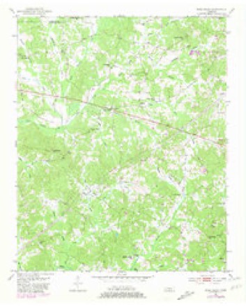
9 topographic sheets cover this place, the earliest surveyed in 1951 and the latest in 1986. It stands in District 4. It lies in ZIP code area 38315. It stands on Chapel Branch. The Survey maps it on the Rose Creek quadrangle.
Topographic sheets covering this place
4 surveys from 9 printed sheetsMatched by testing this settlement's coordinate against the published boundary of every sheet in the United States Geological Survey's historical collection. Each opens the scanned sheet at the Survey.
- 1951 USGS Rose Creek quadrangle1:24000, 3 printings
- 1956 USGS Blytheville quadrangle1:250000, 2 printings
- 1959 USGS Blytheville quadrangle1:250000
- 1986 USGS Selmer quadrangle1:100000, 3 printings
Fires near this place
97 since 1997Regional context, not property-specific evidence. The federal wildfire occurrence database lists 97 fires within 5 miles of Rose Creek between 1997 and 2020, burning about 364 acres in total. 1 started naturally. 26 were recorded as arson. Distance is straight-line from the map coordinates, so a fire counted here may appear on a neighbouring settlement's page as well.
| Reported cause | Fires |
|---|---|
| Debris and open burning | 46 |
| Arson/incendiarism | 26 |
| Equipment and vehicle use | 10 |
| Missing data/not specified/undetermined | 7 |
| Power generation/transmission/distribution | 4 |
| Other causes | 1 |
| Misuse of fire by a minor | 1 |
| Smoking | 1 |
| Natural | 1 |
The most recent of them, most recent first, with the day each was reported and the service that recorded it.
| Date | Cause | Size | Reported by | Name on the report |
|---|---|---|---|---|
| 4 September 1999 | Debris and open burning | 1.0 acres | Tennessee Division of Forestry | not named |
| 30 September 2014 | Debris and open burning | 1.0 acres | Tennessee Division of Forestry | SULPHUR SPRINGS RD |
| 28 September 2016 | Equipment and vehicle use | under an acre | Tennessee Division of Forestry | DEE MOORE RD. |
| 11 September 2013 | Debris and open burning | 5.0 acres | Tennessee Division of Forestry | POWERLINE |
| 31 August 2011 | Debris and open burning | 3.0 acres | Tennessee Division of Forestry | 64 WEST |
| 29 August 2000 | Debris and open burning | 3.0 acres | Tennessee Division of Forestry | not named |
| 19 August 2000 | Arson/incendiarism | 2.0 acres | Tennessee Division of Forestry | not named |
| 11 August 2020 | Missing data/not specified/undetermined | 3.0 acres | Tennessee Division of Forestry | MCNAIRY COUNTY ROWSEY SCHOOL ROAD 2975 |
Settlements close enough to share some of these fires:
Mines and quarries near this place
5 within 5 milesRegional context, not property-specific evidence. The federal mineral resources record lists 5 workings within 5 miles of Rose Creek: 3 occurrences, 1 prospect, 1 past producer. None of them still produces. What was taken out: Clay, Ball Clay. Distance is straight-line from the map coordinates, so a quarry counted here may appear on a neighbouring settlement's page as well.
| Where | Site | Commodity | Status | Recorded |
|---|---|---|---|---|
| Roney Pit | Ball Clay | Past Producer | ||
| County Line Prospect | Clay | Occurrence | ||
| J.F. Basham Farm Prospect | Clay | Prospect | ||
| Rose School Prospect | Clay | Occurrence | ||
| West Selmer Prospect | Clay | Occurrence |
Storms near this place
16 since 1994Regional context, not property-specific evidence. The National Weather Service names Rose Creek in 16 storm reports between 1994 and 2025: 9 thunderstorm wind, 5 hail, 2 tornado. The reports record 14 deaths and 35 injuries. Each account below is quoted exactly as the forecast office filed it, from the NOAA Storm Events Database, and each date opens the federal record of that event.
| When | Event | Place named | Harm | What the report says |
|---|---|---|---|---|
| March 2023 | Tornado (EF3) | Rose Creek | 9 killed, 21 hurt, $20,000,000 | This tornado crossed from Hardeman County into McNairy County and moved east-northeast along Skipper Creek, intensifying as it moved into the Rose Creek area. A swath of significant damage was surveyed along Rose Creek Road from Talley Road to King Road. Tree damage was widespread and several homes were severely damaged. A single-wide manufactured home was destroyed on Rose Creek Road, killing all four occupants. Maximum wind speeds in this area were estimated at 125 mph. The tornado briefly weakened as it approached Highway 64 west of Selmer. Widespread tree damage and sporadic damage to structures were noted along Bud Long Road, Highway 64, and John Moore Road, with several utility poles snapped along Highway 64. A church was damaged at Highway 45 and Dowty Road. The glass in the foyer was blown out and some damage to the siding was observed. Just north of the church, a metal building was destroyed and several utility poles were snapped. More significant damage was noted along Main Street just south of Hopkins Street in the Bethel Springs area. Several homes sustained significant damage. This is the same area affected by a tornado a few hours prior with a few of these properties sustaining damage from both tornadoes. The tornado continued to the east-northeast, damaging trees and utility poles on Murray School Road and numerous homes along Bethel Purdy Road. The Community Center on Purdy Beauty Hill Road was completely destroyed and a nearby home suffered severe damage. The tornado intensified as it followed Old Stage Road. Widespread damage to trees, powerlines, and homes was observed from Dogwood Lane to Leapwood Enville Road. Several homes were completely destroyed and four fatalities occurred in this area. Additional home and tree damage was observed along Puron and Neely Sharp Roads with another area of more significant damage near Highway 22 and Winding Ridge Road where another fatality occurred. In total, nearly 200 structures were damaged in McNairy County between this tornado and the EF-2 that occurred a couple of hours earlier, 91 of which were total losses. The tornado weakened as it moved into Hardin County. Peak winds in McNairy County from this tornado were estimated at 155 mph. |
| April 2025 | Tornado (EF3) | Rose Creek | 5 killed, 14 hurt, $11,000,000 | The tornado developed near Locke Road and quickly intensified as it moved to the east-northeast just north of Sulphur Springs. It produced mainly tree damage along Eldie Foster and Nelson Store Roads. The tornado produced significant damage to several homes on Sulphur Springs Road near Dee Moore Road and destroyed a manufactured home. The tornado then moved over a more forested area south of Ervin Hester Road, but a well-defined swath of downed trees can be seen via aerial imagery. The tornado intensified as it moved across Highway 45 into Selmer, damaging numerous homes on the western and northern portions of town. The most significant damage was surveyed along New Bethel Road and Adams Extension, where several homes were destroyed. Wind speed estimates in this area were 145-160 mph, corresponding to a high-end EF3 rating. Between these locations, damage to homes and trees was generally in the EF2 range. Significant damage continued to be observed east of the Illinois Central Railroad tracks along Bethesda Purdy Road, where a home suffered major roof damage and a metal building was destroyed. The tornado tracked further northeast, producing minor to significant tree damage, but affected a few more homes and outbuildings along Purdy Road and Airport Road. Aerial imagery revealed significant tree damage between Purdy Road and Barnes Road, with damage to trees and outbuildings noted near the intersection of Old Stage Road and Leapwood Enville Road. Consistent tree damage continued as the tornado crossed Puron Road, Neely Sharp Road, and Highway 22 north of Adamsville before crossing into Hardin County. Peak winds were estimated at 160 mph. |
| April 2025 | Thunderstorm Wind | Rose Creek | $10,000 | Several trees were uprooted and trunks snapped along Locke Rd, Eldie Roster Rd and Dee Moore Rd associated with the rear flank downdraft of the Selmer tornado path. |
| July 2002 | Thunderstorm Wind | Rose Creek | $10,000 | Some shingles, power lines and tree limbs were blown down. |
| March 2023 | Thunderstorm Wind | Rose Creek | $5,000 | The rear flank downdraft of the EF-3 tornado that developed in western Hardeman County and moved across McNairy County uprooted trees from Hines Gin Road to Locke Road. |
| March 2023 | Thunderstorm Wind | Rose Creek | $5,000 | Straight-line winds uprooted several trees along Highway 64 between Star Lane and Prentiss Johnson Lane. |
| April 2003 | Thunderstorm Wind | Rose Creek | $5,000 | Three trees were knocked down. |
| April 2007 | Hail | Rose Creek | $1,500 | Quarter to ping pong size hail fell 3 miles south of Rose Creek to 3 miles north of Ramer. |
| May 2003 | Thunderstorm Wind | Rose Creek | $1,000 | A couple of trees were knocked down. |
| April 1994 | Hail | Rose Creek | $500 | no account filed |
| February 2001 | Hail | Rose Creek | $100 | Hail ranged in size from dimes in Rose Creek to quarters in Selmer. |
| June 1996 | Hail | Rose Creek | $10 | no account filed |
| January 2020 | Thunderstorm Wind | Rose Creek | - | Straight-line winds knocked down trees and power lines across McNairy County. |
| July 2015 | Thunderstorm Wind | Rose Creek | - | Straight line winds knocked down several trees and power lines across McNairy County. |
| January 2013 | Thunderstorm Wind | Rose Creek | - | Straight line winds of 70 to 80 mph knocked down numerous trees and power lines on Rose Creek Road and Sulphur Springs Road in Western McNairy County. Large numbers of pine trees were pushed over or uprooted in Bethel Springs. A few of the trees were snapped and many power lines were knocked down. An estimated 100 structures were damaged in McNairy County with the heaviest damage in Bethel Springs area. A couple of vehicles were crushed by fallen trees in Bethel Springs. |
| May 2018 | Hail | Rose Creek | - | no account filed |
Nearest settlements
The eight closest, with where each one stands in the county. Distances are straight-line, computed from the Geographic Names Information System coordinates.
| Map | Place | Distance | Sheets |
|---|---|---|---|
| Sulphur Springs | 5.1 miles | 9 | |
| Bethel Springs | 5.2 miles | 10 | |
| Selmer | 6.1 miles | 10 | |
| Falcon | 6.6 miles | 10 | |
| McNairy | 8.2 miles | 7 | |
| Forty Forks | 8.6 miles | 9 | |
| Purdy | 8.9 miles | 10 | |
| Beauty Hill | 9.1 miles | 9 |
Provenance
This settlement is recorded in the Geographic Names Information System as feature 1269914. The sheet list is computed by point-in-boundary test against the United States Geological Survey's historical topographic inventory. Both are works of the United States government and carry no copyright under 17 U.S.C. 105.
Wildfire. Short, Karen C. 2022. Spatial wildfire occurrence data for the United States, 1992-2020 [FPA_FOD_20221014]. 6th Edition. Fort Collins, CO: Forest Service Research Data Archive. https://doi.org/10.2737/RDS-2013-0009.6 Collected with United States Government funding and usable without additional permissions or fees.
Mines and quarries. USGS Mineral Resources Data System (MRDS) https://mrdata.usgs.gov/mrds/ A work of the United States government, no copyright under 17 U.S.C. 105.
Storms. NOAA National Centers for Environmental Information, Storm Events Database https://www.ncei.noaa.gov/stormevents/ A work of the United States government, no copyright under 17 U.S.C. 105. Narratives are quoted verbatim from the National Weather Service report and are not edited or summarised.