 Block
Sadlersville, Tennessee
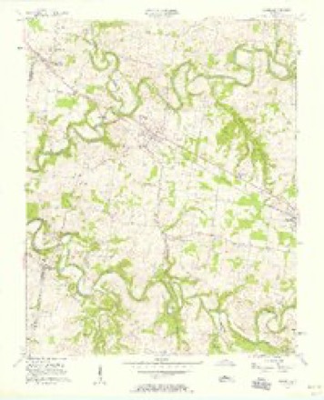
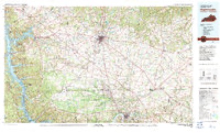
8 topographic sheets cover this place, the earliest surveyed in 1956 and the latest in 1980. It stands in District 7. It lies in ZIP code area 37010. The Survey maps it on the Adams quadrangle.
Topographic sheets covering this place
4 surveys from 8 printed sheetsMatched by testing this settlement's coordinate against the published boundary of every sheet in the United States Geological Survey's historical collection. Each opens the scanned sheet at the Survey.
- 1956 USGS Nashville quadrangle1:250000, 2 printings
- 1957 USGS Adams quadrangle1:24000, 4 printings
- 1959 USGS Nashville quadrangle1:250000
- 1980 USGS Hopkinsville quadrangle1:100000


Fires near this place
1 since 2000Regional context, not property-specific evidence. The federal wildfire occurrence database lists 1 fire within 5 miles of Sadlersville in 2000, burning under an acre in total. None started naturally. None was recorded as arson. Distance is straight-line from the map coordinates, so a fire counted here may appear on a neighbouring settlement's page as well.
| Reported cause | Fires |
|---|---|
| Debris and open burning | 1 |
The most recent of them, most recent first, with the day each was reported and the service that recorded it.
| Date | Cause | Size | Reported by | Name on the report |
|---|---|---|---|---|
| 7 April 2000 | Debris and open burning | under an acre | Tennessee Division of Forestry | not named |
Settlements close enough to share some of these fires:
Storms near this place
10 since 2010Regional context, not property-specific evidence. The National Weather Service names Sadlersville in 10 storm reports between 2010 and 2025: 5 flash flood, 3 thunderstorm wind, 2 flood. No death or injury is recorded in these reports. Each account below is quoted exactly as the forecast office filed it, from the NOAA Storm Events Database, and each date opens the federal record of that event.
| When | Event | Place named | Harm | What the report says |
|---|---|---|---|---|
| July 2016 | Flash Flood | Sadlersville | $1,000,000 | Major flash flooding affected much of Robertson County, with several homes, businesses, and roads damaged by flooding. Homes that were flooded included several on Owens Chapel Road along Sulfer Fork Creek around 4 miles northeast of Springfield, where several people were rescued from flooded homes. Businesses that were flooded in Springfield included a trucking depot on Highway 41 North and a Little Caesars Pizza, where the roof caved in due to the amount of heavy rain on the roof. American Legion Baseball Park at 4660 Highway 41 North and the Springfield Greenway were also submerged by flood waters. Roads that were flooded and impassable included several streets in Springfield such as 11th Avenue East, where some residents trapped in homes, and Armstrong Road around 6 miles east of Springfield. No injuries or fatalities were reported. |
| May 2012 | Thunderstorm Wind | Sadlersville | $10,000 | Some trees were downed across western portions of county. |
| May 2012 | Thunderstorm Wind | Sadlersville | $10,000 | Some trees were snapped near Adams. |
| November 2010 | Thunderstorm Wind | Sadlersville | $10,000 | Trees were blown down across Guthrie Road. |
| March 2025 | Flood | Sadlersville | - | The Red River at Port Royal crested to 33.05 feet which was minor flood stage. At this stage, flood waters impacted agricultural land and adjacent areas along the river from the Kentucky State Line through Adams, past Port Royal State Park, and to Clarksville. This included the Red River Valley Park where water covered most of the parking area, the Porters Chapel Public Access area, the River Club golf course, and portions of the Clarksville Country Club. |
| April 2025 | Flash Flood | Sadlersville | - | Heavy rain across Robertson County resulted in widespread flash flooding, especially along waterways and across other low-lying areas. Numerous flash flooding reports were received particularly in the Springfield area where several roads were closed. Extent of damages is unknown. |
| April 2025 | Flash Flood | Sadlersville | - | Heavy rain across Robertson County resulted in widespread flash flooding, especially along waterways and across other low-lying areas. By the end of this event, observations and radar estimates showed 7 to 10 inches of rain across Robertson County. Extent of damages is unknown. |
| April 2025 | Flood | Sadlersville | - | The Red River at Port Royal crested to 39.30 feet which was moderate flood stage and just below major flood stage at 40 feet. At this stage, significant flooding impacted agricultural land, parks, and access roads along the river, including the Red River Valley Park where several campsites were flooded. Port Royal Road near Highway 238 was also covered with water. Water approached Dunbar Cave Road just west of Warfield Boulevard, and water also reached low-lying portions of the Swan Lake Golf Course. |
| December 2017 | Flash Flood | Sadlersville | - | Multiple roads were flooded and closed across northwest and north-central parts of Robertson County. |
| April 2013 | Flash Flood | Sadlersville | - | Fast moving high water was reported over Highway 76 at Port Royal Road. |
Nearest settlements
The eight closest, with where each one stands in the county. Distances are straight-line, computed from the Geographic Names Information System coordinates.
| Map | Place | Distance | Sheets |
|---|---|---|---|
| Forest Mills (historical) | 1.3 miles | 8 | |
| Forts (historical) | 2.0 miles | 8 | |
| Adams | 3.4 miles | 8 | |
| Walnut Grove | 4.5 miles | 8 | |
| Kent (historical) | 6.2 miles | 6 | |
| Holmansville (historical) | 6.6 miles | 8 | |
| Glenraven (historical) | 6.7 miles | 8 | |
| Cedar Hill | 7.5 miles | 8 |
Elsewhere
Matched on this settlement's Geographic Names Information System number rather than its name, so it cannot be a different place of the same name in another state.
| Wikidata item Q122546218 | The structured record the population and elevation above come from. Public domain (CC0). |
Provenance
This settlement is recorded in the Geographic Names Information System as feature 1300401. The sheet list is computed by point-in-boundary test against the United States Geological Survey's historical topographic inventory. Both are works of the United States government and carry no copyright under 17 U.S.C. 105.
Wildfire. Short, Karen C. 2022. Spatial wildfire occurrence data for the United States, 1992-2020 [FPA_FOD_20221014]. 6th Edition. Fort Collins, CO: Forest Service Research Data Archive. https://doi.org/10.2737/RDS-2013-0009.6 Collected with United States Government funding and usable without additional permissions or fees.
Storms. NOAA National Centers for Environmental Information, Storm Events Database https://www.ncei.noaa.gov/stormevents/ A work of the United States government, no copyright under 17 U.S.C. 105. Narratives are quoted verbatim from the National Weather Service report and are not edited or summarised.