 Block
From the record
29 National Register listings published here.
Sources: the National Register database, National Park Service
55 topographic sheets cover 51 settlements here, and 29 properties are on the National Register of Historic Places.
29 National Register listings published here.
Sources: the National Register database, National Park Service
Every property in this county listed on the National Register of Historic Places, with the year it was listed and the federal nomination document.
| Photograph | Property | Type | Listed | Reference |
|---|---|---|---|---|
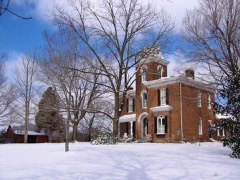 | Beeches, The | building | 1982 | 82004037 |
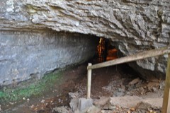 | Bell Witch Cave | site | 2008 | 08000237 |
 | Cornsilk | building | 1974 | 74002266 |
| Frierson Chapel | building | 2019 | 100004694 | |
 | Glen Raven | building | 1973 | 73001816 |
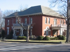 | Mollie and Neel Glenn House | building | 2012 | 12000440 |
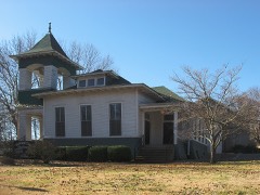 | Highland Chapel Union Church | building | 1991 | 91001592 |
 | Mansfield Cheatham House | building | 1978 | 78002626 |
 | William M. McMurry House | building | 2017 | 100000904 |
| Nelson's Greenbrier Distillery | building | 2008 | 08000703 | |
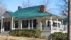 | George O'Bryan House | building | 1989 | 89000073 |
| Arthur Pitt House and Distillery | building | 1973 | 73001820 | |
 | William Randolph House | building | 1973 | 73001818 |
| Red River Blockhouse Number 1 | site | 2003 | 03001157 | |
 | Robertson County Courthouse | building | 1978 | 78002627 |
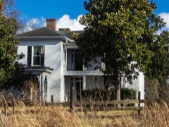 | Rock Jolly | building | 1973 | 73001819 |
 | Russell House | building | 2011 | 11000458 |
| Springfield Town Square Historic District | district | 1979 | 79002456 | |
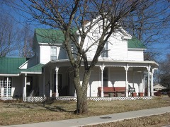 | Granville Babb Sprouse House | building | 1998 | 98001307 |
 | St. Michael's Catholic Church | building | 1973 | 73001817 |
| Strickland Place Farm | district | 2010 | 10000142 | |
 | Sudley Place | building | 1974 | 74001925 |
 | Thomas Drugs | building | 1993 | 93001189 |
 | Dr. Martin Walton House | building | 1996 | 96001318 |
 | Walton-Wiggins Farm | district | 1997 | 97000883 |
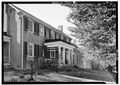 | Wessyngton | building | 1971 | 71000830 |
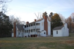 | Woodard Hall | building | 1975 | 75001775 |
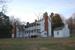 | Woodard Hall Farm (Boundary Increase) | district | 1995 | 95000450 |
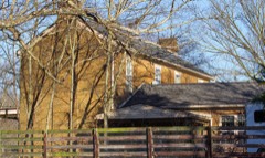 | Thomas Jr. Woodard Farm | building | 2008 | 08000315 |
Every wildfire the federal occurrence database records inside this county: 60 of them, burning about 323 acres. None started naturally and 3 were recorded as arson. Each settlement page carries the fires within five miles of it.
| Reported cause | Fires |
|---|---|
| Debris and open burning | 29 |
| Missing data/not specified/undetermined | 10 |
| Equipment and vehicle use | 6 |
| Smoking | 4 |
| Misuse of fire by a minor | 4 |
| Arson/incendiarism | 3 |
| Other causes | 2 |
| Recreation and ceremony | 1 |
| Power generation/transmission/distribution | 1 |
The five largest, by the area the report gives. None of them was recorded as arson.
| Date | Cause | Size | Reported by | Name on the report |
|---|---|---|---|---|
| 28 January 2001 | Debris and open burning | 30 acres | Tennessee Division of Forestry | not named |
| 18 November 2016 | Equipment and vehicle use | 20 acres | Tennessee Division of Forestry | MURPHEY, AIRPOERT RD FIRE |
| 25 March 2015 | Debris and open burning | 20 acres | Tennessee Division of Forestry | FRIENDSHIP |
| 11 March 2007 | Smoking | 16 acres | Tennessee Division of Forestry | SRILEY ADCOCK |
| 4 March 2009 | Debris and open burning | 15 acres | Tennessee Division of Forestry | COLESTA FIRE |
| 30 August 1999 | Equipment and vehicle use | 15 acres | Tennessee Division of Forestry | not named |
| 15 September 1999 | Equipment and vehicle use | 15 acres | Tennessee Division of Forestry | not named |
| 31 January 2016 | Missing data/not specified/undetermined | 13 acres | Tennessee Division of Forestry | ARMSTRONG RD FIRE |
Every settlement page carries the fires within five miles of it - see the settlement index below.
The NOAA Storm Events Database holds 503 reports for this county, causing 3 deaths, 93 injuries and about $33,931,930 in recorded property damage. Each settlement page carries the reports that name it.
| Kind of event | Reports |
|---|---|
| Thunderstorm Wind | 289 |
| Hail | 121 |
| Flash Flood | 36 |
| Tornado | 30 |
| Heavy Rain | 8 |
| Flood | 7 |
| Lightning | 6 |
| Funnel Cloud | 6 |
The most serious of them, by death, then injury, then recorded damage. The accounts are quoted exactly as the forecast office filed them.
| When | Event | Place named | Harm | What the report says |
|---|---|---|---|---|
| April 1970 | Tornado (F4) | not stated | 2 killed, 75 hurt, $2,500,000 | no account filed |
| May 2021 | Thunderstorm Wind | Coopertown | 1 killed, 1 hurt, $10,000 | A large tree fell onto a pickup truck and a motorcyclist on South Walker Road at McMahan Hollow Road. The driver of the pickup was not seriously injured, but the driver of the motorcycle was pronounced dead at the scene. |
| December 2023 | Tornado (EF2) | Springfield | 4 hurt, $10,000,000 | This EF-2 tornado touched down north of C.M. Martin Road to the west of Highway 431 where it blew down a few trees. The tornado crossed Highway 431 south of Main Street where it knocked over some power poles, then continued to blow down trees east of the highway. The tornado moved into southern Springfield near Fairway Trail and Kemper Court, snapping and uprooting trees along many residential streets and causing minor damage to a few homes. More significant damage to homes occurred further northeast on Rudolph Street and Brentlawn Drive. The tornado strengthened as it crossed Highway 41 near the Kroger shopping center, with numerous businesses damaged from high-end EF1 to low-end EF2 intensity (110-115 mph). 25 vehicles in the Kroger parking lot were flipped with some thrown into nearby ditches. The tornado then crossed the railroad tracks behind Kroger and reached its peak intensity as it entered an industrial area, where multiple warehouse structures were heavily damaged. With the majority of these metal building systems having Grade 5 bolts holding down the columns, winds were estimated at EF-2/120 mph in this area. The tornado then struck a fire department and strip mall (EF-1/110 mph) and bent a steel transmission pole at a power substation (EF-2/115 mph) on the east side of the industrial park. As the tornado continued northeast, it significantly weakened but still uprooted trees and caused minor roof damage to homes on Greystone Drive and Sloan Lane. On Roy Pitt Road, the tornado destroyed a two car garage and rolled a trailer on its side (EF-1). The tornado continued to blow down trees as it moved northeast across Highway 76E near Oakland Road before finally lifting north of Sloan Road. |
| June 2009 | Thunderstorm Wind | Greenbrier | 4 hurt, $100,000 | Four adults at the Valley View Church Camp were injured when a tree fell onto the mobile home camper. The adults were inside the camper checking the latest weather report when the tree smashed through the middle, trapping two people inside. All four adults were sent to a local hospital in Greenbrier. At the time this article was posted to the internet on 6/23 at 3:03 PM CST, three adults remained hospitalized with a variety of injuries including broken bones and a punctured lung. The fourth adult was treated for minor injuries and was released. |
| April 1998 | Tornado (F2) | Springfield | 3 hurt, $500,000 | 30 homes were damaged and 7 trailers were totally destroyed. Most of the damage was on Hwy 431 in Coopertown, Reader School Rd. and also along Hwy 41 near Greenbrier. Many trees and power lines were down. One mobile home was hurled 100 yards across Hwy 431and totally destroyed. 3 were slightly injured in the mobile home. |
| April 1991 | Thunderstorm Wind | not stated | 3 hurt | no account filed |
| January 2013 | Tornado (EF1) | Eden Corner | 1 hurt, $750,000 | A second EF1 tornado touched down about 2.8 miles south-southwest of Cross Plains and moved northeast across eastern Robertson County and crossed Interstate 65 into western Sumner County. The tornado snapped or uprooted dozens of trees along Cross Plains Road north of Owens Chapel Road. A barn and mobile home were damaged along Jernigan Road, and several more trees were blown down on Calista Road. A home on Village Green Drive at Highway 25 was heavily damaged and a few others in the area suffered minor roof damage. More trees were snapped and uprooted as the tornado crossed Interstate 65 at mile marker 113 and Highway 31 one-half mile north of Highway 25 before the tornado moved into Sumner County. Winds were estimated around 95 mph. |
| January 2013 | Thunderstorm Wind | Oakland | 1 hurt, $500,000 | An NWS Storm Survey found a large and intense 2-mile wide macroburst struck areas of eastern Robertson County. Damage began along Armstrong Road east of Springfield where several trees were blown down. More widespread and significant damage began further east along Bethlehem Road and Baggett Road where dozens of homes and outbuildings suffered minor to moderate roof damage and two large barns were destroyed. One 26 year old woman was seriously injured on Baggett Road when a tree fell onto her mobile home. Numerous other homes and mobile homes received minor roof and exterior damage and dozens of trees were snapped or uprooted along Chowning Road, Hoof and Paw Trail, Cook Road, Owens Chapel Road, and Cross Plains Road. Damaged continued eastward with dozens of more homes having minor roof damage, several outbuildings being damaged or destroyed, and many additional trees being snapped or uprooted along Covington Road, Jernigan Road, Apollo Drive, Pleasant Grove Road, and Calista Road. Winds were estimated between 80 and 100 mph. |
| October 2009 | Tornado (EF1) | Ridgeton | 1 hurt, $100,000 | The tornado touched down on a farm near the intersection of Greer Road and Dickson Lane in Robertson County. The tornado then continued on a 1.82 mile path east-northeast into Davidson County. The last evidence of damage was at a residence along Baker Road. An old barn was destroyed near the beginning of the damage path in Robertson County. The most significant damage was right along Greer Road, which marks the border between Robertson and Davidson Counties. On the Robertson County side of the road, dozens of hardwood trees were snapped or uprooted and a residence and outbuilding received roof damage. On the Davidson County side, several trailers were damaged, including one which was pushed approximately 15 feet of it's foundation. A woman sustained minor injuries in one of the trailers. This was the first recorded October tornado in either Robertson or Davidson Counties. |
| May 2003 | Tornado (F1) | Stroudsville | $5,000,000 | There was $1.8 million dollars worth of damage to the Springfield Industrial Park. 25 to 30 homes were damaged from Stroudsville, Sandy Springs and Springfield areas at a cost of $3.2 million dollars. |
| May 2024 | Flash Flood | Orlinda | $2,000,000 | Numerous reports of major flooding were received across Robertson County, including the Cross Plains area. Multiple rounds of heavy rain caused flash flooding to begin early in the morning on May 8th and continue into the overnight hours. Roads that were reported impassable included Empson Road, Covington Road, and Cross Plains Road. A water rescue had to be performed along Cross Plains Road due to the car becoming submerged in flood waters. Life-threatening flash flooding prompted the issuance of a Flash Flood Emergency for Robertson County. Damages are a rough estimate. |
| May 2024 | Flash Flood | Springfield Muni Arp | $2,000,000 | Numerous reports of major flooding were received across Robertson County, including the Springfield area. Multiple rounds of heavy rain caused flash flooding to begin early in the morning on May 8th and continue into the overnight hours. Roads that were reported impassable included New Chapal Road and Lahr Road where a water rescue had to be performed due to the car becoming submerged in flood waters. Life-threatening flash flooding prompted the issuance of a Flash Flood Emergency for Robertson County. Damages are a rough estimate. |
| May 2024 | Flash Flood | Baggettsville | $2,000,000 | Numerous reports of major flooding were received across Robertson County, including the White House area. Multiple rounds of heavy rain caused flash flooding to begin early in the morning on May 8th and continue into the overnight hours. The worst flooding was reported along and south of Highway 76 with specific roadways reported impassable including Sage Road, Melton Road, and Union Road. Flooding was also reported in White House High School. Life-threatening flash flooding prompted the issuance of a Flash Flood Emergency for Robertson County. Damages are a rough estimate. |
| May 2024 | Flash Flood | Courtland | $2,000,000 | Numerous reports of major flooding were received across Robertson County, including the Greenbrier area. Multiple rounds of heavy rain caused flash flooding to begin early in the morning on May 8th and continue into the overnight hours. One home on Old Greenbrier Pike at Worsham Springs was reported to be surrounded by water. Life-threatening flash flooding prompted the issuance of a Flash Flood Emergency for Robertson County. Damages are a rough estimate. |
| July 2016 | Flash Flood | Sadlersville | $1,000,000 | Major flash flooding affected much of Robertson County, with several homes, businesses, and roads damaged by flooding. Homes that were flooded included several on Owens Chapel Road along Sulfer Fork Creek around 4 miles northeast of Springfield, where several people were rescued from flooded homes. Businesses that were flooded in Springfield included a trucking depot on Highway 41 North and a Little Caesars Pizza, where the roof caved in due to the amount of heavy rain on the roof. American Legion Baseball Park at 4660 Highway 41 North and the Springfield Greenway were also submerged by flood waters. Roads that were flooded and impassable included several streets in Springfield such as 11th Avenue East, where some residents trapped in homes, and Armstrong Road around 6 miles east of Springfield. No injuries or fatalities were reported. |
| January 2013 | Tornado (EF2) | Chestnut Grove | $750,000 | An EF2 tornado touched down south of Mount Zion Road east of Coopertown and moved northeastward before lifting about 4.3 miles southeast of Springfield. A few homes had minor roof damage south of Mount Zion Road and several trees were blown down. A gas station roof was partially blown off and gas pump awning damaged on Mount Zion Road at Tom Austin Highway. On the east side of the highway, an outbuilding was destroyed with debris blown 100 yards to the north into a water tower. One home and a business received roof damage on Old Highway 431, and an adjacent warehouse had an exterior door blown in and half of the roof blown off. Sheet metal from the warehouse was scattered up to 200 yards across adjacent fields. Further to the east, several trees were snapped or uprooted on New Cut Road. Major damage occurred on Stacy Springs road where a TVA high transmission tower was toppled, several homes and outbuildings suffered moderate roof damage, and dozens of trees were snapped and uprooted. Several businesses and barns also had roof damage on Highway 11. More barns and homes were damaged and numerous trees blown down on Old Greenbrier Pike and Worsham Springs Road. Winds were estimated around 120 mph. |
| April 1998 | Tornado (F3) | Adams | $400,000 | Part of a roof was blown off the Jo Byrns School in Adams. Many trees fell on homes. |
| April 2026 | Tornado (EF1) | Ridgeton | $300,000 | This is a continuation of the EF-1 tornado that began in Davidson County. As the tornado entered Robertson County, it followed the southern edge of the valley along Browns Lake Road where the most extensive damage occurred with hundreds of trees snapped and uprooted. Most structural damage was caused by falling trees or winds north of the circulation. The tornado damaged around five barns and outbuildings west of Browns Lake before lifting near the lake. Damages are a rough estimate. |
| May 2020 | Thunderstorm Wind | Springfield | $254,530 | Numerous trees and power lines were blown down across Robertson County. |
| May 2024 | Tornado (EF1) | Stroudsville | $250,000 | An EF1 tornado touched down about one mile northeast of the Interstate 24 and Stroudville Road intersection in far southwest Robertson County and moved eastward. Several videos of the tornado were taken by residents and storm chasers as the tornado crossed Winters Road and Maxey Road although the only damage was scattered blown down trees. The tornado strengthened as it turned southeast and followed Ridge Road, blowing down dozens of trees and damaging several homes and barns. Three homes had shingle and roofing material loss along with gutter and soffit damage. One home had fourteen trees snapped or uprooted with one falling onto their home. An older 20-by-40 barn on Ridge Road south of Center Drive was picked up and thrown in a northeasterly direction with metal sheeting blown into and wrapped around trees. The tornado took a sharp turn back to the east and continued blowing down trees before it lifted northeast of the Ridge Road and Corlew Road intersection. Damages are a rough estimate. |
| January 2013 | Tornado (EF1) | Oakland | $250,000 | An NWS Storm Survey determined a very complex area of wind damage consisting of two EF1 tornadoes and a large intense macroburst struck eastern Robertson County. The first of these EF1 tornadoes touched down 4.6 miles southeast of Springfield west of Pinson School Road and traveled northeast across Possum Trot Road uprooting and snapping several trees. More significant damage to homes and businesses occurred at the intersection of Highway 76 and Gum Station Road and along Lorilei Lane, where a few homes had moderate roof damage and many more homes and barns had minor roof damage. More homes and barns received minor damage south of Gum Station Road, with one home at 6537 Gum Station Road having moderate roof damage to its southern side and a tree falling on the western side. Another home at the southwest corner of the Bethlehem Road and Gum Station Road intersection was severely damaged, with others on the north side of the intersection suffering minor damage. More homes had minor roof damage further to the east along Bethlehem Road and at the Cross Plains Road and Boyles Road intersection before the tornado lifted. Hundreds of trees were snapped and uprooted all along the path. Winds were estimated up to 105 mph. |
| May 1984 | Tornado (F2) | not stated | $250,000 | no account filed |
| March 1963 | Tornado (F2) | not stated | $250,000 | no account filed |
| March 1955 | Tornado (F2) | not stated | $250,000 | no account filed |
| November 2013 | Tornado (EF1) | Orlinda | $200,000 | A NWS Storm Survey Team concluded an EF-1 tornado with maximum winds between 85 and 90 mph touched down along East Robertson Road near Orlinda. Several homes had roof damage and windows blown out. Multiple trees were snapped and uprooted along the tornadoes path. Damage was noted along East Robertson Road and continued along Pleasant Hill Road. |
| June 2025 | Flash Flood | Orlinda | $100,000 | Heavy rain in Robertson County led to flash flooding of low-lying areas across eastern portions of the county. Known roads impacted included Owens Chapel at Keith Road and Owens Chapel at Wilson Store Road. A few reports of cars stranded with water rescues needed were also received. Damages are a rough estimate. |
| May 2024 | Thunderstorm Wind | Coopertown | $75,000 | A strong thunderstorm downed a tree onto a home along Myra Court in Pleasant View. Heavy rain in the area and a saturated ground likely helped the tree fall. No injuries were reported. Damages are a rough estimate. |
| June 2023 | Thunderstorm Wind | Fairview | $75,000 | Severe thunderstorm winds destroyed a silo in the 4600 Block of Robertson Road north of Springfield. Damages are a rough estimate. |
| April 2026 | Thunderstorm Wind | Cedar Hill | $50,000 | Severe thunderstorm caused numerous downed trees across Robertson County, including in Adams, Cedar Hill, Springfield, Orlinda, and Greenbrier. Damages are a rough estimate. |
| June 2024 | Flash Flood | Cross Plains | $50,000 | Heavy rain fell across portions of Robertson County during the early morning hours of June 30th with flooding reported in the Cross Plains area. CoCoRaHS observers in this area measured 3 to 3.5 inches of rain. In Cross Plains, flooding was reported along Owens Chapel Road at Cross Plains Road. Damages are a rough estimate. |
| July 2023 | Thunderstorm Wind | Greenbrier | $50,000 | Severe thunderstorm winds downed multiple trees and powerlines along Kelly Willis Road with some of these falling onto homes in Greenbrier. Damages are a rough estimate. |
| March 2019 | Thunderstorm Wind | Barren Plain | $50,000 | A NWS storm survey determined a 15 mile long by 1 mile wide downburst caused sporadic wind damage from 6 miles north of Springfield, through Orlinda, to 6 miles east of Orlinda near I-65. A livestock shelter was blown into trees at 2341 Gunn Road near the beginning of the path. More significant damage began along Lamont Road, where an outbuilding was destroyed and several trees were blown down. Several barns and outbuildings suffered roof and siding damage, a few homes lost shingles, and several trees were blown down along Highway 49 from Lamont Road to Orlinda. A power pole was snapped at Highway 52 and Cook Road. An abandoned home suffered exterior damage and some trees were blown down on Highway 52 around Pleasant Hill Road, including two trees that fell onto an outbuilding. Scattered trees continued to be blown down eastward along Highway 52 to near I-65. Winds were estimated up to 75 mph. |
| June 2019 | Thunderstorm Wind | Springfield | $50,000 | Approximately 40 trees were downed across Robertson County with two trees landing on houses but causing no damage. A couple buildings received minor damage from high winds, and downed power lines resulted in 5,200 people without power. |
| February 2018 | Tornado (EF1) | Adams | $50,000 | An EF-1 tornado touched down east of Adams near Johnson Springs Road and moved northeast. Corn from a farm on the east side of Johnson Springs Road was blown over a quarter of a mile to the northeast. One home suffered minor roof damage on Sturgeon Creek Road and dozens of trees were snapped or uprooted along both Sturgeon Creek Road and Barnes Road. Several barns and outbuildings were damaged or destroyed and more trees were blown down along a bend of Buzzard Creek Road before the tornado lifted west of the Fizer Road and Buzzard Creek Road intersection. The path of this tornado was adjusted and extended slightly in June 2020 based on newly available high resolution Google Earth satellite imagery. |
| February 2018 | Tornado (EF1) | Adams | $50,000 | An EF-1 tornado began less than one mile south of the Kentucky/Tennessee state line between Hugh Gill Road and Keysburg Road, then moved northeast snapping and uprooting numerous trees between the two roadways. The tornado then destroyed the roof of a barn on Hugh Gill Road before hitting a home on McGhee Road, causing significant roof and chimney damage. Maximum winds in Tennessee were estimated to be 95 mph. The tornado then moved into Kentucky where it intensified to EF-2 and traveled for another 11.3 miles. Please refer to NWS Louisville and Kentucky Storm Data for more information on the Kentucky portion of the path. The Tennessee portion of the path was updated and extended southwestward in June 2020 based on newly available high resolution Google Earth satellite imagery. |
| January 2010 | Tornado (EF0) | Springfield Muni Arp | $50,000 | A tornado touched down on the South Central Growers Greenhouse near the Springfield-Robertson County Airport and Highway 41. The tornado then continued|on a 3.6 mile path northeast. The last evidence of damage was at a residence just off of Barren Plains Road, also know as State Highway 25. The greenhouse roof was damaged near the beginning of the damage path. The most significant damage was near State Highway 25 where the roof of a barn was ripped off and a small shed was destroyed. A few trees were also snapped at the residence. Some farm equipment was also damaged. Very little damage was noted with the mobile home. This was the first recorded January tornado in Robertson County in more than ten years. |
| July 2009 | Thunderstorm Wind | Springfield | $50,000 | Trees were downed county wide. |
| April 2006 | Thunderstorm Wind | Greenbrier | $50,000 | Thunderstorm winds gusts estimated to be around 70 mph struck Greenbrier. A number of large trees were uprooted or blown down. Some of these trees landed on homes and mobile homes. Some homes had shingle damage due to the strong winds. Cinder blocks from two softball dugouts were blown out at Greenbrier High School. A large sign was blown down as well. There was no structural damage to the high school. |
| January 1999 | Tornado (F1) | Adams | $50,000 | F1 tornado at 4751 Jones Chapel Rd. Lost shingles on roof of his home. The tobacco barn was destroyed. The greenhouse was damaged. A few trees were uprooted. |
| August 1999 | Thunderstorm Wind | Springfield Muni Arp | $50,000 | A private plane, Cessna 150, flipped over in strong thunderstorm winds according to a newspaper article. The plane flipped over on its side and struck the terminal, knocking out the window of the airport office and totaling the plane. |
| May 2012 | Thunderstorm Wind | Turnersville | $30,000 | In Turnersville and the surrounding areas multiple trees were reported downed and Glenn Raven Road was temporarily blocked. One vehicle was struck by a fallen tree. Law enforcement officials confirmed that no one was injured. Specific details concerning any damage to the vehicle were unknown. |
| April 2011 | Thunderstorm Wind | Cross Plains | $30,000 | Straight line winds blew down several trees from Orlinda to Cross Plains. A large metal sign was also blown down near the intersection of State Highway 52 and Interstate 65. |
| May 2025 | Thunderstorm Wind | Springfield Muni Arp | $25,000 | Severe thunderstorm winds downed several trees across Robertson County. Damages are a rough estimate. |
| July 2024 | Thunderstorm Wind | Greenbrier | $25,000 | An apparent microburst caused a brick storage building to collapse at Highway 41 and East College Street in Greenbrier. Damages are a rough estimate. |
| April 2024 | Thunderstorm Wind | Springfield | $25,000 | Severe thunderstorm winds caused a tree to fall on a house along Shelton Street in Springfield. Minor to moderate damage was reported. Damages are a rough estimate. |
| April 2024 | Thunderstorm Wind | Jernigan Town | $25,000 | A Facebook user reported a tree down at Jernigan Road and Archer Road near Cross Plains. Other trees and power lines were reported downed in the Cross Plains and Springfield area, leaving about 1,300 customers without power. Damages are a rough estimate. |
| April 2024 | Thunderstorm Wind | Springfield | $25,000 | A Facebook user reported a tree down at Blackwood Road and Wilks Road near Springfield. Other trees and power lines were reported downed in the Cross Plains and Springfield area, leaving about 1,300 customers without power. Damages are a rough estimate. |
| September 2024 | Lightning | Springfield | $25,000 | The Robertson County Emergency Operations Center was struck by lightning, causing minor damage. |
| May 2024 | Thunderstorm Wind | Orlinda | $25,000 | Severe thunderstorm winds downed trees and power lines in and north of Orlinda. Damages are a rough estimate. |
| August 2023 | Thunderstorm Wind | Baggettsville | $25,000 | Severe thunderstorm winds downed several trees and powerlines across Highway 76 near Greenbrier. Damages are a rough estimate. |
| May 2021 | Tornado (EF0) | Greenbrier | $25,000 | An EF-0 tornado touched down north of Morton Road to the northeast of Greenbrier and moved eastward. Numerous trees were blown down, an outdoor shed was destroyed, and a home on Distillery Road suffered minor damage. More trees were blown down on Gideon Road with at least two homes damaged by falling trees. Additional trees were blown down along the north side of Herbert Shannon Road before the tornado lifted near Highway 76. |
| February 2014 | Thunderstorm Wind | Gause | $25,000 | A NWS Storm Survey along with numerous reports from spotters and social media indicated a large 2 to 3 mile wide downburst struck areas of southern and eastern Robertson County along a 30 mile long path. A tree was blown down on Gause Road in Pleasant View, and one house on Highway 257 in Coopertown suffered minor roof and siding damage. A tree was blown down at Palestine Road at New Cut Road south of Springfield. An old barn was blown onto Pinson School Road and destroyed east of Springfield. In the Cross Plains area, several outbuildings suffered minor roof damage and large tree limbs were blown down. An abandoned mobile home on Bob Carr Road was blown over and destroyed. East of Orlinda, trees were also blown down on Starks Road and on Cedar Grove Road at Highway 31. A power pole was also blown down onto a car on Highway 52, trapping the occupants. Winds were estimated up to 80 mph. |
| April 2011 | Thunderstorm Wind | Springfield | $25,000 | Numerous trees were blown down across the county. |
| May 2009 | Thunderstorm Wind | Adams | $25,000 | Several trees were reported blown down across roads in Adams. |
| April 1981 | Tornado (F1) | not stated | $25,000 | no account filed |
| April 1974 | Tornado (F1) | not stated | $25,000 | no account filed |
| August 1960 | Tornado (F1) | not stated | $25,000 | no account filed |
| July 2023 | Thunderstorm Wind | Springfield Muni Arp | $20,000 | Severe thunderstorm winds downed numerous trees and powerlines across Robertson County, including along Kinneys Road, Airport Road, and Justice Road. Damages are a rough estimate. |
| July 2023 | Thunderstorm Wind | Ridgeton | $20,000 | Severe thunderstorm winds downed numerous trees in the Ridgetop area. Damages are a rough estimate. |
| August 2023 | Lightning | Greenbrier | $20,000 | A tree was struck by lightning about two miles south of Greenbrier. This caused the tree to fall onto a transformer and cause power outages in the area. Damages are a rough estimate. |
The Survey's mineral resources record lists 10 workings inside this county. 5 still produce and 5 are closed or unrecorded. Each settlement page carries the workings within five miles of it.
| Commodity | Workings |
|---|---|
| Stone, Crushed/Broken | 6 |
| Stone, Crushed/Broken, Limestone, General | 2 |
| Zinc | 2 |
The least common of them first, because a county's hundredth gravel pit says nothing its first ten did not.
| Where | Site | Commodity | Status | Recorded |
|---|---|---|---|---|
| Deep Well-Sphalerite Occurrence | Zinc | Occurrence | Sphalerite | |
| Deep Well-Sphalerite Occurrence | Zinc | Occurrence | ||
| Porter Brown Limestone Co. Quarry | Stone, Crushed/Broken, Limestone, General | Producer | Limestone | |
| White House Quarry | Stone, Crushed/Broken, Limestone, General | Producer | Limestone | |
| Dump Quarry | Stone, Crushed/Broken | Past Producer | ||
| Greenbrier Plant | Stone, Crushed/Broken | Past Producer | ||
| Pleasant View No 2 | Stone, Crushed/Broken | Past Producer | ||
| Pleasant View Quarry | Stone, Crushed/Broken | Producer | ||
| Springfield Quarry | Stone, Crushed/Broken | Producer | ||
| White House Quarry | Stone, Crushed/Broken | Producer |
Named settlements recorded in the Geographic Names Information System, each with the topographic sheets covering it. Villages, hamlets and abandoned places alike. Each is shown with the nearest named watercourse or landform and the survey quadrangle it falls on.
District 3 · 37172 · On Peyton Branch · White House quadrangle
13 sheets, 1903 to 1984
District 1 · 37049 · Near Jones Hill · Orlinda quadrangle
10 sheets, 1942 to 1985
No longer a settlement
District 6 · 37073 · On Brush Fork · Springfield South quadrangle
16 sheets, 1903 to 1984
District 10 · 37172 · Near Sleepy Hollow · Springfield South quadrangle
16 sheets, 1903 to 1984
District 8 · 37172 · Near Santee Creek Hollow · Orlinda quadrangle
10 sheets, 1942 to 1985
District 7 · 37032 · On Chambers Spring Branch · Adams quadrangle
8 sheets, 1956 to 1980
No longer a settlement
District 10 · 37172 · On Brushy Creek · Springfield South quadrangle
16 sheets, 1903 to 1984
District 8 · 37172 · Near Santee Creek Hollow · Youngville quadrangle
8 sheets, 1952 to 1985
District 5 · 37073 · On Pole Bridge Branch · Greenbrier quadrangle
15 sheets, 1903 to 1984
District 7 · 37010 · On Brush Creek · Adams quadrangle
8 sheets, 1956 to 1980
No longer a settlement
District 5 · 37073 · On Pole Bridge Branch · Greenbrier quadrangle
15 sheets, 1903 to 1984
District 12 · 37172 · On Black Branch · Springfield North quadrangle
8 sheets, 1952 to 1985
District 7 · 37010 · On West Fork Creek · Pleasant View quadrangle
7 sheets, 1956 to 1985
District 7 · 37032 · On Honey Run Creek · Pleasant View quadrangle
7 sheets, 1956 to 1985
District 7 · 37032 · On Spring Creek · Adams quadrangle
8 sheets, 1956 to 1980
No longer a settlement
District 7 · 37032 · On Calebs Creek · Adams quadrangle
8 sheets, 1956 to 1980
No longer a settlement
The vanished settlements of Robertson County: the places named above that are no longer on the map.