 Block
Shelbyville, Tennessee
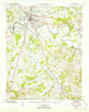
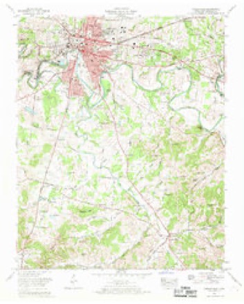
13 topographic sheets cover this place, the earliest surveyed in 1936 and the latest in 1981. It stands in District 6. It lies in ZIP code area 37160. It stands on Pettus Branch. The Survey maps it on the Shelbyville quadrangle. 23,557 people lived here at the 2020 count. It stands 755 feet above sea level.
Research this city
On record in Shelbyville
Buildings and businesses the archive holds for this place. Each opens its own page, with the source record it came from.
On the National Register 12 of 20 shown
 Jenkins Lutheran Chapel and CemeteryNational Historic Landmark · listed 1997
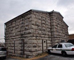 Bedford County Jaillisted 1975
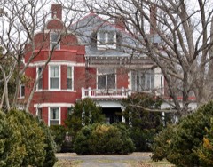 Gov. Prentice Cooper Houselisted 1975
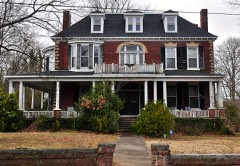 Winston Evans Houselisted 1989
 First Presbyterian Churchlisted 1980
 Fly Manufacturing Company Buildinglisted 1996
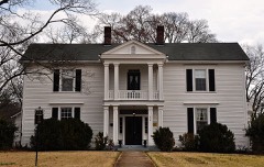 Frierson-Coble Houselisted 1982
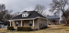 James Gilliland Houselisted 1975
 Grassland Farmlisted 1975
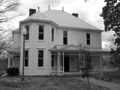 River Side Farmhouselisted 1997
 Shelbyville Courthouse Square Historic Districtlisted 1982
 Shelbyville Hydroelectric Stationlisted 1990
Population over time
2 figuresShelbyville grew from 20,335 to 23,557 between 2010 and 2020. These are the recorded population figures Wikidata holds for this place, reached through the Geographic Names Information System number this page is keyed on rather than by name, so they belong to this place and not to another of the same name. Most are census counts, but not all are: an early figure may be a founding or settlement estimate, and an estimate published within five years of a census is left out. The change column is computed, and is left blank where more than 20 years separate a figure from the one before it, because a gap that long is not a change between two counts.
| Year | People | Change |
|---|---|---|
| 2010 | 20,335 | |
| 2020 | 23,557 | +3,222 (+16%) |
Topographic sheets covering this place
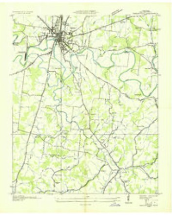
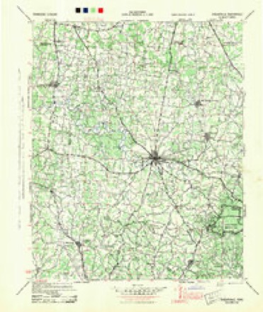
6 surveys from 13 printed sheetsMatched by testing this settlement's coordinate against the published boundary of every sheet in the United States Geological Survey's historical collection. Each opens the scanned sheet at the Survey.
- 1936 USGS Shelbyville quadrangle1:24000
- 1944 USGS Shelbyville quadrangle1:100000
- 1947 USGS Shelbyville quadrangle1:24000, 2 printings
- 1956 USGS Columbia quadrangle1:250000, 6 printings
- 1966 USGS Shelbyville quadrangle1:24000, 2 printings
- 1981 USGS Tullahoma quadrangle1:100000

Fires near this place
1 since 2007Regional context, not property-specific evidence. The federal wildfire occurrence database lists 1 fire within 5 miles of Shelbyville in 2007, burning under an acre in total. None started naturally. None was recorded as arson. Distance is straight-line from the map coordinates, so a fire counted here may appear on a neighbouring settlement's page as well.
| Reported cause | Fires |
|---|---|
| Debris and open burning | 1 |
The most recent of them, most recent first, with the day each was reported and the service that recorded it.
| Date | Cause | Size | Reported by | Name on the report |
|---|---|---|---|---|
| 5 October 2007 | Debris and open burning | under an acre | Tennessee Division of Forestry | VANDERGRIFF |
Settlements close enough to share some of these fires:
Mines and quarries near this place
3 within 5 milesRegional context, not property-specific evidence. The federal mineral resources record lists 3 workings within 5 miles of Shelbyville: 2 past producers, 1 producer. 1 still produces. What was taken out: Limestone, General, Stone, Crushed/Broken, Quartz, Gemstone. Distance is straight-line from the map coordinates, so a quarry counted here may appear on a neighbouring settlement's page as well.
| Where | Site | Commodity | Status | Recorded |
|---|---|---|---|---|
| Delton Baker Quarry | Limestone, General | Past Producer | Sedimentary | |
| Delton Baker Quarry | Stone, Crushed/Broken | Past Producer | ||
| Silvertooth Agate Fields | Quartz, Gemstone | Producer | 1945 |
Storms near this place
60 of 109 shownRegional context, not property-specific evidence. The National Weather Service names Shelbyville in 109 storm reports between 1993 and 2025: 58 thunderstorm wind, 35 hail, 11 flash flood, 3 funnel cloud. The reports record 1 injury. Each account below is quoted exactly as the forecast office filed it, from the NOAA Storm Events Database, and each date opens the federal record of that event.
| When | Event | Place named | Harm | What the report says |
|---|---|---|---|---|
| August 2011 | Thunderstorm Wind | Shelbyville | 1 hurt, $25,000 | A one mile wide microburst struck the northern side of Shelbyville. A gym on North Main Street lost part of its roof and facade, while a nearby lumber company also lost its roof. A home on Edmond Road suffered minor roof damage. Numerous trees were blown down along Green Lane, North Main Street, Wood Street, Collier Road, Edmond Road, Glenoaks Road, and at H.V. Griffin Park. Winds were estimated from 65 to 75 mph. One tree was blown down onto a moving vehicle on Green Lane, causing minor injuries to the driver. A few power lines and business signs were also knocked down. |
| May 2020 | Thunderstorm Wind | Shelbyville | $173,020 | Numerous trees and power lines were blown down across Bedford County. The roof was blown off the Shelbyville Times Gazette building on Depot Street and the Title Max Store on Madison Street. |
| April 2008 | Tornado (EF2) | Shelbyville | $100,000 | A low end EF2 tornado leveled 2 barns, took part of a roof and the back walls of a residential home at 2309 Fairfield Pike. Trees were snapped and uprooted. Other homes had roof damage. Utility poles were bent along the path of the tornado. |
| July 2023 | Thunderstorm Wind | Shelbyville | $50,000 | Severe thunderstorm winds tore the roof off of the Life Style Staffing office along Madison Street in Shelbyville as well as uprooted a large tree in its parking lot. Damages are a rough estimate. |
| July 2011 | Thunderstorm Wind | Shelbyville | $50,000 | Extensive damage to a house occurred on East Depot Street as an eighteen inch tree fell onto the house. |
| June 2006 | Lightning | Shelbyville | $50,000 | Lightning struck and destroyed the Bedford Home Furnishings store on South Cannon Blvd. The fire spread quickly to an adjoining warehouse. The fire was brought under control at 7 PM CST, but firefighters had to return again Friday, June 2, to put out a flare-up. |
| October 1993 | Thunderstorm Wind | Shelbyville | $50,000 | A car repair shop lost its roof, a carport was damaged and hundreds of trees were blown down. |
| June 2009 | Thunderstorm Wind | Shelbyville | $30,000 | County Sheriff reported that trees were down county wide. Newspaper reported that some trees fell onto U.S. 231 South in several places resulting in some traffic tie-ups. WLIJ 1580 AM in Shelbyville was knocked off the air for a brief time due to the weather also. Extent of any damage that caused the radio station to be knocked off the air was unknown. |
| May 2024 | Thunderstorm Wind | Shelbyville | $15,000 | Straight-line winds downed a tree, causing damage to a fence near Shelbyville. Damages are a rough estimate. |
| April 2017 | Thunderstorm Wind | Shelbyville | $10,000 | A Facebook photo showed the sheet metal roof was blown off a warehouse building on West Jackson Street in Shelbyville. |
| April 2017 | Thunderstorm Wind | Shelbyville | $10,000 | A Facebook photo showed sheet metal roofing was blown off a building on the downtown square in Shelbyville. |
| April 2017 | Thunderstorm Wind | Shelbyville | $10,000 | A NWS storm survey along with Bedford County Emergency Management determined straight-line winds caused a small area of generally minor damage in downtown Shelbyville. A large tree limb was blown down on Courtland Drive. An awning was damaged and a small weak tree blown down at Thomas Magnet School on Tate Avenue. Half of the roof of a nearby two-story America's Best Value Inn motel on West End Circle was blown off, with debris blown a considerable distance across the street. However, this part of the roof was an addition on top of the original flat roof, and appeared poorly constructed with 2 by 4 rafters and a sheet metal surface. No other damage was noted in this concentrated commercial area of the city. Eyewitnesses and radar data suggested this may have been a brief weak tornado, but this could not be confirmed. Winds were estimated up to 70 mph. |
| June 2014 | Thunderstorm Wind | Shelbyville | $10,000 | Several trees were blown down in Shelbyville with one tree falling onto a house. |
| October 2009 | Thunderstorm Wind | Shelbyville | $10,000 | Large tree fell at a residence in Shelbyville, crushing a back shed, which riding lawnmowers, push mowers, garden tillers, and children bicycles were stored in. Amount of damage to the lawnmower, push mower, garden tillers, and children bicycles was unknown. |
| August 2006 | Thunderstorm Wind | Shelbyville | $10,000 | Large trees were blown down in Shelbyville. Several sign were blown down along with a portion of a facade of Clifton Furniture. The facade blocked one lane on busy Dept Street in Shelbyville. One tree fell on a car, on the passenger side, at the interesection of Belmont Avenue and Thompson Street. The driver just received a bump on the head. |
| June 1995 | Thunderstorm Wind | Shelbyville | $10,000 | Numerous trees and power lines were blown down. |
| September 2016 | Thunderstorm Wind | Shelbyville | $8,000 | Numerous tree were reportedly blown down across Bedford County in Shelbyville, Wartrace, Bell Buckle and Normandy, including at Highway 270 and Halls Mill Road, on Normandy Road, and on Highway 41A south. Power lines were also blown down on Lyncrest Drive, and on Richdale Road at Fairfield Pike. |
| June 2023 | Thunderstorm Wind | Shelbyville | $5,000 | A #tspotter reported via Twitter that severe thunderstorm winds downed a few trees in Shelbyville, including one on Mac Street. Damages are a rough estimate. |
| April 2022 | Thunderstorm Wind | Shelbyville | $5,000 | Scattered trees were blown down across Bedford County. |
| July 2020 | Thunderstorm Wind | Shelbyville | $5,000 | A tree split and fell on a home on Ridgeway Avenue in Shelbyville. |
| June 2019 | Thunderstorm Wind | Shelbyville | $5,000 | Numerous trees were blown down across Bedford County. |
| March 2017 | Thunderstorm Wind | Shelbyville | $5,000 | Several business signs were damaged along Main Street between Collier Avenue and Colloredo Boulevard. |
| June 2016 | Thunderstorm Wind | Shelbyville | $5,000 | Numerous trees down across the county. |
| June 2011 | Thunderstorm Wind | Shelbyville | $5,000 | Several trees were blown down across Bedford County. |
| August 2005 | Thunderstorm Wind | Shelbyville | $5,000 | 5 trees were blown down along Robinwood Drive. Newspaper article stated that a carport from Brown's Body Shop on Stanley Boulevard, was blown onto Reese Street and struck and damaged a home and a car. The body shop is about 2.9 miles east of downtown Shelbyville. |
| March 2020 | Thunderstorm Wind | Shelbyville | $3,000 | Trees and power lines were blown down on Highway 64. |
| July 2020 | Thunderstorm Wind | Shelbyville | $3,000 | Trees and power lines were blown down on the corner of Horseshoe Drive at Vine Street in Shelbyville. |
| July 2016 | Thunderstorm Wind | Shelbyville | $3,000 | Several trees and power lines were blown down with power outages in Shelbyville. |
| February 2014 | Thunderstorm Wind | Shelbyville | $3,000 | A tree and power lines were blown down on East Lane Street. |
| July 2022 | Thunderstorm Wind | Shelbyville | $2,000 | Twitter tSpotter report indicated two large trees were blown down near a home at the corner of Union Street and Woodmont Drive. |
| June 2021 | Thunderstorm Wind | Shelbyville | $2,000 | Trees were blown down on power lines at Morton Street and Colloredo Boulevard. |
| February 2020 | Thunderstorm Wind | Shelbyville | $2,000 | Tree down on an apartment building on Landers Street in Shelbyville. |
| April 2017 | Thunderstorm Wind | Shelbyville | $2,000 | A tree was blown down on a house on Dover Street. |
| July 2015 | Thunderstorm Wind | Shelbyville | $2,000 | Two trees down were blown down in Shelbyville, one on Collier Avenue and another 1 mile south of the Shelbyville Municipal Airport. The KSYI AWOS at Shelbyville Municipal Airport measured a wind gust of 52 mph. |
| December 2013 | Thunderstorm Wind | Shelbyville | $2,000 | A tree was blown down on a house on Central Avenue in Shelbyville. |
| January 2006 | Flash Flood | Shelbyville | $2,000 | Water flooded several homes in the area. Low water crossings were under water. |
| August 2024 | Thunderstorm Wind | Shelbyville | $1,000 | Strong thunderstorm winds snapped tree tops in the Flat Creek area. Damages are a rough estimate. |
| July 2022 | Thunderstorm Wind | Shelbyville | $1,000 | Twitter tSpotter report indicated a large tree was blown down at the Bedford County Board of Education building on Madison Street. |
| July 2021 | Thunderstorm Wind | Shelbyville | $1,000 | A large tree was blown down on Belmont Avenue. |
| June 2021 | Thunderstorm Wind | Shelbyville | $1,000 | A large tree was uprooted on Alton Avenue in Shelbyville. |
| December 2018 | Thunderstorm Wind | Shelbyville | $1,000 | A tSpotter Twitter photo showed a tree was blown down on Highway 41A. |
| March 2017 | Thunderstorm Wind | Shelbyville | $1,000 | Power lines were blown down at 113 Main Street in Shelbyville. |
| March 2009 | Flash Flood | Shelbyville | $1,000 | One and one half inches of rainfall occurred in 2 hours between 1 AM and 3 AM. Total of 1.88 inches reported at 7 AM through a CoCoRAHS report. County officials blocked some flooded roads in various areas of the county, that were the result of the heavy rainfall and swelling streams. |
| July 2008 | Thunderstorm Wind | Shelbyville | $1,000 | Trees were blown down along Fairfield Pike. |
| June 2004 | Flash Flood | Shelbyville | $1,000 | Several roads in and around Shelbyville were blocked by high water. |
| May 2004 | Flash Flood | Shelbyville | $1,000 | There was 8 inches of water in front of the Post Office and 12 inches of water on Riverbend Road. Some motorists had to be helped by firefighters when their vehicles stalled in high water. The roof and outer wall collapsed at the Bedford County Probation Office on Depot Street. Suddenly, swollen streams surrounded homes on Eagle Boulevard, Ligon Drive and East Depot Street. |
| May 2004 | Flash Flood | Shelbyville | $1,000 | Law enforcment reported Height Street and West Lane Street were both closed due to high water. |
| October 2004 | Flash Flood | Shelbyville | $1,000 | Flooding of roads were reported at Woodlawn, Suguar Creek and Bug Scuffle. |
| April 1994 | Thunderstorm Wind | Shelbyville | $500 | Many trees were blown down. |
| May 1993 | Thunderstorm Wind | Shelbyville | $500 | A few trees were knocked down. |
| April 1993 | Thunderstorm Wind | Shelbyville | $500 | Scattered trees were blown down. |
| May 1995 | Hail | Shelbyville | $5 | no account filed |
| March 2025 | Hail | Shelbyville | - | Estimated quarter size hail fell from a severe thunderstorm in Shelbyville. |
| February 2023 | Hail | Shelbyville | - | Numerous reports of quarter size hail was received in Shelbyville. |
| October 2021 | Flash Flood | Shelbyville | - | Madison Street near First Bank, and Lane Parkway near Police HQ, were flooded and impassable. |
| May 2013 | Hail | Shelbyville | - | An amateur radio operator reported dime to nickel sized hail falling two miles north of the city of Shelbyville. |
| October 2011 | Hail | Shelbyville | - | Hail up to golfball size was reported west of Shelbyville. |
| January 2010 | Hail | Shelbyville | - | Newspaper reported a two inch hail depth on the ground near a section of U.S. 41 North near Brad's Market and Deli, just outside of Shelbyville. This forced drivers to pull off the road and watch as the penny size hail pelted their vehicles. Details on amount of vehicle damage and associated damage amounts were unknown. |
| January 2010 | Hail | Shelbyville | - | Quarter size hail was reported on North Main Street. |
| October 2010 | Funnel Cloud | Shelbyville | - | A funnel cloud was reported over downtown Shelbyville. |
Nearest settlements
The eight closest, with where each one stands in the county. Distances are straight-line, computed from the Geographic Names Information System coordinates.
| Map | Place | Distance | Sheets |
|---|---|---|---|
| Creekwood | 1.5 miles | 13 | |
| Shelbyville Mills | 1.7 miles | 13 | |
| Fairlane Estates | 1.7 miles | 12 | |
| Forest Hills | 2.1 miles | 13 | |
| Elbethel | 3.4 miles | 14 | |
| Himesville | 3.9 miles | 13 | |
| Caldwell | 4.4 miles | 12 | |
| Anchor Mill | 5.4 miles | 14 |
Elsewhere
Matched on this settlement's Geographic Names Information System number rather than its name, so it cannot be a different place of the same name in another state.
| Wikipedia article on Shelbyville | An encyclopaedic summary. Its text is share-alike, so it is linked here rather than copied. |
| Wikidata item Q1969316 | The structured record the population and elevation above come from. Public domain (CC0). |
Provenance
This settlement is recorded in the Geographic Names Information System as feature 1269993. The sheet list is computed by point-in-boundary test against the United States Geological Survey's historical topographic inventory. Both are works of the United States government and carry no copyright under 17 U.S.C. 105.
Wildfire. Short, Karen C. 2022. Spatial wildfire occurrence data for the United States, 1992-2020 [FPA_FOD_20221014]. 6th Edition. Fort Collins, CO: Forest Service Research Data Archive. https://doi.org/10.2737/RDS-2013-0009.6 Collected with United States Government funding and usable without additional permissions or fees.
Mines and quarries. USGS Mineral Resources Data System (MRDS) https://mrdata.usgs.gov/mrds/ A work of the United States government, no copyright under 17 U.S.C. 105.
Storms. NOAA National Centers for Environmental Information, Storm Events Database https://www.ncei.noaa.gov/stormevents/ A work of the United States government, no copyright under 17 U.S.C. 105. Narratives are quoted verbatim from the National Weather Service report and are not edited or summarised.