Block
From the record
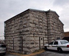
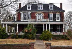
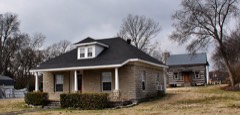
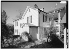
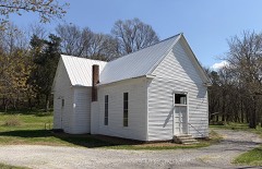
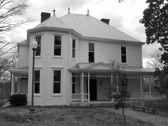
33 National Register listings published here, 1 of them a National Historic Landmark.
Sources: the National Register database, National Park Service
76 topographic sheets cover 53 settlements here, and 33 properties are on the National Register of Historic Places.
33 National Register listings published here, 1 of them a National Historic Landmark.
Sources: the National Register database, National Park Service
Every property in this county listed on the National Register of Historic Places, with the year it was listed and the federal nomination document.
Every wildfire the federal occurrence database records inside this county: 22 of them, burning about 216 acres. None started naturally and 4 were recorded as arson. Each settlement page carries the fires within five miles of it.
| Reported cause | Fires |
|---|---|
| Debris and open burning | 13 |
| Arson/incendiarism | 4 |
| Power generation/transmission/distribution | 2 |
| Recreation and ceremony | 1 |
| Smoking | 1 |
| Missing data/not specified/undetermined | 1 |
The five largest, by the area the report gives. One of them was set deliberately.
| Date | Cause | Size | Reported by | Name on the report |
|---|---|---|---|---|
| 8 January 2006 | Arson/incendiarism | 62 acres | Tennessee Division of Forestry | not named |
| 27 February 2006 | Debris and open burning | 54 acres | Tennessee Division of Forestry | not named |
| 20 August 2007 | Missing data/not specified/undetermined | 25 acres | Tennessee Division of Forestry | FOSTER/FLY RD FIRE |
| 26 February 2006 | Recreation and ceremony | 22 acres | Tennessee Division of Forestry | not named |
| 9 April 2014 | Power generation/transmission/distribution | 20 acres | Tennessee Division of Forestry | SANDERS |
| 4 March 2006 | Debris and open burning | 6.0 acres | Tennessee Division of Forestry | not named |
| 18 August 2007 | Debris and open burning | 5.0 acres | Tennessee Division of Forestry | PASS ROAD FIRE |
| 6 August 1998 | Debris and open burning | 4.1 acres | Tennessee Division of Forestry | not named |
Every settlement page carries the fires within five miles of it - see the settlement index below.
The NOAA Storm Events Database holds 378 reports for this county, causing 1 death, 12 injuries and about $5,587,825 in recorded property damage. Each settlement page carries the reports that name it.
| Kind of event | Reports |
|---|---|
| Thunderstorm Wind | 231 |
| Hail | 70 |
| Flash Flood | 36 |
| Tornado | 20 |
| Flood | 11 |
| Funnel Cloud | 8 |
| Lightning | 1 |
| Heavy Rain | 1 |
The most serious of them, by death, then injury, then recorded damage. The accounts are quoted exactly as the forecast office filed them.
| When | Event | Place named | Harm | What the report says |
|---|---|---|---|---|
| April 2000 | Tornado (F1) | Wartrace | 1 killed, $30,000 | The tornado first touched down about 2.5 mles west of Wartrace at the intersection of Railroad Avenue and Horse Mountain Road...having an intensity of F1 and a width of about 200 feet. The total path length is about 2 miles.The greatest amount of damage and the fatality occurred near the beginning of its track where the tornado had its greatest intensity. The damage included some large trees that were uprooted and snapped...roof damage to one house...moving both a house and mobile home on their foundations..and overturning a nearby mobile home.Regarding the fatality...local law enforcement mentioned that as the storm approached...a man got back in a small pickup truck to escape the impending rain and hail. The tornado then struck and moved or rolled the truck across a field and through a barn...causing or aiding the barn being destroyed. The truck ended up in a creekbed over 350 feet away. The man was throw from the truck and was found underneath the vehicle in the creekbed. Only sporadic damage occurred after the tornado weakened...with roof damage to several barns and out buildings...some twisting...snapping...and uprooting of some trees...and a few power poles snapped. |
| January 1997 | Tornado (F2) | Wheel | 3 hurt, $250,000 | no account filed |
| November 2002 | Tornado (F2) | Bugscuffle | 3 hurt, $100,000 | An F2 tornado struck near Bugscuffle and caused very minor injuries. A second floor was torn off 2 late model frame houses. Several houses had roofs stripped and a couple of barns were demolished. This tornado went into Coffee county. TEMA reported 5 homes destroyed, 6 damaged, one mobile home destroyed and a TVA 500 KV tower was destroyed. |
| April 1996 | Thunderstorm Wind | Countywide | 2 hurt, $100,000 | no account filed |
| April 1974 | Tornado (F1) | not stated | 2 hurt, $2,500 | no account filed |
| May 1995 | Tornado (F1) | not stated | 1 hurt, $200,000 | The tornado first touched down on the west side of Shelbyville. The tornado continued east and eventually hit the city of Normandy and continued into the extreme western part of Coffee County. A fire hall was destroyed in Normandy. A supermarket lost its roof in Shelbyville. Several other business sustained roof damage. Four barns at a nearby animal exhibition park were damaged. A mobile home was destroyed in Normandy. A few homes were damaged. Many trees, power poles and power lines were knocked down as well. One horse was badly injured when a tree fell on it and the horse had to be destroyed. |
| August 2011 | Thunderstorm Wind | Shelbyville | 1 hurt, $25,000 | A one mile wide microburst struck the northern side of Shelbyville. A gym on North Main Street lost part of its roof and facade, while a nearby lumber company also lost its roof. A home on Edmond Road suffered minor roof damage. Numerous trees were blown down along Green Lane, North Main Street, Wood Street, Collier Road, Edmond Road, Glenoaks Road, and at H.V. Griffin Park. Winds were estimated from 65 to 75 mph. One tree was blown down onto a moving vehicle on Green Lane, causing minor injuries to the driver. A few power lines and business signs were also knocked down. |
| May 2004 | Thunderstorm Wind | Southeast Portion | $1,000,000 | Numerous trees and power lines were down. Flat Creek and Hilltop areas were hardest hit. A 2-story brick home lost the front porch which was facing west at 415 Smith Chapel Rd. The damage to the home was estimated to be about $40,000. The EMA Director estimated one million dollars worth of damage to utilities because of the straight line winds. |
| March 2025 | Tornado (EF1) | Longview | $500,000 | An EF-1 tornado first touched down in far northwest Bedford County near Carter Crossroads on Kingdom Road. At this location, a half dozen outbuildings, storage buildings, and barns were damaged or destroyed. The tornado continued east-northeast where some minor damage occurred to homes along Longview Road. Garage doors were blown in, fences were knocked down, outbuildings were destroyed, and minor roof damage was observed. The tornado then continued into far southwest Rutherford County. Damages are a rough estimate. |
| November 2018 | Tornado (EF2) | Longview | $400,000 | The Christiana tornado first touched down in far northern Bedford County southwest of Kimmons Road at Longview Road, damaging an outbuilding and blowing down a few trees. This small but very intense tornado moved northeast and quickly increased in intensity to EF-2 as it approached the Bedford/Rutherford County line, severely damaging two homes on the south side of Kingdom Road/Midland Fosterville Road. The tornado then crossed the road into Rutherford County, where a small but well-built brick home had its roof blown off and brick walls blown in. One wall fell onto the homeowner causing minor injuries. Further to the northeast on Williams Road, one barn was heavily damaged and another completely destroyed. The narrow but strong EF-2 tornado continued northeast, carving a well-defined path through forests before striking a new 3000 square foot home on the west side of Midland Crescent Road. This large house, which was poorly attached to its cinder-block foundation, was lifted almost completely intact, flipped upside down, and rotated 90 degrees as it was blown to the north-northwest. One woman inside the home was killed. Numerous trees continued to be blown down further to the northeast across Jones Road. Upon reaching Rock Springs Midland Road, another home that was built in the 1800s took a direct hit from the tornado, losing its roof and all of the third story. The homeowners inside received the warning and took appropriate shelter on the lowest floor, escaping uninjured. Two silos and a barn just north of the home were de-roofed, and several nearby trees were blown down. Curving more to the east-northeast, two 70 foot-tall silos and two sheet metal barns located northwest of Rock Springs Midland Road at Gray Fox Drive were completely destroyed. Another smaller barn was destroyed and adjacent home received roof damage north of Eagle Creek Road. As the tornado crossed a northward bend in Rock Springs Road, a detached garage was completely destroyed while a home suffered minor roof damage. Further to the east, an outbuilding and mobile home were heavily damaged, with debris being blown up to 200 yards to the east. The tornado continued east-northeast, causing minor exterior damage to a home and damaging the roof of a barn. Approaching Rock Springs Midland Road, the tornado completely destroyed a small home on the south side of the roadway, with debris being blown in a cyclonic curved path 200 yards off to the east. The tornado finally weakened to EF-1 as it crossed Rock Springs Midland Road yet again, overturning an old, small mobile home on the north side of the road just west of Highway 231. Two women inside the mobile home were injured. The final damage occurred on Christiana Fosterville Road just one-quarter mile south of Christiana, where part of the roof of a barn was blown off and several trees were blown down. The total path length for this tornado in both Bedford and Rutherford Counties was 8.61 miles. |
| February 2019 | Flash Flood | Rover | $275,400 | Numerous roads were flooded and closed across Bedford County, including Highway 30 between the Duck River Bridge and Sulphur Springs Road, Sevier Street, Lipscomb Street, Coopertown Road, Maxwell Chapel Road, Threet Road, Longview Road, Rattlesnake Lodge Road, McDale Lane, Blue Ribbon Parkway, and many others. |
| February 1955 | Tornado (F2) | not stated | $250,000 | no account filed |
| May 2025 | Tornado (EF0) | Palmetto | $200,000 | An EF-0 tornado touched down near Bedford Lake Road near Shiloh, damaging trees. The tornado moved north-northeast, causing additional timber damage and damaging some farm structures along Bedford Lake Road and Hobbs Lane. The tornado then crossed into Coffee County at Sixteenth Model Road. Damages are a rough estimate. |
| May 2009 | Flash Flood | Bomar Arpt | $175,000 | Airport Road was flooded. Newspaper also reported that a dozen other roads were closed due to high water as the result of flash flooding. Other newspaper articles reported that the Duck River in Shelbyville overflowed its banks, causing several roads to be flooded in the area and also resulting in a release of water from the Normandy Dam. Other newspaper articles reported that Fisherman's Park was completely flooded|along with portions of Riverwalk Park. A residence on Tommy Drive in Columbia did have serious damage to a recently installed chain link fence. |
| May 2020 | Thunderstorm Wind | Shelbyville | $173,020 | Numerous trees and power lines were blown down across Bedford County. The roof was blown off the Shelbyville Times Gazette building on Depot Street and the Title Max Store on Madison Street. |
| October 2010 | Thunderstorm Wind | Unionville | $100,000 | A microburst resulted in three barns with partial roof loss and an outbuilding along Unionville-Deason Road losing its entire roof. A couple dozen trees were snapped and many more had large limbs lost. The damage path was approximately 5 miles long and nearly half mile wide. Maximum wind speeds were estimated at around 70 mph. |
| September 2009 | Flood | Rover | $100,000 | A few public roads were covered with water, but several private roads and access lanes were impassible and many yards were turned into ponds across the county. The location receiving the greatest amount of rainfall was in Unionville, where a local CoCoRaHS observer reported 7.20 inches of rainfall. Other locations across the county ranged from 7 inches at Community High School to 2.85 inches at the Shelbyville Municipal Airport near Deason. One of the most hardest-hit locations was DJ's Market and Deli, on U.S. 231 North, across from Blackberry Ridge Golf Club, where up to five inches of water inundated the store. Part of the store's parking lot was also damaged, with large chunks cut into the pavement. Water also rose in several places along Liberty Pike (State Highway 269) north of Bell Buckle. The entrance to Parker Sain Road was impassible late in the morning and water was almost to the edge of the highway. |
| April 2008 | Tornado (EF2) | Shelbyville | $100,000 | A low end EF2 tornado leveled 2 barns, took part of a roof and the back walls of a residential home at 2309 Fairfield Pike. Trees were snapped and uprooted. Other homes had roof damage. Utility poles were bent along the path of the tornado. |
| January 2002 | Flash Flood | Countywide | $100,000 | Hwy Dept. reported several roads still closed. Streams and creeks were out of its banks. Damage to roads estimated at $100.000. |
| April 2023 | Tornado (EF1) | Rover | $50,000 | This narrative continues a tornado that began in Marshall County before tracking into Rutherford County. This tornado just clipped the extreme northwest edge of Bedford County where an outbuilding was heavily damaged. The tornado then continued back into Rutherford County. Damages are estimated for Bedford County. |
| July 2023 | Thunderstorm Wind | Shelbyville | $50,000 | Severe thunderstorm winds tore the roof off of the Life Style Staffing office along Madison Street in Shelbyville as well as uprooted a large tree in its parking lot. Damages are a rough estimate. |
| April 2017 | Tornado (EF1) | Mt Herman | $50,000 | A rare and unique anticyclonic landspout tornado touched down in southern Bedford County off a left splitting supercell and an anticyclonic rear flank downdraft coupled with strong southwesterly surface flow. The damage path started off of Charlie Russell Road consisting of uprooted and snapped trees as well as a barn sustaining significant damage from rear flank downdraft winds. The path continued northeast uprooting and snapping dozens of hardwood and softwood trees. Off of Highway 412, several homes sustained roof damage as well as loss of underpinning off of a couple of mobile homes. Additional barn damage was observed on Womack Road along with several more trees uprooted and snapped. Significant tree damage occurred off of Narrows Lane including a 4ft wide oak tree snapped at the base. The tornado then weakened and continued northeast across Highway 82 and Highway 130 blowing down more trees. Entering Shelbyville, the tornado weakened further, but still blew a boat across a parking lot, shifted a few cars, and tossed a dumpster at the Davis Estates Apartments on Anthony Lane, then blew down some playground equipment at Coopers Steel Manufacturing on Hillcrest Drive before lifting. The tornado was widely viewed and documented on video by numerous residents of the area.||NWS Nashville greatly appreciates the opinions and expertise from NWS Norman and NWS Huntsville in determining the characteristics of this very unique event. |
| December 2015 | Tornado (EF1) | Gray | $50,000 | This low end EF1 tornado started at the northwest side of the Newell Rubbermaid plant and moved east-southeast through the rest of the plant complex including the neighboring Calsonic plant. Two large sections of roof were peeled back at the Rubbermaid plant. Roof gravel was blown in all directions and damaged several company vehicles. Six empty tractor trailers were blown around and partially stacked upon each other. Several garage doors failed and at least 3 were blown into the facility. One large tree between the two facilities was blown over. At Calsonic, two windows were blown out, a carport was damaged, a glass doorway was blown in, a few tree branches were broken and metal signs were smashed to the ground. This information is from a storm survey conducted jointly by NWS Nashville and the Bedford County Emergency Management Agency on December 26. |
| March 2013 | Tornado (EF0) | Poplins Xrds | $50,000 | An EF0 tornado touched down in northwestern Bedford County about 4.6 miles southwest of Unionville where a few trees were blown down and a barn damaged on Moon Bend Road. More trees were blown down and an outbuilding blown over on State Highway 270. A barn lost its roof and several more trees were snapped and uprooted in all directions on Clem Creek Road and Old Pencil Mill Road. |
| September 2012 | Tornado (EF0) | Haley | $50,000 | An EF0 tornado with an estimated peak wind speed of 80 mph touched down at a residence along U.S. Highway 41A approximately 1/2 mile east of the U.S. Highway 41A and Normandy Road intersection. Dozens of trees were snapped and uprooted at this location and the residence suffered roof damage with many shingles blown off. The tornado then crossed U.S. Highway 41A and Shofner Road before lifting. |
| July 2011 | Thunderstorm Wind | Shelbyville | $50,000 | Extensive damage to a house occurred on East Depot Street as an eighteen inch tree fell onto the house. |
| February 2009 | Thunderstorm Wind | Wartrace | $50,000 | Minor roof damage to a home was reported. Trees were blown down county wide. |
| June 2006 | Lightning | Shelbyville | $50,000 | Lightning struck and destroyed the Bedford Home Furnishings store on South Cannon Blvd. The fire spread quickly to an adjoining warehouse. The fire was brought under control at 7 PM CST, but firefighters had to return again Friday, June 2, to put out a flare-up. |
| April 1997 | Hail | Fairfield | $50,000 | Half dollar size hail reported just west of Fairfield on Fairfield Pike. It lasted for about 20 minutes and caused substantial damage to vehicles and homes. One person received $3200 worth of damage to a new car. |
| October 1993 | Thunderstorm Wind | Shelbyville | $50,000 | A car repair shop lost its roof, a carport was damaged and hundreds of trees were blown down. |
| March 2017 | Thunderstorm Wind | Bomar Arpt | $35,000 | A severe microburst struck an industrial park area and the Shelbyville Airport north of Shelbyville. A tractor trailer was blown over at a warehouse on Northcreek Road. Significant damage occurred at the Shelbyville Airport Fire Station, where much of the roof was blown off, windows were blown out, and a steel beam on the building frame was twisted around 180 degrees. An old small airplane at the north end of the airport was flipped upside down and thrown 30 yards to the east, heavily damaging the plane. Unfortunately, the AWOS station at the Shelbyville Airport lost power, so no peak wind gusts were measured. Security cameras at the airport captured the microburst on video as well as a nearby power flash. |
| June 2009 | Thunderstorm Wind | Shelbyville | $30,000 | County Sheriff reported that trees were down county wide. Newspaper reported that some trees fell onto U.S. 231 South in several places resulting in some traffic tie-ups. WLIJ 1580 AM in Shelbyville was knocked off the air for a brief time due to the weather also. Extent of any damage that caused the radio station to be knocked off the air was unknown. |
| May 2025 | Thunderstorm Wind | Union Ridge | $25,000 | Severe thunderstorm winds downed trees and powerlines in the Knob Creek and White Road areas east of Wartrace. Damages are a rough estimate. |
| July 2023 | Flash Flood | Normandy | $25,000 | Heavy rain in the Normandy area resulted in flash flooding along Rowesville Road. One person had to be rescued from their vehicle which got trapped in the flood waters. No injuries were reported. Damages are a rough estimate. |
| March 2017 | Thunderstorm Wind | Richmond | $25,000 | A NWS storm survey found a large and severe 18 mile long by 1 to 2.5 mile wide downburst struck areas in Marshall County from southern Lewisburg east-southeastward across Belfast, then continued into southwestern Bedford County before ending near Highway 231 south of Shelbyville. Widespread straight line wind damage occurred across the southern half of Lewisburg, with a tall radio tower bent in half on Skyline Drive. Part of the poorly-attached metal roof on a home on Gina Lynn Drive was blown up to 3/4 mile away. Another home had numerous shingles blown off on Midway Street near Scenic Drive, and a neighboring home had its metal carport destroyed. A barn lost part of its roof on Cornersville Road, and another carport was destroyed on Cornersville Road north of Highway 31A. An old warehouse building was heavily damaged on Old Belfast Road just west of Garrett Parkway, with much of the roof blown off and one wall collapsed. In addition, dozens of large trees were snapped and uprooted on Lakehill Drive, Green Valley Drive, Fox Lane, Midway Street, and others in southern Lewisburg. Farther to the east just west of Belfast, a barn lost much of its roof and a carport was destroyed on Old Belfast Road. Another barn was destroyed and numerous trees uprooted south of Belfast on Highway 431. Winds within the 1 mile wide downburst across Marshall County were estimated mainly in the 60-80 mph range, although pockets of damage such as the bent radio tower indicated winds reached 80 to 100 mph in some areas.||In Bedford County, the porch was blown off a home on Cortner Hollow Road, and a barn had significant roof damage on Pickle Road. Several trees were blown down on Quail Valley Road. In the Richmond area, the sheet metal roof and walls were blown off an outbuilding on Sinking Creek Road, the roof was blown off a barn on Highway 130, and a gas station canopy collapsed on Highway 130 at Gant Hollow Road. Further to the east, another small barn was destroyed on Bluestocking Hollow Road at D Martin Road, and trees and power poles were blown down on Highway 231 near Bluestocking Hollow Road. Winds within the downburst across southwestern Bedford County, which was up to 2.5 miles wide, were estimated from 60 to 80 mph. |
| April 2011 | Tornado (EF1) | Normandy | $25,000 | An EF1 tornado with maximum winds 90 to 100 mph touched down around 615 am in extreme southeast Bedford County. Damage was centered along Magnolia Lane and Winding Way Road. The damage path in Bedford and Coffee counties was approximately 1 mile long. Maximum path width was 75 yds. Hundreds of trees were snapped along the path. |
| November 2010 | Flood | Elbethel | $22,000 | A one lane concrete bridge on Busccuffle Road near Wartrace was totally covered with water, with a massive pile of driftwood creating a logjam on the upstream side. A black Honda, which was driven by a passenger, was trying to ease into the water covered area near this bridge so that the vehicle's driver could rescue a Labrador dog. The car was swept away and ended up stuck in a flooded nearby ditch. |
| April 2023 | Thunderstorm Wind | Elbethel | $20,000 | Severe thunderstorm winds caused a tree to fall through a house along Troupe Road near Shelbyville. No injuries were reported. Damages are estimated. |
| July 2022 | Thunderstorm Wind | Gray | $20,000 | Facebook report indicated a tree fell and crushed a garage on Fairfield Pike. |
| October 2007 | Thunderstorm Wind | Fall Creek | $20,000 | Pieces of tin roof from a barn was scattered about a farm. The tin traveled about 150 yards and struck the tailgate of a flatbed trailer, the roof of a farm home, smashed the windshield of a van, and bent the doors of two chicken houses over 100 yards away. |
| May 2004 | Tornado (F1) | Mt Herman | $20,000 | A mobile home was demolished at 223 Hart Rd. Several trees were uprooted along the tornado's path. The estimated damage due to the tornado was around $20,000. |
| May 2024 | Thunderstorm Wind | Shelbyville | $15,000 | Straight-line winds downed a tree, causing damage to a fence near Shelbyville. Damages are a rough estimate. |
| May 2024 | Thunderstorm Wind | Rover | $15,000 | Numerous trees were snapped south of Eagleville from straight-line winds. Damages are a rough estimate. |
| September 2021 | Flash Flood | Normandy | $15,000 | A house was reportedly flooded with vehicles floating down the creek in the 500 block of Carr Creek Road. |
| March 2020 | Thunderstorm Wind | Beechwood | $15,000 | Part of the roof was blown off a large home on Highway 64 at Jake Branch Road. |
| March 2020 | Thunderstorm Wind | Bell Buckle | $15,000 | Drone video footage and social media photos showed widespread wind damage in and around Bell Buckle, with numerous large trees uprooted, power lines blown down, outbuildings destroyed, and minor exterior damage to buildings. Winds were estimated up to 75 mph. |
| November 2018 | Thunderstorm Wind | Cedar Grove | $15,000 | A NWS storm survey along with Google Earth high resolution satellite imagery determined a 3.34 mile long by 150 yard wide swath of wind damage occurred along a path from 2.4 miles southwest of Rover to 1.1 miles east-southeast of Rover. Several trees were blown down at the start of the path to the north of Virgil Beasley Road just east of the Marshall County line. A barn lost some sheet metal roof panels and several cedar trees were snapped on a farm on Blanton Road just north of Cedar Grove Road. Further to the east, at least 4 homes on Amy Lane just south of Coopertown Road suffered minor wind damage such as loss of a few shingles and siding. One shed was also overturned and several trees were blown down. A barn also lost part of its roof on Jack Taylor Road. Winds were estimated up to 70 mph. Based on radar data, this damage was likely caused by a brief EF-0 tornado, but the damage was considered too sparse and weak to be conclusive. The information on this damage was updated in July 2020 based on newly available high resolution satellite imagery. |
| March 2017 | Thunderstorm Wind | Deason | $15,000 | An intense 1/2 mile long by 1/4 mile wide microburst affected areas along Highway 231 just north of Deason in association with a mesovortex on radar. Two barns suffered considerable roof damage and a large tree was uprooted to the northeast around a home on the west side of Highway 231 north of Joywood Trailer Park Road. A mobile home was also significantly damaged on the east side of Highway 231. Two large outbuildings were destroyed at the Joy Vail Allman Farm on the east side of Highway 231, and several trees were snapped and uprooted. Winds were estimated up to 80 mph. |
| June 2013 | Thunderstorm Wind | Deason | $15,000 | A NWS Storm Survey found that damage along Minkslide Road and Highway 82 was due to a microburst. Dozens of large trees were uprooted with smaller trees snapped. Outbuildings suffered minor to moderate roof damage and homes had minor exterior damage. Some trees fell onto homes causing more substantial damage. Winds were estimated between 70 and 75 mph. |
| April 2011 | Thunderstorm Wind | Unionville | $15,000 | Trees and power lines were downed in Unionville. |
| March 2025 | Thunderstorm Wind | Longview | $10,000 | A tornadic thunderstorm caused damage to a powerline and a tree at the intersection of Longview Road and Pepper Hill near Unionville. Damages are a rough estimate. |
| June 2025 | Thunderstorm Wind | Gray | $10,000 | Severe thunderstorm winds downed powerlines and poles near the intersection of Wartrace Pike and Ligon Drive in Shelbyville. Damages are a rough estimate. |
| May 2024 | Thunderstorm Wind | Normandy | $10,000 | Severe thunderstorm winds downed trees on Normandy Road and along Highway 269 in Normandy. Damages are a rough estimate. |
| January 2023 | Thunderstorm Wind | Unionville | $10,000 | Strong thunderstorm winds destroyed a shed at a residence near Unionville. Damages are estimated for the loss of the shed. |
| February 2023 | Thunderstorm Wind | Bedford | $10,000 | Three power poles were broken and downed along Highway 64 near Shelbyville due to severe thunderstorm winds. Damages are estimated. |
| August 2023 | Thunderstorm Wind | Union Ridge | $10,000 | Severe thunderstorm winds downed numerous trees and tree limbs in east Wartrace. Damages are a rough estimate. |
| August 2023 | Thunderstorm Wind | Bell Buckle | $10,000 | Severe thunderstorm winds downed numerous trees across Bell Buckle. Damages are a rough estimate. |
| August 2023 | Thunderstorm Wind | Wheel | $10,000 | Severe thunderstorm winds caused roof damage to a barn in Wheel. Damages are a rough estimate. |
| February 2021 | Thunderstorm Wind | Wartrace | $10,000 | Several trees, large limbs, and outbuildings were damaged in and around Wartrace. |
| May 2021 | Thunderstorm Wind | Vannatta | $10,000 | A large metal barn was destroyed and a grain bin pushed off its foundation on Mankin Road. |
The Survey's mineral resources record lists 5 workings inside this county. 3 still produce and 2 are closed or unrecorded. Each settlement page carries the workings within five miles of it.
| Commodity | Workings |
|---|---|
| Stone, Crushed/Broken | 3 |
| Quartz, Gemstone | 1 |
| Limestone, General | 1 |
The least common of them first, because a county's hundredth gravel pit says nothing its first ten did not.
| Where | Site | Commodity | Status | Recorded |
|---|---|---|---|---|
| Delton Baker Quarry | Limestone, General | Past Producer | Sedimentary | |
| Silvertooth Agate Fields | Quartz, Gemstone | Producer | 1945 | |
| Delton Baker Quarry | Stone, Crushed/Broken | Past Producer | ||
| Shelbyville Mine | Stone, Crushed/Broken | Producer | ||
| The Stone Man Quarry | Stone, Crushed/Broken | Producer | Limestone |
Named settlements recorded in the Geographic Names Information System, each with the topographic sheets covering it. Villages, hamlets and abandoned places alike. Each is shown with the nearest named watercourse or landform and the survey quadrangle it falls on.
District 1 · 37020 · Near Woodfin Valley · Webbs Jungle quadrangle
14 sheets, 1936 to 1985
District 4 · 37160 · On Little Hurricane Creek · Unionville quadrangle
14 sheets, 1936 to 1985
District 5 · 37160 · Near Renegar Hollow · Lynchburg West quadrangle
13 sheets, 1936 to 1981
District 5 · 37160 · Near Mullins Hollow · Lynchburg West quadrangle
13 sheets, 1936 to 1981
District 3 · 37180 · On Clem Creek · Unionville quadrangle
14 sheets, 1936 to 1985
District 9 · 37160 · On Flat Creek · Shelbyville quadrangle
13 sheets, 1936 to 1981
District 4 · 37160 · On Sims Spring Branch · Unionville quadrangle
14 sheets, 1936 to 1985
District 1 · 37020 · Near Puncheon Camp Hollow · Webbs Jungle quadrangle
14 sheets, 1936 to 1985